
Showing 142 items matching "kew subdivision plan"
-
 Kew Historical Society Inc
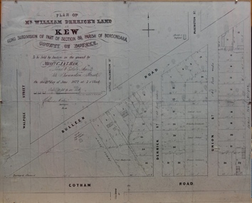
Plan - Framed Subdivision Plan (copy), F Price, Plan of Mr William Derrick's Land, Kew being Subdivision of Part of Section 86, Parish of Boroondara, County of Bourke, 1872, 1872
... Plan of Mr William Derrick's Land, Kew being Subdivision of Part of Section 86, Parish of Boroondara, County of Bourke, 1872...kew subdivision plan...‘Plan of Mr Willia Derrick's Land, Kew being Subdivision of Part of Section 86, Parish of Boroondara, County of Bourke’. ...Derrick Street in Kew is named after him. kew subdivision plan john derrick subdivision plans -- kew (vic.) ...William Derrick was an early landowner in Kew, and with James Venn Morgan and James Dannock the purchaser of the parcel of land bounded by Cotham Road, High Street and Mary Street. Derrick Street in Kew is named after him.Map mounted under perspex. ‘Plan of Mr Willia Derrick's Land, Kew being Subdivision of Part of Section 86, Parish of Boroondara, County of Bourke’. This is a copy of the plan held in the State Library of Victoria.kew subdivision plan, john derrick, subdivision plans -- kew (vic.) -
 Ringwood and District Historical Society
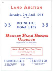
Flyer - Land Auction, Bexley Park Estate Croydon, Victoria - 1976
... Kew 804473. C.E. Carter & Son, 122 Whitehorse Road, Ringwood, Telephone 8706211. Double-sided A3 page folded to form four A4 size pages advertising auction of 35 home sites on Saturday 3rd April 1976, with summary of local facilities, services and subdivision plan showing allotments in Murray Road, Penhyrn Avenue, Webster Avenue and Columbia Avenue, Croydon. ...Double-sided A3 page folded to form four A4 size pages advertising auction of 35 home sites on Saturday 3rd April 1976, with summary of local facilities, services and subdivision plan showing allotments in Murray Road, Penhyrn Avenue, Webster Avenue and Columbia Avenue, Croydon.15% deposit per lot. $120 per month. Interest at 8½%. Balance at end of 3 years. Auctioneers in conjunction - K. Gardner & Lang Pty Ltd., 227 Collins Street, Melbourne (Phone) 632821, 185 Glenferrie Road, Malvern 5099544, 1161 Burke Road, Kew 804473. C.E. Carter & Son, 122 Whitehorse Road, Ringwood, Telephone 8706211. -
 Kew Historical Society Inc
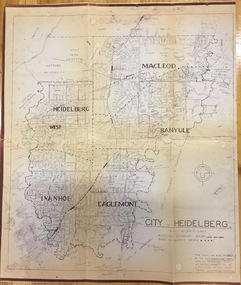
Plan, City Engineers Department (Heidelberg), City of Heidelberg Plan: Scale 20 chns to 1 inch, 1970-1993
... Plan of number of areas in the City of Heidelberg showing municipal and ward boundaries, subsequently annotated by the historian Gwen McWilliam, identifying significant landholdings, subdivisions and key dates.The base map was printed in 1970 and annotated c.1993. The plan was donated to the Kew...Primary source annotated by a distinguished local historian. city of heidelberg maps -- heidelberg (vic.) gwen mcwilliam Handwritten annotations by Gwen McWilliam, 1993 Plan of number of areas in the City of Heidelberg showing municipal and ward boundaries, subsequently annotated by the historian Gwen McWilliam, identifying significant landholdings, subdivisions and key dates.The base map was printed in 1970 and annotated c.1993. The plan was donated to the Kew ...Gwen Barton McWilliam (nee: Nelson), OAM, BA (1933- ). Gwen McWilliam is well known as an authority on the history of Boroondara and the author of a large number of books and pamphlets about the City. She was awarded the medal of the Order of Australia in 2001 ‘for service to the community of Hawthorn and district, particularly through the research, documentation and publication of its history.’ Primary source annotated by a distinguished local historian.Plan of number of areas in the City of Heidelberg showing municipal and ward boundaries, subsequently annotated by the historian Gwen McWilliam, identifying significant landholdings, subdivisions and key dates.The base map was printed in 1970 and annotated c.1993. The plan was donated to the Kew Historical Society by Gwen McWilliam. Handwritten annotations by Gwen McWilliam, 1993city of heidelberg, maps -- heidelberg (vic.), gwen mcwilliam -
 Kew Historical Society Inc
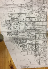
Plan, Gwen McWilliam, Annotated Plan of Kew & Hawthorn, 1993
... Plan of Kew and Hawthorn, forming part of a larger plan of the City of Boroondara, including annotations by the historian Gwen McWilliam, identifying significant landholdings, subdivisions and key dates. ...She was awarded the medal of the Order of Australia in 2001 ‘for service to the community of Hawthorn and district, particularly through the research, documentation and publication of its history.’ city of boroondara, subdivisions - hawthorn, subdivisions - kew, gwen mcwilliam Plan of Kew and Hawthorn, forming part of a larger plan of the City of Boroondara, including annotations by the historian Gwen McWilliam, identifying significant landholdings, subdivisions and key dates. ...Gwen Barton McWilliam (nee: Nelson), OAM, BA (1933- ). Gwen McWilliam is well known as an authority on the history of Boroondara and the author of a large number of books and pamphlets about the City. She was awarded the medal of the Order of Australia in 2001 ‘for service to the community of Hawthorn and district, particularly through the research, documentation and publication of its history.’ Plan of Kew and Hawthorn, forming part of a larger plan of the City of Boroondara, including annotations by the historian Gwen McWilliam, identifying significant landholdings, subdivisions and key dates. The plan was donated to the Kew Historical Society by Ms McWilliam. city of boroondara, subdivisions - hawthorn, subdivisions - kew, gwen mcwilliam -
 Kew Historical Society Inc
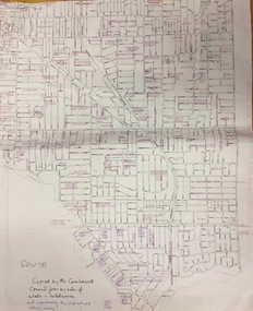
Plan, Gwen McWilliam, Annotated Plan of the City of Camberwell, 1993
... Plan of Camberwell, Canterbury, Balwyn and Surrey Hills, forming part of a larger plan of the City of Boroondara, including annotations by the historian Gwen McWilliam, identifying significant landholdings, subdivisions and key dates. The plan was donated to the Kew...She was awarded the medal of the Order of Australia in 2001 ‘for service to the community of Hawthorn and district, particularly through the research, documentation and publication of its history.’ city of boroondara, subdivisions - camberwell, subdivisions - balwyn, subdivisions - surrey hills, subdivisions - canterbury, gwen mcwilliam Plan of Camberwell, Canterbury, Balwyn and Surrey Hills, forming part of a larger plan of the City of Boroondara, including annotations by the historian Gwen McWilliam, identifying significant landholdings, subdivisions and key dates. The plan was donated to the Kew ...Gwen Barton McWilliam (nee: Nelson), OAM, BA (1933- ). Gwen McWilliam is well known as an authority on the history of Boroondara and the author of a large number of books and pamphlets about the City. She was awarded the medal of the Order of Australia in 2001 ‘for service to the community of Hawthorn and district, particularly through the research, documentation and publication of its history.’ Plan of Camberwell, Canterbury, Balwyn and Surrey Hills, forming part of a larger plan of the City of Boroondara, including annotations by the historian Gwen McWilliam, identifying significant landholdings, subdivisions and key dates. The plan was donated to the Kew Historical Society by Ms McWilliam. city of boroondara, subdivisions - camberwell, subdivisions - balwyn, subdivisions - surrey hills, subdivisions - canterbury, gwen mcwilliam -
 Kew Historical Society Inc
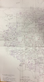
Plan, Gwen McWilliam, Annotated Plan of City of Boroondara, c.1995
... She was awarded the medal of the Order of Australia in 2001 ‘for service to the community of Hawthorn and district, particularly through the research, documentation and publication of its history.’ subdivisions - hawthorn, subdivisions - kew, subdivisions - camberwell, subdivisions - balwyn, subdivisions - surrey hills, subdivisions - canterbury, gwen mcwilliam Council markings in pink Digitally annotated part plan of the City of Boroondara, created by Council (Library?) ...Gwen Barton McWilliam (nee: Nelson), OAM, BA (1933- ). Gwen McWilliam is well known as an authority on the history of Boroondara and the author of a large number of books and pamphlets about the City. She was awarded the medal of the Order of Australia in 2001 ‘for service to the community of Hawthorn and district, particularly through the research, documentation and publication of its history.’ Digitally annotated part plan of the City of Boroondara, created by Council (Library?) staff, based on annotated plans provided by the historian Gwen McWilliam, identifying significant landholdings, subdivisions and key dates. On the plan Gwen McWilliam noted that the attempt to copy her annotations had resulted in incorrect data being included, so the plans were never published. For plans including her original 1993 annotations, see 2017.0143 and 2017.0144.Council markings in pinksubdivisions - hawthorn, subdivisions - kew, subdivisions - camberwell, subdivisions - balwyn, subdivisions - surrey hills, subdivisions - canterbury, gwen mcwilliam -
 Kew Historical Society Inc
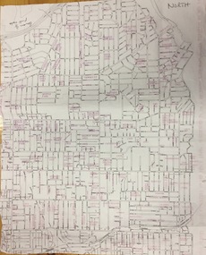
Plan, Gwen McWilliam, Annotated Plan of City of Boroondara, c.1995
... She was awarded the medal of the Order of Australia in 2001 ‘for service to the community of Hawthorn and district, particularly through the research, documentation and publication of its history.’ subdivisions - hawthorn, subdivisions - kew, subdivisions - camberwell, subdivisions - balwyn, subdivisions - surrey hills, subdivisions - canterbury, gwen mcwilliam Council additions in pink Digitally annotated part plan of the City of Boroondara, created by Council (Library?) ...Gwen Barton McWilliam (nee: Nelson), OAM, BA (1933- ). Gwen McWilliam is well known as an authority on the history of Boroondara and the author of a large number of books and pamphlets about the City. She was awarded the medal of the Order of Australia in 2001 ‘for service to the community of Hawthorn and district, particularly through the research, documentation and publication of its history.’ Digitally annotated part plan of the City of Boroondara, created by Council (Library?) staff, based on annotated plans provided by the historian Gwen McWilliam, identifying significant landholdings, subdivisions and key dates. On the plan Gwen McWilliam noted that the attempt to copy her annotations had resulted in incorrect data being included, so the plans were never published. For plans including her original 1993 annotations, see 2017.0143 and 2017.0144.Council additions in pinksubdivisions - hawthorn, subdivisions - kew, subdivisions - camberwell, subdivisions - balwyn, subdivisions - surrey hills, subdivisions - canterbury, gwen mcwilliam -
 Kew Historical Society Inc
Plan, Gwen McWilliam, Annotated Plan of City of Boroondara, c.1995
... She was awarded the medal of the Order of Australia in 2001 ‘for service to the community of Hawthorn and district, particularly through the research, documentation and publication of its history.’ subdivisions - hawthorn, subdivisions - kew, subdivisions - camberwell, subdivisions - balwyn, subdivisions - surrey hills, subdivisions - canterbury, gwen mcwilliam Additions in pink by City of Boroondara Digitally annotated part plan of the City of Boroondara, created by Council (Library?) ...Gwen Barton McWilliam (nee: Nelson), OAM, BA (1933- ). Gwen McWilliam is well known as an authority on the history of Boroondara and the author of a large number of books and pamphlets about the City. She was awarded the medal of the Order of Australia in 2001 ‘for service to the community of Hawthorn and district, particularly through the research, documentation and publication of its history.’ Digitally annotated part plan of the City of Boroondara, created by Council (Library?) staff, based on annotated plans provided by the historian Gwen McWilliam, identifying significant landholdings, subdivisions and key dates. On the plan Gwen McWilliam noted that the attempt to copy her annotations had resulted in incorrect data being included, so the plans were never published. For plans including her original 1993 annotations, see 2017.0143 and 2017.0144.Additions in pink by City of Boroondarasubdivisions - hawthorn, subdivisions - kew, subdivisions - camberwell, subdivisions - balwyn, subdivisions - surrey hills, subdivisions - canterbury, gwen mcwilliam -
 Kew Historical Society Inc
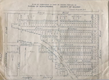
Plan - Subdivision Plan, Plan of Subdivision of Part of Crown Portion 84 / Parish of Boroondara / County of Bourke / Lodged Plan No. 2217, Twentieth Century
... Kew Urban Conservation Study : Volume 2 - Development History’ (1988), summarised the periods of urban development and subdivisions of land in Kew. The periods that she identified included 1845-1880, 1880-1893, 1893-1921, 1921-1933, 1933-1943, and Post-War Development. These periods were selected as they represented periods of rapid growth or decline in urban development. An obvious starting point for Sanderson’s groupings involved population growth and the associated economic cycles. These cycles also highlighted urban expansion onto land that was predominantly rural, although in other cases it represented the decline and breakup of large estates. A number of the plans...Undated Plan of Subdivision of Crown Portion 84 in what is now Kew. The area shown is bordered by Burke Road, Harp Road, Arglye Road and Normanby Road....Barnes. Subdivision plans -- Kew (Vic) Harp Road Burke Road Normanby Road Lady Loch's Drive Gladstone Street Second Avenue First Avenue Undated Plan of Subdivision of Crown Portion 84 in what is now Kew. ...Pru Sanderson, in her groundbreaking ‘City of Kew Urban Conservation Study : Volume 2 - Development History’ (1988), summarised the periods of urban development and subdivisions of land in Kew. The periods that she identified included 1845-1880, 1880-1893, 1893-1921, 1921-1933, 1933-1943, and Post-War Development. These periods were selected as they represented periods of rapid growth or decline in urban development. An obvious starting point for Sanderson’s groupings involved population growth and the associated economic cycles. These cycles also highlighted urban expansion onto land that was predominantly rural, although in other cases it represented the decline and breakup of large estates. A number of the plans in the Kew Historical Society’s collection can also be found in other collections, such as those of the State Library of Victoria and the Boroondara Library Service. A number are however unique to the collection.The Kew Historical Society collection includes almost 100 subdivision plans pertaining to suburbs of the City of Melbourne. Most of these are of Kew, Kew East or Studley Park, although a smaller number are plans of Camberwell, Deepdene, Balwyn and Hawthorn. It is believed that the majority of the plans were gifted to the Society by persons connected with the real estate firm - J. R. Mathers and McMillan, 136 Cotham Road, Kew. The Plans in the collection are rarely in pristine form, being working plans on which the agent would write notes and record lots sold and the prices of these. The subdivision plans are historically significant examples of the growth of urban Melbourne from the beginning of the 20th Century up until the 1980s. A number of the plans are double-sided and often include a photograph on the reverse. A number of the latter are by noted photographers such as J.E. Barnes.Undated Plan of Subdivision of Crown Portion 84 in what is now Kew. The area shown is bordered by Burke Road, Harp Road, Arglye Road and Normanby Road.subdivision plans -- kew (vic), harp road, burke road, normanby road, lady loch's drive, gladstone street, second avenue, first avenue -
 Kew Historical Society Inc
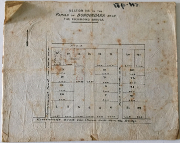
Plan - Subdivision Plan, J Hurrey, Section 115 in the Parish of Boroondara Near Richmond Bridge, 1853
... plans claims that it is a subdivision near the Richmond Bridge, Section 115 was located at what is now Camberwell Junction. While the plan only lists government roads rather than named streets, the section was located on the east side of Burke Road, stretching up the hill from the current Junction. Research on Trove, conducted by Kerry Fairbank, discovered an advertisement for unsold lots in Section 115 which clarifies the extent and location of subsequent land sales in the original section. The original article can be viewed through the link in the catalogue record. The interesting link to Kew...The Bevans were descendants of the Derricks family of Kew. This subdivision plan is the earliest original map or plan in the collection which shows parts of what is now the City of Boroondara, dating from circa 1853. ...Despite the plans claims that it is a subdivision near the Richmond Bridge, Section 115 was located at what is now Camberwell Junction. While the plan only lists government roads rather than named streets, the section was located on the east side of Burke Road, stretching up the hill from the current Junction. Research on Trove, conducted by Kerry Fairbank, discovered an advertisement for unsold lots in Section 115 which clarifies the extent and location of subsequent land sales in the original section. The original article can be viewed through the link in the catalogue record. The interesting link to Kew is the reference to James Beavan as the purchaser of lots 14 and 15. The historian Gwen McWilliam has notes that a Mr Beavan changed his name from Bevan. The Bevans were descendants of the Derricks family of Kew. This subdivision plan is the earliest original map or plan in the collection which shows parts of what is now the City of Boroondara, dating from circa 1853. It provides important information for researchers on subsequent subdivisions following the original land sales in [Camberwell] Boroondara. The site, on the east side of Burke Road is a highly-significant and historic site. This is believed to be the only extant copy of the subdivision in public collections.A small plan on parchment listing 28 lots, between one and two acres each, for sale in Section 115 in the Parish of Boroondara, dating from 1853 when the portion was subdivided.Obverse: Lot 16 "Joseph Duval", Lots 14 & 15 "James Beavan". Other annotations (measurements) are unreadable. Reverse: "KH-981 / Section 115 in the Parish of Boroondara / Near Richmond Bridge / 1640T. / J Duval / 14-15 J. Beavanparish of boroondara, subdivision plans - camberwell, section 115 - boroondara, subdivision plans -- camberwell (vic), riverscape road, burke road, camberwell junction -
 Kew Historical Society Inc
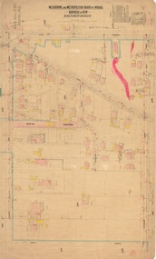
Plan, Melbourne and Metropolitan Board of Works, Melbourne & Metropolitan Board of Works : Borough of Kew : Detail Plan No.1294 & 1295, 1904
... plans include sections of Studley Park. Dominating the south and west corners of Kew Junction are the Clifton and Kew Hotels. The Kew Hotel, owned by Patrick O’Shaughnessy was one of the oldest in Kew. MMBW plans were amended over time to take account of new subdivisions...plans include sections of Studley Park. Dominating the south and west corners of Kew Junction are the Clifton and Kew Hotels. The Kew Hotel, owned by Patrick O’Shaughnessy was one of the oldest in Kew. MMBW plans were amended over time to take account of new subdivisions ...The Melbourne and Metropolitan Board of Works (MMBW) plans were produced from the 1890s to the 1950s. They were crucial to the design and development of Melbourne's sewerage and drainage system. The plans, at a scale of 40 feet to 1 inch (1:480), provide a detailed historical record of Melbourne streetscapes and environmental features. Each plan covers one or two street blocks (roughly six streets), showing details of buildings, including garden layouts and ownership boundaries, and features such as laneways, drains, bridges, parks, municipal boundaries and other prominent landmarks as they existed at the time each plan was produced. (Source: State Library of Victoria). This plan forms part of a large group of MMBW plans and maps that was donated to the Society by the Mr Poulter, City Engineer of the City of Kew in 1989. Within this collection, thirty-five hand-coloured plans, backed with linen, are of statewide significance as they include annotations that provide details of construction materials used in buildings in the first decade of the 20th century as well as additional information about land ownership and usage. The copies in the Public Record Office Victoria and the State Library of Victoria are monochrome versions which do not denote building materials so that the maps in this collection are invaluable and unique tools for researchers and heritage consultants. A number of the plans are not held in the collection of the State Library of Victoria so they have the additional attribute of rarity.Original survey plan, issued by the MMBW to a contractor with responsibility for constructing sewers in the area identified on the plan within the Borough of Kew. The plan was at some stage hand-coloured, possibly by the contractor, but more likely by officers working in the Engineering Department of the Borough and later Town, then City of Kew. The hand-coloured sections of buildings on the plan were used to denote masonry or brick constructions (pink), weatherboard constructions (yellow), and public buildings (grey).The streets and built structures in MMBW Detail Plan 1294 & 1295 were surveyed in 1903 and released to contractors in 1904. This plan is one of two in the collection where the lithographers amalgamated two separate plans. Both plans include sections of Studley Park. Dominating the south and west corners of Kew Junction are the Clifton and Kew Hotels. The Kew Hotel, owned by Patrick O’Shaughnessy was one of the oldest in Kew. MMBW plans were amended over time to take account of new subdivisions such as that which created Merrion Place. Of the four mansions shown in Studley Park Road, three remain – ‘Field Place’, the home of Frances Henty, ‘Leaghur’ and ‘Darley’. ‘Byram’ (later ‘Goathland’, then ‘Tara Hall’) was an architectural marvel. Designed in 1888 by E.G. Kilburn for the paper magnate George Ramsden, it was demolished in 1960. While an earlier sale of the southern section of Byram had created Tara Avenue in 1927, the demolition of the house in 1960 enabled the extension of Tara Avenue northward.melbourne and metropolitan board of works, detail plans, mmbw 1294, mmbw 1295, cartography -
 Kew Historical Society Inc
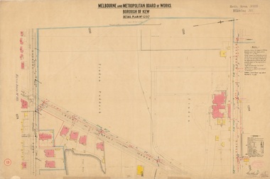
Plan, Melbourne & Metropolitan Board of Works : Borough of Kew : Detail Plan No.1297, 1904
... Kew, described here as the ‘Findon Paddock’. ‘Findon’, the house from which the name of the paddock was taken fronts Stevenson Street and was clearly a rambling structure. The best-known occupant of Findon was Henry ‘Money Miller’ who bought the house in 1871. Miller was a member of Victoria’s first parliament and assisted in the framing of its constitution. Findon was to be subdivided as early as 1912, when the Findon Subdivision was advertised to be sold by auction. In the plan...Kew, described here as the ‘Findon Paddock’. ‘Findon’, the house from which the name of the paddock was taken fronts Stevenson Street and was clearly a rambling structure. The best-known occupant of Findon was Henry ‘Money Miller’ who bought the house in 1871. Miller was a member of Victoria’s first parliament and assisted in the framing of its constitution. Findon was to be subdivided as early as 1912, when the Findon Subdivision was advertised to be sold by auction. In the plan ...The Melbourne and Metropolitan Board of Works (MMBW) plans were produced from the 1890s to the 1950s. They were crucial to the design and development of Melbourne's sewerage and drainage system. The plans, at a scale of 40 feet to 1 inch (1:480), provide a detailed historical record of Melbourne streetscapes and environmental features. Each plan covers one or two street blocks (roughly six streets), showing details of buildings, including garden layouts and ownership boundaries, and features such as laneways, drains, bridges, parks, municipal boundaries and other prominent landmarks as they existed at the time each plan was produced. (Source: State Library of Victoria)This plan forms part of a large group of MMBW plans and maps that was donated to the Society by the Mr Poulter, City Engineer of the City of Kew in 1989. Within this collection, thirty-five hand-coloured plans, backed with linen, are of statewide significance as they include annotations that provide details of construction materials used in buildings in the first decade of the 20th century as well as additional information about land ownership and usage. The copies in the Public Record Office Victoria and the State Library of Victoria are monochrome versions which do not denote building materials so that the maps in this collection are invaluable and unique tools for researchers and heritage consultants. A number of the plans are not held in the collection of the State Library of Victoria so they have the additional attribute of rarity.Original survey plan, issued by the MMBW to a sewage contractor with responsibility for constructing sewers in the area identified on the plan within the Borough of Kew. The plan was at some stage hand-coloured, possibly by the contractor, but more likely by officers working in the Engineering Department of the Borough and later Town, then City of Kew. The hand-coloured sections of buildings on the plan were used to denote masonry or brick constructions (pink), weatherboard constructions (yellow), and public buildings (grey). This plan of Kew encompasses the area bounded by Barkers Road, High Street and Stevenson Street. Because of the angle created by High Street, a number of houses on the northern side of High Street are shown. The area is dominated by one of the great original landholdings in Kew, described here as the ‘Findon Paddock’. ‘Findon’, the house from which the name of the paddock was taken fronts Stevenson Street and was clearly a rambling structure. The best-known occupant of Findon was Henry ‘Money Miller’ who bought the house in 1871. Miller was a member of Victoria’s first parliament and assisted in the framing of its constitution. Findon was to be subdivided as early as 1912, when the Findon Subdivision was advertised to be sold by auction. In the plan of the subdivision, the original house is not shown, so, presumably it had previously been demolished. Fincham & Son moved the organ, built by Henry Willis, which was installed in the house, first to ‘Whernside’ in Toorak, and later to the Box Hill Methodist Church.melbourne and metropolitan board of works, detail plans, mmbw 1297, cartography, kew (vic.) — municipal collection -
 Kew Historical Society Inc
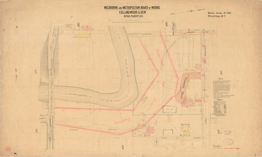
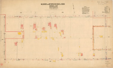
Plan, Melbourne & Metropolitan Board of Works : Borough of Kew : Detail Plan No.1301, 1910
... Kew. The plan was at some stage hand-coloured, possibly by the contractor, but more likely by officers working in the Engineering Department of the Borough and later Town, then City of Kew. The hand-coloured sections of buildings on the plan were used to denote masonry or brick constructions (pink), weatherboard constructions (yellow), and public buildings (grey). Throughout its history, the land in what is known today as Studley Ward of the City of Boroondara has been subject to continuing subdivision...Kew. The plan was at some stage hand-coloured, possibly by the contractor, but more likely by officers working in the Engineering Department of the Borough and later Town, then City of Kew. The hand-coloured sections of buildings on the plan were used to denote masonry or brick constructions (pink), weatherboard constructions (yellow), and public buildings (grey). Throughout its history, the land in what is known today as Studley Ward of the City of Boroondara has been subject to continuing subdivision ...The Melbourne and Metropolitan Board of Works (MMBW) plans were produced from the 1890s to the 1950s. They were crucial to the design and development of Melbourne's sewerage and drainage system. The plans, at a scale of 40 feet to 1 inch (1:480), provide a detailed historical record of Melbourne streetscapes and environmental features. Each plan covers one or two street blocks (roughly six streets), showing details of buildings, including garden layouts and ownership boundaries, and features such as laneways, drains, bridges, parks, municipal boundaries and other prominent landmarks as they existed at the time each plan was produced. (Source: State Library of Victoria)This plan forms part of a large group of MMBW plans and maps that was donated to the Society by the Mr Poulter, City Engineer of the City of Kew in 1989. Within this collection, thirty-five hand-coloured plans, backed with linen, are of statewide significance as they include annotations that provide details of construction materials used in buildings in the first decade of the 20th century as well as additional information about land ownership and usage. The copies in the Public Record Office Victoria and the State Library of Victoria are monochrome versions which do not denote building materials so that the maps in this collection are invaluable and unique tools for researchers and heritage consultants. A number of the plans are not held in the collection of the State Library of Victoria so they have the additional attribute of rarity.Original survey plan, issued by the MMBW to a contractor with responsibility for constructing sewers in the area identified on the plan within the Borough of Kew. The plan was at some stage hand-coloured, possibly by the contractor, but more likely by officers working in the Engineering Department of the Borough and later Town, then City of Kew. The hand-coloured sections of buildings on the plan were used to denote masonry or brick constructions (pink), weatherboard constructions (yellow), and public buildings (grey). Throughout its history, the land in what is known today as Studley Ward of the City of Boroondara has been subject to continuing subdivision. This is evident in Plan 1301, where later hands have modified the original map to include streets created subsequent to the printing of the plan in 1904. Other annotations such as the ‘Reserved for Road Purposes’ beside the Yarra never eventuated. The plan continued to be modified to at least 1953, when a later hand noted that a particular site was ‘Property site P. McIntyre house’ in Swinton Avenue. Two significant houses in the area are outlined on the plan: ‘Swinton’ on the corner of the streets then named Effey and Maud Streets (now Swinton Avenue) and ‘Fairhaven’ [unnamed] in Stevenson Street. The gardens of the two David Syme owned mansions of ‘Blythswood’ and ‘Rockingham’, stretching down to the River Yarra, are also represented.melbourne and metropolitan board of works, detail plans, mmbw 1301, cartography -
 Kew Historical Society Inc
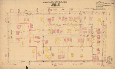
Plan, Melbourne & Metropolitan Board of Works : Borough of Kew : Detail Plan No.1564, 1905
... Kew. The plan was at some stage hand-coloured, possibly by the contractor, but more likely by officers working in the Engineering Department of the Borough and later Town, then City of Kew. The hand-coloured sections of buildings on the plan were used to denote masonry or brick constructions (pink), weatherboard constructions (yellow), and public buildings (grey). In 1905, when Plan No.1564 was printed, that part of Kew bordered by Brougham Place (now Daniell Place), Mount Street, Sackville Street and Ross Street was already the location of a number of large mansions. Here, subdivisions...Kew. The plan was at some stage hand-coloured, possibly by the contractor, but more likely by officers working in the Engineering Department of the Borough and later Town, then City of Kew. The hand-coloured sections of buildings on the plan were used to denote masonry or brick constructions (pink), weatherboard constructions (yellow), and public buildings (grey). In 1905, when Plan No.1564 was printed, that part of Kew bordered by Brougham Place (now Daniell Place), Mount Street, Sackville Street and Ross Street was already the location of a number of large mansions. Here, subdivisions ...The Melbourne and Metropolitan Board of Works (MMBW) plans were produced from the 1890s to the 1950s. They were crucial to the design and development of Melbourne's sewerage and drainage system. The plans, at a scale of 40 feet to 1 inch (1:480), provide a detailed historical record of Melbourne streetscapes and environmental features. Each plan covers one or two street blocks (roughly six streets), showing details of buildings, including garden layouts and ownership boundaries, and features such as laneways, drains, bridges, parks, municipal boundaries and other prominent landmarks as they existed at the time each plan was produced. (Source: State Library of Victoria)This plan forms part of a large group of MMBW plans and maps that was donated to the Society by the Mr Poulter, City Engineer of the City of Kew in 1989. Within this collection, thirty-five hand-coloured plans, backed with linen, are of statewide significance as they include annotations that provide details of construction materials used in buildings in the first decade of the 20th century as well as additional information about land ownership and usage. The copies in the Public Record Office Victoria and the State Library of Victoria are monochrome versions which do not denote building materials so that the maps in this collection are invaluable and unique tools for researchers and heritage consultants. A number of the plans are not held in the collection of the State Library of Victoria so they have the additional attribute of rarity.Original survey plan, issued by the MMBW to a contractor with responsibility for constructing sewers in the area identified on the plan within the Borough of Kew. The plan was at some stage hand-coloured, possibly by the contractor, but more likely by officers working in the Engineering Department of the Borough and later Town, then City of Kew. The hand-coloured sections of buildings on the plan were used to denote masonry or brick constructions (pink), weatherboard constructions (yellow), and public buildings (grey). In 1905, when Plan No.1564 was printed, that part of Kew bordered by Brougham Place (now Daniell Place), Mount Street, Sackville Street and Ross Street was already the location of a number of large mansions. Here, subdivisions, at least at this stage, produced larger blocks than in Central Kew. Many of the houses on this plan are named: ‘Faybrook’, ‘Northumbria’, ‘Parkholm[e]’, ‘Dunboe’, ‘Katoomba’ and ‘Eschol’ fronting Sackville Street. Eschol was once the home of the manufacturer Robert Harrison, whose cordial factory in Spring and Argyle Streets Fitzroy are noted on the Victorian Heritage Register. ‘The Hawthorns’ on the corner of Brougham Place and Mount Street was the home of the medical practitioner Frank William Fay, who won the military cross and other honours for conspicuous gallantry and devotion to duty in World War 1.melbourne and metropolitan board of works, detail plans, mmbw 1564, cartography -
 Kew Historical Society Inc
Plan, Melbourne & Metropolitan Board of Works : Borough of Kew : Detail Plan No.1575, 1905
... Kew. The plan was at some stage hand-coloured, possibly by the contractor, but more likely by officers working in the Engineering Department of the Borough and later Town, then City of Kew. The hand-coloured sections of buildings on the plan were used to denote masonry or brick constructions (pink), weatherboard constructions (yellow), and public buildings (grey). Plan No.1575 shows that in the area bounded by Wellington Street, Edgevale Road, Glenferrie Road, and Cotham Road, there had already been significant subdivision...Kew. The plan was at some stage hand-coloured, possibly by the contractor, but more likely by officers working in the Engineering Department of the Borough and later Town, then City of Kew. The hand-coloured sections of buildings on the plan were used to denote masonry or brick constructions (pink), weatherboard constructions (yellow), and public buildings (grey). Plan No.1575 shows that in the area bounded by Wellington Street, Edgevale Road, Glenferrie Road, and Cotham Road, there had already been significant subdivision ...The Melbourne and Metropolitan Board of Works (MMBW) plans were produced from the 1890s to the 1950s. They were crucial to the design and development of Melbourne's sewerage and drainage system. The plans, at a scale of 40 feet to 1 inch (1:480), provide a detailed historical record of Melbourne streetscapes and environmental features. Each plan covers one or two street blocks (roughly six streets), showing details of buildings, including garden layouts and ownership boundaries, and features such as laneways, drains, bridges, parks, municipal boundaries and other prominent landmarks as they existed at the time each plan was produced. (Source: State Library of Victoria)This plan forms part of a large group of MMBW plans and maps that was donated to the Society by the Mr Poulter, City Engineer of the City of Kew in 1989. Within this collection, thirty-five hand-coloured plans, backed with linen, are of statewide significance as they include annotations that provide details of construction materials used in buildings in the first decade of the 20th century as well as additional information about land ownership and usage. The copies in the Public Record Office Victoria and the State Library of Victoria are monochrome versions which do not denote building materials so that the maps in this collection are invaluable and unique tools for researchers and heritage consultants. A number of the plans are not held in the collection of the State Library of Victoria so they have the additional attribute of rarity.Original survey plan, issued by the MMBW to a contractor with responsibility for constructing sewers in the area identified on the plan within the Borough of Kew. The plan was at some stage hand-coloured, possibly by the contractor, but more likely by officers working in the Engineering Department of the Borough and later Town, then City of Kew. The hand-coloured sections of buildings on the plan were used to denote masonry or brick constructions (pink), weatherboard constructions (yellow), and public buildings (grey). Plan No.1575 shows that in the area bounded by Wellington Street, Edgevale Road, Glenferrie Road, and Cotham Road, there had already been significant subdivision of land and houses constructed. As one of the highest points in Kew, as expected, there were already some significant mansions built on large allotments of land. Many of these mansions are identified by name on the plan such as ‘Kelso’, ‘Abbotsford’, ‘Clarendon’ and ‘Ashlyn’ in Cotham Road. Other houses of equal size are unnamed on the plan.melbourne and metropolitan board of works, detail plans, maps - borough of kew, mmbw 1575, cartography -
 Kew Historical Society Inc
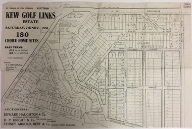
Plan - Subdivision Plan, Kew Golf Links Estate, 1936, 1936
... Kew Golf Links Estate was a major subdivision in North Kew. It derived its title due to the land being previously occupied by the Kew Golf Club, which transferred its course to a number of locations before occupying its current site. The Plan...Monochrome printed, folded subdivision plan for the Kew Golf Links Estate, to be auctioned on 7 November 1936. ...subdivision of the Kew Golf Links Estate was a major subdivision of farmland in Kew. The site was at one stage designated for industrial development and the building of a new Kodak factory. The decision by Council to oppose the redevelopment makes the beginning of the period when all industrial development was banned in Kew. subdivision plans - kew (vic) kodak factory - kew (vic) Monochrome printed, folded subdivision plan for the Kew Golf Links Estate, to be auctioned on 7 November 1936. ...The Kew Golf Links Estate was a major subdivision in North Kew. It derived its title due to the land being previously occupied by the Kew Golf Club, which transferred its course to a number of locations before occupying its current site. The Plan advertises 180 choice home sites. The street names are somewhat different today as those on the map are named after the proposed Kodak Factory to be built on the site. The subdivision of the Kew Golf Links Estate was a major subdivision of farmland in Kew. The site was at one stage designated for industrial development and the building of a new Kodak factory. The decision by Council to oppose the redevelopment makes the beginning of the period when all industrial development was banned in Kew.Monochrome printed, folded subdivision plan for the Kew Golf Links Estate, to be auctioned on 7 November 1936. Streets named include: Carnegie Avenue, Willsmere Road, Kilby Boulevarde, Kodak Avenue, Coleman Avenue, Beresford Avenue, McConchie Avenue, Cole Avenue, White Avenue, Baker Avenue, Spruzen Avenue, Tanner Avenue, Ratten Avenue, Mathers Avenue, Railway Avenue, Sutherland Avenue, and Belford Road. The position of the Yarra River and a large Drainage Reserve are marked on the plan. Lots for sale are numbered. Existing buildings are designated with a square.subdivision plans - kew (vic), kodak factory - kew (vic) -
 Kew Historical Society Inc
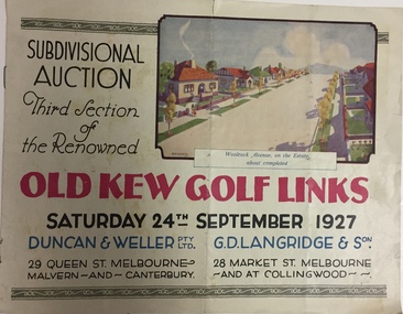
Booklet, Duncan & Weller Pty Ltd, Old Kew Golf Links Estate, 1927, 1927
... 6 page illustrated brochure advertising the third section of a major subdivision in Kew in 1927 including 75 charming home allotments and 7 valuable building sites. The brochure includes the subdivision plan. ...Kew in the 1920s The subdivision of the Kew Golf Links Estate was a major subdivision of farmland in Kew. The site was at one stage designated for industrial development and the building of a new Kodak factory. The decision by Council to oppose the redevelopment makes the beginning of the period when all industrial development was banned in Kew. subdivisions - kew (vic) kew golf links estate 6 page illustrated brochure advertising the third section of a major subdivision in Kew in 1927 including 75 charming home allotments and 7 valuable building sites. The brochure includes the subdivision plan ...The booklet advertises the third sale within the Old Golf Links Estate which was a major subdivision of farmland in North Kew in the 1920sThe subdivision of the Kew Golf Links Estate was a major subdivision of farmland in Kew. The site was at one stage designated for industrial development and the building of a new Kodak factory. The decision by Council to oppose the redevelopment makes the beginning of the period when all industrial development was banned in Kew.6 page illustrated brochure advertising the third section of a major subdivision in Kew in 1927 including 75 charming home allotments and 7 valuable building sites. The brochure includes the subdivision plan. The front cover includes a colour illustration of the almost completed houses in Woolcock Avenue. Streets named include: Kilby Road, Kodak Avenue, Baker Avenue, Mathers Avenue, Coleman Avenue, White Avenue and Belford Road. Lots for sale are numbered. Existing buildings are designated with a square.subdivisions - kew (vic), kew golf links estate -
 Kew Historical Society Inc
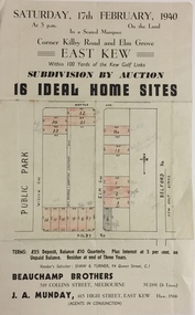
Plan - Subdivision Plan, Subdivision by Auction: 16 Ideal Home Sites, East Kew, 1940, 1940
... Single page subdivision plan advertising the sale by Auction of 16 Ideal Home Sites, in East Kew, on 17 February 1940. ...plan include: Kilby Road, Belford Road, Elm Grove, Willow Grove. Willsmere Park is indicated but not named. The auction was conducted by Beauchamp Brothers. Subdivision by Auction: 16 Ideal Home Sites, East Kew ...An advertisement for the sale of a subdivision by Auction: of 16 Ideal Home Sites, East Kew, 1940. This significant sale of land between the Kew Golf Course and Willsmere Park led to the streets having a high degree of architectural uniformity.The subdivision in the second year of the war indicates that land sales for homes and speculation continued from the 1930s into the period of the Second World War. There is no indication on the plan that a war is occurring.Single page subdivision plan advertising the sale by Auction of 16 Ideal Home Sites, in East Kew, on 17 February 1940. Streets named in the plan include: Kilby Road, Belford Road, Elm Grove, Willow Grove. Willsmere Park is indicated but not named. The auction was conducted by Beauchamp Brothers. A number of lots are coloured pink on the plan indicating those lots for sale and/or those already sold.subdivision plans - kew east (vic) -
 Kew Historical Society Inc
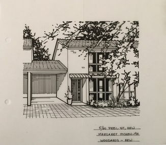
Drawing - Subdivision Plan, Margaret Picken, 5/60 Peel Street, Kew, 1994
... The year in which the drawing was created is also a valuable record for house historians, as a number of the properties depicted have either been altered since that date or demolished. artist -- margaret picken 1950- architectural drawings -- houses -- kew (vic.) 5/60 peel street - kew (vic) 5/60 PEEL ST., KEW / MARGARET PICKEN ~94 / WOODARDS ~ KEW Pen and ink architectural drawing on drafting film of 5/60 Peel Street, Kew by Margaret Picken. 5/60 Peel Street, Kew Drawing Subdivision Plan Margaret Picken Woodards (Kew) ...After training as a Cartographic Draftsman within the mining industry, I worked as a property illustrator for real estate firms in the eastern suburbs of Melbourne for 22 years from 1983. I initially photographed houses with a Polaroid camera and made a 'thumbnail' sketch while there. The photos were used to scale off a sketch in pencil and then that sketch was overlaid with drafting film and the 'pen and ink' completed. The pens I used were the Rotring ‘Rapidigraph’ drafting pens. The ink was also made by Rotring (German).The film was ‘Rapidraw’, polyester drafting film, double matte. It takes a very fine line and doesn’t bleed. As well as house sketches, there were often floor plans and site plans ordered. Aerial sketches were ordered when the property needed an overall view. (Margaret Picken, 2020)This drawing is one of a series created by Margaret Picken for a number of real estate agents in Melbourne between 1983 and 2005. Each work is signed and dated by the artist.Gift of Margaret Picken, 2020Pen and ink architectural drawing on drafting film of 5/60 Peel Street, Kew by Margaret Picken.5/60 PEEL ST., KEW / MARGARET PICKEN ~94 / WOODARDS ~ KEWartist -- margaret picken 1950-, architectural drawings -- houses -- kew (vic.), 5/60 peel street - kew (vic) -
Kew Historical Society Inc
Archive (Sub-series) - Subject File, Kew Historical Society, 'Goldthorns' (Houses, Kew), 1958
... Kew in October 1931. The flyer contains a photograph of the front of the house, a list of its rooms, a site plan (including possible subdivisions) and a photo of the extensive rear garden....Kew in October 1931. The flyer contains a photograph of the front of the house, a list of its rooms, a site plan (including possible subdivisions) and a photo of the extensive rear garden. goldthorns - normanby road - kew (vic), goldthorns estate, mansion - kew (vic) gardens - kew (vic) griffiths family subdivisions - kew (vic) Archive file containing Executor's Auction, Sunday 24th October 1931, "Goldthorns", Normanby Road, Corner of Argyle Road, Kew’ - Four page flyer advertising the sale of Goldthorns in Normanby Road, Kew in October 1931. ...Various partiesReference, Research, InformationSecondary Values (KHS Imposed Order)Subject file containing Executor's Auction, Sunday 24th October 1931, "Goldthorns", Normanby Road, Corner of Argyle Road, Kew’ - Four page flyer advertising the sale of Goldthorns in Normanby Road, Kew in October 1931. The flyer contains a photograph of the front of the house, a list of its rooms, a site plan (including possible subdivisions) and a photo of the extensive rear garden.goldthorns - normanby road - kew (vic),, goldthorns estate, mansion - kew (vic), gardens - kew (vic), griffiths family, subdivisions - kew (vic)goldthorns - normanby road - kew (vic),, goldthorns estate, mansion - kew (vic), gardens - kew (vic), griffiths family, subdivisions - kew (vic) -
 Kew Historical Society Inc
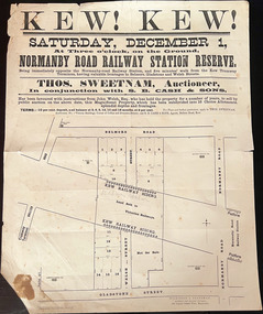
Plan, Kew! Kew!, 1888
... Plan of an 1888 subdivision bounded by Bulleen Road (now High Street), Gladstone Street (now Campbell Street?), Park Street (now Adeney Avenue), and Belmore Road (now Harp Road). The 16 lots in the proposed subdivision are bisected by the route of the Outer Circle railway, and next to the proposed Normanby Station (later renamed East Kew). ...subdivisions in Kew. This subdivision, 'Kew! Kew!' was also impacted by, or resulted from, the decision by the Victorian Government to construct the Outer Circle railway. Construction of the railway began in 1888 and was completed in 1891. Outer Circle Railway Land Subdivisions Plan ...The Land Boom of the 1880s accelerated the rate of subdivisions in Kew. This subdivision, 'Kew! Kew!' was also impacted by, or resulted from, the decision by the Victorian Government to construct the Outer Circle railway. Construction of the railway began in 1888 and was completed in 1891. Plan of an 1888 subdivision bounded by Bulleen Road (now High Street), Gladstone Street (now Campbell Street?), Park Street (now Adeney Avenue), and Belmore Road (now Harp Road). The 16 lots in the proposed subdivision are bisected by the route of the Outer Circle railway, and next to the proposed Normanby Station (later renamed East Kew). On the plan, local landmarks such as the tram terminus, the Harp of Erin hotel, and the station are located. The street where the lots are numbered , was called Welsh Street on the plan as this was the name of the vendor. Surrounding land owners are also named: G. Smith Esq, Matthew Maher Esq, and Maurice Neligan Esq.outer circle railway, land subdivisions -
 Kew Historical Society Inc
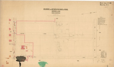
Plan, Melbourne & Metropolitan Board of Works / Borough of Kew, Detail Plan No.1593, 1905
... Plan, and outlined in pink is that part of the section that the contracting engineer was tasked with completing. This included sewering on both sides of this part of Cotham Road, but excluded properties such as ‘Glendonald’ and ‘Monnington’. This area was to undergo a series of subdivisions including the ‘Clifton Estate’, which created housing lots on Adeney Avenue and Florence Avenue in 1916. The most notable occupant of Clifton was William Adeney [died 1893], a pioneer of Camperdown, after which Park Street was later renamed. Melbourne & Metropolitan Board of Works / Borough of Kew ...The Melbourne and Metropolitan Board of Works (MMBW) plans were produced from the 1890s to the 1950s. They were crucial to the design and development of Melbourne's sewerage and drainage system. The plans, at a scale of 40 feet to 1 inch (1:480), provide a detailed historical record of Melbourne streetscapes and environmental features. Each plan covers one or two street blocks (roughly six streets), showing details of buildings, including garden layouts and ownership boundaries, and features such as laneways, drains, bridges, parks, municipal boundaries and other prominent landmarks as they existed at the time each plan was produced. (Source: State Library of Victoria)This plan forms part of a large group of MMBW plans and maps that was donated to the Society by the Mr Poulter, City Engineer of the City of Kew in 1989. Within this collection, thirty-five hand-coloured plans, backed with linen, are of statewide significance as they include annotations that provide details of construction materials used in buildings in the first decade of the 20th century as well as additional information about land ownership and usage. The copies in the Public Record Office Victoria and the State Library of Victoria are monochrome versions which do not denote building materials so that the maps in this collection are invaluable and unique tools for researchers and heritage consultants. A number of the plans are not held in the collection of the State Library of Victoria so they have the additional attribute of rarity.Original survey plan, issued by the MMBW to a contractor with responsibility for constructing sewers in the area identified on the plan within the Borough of Kew. The plan was at some stage hand-coloured, possibly by the contractor, but more likely by officers working in the Engineering Department of the Borough and later Town, then City of Kew. The hand-coloured sections of buildings on the plan were used to denote masonry or brick constructions (pink), weatherboard constructions (yellow), and public buildings (grey). The laborious task of hand-tinting these Board of Works plans was not without hazards as is evidenced by Plan No. 1593. On the Plan, the original colourist spilt black and green ink, partially obscuring some parts. The most obvious casualty is ‘Clifton’ located on the corner of Cotham Road and Park Street [now Adeney Avenue]. Included in this Plan, and outlined in pink is that part of the section that the contracting engineer was tasked with completing. This included sewering on both sides of this part of Cotham Road, but excluded properties such as ‘Glendonald’ and ‘Monnington’. This area was to undergo a series of subdivisions including the ‘Clifton Estate’, which created housing lots on Adeney Avenue and Florence Avenue in 1916. The most notable occupant of Clifton was William Adeney [died 1893], a pioneer of Camperdown, after which Park Street was later renamed.melbourne and metropolitan board of works, detail plans, survey plans - borough of kew, mmbw 1593, cartography -
 Kew Historical Society Inc
Plan - Subdivision Plan, H C Crouch, Old Golf Links Estate, 1930s
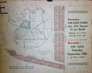
... One part of a massive subdivision of the Old Golf Links Estate in North Kew of 80 allotments bordering Sutherland Avenue, Ramsay Avenue, Belford Road, Beresford Street and Coleman Avenue. Inset on the plan...The numerous subdivision plans in the Kew Historical Society's collection represent working documents, ranging from the initial sketches made in planning a subdivision to printed plans on which auctioneers or agents listed the prices for which individual lots were sold. ...The land in North Kew between the Outer Circle Railway and the River Yarra was released in sections. This release included 80 lots. Most of this area was released during the Depression years in the early 1930s.Subdivision plans are historically important documents used as evidence of the growth of suburbs in Australia. They frequently provide information about when the land was sold on which a built structure was subsequently constructed as well as evidence relating to surveyors and real estate and financial agents. The numerous subdivision plans in the Kew Historical Society's collection represent working documents, ranging from the initial sketches made in planning a subdivision to printed plans on which auctioneers or agents listed the prices for which individual lots were sold. In a number of cases, the reverse of a subdivision plan in the collection includes a photograph of a house that was also for sale by the agent. These photographs provide significant heritage information relating house design and decoration, fencing and household gardens.One part of a massive subdivision of the Old Golf Links Estate in North Kew of 80 allotments bordering Sutherland Avenue, Ramsay Avenue, Belford Road, Beresford Street and Coleman Avenue. Inset on the plan at the top left, the route of the Outer Circle Railway is clearly marked. The Kew Golf Links is identified in its current location. The land on which Greenacres Golf Club was to be constructed is at this time marked as ‘Recreation Ground’. The ‘new bridge’ over the Yarra at Burke Road is also marked on the inset map. The Plan identifies the surveyor (sic) H.C. Crouch BCE MVIS, 443 Little Collins St., Melbourne. The date of the subdivision auction sale in identified as Saturday September 25th at three o'clock.Annotations: "E" top left. "Golf Links" top right. Lots 73-76 ticked and listed as "6" poundssubdivisions -- kew (vic.), old golf links estate -
 Kew Historical Society Inc
Photograph - Cosy Five Roomed Rough Cast Bungalow, Kew, J E Barnes, c.1920
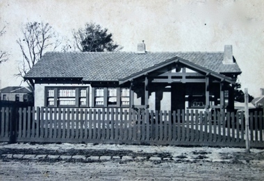
... Subdivision plans are historically important documents used as evidence of the growth of suburbs in Australia. They frequently provide information about when the land was sold on which a built structure was subsequently constructed as well as evidence relating to surveyors and real estate and financial agents. The numerous subdivision plans in the Kew...Subdivision plans are historically important documents used as evidence of the growth of suburbs in Australia. They frequently provide information about when the land was sold on which a built structure was subsequently constructed as well as evidence relating to surveyors and real estate and financial agents. The numerous subdivision plans in the Kew ...Subdivision plans are historically important documents used as evidence of the growth of suburbs in Australia. They frequently provide information about when the land was sold on which a built structure was subsequently constructed as well as evidence relating to surveyors and real estate and financial agents. The numerous subdivision plans in the Kew Historical Society's collection represent working documents, ranging from the initial sketches made in planning a subdivision to printed plans on which auctioneers or agents listed the prices for which individual lots were sold. In a number of cases, the reverse of a subdivision plan in the collection includes a photograph of a house that was also for sale by the agent. These photographs provide significant heritage information relating house design and decoration, fencing and household gardens. The photograph is also aesthetically significant as it was taken by J. E. Barnes, a nationally significant photographer. He was the most important photographer to have worked in Kew. He was active as a photographer in the district from c.1906 until his death in 1921. Best known as 'the Embarkation Photographer' (see the Australian War Memorial collection), Josiah Earl Barnes was also the official photographer employed by the Borough (and later Town, then City) of Kew. He clearly also completed commercial jobs for local businesses, as is the case in this photograph of a house for a local real estate and financial agent. A modest weatherboard house with rough-cast rendered walls. The gabled entrance incorporates elements of the Japanese aesthetic. The strong lines of the dark timber gable are reinforced by the colour and shape of the pickets in the fence. In contrast to an earlier period, the chimneys appear truncated. The use of extensive double-hung sash windows in the front rooms reflects a new interest in light in houses. The use of separate sunshades over windows in an earlier period is here replaced by an extension of the roofline over the window. The photographer Josiah Barnes died in 1921; so, the photograph of the house must predate this date. The location of the house, which was advertised for sale, has to date not been identified. Illegible inscription. Photographer's information on mount.josiah earl barnes, j e barnes, photography - kew, interwar housing - victoria, 1920s housing - kew -
 Kew Historical Society Inc
Photograph - 2 Young Street, Kew, Paramount Photos, 1920s
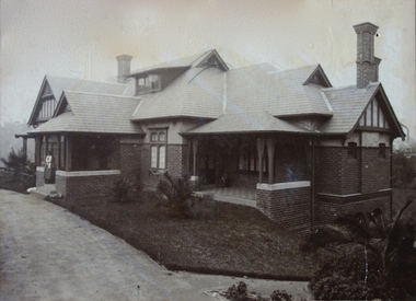
... Subdivision plans are historically important documents used as evidence of the growth of suburbs in Australia. They frequently provide information about when the land was sold on which a built structure was subsequently constructed as well as evidence relating to surveyors and real estate and financial agents. The numerous subdivision plans in the Kew...Subdivision plans are historically important documents used as evidence of the growth of suburbs in Australia. They frequently provide information about when the land was sold on which a built structure was subsequently constructed as well as evidence relating to surveyors and real estate and financial agents. The numerous subdivision plans in the Kew ...Subdivision plans are historically important documents used as evidence of the growth of suburbs in Australia. They frequently provide information about when the land was sold on which a built structure was subsequently constructed as well as evidence relating to surveyors and real estate and financial agents. The numerous subdivision plans in the Kew Historical Society's collection represent working documents, ranging from the initial sketches made in planning a subdivision to printed plans on which auctioneers or agents listed the prices for which individual lots were sold. In a number of cases, the reverse of a subdivision plan in the collection includes a photograph of a house that was also for sale by the agent. These photographs provide significant heritage information relating house design and decoration, fencing and household gardens.A prepossessing, large home constructed in the Arts and Crafts style. Located on the banks of the Yarra at 2 Young Street, Kew overlooking the factories of Richmond, the design of the house takes account of the gradient with the addition of a level below the front entrance. The elegant roof includes a number of projecting gables and dormers. The gables are typically half-timbered and rendered. In addition to the asymmetrically placed portico, there are at least two open verandas, supported by timber pillars and with roofs that reflect the overall pitch of the roof of the housereal estate photographs, 2 young street - kew -
 Kew Historical Society Inc
Photograph - 29 Uvadale Grove, Kew, 1920
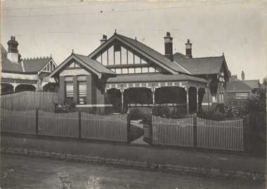
... The numerous subdivision plans in the Kew Historical Society's collection represent working documents, ranging from the initial sketches made in planning a subdivision to printed plans on which auctioneers or agents listed the prices for which individual lots were sold. ...The numerous subdivision plans in the Kew Historical Society's collection represent working documents, ranging from the initial sketches made in planning a subdivision to printed plans on which auctioneers or agents listed the prices for which individual lots were sold. ...The numerous subdivision plans in the Kew Historical Society's collection represent working documents, ranging from the initial sketches made in planning a subdivision to printed plans on which auctioneers or agents listed the prices for which individual lots were sold. In a number of cases, the reverse of a subdivision plan in the collection includes a photograph of a house that was also for sale by the agent. Subdivision plans are historically important documents used as evidence of the growth of suburbs in Australia. They frequently provide information about when the land was sold on which a built structure was subsequently constructed as well as evidence relating to surveyors and real estate and financial agents. These photographs provide significant heritage information relating house design and decoration, fencing and household gardens.When 29 Uvadale Grove, Kew was offered for sale it was described as: ‘Kew. Fine locality, 3 minutes Cotham Road. Splendidly built 6 roomed Brick Villa. Rooms 17 x 14, 16 x 13, &c. Beautifully fitted throughout. Land 70 x 134 to ROW.’ The price was advertised as being £1,400. The house exhibits key features of Federation architecture such as the gabled roof with a facing of half-timber and stucco. The veranda has a curved corrugated iron roof supported by timber pillars and fretwork. The slate roof with terra cotta ridging and finials marks a transition to the more common use of Marseilles tiles in Federation architecture.subdivisions - kew (vic.), 29 uvadale grove - kew (vic.) -
 Kew Historical Society Inc
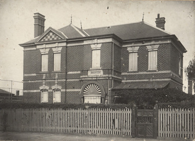
Photograph - 'Mount Eri', 9 Highbury Grove, 1919
... Subdivision plans are historically important documents used as evidence of the growth of suburbs in Australia. They frequently provide information about when the land was sold on which a built structure was subsequently constructed as well as evidence relating to surveyors and real estate and financial agents. The numerous subdivision plans in the Kew ...Subdivision plans are historically important documents used as evidence of the growth of suburbs in Australia. They frequently provide information about when the land was sold on which a built structure was subsequently constructed as well as evidence relating to surveyors and real estate and financial agents. The numerous subdivision plans in the Kew Historical Society's collection represent working documents, ranging from the initial sketches made in planning a subdivision to printed plans on which auctioneers or agents listed the prices for which individual lots were sold. In a number of cases, the reverse of a subdivision plan in the collection includes a photograph of a house that was also for sale by the agent. These photographs provide significant heritage information relating house design and decoration, fencing and household gardens.A photograph of Mount Eri, 9 Highbury Grove, an 11-room house for sale near the junction of Cotham and Glenferrie Roads. The substantial red brick, slate-roofed house and its location are not identified in the photograph, although the extent of the house is noted. It was described then as ‘well situated’ and close to 3 trams. Mathers, a financial agent in Cotham Road, placed advertisements about the sale of the property in The Argus in May and June 1919. The advertisement additionally refers to a billiard room and asserts that the house has every modern convenience. An annotation on the plan indicates that the house, with tennis court, was sold for £1960. Following extensive research, the house has now been conclusively identified, albeit extended and rendered. The house was originally built in the 19th century as a school and for much of the 20th century was used as a venue for receptions. -
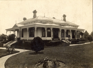 Kew Historical Society Inc
Photograph - Victorian Villa, High Street, c.1922
... The subdivision called the ‘Flower Farm Estate’ in East Kew occurred in 1922. [The subdivision plan is on the reverse of this photo.] ...Subdivision plans are historically important documents used as evidence of the growth of suburbs in Australia. They frequently provide information about when the land was sold on which a built structure was subsequently constructed as well as evidence relating to surveyors and real estate and financial agents. The numerous subdivision plans in the Kew ...Subdivision plans are historically important documents used as evidence of the growth of suburbs in Australia. They frequently provide information about when the land was sold on which a built structure was subsequently constructed as well as evidence relating to surveyors and real estate and financial agents. The numerous subdivision plans in the Kew Historical Society's collection represent working documents, ranging from the initial sketches made in planning a subdivision to printed plans on which auctioneers or agents listed the prices for which individual lots were sold. In a number of cases, the reverse of a subdivision plan in the collection includes a photograph of a house that was also for sale by the agent. These photographs provide significant heritage information relating house design and decoration, fencing and household gardens.An old inscription on this photograph identifies it as ‘an elegant timber villa in High Street. It occupied part of Lot 91, bought by Edward Glyn in the land sale of 16th October 1851, and run as a flower farm’. The subdivision called the ‘Flower Farm Estate’ in East Kew occurred in 1922. [The subdivision plan is on the reverse of this photo.] The Estate included 61 lots on either side of Boorool Road between High Street and Harp Road. In the MMBW Detail Plan 2017 of 1926, a number of these new villas had already been built. Matching houses with MMBW maps can always be a challenge, however if this house was near the corner of Boorool Road and High Street, it seems to fit the profile of a house called ‘Maxton’ (demolished).Photographer's name on photograph, lower right, and stamp on mount lower right: "A. Aberline, Glenferrie".houses - maxton - high street - kew (vic.), violet farm estate, subdivisions - kew (vic.) -
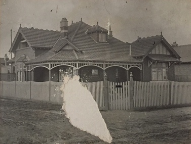 Kew Historical Society Inc
Photograph - 8 roomed DF Brick Villa, Kew, J E Barnes, c.1920
... Subdivision plans are historically important documents used as evidence of the growth of suburbs in Australia. They frequently provide information about when the land was sold on which a built structure was subsequently constructed as well as evidence relating to surveyors and real estate and financial agents. The numerous subdivision plans in the Kew...Kew. On the reverse of the photograph is a subdivision plan for the Normanby Estate, East Kew - 2016.0039.1. ...Kew. On the reverse of the photograph is a subdivision plan for the Normanby Estate, East Kew - 2016.0039.1. ...Subdivision plans are historically important documents used as evidence of the growth of suburbs in Australia. They frequently provide information about when the land was sold on which a built structure was subsequently constructed as well as evidence relating to surveyors and real estate and financial agents. The numerous subdivision plans in the Kew Historical Society's collection represent working documents, ranging from the initial sketches made in planning a subdivision to printed plans on which auctioneers or agents listed the prices for which individual lots were sold. In a number of cases, the reverse of a subdivision plan in the collection includes a photograph of a house that was also for sale by the agent. These photographs provide significant heritage information relating house design and decoration, fencing and household gardens. The photograph is of additional aesthetic significance as it was photographed by J. E. Barnes. Josiah Earl Barnes is a nationally significant photographer. He was also the most important photographer to have worked in Kew. He was active as a photographer in the district from c.1906 until his death in 1921. Best known as 'the Embarkation Photographer' (see the Australian War Memorial collection), J. Earl Barnes was also the official photographer employed by the Borough (and later Town, then City) of Kew. He clearly also completed commercial jobs for local businesses, as is the case in this photograph of a house for a local real estate and financial agent.A photograph, mounted on board of a double fronted Federation-era brick villa in Kew, photographed for a local real estate agent and financier by J. E. Barnes of Kew. On the reverse of the photograph is a subdivision plan for the Normanby Estate, East Kew - 2016.0039.1. As can be seen from the image, there is a large tear on the surface of the photograph.The brown card on which the photograph is mounted includes the following handwritten description, which may aid the identification of the house: "Kew, 3 minutes from tram, 8 roomed DF Brick Villa, tile roof including two attics, sleepout, bathroom, heater, E Light, Entrance Hall, double doors, leadlights, laundry, garden, lawns, land 75 x 170, 1975 pounds". Also photographers inscription on mount, lower left: J. E. Barnes / Photo / Phone 1966 Haw. KEW.j. e. barnes, josiah earl barnes, j. earl banes - photographer, architecture - federation style, houses - kew, real estate photographs -
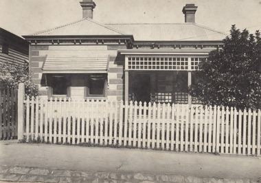 Kew Historical Society Inc
Photograph - W.B. Villa, Kew, c.1919
... A real estate photograph, mounted on brown card, showing a double fronted weatherboard villa, located in Kew, Victoria. On the reverse of the photograph is a subdivision plan for the Altyre Estate....Subdivision plans are historically important documents used as evidence of the growth of suburbs in Australia. They frequently provide information about when the land was sold on which a built structure was subsequently constructed as well as evidence relating to surveyors and real estate and financial agents. The numerous subdivision plans in the Kew ...The photograph offers significant information relating to late Victorian / Federation colour schemes and fencing.The block fronted villa has a corrugated iron roof and a flat projecting verandah, ornamented with a trellis design of timber. The front window features a timber shade, mounted on brackets. The treatment of the block-fronted panels shows that there is an attempt to highlight imitation quoining through use of a darker colour. The windows and door are also in this darker shade. The front fence and gate are made of wooden pickets. It is unlikely that the photograph was taken at the time of the villa's construction given the size of the shrub/tree in the front garden.Subdivision plans are historically important documents used as evidence of the growth of suburbs in Australia. They frequently provide information about when the land was sold on which a built structure was subsequently constructed as well as evidence relating to surveyors and real estate and financial agents. The numerous subdivision plans in the Kew Historical Society's collection represent working documents, ranging from the initial sketches made in planning a subdivision to printed plans on which auctioneers or agents listed the prices for which individual lots were sold. In a number of cases, the reverse of a subdivision plan in the collection includes a photograph of a house that was also for sale by the agent. These photographs provide significant heritage information relating house design and decoration, fencing and household gardens.A real estate photograph, mounted on brown card, showing a double fronted weatherboard villa, located in Kew, Victoria. On the reverse of the photograph is a subdivision plan for the Altyre Estate.Stamped on mount: Top - "KEW. Close tram. Fine View. / W.B. Villa Containing 8 Rooms. / Up-to-date Conveniences. EL Etc." Below - "Land 40 x 165. 615 pounds. Sold"houses - kew, real estate photographs
