
Showing 27 items matching "lake hume"
-
 8th/13th Victorian Mounted Rifles Regimental Collection
Photograph
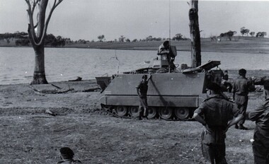
... 8/13 VMR carried out water training in M 113s at Lake Hume near Albury. The 8th/13th Victorian Mounted Rifles was raised as a regiment of the Royal Australian Armoured Corps on 1 May 1948 with Headquarters in Melbourne and squadrons in Sale, Benalla/Wangaratta and Albury. ...Black and white photograph of M 113 Personnel Carrier preparing to enter water at Lake Hume 1975....Black and white photograph of M 113 Personnel Carrier preparing to enter water at Lake Hume 1975. Photograph ...8/13 VMR carried out water training in M 113s at Lake Hume near Albury. The 8th/13th Victorian Mounted Rifles was raised as a regiment of the Royal Australian Armoured Corps on 1 May 1948 with Headquarters in Melbourne and squadrons in Sale, Benalla/Wangaratta and Albury. In 1955 Regimental Headquarters moved to Wangaratta and a second squadron was located at Albury. The Sale squadron transferred to 4th/19th Prince of Wales’s Light Horse. In 1977 8/13 VMR Regiment was reduced to an independent squadron A Squadron 8th/13th Victorian Mounted Rifles and in 1991 was linked with 4th/19th Prince of Wales’s Light Horse forming the VMR Squadron of that regiment.Black and white photograph of M 113 Personnel Carrier preparing to enter water at Lake Hume 1975. -
 The Beechworth Burke Museum
Photograph, c.1927-1930
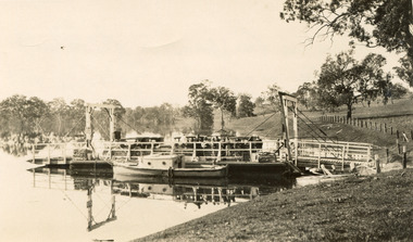
... ...Lake Hume...The Hume Dam, formerly known as the Hume Weir, was in construction between 1919 and 1936, which swelled the Murray River into the floodplain to the East of the dam permanently, creating Lake Hume, and isolating the residents of Bethanga and nearby towns, for whom the trip all the way around the new lake to another river crossing was a massive undertaking. ... Dam and the Bethanga Bridge, and shows the environment during the process of construction and the creation of Lake Hume Bethanga Bethanga Bridge Hume Hume Dam Artificial Lake Lake Hume Hume Weir Flood Floodplain Boat Punt Weir Pier Dock Transport Transportation Reverse: 1997.3189 / 84 -19 -1 / This is the snap of the Punt. / Our only means of getting out / of Bethanga for the present / Until the bridge is completed / it is 2 miles above the junction / of the Mitta + Murray. ...This image shows the Punt (a kind of small boat) that took residents of Bethanga across the Murray River before the Bethanga Bridge was built. Bethanga Bridge was built between 1927 and 1930, and was made a necessity by the building of the Hume Dam. The Hume Dam, formerly known as the Hume Weir, was in construction between 1919 and 1936, which swelled the Murray River into the floodplain to the East of the dam permanently, creating Lake Hume, and isolating the residents of Bethanga and nearby towns, for whom the trip all the way around the new lake to another river crossing was a massive undertaking. The person who wrote on the back of this card instead chose to cross the river on a boat until the Bethanga Bridge became available. Interestingly, partially submerged trees can be seen in the lake in the background of this photograph, illustrating that the dam had already begun to fill the floodplain even before the bridge was built. This photograph shows the methods the residents of Bethanga used while the Bethanga Bridge was being built. This record is associated with the Heritage Listed sites of the Hume Dam and the Bethanga Bridge, and shows the environment during the process of construction and the creation of Lake HumeSepia rectangular photograph printed on matte photographic paperReverse: 1997.3189 / 84 -19 -1 / This is the snap of the Punt. / Our only means of getting out / of Bethanga for the present / Until the bridge is completed / it is 2 miles above the junction / of the Mitta + Murray. It is / 1/2 a mile wide + runs across / the Murray into NSW / Kodak Print / bethanga, bethanga bridge, hume, hume dam, artificial lake, lake hume, hume weir, flood, floodplain, boat, punt, weir, pier, dock, transport, transportation -
 The Beechworth Burke Museum
Photograph
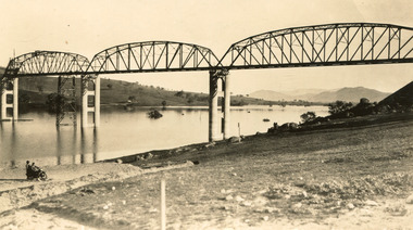
... ...Lake Hume...Bethanga Bridge Lake Hume Hume Dam Hume Weir Murray River Bridge Bethanga Albury Reverse: 1997 3186 / 84-19-3 / This is the bridge. / It is not yet open to traffic / yet. will not be completed / until May next / It is a wonderful bridge the / pillars are 100 feet high. / KODAK PRINT Envelope Obverse: Peterson PHOTO / Hume Weir Envelope Reverse: BMM 84-20-1,2+3. ...Taken between 1928 and 1930, depicted is the Bethanga Bridge under construction. The Bridge was completed in 1930 and was built to assist residents of the Bethanga district to travel to Albury. Other bridges would become submerged by the backed-up water of the Murray and Mitta Rivers so the Bethanga bridge was built two miles above the Mitta Weir. The Bethanga Bridge was built north of the future Hume Dam which would be completed in 1936. At 2430 feet long, Bethanga Bridge was the longest road bridge in Australia at the time of its completion. The Bridge is 20 feet wide and made up of nine 270 feet long spans. Materials used include ten tons of paint for the steel works; 1600 tons of steel; 900 tons of timber for the decking; and reinforced concrete for the piers. The tender for the construction was awarded to C. Ruwolt Pty. Ltd., engineers who were located on Victoria Street, West Richmond. The contract was awarded for £71,890. It was predicted between 250 and 300 men would find employment on the project. The news was well received by trade unions at the time as there had been a drop in available engineering work.This photograph is historically significant as it depicts the progress of the Bethanga Bridge construction, which was important infrastructure for the area. It is also a good example of methods used in the area to assist in travel over the river prior to the construction of the Hume Dam.Black and white rectangular photo printed on matte photographic paper.Reverse: 1997 3186 / 84-19-3 / This is the bridge. / It is not yet open to traffic / yet. will not be completed / until May next / It is a wonderful bridge the / pillars are 100 feet high. / KODAK PRINT Envelope Obverse: Peterson PHOTO / Hume Weir Envelope Reverse: BMM 84-20-1,2+3. bethanga bridge, lake hume, hume dam, hume weir, murray river, bridge, bethanga, albury -
 Rutherglen Historical Society
Image, c 1930
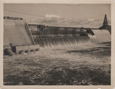
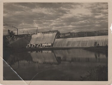
... ...lake hume...hume dam hume weir hume reservoir lake hume dam construction On back of photo: "Hume Weir" and an oval rubber stamp "V. ...Black and white photograph of the Hume Weir under construction.On back of photo: "Hume Weir" and an oval rubber stamp "V. Peterson | Photographer | Hume Reservoir"hume dam, hume weir, hume reservoir, lake hume, dam construction -
 Rutherglen Historical Society
Image, c 1930
... ...lake hume...hume dam hume weir hume reservoir lake hume dam construction On back of photo: "Hume Weir" and an oval rubber stamp "V. ...Black and white photograph of the Hume Weir under construction.On back of photo: "Hume Weir" and an oval rubber stamp "V. Peterson | Photographer | Hume Reservoir"hume dam, hume weir, hume reservoir, lake hume, dam construction -
 Rutherglen Historical Society
Image, c 1930
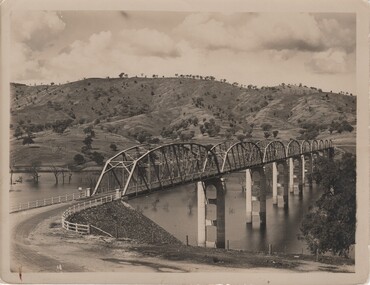
... ...lake hume...hume dam hume weir hume reservoir lake hume bethanga bridge On back of photo: "Hume Weir" and an oval rubber stamp "V. ...Black and white photograph of the Bethanga Bridge with hills in the background.On back of photo: "Hume Weir" and an oval rubber stamp "V. Peterson | Photographer | Hume Reservoir"hume dam, hume weir, hume reservoir, lake hume, bethanga bridge -
 Wodonga & District Historical Society Inc
Book - Doomed Talgarno - A History, W. H. Ferguson, C. 1920 - 1929
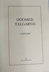
... ...Lake Hume...Talgarno Pioneers north east Victoria Lake Hume A detailed study of the township of Talgarno in North Eastern Victoria, its geography and pioneering families. ...A detailed study of the township of Talgarno in North Eastern Victoria, its geography and pioneering families. In the mid-1930s Talgarno’s river flats were inundated by the development of Lake Hume.non-fictionA detailed study of the township of Talgarno in North Eastern Victoria, its geography and pioneering families. In the mid-1930s Talgarno’s river flats were inundated by the development of Lake Hume.talgarno, pioneers north east victoria, lake hume -
 Musculoskeletal Health Australia (now held by the Glen Eira Historical Society)
Photograph - Group photo, 12/04/1999
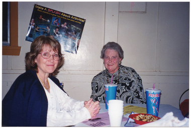
... lake... christine hume-cook...On the 12th of April, 1999, the Arthritis Foundation of Victoria (AFV) held a Bone & Joint Ball at Sea Lake during National Arthritis Week as part of the Rural Access Project. This photo depicts AFV's Christine Hume-Cook with an unidentified woman at the event....[Handwritten in blue ink] Christine Hume-Cook at Sea Lake B & J Arthritis Week April 12 1999...On the 12th of April, 1999, the Arthritis Foundation of Victoria (AFV) held a Bone & Joint Ball at Sea Lake during National Arthritis Week as part of the Rural Access Project. This photo depicts AFV's Christine Hume-Cook with an unidentified woman at the event. arthritis foundation of victoria afv rural access project national arthritis week naw outreach bone & joint ball sea lake christine hume-cook 1999 [Handwritten in blue ink] Christine Hume-Cook at Sea Lake B & J Arthritis Week April 12 1999 COL photo of two women seated at a table. ...On the 12th of April, 1999, the Arthritis Foundation of Victoria (AFV) held a Bone & Joint Ball at Sea Lake during National Arthritis Week as part of the Rural Access Project. This photo depicts AFV's Christine Hume-Cook with an unidentified woman at the event.COL photo of two women seated at a table. On the table, there are two PhysiCal disposable milkshake cups, a small stack of polystyrene cups, a red bowl containing fruit and nut mix, and several printed leaflets in different colours. On the wall behind them, there is a poster titled "Make A SPLASH About Arthritis!", with the sub-title "Water exercise is a great way to keep your joints moving."[Handwritten in blue ink] Christine Hume-Cook at Sea Lake B & J Arthritis Week April 12 1999arthritis foundation of victoria, afv, rural access project, national arthritis week, naw, outreach, bone & joint ball, sea lake, christine hume-cook, 1999 -
 Wodonga & District Historical Society Inc
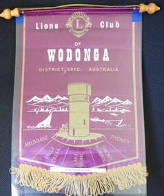
Banner - Lions Club of Wodonga
... At the top centre: The logo of Lions International Across the centre of banner: Lions Club of Wodonga / District 201C Australia In semi-circle below Water Tower: Melbourne/ Falls Creek/Lake Hume/ Snowy Mountains/ Sydney...Les Cole Wodonga Lions Club Lions International At the top centre: The logo of Lions International Across the centre of banner: Lions Club of Wodonga / District 201C Australia In semi-circle below Water Tower: Melbourne/ Falls Creek/Lake Hume/ Snowy Mountains/ Sydney A small purple and gold fringed banner with the emblem of Wodonga Lions Club Lions Club of Wodonga Banner Lions Club of Wodonga ...Leslie William Cole was born on 31 January 1920 in Albury, the first child of William James Cole and Gwendoline Fair. Les spent most of his childhood living with his grandparents in Bethanga, Victoria. In 1934 when he finished school, Les moved into Wodonga. His first job was at Mates Timber Yard. He later worked for Mylons of Wodonga driving taxis and buses. In 1939 after completing militia training, Les applied to enlist with the RAAF and eventually trained as an Aircraft Mechanic. He was posted to the 6th Squadron, serving in Port Moresby, Milne Bay and Goodenough Island before returning to the RAAF base in Sale, Victoria. On discharge. Les returned to Wodonga and resumed working with Mylons. After a range of jobs, Les and his wife Lorna operated a shop in Ariel Street, Wodonga. In the community, Les was a founding member of Wodonga Lions Club. He also joined the Civil Defence which was a predecessor off the SES. He became the Communications Officer and trained other members. Les became the first Controller of the Wodonga Branch of the State Emergency Service, a position he held for 17 years. The new SES headquarters was named in his honour. In retirement he also worked as a Volunteer Community Driver. Les was also named Wodonga Citizen of the Year in 1984 Les continued living in Wodonga until the age of 103 in 2023, when he moved to Melbourne to be closer to his children. He passed away on 12 December 2023. The Lions Club of Wodonga was chartered in 1965 with 18 Founding Members including Les Cole. Lions Australia was first formed in Lismore, NSW in September and has grown to be Australia’s largest service club organisation.A small purple and gold fringed banner with the emblem of Wodonga Lions ClubAt the top centre: The logo of Lions International Across the centre of banner: Lions Club of Wodonga / District 201C Australia In semi-circle below Water Tower: Melbourne/ Falls Creek/Lake Hume/ Snowy Mountains/ Sydneyles cole, wodonga lions club, lions international -
 Bendigo Military Museum
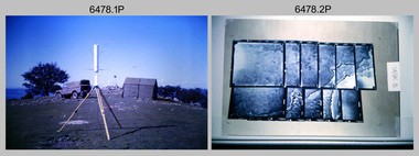
Photograph - Royal Australian Survey Corps - Map Production Processes, c1990
... Photo .1P was probably taken on a survey station overlooking Lake Hume near Albury-Wodonga. The field party occupying the survey station was likely from a Map Control Survey course conducted by the School of Military Survey, Bonegilla. ...Geodetic Surveying: AN/PRR-14 Geoceiver antenna on hill surrounding Lake Hume. Series 3 Land Rover, field party tent and survey station beacon in background. .2) – Photo, black & white, c1980s. ...Geodetic Surveying: AN/PRR-14 Geoceiver antenna on hill surrounding Lake Hume. Series 3 Land Rover, field party tent and survey station beacon in background. .2) – Photo, black & white, c1980s. ...This is a collection of 20 photographs of Royal Australian Survey Corps phases of map production at the School of Military Survey, Bonegilla, the Army Survey Regiment, Bendigo, and the Army Map Depot, Bandiana circa 1990. Colour photos are on 35mm slide film and were scanned at 96 dpi. They are part of the Army Survey Regiment’s Collection. Photo .1P was probably taken on a survey station overlooking Lake Hume near Albury-Wodonga. The field party occupying the survey station was likely from a Map Control Survey course conducted by the School of Military Survey, Bonegilla. This survey station was part of a geodetic network used in field survey training and RASvy’s Lake Hume Test Range. Photos .3P to .16P were taken at the Army Survey Regiment, Bendigo and photos .17P & .18P were taken at the Army Map Depot, Bandiana. Photo .19P depicts a map of RASvy’s ARA units before the disbandment of 5th Field Survey Squadron, Perth and 2nd Field Survey Squadron, Sydney in 1990. This is a collection of 20 photographs of map production processes taken at the School of Military Survey, Bonegilla, the Army Survey Regiment, Bendigo, and the Army Map Depot, Bandiana circa 1990. Colour photos are on 35mm slide film and were scanned at 96 dpi. They are part of the Army Survey Regiment’s Collection. Photo .2P is printed on photographic and scanned at 300 dpi. .1) – Photo, colour, c1980s. Geodetic Surveying: AN/PRR-14 Geoceiver antenna on hill surrounding Lake Hume. Series 3 Land Rover, field party tent and survey station beacon in background. .2) – Photo, black & white, c1980s. Geodetic Surveying: AN/PRR-14 Geoceiver antennas set up at the School of Military Survey, Bonegilla, Victoria. .3) – Photo, colour, c1990. Aerotriangulation: Wild PUG4 point transfer device, SSGT Bruce Hammond. .4) – Photo, colour, c1990. Aerotriangulation: Zeiss (Jena) Stecometer, SSGT Bruce Hammond. .5) – Photo, colour, c1990. Aerotriangulation: computer tape maintenance, SSGT Noel McNamara. .6) – Photo, colour, c1990. AUTOMAP 2: computer tape maintenance, SPR Nadine (Paul) Read. .7) - Photo, colour, c1990s. AUTOMAP 2: Optronics 4040 scanning/film output in Lithographic Squadron, SGT Sherri (Dally) Burke. .8) - Photo, colour, c1990s. AUTOMAP 2: Benson verification plotter output, SPR Nadine (Paul) Read. .9) – Photo, colour, c1990. Aerotriangulation: data management, SGT Neil ‘Ned’ Kelly. .10) & .11) - Photo, colour, c1990s. AUTOMAP 2: Wild B8 Aviograph stereoplotter Feature Extraction, unidentified technician. .12) - Photo, colour, c1990s. AUTOMAP 2: Graphic Edit Workstation, SPR Nadine (Paul) Read. .13) - Photo, colour, c1990s. AUTOMAP 2: Graphic Edit Workstation, SPR Dawn Hoadley. .14) & .15) - Photo, colour, c1990s. AUTOMAP 2: Graphic Edit Workstation, unidentified technician. .16) – Photo, colour, c1990s. Heidelberg Speedmaster 102 computer-controlled five colour lithographic offset printing press. .17) & .18) – Photo, colour, c1990s. Army Map Depot, unidentified storeman, Bandiana. .19) – Photo, colour, c1990. RASvy ARA Unit Locations before disbandment of field units in Perth and Sydney. .20) – Photo, colour, c1990. Set of overlapping aerial photography..1P, .3P to .20P - Some equipment is identified on the frame of the 35mm slides.royal australian survey corps, rasvy, army survey regiment, army svy regt, fortuna, asr, school of military survey, army map depot -
 Wodonga & District Historical Society Inc
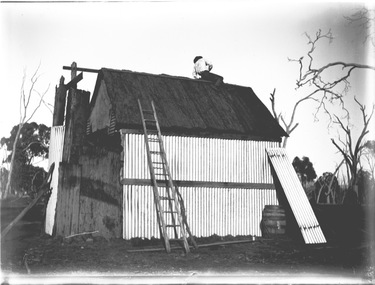
Negative - Haeusler Glass Negatives Collection - Mick Egan's house at Bonegilla, Victoria
... As a result of the construction and expansion of the Hume Weir, whatever may remain of the house is now below the waters of Lake Hume....As a result of the construction and expansion of the Hume Weir, whatever may remain of the house is now below the waters of Lake Hume. Haeusler Glass Negatives Collection - Mick Egan's house at Bonegilla, Victoria Negative Haeusler Glass Negatives Collection - Mick Egan's house at Bonegilla, Victoria ...The Wodonga Historical Society Haeusler Collection provides invaluable insight into life in late nineteenth and early twentieth century north east Victoria. The collection comprises manuscripts, personal artefacts used by the Haeusler family on their farm in Wodonga, and a set of glass negatives which offer a unique visual snapshot of the domestic and social lives of the Haeusler family and local Wodonga community. The Haeusler family migrated from Prussia (Germany) to South Australia in the 1840s and 1850s, before purchasing 100 acres of Crown Land made available under the Victorian Lands Act 1862 (also known as ‘Duffy’s Land Act’) in 1866 in what is now Wodonga West. The Haeusler family were one of several German families to migrate from South Australia to Wodonga in the 1860s. This digital image was produced from one of the glass negatives that form part of the collection, probably taken by Louis Haeusler (b.1887) with the photographic equipment in the Wodonga Historical Society Haeusler Collection. This item is unique and has well documented provenance and a known owner. It forms part of a significant and representative historical collection which reflects the local history of Wodonga. It contributes to our understanding of domestic and family life in early twentieth century Wodonga, as well as providing interpretative capacity for themes including local history and social history.Digital image created from the Haeusler Glass negative collection. Mick Egan's house in Bonegilla, Victoria under the final stages of construction. The house is made primarily from timber and corrugated iron. As a result of the construction and expansion of the Hume Weir, whatever may remain of the house is now below the waters of Lake Hume.wodonga pioneers, haeusler family, glass negatives, dry plate photography, bonegilla families, early victorian housing, mick egan -
 Kiewa Valley Historical Society
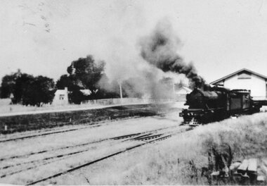
Photographs – Set of 3 black and white photographs of a building being transported by steam train
... Photo could have been taken in Tallangatta, Cudgewa or Ebden near Lake Hume where trains were a major form of transport prior to the 1950’s. ...Photo could have been taken in Tallangatta, Cudgewa or Ebden near Lake Hume where trains were a major form of transport prior to the 1950’s. ...Prior to the sealing of the Kiewa Valley Highway in 1950, all heavy road stock including building materials, farm equipment and other heavy machinery had to be transported via railway lines to either Albury, Wodonga or Bright and then transported overland for the remainder of the distance by wagon on rough, poorly made roads. Trains also services the mining industries of the Ovens Valley and the transportation of tourists to Mount Buffalo and the very popular Mount Buffalo Chalet.Steam trains were a major form of transport for rural community members prior to the introduction of road transport. Local producers including farmers relied on rail transport to send and receive essential building equipment, farming produce, materials, stock and mail to maintain their lifestyles and social connections with the outside world. 3 black and white photographs of a building being transported by steam train. Photos show the train in three progressively closer photos. Photo shows a man standing in the doorway at the controls of the train, 3 figures, possibly children leaning out of the window of the carriage and another man, standing on the tracks with hands on hips. Photo could have been taken in Tallangatta, Cudgewa or Ebden near Lake Hume where trains were a major form of transport prior to the 1950’s. No markingstransportables; steam train; railway;, old tallangatta, esther temple -
 Bendigo Military Museum
Postcard - 75th Anniversary Royal Australian Survey Corps First Day Cover 1990, Australia Post, 29 June 1990
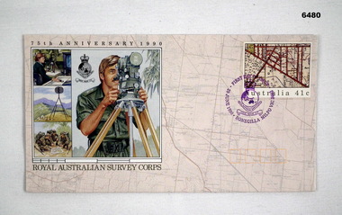
... The School of Military Survey was located at Bonegilla Victoria adjacent to Lake Hume reservoir. The envelope was designed by Lynette Brown from the Australia Post Graphic Design Studio utilising illustrations produced by Brian Clinton, Melbourne....The School of Military Survey was located at Bonegilla Victoria adjacent to Lake Hume reservoir. The envelope was designed by Lynette Brown from the Australia Post Graphic Design Studio utilising illustrations produced by Brian Clinton, Melbourne. ...This envelope was specifically produced for the 75th Anniversary of the Royal Australian Survey Corps. This First Day cover envelope was stamped at the Bonegilla Military Post Office on 29 June 1990 in preparation for the Corps birthday on 1 July. The Envelope was stamped in Purple the Survey Corps Colour as apposed to normally being stamped in Black. The School of Military Survey was located at Bonegilla Victoria adjacent to Lake Hume reservoir. The envelope was designed by Lynette Brown from the Australia Post Graphic Design Studio utilising illustrations produced by Brian Clinton, Melbourne.Royal Australian Survey Corps 75th Anniversary First Day Cover Envelope. The Postal Stamp is stamped with a Survey Corps badge in purple (the Corps Colour) " First day of Issue, Bonegilla Military Post Office 29 June 1990. The 41cent stamp is a map extract. The envelope contains one large and three small graphics of Royal Australian Survey Corps activities and includes a Survey Corps Badge and Logo. The rear of the envelope contains a short history and role of the Royal Australian Survey Corps.royal australian survey corps, rasvy, fortuna, army survey regiment, army svy regt, asr -
 Bendigo Military Museum
Photograph - Tasks Demonstrated by Royal Australian Survey Corps Technicians, c1990s
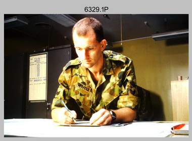
... Photos .10P to .15P and .17P of students operating survey equipment, were taken at the School of Military Survey, Bonegilla and survey stations surrounding Lake Hume. The base camp at photo .16P was probably taken at Sandy Creek, near Tallangatta Victoria, during the field phase of a basic or advanced RA Svy training course. ...Photos .10P to .15P and .17P of students operating survey equipment, were taken at the School of Military Survey, Bonegilla and survey stations surrounding Lake Hume. The base camp at photo .16P was probably taken at Sandy Creek, near Tallangatta Victoria, during the field phase of a basic or advanced RA Svy training course. ...This is a set of 17 photographs of technicians from the Royal Australian Survey Corps undertaking technical tasks circa 1990s. Photos .1P to .9P were taken at the Army Survey Regiment, Fortuna, Bendigo. Photos .10P to .15P and .17P of students operating survey equipment, were taken at the School of Military Survey, Bonegilla and survey stations surrounding Lake Hume. The base camp at photo .16P was probably taken at Sandy Creek, near Tallangatta Victoria, during the field phase of a basic or advanced RA Svy training course. CPL Steve Nokes appearing in photo .17P was attending the 1/90 Map Control Survey Course.This is a set of 17 photographs of technicians from the Royal Australian Survey Corps undertaking technical tasks at the Army Survey Regiment, Fortuna, Bendigo, and the School of Military Survey, Bonegilla c1992. Colour photos are on 35mm slide film and were scanned at 96 dpi. Photo .17P is in black & white, printed on photographic paper and scanned at 300 dpi. The photos are part of the Army Survey Regiment’s Collection. .1) – Photo, colour, c1992, Aerial photography Assessment, SGT Tony Grivell. .2) – Photo, colour, c1992, Aerial photography Assessment, L to R: WO2 Noel McNamara and LCPL Grant Lloyd. .3) – Photo, colour, c1992, Wild PUG4 point transfer device, LCPL Mark Fedden. .4) – Photo, colour, c1992, AUTOMAP 2 Graphic Edit Workstation, unidentified technician. .5) – Photo, colour, c1992, Heidelberg Speedmaster 102 computer-controlled five colour lithographic offset printing press, CPL Nick Vanderzwan. .6) – Photo, colour, c1992, Daylight film contact frame, SPR Ken Labourchardiere. .7) – Photo, colour, c1992, Heidelberg Speedmaster 102 Map Colour Evaluation Workstation, SGT Stuart Ridge. .8) – Photo, colour, c1992, Map proof evaluation, CPL John Bragg. .9) – Photo, colour, c1992, Wohlenberg MCS-2 guillotine, unidentified technician. .10) – Photo, colour, c1992, Wild T2 Theodolite, L to R: SPR Matt Arnold, SPR Kim Baker. .11) – Photo, colour, c1992, Wild T2 Theodolite, L to R: SSGT Bob Bright, SPR Kim Baker. .12) to .14) – Photo, colour, c1992, MRA-7 Tellurometer, CPL Mark Bourne. .15) – Photo, colour, c1992, Plane Tabling, CPL Mark Bourne. .16) – Photo, colour, c1992, School of Military Survey base camp, Sandy Creek, VIC. .17) – Photo, black & white, 1990, MRA-7 Tellurometer, CPL Steve Nokes. .1P to .16P - There are no annotations. .17P – annotated on back ‘CPL NOKES WITH MRA7 ON 1/90 MAP CONTROL COURSE’royal australian survey corps, rasvy, army survey regiment, army svy regt, school of military survey, fortuna, asr -
 Wodonga & District Historical Society Inc
Souvenir - Tallangatta - Hume Weir Tiepin, 1980s
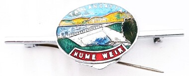
... In the 1950s, the height of the Hume Weir wall was increased, resulting in a nine metre rise in the level of the water in Lake Hume. This necessitated the moving of most of the town of Old Tallangatta due to flooding. ...In the 1950s, the height of the Hume Weir wall was increased, resulting in a nine metre rise in the level of the water in Lake Hume. This necessitated the moving of most of the town of Old Tallangatta due to flooding. ...A wide range of items have been created as souvenirs to represent the Hume Weir on the Murray River. Work on Hume Dam started in 1919 and took 17 years to complete. Souvenir items have included chinaware, ashtrays, placemats and small jewellery items such as this tie pin. This tie pin was created as a souvenir for the town of Tallangatta. In the 1950s, the height of the Hume Weir wall was increased, resulting in a nine metre rise in the level of the water in Lake Hume. This necessitated the moving of most of the town of Old Tallangatta due to flooding. The transfer of the township by the State Rivers and Waters Supply Commission to a new site approximately 8 kilometres to the west was completed on 29 June 1956.This item is representative of many items commemorating the Hume Weir and the township of Tallangatta.A small metal and enamelled oval tie pin. It features and image of the Hume Weir.Around top edge in white: TALLANGATTA Around bottom edge" HUME WEIR"hume weir australia, tallangatta, tallangatta - the town that moved -
 Wodonga & District Historical Society Inc
Souvenir - Cup Hovell's Tree, Albury
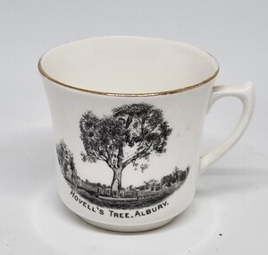
... Hume and Hovell travelled from the Yass area and after crossing the Murray River where Lake Hume now is, they crossed the Mitta Mitta River and proceeded to Corio Bay, Westernport....Hume and Hovell travelled from the Yass area and after crossing the Murray River where Lake Hume now is, they crossed the Mitta Mitta River and proceeded to Corio Bay, Westernport. ...This souvenir represents the Hovell Tree, a local historic landmark in Albury, NSW. This item is from a collection donated by descendants of John Francis Turner of Wodonga. The Hovell Tree commemorates the exploration and naming of the Hume River (now the Murray) by Hume and Hovell`s expedition of 1824. In 1824, Governor Brisbane asked Hume to join forces with an English sea captain, William Hovell, to go from Lake George to the Spencer Gulf in South Australia. The Hovell Tree, marked by William Hovell on November 17, 1824 was flanked by another tree marked by Hamilton Hume which was destroyed by fire in the 1840's. The river gum was marked by William Hovell when discovering river. Hume and Hovell travelled from the Yass area and after crossing the Murray River where Lake Hume now is, they crossed the Mitta Mitta River and proceeded to Corio Bay, Westernport.This item is representative of souvenirs produced to represent key buildings and historic landmarks in the Albury-Wodonga district.A white cup with gilt trim around the lip. It bears an image of the Hovell Tree in Albury, NSWBeneath image: "HOVELL'S TREE, ALBURY."albury souvenirs, hovell tree, hume and hovell, australian exploration -
 Marysville & District Historical Society
THE TRIANGLE NEWS-VOL 40 NO 31-AUGUST 31 2013
... hume and hovell expedition...marysville & district lions club...church notices...upper goulburn food wine and culture group...grants coordinator permanent p/t position...exhibition tells story of recovery and resilience...marysville lake...marysville victoria australia villains into grand final marysville football club veterans what's on when in august tag agm the committee of management of the gallipoli park precinct marysville community market creative triangle ceremony celebrates our early explorer links the hovell tree celebrates hume and hovell expedition marysville & district lions club church notices upper goulburn food wine and culture group grants coordinator permanent p/t position exhibition tells story of recovery and resilience marysville lake mountain visitor information centre advertisements mayor's chair gallipoli park community agm mystic mountain tourism agm mops sale high tea at st john's alexandra real estate ugfm presents a taste of tamworth alexandra townhall marysville preschool needs help the upper goulburn winegrowers assocn alexandra railway precinct the alexandra timber tramway and museum committee taggerty community projects expressions of interest called for project reference group marysville golf report zumba buxton hall fauna safety takes top priority in bridge works eildon jamieson road bridge department of environment & primary industries ugfm extends broadcast from marysville studio seasonal road closures are enforceable parks victoria councillor comment australian centre for grief & bereavement intrepid triangle bushwalkers triangle community dance group bushdance buxton hall marysville cultural community irwell street string band THE TRIANGLE NEWS-VOL 40 NO 31-AUGUST 31 2013 ...marysville, victoria, australia, villains into grand final, marysville football club veterans, what's on when in august, tag agm, the committee of management of the gallipoli park precinct, marysville community market, creative triangle, ceremony celebrates our early explorer links, the hovell tree celebrates hume and hovell expedition, marysville & district lions club, church notices, upper goulburn food wine and culture group, grants coordinator permanent p/t position, exhibition tells story of recovery and resilience, marysville lake mountain visitor information centre, advertisements, mayor's chair, gallipoli park community agm, mystic mountain tourism agm, mops sale, high tea at st john's alexandra, real estate, ugfm presents a taste of tamworth, alexandra townhall, marysville preschool needs help, the upper goulburn winegrowers assocn, alexandra railway precinct, the alexandra timber tramway and museum committee, taggerty community projects, expressions of interest called for project reference group, marysville golf report, zumba buxton hall, fauna safety takes top priority in bridge works, eildon jamieson road bridge, department of environment & primary industries, ugfm extends broadcast from marysville studio, seasonal road closures are enforceable, parks victoria, councillor comment, australian centre for grief & bereavement, intrepid triangle bushwalkers, triangle community dance group, bushdance buxton hall, marysville cultural community, irwell street string band -
 Eltham District Historical Society Inc
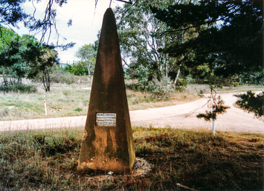
Photograph, Hume and Hovell Monument, near Lake Nillachootie, Barjarg, Spring Excursion, Hume and Hovell's 1824 expedition (Part 2), 26 October 1997, 26/10/1997
... Hume and Hovell Monument, near Lake Nillachootie, Barjarg, Spring Excursion, Hume and Hovell's 1824 expedition (Part 2), 26 October 1997...hume and hovell...monument...barjarg...Lake...Thank you to Russell and to everyone who made the day so informative and pleasurable. activities hume and hovell monument barjarg Lake Nillachootie Colour photograph Hume and Hovell Monument, near Lake Nillachootie, Barjarg, Spring Excursion, Hume and Hovell's 1824 expedition (Part 2), 26 October 1997 Photograph ...[article by Diana Bassett-Smith in EDHS Newsletter No. 117, November 1997:] MONUMENT HUNTING THE HUME AND HOVELL WAY - Sunday October 26 1997 dawned bright and very warm. Some twenty-five members, complete with picnic baskets, met outside the Eltham Library awaiting the Cobb and Co. large coach which would be taking us on the second leg of our travels along the route of the early explorers Hume and Hovell. Stephen West was our very good driver for the day. He would be guided around the circuitous route by Russell Yeoman who had made a detailed study, not only of the intended route, but of the story of these two explorers. During the trip Russell regaled us with poetry, quotations from the Journals and the History of the Shire of Seymour, "The New Crossing Place" by Martindale, 1982, (now Mitchell Shire due to the recent amalgamations). We headed towards the Hume Highway via Greensborough and Cooper Street and proceeded north to our first stop, noting on the way Monument Hill in the distance which is near Kilmore and, according to Russell, well worth the effort to visit as the view across the valley is magnificent. Past Sunday Creek Valley, Mt Piper and Mt Disappointment, all traversed and noted and named by them. We passed through Tallarook, then onto Seymour where we took photos of the monument telling us that Hume and Hovell had passed through on the 28th of October 1824. We also deviated down Hume and Hovell Road viewing deer and emu farming and the Bellbourie property now a sanctuary. Leaving Seymour behind we travelled up the Avenel Road to the Avenel monument, pyramidal in design of four reducing square blocks with a sharply pointed peak, erected in 1924 in memory of the 1824 exploration. The day was warming up and the countryside showing the dryness of the current drought. A parallel note had been made in their journal too of 1824 of the drought appearance of the country they were traversing. At Seven Creeks, Euroa we stopped for some minutes to check the monument placed 20th November 1924 to commemorate their passage on the 29th December 1824. More photos. Russell had pointed out the abrupt termination of the distant ranges which is noted in their journal. The next monument is beside the road at the entrance to Honey Suckle Creek Caravan Park, Violet Town. The squarish shaped monument some eight feet high is topped with a simple steel cross, and was to mark the date of 28th December 1824 and built for the 20th November 1924. By now it was 12.20 and nearly lunchtime as we drove along the Warranbayne Road to Roach's Road, monument hunting without success. Though there is a large, what appears to be an old timber sign which was hard to read, maybe this was the lost monument. In many of the paddocks hay had been cut and baled or was being cut, what a contrast to the rugged country they had passed through which was smoky from the fires of the natives burning off. By 1.00 pm we were at Benalla and pulled up beside the park where abundant beds of roses filled the air with their scent and the smell of barbecued food twitched the nostrils whilst the cheerful sounds of other picnickers could be heard throughout the park. We left the bus and collected up our picnics, dispersed to the various tables and enjoyed the shade from the various European trees. 2.00 pm and we were on the road again driving along the Benalla, Mansfield, Yea road. The Swanpool monument states that they passed four miles south and returned three miles north. Then we stopped at the Barjarg monument which notes that they camped near this spot. It is again a pyramidal monument and this time topped with a steel arrow indicating their route of the 29th November 1824. Half an hour later we came to another monument, again with a steel arrow marker on top and the plaque dated the 2nd of 12th 1824. Erected on the 12th of 12th 1924. "They blazed the way that we might inherit the land." Another square based and needle topped monument appeared at Yarck near Yea and this plaque records the date of 3 December 1824. Near McGuigans Road Russell related that the expedition had lost a dog but it had found them next day, the dog was apparently torn by a kangaroo. A short while later Russell reminded us here of the problems they encountered in crossing the Goulburn River near Molesworth where banks were high, water deep and wide. "Good coat of grass but quite dry due to drought". At Yea we stopped for afternoon tea and raided the last of our picnics and looked at the monument to their journey of 1824, situated at a corner of the gardens near the bowling green. No photo – we were out of film. We returned home via Kinglake West and Whittlesea past the Yan Yean Reservoir, not full. 5.00 pm back at Eltham we emptied out of the bus and everyone, including Joan Cole, collected their things, Joan also had the major souvenir of the day, a large carp she had picked up from the river bank, her cat was in for a great feast. The day was made so interesting by the informed commentary which Russell provided. His background knowledge of the route and nature of the journey could only have come from many hours of reading and driving the area. Thank you to Russell and to everyone who made the day so informative and pleasurable. Colour photographactivities, hume and hovell, monument, barjarg, lake nillachootie -
 Kiewa Valley Historical Society
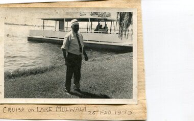
Photographs x 3- Cruise on Lake Mulwala, 25/2/1973
... Lake Mulwala is a man–made reservoir created through the construction of the Yarrawonga Weir across the Murray River, is located between Bundalong and Yarrawonga in Hume region of Victoria and Mulwala in the Riverina region of New South Wales, in eastern Australia. ...Lake Mulwala is a man–made reservoir created through the construction of the Yarrawonga Weir across the Murray River, is located between Bundalong and Yarrawonga in Hume region of Victoria and Mulwala in the Riverina region of New South Wales, in eastern Australia. ...Lake Mulwala is a man–made reservoir created through the construction of the Yarrawonga Weir across the Murray River, is located between Bundalong and Yarrawonga in Hume region of Victoria and Mulwala in the Riverina region of New South Wales, in eastern Australia. The weir was constructed in 1939 to provide water for irrigation of the surrounding district. The weir also serves as a crossing of the Murray between the two towns. It is a popular tourist destination for boating, fishing and other water recreation.Photographs demonstrate local Kiewa Valley residents enjoying a visit to the picturesque area of Lake Mulwala. Also provides a pictorial history of 1973.3 black and white photographs mounted on buff card. Photographs of a cruise on Lake Mulwala 25th Feb. 1973 1. Photo of unidentified man standing on the shore of Lake Mulwala beside cruise launch. 2. Group photo of people standing by cruise boat as others disembark. Woman in centre holding handbag may be Clare Roper (unconfirmed) 3. Photo of 2 men aboard cruise launch looking out over Lake Mulwala1. Handwritten at bottom of photo in black ink. 'Cruise on Lake Mulwala. 25th Feb. 1973' 2. Painted sign above cruise launch- Scenic Lake Cruises 3. No markingsclare roper -
 Sunshine and District Historical Society Incorporated
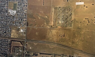
Photograph - Aerial Photographs Of Melbourne Metropolitan Area 1989, Qascophoto, 17th November 1989 & 28th November 1989
... Peters School, Sunshine Golf Course, Ralph Reserve, Glengala Primary School 953.08 - Aerial Photographs Of Melbourne Metropolitan Area 1989.JPG Suburb(s): Derrimut, Ravenhall Area bounded by: East of Station Road, now Derrimut Road (East), West of Robinsons Road (West), South of Railway Line (North), North of Future Deer Park Bypass Points of Interest: Old Farms and Quarries 953.09 - Aerial Photographs Of Melbourne Metropolitan Area 1989.JPG Suburb(s): Sydenham, Taylors Lakes, Taylors Hill Area bounded by: Taylors Creek (North), Future Hume Drive (South), West of Future Parmelia Drive (East), Future Hawthorn Grove (West) Points of Interest: Sydenham Reservoir, Sydenham Railway Station, Sydenham Memorial Hall, Sydenham Primary School, Sydenham Recreation Reserve, Catholic Regional College Sydenham, Kingdom Hall of Jehovah's Witnesses 953.10 - Aerial Photographs Of Melbourne Metropolitan Area 1989.JPG Suburb(s): Brooklyn, Tottenham Area bounded by: Stony Creek (North), South of Somerville Road (South), Holmwood Road (East), West of McDonald Road (West) Points of Interest: Monsanto, Dalgety's, Wool Stores, Sims Metals, Farmer & Graziers, Olex Cables, Redbrook Carpets, May & Baker, Cargil Oil, Smorgans 953.11 - Aerial Photographs Of Melbourne Metropolitan Area 1989.JPG Suburb(s): Brooklyn Area bounded by: South of Fourth Avenue (North), South of Bunting Road (South), West of McDonald Road, East of Fitzgerald Road (West) Points of Interest: Market Road, Bunting & Jones Road Quarries, Monsanto, ANI, Market Timber 953.12 - Aerial Photographs Of Melbourne Metropolitan Area 1989.JPG Suburb(s): Brooklyn, Laverton North Area bounded by: South of Bunting Road (North), Buchanan Road (South), Cypress Avenue (East). ...Peters School, Sunshine Golf Course, Ralph Reserve, Glengala Primary School 953.08 - Aerial Photographs Of Melbourne Metropolitan Area 1989.JPG Suburb(s): Derrimut, Ravenhall Area bounded by: East of Station Road, now Derrimut Road (East), West of Robinsons Road (West), South of Railway Line (North), North of Future Deer Park Bypass Points of Interest: Old Farms and Quarries 953.09 - Aerial Photographs Of Melbourne Metropolitan Area 1989.JPG Suburb(s): Sydenham, Taylors Lakes, Taylors Hill Area bounded by: Taylors Creek (North), Future Hume Drive (South), West of Future Parmelia Drive (East), Future Hawthorn Grove (West) Points of Interest: Sydenham Reservoir, Sydenham Railway Station, Sydenham Memorial Hall, Sydenham Primary School, Sydenham Recreation Reserve, Catholic Regional College Sydenham, Kingdom Hall of Jehovah's Witnesses 953.10 - Aerial Photographs Of Melbourne Metropolitan Area 1989.JPG Suburb(s): Brooklyn, Tottenham Area bounded by: Stony Creek (North), South of Somerville Road (South), Holmwood Road (East), West of McDonald Road (West) Points of Interest: Monsanto, Dalgety's, Wool Stores, Sims Metals, Farmer & Graziers, Olex Cables, Redbrook Carpets, May & Baker, Cargil Oil, Smorgans 953.11 - Aerial Photographs Of Melbourne Metropolitan Area 1989.JPG Suburb(s): Brooklyn Area bounded by: South of Fourth Avenue (North), South of Bunting Road (South), West of McDonald Road, East of Fitzgerald Road (West) Points of Interest: Market Road, Bunting & Jones Road Quarries, Monsanto, ANI, Market Timber 953.12 - Aerial Photographs Of Melbourne Metropolitan Area 1989.JPG Suburb(s): Brooklyn, Laverton North Area bounded by: South of Bunting Road (North), Buchanan Road (South), Cypress Avenue (East). ...953.01 - Aerial Photographs Of Melbourne Metropolitan Area 1989.JPG Suburb(s): Ardeer, Deer Park (Now Derrimut), Sunshine West Area bounded by: Railway Parade (North), Paramount Bouvard (South), Allison Street (East), Approx Station Road (West) Points of Interest: IVI Explosive Bunkers, Railway Siding into ICI off Forrest Street, Former Railway Station Tilburn Road, Sunshine Technical School Annex, Croatian Catholic Centre Sunshine Fitzgerald Road 953.02 - Aerial Photographs Of Melbourne Metropolitan Area 1989.JPG Suburb(s): Brooklyn, Yarraville Area bounded by: South of Somerville Road (North), Westgate Freeway (South), Urwin Street (East). West of McDonald Road (West) Points of Interest: State Electricity Commission of Victoria (SECV) Stores, Brooklyn Wool Stores, Brooklyn Primary School, Half Moon Caravan Park, Footscray Cemetery, Rheems, James Hardy 953.03 - Aerial Photographs Of Melbourne Metropolitan Area 1989.JPG Suburb(s): Ascot Vale, Maribyrnong Area bounded by: Raleigh Road (North), River Street and James Street (South), Holdsworth Street (East), West of Van Ness Avenue (West) Points of Interest: Highpoint City, Fairbairn Park, Hume Pipes, Riverside Golf Course, ICI Laboratories 953.04 - Aerial Photographs Of Melbourne Metropolitan Area 1989.JPG Suburb(s): Albion, Ardeer, Sunshine, Sunshine West Area bounded by: Dubbo Street (North), South of Glengala Road (South), West of Sydney Street (East), Vernon Crescent (West) Points of Interest: Ainsworth Reserve, Selwyn Park, St. Paul Church, Marian College, Ardeer Primary School, Glengala Road Shopping Centre, 953.05 - Aerial Photographs Of Melbourne Metropolitan Area 1989.JPG Suburb(s): Deer Park Area bounded by: Station Road (East), Marcellin Court (West), Irvine Street (North), Deer Street (South) Points of Interest: Deer Park Primary School, Deer Park Play Kindergaten, Deer Park Shopping Centre, St. Peter Chanel Church & School 953.06 - Aerial Photographs Of Melbourne Metropolitan Area 1989.JPG Suburb(s): Derrimut Area bounded by: Future Ring Road (North), South of Boundary Road (South), East of Andersons Swamp (East), West of Fitzgerald Road (West) Points of Interest: Andersons Swamp 953.07 - Aerial Photographs Of Melbourne Metropolitan Area 1989.JPG Suburb(s): Sunshine West Area bounded by: East of Fairbairn Road (East), East of Fitzgerald Road (West), North of Mailey Street (North), South of Talintyre Road (South) Points of Interest: Sunshine West High School, Sunshine Heights Primary School, Castley Reserve, Talintyre Reserve, Talintyre Road Shops, St. Peters School, Sunshine Golf Course, Ralph Reserve, Glengala Primary School 953.08 - Aerial Photographs Of Melbourne Metropolitan Area 1989.JPG Suburb(s): Derrimut, Ravenhall Area bounded by: East of Station Road, now Derrimut Road (East), West of Robinsons Road (West), South of Railway Line (North), North of Future Deer Park Bypass Points of Interest: Old Farms and Quarries 953.09 - Aerial Photographs Of Melbourne Metropolitan Area 1989.JPG Suburb(s): Sydenham, Taylors Lakes, Taylors Hill Area bounded by: Taylors Creek (North), Future Hume Drive (South), West of Future Parmelia Drive (East), Future Hawthorn Grove (West) Points of Interest: Sydenham Reservoir, Sydenham Railway Station, Sydenham Memorial Hall, Sydenham Primary School, Sydenham Recreation Reserve, Catholic Regional College Sydenham, Kingdom Hall of Jehovah's Witnesses 953.10 - Aerial Photographs Of Melbourne Metropolitan Area 1989.JPG Suburb(s): Brooklyn, Tottenham Area bounded by: Stony Creek (North), South of Somerville Road (South), Holmwood Road (East), West of McDonald Road (West) Points of Interest: Monsanto, Dalgety's, Wool Stores, Sims Metals, Farmer & Graziers, Olex Cables, Redbrook Carpets, May & Baker, Cargil Oil, Smorgans 953.11 - Aerial Photographs Of Melbourne Metropolitan Area 1989.JPG Suburb(s): Brooklyn Area bounded by: South of Fourth Avenue (North), South of Bunting Road (South), West of McDonald Road, East of Fitzgerald Road (West) Points of Interest: Market Road, Bunting & Jones Road Quarries, Monsanto, ANI, Market Timber 953.12 - Aerial Photographs Of Melbourne Metropolitan Area 1989.JPG Suburb(s): Brooklyn, Laverton North Area bounded by: South of Bunting Road (North), Buchanan Road (South), Cypress Avenue (East). Little Boundary Road (West) Points of Interest: Jones Road and Old Geelong Road Quarries, Brooklyn Go Kart Track, Sims Metal Foundry, Ralphs, Guiding Star Hotel, Gas & Fuel Substation 953.13 - Aerial Photographs Of Melbourne Metropolitan Area 1989.JPG Suburb(s): Sunshine, Sunshine West Area bounded by: Parsons Street (North), South of Fourth Avenue (South), Alfred Street (East), West of Kororoit Creek (West) Points of Interest: Parsons Reserve, Wheat Silos, H.V. McKay Trade Wing, Tottenham Hotel, Sunshine Carvan Park 953.14 - Aerial Photographs Of Melbourne Metropolitan Area 1989.JPG Suburb(s): Derrimut, Mt. Derrimut, Sunshine West, Area bounded by: East of Allison Street (East), Mt. Derrimut (West), Hilma Street (North), South of old Sunshine Golf Course (South) Points of Interest: Mt. Derrimut, Sunshine Golf Course 953.15 - Aerial Photographs Of Melbourne Metropolitan Area 1989.jpeg Suburb(s): Avondale Height, Braybrook, Sunshine North Area bounded by: Canning Street (North), North of Cranwell Street (South), Medway Golf Course (East), Nottingham Street (West) Points of Interest: Duke Street Quarries, Cranwell Park, Pennell Reserve 953.16 - Aerial Photographs Of Melbourne Metropolitan Area 1989.jpeg Suburb(s): All of City of Sunshine Area bounded by: Maribyrnong River (North), Westgate Freeway (South), Nicholson Street (East), Robinsons Road (West) Points of Interest: General overall of the City of Sunshine 953.17 - Aerial Photographs Of Melbourne Metropolitan Area 1989.jpeg Map is missing 953.18 - Aerial Photographs Of Melbourne Metropolitan Area 1989.jpeg Suburb(s): Braybrook, Maidstone, Sunshine Area bounded by: Ballarat Road (North), North of South Road (South), East of Ashley Street (East), West of Duke Street (West) Points of Interest: Skinner Reserve, Kinder Smith Reserve, Churchill Avenue Shops, St. John College, Industrial Engineering, Invita Carpets, Tottenham Technical School, Carolone Chisholm College, Christ The King Primary School, Sunshine East Primary School, Dyecraft 953.19 - Aerial Photographs Of Melbourne Metropolitan Area 1989.JPG Suburb(s): Laverton North, Sunshine West Area bounded by: North of Boundary Road (North), Sewer Out Fall (South), East of Little Boundary Road (East), East of Future Ring Road (West). Points of Interest: Factories in Laverton Northmelbourne, aerial photograph -
Victorian Aboriginal Corporation for Languages
Book, A month in the bush of Australia : journal of one of a party of gentlemen who recently travelled from Sydney to Port Philip : with some remarks on the present state of the farming establishments and society in the settled parts of the Argyle Country, 1965
... Lakes Bathurst &? George; p.15; Family, Yass area gathering &? eating manna; p.20; Meeting with small tribe Mantons Station; p.23-24; Hume R., tribe, guide Baambargan; p.26; Meeting with native party 27 miles S.E. ...Lakes Bathurst &? George; p.15; Family, Yass area gathering &? eating manna; p.20; Meeting with small tribe Mantons Station; p.23-24; Hume R., tribe, guide Baambargan; p.26; Meeting with native party 27 miles S.E. ...Journal of a party of gentlemen travelling from Sydney to Port Phillip; p.6-7; Information on Lakes Bathurst &? George; p.15; Family, Yass area gathering &? eating manna; p.20; Meeting with small tribe Mantons Station; p.23-24; Hume R., tribe, guide Baambargan; p.26; Meeting with native party 27 miles S.E. Ovens R.; p.30-32; Catching possum Violet Creek, Aboriginal - English, flies warn game of danger, finding honey; p.38; Visit to camp Campaspe R.; p.41-42; Yarrayarre R. natives seen, attempts by guide to obtain wife, language difficulties; p.46; Head of Wearidy R. camp visited by natives.7colonisation, frontier life, pioneer life -
 Ballarat Tramway Museum
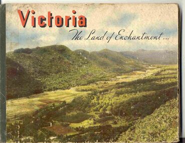
Book, Nu-color-vue or Nucolorvue Productions, "Victoria The Land of Enchantment", c1950
... Photos of Mt Buffalo, Gippsland lakes, Mornington Beach, Yarra River, Flinders St. station from the Yarra, Collins and Spring St (with two W2's - see image No. 2), Parliament House, Kiewa Hydro scheme, Eildon Weir, Swan Hill Murray River Bridge, Bendigo Post Office, Melbourne Botanical Gardens, Ballarat - Grenville and Sturt St (No. 22 - see image No. 3), Lorne, Yallourn Power Station, Hume Weir, Maroondah Weir, Great Ocean Road, Warrnambool, Portland Beach, A timber train (see image No. 4), Mildura, flax mills, Eastern Geelong and the Prime Ministers Ave, Ballarat. ...Photos of Mt Buffalo, Gippsland lakes, Mornington Beach, Yarra River, Flinders St. station from the Yarra, Collins and Spring St (with two W2's - see image No. 2), Parliament House, Kiewa Hydro scheme, Eildon Weir, Swan Hill Murray River Bridge, Bendigo Post Office, Melbourne Botanical Gardens, Ballarat - Grenville and Sturt St (No. 22 - see image No. 3), Lorne, Yallourn Power Station, Hume Weir, Maroondah Weir, Great Ocean Road, Warrnambool, Portland Beach, A timber train (see image No. 4), Mildura, flax mills, Eastern Geelong and the Prime Ministers Ave, Ballarat. ...Book with hardcovers, 48 pages titled "Victoria The Land of Enchantment". Sewn in three sections, with a green strip of cloth and self end papers and printed outer paper, sides glued onto board covers. Consists of 43 colour photographs (full and half page) with captions, detailed text, and two black and white photos printed in blue on end covers. Photos of Mt Buffalo, Gippsland lakes, Mornington Beach, Yarra River, Flinders St. station from the Yarra, Collins and Spring St (with two W2's - see image No. 2), Parliament House, Kiewa Hydro scheme, Eildon Weir, Swan Hill Murray River Bridge, Bendigo Post Office, Melbourne Botanical Gardens, Ballarat - Grenville and Sturt St (No. 22 - see image No. 3), Lorne, Yallourn Power Station, Hume Weir, Maroondah Weir, Great Ocean Road, Warrnambool, Portland Beach, A timber train (see image No. 4), Mildura, flax mills, Eastern Geelong and the Prime Ministers Ave, Ballarat. Produced by Nucolorvue Productions, c1950. See also Reg Item 2925 for the same photo of No. 22 and Reg Item 5354 for a postcard. Purchased via eBay site - see attached sheets and packing slip. Purchased 10/2/2005 for A$12.50 including postage, from Virginia Georgopoulos of West Brunswick. eBay sheets and envelope with worksheet file. Has Swains 123 Pitt St, Sydney sticker on bottom left hand corner page 2trams, tramways, ballarat, sturt st, grenville st, bogie trams, geelong, bendigo, melbourne -
 Wodonga & District Historical Society Inc
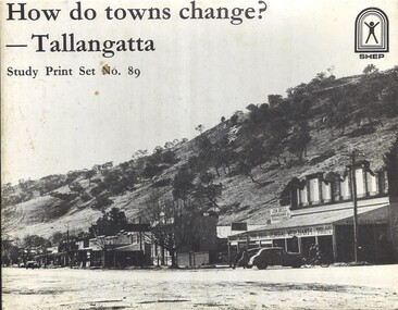
Education kit - How do towns change? - Tallangatta, SHEP Project, 1979
... Plans for a reservoir at the confluence of the Mitta Mitta and Murray Rivers threatened the town. Stage one of Lake Hume was completed in 1936, sparing the town temporarily. ...The Tallangatta pastoral run was established in 1838. By the 1850s a thriving town had been established near the junction of the Mitta Mitta River and Tallangatta Creek. Officially named in 1854, Tallangatta became a vital gateway to nearby goldfields such as Mount Wills, Mitta Mitta, and Cravensville. It also grew as a service centre to the pastoralists in the surrounding area. Rail reached Tallangatta in 1891, doubling the population within a decade. A mile-long viaduct took two years to complete. The railway brought jobs and connected local mining and farming industries to broader markets. From 1918, Tallangatta's future was uncertain. Plans for a reservoir at the confluence of the Mitta Mitta and Murray Rivers threatened the town. Stage one of Lake Hume was completed in 1936, sparing the town temporarily. After WWII, demand for irrigation water rose—and residents were told the town would be flooded. Between 1952 and 1958, Tallangatta was relocated. The State Rivers and Water Supply Commission oversaw the move with a £3 million budget. Over 100 timber homes were relocated, 37 brick homes rebuilt, and 74 prefabricated houses brought in. Thirty-five new buildings were added, including hotels, banks, a butter factory, a hospital, and a modern shopping centre. The new town of Tallangatta was officially reopened by Governor Sir William Slim on June 29, 1956. In 2016, Tallangatta was designated a "Notable Town" by the National Trust for its architectural and historical significance, making it the second town to receive this honour.A set of 89 Photographs, maps and information sheets produced as a case study of the moving of the town of Tallangatta in the 1950s. It was created as a resource to enable secondary school students to investigate how towns can change over time. non-fictionThe Tallangatta pastoral run was established in 1838. By the 1850s a thriving town had been established near the junction of the Mitta Mitta River and Tallangatta Creek. Officially named in 1854, Tallangatta became a vital gateway to nearby goldfields such as Mount Wills, Mitta Mitta, and Cravensville. It also grew as a service centre to the pastoralists in the surrounding area. Rail reached Tallangatta in 1891, doubling the population within a decade. A mile-long viaduct took two years to complete. The railway brought jobs and connected local mining and farming industries to broader markets. From 1918, Tallangatta's future was uncertain. Plans for a reservoir at the confluence of the Mitta Mitta and Murray Rivers threatened the town. Stage one of Lake Hume was completed in 1936, sparing the town temporarily. After WWII, demand for irrigation water rose—and residents were told the town would be flooded. Between 1952 and 1958, Tallangatta was relocated. The State Rivers and Water Supply Commission oversaw the move with a £3 million budget. Over 100 timber homes were relocated, 37 brick homes rebuilt, and 74 prefabricated houses brought in. Thirty-five new buildings were added, including hotels, banks, a butter factory, a hospital, and a modern shopping centre. The new town of Tallangatta was officially reopened by Governor Sir William Slim on June 29, 1956. In 2016, Tallangatta was designated a "Notable Town" by the National Trust for its architectural and historical significance, making it the second town to receive this honour.moving tallangatta, tallangatta - the town that moved, history tallangatta -
 Wodonga & District Historical Society Inc
Book - Touring Murray River Country, Stone, Derrick I & Stone, Sascha C, 1996
... The first sections cover information about the area of the Upper Murray, including Lake Hume and the Albury-Wodonga area. A publication of 128 pages includes 230 full colour photos, 42 illustrations and 19 colour route maps. ...A touring guide of the Murray RIver, Australia from its source in the mountains following its journey to the sea. The first sections cover information about the area of the Upper Murray, including Lake Hume and the Albury-Wodonga area.A publication of 128 pages includes 230 full colour photos, 42 illustrations and 19 colour route maps. A touring guide of the Murray RIver, Australia from its source in the mountains following its journey to the sea. The first sections cover information about the area of the Upper Murray, including Lake Hume and the Albury-Wodonga area.murray river, australia - tourism -
 Wodonga & District Historical Society Inc
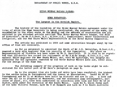
Album - Hume Reservoir Australia Album - Introduction - Part 1, Department of Public Works, N.S.W, 1927
... Lock No.9, which forms part of the Lake Victoria Scheme, Lock No.5 at Renmark and Lock No.3 in South Australia Hume Reservoir Australia Album - Introduction - Part 1 Album Hume Reservoir Australia Album - Introduction - Part 1 Department of Public Works, N.S.W. ...This set of photos is from a leather bound album bearing the inscription "HUME RESERVOIR AUSTRALIA" plus 'The Rt. Hon. L. C. M. S. Amery, P. C., M .P.' all inscribed in gold. It was presented to The Rt. Hon. L. C. M. S. Amery, P. C., M. P, Secretary of State for Dominion Affairs on the occasion of his visit to the Hume Reservoir on 2nd November 1927. This album is of local and national significance as it documents the planning and development of the Hume Reservoir up to 1927. It was the largest water reservoir in the British Empire. The album records the pioneering engineering work that went into its construction.RIVER MURRAY WATERS SCHEME, HUME RESERVOIR THE LARGEST IN THE BRITISH EMPIRE. ' The history of the inception of the River Murray Waters Agreement under the terms of which the Hume Reservoir is being constructed, the purposes of the work, its correlation to the other works on the Murray and the methods of construction are all outlined in the attached article entitled “The River Murray Waters Scheme, the Nile of Australia”, by Mr H.H. Dare, M.E., M.Inst.C.E., Commissioner, Water Conservation and Irrigation, and the New South Wales Representative on the River Murray Commission. The article was published in 1925 and some alterations brought about by the efflux of time are necessary. As far as personnel is concerned, the death of Mr J.S. Dethridge, M.Inst.C.E., removed a very able engineer from the councils of the Commission. His place as Representative of Victoria has been taken by Mr R. Horsfield. It is also to be regretted that ill-health has caused the retirement of Mr E.M. de Burgh, M.Inst.C.E., the eminent Chief Engineer for New South Wales, who, with Mr Dethridge, was largely responsible for the Agreement cemented by the River Murray Waters Acts and, inter alia, for the design of the Hume Dam. The following summary of the progress of work on the Locks might be substituted for the latter part of Mr Dare’s paragraph. Up to the present time six locks and weirs have been completed, the highest in the series being at Torrumberry and the lowest at Blanchetown. Locks No.26 at Torrumberry and No.11 at Mildura were built by Victoria and are in use. A lock and weir (No.10) is in progress at Wentworth, and the necessary camp arrangements, purchase of plant, etc., have been undertaken in connection with lock and weir No.15 at Euston, both under the direction of New South Wales. Lock No.9, which forms part of the Lake Victoria Scheme, Lock No.5 at Renmark and Lock No.3 in South Australia hume reservoir australia, river murray waters scheme -
 Wodonga & District Historical Society Inc
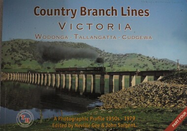
Book - Country Branch Lines Victoria: Wodonga - Tallangatta - Cudgewa: a Photographic Profile 1950s - 1979, Neville Gee and John A. Sargent, 01 Feb 2008
... locomotives -- victoria -- history cudgewa train victoria railways high country trains The book covers the branch line that ran eastward from Wodonga past Lake Hume and on to Tallangatta, over the highest point on Victorian Railways at Shelley and terminated at Cudgewa. ...The book covers the branch line that ran eastward from Wodonga past Lake Hume and on to Tallangatta, over the highest point on Victorian Railways at Shelley and terminated at Cudgewa. A photographic profilenon-fictionThe book covers the branch line that ran eastward from Wodonga past Lake Hume and on to Tallangatta, over the highest point on Victorian Railways at Shelley and terminated at Cudgewa. A photographic profilelocomotives -- victoria -- history, cudgewa train, victoria railways, high country trains -
 Wodonga & District Historical Society Inc
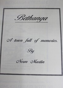
Booklet - Bethanga: A town full of memories, Norm Martin, 1997
... He had three stints as president of the former Tallangatta Shire between the mid-1960s and mid-1980s in a council career which started in the 1950s. bethanga hume weir tallangatta shire norm martin A short history of the town of Bethanga , located on Lake Hume Bethanga: A town full of memories Booklet Bethanga: A town full of memories Norm Martin ...A short history of the town of Bethanga , located on Lake Humenon-fictionA short history of the town of Bethanga , located on Lake Humebethanga, hume weir, tallangatta shire, norm martin
