


Historical information
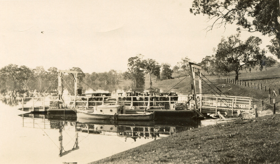
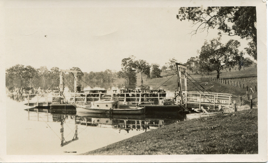
This image shows the Punt (a kind of small boat) that took residents of Bethanga across the Murray River before the Bethanga Bridge was built.
Bethanga Bridge was built between 1927 and 1930, and was made a necessity by the building of the Hume Dam. The Hume Dam, formerly known as the Hume Weir, was in construction between 1919 and 1936, which swelled the Murray River into the floodplain to the East of the dam permanently, creating Lake Hume, and isolating the residents of Bethanga and nearby towns, for whom the trip all the way around the new lake to another river crossing was a massive undertaking. The person who wrote on the back of this card instead chose to cross the river on a boat until the Bethanga Bridge became available.
Interestingly, partially submerged trees can be seen in the lake in the background of this photograph, illustrating that the dam had already begun to fill the floodplain even before the bridge was built.
Significance
This photograph shows the methods the residents of Bethanga used while the Bethanga Bridge was being built. This record is associated with the Heritage Listed sites of the Hume Dam and the Bethanga Bridge, and shows the environment during the process of construction and the creation of Lake Hume
Physical description
Sepia rectangular photograph printed on matte photographic paper
Inscriptions & markings
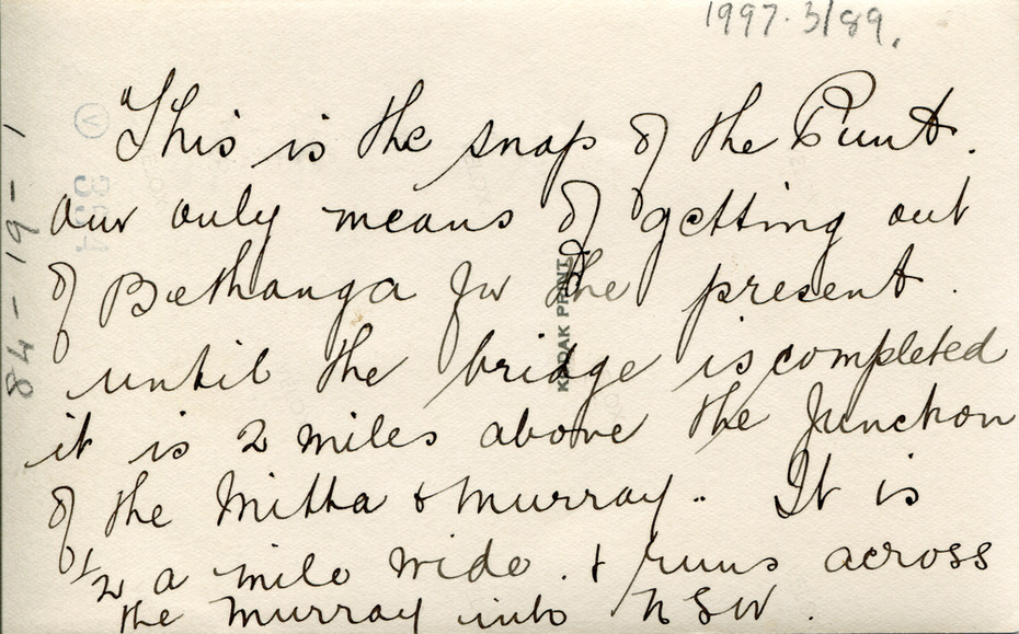
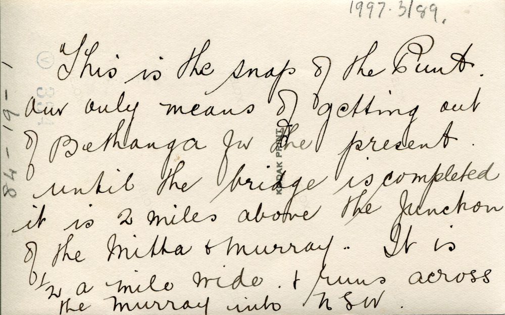
Reverse:
1997.3189 /
84 -19 -1 /
This is the snap of the Punt. /
Our only means of getting out /
of Bethanga for the present /
Until the bridge is completed /
it is 2 miles above the junction /
of the Mitta + Murray. It is /
1/2 a mile wide + runs across /
the Murray into NSW /
Kodak Print /
Subjects
References
- Bethanga Bridge - VHD Bethanga bridge entry Victorian Heritage Database
- Bethanga Bridge - NSW Heritage Inventory NSW Heritage list for Bethanga Bridge