Showing 11953 items matching "lander"
-
 Robin Boyd Foundation
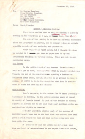
Letter, Harold Lander to Robin Boyd and others. (Crawford Productions), 23.11.1967
... Harold Lander to Robin Boyd and others. (Crawford Productions) ...Memo from Harold Lander, providing background information for a planning meeting to be held to discuss ‘Hunter’ television series. ...Harold Lander...Typewritten, carbon copy, foolscap, 11 pages. Harold Lander to Robin Boyd and others. (Crawford Productions) Letter Harold Lander ...Memo from Harold Lander, providing background information for a planning meeting to be held to discuss ‘Hunter’ television series. 'Hunter' is an Australian spy drama which ran from 4 July 1967 – 5 March 1969 on Nine Network. Lander writes about considerations for making the show commercially successful including publicity tactics. Robin Boyd is mentioned on page 9. Lander asks for his suggestion on a new set design for the Independent Surveys office for the show.Crawford Productions and Robin Boyd also explored ideas for other television productions, besides the successful 'The Flying Dogtor" series.Typewritten, carbon copy, foolscap, 11 pages.Black pen mark up on pages 1-9, red pen mark up on pages 1 and 2.hunter, australian television, crawford productions, homicide, nine network -
 Embroiderers Guild, Victoria
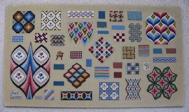
Textile - Sampler, Joan Lander, RSN Canvas Work Sampler, Mid 20th Century
... Artist, Joan Lander, worked at the Royal School, London....Joan Lander 1963...Joan Lander...Artist, Joan Lander, worked at the Royal School, London. ...Artist, Joan Lander, worked at the Royal School, London.Teaching sampler of the Royal School. Crewel work on linen canvas. Location: C7 Top Shelf 97Joan Lander 1963embroidery, panel, canvas work, samplers, 1940-60, england -
 Moorabbin Air Museum
Book - MOON LANDER, THOMAS J KELLY, 2001
... MOON LANDER...Moorabbin Air Museum Moorabbin Airport 12 First Street Moorabbin melbourne MOON LANDER Book MOON LANDER THOMAS J KELLY ... -
 Footscray Community Arts
The Happy Man, Heath Lander, 2006
... Heath Lander...Footscray Community Arts 45 Moreland Street Footscray melbourne MEDIUM: Oil on canvas The Happy Man The Happy Man Heath Lander ...MEDIUM: Oil on canvas -
 Greensborough Historical Society
Genealogical Document, Family records: various sources, 15/02/1840o
... Families include: Mayger, Lecky, Britnell, Garthwaite, Green, Beale, Coulstock, Sherwin, Batey, Cobham, Partington, Catchpole, Whatmough.Contains transcript of land ownership in Greensborough area 1840-1906....One page of details transcribed from Land ownership 1840-1906....Land ownership notes are hand written....One page of details transcribed from Land ownership 1840-1906. Family records: various sources Genealogical Document ...Families include: Mayger, Lecky, Britnell, Garthwaite, Green, Beale, Coulstock, Sherwin, Batey, Cobham, Partington, Catchpole, Whatmough.Contains transcript of land ownership in Greensborough area 1840-1906.One page of details transcribed from Land ownership 1840-1906.Land ownership notes are hand written.greensborough -
 Phillip Island and District Historical Society Inc.
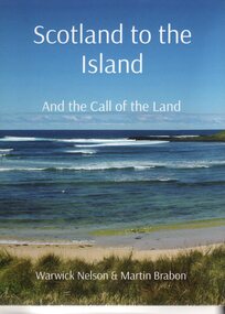
Book, Warwick Nelson & Martin Brabon, Scotland to the Island. And the call of the land, 2022
... And the call of the land....Robert Miller selected land in Ventnor in 1868. His daughter, Catherine, later lived nearby with the neighbouring bay named after her, Kitty Miller Bay....Book - Scotland to the Island and the call of the land. Large Book...Scotland to the Island. and the call of the land. Warwick Nelson & Martin Brabon...And the call of the land. Book Warwick Nelson & Martin Brabon ...The Miller family were one of the early settlers on Phillip Island. Robert Miller selected land in Ventnor in 1868. His daughter, Catherine, later lived nearby with the neighbouring bay named after her, Kitty Miller Bay.HistoricalBook - Scotland to the Island and the call of the land. Large BookScotland to the Island. and the call of the land. Warwick Nelson & Martin Brabonmiller family, kitty miller bay phillip island, catherine walker (nee kitty miller), warwick nelson, robert miller, farming, ventnor -
Clunes Museum
Document - LAND PURCHASE, 1862
... SPECIAL LAND PURCHASE CERTIFICATE FOR LAND PURCHASED BY JAMES GRIFFIS OF CLUNES, DATED 4TH APRIL 1862....CERTIFICATE OF SPECIAL LAND PURCHASE....ENTERED ON RECORD AND ENROLLED IN THE OFFICE OF THE REGISTRAR OF THE SUPREME COURT OF THE COLONY OF VICTORIA, IN REGISTER NO. 13 SPECIAL LAND PURCHASES, FOLIO 2483 THIS THIRTEENTH DAY OF MAY 1862. ...SIGNED BY ACTING REGISTRAR CERTIFICATE OF SPECIAL LAND PURCHASE. Document LAND PURCHASE ...SPECIAL LAND PURCHASE CERTIFICATE FOR LAND PURCHASED BY JAMES GRIFFIS OF CLUNES, DATED 4TH APRIL 1862.CERTIFICATE OF SPECIAL LAND PURCHASE.ENTERED ON RECORD AND ENROLLED IN THE OFFICE OF THE REGISTRAR OF THE SUPREME COURT OF THE COLONY OF VICTORIA, IN REGISTER NO. 13 SPECIAL LAND PURCHASES, FOLIO 2483 THIS THIRTEENTH DAY OF MAY 1862. SIGNED BY ACTING REGISTRARlocal history, document, certificates, griffis james -
 Orbost & District Historical Society
black and white photograph, late 19th century - early 20th century
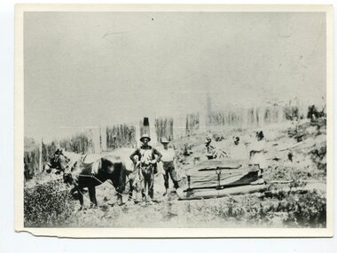
... This photograph shows land clearing at Bendoc. From 1845 the Bendoc area was part of pastoral leases. ...A badly distorted black / white photograph of a horse drawn wagon, three men and two women clearing land....on back - "Clearing land at Bendoc"...Some miners selected land, which in many cases is still held by descendants. ...This photograph shows land clearing at Bendoc. From 1845 the Bendoc area was part of pastoral leases. In the 1850s alluvial gold was discovered in the Bendoc River. This was quickly exhausted, and a number of mines began successful reef operations. At the head of the river, the settlement of Clarkville clustered round several other mines. Many miners, including numbers of Chinese, sluiced the rivers. The population of the area was as high as 500 during this period. The township was surveyed in 1869 and the hotel built in 1870. This building was burnt down in the early 1900s and rebuilt. A school was also begun at this time. In the 1870s there was a decline in gold mining. Some miners selected land, which in many cases is still held by descendants. Dairying was common in the early days, supplying a butter factory at the New South Wales border, and a milk factory at Orbost in more recent times. Wheat was grown for the settlers' own use and ground at Bombala. Now beef cattle grazing is the main occupation. (info. from Victorian Places)This is a pictorial history associated with the early settlement of Bendoc in East Gippsland.A badly distorted black / white photograph of a horse drawn wagon, three men and two women clearing land.on back - "Clearing land at Bendoc"bendoc-land-clearing bendoc-early-settlement -
 Greensborough Historical Society
Genealogical Document, Family records: various sources, 06/02/1854o
... Item 365 contains transcript of land ownership in Greensborough area 1840-1906....One page of details transcribed from various rolls and directories. Also Item 365 Land ownership 1840-1906....Land ownership notes are hand written....Also Item 365 Land ownership 1840-1906. Family records: various sources Genealogical Document ...Family details collected and transcribed from various sources: rolls, directories, insolvency lists, etc. Families include: Mayger, Lecky, Britnell, Garthwaite, Green, Beale, Coulstock, Sherwin, Batey, Cobham, Partington, Catchpole, Whatmough. Item 365 contains transcript of land ownership in Greensborough area 1840-1906.One page of details transcribed from various rolls and directories. Also Item 365 Land ownership 1840-1906.Land ownership notes are hand written.greensborough, mayger, lecky, britnell, garthwaite, green, beale, coulstock, sherwin, batey, cobham, partington, catchpole, whatmough. -
 Clunes Museum
Photograph
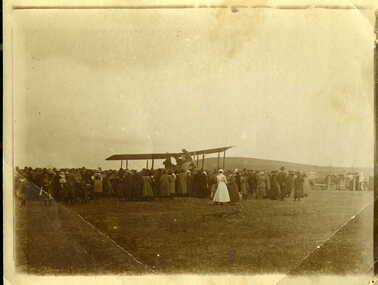
... PHOTO OF FIRST PLANE TO LAND IN CLUNES, NEAR THE OLD HOSPITAL....PHOTOGRAPH OF FIRST PLANE TO LAND IN CLUNES...HANDWRITTEN ON BACK - "ONE OF THE FIRST AEROPLANES TO LAND IN CLUNES (IF NOT THE FIRST). LANDED IN PADDOCK ALONGSIDE CLUNES HOSPITAL ON CRESWICK ROAD ABOUT 1920. ...Clunes Museum 36 Fraser Street enter building through Collins Place Clunes goldfields PHOTO OF FIRST PLANE TO LAND IN CLUNES, NEAR THE OLD HOSPITAL. local history photography photographs events and celebrations first plane to land in clunes HANDWRITTEN ON BACK - "ONE OF THE FIRST AEROPLANES TO LAND IN CLUNES (IF NOT THE FIRST). ...PHOTO OF FIRST PLANE TO LAND IN CLUNES, NEAR THE OLD HOSPITAL.PHOTOGRAPH / COPY OF AEROPLANE WITH CROWD OF PEOPLE. PHOTOGRAPH OF FIRST PLANE TO LAND IN CLUNESHANDWRITTEN ON BACK - "ONE OF THE FIRST AEROPLANES TO LAND IN CLUNES (IF NOT THE FIRST). LANDED IN PADDOCK ALONGSIDE CLUNES HOSPITAL ON CRESWICK ROAD ABOUT 1920. NOTE NURSE IN UNIFORM."local history, photography, photographs, events and celebrations, first plane to land in clunes -
Clunes Museum
Document - LAND PURCHASE AGREEMENT, 1862
... SALE OF CROWN LAND IN VICTORIA 1862...TO ABEL GRENFELL OF CRESWICK. LAND SITUATED IN ALLIANCE STREET, CLUNES....LAND SITUATED IN ALLIANCE STREET, CLUNES. SALE OF CROWN LAND IN VICTORIA 1862 Document LAND PURCHASE AGREEMENT ...SIGNED IN MELBOURNE 29TH MARCH 1862 BY SIR HENRY BARKLEY GOVERNOR-IN-CHIEF OF THE COLONY OF VICTORIASALE OF CROWN LAND IN VICTORIA 1862TO ABEL GRENFELL OF CRESWICK. LAND SITUATED IN ALLIANCE STREET, CLUNES.local history, document, land purchase, government, colonial government -
 Bacchus Marsh & District Historical Society
Map, Atkins and Clarke Land Sale situate at Bacchus Marsh 1856 Copy 2
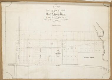
... Atkins and Clarke Land Sale situate at Bacchus Marsh 1856 Copy 2...This plan of land allotments for sale indicates the property once owned by the Bacchus family in and around the township area of Bacchus Marsh. ...A single page paper map showing a portions of land available for sale in Bacchus Marsh in 1856. ...Plan of the first portion of land. The property of Messers Atkins and Clarke situate at Bacchus Marsh....Atkins and Clarke Land Sale situate at Bacchus Marsh 1856 Copy 2 Map Shire of Bacchus Marsh ...This plan of land allotments for sale indicates the property once owned by the Bacchus family in and around the township area of Bacchus Marsh. The Bacchus family sold their property in Bacchus Marsh to John Atkins and Robert Nalder Clarke in March 1851. Atkins and Clarke kept the property for a number of years until April 1856 when these allotments were put up for sale.This plan is almost identical to another copy held by the Bacchus Marsh and District Historical Society, VC Record 707, BMDHS collection). This plan, VC Record 452 Copy 2, contains a less detail than than VC Record 707 Copy 1. For example the selling agents and the surveyor who created the plan are not indicated on this copy of the plan. This copy of the plan does indicate the name Crook Street on the map. As the Crook family were the buyers of the Manor House property and surrounding land from Atkins and Clarke in 1856 it suggests that this copy is a later one of the earlier version. It is unlikely that the Crook family would have had the adjacent street named after them prior to purchasing the house and property. This is a very early land sales plan for the township of Bacchus Marsh and it therefore provides some clues as to how the early urban development of the township took place. Upon seeing the map in 1911 Bacchus Marsh Express newspaper editor Christopher Crisp wrote "The sale appears to have created the present township, which had a nucleus in earlier times further east", Express, 30 September, 1911, page 3. A single page paper map showing a portions of land available for sale in Bacchus Marsh in 1856. The subdivided land shown was owned by John Atkins and Robert Nalder Clarke, but previously owned by the Bacchus Family and was in and around their Manor House (Mansion) property in Bacchus Marsh.There are 5 portions of land further divided into numerous small portions. The land for sale is bounded by the present day streets of Main Street, Young Street, McFarland Street, Morton Streets, Crook Street, and part of the eastern section extends to the Lerderderg River. Scale: 4 chains to 1 inch. The map is pasted into a bound volume containing 76 maps or plans in total. High resolution digital image stored on BMDHS computer network. Plan of the first portion of land. The property of Messers Atkins and Clarke situate at Bacchus Marsh.land sales, land sales bacchus marsh, manor house bacchus marsh, crook family bacchus marsh -
 Bendigo Historical Society Inc.
Document - LAND SALES REGISTER - 1882 - 1909, 1882 - 1909
... Journal: Hard cover journal, dark green cover with buff corners and spine. Land Sales by auction 1882 - 1909. The sale of land in the following areas: Sandhurst, Bendigo, Heathcote, Shepparton, Inglewood, Rushworth. ...Land Sales Office...Land Sales by auction 1882 - 1909. The sale of land in the following areas: Sandhurst, Bendigo, Heathcote, Shepparton, Inglewood, Rushworth. ...Journal: Hard cover journal, dark green cover with buff corners and spine. Land Sales by auction 1882 - 1909. The sale of land in the following areas: Sandhurst, Bendigo, Heathcote, Shepparton, Inglewood, Rushworth. On front cover label (light buff) in blue ink, Bendigo, Sale Register, 1882 - 1909. On spine red label with gold lettering: Report of sales by auction.Land Sales Officeland sales, bendigo, sandhurst, auctions, sales register -
 Bendigo Historical Society Inc.
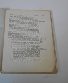
Administrative record - The Land Act 1869
... The Victorian Parliament passed Land Acts in 1860, 1862 and 1869, which offered settlers land within defined agricultural areas. ...The book contains amendments to the land act 1869. throughout the book there are handwritten notes with names and localities...Red pen mark at the front Land(?) 869. some of the nameswriten are: Sanderson, O'Brien, H. ...(from Wikipedia) Land act Victorian legislation Red pen mark at the front Land(?) ...The Victorian Parliament passed Land Acts in 1860, 1862 and 1869, which offered settlers land within defined agricultural areas. Settlers paid for half of an allotment on selection at a uniform price of £1 per acre and paid rent on the other half for usually 7 years. By the end of the period, to obtain title to the land, settlers would have had to pay the balance of the purchase price and make certain improvements. (from Wikipedia)Blue book missing front cover, some loose pages. The book contains amendments to the land act 1869. throughout the book there are handwritten notes with names and localitiesRed pen mark at the front Land(?) 869. some of the nameswriten are: Sanderson, O'Brien, H. Jackson, R. Wharton, W. Porter, J. Stewart, Foley and Mortonland act, victorian legislation -
 Bendigo Historical Society Inc.
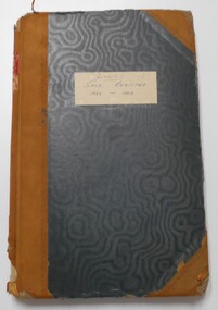
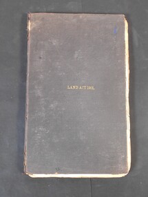
Legal record - Land Act 1901
... Black hardcover book. Land Act 1901 in gold letters on the font. ...Land Act 1901 on the cover...History House 11 Mackenzie Street Bendigo goldfields Land Act 1901 legal record Land Act 1901 on the cover Black hardcover book. ...Black hardcover book. Land Act 1901 in gold letters on the font. The book has 286 pages with few handwritten notes attached to the pages.Land Act 1901 on the coverland act 1901, legal record -
Whitehorse Historical Society Inc.
Article, Rating on unimproved land values, 1911
... Rating on unimproved land values....Complaining about the difference between rating of unimproved land and improved land....Complaining about the difference between rating of unimproved land and improved land....Rating on unimproved land values. Article Article ...A letter from 'Ratepayer' in the Open Column of the Reporter (Box Hill).A letter from 'Ratepayer' in the Open Column of the Reporter (Box Hill) .A letter from 'Ratepayer' in the Open Column of the Reporter (Box Hill). shire of nunawading, mitcham road mitcham, whitehorse road mitcham, station street mitcham -
Whitehorse Historical Society Inc.
Document, Robert Collier Land, 1903
... Robert Collier Land...Morton & Coghill 10 Aug 1903; statement and receipt from Maddock & Jamison for services relating to above sale and to purchase of land in Tunstall from Freehold Investment Company 6 Nov 1903....Papers relating to land dealings by Robert Collier of Springvale Road Tunstall. ...Morton & Coghill 10 Aug 1903; statement and receipt from Maddock & Jamison for services relating to above sale and to purchase of land in Tunstall from Freehold Investment Company 6 Nov 1903....Robert Collier Land Document Document ...50 acres and house in Canterbury Road Blackburn to I.N. Cuttle for (pounds)590Papers relating to land dealings by Robert Collier of Springvale Road Tunstall. 50 acres and house in Canterbury Road Blackburn to I.N. Cuttle for (pounds)590collier, robert, t.r.b morton & coghill, maddock & jamison, canterbury road blackburn, freehold investment company of australia ltd -
 Kew Historical Society Inc
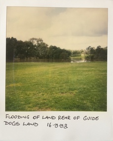
Photograph - Flooding at parkland at rear of Guide Dogs Victoria, 1993
... This includes the land, designated as parkland which adjoins the Yarra River. ..."Flooding of land rear of Guide Dogs land 16.9.93"...This includes the land, designated as parkland which adjoins the Yarra River. ...The land currently occupied by Guide Dogs Victoria was once part of the grounds of the Kew Lunatic Asylum. This includes the land, designated as parkland which adjoins the Yarra River. It is now designated as the Chandler Park.Original colour small format polaroid photograph of flooding in parkland at the rear of Guide Dogs Victoria in the area now used as the Main Yarra Trail; taken on 16 September 1993."Flooding of land rear of Guide Dogs land 16.9.93"yarra river -- floods -- kew (vic.), guide dogs victoria, main yarra trail, chandler park -
4th/19th Prince of Wales's Light Horse Regiment Unit History Room
Book, Joseph Wones Ltd, Land Rover Series IIA Owner's Manual, Oct 1962
... Land Rover Series IIA Owner's Manual...Soft covered owner's manual for the Land Rover Series II A....Land Rover Series IIA Part No 4482 'Regular', 'Long' and Forward Control Owner's Manual ...Land Rover Series IIA Owner's Manual Book Joseph Wones Ltd ...Manual for vehicles used by the RegimentSoft covered owner's manual for the Land Rover Series II A.Land Rover Series IIA Part No 4482 'Regular', 'Long' and Forward Control Owner's Manual user manual, land rover -
Emerald Museum & Nobelius Heritage Park
Map - Land Capability Study of the Shire of Cardinia, parish of Emerald, c1996
... Land Capability Study of the Shire of Cardinia, parish of Emerald...Image of a land capability study map in the Shire of Cardinia, parish Parcels of Emerald...A land Capability Study of the Shire of Cardinia/Map Units and Parish parcels of Emerald/C1996...Emerald Museum & Nobelius Heritage Park 5 Crichton Rd Emerald yarra-valley-and-the-dandenong-ranges A land Capability Study of the Shire of Cardinia/Map Units and Parish parcels of Emerald/C1996 Image of a land capability study map in the Shire of Cardinia, parish Parcels of Emerald Land Capability Study of the Shire of Cardinia, parish of Emerald Map Land Capability Study of the Shire of Cardinia, parish of Emerald ...Image of a land capability study map in the Shire of Cardinia, parish Parcels of EmeraldA land Capability Study of the Shire of Cardinia/Map Units and Parish parcels of Emerald/C1996 -
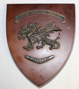 Dandenong/Cranbourne RSL Sub Branch
Plaque - Land Warfare Centre plaque
... Shield shaped plaque made on a red varnished wood with a copper badge of a seven headed dragon affixed to the centre above the dragon is a banner with " Land Warfare Centre" and below it is a boomerang pointed down with "Australia" on in...Land Warfare Centre--- Australia...Land Warfare Centre--- Australia Shield shaped plaque made on a red varnished wood with a copper badge of a seven headed dragon affixed to the centre above the dragon is a banner with " Land Warfare Centre" and below it is a boomerang pointed down with "Australia" on in Plaque Land Warfare Centre plaque ...Shield shaped plaque made on a red varnished wood with a copper badge of a seven headed dragon affixed to the centre above the dragon is a banner with " Land Warfare Centre" and below it is a boomerang pointed down with "Australia" on inLand Warfare Centre--- Australia -
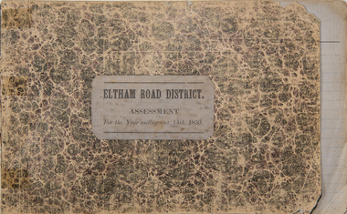 Eltham District Historical Society Inc
Ledger, Eltham Road District. Assessment for the Year ending Oct. 14th, 1859, 1858c
... Ledger with printed columns: Number, Name of Occupier, Description, Where situated, Cultivated land, Pasture land, Estimated annual value of buildings, Rate, Remarks, Arrears collected, excused, unoccupied, uncollected and amount actually collected. ...Inside cover includes pasted printed note: RATE OF ASSESSMENT AS FOLLOWS: Cultivated land 6d per acre Pasture land 2d per acre Unalienated Pasture Land 8d per Acre Estimated Annual Value of Buildings, &c., 6d. in the Pound ...At the time properties were rated as follows: Cultivated land. 6d. per acre; pasture land, 1d. per acre: estimated annual value of buildings, etc., 6d in the (pound). ...The Eltham Roads Board was established in 1856. This ledger includes the signature of Road Board Secretary and Collector Wingrove, a significant person in Eltham's early history. This is a unique significant record of early settlers in the Shire of Eltham. One of 6 early rate books. This is among the oldest items in the EDHS collection. An article in the Eltham and Whittlesea Shires Advertiser Friday 21 Nov 1941 Page 5 titled: District's Early History states: "The first rate book which is still in existence at the Shire Office is for the year ending October 14, 1858 and is probably the best record possible to indicate the development of the district. At the time properties were rated as follows: Cultivated land. 6d. per acre; pasture land, 1d. per acre: estimated annual value of buildings, etc., 6d in the (pound). The total amount of rate recorded for the year was (pounds)153/14/8. Properties were described as being situated at Lower Plenty, Yarra Yarra, Eltham, Lower Eltham, Kangaroo Ground, Yarra Flats, Diamond Creek and the Yarra."Ledger with printed columns: Number, Name of Occupier, Description, Where situated, Cultivated land, Pasture land, Estimated annual value of buildings, Rate, Remarks, Arrears collected, excused, unoccupied, uncollected and amount actually collected. Ledger filled out by hand with 173 entries (not alphabetically arranged). A number of blank pages are included. Inside cover includes pasted printed note: RATE OF ASSESSMENT AS FOLLOWS: Cultivated land 6d per acre Pasture land 2d per acre Unalienated Pasture Land 8d per Acre Estimated Annual Value of Buildings, &c., 6d. in the Pound eltham roads board, rate book, rate payers, transaction, pioneers, settlers, wingrove, 1859, assessment ledger, eltham road district, public records office victoria (prov), rate books, shire of eltham archives -
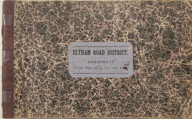 Eltham District Historical Society Inc
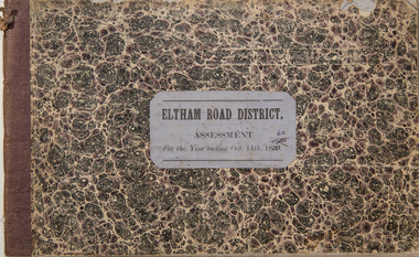
Ledger, Eltham Road District. Assessment for the Year ending Oct. 14th, 1860 (Version 1), 1859c
... Ledger with printed columns: Number, Name of Occupier, Description, Where situated, Cultivated land, Pasture land, Estimated annual value of buildings, Rate, Remarks, Arrears collected, excused, unoccupied, uncollected and amount actually collected. ...Inside cover includes pasted printed note: RATE OF ASSESSMENT AS FOLLOWS: Cultivated land 6d per acre Pasture land 2d per acre Unalienated Pasture Land 8d per Acre Estimated Annual Value of Buildings, &c., 6d. in the Pound ...At the time properties were rated as follows: Cultivated land. 6d. per acre; pasture land, 1d. per acre: estimated annual value of buildings, etc., 6d in the (pound). ...The Eltham Roads Board was established in 1856. This is a unique significant record of early settlers in the Shire of Eltham. One of 6 early rate books. This is among the oldest items in the EDHS collection. An article in the Eltham and Whittlesea Shires Advertiser Friday 21 Nov 1941 Page 5 titled: District's Early History states: "The first rate book which is still in existence at the Shire Office is for the year ending October 14, 1858 and is probably the best record possible to indicate the development of the district. At the time properties were rated as follows: Cultivated land. 6d. per acre; pasture land, 1d. per acre: estimated annual value of buildings, etc., 6d in the (pound). The total amount of rate recorded for the year was (pounds)153/14/8. Properties were described as being situated at Lower Plenty, Yarra Yarra, Eltham, Lower Eltham, Kangaroo Ground, Yarra Flats, Diamond Creek and the Yarra."Ledger with printed columns: Number, Name of Occupier, Description, Where situated, Cultivated land, Pasture land, Estimated annual value of buildings, Rate, Remarks, Arrears collected, excused, unoccupied, uncollected and amount actually collected. Ledger filled out by hand with 177 entries (not alphabetically arranged). A number of blank pages are included. Inside cover includes pasted printed note: RATE OF ASSESSMENT AS FOLLOWS: Cultivated land 6d per acre Pasture land 2d per acre Unalienated Pasture Land 8d per Acre Estimated Annual Value of Buildings, &c., 6d. in the Pound eltham roads board, rate book, rate payers, transaction, pioneers, settlers, wingrove, 1860, assessment ledger, eltham road district, public records office victoria (prov), rate books, shire of eltham archives -
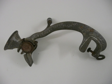 Bendigo Historical Society Inc.
Tool - FOOD MINCER
... Cast iron food mincer for seeding raisins, with handle & screw attachment for securing to bench or table, black wooden handle. Marked Landers Frary & Clark New Britain Conn. USA. ...Landers Frary & Clark...Marked Landers Frary & Clark New Britain Conn. USA. ...Cast iron food mincer for seeding raisins, with handle & screw attachment for securing to bench or table, black wooden handle. Marked Landers Frary & Clark New Britain Conn. USA. Pat Nov 24.96 Wet the Raisins No 4 Crown.Landers Frary & Clarkdomestic equipment, food preparation, raisin seeder, k195 -
 Eltham District Historical Society Inc
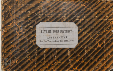
Ledger, Eltham Road District. Assessment for the Year ending Oct. 14th, 1861, 1860c
... Ledger with printed columns: Number, Name of Occupier, Description, Where situated, Cultivated land, Pasture land, Estimated annual value of buildings, Rate, Remarks, Arrears collected, excused, unoccupied, uncollected and amount actually collected. ...Inside cover includes pasted printed note: RATE OF ASSESSMENT AS FOLLOWS: Cultivated land 6d per acre Pasture land 2d per acre Unalienated Pasture Land 8d per Acre Estimated Annual Value of Buildings, &c., 6d. in the Pound ...At the time properties were rated as follows: Cultivated land. 6d. per acre; pasture land, 1d. per acre: estimated annual value of buildings, etc., 6d in the (pound). ...The Eltham Roads Board was established in 1856. This is a unique significant record of early settlers in the Shire of Eltham. One of 6 early rate books. This is among the oldest items in the EDHS collection. An article in the Eltham and Whittlesea Shires Advertiser Friday 21 Nov 1941 Page 5 titled: District's Early History states: "The first rate book which is still in existence at the Shire Office is for the year ending October 14, 1858 and is probably the best record possible to indicate the development of the district. At the time properties were rated as follows: Cultivated land. 6d. per acre; pasture land, 1d. per acre: estimated annual value of buildings, etc., 6d in the (pound). The total amount of rate recorded for the year was (pounds)153/14/8. Properties were described as being situated at Lower Plenty, Yarra Yarra, Eltham, Lower Eltham, Kangaroo Ground, Yarra Flats, Diamond Creek and the Yarra."Ledger with printed columns: Number, Name of Occupier, Description, Where situated, Cultivated land, Pasture land, Estimated annual value of buildings, Rate, Remarks, Arrears collected, excused, unoccupied, uncollected and amount actually collected. Ledger filled out by hand with 185 entries (not alphabetically arranged) and summary section. A number of blank pages are included. Inside cover includes pasted printed note: RATE OF ASSESSMENT AS FOLLOWS: Cultivated land 6d per acre Pasture land 2d per acre Unalienated Pasture Land 8d per Acre Estimated Annual Value of Buildings, &c., 6d. in the Pound eltham roads board, rate book, rate payers, transaction, pioneers, settlers, 1861, assessment ledger, eltham road district, public records office victoria (prov), rate books, shire of eltham archives -
Ringwood and District Historical Society
Newspaper Cutting, The Sun, Ringwood Development article (Sun Newspaper) 23 Aug 1960, 23-Aug-60
... Article about land 'frieze' of the 16 acres of land for the proposed development site for Eastland....Land 'Frieze' at Ringwood....Ringwood and District Historical Society 125A Warrandyte Road Ringwood North melbourne Article about land 'frieze' of the 16 acres of land for the proposed development site for Eastland. ...Article about land 'frieze' of the 16 acres of land for the proposed development site for Eastland.Article about Ringwood development in Sun newspaper. Double page. +Additional Keywords: Lavis, A.G., Mayor / Dwerryhouse, F.P., Town ClerkLand 'Frieze' at Ringwood. -
 Eltham District Historical Society Inc
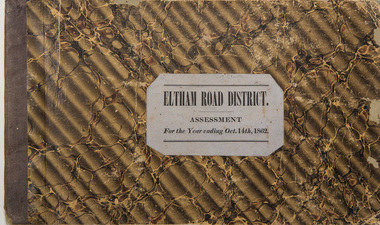
Ledger, Eltham Road District. Assessment for the Year ending Oct. 14th, 1862, 1861c
... Ledger with printed columns: Number, Name of Occupier, Description, Where situated, Cultivated land, Pasture land, Estimated annual value of buildings, Rate, Remarks, Arrears collected, excused, unoccupied, uncollected and amount actually collected. ...Inside cover includes pasted printed note: RATE OF ASSESSMENT AS FOLLOWS: Cultivated land 6d per acre Pasture land 1/2d per acre Unalienated Pasture Land 1/28 per Acre Estimated Annual Value of Buildings, &c., 6d. in the Pound ...At the time properties were rated as follows: Cultivated land. 6d. per acre; pasture land, 1d. per acre: estimated annual value of buildings, etc., 6d in the (pound). ...The Eltham Roads Board was established in 1856. This is a unique significant record of early settlers in the Shire of Eltham. One of 6 early rate books. This is among the oldest items in the EDHS collection. An article in the Eltham and Whittlesea Shires Advertiser Friday 21 Nov 1941 Page 5 titled: District's Early History states: "The first rate book which is still in existence at the Shire Office is for the year ending October 14, 1858 and is probably the best record possible to indicate the development of the district. At the time properties were rated as follows: Cultivated land. 6d. per acre; pasture land, 1d. per acre: estimated annual value of buildings, etc., 6d in the (pound). The total amount of rate recorded for the year was (pounds)153/14/8. Properties were described as being situated at Lower Plenty, Yarra Yarra, Eltham, Lower Eltham, Kangaroo Ground, Yarra Flats, Diamond Creek and the Yarra."Ledger with printed columns: Number, Name of Occupier, Description, Where situated, Cultivated land, Pasture land, Estimated annual value of buildings, Rate, Remarks, Arrears collected, excused, unoccupied, uncollected and amount actually collected. Ledger filled out by hand with 184 entries (not alphabetically arranged) and summary section. A number of blank pages are included. Inside cover includes pasted printed note: RATE OF ASSESSMENT AS FOLLOWS: Cultivated land 6d per acre Pasture land 1/2d per acre Unalienated Pasture Land 1/28 per Acre Estimated Annual Value of Buildings, &c., 6d. in the Pound eltham roads board, rate book, rate payers, transaction, pioneers, settlers, 1862, assessment ledger, eltham road district, public records office victoria (prov), rate books, shire of eltham archives -
 Eltham District Historical Society Inc
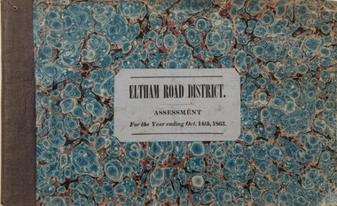
Ledger, Eltham Road District. Assessment for the Year ending Oct. 14th, 1863, 1862c
... Ledger with printed columns: Number, Name of Occupier, Description, Where situated, Cultivated land, Pasture land, Estimated annual value of buildings, Rate, Remarks, Arrears collected, excused, unoccupied, uncollected and amount actually collected. ...Inside cover includes pasted printed note: RATE OF ASSESSMENT AS FOLLOWS: Cultivated land 6d per acre Pasture land 1/2d per acre Unalienated Pasture Land 1/28 per Acre Estimated Annual Value of Buildings, &c., 6d. in the Pound ...At the time properties were rated as follows: Cultivated land. 6d. per acre; pasture land, 1d. per acre: estimated annual value of buildings, etc., 6d in the (pound). ...The Eltham Roads Board was established in 1856. This is a unique significant record of early settlers in the Shire of Eltham. One of 6 early rate books. This is among the oldest items in the EDHS collection. An article in the Eltham and Whittlesea Shires Advertiser Friday 21 Nov 1941 Page 5 titled: District's Early History states: "The first rate book which is still in existence at the Shire Office is for the year ending October 14, 1858 and is probably the best record possible to indicate the development of the district. At the time properties were rated as follows: Cultivated land. 6d. per acre; pasture land, 1d. per acre: estimated annual value of buildings, etc., 6d in the (pound). The total amount of rate recorded for the year was (pounds)153/14/8. Properties were described as being situated at Lower Plenty, Yarra Yarra, Eltham, Lower Eltham, Kangaroo Ground, Yarra Flats, Diamond Creek and the Yarra."Ledger with printed columns: Number, Name of Occupier, Description, Where situated, Cultivated land, Pasture land, Estimated annual value of buildings, Rate, Remarks, Arrears collected, excused, unoccupied, uncollected and amount actually collected. Ledger filled out by hand with 181 entries (not alphabetically arranged) and summary section. A number of blank pages are included. Inside cover includes pasted printed note: RATE OF ASSESSMENT AS FOLLOWS: Cultivated land 6d per acre Pasture land 1/2d per acre Unalienated Pasture Land 1/28 per Acre Estimated Annual Value of Buildings, &c., 6d. in the Pound eltham roads board, rate book, rate payers, transaction, pioneers, settlers, 1863, assessment ledger, eltham road district, public records office victoria (prov), rate books, shire of eltham archives -
 Eltham District Historical Society Inc
Ledger, Eltham Road District. Assessment for the Year ending Oct. 14th, 1860 (Version 2), 1859c
... Ledger with printed columns: Number, Name of Occupier, Description, Where situated, Cultivated land, Pasture land, Estimated annual value of buildings, Rate, Remarks, Arrears collected, excused, unoccupied, uncollected and amount actually collected. ...Inside cover includes pasted printed note: RATE OF ASSESSMENT AS FOLLOWS: Cultivated land 6d per acre Pasture land 2d per acre Unalienated Pasture Land 8d per Acre Estimated Annual Value of Buildings, &c., 6d. in the Pound ...At the time properties were rated as follows: Cultivated land. 6d. per acre; pasture land, 1d. per acre: estimated annual value of buildings, etc., 6d in the (pound). ...The Eltham Roads Board was established in 1856. This is a unique significant record of early settlers in the Shire of Eltham. One of 6 early rate books. This is among the oldest items in the EDHS collection. An article in the Eltham and Whittlesea Shires Advertiser Friday 21 Nov 1941 Page 5 titled: District's Early History states: "The first rate book which is still in existence at the Shire Office is for the year ending October 14, 1858 and is probably the best record possible to indicate the development of the district. At the time properties were rated as follows: Cultivated land. 6d. per acre; pasture land, 1d. per acre: estimated annual value of buildings, etc., 6d in the (pound). The total amount of rate recorded for the year was (pounds)153/14/8. Properties were described as being situated at Lower Plenty, Yarra Yarra, Eltham, Lower Eltham, Kangaroo Ground, Yarra Flats, Diamond Creek and the Yarra."Ledger with printed columns: Number, Name of Occupier, Description, Where situated, Cultivated land, Pasture land, Estimated annual value of buildings, Rate, Remarks, Arrears collected, excused, unoccupied, uncollected and amount actually collected. Ledger filled out by hand with 177 entries (not alphabetically arranged). A number of blank pages are included. This version was slight changes to version one. Inside cover includes pasted printed note: RATE OF ASSESSMENT AS FOLLOWS: Cultivated land 6d per acre Pasture land 2d per acre Unalienated Pasture Land 8d per Acre Estimated Annual Value of Buildings, &c., 6d. in the Pound eltham roads board, rate book, rate payers, transaction, pioneers, settlers, 1860, assessment ledger, eltham road district, public records office victoria (prov), rate books, shire of eltham archives -
 Bendigo Historical Society Inc.
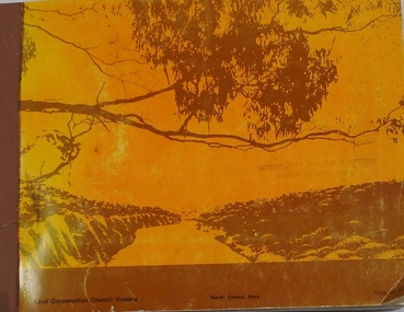
Book - REPORT ON THE NORTH CENTRAL STUDY AREA OF VICTORIA
... 252 page Report on the North Central Study Area by the Land Conservation Council of Victoria - July 1978 Illustrated with B&W photos Back section contains several removeable maps. ...Land Conservation Council, Victoria...History House 11 Mackenzie Street Bendigo goldfields Land Conservation North Central Region Land Conservation Council, Victoria 252 page Report on the North Central Study Area by the Land Conservation Council of Victoria - July 1978 Illustrated with B&W photos Back section contains several removeable maps. ...252 page Report on the North Central Study Area by the Land Conservation Council of Victoria - July 1978 Illustrated with B&W photos Back section contains several removeable maps. Printed by F D Atkinson, Government Printer, MelbourneLand Conservation Council, Victorialand conservation, north central region