Showing 1889 items matching "maps and documents"
-
 Federation University Historical Collection
Document - Documents and maps, Holmes - Documents, Letters, Family Trees, Maps
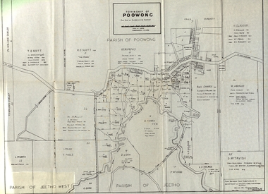
... Holmes - Documents, Letters, Family Trees, Maps...Letters and maps and information relating to the Holmes family of Ascot, Victoria. ...Documents include: Sarah Holmes inquest Ancestors of Elizabeth Mary Holmes Holmes Family Reunion at Arawata Hall Holmes - Documents, Letters, Family Trees, Maps Document Documents and maps ...Letters and maps and information relating to the Holmes family of Ascot, Victoria. Documents include: Sarah Holmes inquest Ancestors of Elizabeth Mary Holmes Holmes Family Reunion at Arawata Hallelizabeth mary holmes, ascot residence tender notice, family tree, map of poowong township, family history, genealogy, samuel pickford, william pickford, elizabeth cross, charles robbins, harry holmes, edith pickford, ian coghill holmes, elizabeth fry -
 Federation University Historical Collection
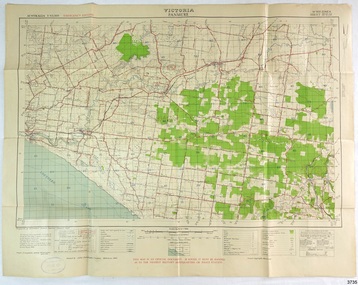
Map - Documents, Documents relating to Land - Selection of Maps of subdivisions; Titles; Cemetery sections
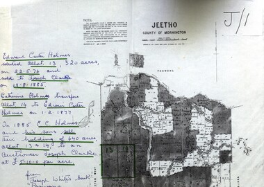
... Documents relating to Land - Selection of Maps of subdivisions; Titles; Cemetery sections...Edward Carter Holmes J.P. selected land and called it Launchley - later called Wambalano. Documents relating to Land - Selection of Maps of subdivisions; Titles; Cemetery sections Map Documents ...Maps indicate the land owned in various areas of Victoria - Mornington Peninsula, Ascot / Creswick areaLand maps showing block divisions and owners. Edward Carter Holmes J.P. selected land and called it Launchley - later called Wambalano.jeetho, county of mornington, edward carter holmes, joseph clarke, catherine holmes, talbot, william coghill, pre-emptive right, tourello pre-emptive right, glendonald pre-emptive right, clunes, smeaton, ascot, counties of ripon and talbot, certificate of title, ballaarat general cemetery, new cemetery, poowong, helen coghill -
 Victorian Aboriginal Corporation for Languages
Book, Ian D Clark, Place names and land tenure : windows into Aboriginal landscapes : essays in Victorian Aboriginal history, 1998
... maps, document reproductions...Victorian Aboriginal Corporation for Languages 33 Saxon Street Brunswick melbourne Djab Wurrung Ngengen Wurrung Koroitgundidj Dhauwurud Wurrung Djab Wurrung Barababaraba Daung Wurrung Taungurung Dja Dja Wurrung Jardwadjali Jodajoda Yorta Yorta Nguri-illam Wurrung Waywurru Koroit Buangor Mt Eccles Mt Napier Langi Ghiran Grampians National Park massacres clan organization land tenure George Augustus Robinson Samuel Carter Aldo Massola Alfred William Howitt maps, document reproductions This work is a collection of twelve essays that are concerned with place names, clan organisation and local and regional Aboriginal history. ...This work is a collection of twelve essays that are concerned with place names, clan organisation and local and regional Aboriginal history.maps, document reproductionsdjab wurrung, ngengen wurrung, koroitgundidj, dhauwurud wurrung, djab wurrung, barababaraba, daung wurrung, taungurung, dja dja wurrung, jardwadjali, jodajoda, yorta yorta, nguri-illam wurrung, waywurru, koroit, buangor, mt eccles, mt napier, langi ghiran, grampians national park, massacres, clan organization, land tenure, george augustus robinson, samuel carter, aldo massola, alfred william howitt -
 Bendigo Military Museum
Document - ADF Map and Air Chart Catalogue Part A, RASvy Corps, May 1991
... This document contains the "map and Air Chart Demand and Issue Voucher" to enable the ordering of map products. ...The names of all the 1:100,000 maps are listed in alphabetical order. 3. The Map and Air Chart Demand and Issue Voucher is printed on the back of the document. 4. ...Bendigo Military Museum 37 - 39 Pall Mall Bendigo goldfields This document contains the "map and Air Chart Demand and Issue Voucher" to enable the ordering of map products. ...This document contains the "map and Air Chart Demand and Issue Voucher" to enable the ordering of map products. The catalogue of available products is shown on the reverse side to assist in the ordering process.1. A Map sheet of Australia folded to A4 in size. 2. A selection of map examples and a catalogue of products, Tactical Line Maps (TLM) at 1:50,000 scale to Digital Chart of the World (DCW) at 1:1,000,000 scale maps. The names of all the 1:100,000 maps are listed in alphabetical order. 3. The Map and Air Chart Demand and Issue Voucher is printed on the back of the document. 4. Front section has a photo of a soldier with a Steyr rifle kneeling reading a map.royal australian survey corps, rasvy, fortuna, army survey regiment, army svy regt, asr -
 Tatura Irrigation & Wartime Camps Museum
Folder - survey maps
... Maps of no 14 A, B, C and D internment camps and documents on Loveday Camp, South Australia. ...Blue back clear plastic folder containing maps of No 14 camp and documents on Loveday Camp....Tatura Irrigation & Wartime Camps Museum 49 Hogan Street Tatura the-murray Maps of no 14 A, B, C and D internment camps and documents on Loveday Camp, South Australia. ...Maps of no 14 A, B, C and D internment camps and documents on Loveday Camp, South Australia. Donated by Gerhard Meinke concerning Loveday Camp. Brief outline of camps life, release and repatriation, list of deaths, of POW's and internees.Blue back clear plastic folder containing maps of No 14 camp and documents on Loveday Camp.gerhard meinke, loveday camp, camp 14, south australian internment camps, japanese internees -
 Victorian Aboriginal Corporation for Languages
Book, Christobel Mattingley, Survival in our own land : 'Aboriginal' experiences in 'South Australia' since 1836 : told by Nungas and others, 1998
... maps, b&w photographs, document reproductions...Victorian Aboriginal Corporation for Languages 33 Saxon Street Brunswick melbourne South Australia Nunga Goonya colonisation maps, b&w photographs, document reproductions A history of Aboriginal experiences in 'South Australia' since 1836. ...A history of Aboriginal experiences in 'South Australia' since 1836.maps, b&w photographs, document reproductionssouth australia, nunga, goonya, colonisation -
 Victorian Aboriginal Corporation for Languages
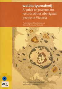
Book, Public Record Office Victoria et al, Walata tyamateetj : a guide to government records about Aboriginal people in Victoria, 2014
... document reproductions, maps, b&w photographs...Victorian Aboriginal Corporation for Languages 33 Saxon Street Brunswick melbourne archives archives directories historical sources public records Victorian history document reproductions, maps, b&w photographs Public Record Office Victoria and the National Archives of Australia hold many government records about Aboriginal people in Victoria. ...Public Record Office Victoria and the National Archives of Australia hold many government records about Aboriginal people in Victoria. This guide is designed to help Victorian Aboriginal people find records about their family and country. It will also assist anyone researching the history and administration of Aboriginal affairs in Victoria to find relevant records.document reproductions, maps, b&w photographsarchives, archives directories, historical sources, public records, victorian history -
 Victorian Aboriginal Corporation for Languages
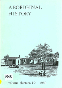
Periodical, Australian National University Department of Pacific and Southeast Asian History, Aboriginal history, 1989
... b&w photographs, maps, charts, document reproductions...Victorian Aboriginal Corporation for Languages 33 Saxon Street Brunswick melbourne b&w photographs, maps, charts, document reproductions Aboriginal history Periodical Australian National University Department of Pacific and Southeast Asian History ...b&w photographs, maps, charts, document reproductions -
 Victorian Aboriginal Corporation for Languages
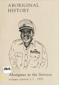
Periodical, Australian National University Department of Pacific and Southeast Asian History, Aboriginal history : Aborigines in the services, 1992
... maps, charts, b&w photographs, document reproductions...Victorian Aboriginal Corporation for Languages 33 Saxon Street Brunswick melbourne maps, charts, b&w photographs, document reproductions Aboriginal history : Aborigines in the services Periodical Australian National University Department of Pacific and Southeast Asian History ...maps, charts, b&w photographs, document reproductions -
 Victorian Aboriginal Corporation for Languages
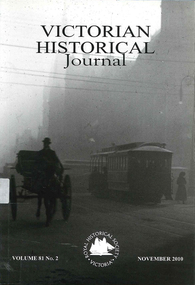
Periodical, Royal Historical Society of Victoria, Victorian historical journal, 2010
... maps, tables, b&w photographs, document reproductions...Victorian Aboriginal Corporation for Languages 33 Saxon Street Brunswick melbourne maps, tables, b&w photographs, document reproductions Victorian historical journal Periodical Royal Historical Society of Victoria ...maps, tables, b&w photographs, document reproductions -
Ballarat Tramway Museum
Administrative record, State Electricity Commission of Victoria (SECV), "Queen Mother's visit - Tramway Arrangements", March 1958
... Set of documents regarding the visit of the Queen Mother to Ballarat for the Begonia Festival on 2 March 1958. ...Administrative record or documents - 8 sheets, and one folded map....Yields information about the 1958 visit by the Queen Mother. tramways Queen Mother Begonia Festival Royal Visit Map Administrative record or documents - 8 sheets, and one folded map. ...Set of documents regarding the visit of the Queen Mother to Ballarat for the Begonia Festival on 2 March 1958. Comprises: 1 - SEC tramway arrangements - giving tramcar termination and restarting while the visit occurred 2 - Multiple copies of the Begonia Festival programme and the Music for the People event 3 - Letter from D I Graham thanking all those involved on Begonia Festival letterhead dated 7/4/1958 4 - Greater Ballarat map - with tram notes along the top edge. 5 - three page handwritten notes regarding tram arrangements, inspectors, and other notes.Yields information about the 1958 visit by the Queen Mother.Administrative record or documents - 8 sheets, and one folded map.tramways, queen mother, begonia festival, royal visit, map -
 Victorian Aboriginal Corporation for Languages
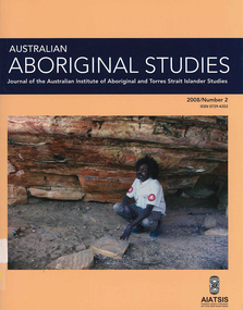
Periodical, Australian Institute of Aboriginal and Torres Strait Islander Studies, Australian Aboriginal studies : journal of the Australian Institute of Aboriginal and Torres Strait Islander Studies, 2008
... document reproductions, maps, b&w photographs, colour photographs...Victorian Aboriginal Corporation for Languages 33 Saxon Street Brunswick melbourne Kimberley Mawul Rom project 3D computer game storytelling Vincent Serico beeswax Namarrkon artefact assemblages Strathbogie Ranges Groote Eylandt Budd Billy II document reproductions, maps, b&w photographs, colour photographs Mawul Rom Project: Openness, obligation and reconciliation Morgan Brigg (Universtiy of Queensland) and Anke Tonnaer (University of Aarhus, Denmark) Aboriginal Australian initiatives to restore balanced relationships with White Australians have recently become part of reconciliation efforts. ...Mawul Rom Project: Openness, obligation and reconciliation Morgan Brigg (Universtiy of Queensland) and Anke Tonnaer (University of Aarhus, Denmark) Aboriginal Australian initiatives to restore balanced relationships with White Australians have recently become part of reconciliation efforts. This paper provides a contextualised report on one such initiative, the Mawul Rom crosscultural mediation project. Viewing Mawul Rom as a diplomatic venture in the lineage of adjustment and earlier Rom rituals raises questions about receptiveness, individual responsibility and the role of Indigenous ceremony in reconciliation efforts. Yolngu ceremonial leaders successfully draw participants into relationship and personally commit them to the tasks of cross-cultural advocacy and reconciliation. But Mawul Rom must also negotiate a paradox because emphasis on the cultural difference of ceremony risks increasing the very social distance that the ritual attempts to confront. Managing this tension will be a key challenge if Mawul Rom is to become an effective diplomatic mechanism for cross-cultural conflict resolution and reconciliation. Living in two camps: the strategies Goldfields Aboriginal people use to manage in the customary economy and the mainstream economy at the same time Howard Sercombe (Strathclyde University, Glasgow) The economic sustainability of Aboriginal households has been a matter of public concern across a range of contexts. This research, conducted in the Eastern Goldfields of Western Australia, shows how economically successful Aboriginal persons manage ?dual economic engagement?, or involvement in the customary economy and the mainstream economy at the same time. The two economies sometimes reinforce each other but are more often in conflict, and management of conflicting obligations requires high degrees of skill and innovation. As well as creating financially sustainable households, the participants contributed significantly to the health of their extended families and communities. The research also shows that many Aboriginal people, no matter what their material and personal resources, are conscious of how fragile and unpredictable their economic lives can be, and that involvement in the customary economy is a kind of mutual insurance to guarantee survival if times get tough. Indigenous population data for evaluation and performance measurement: A cautionary note Gaminiratne Wijesekere (Dept. of Families, Housing, Community Services and Indigenous Affairs, Canberra) I outline the status of population census counts for Indigenous peoples, identifying information on Indigenous births and deaths, and internal migration estimates. I comment on the ?experimental? Indigenous population projections and question the rationale for having two sets of projections. Program managers and evaluators need to be mindful of limitations of the data when using these projections for monitoring, evaluating and measuring Indigenous programs. Reaching out to a younger generation using a 3D computer game for storytelling: Vincent Serico?s legacy Theodor G Wyeld (Flinders University, Adeliade) and Brett Leavy (CyberDreaming Australia) Sadly, Vincent Serico (1949?2008), artist, activist and humanist, recently passed away. Born in southern Queensland in Wakka Wakka/Kabi Kabi Country (Carnarvon Gorge region) in 1949, Vincent was a member of the Stolen Generations. He was separated from his family by White administration at four years of age. He grew up on the Cherbourg Aboriginal Reserve in the 1950s, when the policies of segregation and assimilation were at their peak. Only returning to his Country in his early forties, Vincent started painting his stories and the stories that had been passed on to him about the region. These paintings manifest Vincent?s sanctity for tradition, storytelling, language, spirit and beliefs. A team of researchers was honoured and fortunate to have worked closely with Vincent to develop a 3D simulation of his Country using a 3D computer game toolkit. Embedded in this simulation of his Country, in the locations that their stories speak to, are some of Vincent?s important contemporary art works. They are accompanied by a narration of Vincent?s oral history about the places, people and events depicted. Vincent was deeply concerned about members of the younger generation around him ?losing their way? in modern times. In a similar vein, Brett Leavy (Kooma) sees the 3D game engine as an opportunity to engage the younger generation in its own cultural heritage in an activity that capitalises on a common pastime. Vincent was an enthusiastic advocate of this approach. Working in consultation with Vincent and the research team, CyberDreaming developed a simulation of Vincent?s Country for young Aboriginal and non-Aboriginal persons from the Carnarvon Gorge region to explore Vincent?s life stories of the region. The use of Vincent?s contemporary paintings as storyboards provides a traditional medium for the local people to interactively re-engage with traditional values. Called Serico?s World, it represents a legacy to his life?s works, joys and regrets. Here we discuss the background to this project and Vincent?s contribution. A singular beeswax representation of Namarrkon, the Lightning Man, from western Arnhem Land RG Gunn (La Trobe University) and RL Whear (Jawoyn Association) Samples from a beeswax representation of Namarrkon, the Lightning Man, from western Arnhem Land were analysed for radiocarbon and dated to be about 150 years old. An underlying beeswax figure was found to be approximately 1100 years old. The Dreaming Being Namarrkon is well known throughout Arnhem Land, although his sphere of activity is concentrated around the northern half of the Arnhem Land plateau. Namarrkon is well represented in rock-paintings in this area and continues to be well represented in contemporary canvas-paintings by artists from the broader plateau region. We conclude that representations of Namarrkon in both painted and beeswax forms appear to be parallel manifestations of the late Holocene regionalisation of Arnhem Land. ?Missing the point? or ?what to believe ? the theory or the data?: Rationales for the production of Kimberley points Kim Akerman (Moonah) In a recent article, Rodney Harrison presented an interesting view on the role glass Kimberley points played in the lives of the Aborigines who made and used them. Harrison employed ethnographic and historical data to argue that glass Kimberley points were not part of the normal suite of post-contact artefacts used primarily for hunting and fighting or Indigenous exchange purposes, but primarily were created to service a non-Indigenous market for aesthetically pleasing artefacts. Harrison asserted that this market determined the form that these points took. A critical analysis of the data does not substantiate either of these claims. Here I do not deal with Harrison?s theoretical material or arguments; I focus on the ethnographic and historical material that he has either omitted or failed to appreciate in developing his thesis and which, in turn, renders it invalid. The intensity of raw material utilisation as an indication of occupational history in surface stone artefact assemblages from the Strathbogie Ranges, central Victoria Justin Ian Shiner (La Trobe University, Bundoora) Stone artefact assemblages are a major source of information on past human?landscape relationships throughout much of Australia. These relationships are not well understood in the Strathbogie Ranges of central Victoria, where few detailed analyses of stone artefact assemblages have been undertaken. The purpose of this paper is to redress this situation through the analysis of two surface stone artefact assemblages recorded in early 2000 during a wider investigation of the region?s potential for postgraduate archaeological fieldwork. Analysis of raw material utilisation is used to assess the characteristics of the occupational histories of two locations with similar landscape settings. The analysis indicates variability in the intensity of raw material use between the assemblages, which suggests subtle differences in the occupational history of each location. The results of this work provide a direction for future stone artefact studies within this poorly understood region.document reproductions, maps, b&w photographs, colour photographskimberley, mawul rom project, 3d computer game, storytelling, vincent serico, beeswax, namarrkon, artefact assemblages, strathbogie ranges, groote eylandt, budd billy ii -
 Victorian Aboriginal Corporation for Languages
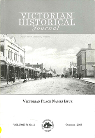
Periodical, Royal Historical Society of Victoria, Victorian historical journal : Victorian place names issue, 2005
... maps, b&w photographs, word lists, document reproductions...Victorian Aboriginal Corporation for Languages 33 Saxon Street Brunswick melbourne maps, b&w photographs, word lists, document reproductions Victorian historical journal : Victorian place names issue Periodical Royal Historical Society of Victoria ...maps, b&w photographs, word lists, document reproductions -
 Victorian Aboriginal Corporation for Languages
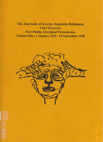
Book, Ian D Clark, The journals of George Augustus Robinson, Chief Protector, Port Phillip Aboriginal Protectorate : volume one : 1 January 1839 - 30 September 1840, 1998
... maps, document reproductions, b&w illustrations, word lists...Victorian Aboriginal Corporation for Languages 33 Saxon Street Brunswick melbourne George Augustus Robinson Port Phillip colonisation maps, document reproductions, b&w illustrations, word lists Transcription of G. ...Transcription of G. A. Robinson?s journals for the period 01/01/1839 - 30/09/1840. Includes some reproductions of sketches, and some wordlists of Aboriginal languages and Aboriginal personal and place names.maps, document reproductions, b&w illustrations, word listsgeorge augustus robinson, port phillip, colonisation -
 Flagstaff Hill Maritime Museum and Village
Document - Map, Department of Lands & Survey, Victoria / Panmure, 1942
... Military map of Panmure, Victoria, Australia; part of the W.R. ...Printed in black; 'Victoria / Panmure", "No. 930 / Zone 6" Printed in red; “EMERGENCY EDITION”, “THIS MAP IS AN OFFICIAL DOCUMENT. IF FOUND, IT MUST BE HANDED / IN TO THE NEAREST MILITARY HEADQUARTERS OR POLICE STATION” Stamped: within concentric ovals (“- - - FOR SALE / PRICE 2/- / - - - - - OF THE ARMY”)...Victoria / Panmure Document Map Department of Lands & Survey Australian Section, Imperial General Staff A.H.Q. ...This Emergency Edition of the map of Panmure, Victoria, is part of the W.R. Angus Collection. It was printed in 1942 during World War II. It is one of two maps donated to Flagstaff Hill Maritime Village by the family of Doctor William Roy Angus, who served as Surgeon Captain in the Australian Defence Department. The map was compiled for the Dept. of Army by the Dept. of Lands and Survey in Melbourne, prepared by the Australian Section of the Imperial General Staff, which was a British Government body created in 1907 to co-ordinate the defence of Britain and its Empire. It was printed by A.H.Q. Cartographic Company, Survey Corps, which was formed in 1941. The Corp changed its name to L.H.Q. Cartographic Company of Bendigo. In 1947 the name reverted back to the A.H.Q. Cartographic Company until 1955 when it became the A.H.Q. Survey Regiment. The W.R. Angus Collection includes historical medical equipment, surgical instruments and material once belonging to Dr Edward Ryan and Dr Thomas Francis Ryan, (both of Nhill, Victoria) as well as Dr Angus’ own belongings. The Collection’s history spans the medical practices of the two Doctors Ryan, from 1885-1926 plus that of Dr Angus who began practice in 1924. Dr. Angus served with the Australian Department of Defence as a Surgeon Captain during the Second World Was from 1942 to 1945. He served in Ballarat, Victoria, and in Bonegilla, N.S.W. until he suffering from a heart attack just before the war ended. ABOUT THE “W.R.ANGUS COLLECTION” - Doctor William Roy Angus M.B., B.S., Adel., 1923, F.R.C.S. Edin.,1928, was generally known as Dr Roy Angus. His working life included a position as a doctor with the Flying Doctor Service in Australia’s rural and remote areas. After many varied experiences Dr Angus and his family moved to Warrnambool in 1939 where he purchased “Birchwood,” the 1852 home and medical practice of Dr John Hunter Henderson. He was appointed on a part-time basis as Port Medical Officer in Warrnambool and held this position until the 1940’s when the government no longer required the service of a Port Medical Officer. Dr Angus was a surgeon at the Warrnambool Base Hospital 1939-1942. After further studies he commenced practice as an ophthalmologist in Warrnambool, pioneering in artificial eye improvements. He was Honorary Consultant Ophthalmologist to Warrnambool Base Hospital for 31 years and made monthly visits to Portland to perform eye surgery. Dr Angus and his wife Gladys were very involved in Warrnambool’s community with a strong interest in civic affairs. They were both involved in the creation of Flagstaff Hill Maritime Village, including the layout of the gardens. After his death on 28th March 1970 his family requested his practitioner’s plate, medical instruments and some personal belongings be displayed in the Port Medical Office surgery at Flagstaff Hill Maritime Village, and be called the “W. R. Angus Collection”. This Emergency Edition of the Map of Panmure is significant as an example of the documents prepared for the defence of Australia in World War 2. The Map is also significant for its connection between the Australian Army and the involvement of Dr WR Angus as a Surgeon in the Medical Services during World War II. The W.R. Angus Collection is significant for still being located at the site it is connected with, Doctor Angus being the last Port Medical Officer in Warrnambool. The collection of medical instruments and other equipment is culturally significant, being an historical example of medicine, administration, household equipment and clothing from late 19th to mid-20th century. Dr Angus assisted Dr Tom Ryan, a pioneer in the use of X-rays and in ocular surgery. The collection includes Dr Angus’s Army objects and is significant as an example of items issued to Doctors and Surgeons in the Medical Services of the Australian Army in World War IIMilitary map of Panmure, Victoria, Australia; part of the W.R. Angus Collection. Rectangular coloured map on cream paper for the Australian Army. Details include sea, waterways and land, contour lines, grid lines, names of districts, towns and roads, bridges, swamps, rail lines, cuttings, tracks, buildings (including blacksmiths), pumps, lighthouses, telegraph, telephones and electric transmission lines, and fire stations. The map has margin notes that include distances in miles to nearby towns. The map was compiled for the Dept. of Army by the Dept. of Lands and Survey in Melbourne, prepared by the Australian Section, Imperial General Staff and printed by A.H.Q. Cartographic Company, Melbourne in 1942. Crown Copyright Reserved. Inscriptions in red print state that it is and Emergency Edition and an Official document. An oval purple stamp includes the price.Printed in black; 'Victoria / Panmure", "No. 930 / Zone 6" Printed in red; “EMERGENCY EDITION”, “THIS MAP IS AN OFFICIAL DOCUMENT. IF FOUND, IT MUST BE HANDED / IN TO THE NEAREST MILITARY HEADQUARTERS OR POLICE STATION” Stamped: within concentric ovals (“- - - FOR SALE / PRICE 2/- / - - - - - OF THE ARMY”)flagstaff hill, warrnambool, flagstaff hill maritime museum, maritime museum, shipwreck coast, flagstaff hill maritime village, great ocean road, dr w r angus, dr ryan, warrnambool base hospital, flying doctor, surgeon captain, australian department of defence, royal australian army, world war 2, map panmure 1942, roy angus, port medical officer, nhill base hospital, military map, emergency map, military service australian army, department of army, department of lands and survey, a.h.q. cartographic company melbourne, panmure 1942, australian section, imperial general staff -
 Victorian Aboriginal Corporation for Languages
Periodical, Australian National University Department of Pacific and Southeast Asian History, Aboriginal history, 1987
... maps, b&w illustrations, b&w photographs, document reproductions...Victorian Aboriginal Corporation for Languages 33 Saxon Street Brunswick melbourne maps, b&w illustrations, b&w photographs, document reproductions Aboriginal history Periodical Australian National University Department of Pacific and Southeast Asian History ...maps, b&w illustrations, b&w photographs, document reproductions -
 Victorian Aboriginal Corporation for Languages
Periodical, Royal Historical Society of Victoria, Victorian historical journal : Victoria : 150 years of gold, 2001
... maps, b&w illustrations, b&w photographs, document reproductions...Victorian Aboriginal Corporation for Languages 33 Saxon Street Brunswick melbourne maps, b&w illustrations, b&w photographs, document reproductions Victorian historical journal : Victoria : 150 years of gold Periodical Royal Historical Society of Victoria ...maps, b&w illustrations, b&w photographs, document reproductions -
Victorian Aboriginal Corporation for Languages
Book, Edgar Morrison, Early days in the Loddon Valley : memoirs of Edward Stone Parker 1802-1865, 1966
... maps, b&w illustrations, b&w photographs, document reproductions...Victorian Aboriginal Corporation for Languages 33 Saxon Street Brunswick melbourne Loddon maps, b&w illustrations, b&w photographs, document reproductions Early days in the Loddon Valley : memoirs of Edward Stone Parker 1802-1865 Book Edgar Morrison ...maps, b&w illustrations, b&w photographs, document reproductionsloddon -
 Victorian Aboriginal Corporation for Languages
Book, The Aboriginal people of the Monaro, 2000
... maps, b&w photographs, b&w illustrations, document reproductions...Victorian Aboriginal Corporation for Languages 33 Saxon Street Brunswick melbourne maps, b&w photographs, b&w illustrations, document reproductions A comprehensive history of the Aboriginal people of the Monaro district. ...A comprehensive history of the Aboriginal people of the Monaro district. Written by a collection of contributors.maps, b&w photographs, b&w illustrations, document reproductions -
 Victorian Aboriginal Corporation for Languages
Book, Ian D Clark, Goulburn River Aboriginal Protectorate : a history of the Goulburn River Aboriginal Protectorate Station at Murchison, Victoria, 1840 - 1853, 2013
... maps, b&w illustrations, b&w photographs, document reproductions...Victorian Aboriginal Corporation for Languages 33 Saxon Street Brunswick melbourne Ngurai-illam balug Ngurai-illam wurrung Daungwurrung Yaithmathang Yortayorta Yorta Yorta Bangerang Murchison Murnang George Augustus Robinson Goulburn River Aboriginal Protectorate Goulburn River region Victorian history maps, b&w illustrations, b&w photographs, document reproductions This study explains why the locality of what is now known as Murchison is one of the most important historic Aboriginal places in regional Victoria. ...This study explains why the locality of what is now known as Murchison is one of the most important historic Aboriginal places in regional Victoria.maps, b&w illustrations, b&w photographs, document reproductionsngurai-illam balug, ngurai-illam wurrung, daungwurrung, yaithmathang, yortayorta, yorta yorta, bangerang, murchison, murnang, george augustus robinson, goulburn river aboriginal protectorate, goulburn river region, victorian history -
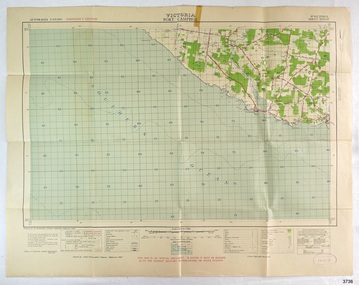 Flagstaff Hill Maritime Museum and Village
Document - Map, Department of Lands & Survey, Victoria / Port Campbell, 1942
... Military map of Port Campbell, Victoria, Australia; part of the W.R. ...Printed in black; 'Victoria / Port Campbell", "No. 932 / Zone 6" Printed in red; “EMERGENCY EDITION”, “THIS MAP IS AN OFFICIAL DOCUMENT. IF FOUND, IT MUST BE HANDED / IN TO THE NEAREST MILITARY HEADQUARTERS OR POLICE STATION” Stamped: within concentric ovals (“- - - FOR SALE / PRICE 2/- / - - - - - OF THE ARMY”)...Victoria / Port Campbell Document Map Department of Lands & Survey Australian Section, Imperial General Staff A.H.Q. ...This Emergency Edition of the map of Port Campbell, Victoria, is part of the W.R. Angus Collection. It was printed in 1942 during World War II. It is one of two maps donated to Flagstaff Hill Maritime Village by the family of Doctor William Roy Angus, who served as Surgeon Captain in the Australian Defence Department. The map was compiled for the Dept. of Army by the Dept. of Lands and Survey in Melbourne, prepared by the Australian Section of the Imperial General Staff, which was a British Government body created in 1907 to co-ordinate the defence of Britain and its Empire. It was printed by A.H.Q. Cartographic Company, Survey Corps, which was formed in 1941. The Corp changed its name to L.H.Q. Cartographic Company of Bendigo. In 1947 the name reverted back to the A.H.Q. Cartographic Company until 1955 when it became the A.H.Q. Survey Regiment. The W.R. Angus Collection includes historical medical equipment, surgical instruments and material once belonging to Dr Edward Ryan and Dr Thomas Francis Ryan, (both of Nhill, Victoria) as well as Dr Angus’ own belongings. The Collection’s history spans the medical practices of the two Doctors Ryan, from 1885-1926 plus that of Dr Angus who began practice in 1924. Dr Angus served with the Australian Department of Defence as a Surgeon Captain during the Second World Was from 1942 to 1945. He served in Ballarat, Victoria, and in Bonegilla, N.S.W. until he suffering from a heart attack just before the war ended. ABOUT THE “W.R.ANGUS COLLECTION” - Doctor William Roy Angus M.B., B.S., Adel., 1923, F.R.C.S. Edin.,1928, was generally known as Dr Roy Angus. His working life included a position as a doctor with the Flying Doctor Service in Australia’s rural and remote areas. After many varied experiences Dr Angus and his family moved to Warrnambool in 1939 where he purchased “Birchwood,” the 1852 home and medical practice of Dr John Hunter Henderson. He was appointed on a part-time basis as Port Medical Officer in Warrnambool and held this position until the 1940’s when the government no longer required the service of a Port Medical Officer. Dr Angus was a surgeon at the Warrnambool Base Hospital 1939-1942. After further studies he commenced practice as an ophthalmologist in Warrnambool, pioneering in artificial eye improvements. He was Honorary Consultant Ophthalmologist to Warrnambool Base Hospital for 31 years and made monthly visits to Portland to perform eye surgery. Dr Angus and his wife Gladys were very involved in Warrnambool’s community with a strong interest in civic affairs. They were both involved in the creation of Flagstaff Hill Maritime Village, including the layout of the gardens. After his death on 28th March 1970 his family requested his practitioner’s plate, medical instruments and some personal belongings be displayed in the Port Medical Office surgery at Flagstaff Hill Maritime Village, and be called the “W. R. Angus Collection”. This Emergency Edition of the Map of Port Campbell is significant as an example of the documents prepared for the defence of Australia in World War 2. The Map is also significant for its connection between the Australian Army and the involvement of Dr WR Angus as a Surgeon in the Medical Services during World War II. The W.R. Angus Collection is significant for still being located at the site it is connected with, Doctor Angus being the last Port Medical Officer in Warrnambool. The collection of medical instruments and other equipment is culturally significant, being an historical example of medicine, administration, household equipment and clothing from late 19th to mid-20th century. Dr Angus assisted Dr Tom Ryan, a pioneer in the use of X-rays and in ocular surgery. The collection includes Dr Angus’s Army objects and is significant as an example of items issued to Doctors and Surgeons in the Medical Services of the Australian Army in World War IIMilitary map of Port Campbell, Victoria, Australia; part of the W.R. Angus Collection. Rectangular coloured map on cream paper for the Australian Army. Details include sea, waterways and land, contour lines, grid lines, names of districts, towns and roads, bridges, swamps, rail lines, cuttings, tracks, buildings (including blacksmiths), pumps, lighthouses, telegraph, telephones and electric transmission lines, and fire stations. The map has margin notes that include distances in miles to nearby towns. The map was compiled for the Dept. of Army by the Dept. of Lands and Survey in Melbourne, prepared by the Australian Section, Imperial General Staff and printed by A.H.Q. Cartographic Company, Melbourne in 1942. Crown Copyright Reserved. Inscriptions in red print state that it is and Emergency Edition and an Official document. An oval purple stamp includes the price.Printed in black; 'Victoria / Port Campbell", "No. 932 / Zone 6" Printed in red; “EMERGENCY EDITION”, “THIS MAP IS AN OFFICIAL DOCUMENT. IF FOUND, IT MUST BE HANDED / IN TO THE NEAREST MILITARY HEADQUARTERS OR POLICE STATION” Stamped: within concentric ovals (“- - - FOR SALE / PRICE 2/- / - - - - - OF THE ARMY”)flagstaff hill, warrnambool, flagstaff hill maritime museum, maritime museum, shipwreck coast, flagstaff hill maritime village, great ocean road, dr w r angus, dr ryan, warrnambool base hospital, nhill base hospital, flying doctor, surgeon captain, map port campbell 1942, roy angus, port medical officer, military map, emergency map, australian department of defence, royal australian army, military service australian army, department of army, department of lands and survey, world war 2, a.h.q. cartographic company melbourne, australian section, imperial general staff, port campbell 1942 -
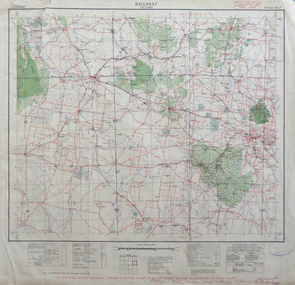 Federation University Historical Collection
Map, Ballarat, Victoria, 1942, 1942
... Printed in red at the base of the map "This map is an official document. If found, itmust be handed in to the nearest Military Headquarters or Police Station....Barker Library (top floor) Mount Helen goldfields ballarat map world war two skipton creswick ararat lake bolac Printed in red at the base of the map "This map is an official document. ...Two copies of a map of the district around Ballarat, including Creswick, Scarsdale, Smythesdale, Lake Bolac, Ararat, Talbot, Sebastopol, Maryborough, Cardigan, Skipton, Mount Emu Creek, Leigh River, Fiery Creek, Hopkins River. Street names are listed on the back of the map. It includes roads, timber, creeks, rivers, telephone lines, railwayPrinted in red at the base of the map "This map is an official document. If found, itmust be handed in to the nearest Military Headquarters or Police Station.ballarat, map, world war two, skipton, creswick, ararat, lake bolac -
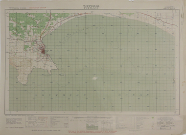 Federation University Historical Collection
Map, Portland, 1942, 1942
... "This map is an official document. If found, it must be handed in to the nearest military headquarters or police. ...Barker Library (top floor) Mount Helen goldfields porland cape nelson lawrence rock point danger whaler's point "This map is an official document. If found, it must be handed in to the nearest military headquarters or police. ...Printed colour map on paper"This map is an official document. If found, it must be handed in to the nearest military headquarters or police. porland, cape nelson, lawrence rock, point danger, whaler's point -
 Victorian Aboriginal Corporation for Languages
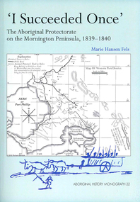
Book, Marie Hansen Fels, I succeeded once : the Aboriginal Protectorate on the Mornington Peninsula, 1839-1840, 2011
... maps, document reproductions, b&w illustrations, colour illustrations, colour photographs...Victorian Aboriginal Corporation for Languages 33 Saxon Street Brunswick melbourne Boon wurrung Yarra Mission William Thomas maps, document reproductions, b&w illustrations, colour illustrations, colour photographs 1. ...1. The writings of William Thomas 2. The Context 3. The record of observation 4. Tubberubbabel, Protectorate head station 5. Kangerong, Protectorate second station 6. Buckkermitterwarrer, Protectorate third station 7. Kullurk, the Bonurong choice for a reserve 8. The raid into Gippsland and the massacres remembered 9. Manufacturing industry on the Mornington Peninsula, 'the successful plan at Arthurs Seat' 10. Death of Johnny and his burial on the foreshore at McCrae 11. The abduction between Arthurs Seat and Point Nepean, and Yankee Yankee's return 12. Thomas' translations.maps, document reproductions, b&w illustrations, colour illustrations, colour photographsboon wurrung, yarra mission, william thomas -
 Victorian Aboriginal Corporation for Languages
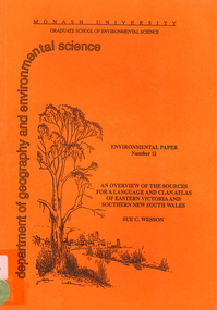
Book, Sue C Wesson, An overview of the sources for a language and clan atlas of Eastern Victoria and Southern New South Wales, 1994
... maps, b&w illustrations, b&w photographs, document reproductions, tables...Victorian Aboriginal Corporation for Languages 33 Saxon Street Brunswick melbourne Woiworung Bunurong Taungurong Ngurai-illam-wurung Bidawal Maap Norman Tindale Diane Barwick Aldo Massola Eve Fesl Ian David Clark George Augustus Robinson Reverend John Bulmer Robert Brough Smyth Alfred William Howitt moieties clan names maps, b&w illustrations, b&w photographs, document reproductions, tables This monograph concerns Eastern Victoria and Southern New South Wales and reviews the ethnographic record available for the study area. ...This monograph concerns Eastern Victoria and Southern New South Wales and reviews the ethnographic record available for the study area. A test case is made of one tribe within the study area which requires further research. Overall, the literature review and the case study demonstrate that the ability to undertake detailed reconstructions, as Clark and Barwick have done for the other regions, can be undertaken in Eastern Victoria and Southern New South Wales, and this model will form the basis of future research.maps, b&w illustrations, b&w photographs, document reproductions, tableswoiworung, bunurong, taungurong, ngurai-illam-wurung, bidawal, maap, norman tindale, diane barwick, aldo massola, eve fesl, ian david clark, george augustus robinson, reverend john bulmer, robert brough smyth, alfred william howitt, moieties, clan names -
 Federation University Historical Collection
Map, Queenscliff, 1942, 1942
... "This map in an official document, if found, it must be handed in to the nearest military headquarters or police station."...Barker Library (top floor) Mount Helen goldfields queenscliff portsea point nepean point lonsdale barwon heads geelong corio bay port phillip bay "This map in an official document, if found, it must be handed in to the nearest military headquarters or police station." ...Two copies of printed colour map on paper showing Queenscliff and surrounds"This map in an official document, if found, it must be handed in to the nearest military headquarters or police station."queenscliff, portsea, point nepean, point lonsdale, barwon heads, geelong, corio bay, port phillip bay -
 Federation University Historical Collection
Map, Mallacoota, 1942, 1942
... This map is an official document, if found, it must be handed in to the nearest military headquarters or police station...Barker Library (top floor) Mount Helen goldfields mallacoota bass straight cape evarard cann river genoa river disaster bay This map is an official document, if found, it must be handed in to the nearest military headquarters or police station Printed colour map on paper Mallacoota, 1942 Map Map ...Printed colour map on paperThis map is an official document, if found, it must be handed in to the nearest military headquarters or police stationmallacoota, bass straight, cape evarard, cann river, genoa river, disaster bay -
 Victorian Aboriginal Corporation for Languages
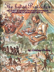
Book, Lindsey Arkley, The hated protector : the story of Charles Wightman Sievwright, protector of Aborigines 1839-42, 2000
... maps, document reproductions, b&w photographs, colour photographs, b&w illustrations...Victorian Aboriginal Corporation for Languages 33 Saxon Street Brunswick melbourne Charles Wightman Sievwright racial policies British colonial history race relations Victorian history maps, document reproductions, b&w photographs, colour photographs, b&w illustrations "The hated Protector" tells for the first time the real story behind the extraordinary experiences of Charles Sievwright, Assistant Aboriginal Protector from 1839-42 in what was then part of the British colony of New South Wales, but is now the Western District of the Australian state of Victoria. ..."The hated Protector" tells for the first time the real story behind the extraordinary experiences of Charles Sievwright, Assistant Aboriginal Protector from 1839-42 in what was then part of the British colony of New South Wales, but is now the Western District of the Australian state of Victoria. Sievwright, an Edinburgh-born former British army officer, lived in the bush with his young family as he tried to save the Aborigines of the District from extinction. In doing so, he would isolate himself from the rest of his fellow whites. The hated Protector tells of this process. The book should appeal to anyone interested in British colonial and Australian history, particularly in the years of first contact between British settlers and the Aborigines. More broadly, it should also appeal to anyone interested a story of one man's battle against overwhelming odds, where the price of failure was numerous deaths. It is a story of hatred, prejudice, courage, determination, and hope. In telling Sievwright's story, Lindsey Arkley draws largely on original archival material, including official reports, journals and letters, found in Melbourne, Sydney, Hobart, Edinburgh and London. Most has never before been published. The archival material is supplemented by contemporary newspaper accounts, and some oral history. Full notes are given to all sources, and the book is indexed and lavishly illustrated with drawings by Joan Bognuda, as well as about 80 paintings and samples of documents. Contents: 1. In the bush 2. "Equal and indiscriminate justice" 3. "A few doses of lead" 4. "A curse to the land" 5. "The most unpopular man" 6. Retaliation 7. A hostage debate 8. Hallucinations 9. A mass escape 10. Possessors of the soil 11. Move to Keilambete 12. Bureaucratic 13. "A hideous pandemonium" 14. Divine visitations 15. Pay backs 16. Explanations 17. A squatter on trial 18. Claptrap and deceit 19. The black cap - 20. To Mt Rouse 21. "The impending evil" 22. In the balance 23. An arrest at Mt Rouse 24. A fair moral name 25. Roger's trial 16. Intensified evidence 27. A declaration of war 28. Mr Cold Morning 29. Holding ranks 30. To rags 31. Fightback 32. Return to London 33. The inquiry 34. Judgement 35. And what remains.maps, document reproductions, b&w photographs, colour photographs, b&w illustrationscharles wightman sievwright, racial policies, british colonial history, race relations, victorian history -
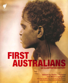 Victorian Aboriginal Corporation for Languages
Book, Rachel Perkins, First Australians : an illustrated history, 2008
... maps, document reproductions, b&w illustrations, colour illustrations, colour photographs, b&w photographs...Victorian Aboriginal Corporation for Languages 33 Saxon Street Brunswick melbourne colonisation race relations Australian Aboriginal history pictorial histories maps, document reproductions, b&w illustrations, colour illustrations, colour photographs, b&w photographs "A landmark history of Indigenous Australia which accompanies a major nine part Australian television series. ..."A landmark history of Indigenous Australia which accompanies a major nine part Australian television series. It combines the most rigorous academic research with capitvating contemporary story-telling. Richly illustrated book that includes images of the landscape, evocative ninteenth-century photography and Aboriginal art. Written by Australia's leading Indigenous historian and public intellectuals"--Provided by publisher.maps, document reproductions, b&w illustrations, colour illustrations, colour photographs, b&w photographscolonisation, race relations, australian aboriginal history, pictorial histories -
 Federation University Historical Collection
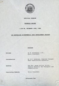
Document - Documents, Tourello: Opening of Tourello Bridge; Tourello Hunt Club, 1909; Tourello Tennis Club; Government Land Auction, 1855
... Maps and typed documents...Anderson Ralph Willis Creswick Maps and typed documents Tourello: Opening of Tourello Bridge; Tourello Hunt Club, 1909; Tourello Tennis Club; Government Land Auction, 1855 Document Documents ...Maps and typed documentstourello bridge, hunt club, tennis club, government land auctions, talbot, clunes, coghill, lenaghan, peter lalor, r. kinnersly, d.t. anderson, ralph willis, creswick