Showing 9038 items matching "mckillops-bridge"
-
 Lakes Entrance Historical Society
Book, Anne Bell, McKillops Bridge by Rhonda Coates
... McKillops Bridge by Rhonda Coates...history of McKillops Bridge over the Snowy River ...Soft cover book by Rhonda Coates detailing the history McKillops Bridge over the Snowy River ...Lakes Entrance Historical Society 4 Marine Parade Lakes Entrance gippsland history of McKillops Bridge over the Snowy River Bridges Civil Engineering Road Construction and Maintenance Topography Soft cover book by Rhonda Coates detailing the history McKillops Bridge over the Snowy River McKillops Bridge by Rhonda Coates Book Book Anne Bell ...history of McKillops Bridge over the Snowy River Soft cover book by Rhonda Coates detailing the history McKillops Bridge over the Snowy River bridges, civil engineering, road construction and maintenance, topography -
 Orbost & District Historical Society
Film - video Unveiling Hope, Centre of Rural Communities Inc. and Sisters of St Joseph, Victoria, Unveiling Hope on McKillops Bridge, 2002
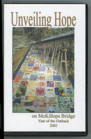
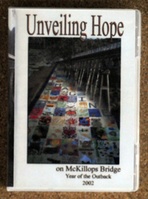
... Unveiling Hope on McKillops Bridge...On 8th August 2002, 19 large banners each 18 metres long, each made from hundreds of square pieces of fabric with images and messages, were attached to the side of McKillops Bridge at Deddick, Victoria. This bridge spans the Snowy River and is a significant crossing point in an isolated location. ...The front cover of the case has a compiled image of a large bridge and also a large multi-coloured banner of many squares beside it. ...Unveiling Hope on McKillops Bridge Year of the Outback 2002...Banners of Hope Year of the Outback Snowy River McKillops Bridge Orbost Deddick Unveiling Hope on McKillops Bridge Year of the Outback 2002 A video inside a plastic case. ...On 8th August 2002, 19 large banners each 18 metres long, each made from hundreds of square pieces of fabric with images and messages, were attached to the side of McKillops Bridge at Deddick, Victoria. This bridge spans the Snowy River and is a significant crossing point in an isolated location. This ceremony was the culmination of a large multi-community project titled 'Banners of Hope', initiated as a focus on the 'year of the outback'. Many people, community groups, and schools contributed to this project, each coming from different locations associated with East Gippsland and with the Snowy River in particular. This video compilation is significant because it is a record of a significant community project called 'Banners of Hope' staged at McKillops Bridge during the Year of the Outback, 2002.A video inside a plastic case. The front cover of the case has a compiled image of a large bridge and also a large multi-coloured banner of many squares beside it. The words Unveiling Hope are printed in gold/cream above the image. Unveiling Hope on McKillops Bridge Year of the Outback 2002banners of hope, year of the outback, snowy river, mckillops bridge, orbost, deddick -
 Orbost & District Historical Society
album, Walcott, Judy, Unveiling Hope on McKillops Bridge, 2005
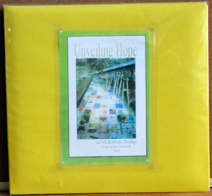
... Unveiling Hope on McKillops Bridge...McKillop's Bridge, located high in the Snowy Mountains, is named after George McKillop, a pioneering explorer of the area. ...It contains photographs, newspaper clippings, brochures , maps and an invitation to the veiling of McKillops Bridge on 8th August 2002. It also contains the history of McKillops Bridge....Unveiling Hope on McKillops Bridge album Walcott, Judy ...This album was donated to the Orbost & District Historical Society after the death of Judy Walcott, a long-time member. The veiling of McKillops bridge was a 'Year of the Outback' event. The event was organised by Orbost resident, Sr Helen Barnes RSJ. to show solidarity with rural people. The local community transformed the bridge into "a symbol of communal love and hope", when its sides were draped with hundreds of personal messages. McKillop's Bridge, located high in the Snowy Mountains, is named after George McKillop, a pioneering explorer of the area. The bridge is a vital link for isolated farming communities living beyond the Bonang highway.This album is a useful reference tool.A large photo album with a bright yellow cover and 19 plastic sleeves. It contains photographs, newspaper clippings, brochures , maps and an invitation to the veiling of McKillops Bridge on 8th August 2002. It also contains the history of McKillops Bridge.On inside cover - left hand side - "To Marie with Best Wishes from Judy Walcott 8/8/2005"mckillops-bridge album -
 Orbost & District Historical Society
book, McKillops Bridge, 2014
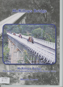
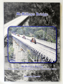
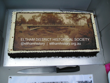
... McKillops Bridge...McKillops-Bridge...A paper back book, titled McKillops Bridge, written by Rhonda Coates. On the front cover is a photograph tractors crossing the bridge during the Great Snowy River Tractor Stampede ( The Snowy River Tractor Strampede, a 560-kilometre journey, is organised by the Bega and District Historical Machinery Club every January - the first being held in 2009.) this photograph is inset over an earlier phpotograph by Howard Bulmer c 1936. ...McKillops Bridge book Black Rainbow ...This book was purchased new by Orbost & District Historical Society. Written by Buchan historian, Rhonda Coates, the book was commissioned by Tubbut Neighbourhood House following a commemoration event in 2002 when many people gathered for a special day organised by Sister Helen Barnes and the Tubbut community. (ref. Bombala Times)This book is a useful research item.A paper back book, titled McKillops Bridge, written by Rhonda Coates. On the front cover is a photograph tractors crossing the bridge during the Great Snowy River Tractor Stampede ( The Snowy River Tractor Strampede, a 560-kilometre journey, is organised by the Bega and District Historical Machinery Club every January - the first being held in 2009.) this photograph is inset over an earlier phpotograph by Howard Bulmer c 1936. The book contains the history of the bridge, photographs of the bridge and times before its construction.On front fly-Orbost &District Historical Society Incmckillops-bridge -
 Orbost & District Historical Society
black and white photograph, mid 1930s
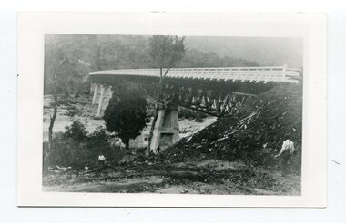
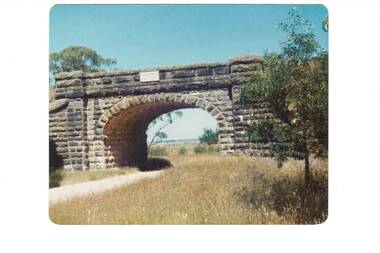
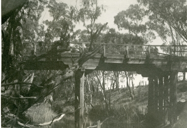
... This is a photograph of McKillop's Bridge probably taken just after its rebuilding. ...A black / white photograph of a wooden bridge across a river. At the bottom right is a man with his back to the camera. ...on back - McKillops Bridge...It was once an important route for cattlemen, who used the ford across the Snowy in the years preceding the bridge's existence" This is a pictorial record of McKillop's Bridge just after its construction. bridge-McKillop's Snowy-River-bridge on back - McKillops Bridge A black / white photograph of a wooden bridge across a river. ...This is a photograph of McKillop's Bridge probably taken just after its rebuilding. The current McKillop’s Bridge was built by the Country Roads Board in two stages between 1931-36, during which its height was raised after the original bridge superstructure was washed away in record floods of January 1934, prior to its original official opening. In its reconstructed form the original concrete abutments were turned into additional piers and the welded-steel trusses were cantilevered back over them to meet the new higher road approaches. "McKillops Bridge was Heritage listed due to its social and technological significance – the steel trusses' arc-welded construction technique was a pretty big deal in the 1930s. It was once an important route for cattlemen, who used the ford across the Snowy in the years preceding the bridge's existence"This is a pictorial record of McKillop's Bridge just after its construction.A black / white photograph of a wooden bridge across a river. At the bottom right is a man with his back to the camera. He is looking at flood debris on the bank. At the bottom left are two men near a pylon.on back - McKillops Bridgebridge-mckillop's snowy-river-bridge -
 Lakes Entrance Historical Society
Book, Coates Rhonda B, McKillops Bridge by Rhonda Coates
... McKillops Bridge by Rhonda Coates...A lively account of the planning,construction,and celebration of the bridge over the Snowy River at Deddick, previously the major river crossing between the Monaro and East Gippsland, first by foot or horseback then ferry or punts....McKillops Bridge by Rhonda Coates Book Coates Rhonda B ...A lively account of the planning,construction,and celebration of the bridge over the Snowy River at Deddick, previously the major river crossing between the Monaro and East Gippsland, first by foot or horseback then ferry or punts.bridges, waterways -
 Stawell Historical Society Inc
Photograph, Three bridges at Campbells bridge c 1960 -- Coloured
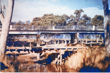
... Three bridges at Campbells bridge c 1960 -- Coloured...Coloured photo of three bridges at Campbells bridge c 1960. Phtograph show two wodden bridge structures and new cement construction bridge....Coloured photograph of three bridges over a river. Each bridge is built at a different height. ...3 Bridges @ Campbell's Bridge ...Coloured photo of three bridges at Campbells bridge c 1960. Phtograph show two wodden bridge structures and new cement construction bridge. stawell shire 3 Bridges @ Campbell's Bridge Coloured photograph of three bridges over a river. ...Coloured photo of three bridges at Campbells bridge c 1960. Phtograph show two wodden bridge structures and new cement construction bridge.Coloured photograph of three bridges over a river. Each bridge is built at a different height. 3 Bridges @ Campbell's Bridge stawell shire -
Stawell Historical Society Inc
Archive - Books & Papers, Ken Hyslop, Campbells Bridge Back to 1991, 1991
... Campbells Bridge Back to 1991...Associated with Back to Campbells Bridge and writing of Campbells bridge development and Social History 1861 - 1991. ...Records relating to Campbells Bridge back to 1991. Plus Back to sign in book...Campbells Bridge, Australia...Stawell Historical Society Inc 46 Longfield St Stawell grampians Associated with Back to Campbells Bridge and writing of Campbells bridge development and Social History 1861 - 1991. ...Associated with Back to Campbells Bridge and writing of Campbells bridge development and Social History 1861 - 1991. By Ken HyslopRecords relating to Campbells Bridge back to 1991. Plus Back to sign in bookVisitors Booksocial history -
 Kew Historical Society Inc
Photograph - Photograph (copy), Kanes Bridge, Studley Park, 195-1955
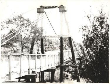
... Kanes Bridge, Studley Park...The total cost of construction came to 250 pounds and the bridge became known as Kane's Bridge. During the 1934 floods the bridge was washed downstream, and was subsequently rebuilt. ...A photographic copy of an older photograph of Kanes Bridge...."Kanes Bridge"...The total cost of construction came to 250 pounds and the bridge became known as Kane's Bridge. During the 1934 floods the bridge was washed downstream, and was subsequently rebuilt. ...In 1928 a footbridge was erected to link Kew with the public golf course across the Yarra. The total cost of construction came to 250 pounds and the bridge became known as Kane's Bridge. During the 1934 floods the bridge was washed downstream, and was subsequently rebuilt. The present form of the bridge resembles the earlier bridge which crossed from the Yarra Bend Asylum to Kew, further upstream. (VHD)This work forms part of the collection assembled by the historian Dorothy Rogers, that was donated to the Kew Historical Society by her son John Rogers in 2015. The manuscripts, photographs, maps, and documents were sourced by her from both family and local collections or produced as references for her print publications. Many were directly used by Rogers in writing ‘Lovely Old Homes of Kew’ (1961) and 'A History of Kew' (1973), or the numerous articles on local history that she produced for suburban newspapers. Most of the photographs in the collection include detailed annotations in her hand. The Rogers Collection provides a comprehensive insight into the working habits of a historian in the 1960s and 1970s. Together it forms the largest privately-donated collection within the archives of the Kew Historical Society.A photographic copy of an older photograph of Kanes Bridge."Kanes Bridge"kanes bridge, yarra river, bridges - kew (vic.) -
 Chelsea & District Historical Society Inc
Photograph - Patterson River, Temporary and Old Bridge, c 1927
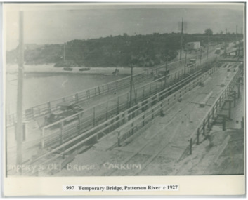
... Temporary and Old Bridge...The first bridge over the river was built in the early 1880's, prior to this it was a pontoon bridge. ...Black and white photo of the old wooden road bridge (Point Nepean / Nepean Highway), and a temporary bridge over Patterson River, Carrum near the mouth of the river. ...Temporary and old bridge, Carrum...In 1927 the construction of a concrete bridge was undertaken. Patterson River road bridge rail bridge Chelsea transport Patterson River Bridge Carrum Bridge temporary bridge cars Temporary and old bridge, Carrum Black and white photo of the old wooden road bridge (Point Nepean / Nepean Highway), and a temporary bridge over Patterson River, Carrum near the mouth of the river. ...The first bridge over the river was built in the early 1880's, prior to this it was a pontoon bridge. In 1927 the construction of a concrete bridge was undertaken.Black and white photo of the old wooden road bridge (Point Nepean / Nepean Highway), and a temporary bridge over Patterson River, Carrum near the mouth of the river. Cars using the old bridge. Rowing boats on shore. Temporary and old bridge, Carrumpatterson river, road bridge, rail bridge, chelsea, transport, patterson river bridge, carrum bridge, temporary bridge, cars -
 Bendigo Military Museum
Photograph - 4th Field Survey Squadron Regimental Training, Murray Bridge Training Area, SA, 1988
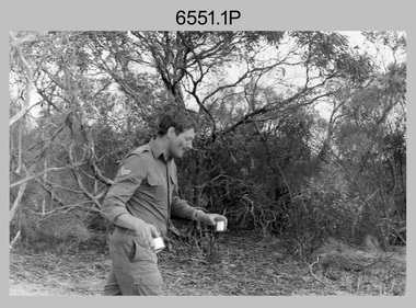
... 4th Field Survey Squadron Regimental Training, Murray Bridge Training Area, SA...This is a set of eight photographs of 4th Field Survey Squadron personnel undergoing regimental training held at the Murray Bridge Training Area of South Australia in 1988. ...This is a set of eight photographs of 4th Field Survey Squadron personnel undergoing regimental training held at the Murray Bridge Training Area of South Australia in 1988. ....1P to .8P – There are no personnel identified. ‘1988 REGT ADV TRAINING MURRAY BRIDGE’ annotated on negatives sleeve.......Murray Bridge Training Area, South Australia...L to R: Unidentified, SGT Laurie Justin, remainder unidentified. 4th Field Survey Squadron Regimental Training, Murray Bridge Training Area, SA Photograph 4th Field Survey Squadron Regimental Training, Murray Bridge Training Area, SA Army Survey Regiment ...This is a set of eight photographs of 4th Field Survey Squadron personnel undergoing regimental training held at the Murray Bridge Training Area of South Australia in 1988. The aim of regimental training was typically to provide personnel a practical knowledge of infantry and minor tactics at the section level, navigation and map reading, RATEL and survival in the Field.This is a set of eight photographs of 4th Field Survey Squadron personnel undergoing regimental training held at the Murray Bridge Training Area of South Australia in 1988. The black and white photographs are on 35mm negative film and are part of the Army Survey Regiment’s Collection. The photographs were scanned at 96 dpi. .1) - Photo, black & white, 1988. CPL Steve McGuiness. .2) - Photo, black & white, 1988. L to R: Unidentified, SPR Charmian McKean. .3) - Photo, black & white, 1988. SPR Andrew Quin. .4) - Photo, black & white, 1988. L to R: Unidentified, LT Geoff ‘GT’ Ford. .5) & .6) - Photo, black & white, 1988. Unidentified personnel. .7) - Photo, black & white, 1988. L to R: Unidentified (x2), SPR Perry Langeberg, SGT Laurie Justin (3rd from right), remainder unidentified. .8) - Photo, black & white, 1988. L to R: Unidentified, SGT Laurie Justin, remainder unidentified..1P to .8P – There are no personnel identified. ‘1988 REGT ADV TRAINING MURRAY BRIDGE’ annotated on negatives sleeve.royal australian survey corps, rasvy, 4 fd svy sqn -
 Orbost & District Historical Society
D.V.D, Jenkins, Daniel - Hot Dog Films, Unveiling Hope, 8.8.2002
... As part of the Crelebration of the Year of the Outback, McKillop's Bridge in the Deddick Valley was hung with nineteen banners made by individuals and groups of East Gippsland. ...On the front is a coloured photograph of McKillop's Bridge in the Deddick Valley....McKillop's-Bridge banners-of-hope A D.V.D. titled, Unveiling Hope. ...As part of the Crelebration of the Year of the Outback, McKillop's Bridge in the Deddick Valley was hung with nineteen banners made by individuals and groups of East Gippsland. Banners containing thousands of messages of hope and optimism for the future of rural communities were suspended from he bridge in the Snowy River National Park, in front of a three hundred strong crowd that had assembled. Sister Helen Barnes from the Sisters of St Joseph Order, founded by Mary McKillop, initiated the project. This event was a significant event in local history and this item is a contemporary recording of it.A D.V.D. titled, Unveiling Hope. On the front is a coloured photograph of McKillop's Bridge in the Deddick Valley.mckillop's-bridge banners-of-hope -
Winchelsea and District Historical Society
Photograph, Old wooden bridge and New Bluestone Bridge circa 1867
... Old wooden bridge and New Bluestone Bridge circa 1867...Bridge...photograph taken circa 1867/8 Original wooden bridge built about 1857...Very early Winchelsea circa 1867/8.photo taken from opposite old Library. Early wooden bridge right foreground and present bluestone bridge centre foreground. ...Old wooden Bridge and New Bluestone Bridge circa 1867. ...Old wooden Bridge and New Bluestone Bridge circa 1867. ...photograph taken circa 1867/8 Original wooden bridge built about 1857Photo of Blue stone bridge, as is today This photo is important, shows Winchelsea before many buildings.Very early Winchelsea circa 1867/8.photo taken from opposite old Library. Early wooden bridge right foreground and present bluestone bridge centre foreground. First Shire Hall and Dr. Meyler,s residence right above wooden bridge. On the left is Stirling's StoreOld wooden Bridge and New Bluestone Bridge circa 1867. Winchelsea Shire Hall top right (First Shire Hall).bridge, dr. meyler, stirling's store, first shire hall, wooden. -
 Flagstaff Hill Maritime Museum and Village
Postcard - Scenic, Warrnambool, Titan Bridge, Shelly Beach, Warrnambool, 1902-1929
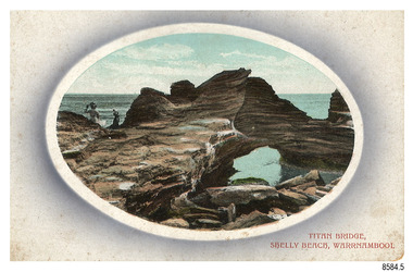
... Titan Bridge, Shelly Beach, Warrnambool...Soon, the regulations changed and the back was divided for a message and the address. Titan Bridge, Warrnambool – The name Titan Bridge is likely to be a reference to the huge Titan crane that was used in the construction of the Breakwater in the late 19th century. ...The cameo image shows two figures, one seated and one standing, beside the sea on a rough rock beside a rock formation resembling a bridge. There is no correspondence written on the card. ...Front, in red: “TITAN BRIDGE / SHELLY BEACH, NEAR WARRNAMBOOL” Back in black: “Jordan Series” “POST CARD” “PRINTED IN GREAT BRITAIN” “For correspondence” “The Address only to be written here”...Titan Bridge, Shelly Beach, Warrnambool, Great Ocean Road, Victoria, Australia...Soon, the regulations changed and the back was divided for a message and the address. Titan Bridge, Warrnambool – The name Titan Bridge is likely to be a reference to the huge Titan crane that was used in the construction of the Breakwater in the late 19th century. ...The nine postcards in this set were donated together and date to the early 1900s. All but one postcard in this set shows images of Warrnambool, in the Western District of Victoria; the other has a London image. The postcards were all printed in Great Britain according to that country’s postal regulations. The fronts of all cards have titles printed in red. Most of the images on the cards are attributed to photographer Joseph Jordan and belong to the Jordan Series. The back of these cards has an outline for a postage stamp, a vertical dividing line and a heading on each side of the line to separate the Correspondence from the Address. Postcards or ‘correspondence cards’ appeared in Britain in 1894. They were plain cards with a space for the message on one side and an address on the other; regulations didn’t allow anything but the address to be written on the ‘address’ side. In 1902 the British regulations then allowed a picture to be printed on the front and the address on the back, so messages had to be written on the picture side. Soon, the regulations changed and the back was divided for a message and the address. Titan Bridge, Warrnambool – The name Titan Bridge is likely to be a reference to the huge Titan crane that was used in the construction of the Breakwater in the late 19th century. Shelly Beach is a popular swimming area with the added attraction of rock pools to investigate and rock formations to climb. Joseph Jordan - Joseph Jordan was born in 1841 in Leicester England. When he was 16 he joined the 7th Queen's Own Hussars and was sent to India at the outbreak of the mutiny. He took part in the relief of Lucknow and remained in India for eleven years. It was during this time that he became interested in photography. He was posted to New Zealand and later came to Victoria, becoming a sergeant major of the Mounted Rifles. In the mid-1880s he came to the Western district where he was responsible for establishing units of the Mounted Rifles in various country towns such as Dunkeld, Mortlake, Panmure, Bushfield, Koroit etc. He resigned from the army in 1889 and set up a professional photography studio in Liebig Street, Warrnambool. He became very well known in the Western District for family photographs, official photographs of local councillors and groups as well as views of local scenery. In 1891 he photographed the wrecked barque ‘Fiji’ at ‘Wrecks Beach’ near Princetown. His business was taken over by his son Arthur around 1917. Joseph was a keen rifle shot and in 1924 he donated the "Jordan Shield" as a prize to the Victorian Rifle Association. He was made a "Life Honorary Member" of the Warrnambool Returned Soldiers League and in 1933 he was recognised as being the oldest living soldier in Victoria. Joseph died in 1935 aged 95.The image of the Titan Bridge rock formation with figures on it suggests that the location was a popular place to visit. It captures a time when the rock formation was publically accessible. The choice of subject for this postcard indicates the popularity of Warrnambool's natural environment as a tourist attraction at a time when ships called coastal traders brought passengers and cargo to the Port of Warrnambool from ports along Victoria's southwest coast. Joseph Jordan is a significant figure in Warrnambool history as he helped to establish early units of the Mounted Rifles (G Company) in local towns during the late 1880's and later, photographed local scenes, groups and citizens of early Warrnambool.Postcard, one of nine, landscape orientation, coloured print within an oval border and mauve-toned shading. The cameo image shows two figures, one seated and one standing, beside the sea on a rough rock beside a rock formation resembling a bridge. There is no correspondence written on the card. The back has inscriptions and outlines for a postage stamp. Jordan Series, printed in Great Britain.Front, in red: “TITAN BRIDGE / SHELLY BEACH, NEAR WARRNAMBOOL” Back in black: “Jordan Series” “POST CARD” “PRINTED IN GREAT BRITAIN” “For correspondence” “The Address only to be written here”flagstaff hill maritime museum, flagstaff hill maritime village, flagstaff hill maritime museum and village, maritime museum, warrnambool, great ocean road, warrnambool and district, warrnambool scenes, local scenes, views of warrnambool, joseph jordan, jordan series, jordan photography, postcard, souvenir, correspondence, cameo postcard, landscape, shelly beach, titan bridge, titan, rock formation -
 Buninyong & District Historical Society
Photograph - Colour photograph, Blue Bridge Mt. Doran
... Blue Bridge Mt. Doran...View of bluestone railway bridge built as part of the 1858 project to link Ballarat to Geelong...View of the bluestone railway bridge near Clarendon...Blue Bridge 1988...Buninyong & District Historical Society Old Court House, Buninyong Town Hall 313 Learmonth Street Buninyong goldfields View of bluestone railway bridge built as part of the 1858 project to link Ballarat to Geelong The building of the railway between Ballarat and Geelong contributed to significant change within the district Landscape Clarendon Railway Transport Blue Bridge 1988 View of the bluestone railway bridge near Clarendon Blue Bridge Mt. ...View of bluestone railway bridge built as part of the 1858 project to link Ballarat to GeelongThe building of the railway between Ballarat and Geelong contributed to significant change within the districtView of the bluestone railway bridge near ClarendonBlue Bridge 1988landscape, clarendon, railway, transport -
 Eltham District Historical Society Inc
Photograph, Fay Bridge, Centenary celebration, Monash Bridge, Hurstbridge, 7 November 2017
... Centenary celebration, Monash Bridge, Hurstbridge...The area of Hurstbridge was originally known as Hurst’s-bridge after the timber bridge built over the Diamond Creek near Hurst’s station in late 1881/early 1882. ...Fay Bridge...Fay Bridge Collection 2017-11-07 Hurstbridge Hurstbridge Heritage Trail Monash Bridge Ruins 12 images - born digital Centenary celebration, Monash Bridge, Hurstbridge Photograph Photograph Fay Bridge ...The area of Hurstbridge was originally known as Hurst’s-bridge after the timber bridge built over the Diamond Creek near Hurst’s station in late 1881/early 1882. It was replaced by a new concrete bridge designed by Sir John Monash over the Diamond Creek near Hurst's home of 'Mia Mia' at Hurstbridge. The official opening of the new Monash bridge at Hurstbridge was held 3 November 1917.fay bridge collection, 2017-11-07, hurstbridge, hurstbridge heritage trail, monash bridge, ruins -
 Stawell Historical Society Inc
Photograph, Old Campbells Bridge over Wimmera River
... Old Campbells Bridge over Wimmera River...Old Campbells Bridge over Wimmera River. Photo identified by Stuart McGregor Aug.2009...Black and white photograph of a tall bridge in a timber setting....Old Campbells Bridge ...Old Campbells Bridge over Wimmera River. Photo identified by Stuart McGregor Aug.2009 stawell shire Old Campbells Bridge Black and white photograph of a tall bridge in a timber setting. ...Old Campbells Bridge over Wimmera River. Photo identified by Stuart McGregor Aug.2009Black and white photograph of a tall bridge in a timber setting.Old Campbells Bridge stawell shire -
 Lakes Entrance Historical Society
Photograph - McKillops Bridge on Snowy River, East Gippsland
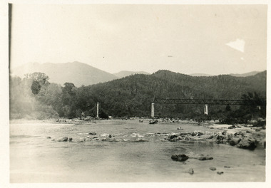
... Black and white photograph showing partially built McKillops Bridge on Snowy River, East Gippsland, Victoria....Cantilever new bridge over Snowy River at McKillops Crossing, 45 feet above recorded flood, washed away before officially opened, decking, etc, down stream more than a mile. ...Photograph McKillops Bridge on Snowy River, East Gippsland ...Black and white photograph showing partially built McKillops Bridge on Snowy River, East Gippsland, Victoria.Cantilever new bridge over Snowy River at McKillops Crossing, 45 feet above recorded flood, washed away before officially opened, decking, etc, down stream more than a mile. (on back)bridges, waterways, topography, construction -
 Eltham District Historical Society Inc
Photograph, Fay Bridge, Wattletree Road Bridge, Eltham, c.Jan. 1990
... Wattletree Road Bridge, Eltham...Shows Eltham Council sign notifying temporary closure of the bridge 19 Feb to 27 April 1990 for redecking. ...Fay Bridge...Fay Bridge Collection 1990-01 Wattletree Road Bridge 2 images - Scanned from colour prints on loan Wattletree Road Bridge, Eltham Photograph Photograph Fay Bridge ...Shows Eltham Council sign notifying temporary closure of the bridge 19 Feb to 27 April 1990 for redecking. Illustrates the timber decking of the bridge and pedestrian footbridge extension on southern side.fay bridge collection, 1990-01, wattletree road bridge -
 Phillip Island and District Historical Society Inc.
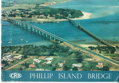
Booklet, Official Opening of the Phillip Island Bridge at San Remo 1969 and notes by the Bridge engineer, Tom Russell, 1969
... Official Opening of the Phillip Island Bridge at San Remo 1969 and notes by the Bridge engineer, Tom Russell...The decision to build a new bridge was made in the 1960s....Coloured, bound booklet with a photo of the old and new Phillip Island bridges on the cover and the CRB logo and name on rear. ...Official Opening of the Phillip Island Bridge at San Remo by The Hon. M.V. Porter, MLA. ...The decision to build a new bridge was made in the 1960s. Historical Bridges 2nd phillip island bridge construction Tom Russell Phillip Island Bridge Opening 1969 Official Opening of the Phillip Island Bridge at San Remo by The Hon. ...Prior to 1939 access to the Island was by punt from San Remo or car ferry from Stony Point. A bridge was opened in 1940 but increased traffic and low load capacity was a problem. The decision to build a new bridge was made in the 1960s.HistoricalColoured, bound booklet with a photo of the old and new Phillip Island bridges on the cover and the CRB logo and name on rear. It includes the order of proceedings for the opening and bridge statistics, plans and contractor information. Also photos of construction and a history of travel to the Island before a bridge was built and the first bridge. There is also a 2 page typed document written by the bridge engineer who gives a brief history of access to the Island and problems at the opening with access and a rebel who tried to open it unofficially.Official Opening of the Phillip Island Bridge at San Remo by The Hon. M.V. Porter, MLA. Minister of Public Works. November 21 1969bridges, 2nd phillip island bridge construction, tom russell, phillip island bridge opening 1969 -
 Buninyong & District Historical Society
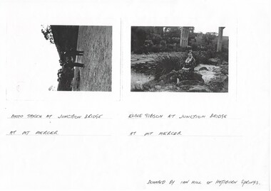
Photograph - Photocopy of two original B/W photographs, Mt Mercer Junction Bridge, photocopy made in 1995
... Mt Mercer Junction Bridge......bridge...Photos taken of the Junction Bridge at Mt Mercer, documenting the location, date unknown....Mt Mercer Junction Bridge. Photo 1 shows two men on the river bed probably looking at the bridge. ...Photo taken at Junction Bridge at Mt Mercer. Photo 2. Elsie Gibson at Junction Bridge at Mt Mercer. ...Junction Bridge Mt Mercer bridge Elsie Gibson Gibson Landscape Photo 1. ...Photos taken of the Junction Bridge at Mt Mercer, documenting the location, date unknown.The photos document the physical status of the location of the Junction Bridge at Mt Mercer at the time of photography, date unknown.Mt Mercer Junction Bridge. Photo 1 shows two men on the river bed probably looking at the bridge. Photo 2 shows Elsie Gibson sitting on the river bank with the bridge in the background.Photo 1. Photo taken at Junction Bridge at Mt Mercer. Photo 2. Elsie Gibson at Junction Bridge at Mt Mercer. Donated by Ian Hill of Hepburn Springsjunction bridge, mt mercer, bridge, elsie gibson, gibson, landscape -
 Orbost & District Historical Society
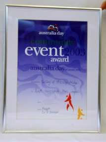
framed certificate, January 2003
... McKillop's Bridge, located high in the Snowy Mountains, is named after George McKillop, a pioneering explorer of the area. ...presented to "Veiling of McKillops Bridge on frame corner AMS by East Gippsland Shie Council signed by Cr P. ...The Veiling of McKillops Bridge was a significant community event. mckillops-bridge-veiling east-gippsland-shire-council-australia-day presented to "Veiling of McKillops Bridge on frame corner AMS by East Gippsland Shie Council signed by Cr P. ...This certificate was presented at the East Gippsland Shire Council Australia Day celebrations on 26.1.2003. The veiling of McKillops bridge was a 'Year of the Outback' event. The event was organised by Orbost resident, Sr Helen Barnes RSJ. to show solidarity with rural people. The local community transformed the bridge into "a symbol of communal love and hope", when its sides were draped with hundreds of personal messages. McKillop's Bridge, located high in the Snowy Mountains, is named after George McKillop, a pioneering explorer of the area. The bridge is a vital link for isolated farming communities living beyond the Bonang highway. The Veiling of McKillops Bridge was a significant community event.A large framed certificate. An Australia Day Community Event certificate for January 2003. The frame is silver The certificate has white, green and blue print on a blue background.presented to "Veiling of McKillops Bridge on frame corner AMS by East Gippsland Shie Council signed by Cr P. Bommer (mayor)mckillops-bridge-veiling east-gippsland-shire-council-australia-day -
 Mt Dandenong & District Historical Society Inc.
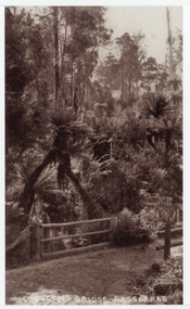
Photograph, Crescent Bridge Sassafras
... Crescent Bridge Sassafras......bridge... The Crescent Bridge crossing Sassafras Creek on 'The Crescent' at Sassafras. ...Black and white copy of a post card a bridge with a bush and tree fern background....On front: Crescent Bridge Sassafras...View of water and ferns. c1912 sassafras crescent bridge the crescent tree ferns bridge On front: Crescent Bridge Sassafras Black and white copy of a post card a bridge with a bush and tree fern background. ...The Crescent Bridge crossing Sassafras Creek on 'The Crescent' at Sassafras. View of water and ferns. c1912Black and white copy of a post card a bridge with a bush and tree fern background.On front: Crescent Bridge Sassafrassassafras, crescent bridge, the crescent, tree ferns, bridge -
![Studley Park [Toll] Bridge, Kew](/media/collectors/550653872162f11fb04854aa/items/579ebf04d0cdd117c4c0815f/item-media/579ebf3ad0cdd117c4c0953e/item-fit-380x285.jpg?cb=6) Kew Historical Society Inc
Kew Historical Society IncPhotograph, Studley Park [Toll] Bridge, Kew, 1870s
... Studley Park [Toll] Bridge, Kew......bridge...‘Studley Park Bridge’ or ‘penny bridge’ linked Church Street in Abbotsford and what is now Yarra Bend Park. ...The photograph shows the toll bridge (also known as the Penny Bridge) from the northern end...."P[enny] Toll Bridge - built 1857. from old photo"...Kew Historical Society Inc Kew Court House 188 High Street Kew melbourne ‘Studley Park Bridge’ or ‘penny bridge’ linked Church Street in Abbotsford and what is now Yarra Bend Park. ...‘Studley Park Bridge’ or ‘penny bridge’ linked Church Street in Abbotsford and what is now Yarra Bend Park. The privately constructed bridge opened in 1857, gaining its popular name from the toll charged at the Abbotsford end. The engineer of the 485ft wide bridge was Mr. Austin and the builder was ‘Mr Grant, who threw the bridge over the Niagara’. Following the opening of Johnston Street Bridge, declining tolls led to the Bridge falling into disrepair. Badly damaged by the flood of 1891, the Bridge was compulsorily acquired by the Government in 1899, and later dismantled and sold for firewood.This work forms part of the collection assembled by the historian Dorothy Rogers, that was donated to the Kew Historical Society by her son John Rogers in 2015. The manuscripts, photographs, maps, and documents were sourced by her from both family and local collections or produced as references for her print publications. Many were directly used by Rogers in writing ‘Lovely Old Homes of Kew’ (1961) and 'A History of Kew' (1973), or the numerous articles on local history that she produced for suburban newspapers. Most of the photographs in the collection include detailed annotations in her hand. The Rogers Collection provides a comprehensive insight into the working habits of a historian in the 1960s and 1970s. Together it forms the largest privately-donated collection within the archives of the Kew Historical Society.A print, taken in the 1960s by Dorothy Rogers, from an original albumen silver photograph now in the collection of the Kew Historical Society. The photograph shows the toll bridge (also known as the Penny Bridge) from the northern end."P[enny] Toll Bridge - built 1857. from old photo"studley park bridge, penny bridge, bridge, timber bridge, toll bridge -
 Phillip Island and District Historical Society Inc.
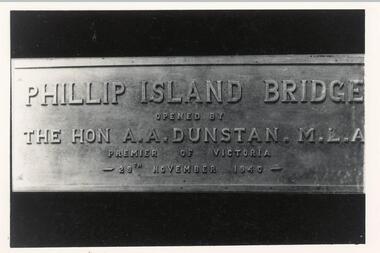
Photograph, Opening of 1st Bridge 1940, 29/11/1940
... Opening of 1st Bridge 1940...Commemoration Plaque showing details of first Bridge opening 29/11/1940...Photo of Plaque for opening of Phillip Island Bridge - 1st bridge built in 1940. ...Phillip Island Bridge opened by The Hon. A. A. Dunstan MLA, Premier of Victoria 29th November 1940...Commemoration Plaque showing details of first Bridge opening 29/11/1940 local history photography bridges phillip island bridge inscription black & white photograph jack jenner phillip island suspension bridge Phillip Island Bridge opened by The Hon. ...Donated by Jack Jenner. Commemoration Plaque showing details of first Bridge opening 29/11/1940Photo of Plaque for opening of Phillip Island Bridge - 1st bridge built in 1940. Phillip Island Bridge opened by The Hon. A. A. Dunstan MLA, Premier of Victoria 29th November 1940local history, photography, bridges, phillip island bridge inscription, black & white photograph, jack jenner, phillip island suspension bridge -
 Phillip Island and District Historical Society Inc.
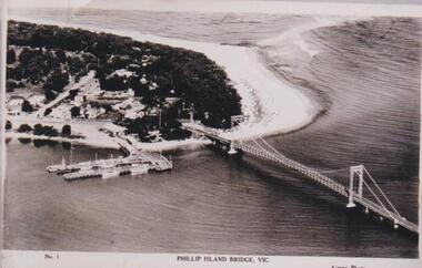
Photograph, Phillip Island Bridge, 1940
... Phillip Island Bridge......bridge...The bridge built around 1939. Fishing fleet. Twin jetties to left of bridge, township, bush and wide sand strip of surf beach....Bridge between Phillip Island and San Remo. ...No. 1. Phillip Island Bridge, Vic. Airspy Photo...Phillip Island and District Historical Society Inc. phillip-island-and-the-bass-coast The bridge built around 1939. Fishing fleet. Twin jetties to left of bridge, township, bush and wide sand strip of surf beach. local history photographs bridges san remo coastline bridge fishing fleet jetties Bruce Bennett No. 1. ...The bridge built around 1939. Fishing fleet. Twin jetties to left of bridge, township, bush and wide sand strip of surf beach.Bridge between Phillip Island and San Remo. Photograph depicting San Remo onlyNo. 1. Phillip Island Bridge, Vic. Airspy Photolocal history, photographs, bridges, san remo, coastline, bridge, fishing fleet, jetties, bruce bennett -
 Port Fairy Historical Society Museum and Archives
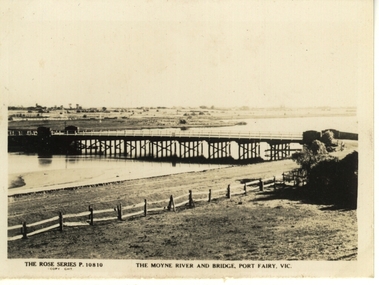
Postcard, The Rose Series / The Rose Stereographs, The Moyne River and bridge Port Fairy
... The Moyne River and bridge Port Fairy...bridge...Post card of the Moyne River Bridge...Black and white photograph of the Moyne river and Bridge...he Rose Series P. 10810 The Moyne River and Bridge, Port Fairy...Port Fairy Historical Society Museum and Archives 30 Gipps Street Port Fairy great-ocean-road Post card of the Moyne River Bridge bridge Moyne river traffic road he Rose Series P. 10810 The Moyne River and Bridge, Port Fairy Black and white photograph of the Moyne river and Bridge The Moyne River and bridge Port Fairy Postcard Postcard The Rose Series / The Rose Stereographs ...Post card of the Moyne River BridgeBlack and white photograph of the Moyne river and Bridgehe Rose Series P. 10810 The Moyne River and Bridge, Port Fairybridge, moyne river, traffic, road -
 Stawell Historical Society Inc
Photograph, Harris Bridge – Red Bend Road -- Great Western
... Harris Bridge – Red Bend Road -- Great Western...Harris Bridge – Red Bend Road Great Western....Black & white photo of Bridge. Photo is out of focus so hard to work out....Harris' Bridge Red bend Road Great Western...Stawell Historical Society Inc 46 Longfield St Stawell grampians Harris Bridge – Red Bend Road Great Western. stawell Harris' Bridge Red bend Road Great Western Black & white photo of Bridge. ...Harris Bridge – Red Bend Road Great Western.Black & white photo of Bridge. Photo is out of focus so hard to work out.Harris' Bridge Red bend Road Great Westernstawell -
 Clunes Museum
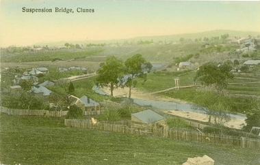
Photograph - POSTCARD, PRINTED IN GERMANY, SUSPENSION BRIDGE, CLUNES
... SUSPENSION BRIDGE, CLUNES...THE SUSPENSION BRIDGE OVER CRESWICK CREEK, PLACED AT CREEK PARADE CLUNES, WAS WASHED AWAY IN A SEVERE FLOOD....COLOURED PHOTOGRAPH OF SUSPENSION BRIDGE CLUNES. PRODUCED AS A POSTCARD - 2 COPIES. ...SUSPENSION BRIDGE - CLUNES...Clunes Museum 36 Fraser Street enter building through Collins Place Clunes goldfields THE SUSPENSION BRIDGE OVER CRESWICK CREEK, PLACED AT CREEK PARADE CLUNES, WAS WASHED AWAY IN A SEVERE FLOOD. local history document postcard bridges SUSPENSION BRIDGE - CLUNES COLOURED PHOTOGRAPH OF SUSPENSION BRIDGE CLUNES. ...THE SUSPENSION BRIDGE OVER CRESWICK CREEK, PLACED AT CREEK PARADE CLUNES, WAS WASHED AWAY IN A SEVERE FLOOD.COLOURED PHOTOGRAPH OF SUSPENSION BRIDGE CLUNES. PRODUCED AS A POSTCARD - 2 COPIES. ANOTHER COPY HAS BEEN ENLARGED TO A4 SIZE AND LAMINATED - 760.2SUSPENSION BRIDGE - CLUNESlocal history, document, postcard, bridges -
 Phillip Island and District Historical Society Inc.
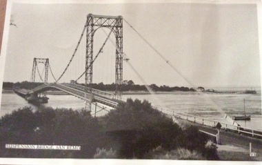
Photograph, Murray Views, Suspension Bridge
... Suspension Bridge...First bridge to link Phillip Island to the mainland...Black & White photo of suspension bridge from San Remo to Newhaven. Taken from San Remo side looking towards Newhaven...Suspension Bridge, San Remo V3...Phillip Island and District Historical Society Inc. phillip-island-and-the-bass-coast First bridge to link Phillip Island to the mainland san remo newhaven suspension bridge san remo/phillip island bridges Photographs Suspension Bridge, San Remo V3 Black & White photo of suspension bridge from San Remo to Newhaven. ...First bridge to link Phillip Island to the mainlandBlack & White photo of suspension bridge from San Remo to Newhaven. Taken from San Remo side looking towards NewhavenSuspension Bridge, San Remo V3san remo, newhaven, suspension bridge san remo/phillip island, bridges, photographs