
Showing 6 items matching "mt beauty golf course"
-
 Kiewa Valley Historical Society
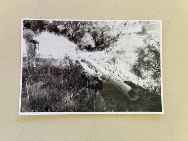
Photo - Mt Beauty Golf Course
... Photo - Mt Beauty Golf Course...Mt Beauty Golf Course...The Mt Beauty Golf Course was opened in 1948 providing recreation for the workers on the construction of the Kiewa Hydro Electric Scheme. ...The Mt Beauty Golf Course was opened in 1948 providing recreation for the workers on the construction of the Kiewa Hydro Electric Scheme. ...The Mt Beauty Golf Course was opened in 1948 providing recreation for the workers on the construction of the Kiewa Hydro Electric Scheme. It is set into the landscape adjacent to the Bogong High Plains Road and attached to the Mt Beauty township. Also see KVHS 1334 and KVHS 1413Early in the construction the SECV helped to build the Mt Beauty Golf Course to provide sport and recreation for its employees of the Kiewa Hydro Electric Scheme. It has also become a tourist attraction encouraging visitors to the area.b & w photo 12.5 cm x 8cm A pipe with an inscription written on the back"Ray Walters overlooking Drain Piping Hazard 9 th February / March 28th 86 / Mt Beauty Golf Club mt beauty golf course, sport and recreation -
 Kiewa Valley Historical Society
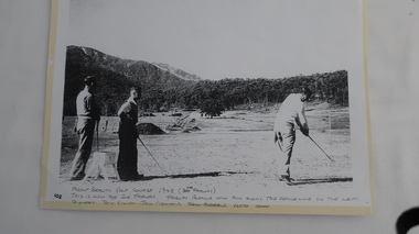
Photo - Golfers at Mt Beauty Golf Course
... Photo - Golfers at Mt Beauty Golf Course....golfing in Mt Beauty. It is dated 1948 and it pictures three high-profile Kiewa Hydro Electric Scheme staff members having a hit of golf on a rudimentary course which was the fore runner to the beautiful golf course we enjoy today. ...Photo - Golfers at Mt Beauty Golf Course. ...This photograph is one of the first photos of golfing in Mt Beauty. It is dated 1948 and it pictures three high-profile Kiewa Hydro Electric Scheme staff members having a hit of golf on a rudimentary course which was the fore runner to the beautiful golf course we enjoy today. This photo may have been published in one of the SECV magazines.Jack Giniff, Jack Ormerod and Lloyd Dunn were well known on the K.H.E.scheme. The photo shows how quickly community facilities were organised to provide sporting opportunities for the 4000+ workforce.Photo of 3 men playing golf copied from the original onto photo-quality paper in an enlarged form.Hand written at the bottom of the photo: "Mount Beauty Golf Course 1948 (7th Fairway). This is now the 2nd Fairway. Fairway Avenue will run along - the fenceline on the left. Players: Jack Giniff, Jack Ormerod, Lloyd Dunn." Note: "Jack Andrews" crossed out.golf at mt beauty, sport and recreation -
 Kiewa Valley Historical Society
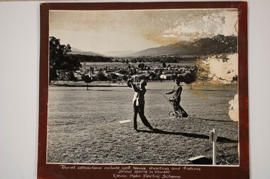
Photos - Kiewa Hydro Electric Scheme - Mt Beauty, Official S.E.C.V. photos
... The Mt Beauty Golf Course was a tourist attraction during the warmer months. ...The Mt Beauty Golf Course was a tourist attraction during the warmer months. ...The Mt Beauty Golf Course was a tourist attraction during the warmer months. The SECV Gate controlled entry to the KHES only allowing permitted workers. -
 Kiewa Valley Historical Society
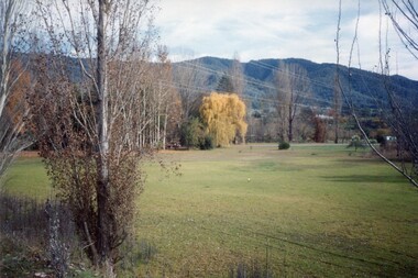
Photos - Coloured - Mt Beauty surrounds
... 5 coloured photos of Mt BEauty surrounds including golf course, lake, mountain with snow and camping -taken recently...Mt Beauty 5 coloured photos of Mt BEauty surrounds including golf course, lake, mountain with snow and camping -taken recently Photos - Coloured - Mt Beauty surrounds ...5 coloured photos of Mt BEauty surrounds including golf course, lake, mountain with snow and camping -taken recentlymt beauty -
 Kiewa Valley Historical Society
Photos x2 - Views of Mt Beauty
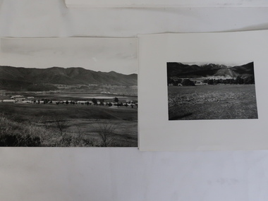
... Large - early photo of houses in front of pondage (taken for what is now the golf course). 2. Medium size - looking south towards Mt Beauty township with Mt Arthur in the background...Mt Beauty township as part of their construction of the Kiewa Hydro Electric Scheme. Historic photos of the development of the Mt Beauty township Mt Beauty township Laurie Richards On back.1. Laurie Richards No. LH 1405 2. Laurie Richards No. Copy 518 2 B & W Photos. 1. Large - early photo of houses in front of pondage (taken for what is now the golf course ...The State Electricity Commission of Victoria constructed the Mt Beauty township as part of their construction of the Kiewa Hydro Electric Scheme.Historic photos of the development of the Mt Beauty township2 B & W Photos. 1. Large - early photo of houses in front of pondage (taken for what is now the golf course). 2. Medium size - looking south towards Mt Beauty township with Mt Arthur in the backgroundOn back.1. Laurie Richards No. LH 1405 2. Laurie Richards No. Copy 518mt beauty township, laurie richards -
 Kiewa Valley Historical Society
Black and white photograph of farmland, Kiewa, 25/8/38, circa 1938
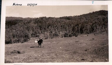
... Mt. Beauty. The land has been cleared of natural vegetation to allow grazing of cattle. grazing kiewa mt. beauty secv Handwritten in the upper left hand corner 'Kiewa 25/8/38'. The number 7 has been stamped in the upper right hand corner. It is part of a set of 8 photographs. On the back are the words Velox repeated several times, indicating the type of photographic paper Black and white photograph of grazing farmland with one animal standing in the paddock. The area could possibly be where the golf course ...This photograph was taken in August, 1938, some eight years prior to the establishment of Mt. Beauty a a township. The area was still being used for grazing, and the land was eventually acquired from the local land owners by the State Electricity Commission. The construction of the road, from Tawonga to the High Plains, was commenced in April, 1938 and this photograph was taken August, 1938. This allowed men and heavy equipment to be transported to the work sites for the construction of the Kiewa Hydro Electric Scheme. Prior to this access was by bridle trail, either on horse back or on foot. By 1946 housing construction had commenced for the new town of Mt. Beauty and by 1948 street construction in the southern part of the town was completed as far as Hill Street.This photograph is important as it shows the upper Kiewa Valley as it was before the establishment of the town of Mt. Beauty. The land has been cleared of natural vegetation to allow grazing of cattle. Black and white photograph of grazing farmland with one animal standing in the paddock. The area could possibly be where the golf course now stands with the road to the high plains not yet commenced.Handwritten in the upper left hand corner 'Kiewa 25/8/38'. The number 7 has been stamped in the upper right hand corner. It is part of a set of 8 photographs. On the back are the words Velox repeated several times, indicating the type of photographic papergrazing, kiewa, mt. beauty, secv
