Historical information
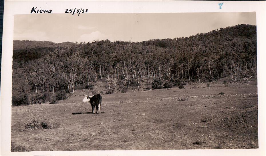
This photograph was taken in August, 1938, some eight years prior to the establishment of Mt. Beauty a a township. The area was still being used for grazing, and the land was eventually acquired from the local land owners by the State Electricity Commission. The construction of the road, from Tawonga to the High Plains, was commenced in April, 1938 and this photograph was taken August, 1938. This allowed men and heavy equipment to be transported to the work sites for the construction of the Kiewa Hydro Electric Scheme. Prior to this access was by bridle trail, either on horse back or on foot. By 1946 housing construction had commenced for the new town of Mt. Beauty and by 1948 street construction in the southern part of the town was completed as far as Hill Street.
Significance
This photograph is important as it shows the upper Kiewa Valley as it was before the establishment of the town of Mt. Beauty. The land has been cleared of natural vegetation to allow grazing of cattle.
Physical description
Black and white photograph of grazing farmland with one animal standing in the paddock. The area could possibly be where the golf course now stands with the road to the high plains not yet commenced.
Inscriptions & markings
Handwritten in the upper left hand corner 'Kiewa 25/8/38'. The number 7 has been stamped in the upper right hand corner. It is part of a set of 8 photographs. On the back are the words Velox repeated several times, indicating the type of photographic paper