Showing 30 items matching "navigational beacon"
-
 Sunshine and District Historical Society Incorporated
Administrative record - City of Sunshine - Commissioner Mr Alexander Alex George Gillon Collection 1976 - 1982 - Minutes of the ordinary meeting of council held on 29th June 1977, City of Sunshine, 29th June 1977
... ...Navigational Beacon...Victorian Family and Community Services Programme Bikeway Seminar Sunshine North Technical School proposed use and agreement Maidstone Elderly Citizens Club And Meals on Wheels Lease if Navigational Beacon site in Robinson Road Deer Park Council Officers Reports...City of Sunshine Alexander "Alex" George Gillon Navigational Beacon Robinsons Road Deer Park Maidstone Elderly Citizens Club Sunshine West High School Lachlan Road Sunshine West Ardeer South Primary School Victorian Family and Community Services Programme Bikeway Seminar Sunshine North Technical School proposed use and agreement Maidstone Elderly Citizens Club And Meals on Wheels Lease if Navigational Beacon site in Robinson Road Deer Park Council Officers Reports Foolscap sized document. ...Victorian Family and Community Services Programme Bikeway Seminar Sunshine North Technical School proposed use and agreement Maidstone Elderly Citizens Club And Meals on Wheels Lease if Navigational Beacon site in Robinson Road Deer Park Council Officers Reports city of sunshine, alexander "alex" george gillon, navigational beacon, robinsons road, deer park, maidstone elderly citizens club, sunshine west high school, lachlan road, sunshine west, ardeer south primary school -
 Sunshine and District Historical Society Incorporated
Administrative record - City of Sunshine - Commissioner Mr Alexander Alex George Gillon Collection 1976 - 1982 - Notice of ordinary meeting of the council of the City of Sunshine to be held on 29th June 1977, City of Sunshine, 22nd June 1977
... ...Navigational Beacon... Victorian Family and Community Services Programme Bikeway Seminar Sunshine North Technical School proposed use and agreement Maidstone Elderly Citizens Club And Meals on Wheels Lease if Navigational Beacon site in Robinson Road Deer Park Council Officer's reports...City of Sunshine Alexander "Alex" George Gillon Sunshine North Technical School Northumberland Road Sunshine North Maidstone Elderly Citizens Club Navigational Beacon Robinsons Road Deer Park Victorian Family and Community Services Programme Bikeway Seminar Sunshine North Technical School proposed use and agreement Maidstone Elderly Citizens Club And Meals on Wheels Lease if Navigational Beacon site in Robinson Road Deer Park Council Officer's reports Foolscap sized document. ...Victorian Family and Community Services Programme Bikeway Seminar Sunshine North Technical School proposed use and agreement Maidstone Elderly Citizens Club And Meals on Wheels Lease if Navigational Beacon site in Robinson Road Deer Park Council Officer's reports city of sunshine, alexander "alex" george gillon, sunshine north technical school, northumberland road, sunshine north, maidstone elderly citizens club, navigational beacon, robinsons road, deer park -
 Sunshine and District Historical Society Incorporated
Administrative record - City of Sunshine - Commissioner Mr Alexander Alex George Gillon Collection 1976 - 1982 - Notice of ordinary meeting of the council of the City of Sunshine to be held on 9th March 1977, City of Sunshine, 2nd March 1977
... ...Navigational Beacon...City of Sunshine Alexander "Alex" George Gillon Gooding Street Willis Street St. Albans Navigational Beacon Robinsons Road Deer Park Acquisition of land bounded by Gooding and Willis Streets and the Railway Line St. ...Acquisition of land bounded by Gooding and Willis Streets and the Railway Line St. Albans Lease of Navigational Deacon site in Robinsons Road Deer Park Council Officers Reports city of sunshine, alexander "alex" george gillon, gooding street, willis street, st. albans, navigational beacon, robinsons road, deer park -
 Port Melbourne Historical & Preservation Society
Photograph - Open Air Campaigners, Garden City Reserve, Reverend Donald LANGFORD, c.1970
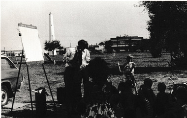
... Behind him, the inland ship navigation Beacon is on the left and the BO building to the right. ...Behind him, the inland ship navigation Beacon is on the left and the BO building to the right. ...An Open Air Campaigner entertains a group of children at Garden City reserve. Behind him, the inland ship navigation Beacon is on the left and the BO building to the right. This building was used for several years in the 1980's as the location for the Port Melbourne Library.B & W photograph of Garden City Reserve with Open Air Campaigner.built environment - industrial, beacon, open air campaigners, port melbourne free library, built environment - recreational facilities, garden city reserve -
 Bendigo Military Museum
Map - RASvy " Map Makers Exhibition 2025 "- Map display, RAN Hydrographic Office, 1972 - 1992
... These charts also contained aeronautical information such as airfields, radio navigation beacons and obstructions. Contours and height information was shown in feet to be compatible with aircraft altimeters. ...These charts also contained aeronautical information such as airfields, radio navigation beacons and obstructions. Contours and height information was shown in feet to be compatible with aircraft altimeters. ...All of these Charts / Maps were used for the RSL Museum display " The Mapmakers " ( of RASvy. ) 10 Jun - 10 Aug 2025. .1 Catalogue of Tactical Pilotage Charts, 1:500 000 Scale. Digital Data Base available as at 30Jun 92. This catalogue page shows the extent of the Australian area of responsibility for aeronautical charting. .2 RAAF PLOTTING CHART. NP 22-2 (Navigational Plotting) Tasmania. MERCATOR PROJECTION. This series of charts were used for the training of RAAF Navigators. These charts were produced and printed at the Army Survey Regiment, Bendigo. .3 RAAF PLOTTING CHART AUSTRALIA - SOUTHEAST. NP 27 is Based on LAMBERT CONFORMAL CONIC PROJECTION. This series of charts was used by RAAF Navigators for the planning of RAAF flights. These charts were produced and printed at the Army Survey Regiment, Bendigo. .4 RAAF LONG RANGE PLOTTING CHART. NP 43-4 AUSTRALIA WESTERN. MERCATOR PROJECTION. This series of maps were used for the planning of RAAF flights. Of Particular note these charts were used to plot "Rhumb Lines or loxodromes" where a course crosses all Meridians (Lines of latitude and longitude) at the same angle. On Mercator projection charts Rhumb lines are conveniently shown as straight lines and are also lines of constant compass bearing. Rhumb lines are usually longer than the shortest distance between two points. The shortest distance between two points on the earth's surface is called a "Great Circle Route" which is a route on a circular path on the surface of the earth where the centre of that circle is also the centre of the earth. Great Circle Routes on a Mercator Projection are however curves and harder to plot. These charts were produced and printed at the Army Survey Regiment, Bendigo. .5 RAAF LONG RANGE PLOTTING CHART. NP 43-7 SOLOMON ISLANDS. MERCATOR PROJECTION. Used for the planning of RAAF flights. .6 RAAF AIR STAFF PLANNING CHART NS 137-1 DARWIN NORTH WEST. AZIMUTHAL EQUIDISTANT PROJECTION. This series of charts were used for planning by the staff. The whole chart was produced by joining the four quadrant maps together. The charts are based on a single point of tangency (in this case Darwin) and shows radius (distance) in nautical miles to and from that point. A series of charts were produced centred on each of the major airfields in Northern Australia. These charts were produced and printed at the Army Survey Regiment, Bendigo. .7 RAAF AIR STAFF PLANNING CHART NS 137-2 DARWIN NORTH EAST. AZIMUTHAL EQUIDISTANT PROJECTION. Used for the planning by the staff. The charts are based on a point of tangency and show radius in nautical miles. .8 RAAF AIR STAFF PLANNING CHART NS 137-4 DARWIN SOUTH WEST. AZIMUTHAL EQUIDISTANT PROJECTION. Used for the planning by the staff. The charts are based on a point of tangency and show radius in nautical miles. .9 RAAF AIR STAFF PLANNING CHART NS 137-3 DARWIN SOUTH EAST. AZIMUTHAL EQUIDISTANT PROJECTION. Used for the planning by the staff. The charts are based on a point of tangency and show radius in nautical miles. .10 TACTICAL PILOTAGE CHART. TPC R-13B. LAMBERT CONFORMAL PROJECTION. Used by pilots for flight planning and could be used in flight if necessary for visual navigation using major ground features shown on the chart. These charts also contained aeronautical information such as airfields, radio navigation beacons and obstructions. Contours and height information was shown in feet to be compatible with aircraft altimeters. Each graticule square also contained a Maximum Safe Elevation Figure (MEF) also in feet. Coverage of this series over Australia's area of interest were produced and printed at the Army Survey Regiment, Bendigo. .11 HYDROGRAPHIC CHART. AUS 158. PORT PHILLIP SOUTH and WEST CHANNELS. PROJECTION TRANSVERSE MERCATOR. Used by all people needing to navigate a vessel. Hydrographic charts were printed at the Army Survey Regiment, Bendigo. .12 HYDROGRAPHIC CHART. AUS 157. GEELONG HARBOUR and APPROACHES. PROJECTION TRANSVERSE MERCATOR. Used by all people needing to navigate a vessel. .13 EN ROUTE CHART. AUSTRALIA ERC HIGH. H1 and H2. LAMBERT CONFORMAL CONIC PROJECTION. This series of charts were regularly produced by the RAAF Aeronautical Information Service (AIS) and contained current aeronautical information for pilots. These charts were printed at the Army Survey Regiment, Bendigo..1 Tactical Pilotage Chart Series Catalogue. Current as at 30 Jun 92. .2 Extract of Navigational Plotting Chart " NP22-2 Tasmania " .3 Extract of Navigational Plotting Chart " NP 27 RAAF PLOTTING CHART AUSTRALIA - SOUTHEAST " .4 Extract of Navigational Plotting Chart " RAAF LONG RANGE PLOTTING CHART NP43-4 AUSTRALIA WESTERN " .5 Extract of Navigational Plotting Chart " RAAF LONG RANGE PLOTTING CHART NP43-7 SOLOMON ISLANDS " .6 Extract of Navigational Series " RAAF AIR STAFF PLANNING CHART NS 137-2 DARWIN NORTH WEST " .7 Extract of Navigational Series " RAAF AIR STAFF PLANNING CHART NS 137-1 DARWIN NORTH EAST " .8 Extract of Navigational Series " RAAF AIR STAFF PLANNING CHART NS 137-4 DARWIN SOUTH WEST " .9 Extract of Navigational Series " RAAF AIR STAFF PLANNING CHART NS 137-3 DARWIN SOUTH EAST " .10 Extract of Tactical Pilotage Chart " TPC R-13B " .11 Extract of Hydrographic Chart " PORT PHILLIP SOUTH and WEST CHANNELS " .12 Extract of Hydrographic Chart " GEELONG HARBOUR and APPROACHES " .13 Extract of En Route Chart " AUSTRALIA ERC HIGH " " H1 and H2 " royal australian survey corps, rasvy, fortuna, detachment - army survey regiment, army svy regt, asr -
 Phillip Island and District Historical Society Inc.
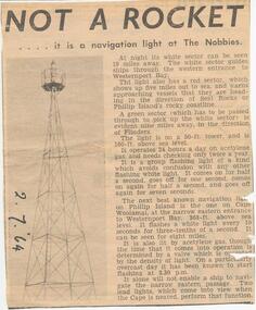
Newspaper Clipping, The Nobbies Navigation Light, 2/7/1964
... ...Navigation Light...Beacon...Phillip Island and District Historical Society Inc. phillip-island-and-the-bass-coast Collection of Newspaper Clippings from a Scrap Book 1960 - 1973 The Nobbies Navigation Light Beacon The Nobbies Phillip Island Jean Jamieson Article about the Navigation Light at The Nobbies The Nobbies Navigation Light Newspaper Clipping ...Collection of Newspaper Clippings from a Scrap Book 1960 - 1973Article about the Navigation Light at The Nobbiesthe nobbies, navigation light, beacon the nobbies, phillip island, jean jamieson -
 Eltham District Historical Society Inc
Photograph, Peter Pidgeon, Manna Gum, Main Road, Eltham South, 8 Sep. 2021
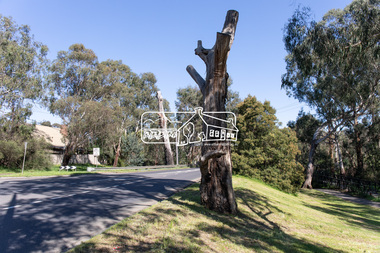
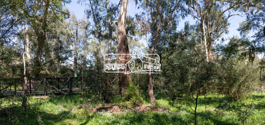
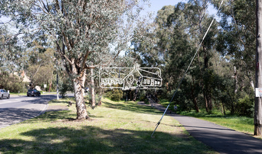
... These trees are not only significant for the natural environment but also present a navigational beacon back in time as the environmental landscape is developed around them. ...This significant tree located near the Main Road Bridge over the Diamond Creek at Eltham dates back to approximately 1870-1880. Though dead now, its trunk has been left as a wildlife habitat.These trees are not only significant for the natural environment but also present a navigational beacon back in time as the environmental landscape is developed around them.Born Digitaleltham south, main road bridge, manna gum, significant tree -
 Eltham District Historical Society Inc
Photograph, Peter Pidgeon, Manna Gum, Main Road, Eltham South, 8 Sep. 2021
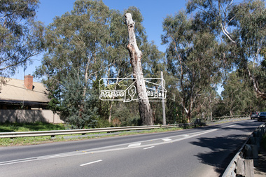
... These trees are not only significant for the natural environment but also present a navigational beacon back in time as the environmental landscape is developed around them. eltham south main road bridge manna gum significant tree Born Digital Manna Gum, Main Road, Eltham South Photograph Photograph Peter Pidgeon ...This significant tree located near the Main Road Bridge over the Diamond Creek at Eltham dates back to approximately 1870-1880. Though dead now, its trunk has been left as a wildlife habitat.These trees are not only significant for the natural environment but also present a navigational beacon back in time as the environmental landscape is developed around them.Born Digitaleltham south, main road bridge, manna gum, significant tree -
 Eltham District Historical Society Inc
Photograph, Peter Pidgeon, Manna Gum, Main Road, Eltham South, 8 Sep. 2021
... These trees are not only significant for the natural environment but also present a navigational beacon back in time as the environmental landscape is developed around them. eltham south main road bridge manna gum significant tree Born Digital Manna Gum, Main Road, Eltham South Photograph Photograph Peter Pidgeon ...This significant tree located near the Main Road Bridge over the Diamond Creek at Eltham dates back to approximately 1870-1880. Though dead now, its trunk has been left as a wildlife habitat.These trees are not only significant for the natural environment but also present a navigational beacon back in time as the environmental landscape is developed around them.Born Digitaleltham south, main road bridge, manna gum, significant tree -
 Eltham District Historical Society Inc
Photograph, Peter Pidgeon, Manna Gum, Main Road Bridge, Eltham South, 8 Sep. 2021
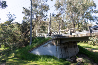
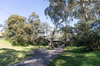
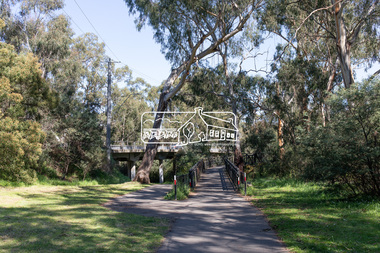
... These trees are not only significant for the natural environment but also present a navigational beacon back in time as the environmental landscape is developed around them. eltham south main road bridge manna gum significant tree Born Digital Manna Gum, Main Road Bridge, Eltham South Photograph Photograph Peter Pidgeon ...This significant tree located near the Main Road Bridge over the Diamond Creek at Eltham dates back to approximately 1870-1880. Though dead now, its trunk has been left as a wildlife habitat. The original timber bridge over the Diamond Creek was built around 1840. It was destroyed by floodwaters in October 1923. A temporary bridge was rigged up but further damaged in April 1924. A new concrete bridge was built and opened in October 1926. The bridge decking was widened along with Main Road to Dalton Street by the Road Construction Authority in 1984., The uygraded bridge was opened in October 1984, 78 years after its original opening.These trees are not only significant for the natural environment but also present a navigational beacon back in time as the environmental landscape is developed around them.Born Digitaleltham south, main road bridge, manna gum, significant tree -
 Eltham District Historical Society Inc
Photograph, Peter Pidgeon, Manna Gum, Main Road Bridge, Eltham South, 8 Sep. 2021
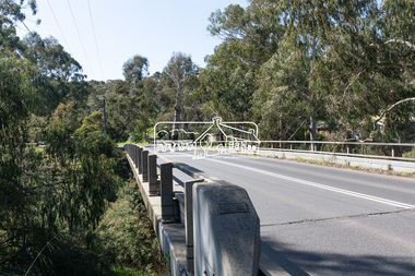
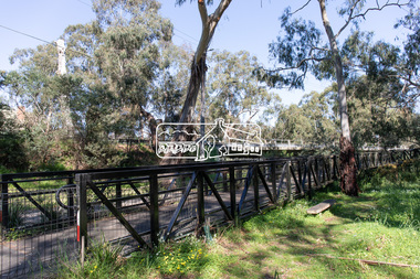
... These trees are not only significant for the natural environment but also present a navigational beacon back in time as the environmental landscape is developed around them. eltham south main road bridge manna gum significant tree diamond creek trail Born Digital Manna Gum, Main Road Bridge, Eltham South Photograph Photograph Peter Pidgeon ...This significant tree located near the Main Road Bridge and Diamond Creek Trail footbridge over the Diamond Creek at Eltham dates back to the early 1900s. The original timber bridge over the Diamond Creek was built around 1840. It was destroyed by floodwaters in October 1923. A temporary bridge was rigged up but further damaged in April 1924. A new concrete bridge was built and opened in October 1926. The bridge decking was widened along with Main Road to Dalton Street by the Road Construction Authority in 1984., The uygraded bridge was opened in October 1984, 78 years after its original opening.These trees are not only significant for the natural environment but also present a navigational beacon back in time as the environmental landscape is developed around them.Born Digitaleltham south, main road bridge, manna gum, significant tree, diamond creek trail -
 Eltham District Historical Society Inc
Photograph, Peter Pidgeon, Manna Gum, Main Road Bridge, Eltham South, 8 Sep. 2021
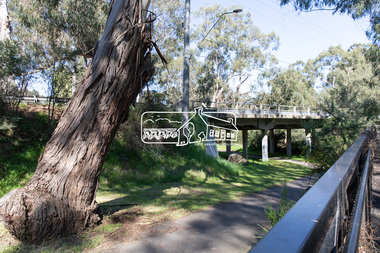
... These trees are not only significant for the natural environment but also present a navigational beacon back in time as the environmental landscape is developed around them. eltham south main road bridge manna gum significant tree diamond creek trail Born Digital Manna Gum, Main Road Bridge, Eltham South Photograph Photograph Peter Pidgeon ...This significant tree located near the Main Road Bridge and Diamond Creek Trail footbridge over the Diamond Creek at Eltham dates back to the early 1900s. The original timber bridge over the Diamond Creek was built around 1840. It was destroyed by floodwaters in October 1923. A temporary bridge was rigged up but further damaged in April 1924. A new concrete bridge was built and opened in October 1926. The bridge decking was widened along with Main Road to Dalton Street by the Road Construction Authority in 1984., The uygraded bridge was opened in October 1984, 78 years after its original opening.These trees are not only significant for the natural environment but also present a navigational beacon back in time as the environmental landscape is developed around them.Born Digitaleltham south, main road bridge, manna gum, significant tree, diamond creek trail -
 Eltham District Historical Society Inc
Photograph, Peter Pidgeon, Manna Gums, Main Road Bridge, Eltham South, 8 Sep. 2021
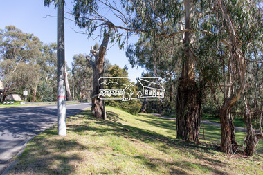
... These trees are not only significant for the natural environment but also present a navigational beacon back in time as the environmental landscape is developed around them. eltham south main road bridge manna gum diamond creek trail Born Digital Manna Gums, Main Road Bridge, Eltham South Photograph Photograph Peter Pidgeon ...The original timber bridge over the Diamond Creek was built around 1840. It was destroyed by floodwaters in October 1923. A temporary bridge was rigged up but further damaged in April 1924. A new concrete bridge was built and opened in October 1926. The bridge decking was widened along with Main Road to Dalton Street by the Road Construction Authority in 1984., The uygraded bridge was opened in October 1984, 78 years after its original opening.These trees are not only significant for the natural environment but also present a navigational beacon back in time as the environmental landscape is developed around them.Born Digitaleltham south, main road bridge, manna gum, diamond creek trail -
 Eltham District Historical Society Inc
Photograph, Peter Pidgeon, Manna Gums, Main Road Bridge, Eltham South, 8 Sep. 2021
... These trees are not only significant for the natural environment but also present a navigational beacon back in time as the environmental landscape is developed around them. eltham south main road bridge manna gum diamond creek trail Born Digital Manna Gums, Main Road Bridge, Eltham South Photograph Photograph Peter Pidgeon ...The original timber bridge over the Diamond Creek was built around 1840. It was destroyed by floodwaters in October 1923. A temporary bridge was rigged up but further damaged in April 1924. A new concrete bridge was built and opened in October 1926. The bridge decking was widened along with Main Road to Dalton Street by the Road Construction Authority in 1984., The uygraded bridge was opened in October 1984, 78 years after its original opening.These trees are not only significant for the natural environment but also present a navigational beacon back in time as the environmental landscape is developed around them.Born Digitaleltham south, main road bridge, manna gum, diamond creek trail -
 Eltham District Historical Society Inc
Photograph, Peter Pidgeon, Manna Gum, Main Road Bridge, Eltham South, 8 Sep. 2021
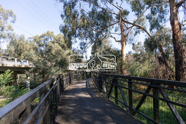
... These trees are not only significant for the natural environment but also present a navigational beacon back in time as the environmental landscape is developed around them. eltham south main road bridge manna gum significant tree diamond creek trail Born Digital Manna Gum, Main Road Bridge, Eltham South Photograph Photograph Peter Pidgeon ...This significant tree located near the Main Road Bridge and Diamond Creek Trail footbridge over the Diamond Creek at Eltham dates back to the early 1900s. The original timber bridge over the Diamond Creek was built around 1840. It was destroyed by floodwaters in October 1923. A temporary bridge was rigged up but further damaged in April 1924. A new concrete bridge was built and opened in October 1926. The bridge decking was widened along with Main Road to Dalton Street by the Road Construction Authority in 1984., The uygraded bridge was opened in October 1984, 78 years after its original opening.These trees are not only significant for the natural environment but also present a navigational beacon back in time as the environmental landscape is developed around them.Born Digitaleltham south, main road bridge, manna gum, significant tree, diamond creek trail -
 Eltham District Historical Society Inc
Photograph, Peter Pidgeon, Manna Gum, Main Road Bridge, Eltham South, 8 Sep. 2021
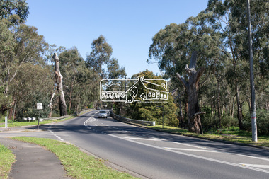
... These trees are not only significant for the natural environment but also present a navigational beacon back in time as the environmental landscape is developed around them. eltham south main road bridge manna gum significant tree diamond creek trail Born Digital Manna Gum, Main Road Bridge, Eltham South Photograph Photograph Peter Pidgeon ...This significant tree located near the Main Road Bridge and Diamond Creek Trail footbridge over the Diamond Creek at Eltham dates back to around 1870-1880. The original timber bridge over the Diamond Creek was built around 1840. It was destroyed by floodwaters in October 1923. A temporary bridge was rigged up but further damaged in April 1924. A new concrete bridge was built and opened in October 1926. The bridge decking was widened along with Main Road to Dalton Street by the Road Construction Authority in 1984., The uygraded bridge was opened in October 1984, 78 years after its original opening.These trees are not only significant for the natural environment but also present a navigational beacon back in time as the environmental landscape is developed around them.Born Digitaleltham south, main road bridge, manna gum, significant tree, diamond creek trail -
 Eltham District Historical Society Inc
Photograph, Peter Pidgeon, Manna Gum, Main Road Bridge, Eltham South, 8 Sep. 2021
... These trees are not only significant for the natural environment but also present a navigational beacon back in time as the environmental landscape is developed around them. eltham south main road bridge manna gum significant tree diamond creek trail Born Digital Manna Gum, Main Road Bridge, Eltham South Photograph Photograph Peter Pidgeon ...This significant tree located near the Main Road Bridge and Diamond Creek Trail footbridge over the Diamond Creek at Eltham dates back to around 1870-1880. The original timber bridge over the Diamond Creek was built around 1840. It was destroyed by floodwaters in October 1923. A temporary bridge was rigged up but further damaged in April 1924. A new concrete bridge was built and opened in October 1926. The bridge decking was widened along with Main Road to Dalton Street by the Road Construction Authority in 1984., The upgraded bridge was opened in October 1984, 78 years after its original opening.These trees are not only significant for the natural environment but also present a navigational beacon back in time as the environmental landscape is developed around them.Born Digitaleltham south, main road bridge, manna gum, significant tree, diamond creek trail -
 Port Melbourne Historical & Preservation Society
Map - Navigation Charts, Port Melbourne, Williamstown and River Yarra, 1994
... Port Melbourne Historical & Preservation Society Port Melbourne Town Hall 333 Bay Street Port Melbourne melbourne Sport - Yachting Maritime Beacons .01 - Navigation chart of Port Melbourne, Williamstown and River Yarra channels 1994. ....01 - Navigation chart of Port Melbourne, Williamstown and River Yarra channels 1994. Chart No Aust 154 .02 - Navigation Chart of approaches to Melbourne. Chart No Aust 155 c1986sport - yachting, maritime, beacons -
 Lakes Entrance Historical Society
Photograph - The Entrance, c1950
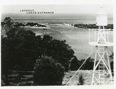
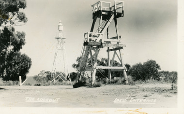
... Lakes Entrance Historical Society 4 Marine Parade Lakes Entrance gippsland Also postcard 7 x 10.5, similar image, Waterways Ocean Navigation The Entrance from Jemmy's Point Black and white photograph of the Entrance, taken from lookout on Jemmy's Point, shows signal beacon adjacent to lookout, people on slope in front of signal, New Works cottages on sand hummocks, ocean horizon in distance. ...Also postcard 7 x 10.5, similar image,Black and white photograph of the Entrance, taken from lookout on Jemmy's Point, shows signal beacon adjacent to lookout, people on slope in front of signal, New Works cottages on sand hummocks, ocean horizon in distance. Lakes Entrance VictoriaThe Entrance from Jemmy's Pointwaterways, ocean, navigation -
 Lakes Entrance Historical Society
Postcard - Lookout tower Jemmy's Point, 1940
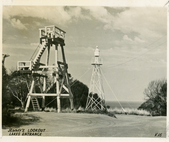
... Lakes Entrance Historical Society 4 Marine Parade Lakes Entrance gippsland Historic Sites Navigation Fences Black and white small format postcard of the timber observation lookout at Jemmy's Point, Lakes Entrance, Victoria, showing the updated and safer steps from ground to observation deck, with fenced landing at halfway point. Old log and seat still nearby, signal beacon ...Black and white small format postcard of the timber observation lookout at Jemmy's Point, Lakes Entrance, Victoria, showing the updated and safer steps from ground to observation deck, with fenced landing at halfway point. Old log and seat still nearby, signal beacon on steel tower a short distance away.historic sites, navigation, fences -
 Lakes Entrance Historical Society
Postcard - Lookout tower Jemmy's Point, Valentine Series, 1940
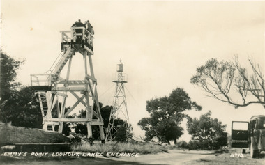
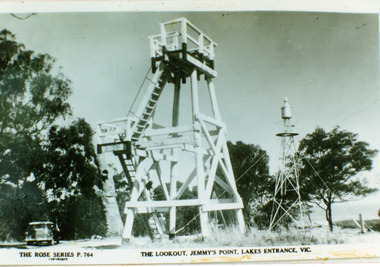
... Lakes Entrance Historical Society 4 Marine Parade Lakes Entrance gippsland Historic Sites Navigation Jemmys Lookout Lakes Entrance Black and white small format postcard of the timber observation lookout at Jemmy's Point, Lakes Entrance, Victoria, showing the timber tower with observation deck, signal beacon on steel tower nearby. ...Black and white small format postcard of the timber observation lookout at Jemmy's Point, Lakes Entrance, Victoria, showing the timber tower with observation deck, signal beacon on steel tower nearby. Top of old standing lookout tree just visible.Jemmys Lookout Lakes Entrancehistoric sites, navigation -
 Lakes Entrance Historical Society
Postcard - Lookout tower Jemmy's Point, Bulmer H D, 1950
... Lakes Entrance Historical Society 4 Marine Parade Lakes Entrance gippsland Historic Sites Navigation The Lookout, Lakes Entrance Black and white postcard of the timber lookout on Jemmy's Point, with the signal beacon on steel tower nearby. ...Black and white postcard of the timber lookout on Jemmy's Point, with the signal beacon on steel tower nearby. Lakes Entrance Victoria,The Lookout, Lakes Entrancehistoric sites, navigation -
 Lakes Entrance Historical Society
Photograph - Lookout tower Jemmy's Point, The Rose Series, 1950
... Lakes Entrance Historical Society 4 Marine Parade Lakes Entrance gippsland Identical copy 10 x 15 Historic Sites Navigation The Lookout Jemmy's Point Lakes Entrance Black and white photograph copied from a postcard showing timber lookout tower and signal beacon on Jemmy's Point. ...Identical copy 10 x 15Black and white photograph copied from a postcard showing timber lookout tower and signal beacon on Jemmy's Point. Old lookout tree in background appears to have some of the top missing. Lakes Entrance Victoria.The Lookout Jemmy's Point Lakes Entrancehistoric sites, navigation -
 Lakes Entrance Historical Society
Photograph - Lookout tower Jemmy's Point, 1960
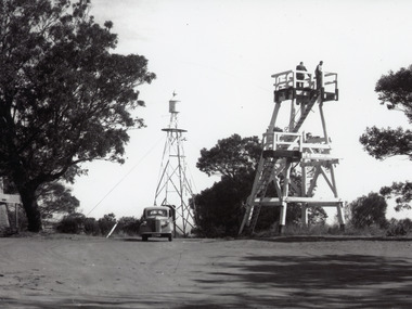
... Historic Sites Navigation Black and white photograph of the timber lookout on Jemmy's Point, steel tower with signal beacon in background, base of old lookout tree visible on left of image. ...Also one other photograh similar showing steps, landing, and Carpenters Chev car parked.Black and white photograph of the timber lookout on Jemmy's Point, steel tower with signal beacon in background, base of old lookout tree visible on left of image. Lakes Entrance, Victoria.historic sites, navigation -
 Lakes Entrance Historical Society
Photograph - Timber Beacon Gippsland Lakes, Vacinity of Raymond Island Victoria, 1900 c
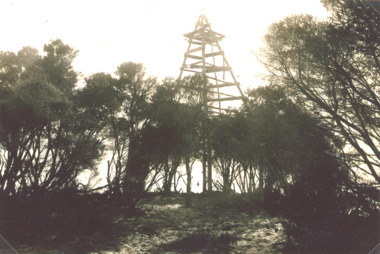
... This survey lookout has been washed away, seawater has killed vegetation and allowed erosion Boats and Boating Navigation Waterways Black and white photograph of a timber beacon on land in Gippsland Lakes in vacinity of Raymond Island Victoria Vacinity of Raymond Island Victoria Photograph Timber Beacon Gippsland Lakes ...On back of original Raymond Island Tambo River in distance. This survey lookout has been washed away, seawater has killed vegetation and allowed erosionBlack and white photograph of a timber beacon on land in Gippsland Lakes in vacinity of Raymond Island Victoriaboats and boating, navigation, waterways -
 Parks Victoria - Gabo Island Lightstation
Light & object
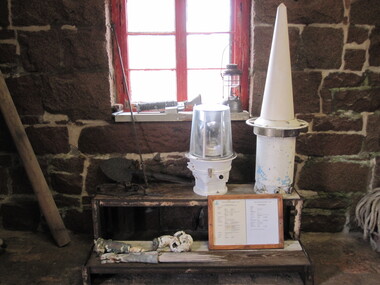
... They have at least second level significance for their probable provenance and association with the theme of visual signalling and the use of navigation equipment for maintaining safe routes for shipping. Beacon and unidentified object (GILS 0095) The portable beacon is a small rotating light containing a lens and prism. ...Further information on the unidentified object has not been available during preparation of this report, but it may be a buoy light, or perhaps even a solar powered rotating light made by Pharos Marine, New Zealand. Portable beacon lights were made with a plastic lens and an aluminium base and it is known that one of these was installed in the Gabo Island Lighthouse in February 1992. It was replaced in May 2006 and the lights are now no longer used within the AMSA network. The unidentified item, which can be described as a white painted conical object, appears to be associated with signalling, but more information is needed to confirm this. These items of equipment are presumed to relate to core lightstation functions and look to be in good condition. They have at least second level significance for their probable provenance and association with the theme of visual signalling and the use of navigation equipment for maintaining safe routes for shipping.Beacon and unidentified object (GILS 0095) The portable beacon is a small rotating light containing a lens and prism. The other item can be described as a white painted conical object. -
 Moorabbin Air Museum
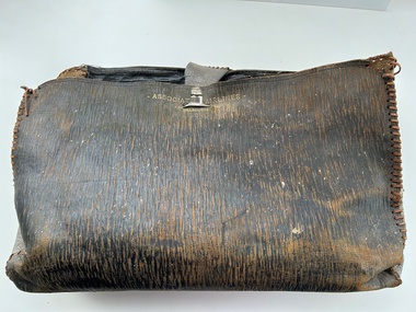
Accessory (Item) - Leather Satchel Marked With Associated Airlines - Melbourne
... Containing the following items, 1 Pr Sunglasses Ray-Ban Anti-Glare USA Style in case. 1 x Flight Plan for Associated Airlines dated 12.04.1960. 1 x Flight Plan TAA for VH-ASC, dated 11.05.57 1 x Flight Plan Associated Airlines dated 14.04.1960. 1 x Letter to airline and senior commercial pilots relating to routine ECG at medical examination from DCA dated 08.09.1959. 1 x Copy of Air Navigation Orders parts 20-95 as at 22.06.1959. 1 x copy of flight plan information for VH-ABH 1 x copy of notes on the radio beacon. 1 x copy of DCA Air Navigation Orders Part 20 Amendment List No.27 dated 07.07.1959. 1 x copy of DCA Emergency Procedure And Failure Of Radio Apparatus dated 29.09.59. 1 x copy of DCA New Route Structure - Sydney Area (Pilots Copy) Dated 16.12.1957. 1 x Measuring tape marked 26 o Lat to 38 o Lat....Containing the following items, 1 Pr Sunglasses Ray-Ban Anti-Glare USA Style in case. 1 x Flight Plan for Associated Airlines dated 12.04.1960. 1 x Flight Plan TAA for VH-ASC, dated 11.05.57 1 x Flight Plan Associated Airlines dated 14.04.1960. 1 x Letter to airline and senior commercial pilots relating to routine ECG at medical examination from DCA dated 08.09.1959. 1 x Copy of Air Navigation Orders parts 20-95 as at 22.06.1959. 1 x copy of flight plan information for VH-ABH 1 x copy of notes on the radio beacon. 1 x copy of DCA Air Navigation Orders Part 20 Amendment List No.27 dated 07.07.1959. 1 x copy of DCA Emergency Procedure And Failure Of Radio Apparatus dated 29.09.59. 1 x copy of DCA New Route Structure - Sydney Area (Pilots Copy) Dated 16.12.1957. 1 x Measuring tape marked 26 o Lat to 38 o Lat. ... -
Moorabbin Air Museum
Book - Aeronautics, Aeronautics Volume II
... Aeronautics Parachutes Instruments & electrical equipment Blind flying panels Radio navigation Flying clothing Engine instruments Navigational equipment Electricity in the cockpit The altimeter Ice formation Airport aids to flight Catapults & assisted take offs Vertical speed indicator Instrument flying Airspeed indicators Air traffic rules Radio beams Air beacons Transatlantic flying Flares & pyrotechnics Cabin equipment Inspection & testing for wireless operators Electrical interference Sextants Hydraulic controls Bad weather flying Bonding & screening Aircraft as disease carriers Overview of aircraft instruments & accessories. ...Overview of aircraft instruments & accessories. No publication date stated, but looks to be around late 1930s/early 1940snon-fictionOverview of aircraft instruments & accessories. No publication date stated, but looks to be around late 1930s/early 1940sparachutes, instruments & electrical equipment, blind flying panels, radio navigation, flying clothing, engine instruments, navigational equipment, electricity in the cockpit, the altimeter, ice formation, airport aids to flight, catapults & assisted take offs, vertical speed indicator, instrument flying, airspeed indicators, air traffic rules, radio beams, air beacons, transatlantic flying, flares & pyrotechnics, cabin equipment, inspection & testing for wireless operators, electrical interference, sextants, hydraulic controls, bad weather flying, bonding & screening, aircraft as disease carriers