Showing 66 items matching "otway area"
-
 Koorie Heritage Trust
Book, Beauglehole, A. C, The distribution and conservation of vascular plants in the Corangamite-Otway area, Victoria, 1980
... The distribution and conservation of vascular plants in the Corangamite-Otway area, Victoria...The distribution and conservation of vascular plants in the Corangamite-Otway area, Victoria Book Beauglehole, A. C. Portland, Vic. : Western Victorian Field Naturalists Clubs Association ...ii,108p. : ill. ; 21x30cm. + 1 col.fold.map in pocket.indigenous vascular plants. distribution. south-west victoria. | botany -- victoria. -
 Federation University Historical Collection
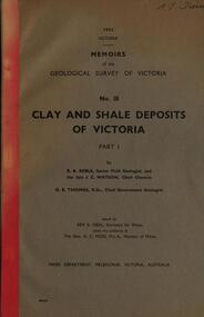
Book, Memoirs of the Geological Survey of Victoria; No 18, Clay and Shale Deposits of Victoria, 1952
... ...otway area...Barker Library (top floor) Mount Helen goldfields r a keble senior field geologist j c watson chief chemist d e watson chief government geologist g c moss minister of mines mallee plains avoca valley loddon valley campaspe valley goulburn valley kiewa mitta glenelg valley pitfield valley otway area moorabool valley darley fireclay campbellfield clay latrobe river valley hendley ball clays felspars pegmatities quartz pakenham fireclay bulla china clay kaolin terracotta stoneware ballan dyke-belt egerton gordon ballan llandeilo colbrook elaine lal lal maryborough ballarat ringwood siliceous clay stawell dromana ptways bulla pyalong china clay linton china clay wedderburn clays lal lal china clays ballan dyke belt Reginald Callister knight's koalin pottery china clay ferdinand krause clarendon bittern frichot hunt's dam vaughan rosenow hickey malone claypits ballarat dyke belt stawell dyke belt maryborough dyke belt guildford daylesford ovens valley Grey soft covered book with red tape spine. ...Grey soft covered book with red tape spine. The 76 pages clay deposits, composition of Victorian clays, clay localities, granitic clays, Residual Clays, Clay-Shales, Jurassic clay shales.r a keble, senior field geologist, j c watson, chief chemist, d e watson, chief government geologist, g c moss, minister of mines, mallee plains, avoca valley, loddon valley, campaspe valley, goulburn valley, kiewa, mitta, glenelg valley, pitfield valley, otway area, moorabool valley, darley fireclay, campbellfield clay, latrobe river valley, hendley, ball clays, felspars, pegmatities, quartz, pakenham fireclay, bulla china clay, kaolin, terracotta, stoneware, ballan dyke-belt, egerton, gordon, ballan, llandeilo, colbrook, elaine, lal lal, maryborough, ballarat, ringwood, siliceous clay, stawell, dromana, ptways, bulla, pyalong china clay, linton china clay, wedderburn clays, lal lal china clays, ballan dyke belt, reginald callister, knight's koalin pottery, china clay, ferdinand krause, clarendon, bittern, frichot, hunt's dam, vaughan, rosenow, hickey, malone, claypits, ballarat dyke belt, stawell dyke belt, maryborough dyke belt, guildford, daylesford, ovens valley -
Creswick Campus Historical Collection - University of Melbourne
Still Image, 1948 - 1956
... South Gippsland .......Otway area prints"...South Gippsland .......Otway area prints" Aerial Photographs Still Image ...Subject: Coffs Harbour 1956 . Subject: Grampians no. 11-15. Subject: Kinglake area 1948 -1950 Run 7 no.14 - 16, Run 8 no.69 -70 . Subject: Princetown Run 7 . Subject: South Gippsland Run 7 no.102 - 105. Subject: Otway area. Stored in 5 brown envelopes in a brown cardboard file box marked "INTERPRETATIONS. South Gippsland .......Otway area prints"Aerial Photographs -
 Otway Districts Historical Society
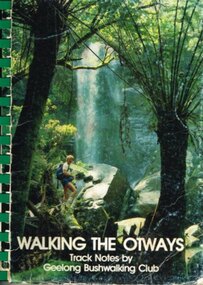
Book, Geelong Bushwalking Club Inc, Walking the Otways, November 1986
... The Otways area of Victoria, at the time of writing, was an underused area for bushwalking. ...Otway Districts Historical Society Cliff Young Drive Beech Forest great-ocean-road The Otways area of Victoria, at the time of writing, was an underused area for bushwalking. ...The Otways area of Victoria, at the time of writing, was an underused area for bushwalking. In the past, people have considered these ranges unsuited for walking because of the thick forest cover, cold and muddy conditions for much of the year, and the steep slopes. Some of the perceived difficulties are actually attractions and that it is possible to enjoy them with a forward planning and up-to-date information to guide the walker.The Geelong Bushwalking Club have included some useful but brief articles on basic aspects of bushwalking.Walking the Otways. Track notes compiled by the Geelong Bushwalking Club. Graeme Allen (ed.); John Van Gemert (maps, photographs). 1st ed. Geelong Bushwalking Club; Geelong (Vic); November 1986. 148 p.; illus, maps. Soft cover.otways; bushwalking; -
 Warrnambool and District Historical Society Inc.
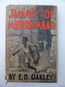
Book, Jimmy of Murrumbar by E D Oakley, 1938
... He was the fourth child of Thomas and Eliza Oakley who had the farm, Oakbank, near the mouth of the Hopkins River, Warrnambool (Otway Road area today). Edward Oakley first worked at Saltau’s shipping office in Warrnambool then ran a dairy farm, Halifax, near Cudgee. ...He was the fourth child of Thomas and Eliza Oakley who had the farm, Oakbank, near the mouth of the Hopkins River, Warrnambool (Otway Road area today). Edward Oakley first worked at Saltau’s shipping office in Warrnambool then ran a dairy farm, Halifax, near Cudgee. ...This book subtitled, ‘A Story of the Amazing Ability and Fidelity of an Australian Black Tracker’, has been written in the late 1930s by Edward Daniel Oakley (1877-1962). He was the fourth child of Thomas and Eliza Oakley who had the farm, Oakbank, near the mouth of the Hopkins River, Warrnambool (Otway Road area today). Edward Oakley first worked at Saltau’s shipping office in Warrnambool then ran a dairy farm, Halifax, near Cudgee. He later had wheat farms in the Grampians area and at Willaura before returning to Warrnambool in 1923. He built a row of shops in Liebig Street and opened a boot and shoe store. He was instrumental in persuading Fletcher Jones to open a shop in Warrnambool. After he retired he researched and wrote the story of Jimmy of Murrumbar. This book is of high significance because: 1. It was written by a local Warrnambool businessman, Edward Oakley. He and other members of his family were prominent residents of the city in the late 19th and early to mid 20th centuries 2. It was written in the late 1930s and tells of the story of a young aboriginal boy, one of the early writings appreciating the talents and worth of young aborigines. This is a hard cover book of 181 pages. A buff-coloured dust cover has been pasted over the hard cover and it has a black, grey and white illustration of a young aboriginal boy being chased. This illustration is repeated in black and white on the second page. The titling on the cover is in red and black printing. The front cover has become almost detached from the pages. An inscription on the inside cover is handwritten in black ink. The book has a foreword, an appreciation, a contents page and 23 chapters. ‘Best Wishes for a Happy Birthday from Graeme Dorman Dec 8th 1942’ edward oakley, history of warrnambool, aboriginal literature, jimmy of murrumbar, thomas and eliza oakley -
 Warrnambool and District Historical Society Inc.
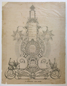
Document - Document The family keepsake Meek family, 1865
... He explored much of the Terang area and the Otway Ranges, speaking and writing of the great potential of the latter area. ...He explored much of the Terang area and the Otway Ranges, speaking and writing of the great potential of the latter area. ...This certificate has been designed and drawn by James McKain Meek, one of several produced by him to sell to local families in Warrnambool and district as a means of raising money to support his family. James Meek (1815-1899) was a fish canner, fisherman, fishmonger, storekeeper, café proprietor, explorer, gold digger, accountant, writer, librarian and above all an outstanding calligrapher. After being a pioneer settler in the Ballarat area and residing also in Port Melbourne he came to Warrnambool and lived in the area in the 1850s and 60s. He explored much of the Terang area and the Otway Ranges, speaking and writing of the great potential of the latter area. One of Meek’s calligraphy works won an award in the International Exhibition of Melbourne in 1861 and some of his works are in various art galleries and museums today. Thomas Fidler was a Warrnambool butcher who married Fanny Cockman in 1849 in London.This certificate is of great significance as one of the calligraphy works of James Meek, a 19th century resident of Warrnambool, celebrated today as a talented calligrapher. The certificate was displayed in 2015 in a James Meek exhibition at Ballarat Art Gallery. The item is also of social significance showing how the more affluent 19th century families recorded and preserved their family history. This is a certificate hand drawn by James Meek. It is a template that enables the owner to insert the details of a family tree, in this case the 19th century family of Thomas Fidler and Fanny Cockman. The certificate is in grey and black shadings with highly ornamental scrolls and patterns. The document has been produced in black ink. It has a central column with spaces for names and side tablets to include more information. The side tablets are star-shaped and the central column has attachments of various shapes – circles, rectangles etc. The base of the column has further ornamental scrolls, swirls and lacework and features sketches of three emus on one side and three kangaroos on the other side. The certificate is mounted on white cardboard. Some of the Fidler family names have been produced in printed letters and some names have been added later by a family member. ‘Th. os Fidler’s Family Register 1865’ ‘The Family Keepsake’ ‘A Present For Home’thomas fidler and fanny cockman, james meek, history of warrnambool -
 Warrnambool and District Historical Society Inc.
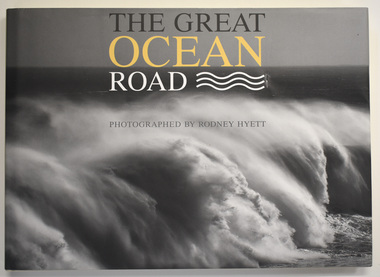
Book, Rodney Hyett, The Great Ocean Road, 2013
... Warrnambool is situated at the western end of the Great Ocean Road and the history of this region is closely associated with that of Warrnambool, particularly with the foundation of Warrnambool and the early explorations of the Otways area. Great Ocean Road Rodney Hyett photographer A book containing Great Ocean Road Photographs This is a book of 144 pages. ...A book containing Great Ocean Road PhotographsThis is a book of 144 pages. The cover is buff-coloured with an embossed title. The dust cover has a black and white photograph and a map with white, yellow and black printing. The pages contain printed text and black and white and colour photographs amd mapsnon-fiction A book containing Great Ocean Road Photographsgreat ocean road, rodney hyett photographer -
 Warrnambool and District Historical Society Inc.
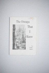
Book, Merimbula Easiprint, The Otways That I Knew, 1993
... His forebears were pioneers in the Wyelangta area of the Otway Ranges and he spent most of his life in that region. ...His forebears were pioneers in the Wyelangta area of the Otway Ranges and he spent most of his life in that region. ...This book was written by Roland (Corker) Brown. His forebears were pioneers in the Wyelangta area of the Otway Ranges and he spent most of his life in that region. In this book he has recorded some of the history of the area and his personal recollections, starting from the 1930s when the last of the bullock and horse teams were transporting timber and the old mills were closing. This book is of interest as it gives the history of the Otway Ranges and one man’s story of life in this region in the early to mid 20th century. It will be useful for researchers. This is a soft-cover book of 211 pages. It has a white cover with a black and white photograph of a bush scene and black printing on the front cover. The book contains a poem by the author, two sections of printed material and many black and white photographs. wyelangta, otway ranges -
 Warrnambool and District Historical Society Inc.
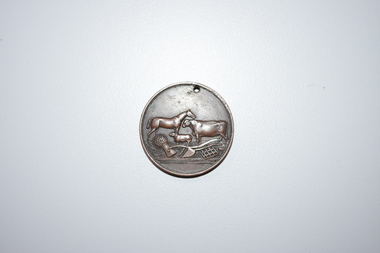
Medal, Stokes and Martin, Rutledge Brothers, 1877
... area at the end of the 19th century. His brother William (1849-1935) also farmed in the Farnham Survey, living at Farnham Park, He later lived at Airlie in Henna Street, Warrnambool and Sherwood on the Hopkins River and had land in the Otway Ranges. ...area at the end of the 19th century. His brother William (1849-1935) also farmed in the Farnham Survey, living at Farnham Park, He later lived at Airlie in Henna Street, Warrnambool and Sherwood on the Hopkins River and had land in the Otway Ranges. ...This medal was made by Stokes and Martin. Thomas Stokes established a medal-making business in Melbourne in 1856 and from 1867 to 1893 he had a partner, George Frederick Martin. In 1962 the Stokes business became a public company and operates today in Melbourne. The medal was awarded at the Annual Show of the Villiers and Heytesbury Agricultural Association in 1877. One of the earliest agricultural associations in Victoria, the V.& H.A.A., the forerunner of the Warrnambool Agricultural Society, was established in 1854 and the first Warrnambool Show was held in 1855 at the first Royal Archer Hotel in Koroit Street. The Warrnambool Agricultural Show is still held annually. The medal, first prize for the best horse hay rake, was awarded in 1877 to the brothers, Thomas and William Rutledge, sons of Eliza and William Rutledge. The latter was a pioneer settler who came to the Warrnambool/Port Fairy district as the purchaser of the Special Survey, Farnham Park in 1841. His land stretched from Tower Hill to Dennington. William Rutledge Senior was a pioneer breeder of a Lincoln sheep stud, the owner of a mercantile business in Port Fairy, a member of the Legislative Council of Victoria and the pioneer developer of farming land around Tower Hill. His son Thomas (1846-1918) was a Warrnambool Shire Councillor who farmed in the Farnham Survey, living at Werronggurt . He went to the Geelong area at the end of the 19th century. His brother William (1849-1935) also farmed in the Farnham Survey, living at Farnham Park, He later lived at Airlie in Henna Street, Warrnambool and Sherwood on the Hopkins River and had land in the Otway Ranges. He later went to New Zealand.This medal is of considerable significance because of its age and its association with Thomas and William Rutledge and with the Villiers and Heytesbury Agricultural Association.This is a bronze medal with an image of agricultural implements, agricultural produce and farm animals on one side and etched printing on the other side. There is also printing around the edge of the medal. The medal has a small hole at the top for attaching the medal to a cord. Villiers & Heytesbury Agricultural Association 1st Prize awarded to Rutledge Bro. for Horse Hay Rake Annual Show Warrnambool 10 Oct. 1877 Stokes & Martin Melbourne thomas and william rutledge, farnham special survey, villiers and heytesbury agricultural association, warrnambool agricultural society, history of warrnambool -
 Warrnambool and District Historical Society Inc.
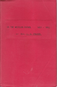
Booklet, On the Western Patrol, Mid 20th century
... Fraser of his two years as a Home Missionary of the Presbyterian Church in the Otway Ranges in 1891-2. The area covered was from Lorne to Peterborough. ...Fraser of his two years as a Home Missionary of the Presbyterian Church in the Otway Ranges in 1891-2. The area covered was from Lorne to Peterborough. ...This is the story told by the Rev. C. Fraser of his two years as a Home Missionary of the Presbyterian Church in the Otway Ranges in 1891-2. The area covered was from Lorne to Peterborough. The booklet includes the names and activities of many settlers of the time and a description of the wreck of the Newfield. This book is of interest to researchers looking for information on the Otway Ranges settlers at the end of the 19th century. It includes names and events and gives an interesting insight into life in the Otway Ranges in the 1890s. This is a small booklet of 44 pages with a red cover and the title printed in black on the front cover. The pages have been stapled together. There are no photographs or illustrations. Front Cover: ‘On the Western Patrol 1891-1892 by Rev. C.A. Fraser’presbyterian church, home missions otway ranges, warrnambool, rev. c. fraser -
 Warrnambool and District Historical Society Inc.
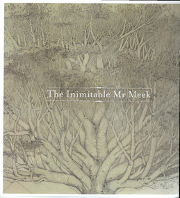
Book, The Inimitable Mr Meek, 2015
... area and establishing a cannery there. In Warrnambool he set up a commercial fishing company which failed, organized an Otways exploration trip looking for gold and established a reputation for producing fine calligraphy works. ...area and establishing a cannery there. In Warrnambool he set up a commercial fishing company which failed, organized an Otways exploration trip looking for gold and established a reputation for producing fine calligraphy works. ...This is a catalogue with a reinforced plastic-covered cover. It has 87 pages with illustrations and photographs. The sepia-coloured cover features a portion of a James Meek work of calligraphy.james meek, the inimitable mr meek, james meek artist -
 Warrnambool and District Historical Society Inc.
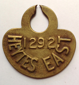
Functional object - Tag, cow Heytesbury East, late 20th century
... The Heytesbury Settlement Scheme in the area west of Colac and bordering the Otway Ranges. The Settlement was established in 1960 as a dairying area and was one of the largest post World War Two farming settlements. ...Warrnambool and District Historical Society Inc. 2 Gilles Street (south of Merri St) Warrnambool great-ocean-road The Heytesbury Settlement Scheme in the area west of Colac and bordering the Otway Ranges. The Settlement was established in 1960 as a dairying area and was one of the largest post World War Two farming settlements. ...The Heytesbury Settlement Scheme in the area west of Colac and bordering the Otway Ranges. The Settlement was established in 1960 as a dairying area and was one of the largest post World War Two farming settlements. This cow tag has been broken at the top and detached from the animal.The item is of some interest as coming from the Heytesbuty Settlement. Dairying is of major importance in the Warrnambool area and this extends to the Heytesbury area. These cow tags have now been superseded by more improved technological equipment. This is a brass cow tag. It is semi-circular with a ring top, broken or worn through at the top. ‘1292’ ‘Heytes East’ heytesbury settlement scheme, cow tag -
 Warrnambool and District Historical Society Inc.
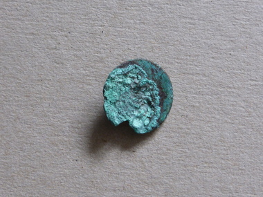
Button, Uniform button
... This wreck has a connection to the establishment of the Cape Otway lighthouse and to Warrnambool’s history as Superintendent Charles LaTrobe came to the Warrnambool district several times in an effort to find the best route to the Cape Otway area. While doing so he became familiar with the Warrnambool area and the need to establish a new settlement at Warrnambool. ...It is presumed that this is an authentic relic from a very significant shipwreck in Tasmania. It was bought at a museum in King Island. The Cataraqui, carrying British emigrants, was wrecked on King Island in 1845 with the loss of over 400 lives. The British Parliamentary and general public outcry following this disaster resulted in the establishment of the lighthouse at Cape Otway in 1848 (and indirectly the establishment of Warrnbambool in 1847)This button, listed as a uniform button, is of some interest as a small relic of the shipwreck, Cataraqui. This wreck has a connection to the establishment of the Cape Otway lighthouse and to Warrnambool’s history as Superintendent Charles LaTrobe came to the Warrnambool district several times in an effort to find the best route to the Cape Otway area. While doing so he became familiar with the Warrnambool area and the need to establish a new settlement at Warrnambool. This is a small metal button covered with verdigris, with any writing or markings obliterated. A small piece is missing at the edge. cataraqui shipwreck, warrnambool, superintendent charles latrobe, button -
 Warrnambool and District Historical Society Inc.
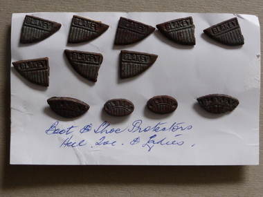
Shoe Protector, Boot & Shoe protectors, Early 19th century
... This wreck has a connection to the establishment of the Cape Otway lighthouse and to Warrnambool’s history as Superintendent Charles LaTrobe came to the Warrnambool district several times in an effort to find the best route to the Cape Otway area. While doing so he became familiar with the Warrnambool area and the need to establish a new settlement at Warrnambool. cataraqui shipwreck buttons warrnambool This is a small metal button covered with verdigris, with any writing or markings obliterated. ...It is presumed that this is an authentic relic from a very significant shipwreck in Tasmania. It was bought at a museum in King Island. The Cataraqui, carrying British emigrants, was wrecked on King Island in 1845 with the loss of over 400 lives. The British Parliamentary and general public outcry following this disaster resulted in the establishment of the lighthouse at Cape Otway in 1848 (and indirectly the establishment of Warrnbambool in 1847)This button, listed as a uniform button, is of some interest as a small relic of the shipwreck, Cataraqui. This wreck has a connection to the establishment of the Cape Otway lighthouse and to Warrnambool’s history as Superintendent Charles LaTrobe came to the Warrnambool district several times in an effort to find the best route to the Cape Otway area. While doing so he became familiar with the Warrnambool area and the need to establish a new settlement at Warrnambool. This is a small metal button covered with verdigris, with any writing or markings obliterated. A small piece is missing at the edge. cataraqui shipwreck, buttons, warrnambool -
 Christ Church Anglican Parish of Warrnambool
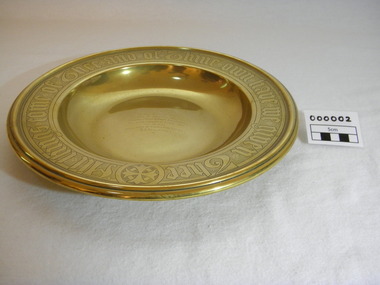
Plate, Untitled, Brass Alms dish, C.1902
... Otway) when the three men went walking, but never returned, all assumed drowned. One theary has it - Mrs M.E. Dallimore was picnicing at Lake Gillear beach when an enormous wave swept over the shore - (much larger than any other during that day) and rolled in all along the beach. This wave may have also reached the area...Otway) when the three men went walking, but never returned, all assumed drowned. One theary has it - Mrs M.E. Dallimore was picnicing at Lake Gillear beach when an enormous wave swept over the shore - (much larger than any other during that day) and rolled in all along the beach. This wave may have also reached the area ...Brass Collection Plate presented to St Paul's Anglican Church, Allansford, by the mother of Joseph & Frank Dallimore as a Memorial to the two brothers who drowned at Ryan's Den (near Cape Otway) on Jan 1st 1903. Major Joseph Dallimore (aged 32) was on leave from Sth Africa during the war and he, his wife (Beatrice Wiggs) and baby, his brother Frank Rupert Dallimore (aged 22), a farm hand Arthur Geach (aged 19) and a house maid servant, were picnicing at Ryan's Den (near Cape Otway) when the three men went walking, but never returned, all assumed drowned. One theary has it - Mrs M.E. Dallimore was picnicing at Lake Gillear beach when an enormous wave swept over the shore - (much larger than any other during that day) and rolled in all along the beach. This wave may have also reached the area where the three men were walking on the rocks and swept them into the ocean. Only one body was recovered - some 4 weeks later - that of Frank Rupert Dallimore and washed into Brown's Creek, 1 mile from the Johanna River and ten miles east of Ryans Den.It is a memorial plate and records the family's attachment and importance to the Church.Brass engraved and embossed Memorial Collection PlateEmbossed wording around edge of plate in Old English font reads - "All things come of Thee and of Thine own have we given Thee". The inscription on the tondo of the plate reads - "TO THE GLORY OF GOD / AND IN MEMORY OF / JOSEPH & FRANK RUPERT DALLIMORE, / WHO WERE DROWNED AT RYAN'S DEN, / JAN 1ST 1903. / PRESENTED BY THEIR LOVING MOTHER, / M.E.DALLIMORE."brass st pauls anglican church allansford warrnambool church of england christ church parish of warrnambool collection plate memorial plate dallimore drowning ryan s den alms dish -
Federation University Historical Collection
Book, John Slorach, From Timber to Tourism: Exploring Place Attachment and Natural Area Values in the Otway Ranges, 05/01/2007
... From Timber to Tourism: Exploring Place Attachment and Natural Area Values in the Otway Ranges...Barker Library (top floor) Mount Helen goldfields university of ballarat school of business john slorach mary hollick tourism timber otway ranges timber harvesting forestry environment Black hard covered book prepared for the BS801 Honours Research Dissertation, Bachelor of Business (Tourism) (Honours) From Timber to Tourism: Exploring Place Attachment and Natural Area Values in the Otway Ranges Book John Slorach ...Black hard covered book prepared for the BS801 Honours Research Dissertation, Bachelor of Business (Tourism) (Honours)university of ballarat, school of business, john slorach, mary hollick, tourism, timber, otway ranges, timber harvesting, forestry, environment -
Federation University Historical Collection
Book, From Timber to Tourism: Exploring Place Attachment and Natural Area Values in the Otway Ranges, 1997
... From Timber to Tourism: Exploring Place Attachment and Natural Area Values in the Otway Ranges...Barker Library (top floor) Mount Helen goldfields university of ballarat school of business tourism Apollo bay otway national park michelle brown melinda gill clare kearns sarah mcEwing Renee Walder cape otway lighthouse point franklin residential estate harbour sand dune erosion great ocean road blanket bay maits rest walking track Spiral bound report From Timber to Tourism: Exploring Place Attachment and Natural Area Values in the Otway Ranges Book ...Spiral bound reportuniversity of ballarat, school of business, tourism, apollo bay, otway national park, michelle brown, melinda gill, clare kearns, sarah mcewing, renee walder, cape otway lighthouse, point franklin residential estate, harbour, sand dune erosion, great ocean road, blanket bay, maits rest walking track -
 Eltham District Historical Society Inc
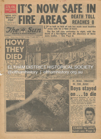
Newspaper - Newspaper articles, Sun News-Pictorial, It's Now Safe in Fire Areas; Death Toll Reacxhes 8, The Sun News-Pictorial, Thursday, January 18, p1, 1962
... Areas; Death Toll Reaches 8, p1 (Illust.) • How they died, pp1-2 • It was “heaven” in the bush … Boys stayed on . . . to die, pp1-2 (Illust.) • Towns take stock as danger drops, p2 • £5400 to the relief fund, p2 • Fire now threat to Otways, p2 • Pensioners lose all, p2 • “…If Only The Rain Had Come” … and then it came to town, p3 (Illust.) • Our best rain since May • It halted at Grandma’s front gate, p5 (Illust.) • Now that the rain has come; It’s time for the clean-up, p6 • Wisps of smoke where flames danced, p7 • Charitry’s a loser, p7 • War Service homes claim, p7 • Help’s on way, p7 (Illust.) • Came with their gifts …, p7 • Fire summons for youth; “sparked the rest”, p9 • Three gaoled, p9 • They had to camp out at Wye River, p9 (Illust.) • “Probe Fires” – Stoneham, p9 • The Fourth Day: Scorched Earth!...Otway Ranges Eric Watts Edith Varty Inverness Road Mt. Evelyn Wye River Panton Hil Heather Sullivan Warrandyte Hall Montrose Kalorama Mrs E. Tucker Shirley Tucker Margaret Tucker Joane Tucker Roger Tucker Trevor Tucker Ann Quinton Tom Dunstan Hurstbridge Hall Digital scan of original pages from newspaper It's Now Safe in Fire Areas; Death Toll Reacxhes 8, The Sun News-Pictorial, Thursday, January 18, p1 Newspaper Newspaper articles Sun News-Pictorial ...Various news articles pertaining to the January 1962 Victorian bushfires in the Dandenong and Healesville districts which by the third day had encompassed large areas of the State. Specific Eltham Shire districts mentioned include Warrandyte on page 1, St. Andrews and Smith’s Gully on page 2, St. Andrews on page 3 and 43, Panton Hill and Warrandyte on p23 and Hurstbridge on page 44 • It's Now Safe in Fire Areas; Death Toll Reaches 8, p1 (Illust.) • How they died, pp1-2 • It was “heaven” in the bush … Boys stayed on . . . to die, pp1-2 (Illust.) • Towns take stock as danger drops, p2 • £5400 to the relief fund, p2 • Fire now threat to Otways, p2 • Pensioners lose all, p2 • “…If Only The Rain Had Come” … and then it came to town, p3 (Illust.) • Our best rain since May • It halted at Grandma’s front gate, p5 (Illust.) • Now that the rain has come; It’s time for the clean-up, p6 • Wisps of smoke where flames danced, p7 • Charitry’s a loser, p7 • War Service homes claim, p7 • Help’s on way, p7 (Illust.) • Came with their gifts …, p7 • Fire summons for youth; “sparked the rest”, p9 • Three gaoled, p9 • They had to camp out at Wye River, p9 (Illust.) • “Probe Fires” – Stoneham, p9 • The Fourth Day: Scorched Earth!, pp22-23 (Illust.) • This home was saved but - , p22 (Illust.) • Relief Centre, p23 (Illust.) • Homeless, p23 (Illust.) • So little was left, p43 (Illust.) • Tommy saved his cat, p43 (Illust.) • Some were lucky … and some were tired, p44 (Illust.) tom fielding collection, victorian bushfires - 1962, victorian bushfires – 1962, ronald ockwell, geoffrey ockwell, woori yallock, william ockwell, leslie ockwell, linda may ockwell, black friday, victorian bushfires – 1939, warrandyte, arthur brown, harold vernon betton, bloom road, william smith, olinda, bushfire relief fund, yarra glen, healesville, railway line, st. andrews, smith’s gully, otway ranges, eric watts, edith varty, inverness road, mt. evelyn, wye river, panton hil, heather sullivan, warrandyte hall, montrose, kalorama, mrs e. tucker, shirley tucker, margaret tucker, joane tucker, roger tucker, trevor tucker, ann quinton, tom dunstan, hurstbridge hall -
 Greensborough Historical Society
Photograph - Photograph Collection, Alison Lendoudis et al, Timber drying kilns at Briar Hill Timber 1996, 1996
... Otways was 1. Milled. 2. Air dried. 3. Kiln dried for up to a week and 4. Reconditioned. Each kiln could hold 6,000 super feet of timber. The kilns were heated by steam pipes from the boiler housed behind them. The Briar Hill Timber and Trading Company was active during the 1930s - 1950s during the development of the local area ...Hardwood from Flowerdale and the Otways was 1. Milled. 2. Air dried. 3. Kiln dried for up to a week and 4. Reconditioned. Each kiln could hold 6,000 super feet of timber. The kilns were heated by steam pipes from the boiler housed behind them.The Briar Hill Timber and Trading Company was active during the 1930s - 1950s during the development of the local area with many houses being built by owner-builders who used the company for their needs. Group of 17 colour and black and white photographsbriar hill timber and trading company, briar hill timber, alison lendoudis, bob manuell, sherbourne road briar hill, squire family -
 Greensborough Historical Society
Photograph - Photograph Collection, Alison Lendoudis et al, Roof vents in timber drying kilns at Briar Hill Timber 1996, 1996
... Otways was 1. Milled. 2. Air dried. 3. Kiln dried for up to a week and 4. Reconditioned. Each kiln could hold 6,000 super feet of timber. The kilns were heated by steam pipes from the boiler housed behind them. Vents in the kilns’ roof allowed condensation from the steam pipes to escape. The Briar Hill Timber and Trading Company was active during the 1930s - 1950s during the development of the local area ...Hardwood from Flowerdale and the Otways was 1. Milled. 2. Air dried. 3. Kiln dried for up to a week and 4. Reconditioned. Each kiln could hold 6,000 super feet of timber. The kilns were heated by steam pipes from the boiler housed behind them. Vents in the kilns’ roof allowed condensation from the steam pipes to escape.The Briar Hill Timber and Trading Company was active during the 1930s - 1950s during the development of the local area with many houses being built by owner-builders who used the company for their needs. Group of 16 colour and black and white photographsbriar hill timber and trading company, briar hill timber, alison lendoudis, bob manuell, sherbourne road briar hill, squire family -
 Greensborough Historical Society
Photograph - Photograph Collection, Alison Lendoudis et al, Transfer trolley line at Briar Hill Timber 1996, 1996
... Otways was 1. Milled. 2. Air dried. 3. Kiln dried for up to a week and 4. Reconditioned. Each kiln could hold 6,000 super feet of timber. The hydraulic lift on the transfer trolley enabled wood stacks to be picked up and put down readily. The Briar Hill Timber and Trading Company was active during the 1930s - 1950s during the development of the local area ...Hardwood from Flowerdale and the Otways was 1. Milled. 2. Air dried. 3. Kiln dried for up to a week and 4. Reconditioned. Each kiln could hold 6,000 super feet of timber. The hydraulic lift on the transfer trolley enabled wood stacks to be picked up and put down readily.The Briar Hill Timber and Trading Company was active during the 1930s - 1950s during the development of the local area with many houses being built by owner-builders who used the company for their needs. Group of 9 black and white photographsbriar hill timber and trading company, briar hill timber, alison lendoudis, bob manuell, sherbourne road briar hill, squire family -
 Greensborough Historical Society
Photograph - Photograph Collection, Alison Lendoudis et al, Bob Manuell in the office at Briar Hill Timber 1996, 1996
... The timber panelling was harvested in the Weeaproinah area of the Otway Ranges. It was sawn on site, trucked to Briar Hill for seasoning and machined to the finished article in the late 1940s....The timber panelling was harvested in the Weeaproinah area of the Otway Ranges. It was sawn on site, trucked to Briar Hill for seasoning and machined to the finished article in the late 1940s. ...Bob Manuell started with Briar Hill Timber in 1956. In this photograph, Bob is in the office of the Briar Hill Timber and Trading Company. The timber panelling was harvested in the Weeaproinah area of the Otway Ranges. It was sawn on site, trucked to Briar Hill for seasoning and machined to the finished article in the late 1940s.The Briar Hill Timber and Trading Company was active during the 1930s - 1950s during the development of the local area with many houses being built by owner-builders who used the company for their needs. A group of 8 colour photographsbriar hill timber and trading company, briar hill timber, alison lendoudis, bob manuell, sherbourne road briar hill, squire family -
 Otway Districts Historical Society
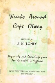
Book, J.K. Loney, Wrecks around Cape Otway
... Otway Districts Historical Society Cliff Young Drive Beech Forest great-ocean-road History of shipwrecks and strandings from Port Campbell to Anglesea, with photographs, locations and gravesites, and some mention of areas either side of the main wrecks. cape otway; shipwrecks; strandings; port campbell; anglesea; apollo bay; lorne; j.k. loney; Wrecks around Cape Otway. ...History of shipwrecks and strandings from Port Campbell to Anglesea, with photographs, locations and gravesites, and some mention of areas either side of the main wrecks.Wrecks around Cape Otway. Shipwrecks and strandings from Port Campbell to Anglesea. J.K. Loney. 1st ed. Apollo Bay (Vic); J.K. Loney; nd. iv, 50 p.; illus. Soft cover.cape otway; shipwrecks; strandings; port campbell; anglesea; apollo bay; lorne; j.k. loney; -
 Otway Districts Historical Society
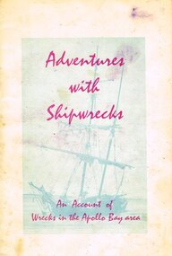
Book, Adventures with shipwrecks
... Otway Districts Historical Society Cliff Young Drive Beech Forest great-ocean-road An account shipwrecks from 1880 to 1958 in the Apollo Bay area. apollo bay; j.k. loney; shipwrecks; apollo bay; j.k. loney; shipwrecks; Adventures with shipwrecks. ...An account shipwrecks from 1880 to 1958 in the Apollo Bay area.Adventures with shipwrecks. An account of wrecks in the Apollo Bay area. J.K. Loney. 1st ed. Apollo Bay (Vic); J.K. Loney; nd. 20 p.; illus, map. Soft cover.222mm x apollo bay; j.k. loney; shipwrecks;, apollo bay; j.k. loney; shipwrecks; -
 Otway Districts Historical Society
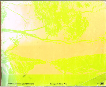
Book, Land Conservation Council, Report on the Corangamite Study Area, May 1976
... Otway Districts Historical Society Cliff Young Drive Beech Forest great-ocean-road The Report describes and assesses the natural resources of public land in the Corangamite study area, and provides a factual basis on which members of the community may base their submissions to the Council. ...The Report describes and assesses the natural resources of public land in the Corangamite study area, and provides a factual basis on which members of the community may base their submissions to the Council.Report on the Corangamite study area. Land Conservation Council. Melbourne; Land Conservation Council; May 1976. x, 310 p.; illus, maps (separate). Soft cover.land conservation council; corangamite; geology; physiography; climate; water resources; soils; vegetation; fauna; -
 Otway Districts Historical Society
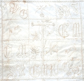
Textile - Quilt, Mrs Perkins, empty, c. 1903
... The Otways Quilt is believed to have originated with the Perkins family, landholders in the Beech Forest area. ...Otway Districts Historical Society Cliff Young Drive Beech Forest great-ocean-road The Otways Quilt is believed to have originated with the Perkins family, landholders in the Beech Forest area. ...The Otways Quilt is believed to have originated with the Perkins family, landholders in the Beech Forest area. Some of the names or initials on the quilt have been tentatively identified with other farmimg families in the same district.A rectangular quilt hand embroidered in white on 20 square panels, with the names or initlals of settlers in the Otway district, and surrounded with an edging of floral embroidery. It is made of polished cotton backed with cotton sheeting.quilt, beech forest, otway, needlework, perkins -
 Otway Districts Historical Society
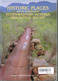
Book, Land Conservation Council, Historic places: Special investigation: South-Western Victoria: Descriptive report, January 1996
... Otway Districts Historical Society Cliff Young Drive Beech Forest great-ocean-road The south-west of Victoria, possessing a rich heritage of the signs of past human activity, is fertile ground for an investigation of historic places on public land. This report includes an initial inventory of almost 2000 places. The report outlines the history and the related heritage of the area ...The south-west of Victoria, possessing a rich heritage of the signs of past human activity, is fertile ground for an investigation of historic places on public land. This report includes an initial inventory of almost 2000 places. The report outlines the history and the related heritage of the area, describes in some detail its biophysical attributes and introduces the natural resources and present land use. This information provides a context for understanding the origins of the historical features that are observes today.Historic places: Special investigation: South-Western Victoria: Descriptive report. Land Conservation Council. Land Conservation Council; Melbourne (Vic); January 1966. viii, 180 p.; illus.; maps. Soft cover. ISBN 0 7241 9288 3Maps in plastic sleeve.land conservation council; conservation; south-western victoria; historic places; -
 Otway Districts Historical Society
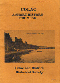
Book, Colac and District Historical Society, Colac. A short history from 1837, After 1981
... Otway Districts Historical Society Cliff Young Drive Beech Forest great-ocean-road This is a time line of Colac, Victoria, giving a short history of the area, some early pioneers of the district, and a brief political history of the representatives of Colac. ...This is a time line of Colac, Victoria, giving a short history of the area, some early pioneers of the district, and a brief political history of the representatives of Colac.Colac. A short history from 1837. Colac and District Historical Society. Colac and District Historical Society; Colac (Vic); nd. 24 p.; illus. Soft cover. colac; time line; history; pioneers; political representatives; colac and district historical society. -
 Otway Districts Historical Society
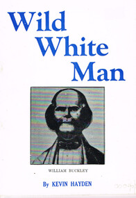
Book, Marine History Publication, Wild White Man
... In about 1835 he was discovered by three white men, members of John Batman's Port Phillip Association investigating the area with a view to future settlement. William Buckley; Aborigines; Otway Ranges; Wild white man. ...William Buckley was born in 1780 at Macclesfield, Cheshire, England. After time as a bricklayer and soldier he was caught with stolen property, sentenced on 2 August 1802, and transported to Australia. Between October, 1803, and January, 1804, he escaped from Sullivan's Bay in the Port Phillip district and spent the next 32 years in the company of aborigines wandering between Port Phillip and the near western district as far as Lake Corangamite. In about 1835 he was discovered by three white men, members of John Batman's Port Phillip Association investigating the area with a view to future settlement.Wild white man. Kevin Hayden. Marine History Publications; Geelong (Vic); nd. 28 p.; illus.; map. Soft cover.william buckley; aborigines; otway ranges; -
 Otway Districts Historical Society
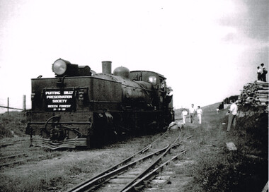
Photograph, Ray Jude, Beech Forest: engine leaving balloon loop, 1959, 21 November 1959
... Otway Districts Historical Society Cliff Young Drive Beech Forest great-ocean-road beech forest; railways; B/W. Engine G41, showing the sign "Puffing Billy Preservation Society, Beech Forest, 21-11-59", leaves the balloon loop at Beech Forest Railway Station, with guard and child hanging from the engine. A number of people are in the area ...B/W. Engine G41, showing the sign "Puffing Billy Preservation Society, Beech Forest, 21-11-59", leaves the balloon loop at Beech Forest Railway Station, with guard and child hanging from the engine. A number of people are in the area, particularly two on top of a stack of timber. beech forest; railways;