Showing 17 items matching "preferred option "
-
 Bendigo Military Museum
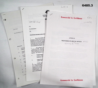
Document - Army Topographic Support Establishment: Preferred In-House Option, 1 23 Nov 1993, .2 30 Nov 1994, .3 14 Jun 1995
... Army Topographic Support Establishment: Preferred In-House Option...Army Topographic Support Establishment: Preferred In-House Option....1 The Preferred In-House Option (PIHO) proposes to meet the full requirements of the Request for Tender (RFT) by disestablishing Army Survey Regiment and establishing a new organisation which they have named the Defence Topographic Support Establishment (DTSE). ....1 Preferred In-House Option, Army Topographic Support Establishment. ...Army Topographic Support Establishment: Preferred In-House Option Document Army Topographic Support Establishment: Preferred In-House Option ....1 The Preferred In-House Option (PIHO) proposes to meet the full requirements of the Request for Tender (RFT) by disestablishing Army Survey Regiment and establishing a new organisation which they have named the Defence Topographic Support Establishment (DTSE). It is proposed to locate the DTSE at Bendigo in the GFE facilities offered by the Commonwealth. The DTSE will be staffed by 140 Defence civilians, principally sourced from ex-RASvy members transferring to the Public Service under the provisions of Section 81B of the Public Service Act. Any existing civilian members excess to DTSE requirements are proposed to be managed within the terms and conditions of the Australian Public Service Redeployment and Retirement (Redundancy) Award 1987. Military members who elect to remain in the Service will be subject to redeployment or retraining in accordance with Service requirements. .2 Proposed re-organisation of Product Construction Squadron (PCS). Due to the transfer of Image and capture Sections to Digital Acquisition Squadron wef Jan 1995 it has been necessary to review the structure of those elements remaining within PCS. The review highlighted that there was an imbalance between Mapping and Digital products Troops. This could only be resolved by collapsing these two Troops into one single production element. This would halve the senior administrative personnel needed thus allowing them to be employed in other higher priority technical areas. The proposed restructure of PCS is outlined in Annex A with redundant personnel listed in Annex B. The combined Troop is to be designated "Construction Troop" and comprises 1 Offr and 69 ORs. The role of this Tp would be to perform all digital production. It is further divided into small and Large Format Sections. This division is functionally based and reflects the hardware and software configurations now resident within the Sqn post system upgrade. .3 During the transition period leading to full implementation of the PHIO, the Army Svy Regt and DTSE (later ATSE) will at times operate concurrently whilst Army Svy Regt scales down production and progressively transfers all technical functions to DTSE. army Svy Regt and 4 Fd Svy Sqn will continue programmed production activities until declared operationally ineffective, however a contingency mapping capability will be maintained throughout the period of implementation. Implementation of the PHIO involves a number of related activities including staff recruitment, equipment acquisition and transfer of technical responsibility. This instruction details the coordination of these and related implementation activities. .1 Preferred In-House Option, Army Topographic Support Establishment. Summary of Tender. 10 x pages typed text and schematic diagrams. .2 Proposed reorganisation - product Construction Squadron. 9 x pages typed text and schematic diagrams. .3 Implementation of the Commercial Support Program (CSP) Digital Topographical support to the Australian Defence Force (ADF). Preferred In-House Option 14 Jun 1995. 22 x pages typed text and schematic diagrams. royal australian survey corps, rasvy, fortuna, army svy reg, army survey regiment, atse -
 Federation University Historical Collection
Book, Alex Sideratos et al, Anderson's Mill Smeaton - Main Report. Student Project, 1992
... ...preferred option & cost analysis...Student Project. anderson's mill smeaton alex sideratos ozlem soyogul michael pearlman jane lennon chris smith simon nelly barry golding russel dawe margaret giles ross squires executive summary introduction methodology swot analysis site analysis concept/product analysis summary of market research other development options to consider community involvement preferred option & cost analysis marketing recommendations management issues conclusion the courier ballarat department of conservation and natural resources creswick business promotions committee creswick daylesford kingston allendale flour mill anderson brothers convent gallery daylesford Mill restaurant Malmsbury oat mill White bound book of 80 pages and includes five appendices. ...Anderson's Mill Smeaton - Main Report. Student Project.White bound book of 80 pages and includes five appendices.anderson's mill, smeaton, alex sideratos, ozlem soyogul, michael pearlman, jane lennon, chris smith, simon nelly, barry golding, russel dawe, margaret giles, ross squires, executive summary, introduction, methodology, swot analysis, site analysis, concept/product analysis, summary of market research, other development options to consider, community involvement, preferred option & cost analysis, marketing recommendations, management issues, conclusion, the courier ballarat, department of conservation and natural resources, creswick business promotions committee, creswick, daylesford, kingston, allendale, flour mill, anderson brothers, convent gallery daylesford, mill restaurant malmsbury, oat mill -
Whitehorse Historical Society Inc.
Article, Support for mergers, 1994
... Nunawading Council resident survey revealed 25% favoured a Nunawading / Box Hill merger, which is the Nunawading Council's preferred option. Other favoured options ranged from 10% to 19%....Local government Amalgamations City of Nunawading City of Box Hill City of Whitehorse City of Ringwood City of Doncaster and Templestowe City of Waverley Nunawading Council resident survey revealed 25% favoured a Nunawading / Box Hill merger, which is the Nunawading Council's preferred option Nunawading Council resident survey revealed 25% favoured a Nunawading / Box Hill merger, which is the Nunawading Council's preferred option. ...Nunawading Council resident survey revealed 25% favoured a Nunawading / Box Hill merger, which is the Nunawading Council's preferred optionNunawading Council resident survey revealed 25% favoured a Nunawading / Box Hill merger, which is the Nunawading Council's preferred option. Other favoured options ranged from 10% to 19%.Nunawading Council resident survey revealed 25% favoured a Nunawading / Box Hill merger, which is the Nunawading Council's preferred optionlocal government, amalgamations, city of nunawading, city of box hill, city of whitehorse, city of ringwood, city of doncaster and templestowe, city of waverley -
 Melbourne Tram Museum
Document - Report, Public Transport Unions and Victorian Trades Hall Council, "Upgrade the Trains, Keep Sydney Road Trams - Position Paper on the Upfield Public Transport Corridor", Mar. 1989
... Notes the issues with the project, experience on the conversion of the St Kilda and Port Melbourne lines, level crossings and staffing. 1586.1 - as above but the full report - 66 pages, stapled along the side with clear plastic front, white card rear cover with a table of contents, including notes on the North-South rail (St Kilda and Port Melbourne) - experience to date, critique on The Met's Upfield line study, the Union's preferred option, Benefits of preferred option and the role of light rail, appendices and recommendations....Notes the issues with the project, experience on the conversion of the St Kilda and Port Melbourne lines, level crossings and staffing. 1586.1 - as above but the full report - 66 pages, stapled along the side with clear plastic front, white card rear cover with a table of contents, including notes on the North-South rail (St Kilda and Port Melbourne) - experience to date, critique on The Met's Upfield line study, the Union's preferred option, Benefits of preferred option and the role of light rail, appendices and recommendations. ...1586 - Photocopy - report - 9 A4 sheets stapled in the top left hand corner, titled "Upgrade the Trains, Keep Sydney Road Trams - Position Paper on the Upfield Public Transport Corridor - Executive Summary", setting out the Union view of the conversion of the Upfield line to light rail. Notes the issues with the project, experience on the conversion of the St Kilda and Port Melbourne lines, level crossings and staffing. 1586.1 - as above but the full report - 66 pages, stapled along the side with clear plastic front, white card rear cover with a table of contents, including notes on the North-South rail (St Kilda and Port Melbourne) - experience to date, critique on The Met's Upfield line study, the Union's preferred option, Benefits of preferred option and the role of light rail, appendices and recommendations.trams, tramways, upfield light rail, sydney rd, unions, light rail -
 Bendigo Military Museum
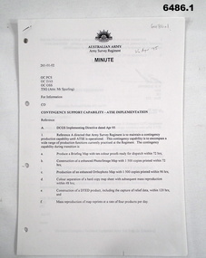
Document - Contingency Support Capability - Army Topographic Support Establishment (ATSE) Implementation, Army Survey Regiment, Bendigo, Apr - Jun 1995
... .1 The Minute details that the Army Survey Regiment is maintain a contingency production capability until ATSE is operational. .2 The Minute details the Data Aquisition Squadron requirements during the Implementation to ATSE. .3 The Minute details the Hardware, Software, Personnel and skills required during Implementation to ATSE. .4 The Instruction details that the non-core mapping, charting and geodetic (MC&G) activities of the Army Survey Regiment and 4 Fd Svy Sqn were tested under the Commercial Support Program (CSP) process resulting in the decision to award the contract for the provision of non-core mapping services to the ADF to the Preferred In-House Option (PIHO). ...Bendigo Military Museum 37 - 39 Pall Mall Bendigo goldfields .1 The Minute details that the Army Survey Regiment is maintain a contingency production capability until ATSE is operational. .2 The Minute details the Data Aquisition Squadron requirements during the Implementation to ATSE. .3 The Minute details the Hardware, Software, Personnel and skills required during Implementation to ATSE. .4 The Instruction details that the non-core mapping, charting and geodetic (MC&G) activities of the Army Survey Regiment and 4 Fd Svy Sqn were tested under the Commercial Support Program (CSP) process resulting in the decision to award the contract for the provision of non-core mapping services to the ADF to the Preferred In-House Option (PIHO). Royal Australian Survey Corps RASvy Fortuna Army Survey Regiment Army Svy Regt ASR ATSE .1 Contingency Support Capability - Army Topographic Support Establishment (ATSE) Implementation 26 Apr 95 (11 x A4 pages) .2 Data Acquisition Squadron (DAS) Contingency Support Capability - Army Topographic Support Establishment (ATSE) Implementation Apr 95 (4 x A4 Pages) .3 Contingency Support Capability - Army Topographic Support Establishment (ATSE) Implementation 28 Apr 95 (9 x A4 pages) .4 Directorate of Military Survey - Army Instruction for Implementation of the Army Topographic Support Establishment (ATSE) Jun 95 (10 x A4 pages) Contingency Support Capability - Army Topographic Support Establishment (ATSE) Implementation Document Contingency Support Capability - Army Topographic Support Establishment (ATSE) Implementation Army Survey Regiment, Bendigo Directorate of Military Survey, Canberra ....1 The Minute details that the Army Survey Regiment is maintain a contingency production capability until ATSE is operational. .2 The Minute details the Data Aquisition Squadron requirements during the Implementation to ATSE. .3 The Minute details the Hardware, Software, Personnel and skills required during Implementation to ATSE. .4 The Instruction details that the non-core mapping, charting and geodetic (MC&G) activities of the Army Survey Regiment and 4 Fd Svy Sqn were tested under the Commercial Support Program (CSP) process resulting in the decision to award the contract for the provision of non-core mapping services to the ADF to the Preferred In-House Option (PIHO). .1 Contingency Support Capability - Army Topographic Support Establishment (ATSE) Implementation 26 Apr 95 (11 x A4 pages) .2 Data Acquisition Squadron (DAS) Contingency Support Capability - Army Topographic Support Establishment (ATSE) Implementation Apr 95 (4 x A4 Pages) .3 Contingency Support Capability - Army Topographic Support Establishment (ATSE) Implementation 28 Apr 95 (9 x A4 pages) .4 Directorate of Military Survey - Army Instruction for Implementation of the Army Topographic Support Establishment (ATSE) Jun 95 (10 x A4 pages)royal australian survey corps, rasvy, fortuna, army survey regiment, army svy regt, asr, atse -
Bendigo Historical Society Inc.
Audio - Making Tracks, c1980s
... It opened in response to political pressures from provincial groups for decentralization, with the Victorian Railways preferring the cheaper option of expanding the existing Newport Workshops in suburban Melbourne. ...It opened in response to political pressures from provincial groups for decentralization, with the Victorian Railways preferring the cheaper option of expanding the existing Newport Workshops in suburban Melbourne. ...Bendigo Workshops is a railway workshop in Bendigo, Victoria, Australia. It is located in the north of the city beside the junction of the Swan Hill and Deniliquin railway lines. The site covers 10.3 hectares of land and has 31 separate buildings, including a 10,000 sqm main workshop building and six kms of railway track. The workshops were opened in November 1917 by the Victorian Railways. It opened in response to political pressures from provincial groups for decentralization, with the Victorian Railways preferring the cheaper option of expanding the existing Newport Workshops in suburban Melbourne. The 1980s were a time of restructuring, and on the breakup of the Victorian Railways the workshops passed to the State Transport Authority and then the Public Transport Corporation.Three Audio Files - by David Bennet, Davis Moon and Kevin Whelan who worked at the Bendigo Railway Workshops. The three share their working life memories history, bendigo, bendigo railway workshops -
 Bendigo Historical Society Inc.
Ephemera - V/Line Bendigo workshops 'Open Day' leaflet
... It opened in response to political pressures from provincial groups for decentralisation, with the Victorian Railways preferring the cheaper option of expanding the existing Newport Workshops in suburban Melbourne. ...It opened in response to political pressures from provincial groups for decentralisation, with the Victorian Railways preferring the cheaper option of expanding the existing Newport Workshops in suburban Melbourne. ...The workshops were opened in November 1917 by the Victorian Railways. It opened in response to political pressures from provincial groups for decentralisation, with the Victorian Railways preferring the cheaper option of expanding the existing Newport Workshops in suburban Melbourne. Furthermore, unemployment had risen in both Bendigo and Ballarat due to a decline in mining operations. The main work carried out was repairs and maintenance of existing wagons and locomotives, however during 1919-22 thirteen new steam locomotives were also built - eight DD class (1033 - 1037, 1047 - 1049) and five A2 class (1078 - 1082). From the 1950s onwards, numerous steam locomotives were scrapped at the workshops. During the years immediately following nominal dieselisation in 1968, they were, at times, cutting up locomotives at the rate of one every two to three weeks. The workshops were also the site of the first VR brass foundry, which was transferred to Newport by the 1960s. Also, throughout 1965, VLX louvred vans were constructed at the workshops, at a rate of one a week. Other tasks included spring manufacture, construction of stainless steel footwarmers, and assembly of pantographs for electric trains, with a staff of 720 employed during 1966. By the 1980s, refurbishment work was also being carried out on Melbourne suburban electric multiple units. The 1980s were also a time of restructuring, and on the breakup of the Victorian Railways the workshops passed to the State Transport Authority and then the Public Transport Corporation. With privatisation the workshops were closed, with the loss of 262 jobs. In February 1996, the workshops were taken over by A Goninan & Co. In October 1999 the workshops were purchased by Great Northern Rail Services, with A Goninan & Co remaining as a tenant. In February 2001 A Goninan & Co vacated the site. The workshops were redeveloped in 2002 at a cost of $6.5 million - $4 million from VicTrack, $2 million from the State Government Regional Infrastructure Development Fund and $500,000 by the City of Greater Bendigo. The Bendigo Rail Workshops at North Bendigo are currently used by Southern Shorthaul Railroad to maintain broad gauge rolling stock for Pacific National, V/Line, Metro Trains Melbourne and CFCLA.Typed document. A4 page folded in half. On tan paper. Document pertaining to Bendigo V/Line workshops open day. Map on inside of folded page. Undated document.train, v/line, workshops, open day -
 Bendigo Military Museum
Document - Disbandment of Army Survey Regiment Planning 1995, Army Survey Regiment, Bendigo, December 1995
... All postings, administration and stores and equipment returns are to be completed by this date. .2 Disbandment of Army Survey Regiment Planning Report 26 May 1995 - Develop possible courses of action for the disbandment of ASR with reference to Technical, Historical and Union Issues by 6 Jun 95. .3 Disbandment of Army Survey Regiment Disbandment Team 26 May 1995 - Allocation of Team Members and responsibilities. .4 Disbandment of Army Survey Regiment May 1995 - Minimum Contingency Technical Equipment List for transition to ATSE. .5 Disbandment of Army Survey Regiment Plan 23 Aug 1995 - During the transition period (1 Jul 95 - 1 Dec 1996) leading to the full implementation of the Preferred In House Option (PIHO) Army Svy Regt and ATSE will at all times operate concurrently whilst Army Svy Regt scales down production and progressively transfers all technical functions to ATSE. ...All postings, administration and stores and equipment returns are to be completed by this date. .2 Disbandment of Army Survey Regiment Planning Report 26 May 1995 - Develop possible courses of action for the disbandment of ASR with reference to Technical, Historical and Union Issues by 6 Jun 95. .3 Disbandment of Army Survey Regiment Disbandment Team 26 May 1995 - Allocation of Team Members and responsibilities. .4 Disbandment of Army Survey Regiment May 1995 - Minimum Contingency Technical Equipment List for transition to ATSE. .5 Disbandment of Army Survey Regiment Plan 23 Aug 1995 - During the transition period (1 Jul 95 - 1 Dec 1996) leading to the full implementation of the Preferred In House Option (PIHO) Army Svy Regt and ATSE will at all times operate concurrently whilst Army Svy Regt scales down production and progressively transfers all technical functions to ATSE. ....1 Disbandment of Army Survey Regiment (ASR) Planning19 May 1995. Reference A - DCGS Directive /95 Implementation of the In-house option for the provision of Digital Topographic Support to the ADF. Reference B - Army Svy Regt 623-11-02 262/95 ADF Contingency Capability for the Provision of Topographic Data during the transition ASR to ATSE dated 12 May 1995. Reference A directs the ASR to be disbanded by 1 Dec 1996. Planning for the Disbandment is to consist of the following: Phase 1 - Development of Draft Outline Plan (1) Determine the Aim, Limitations and factors to be considered in the appreciation into the disbandment, (2) Conduct an appreciation to determine the best course of action, (3) Develop an Outline Plan for the Best Course of Action. (4) Brief DSVY-A and staff on the proposed Outline Plan. Phase 2 - Review of the Outline Plan by DSVY-A and issue further guidance. Phase 3 - Develop the Detailed plan including project management strategy. The disbandment is to achieve the smooth transition of operational responsibility to ATSE. The responsibility and resources to maintain the Minimum Operational Capability outlined in Reference B is to be formally passed to ATSE prior to disbandment. Proposed timings: Phase 1 completed by 1 Jun 95, Phase 2 completed by 15 Jun 95, Phase 3 complete d by 30 Jun 95, Disbandment completed by no later than 1 Dec 96 (Executive Order). All postings, administration and stores and equipment returns are to be completed by this date. .2 Disbandment of Army Survey Regiment Planning Report 26 May 1995 - Develop possible courses of action for the disbandment of ASR with reference to Technical, Historical and Union Issues by 6 Jun 95. .3 Disbandment of Army Survey Regiment Disbandment Team 26 May 1995 - Allocation of Team Members and responsibilities. .4 Disbandment of Army Survey Regiment May 1995 - Minimum Contingency Technical Equipment List for transition to ATSE. .5 Disbandment of Army Survey Regiment Plan 23 Aug 1995 - During the transition period (1 Jul 95 - 1 Dec 1996) leading to the full implementation of the Preferred In House Option (PIHO) Army Svy Regt and ATSE will at all times operate concurrently whilst Army Svy Regt scales down production and progressively transfers all technical functions to ATSE. Army Svy Regt will continue programmed production activities at best endeavor until declared operationally ineffective. During the transition to ATSE a contingency mapping capability is to be maintained. .6 Directorate of Survey - Army Commercial Support Program Digital Topographic Support to the ADF In-House Option Directive Dec 95. This directive defines the CSP contract management arrangements between the contract Administrator (DSVY-A) and the Contractor (ATSE) for the implementation and operation of the IHO for digital Topographic support to the ADF. .1 Disbandment of Army Survey Regiment Planning19 May 1995 - A4 paper clipped document, 4 x hole punched, 21 pages, diagrams and typed and hand written. .2 Disbandment of Army Survey Regiment Planning Report 26 May 1995 - A4 paper stapled document, 4 x hole punched, 9 pages, diagrams and typed and hand written. .3 Disbandment of Army Survey Regiment Disbandment Team 26 May 1995 - A4 paper stapled document, 4 x hole punched, 2 pages, typed. .4 Disbandment of Army Survey Regiment May 1995 - Minimum Contingency Technical Equipment for transition. A4 paper stapled document, 4 x hole punched, 2 pages, typed. .5 Disbandment of Army Survey Regiment Plan 23 Aug 1995 - A4 paper stapled document, 4 x hole punched, 10 pages, diagrams and typed. .6 Directorate of Survey - Army Commercial Support Program Digital Topographic Support to the ADF In-House Option Directive Dec 95. A4 paper clipped document, 4 x hole punched, 16 pages, diagrams and typed, hand written notes. royal australian survey corps, rasvy, fortuna, army survey regiment, army svy regt, atse, asr -
 Eltham District Historical Society Inc
Photograph, Tess Justine (Nillumbik Shire Council), Murray's Bridge over the Diamond Creek, Eltham North, 19 Feb 2022
... Allandale Road was the third option, but the Commissioners' preferred option was No. 2 - on Murray's property. • The Railway Commissioners were not going to finance any such station and the works had to be funded by private landowners and residents, hence Murray investing in this himself. • Murray recommenced work two years later and finished his bridge in 1931 but unfortunately for him, the proposed flag station never eventuated. ...Allandale Road was the third option, but the Commissioners' preferred option was No. 2 - on Murray's property. • The Railway Commissioners were not going to finance any such station and the works had to be funded by private landowners and residents, hence Murray investing in this himself. • Murray recommenced work two years later and finished his bridge in 1931 but unfortunately for him, the proposed flag station never eventuated. ...Murray's Bridge over the Diamond Creek on the Diamond Creek Trail just prior to demolition and replacement with a new steel bridge. Heritage advice obtained by Nillumbik Shire Council, following a suggestion by the Eltham District Historical Society (EDHS), is that the original bridge appears to have been a simplified version of the Country Roads Board’s (CRB) standard timber bridge design of the early-to-mid 1920s. In c1990 Murray’s bridge was renovated with three recycled steel girders as part of a bike/pedestrian path in the reserve. During these alterations many parts of the bridge were removed, and some were replaced. Heritage advice indicates the condition of Murray’s bridge is poor. The remaining original parts are all in poor condition, with severe weathering, splitting and rot, especially to the stringers retained on the bridge. Heritage advice is that Murray’s Bridge does not have sufficient significance in the cultural history of the Nillumbik area to warrant inclusion in the Nillumbik Shire Heritage Overlay and also does not have sufficient significance as a rare survivor to warrant inclusion in the Nillumbik Shire Heritage Overlay. There are no indications in the historical record that this site was individually important to the cultural history of this area. EDHS is comfortable with the heritage advice provided to Council and has worked closely on this project with Council. EDHS has suggested some of the removed timbers be used in the vicinity of the bridge for landscaping and possibly seating, so as to retain these remnants close to the site of the original bridge, which is the last old timber bridge along the lower reaches of the Diamond Creek. Mary (Sweeney) Murray and John Wright Murray selected 80 acres, Lot C Section 16 and Lot 5 Section 17 Parish of Nillumbik, under an occupation license in 1866. John died in 1867 and freehold was granted to his son John in 1873. The farm was known as ‘Laurel Hill’. John Junior was an Eltham Shire councillor and sometime president from 1887 up until 1897. He added Lot A Section 16 to the farm in ca1888. John and his younger brother James arranged to rent/purchase Lot B Section 17, across Diamond Creek to the west, in ca1900. It appears that John and James farmed separately for a few years, with a new homestead built for James ad family on the high point of Lot B Section 17 in ca1910. John sold off Lot 5 Section 17 in 1912. When John died in 1912 James took over the land on both sides of the Diamond Creek. The old homestead on the west side of the Creek disappeared. A farm bridge over Diamond Creek from this period may have been located close to the northern boundary of the farm. John Langlands, owner of the farm known as ‘Ihurst’ on the west side of Diamond Creek to the south of the Murray’s land, died in 1907. In 1909 his land was then subdivided into 100 lots to become the ‘Glen Park Estate’. Other similar subdivisions of nineteenth century farms around Eltham in this period included the ‘Franktonia (or Beard’s) Estate’ to the northeast and ‘Bonsack’s Estate’ between Eltham and Greensborough. Soon after the opening of the railway extension line from Eltham to Hurstbridge in 1912, Glen Park and nearby residents including James Murray agitated for a railway station or siding to be located half-way between Eltham and Hurstbridge, so that the Glen Park residents who used the railway daily did not have to walk into the Eltham or Hurstbridge stations. Some believed Coleman’s Corner (opposite Edendale Farm) was an appropriate spot for the platform. James Murray was among those who thought the railway should be located on his land, closer to half-way between Eltham and Hurstbridge stations. The Railways Commissioners warned that the locals would have to fund these works themselves. The Glen Park Estate residents initially had difficulty accessing Eltham by road, with only an old low-level bridge over Diamond Creek at the south end of their estate. A new timber trestle bridge across the creek, now on Wattletree Road, was opened in 1915. Road access to the north was gained in 1927 when the new Murray’s Road, which crossed the Murray’s land, was built. Residents continued to agitate for a Glen Park station. By 1926 the Railways Commissioners’ preferred site was on the Murray’s land. They arranged an estimate of cost of a full-length platform. The estimate was too much for the locals, who in 1928 argued unsuccessfully for a shorter and hence cheaper platform. By 1929 Murray had agreed to donate the land, but the locals would still have to fund the works. Murray decided, unilaterally it would appear, to commence work on a timber trestle road bridge over Diamond Creek to link the new Murray Road to the proposed station. Late in 1929 he stopped work on the bridge, for reasons unknown, but started work again and completed the bridge in 1931. There is no further newspaper evidence of the campaign for the Glen Park station until 1939, when Murray and another local, Mr Maxwell, met the Railways Commissioner. The Glen Park locale now included 45 homes on the west side of the creek and 20 on the Eltham side. Most of the residents used the train every day. The Commissioner remained adamant that only a full-length platform could be built for safety reasons. It appears the campaign dissolved at this point. The increasing move to cars may have had an impact. There is no evidence of Murray’s bridge ever being connected to Murray’s Road, or of it having wide use for any purpose by locals. James Murray died in 1947 and the farm was taken over by his son James (Jim). Jim started to sell off parts of the farm in the 1980s, retaining a few acres around the ca1910 homestead and building a new house there. Recreation reserves were established along the creek. In ca1990 Murray’s bridge was renovated with steel girders as part of a bike/pedestrian path in the reserve. The old farmhouse was demolished in ca2014. * * * A theory posted on local community Facebook groups was that the bridge was built in the 1860s and was built to be more robust than was necessary for the movement of cows from one side of the creek to the other. It was suggested the robustness was necessary to support the weight of gold ore being transferred from a mine on Murray’s land to a railway siding near Murrays Bridge (presumably for transfer and processing at Diamond Creek). Perhaps this may have been one of the motivators for Murray, who really knows? Knowing when mining operations ceased on his land and how that fits the overall timeline would be useful but at the time the bridge was built, local gold production was minimal at best. The known facts are: • The railway line came to Eltham in 1902. • The extension of the railway from Eltham to Hurstbridge was constructed in 1912 so no railway line even existed through Murray's property until 1912 and the Victorian Railways maps at the time show no such siding on Murray’s property. • In 1923 a new company was formed in anticipation of the old Diamond Creek Gold Mine being re-opened. The mine had been previously closed and flooded. It was noted in the press at the time that the mine was within a mile of the railway. Nothing really came of this. • Construction of Murrays Bridge was commenced by James Murray in early 1929 in anticipation of a proposed flag station being nominated on his land, but work ceased shortly afterwards. The proposed flag station was commonly referred to as Glen Park as the residents of the Glen Park Estate wanted Option 1, located near them with the platform adjacent to Colemans corner. This was probably never going to fly as it was virtually in eyesight of Eltham station. Allandale Road was the third option, but the Commissioners' preferred option was No. 2 - on Murray's property. • The Railway Commissioners were not going to finance any such station and the works had to be funded by private landowners and residents, hence Murray investing in this himself. • Murray recommenced work two years later and finished his bridge in 1931 but unfortunately for him, the proposed flag station never eventuated. The bluestone siding you reference may well have been built by Murray as part of the proposed station platform. • Up until then, apart from the Main Road bridge, which was washed away in 1924, virtually all local crossings over the Diamond Creek were low lying bridges – Kaylocks Bridge at Brougham Street, Diamond Street bridge, Glen Park Road bridge. It is expected that Murray also had a low-lying bridge to connect his land either side of the creek. These were all washed away or severely damaged multiple times in the 1920s. Lessons were learnt, and Murrays Bridge appears to have been built in accordance with Country Road Board standards of the time. Flood damage was ongoing, and even more recently constructed raised bridges kept getting washed away, e.g., the new Wattle Tree Road bridge in 1958 just months after completion. Murray’s bridge was reinforced with steel some 30 years ago presumably to provide additional floodwater resistance, given the history of bridges disappearing in floodwaters. • In March 1932 it was reported in the Advertiser that there were still some prospectors operating around Eltham North who apart from further scarring the face of the earth over the previous two years had gained significant experience but little gold - hardly a driving factor for constructing a dedicated railway siding and bridge to transfer gold ore. It is far more probable that James Murray was hoping to have the railway station located on his property and invested his money by building the bridge to lead to it as well as a station platform. Had the station eventuated, it may well have driven up the value of his land for subdivision and new housing estates like the Glen Park Estate. That did not eventuate. Whilst the bridge was indeed old (90 years), the core structure being completed in 1931, it had been modified substantially from original and hence had no significant historic value – i.e., it was not a representative example of its type, construction, and age. Given that the bridge was not worthy of saving, the Eltham District Historical Society with Council’s support, and the Eltham Woodworkers group endeavoured to see what suitable sized timbers were salvageable to fabricate a commemorative seat. Unfortunately, the experts at the Woodworkers group were unable to salvage any suitable length/width timbers to fabricate the seat due to the presence of rot. Last remaining wooden trestle bridge on the Diamond Creek Trail just prior to demolition and replacementBorn digital image (27)diamond creek (creek), diamond creek trail, murrays bridge, ‘laurel hill’, john wright murray, mary (sweeney) murra, john murray jnr, james murray, john langlands, ‘ihurst’, ‘glen park estate’, beard's estate, franktonia, bonsack's estate, glen park estate, glen park railway station -
Glen Eira Historical Society
Letter - Kooyong Road, 98, Caulfield North
... Simmonds acknowledging the previous letter and outlining which option the trustee’s prefer and how they wish to proceed. ...Simmonds acknowledging the previous letter and outlining which option the trustee’s prefer and how they wish to proceed. ...This file has 4 items: 1/Copy of letter dated October 4, 1972 from Blake and Riggall Solicitors, acting for the Trustees of the Estate of the F.C. Pederson to the tenant of trust property at 98 Kooyong Road, A.F. Gregson. Requests cooperation in inspection of premises for a possible rent increase to satisfy life tenant. Includes handwritten annotations possibly for valuation purposes. 2/Letters dated October 4, 1972 from Blake & Riggall to S.P. Simmonds Real Estate Agents concerning inspection of the relevant property, requesting opinion on a fair rental and valuation. 3/Copy of a letter dated October 17, 1972 from S.D. Simmonds to Blake & Riggall providing details of the relevant property, estimates of the cost of improving, options for increasing the life tenant’s income and a valuation. 4/Letter dated October 23, 1972 from Blake & Riggall to S.P. Simmonds acknowledging the previous letter and outlining which option the trustee’s prefer and how they wish to proceed. Discussion of property rates and annual insurance premiums. Includes handwritten notes.pederson f.c., gregson a.f., mackinnon i.d., pederson mrs., balaclava road, kooyong road, caulfield, brick houses, rents, land values, rates, renting -
 Eltham District Historical Society Inc
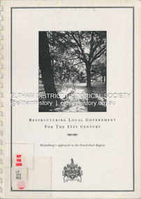
Document (Item) - Book, City of Heidelberg, Restructuring Local Government for the 21st Century: Heidelberg's approach to the North East Region, February 1994
... The City of Heidelberg's Council first preference is "no change" [to municipal restructure] but if this option is unacceptable, the Council would prefer to form larger municipality/municapilites involving the exisitng City of Heidelberg and the Shires of Diamond Valley and Eltham. ...Eltham District Historical Society Inc 728 Main Rd Eltham melbourne The City of Heidelberg's Council first preference is "no change" [to municipal restructure] but if this option is unacceptable, the Council would prefer to form larger municipality/municapilites involving the exisitng City of Heidelberg and the Shires of Diamond Valley and Eltham. ...The City of Heidelberg's Council first preference is "no change" [to municipal restructure] but if this option is unacceptable, the Council would prefer to form larger municipality/municapilites involving the exisitng City of Heidelberg and the Shires of Diamond Valley and Eltham. This report includes an exective summary, Introduction, A Brief History, Heidelberg and its [municiapl] neighbours now, opportunities for restructure, detailed analysis and preferred structure. Includes fold out maps.This report by the City of Heidleberg is a significant local contribution in the consultation leading to a significant change to local government in Victorian when, in 1994 the Kennett State government restructed local government. The reforms dissolved 201 Councils and created 78 new councils through amalgamations. In suburban Melbourne 53 municipalities were reduced to 26. The City of Heidelberg was amalgamated with parts of the Shire of Eltham and Diamond Valley to become the City of Banyule.annexation, council amalgamation, local government -
 Flagstaff Hill Maritime Museum and Village
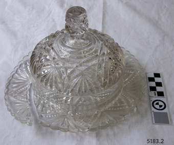
Domestic object - Butter Dish
... During the 19th century, many people preferred glass windows and doors as a decorative option. In the late 19th century, some designers brought back stained glass in decorative windows. ...During the 19th century, many people preferred glass windows and doors as a decorative option. In the late 19th century, some designers brought back stained glass in decorative windows. ...The art of making glass can be traced back to 2600 BC in Mesopotamia. Egyptians practised making glass around 2500 BC. Artificial glass first appeared in the Egyptian or the Mesopotamian civilization, whereas they used tools made out of volcanic glass obsidian in the Stone Age. Ancient China, however, discovered how to make glass a little later. Glass beads are known to be one of the earliest products made out of glass. Their creation is thought to be primarily accidental. In the later Bronze Age, glassmaking came to a halt. Glass was a luxury material back then. Archaeological excavations suggest the use of glass in England during the middle ages. In the 10th century, stained glass found a place in cathedrals and windows of palaces. After the Renaissance, architectural methods changed substantially, leading to a decrease in stained glass as a building material. Domestic use of glass increased following the industrial revolution. Vessels, glass windows, and glass beads gained popularity in Europe during this period. During the 19th century, many people preferred glass windows and doors as a decorative option. In the late 19th century, some designers brought back stained glass in decorative windows. It was during this period that Mr Tiffany discovered several methods to make domed glass handicrafts. People discovered the true versatility of using glass as a building material only in the 20th century. With glassmaking technology receiving an industrial boom, you could produce several different types of glass. Toughened glass, laminated glass, bulletproof glass, and smart glass all boosted the use of glass in buildings. Today, several skyscrapers, small and big homes, and offices use glass in almost all aspects of construction and design. https://www.aisglass.com/glass-made-step-step-process/The invention and development of glass, both as domestic items and in building, has been nothing short of revolutionary. Prior to the use of glass for windows, the interior of buildings were extremely dark, even during sunny days. The use of glass domestic objects, that could be easily washed, led to improved hygiene.Moulded patterned glass butter dish. Base has been broken.None.flagstaff hill, warrnambool, shipwrecked-coast, flagstaff-hill, flagstaff-hill-maritime-museum, maritime-museum, shipwreck-coast, flagstaff-hill-maritime-village, glass, kitchen item, butter -
 Flagstaff Hill Maritime Museum and Village
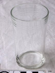
Domestic object - Glass
... During the 19th century, many people preferred glass windows and doors as a decorative option. In the late 19th century, some designers brought back stained glass in decorative windows. ...During the 19th century, many people preferred glass windows and doors as a decorative option. In the late 19th century, some designers brought back stained glass in decorative windows. ...The art of making glass can be traced back to 2600 BC in Mesopotamia. Egyptians practised making glass around 2500 BC. Artificial glass first appeared in the Egyptian or the Mesopotamian civilization, whereas they used tools made out of volcanic glass obsidian in the Stone Age. Ancient China, however, discovered how to make glass a little later. Glass beads are known to be one of the earliest products made out of glass. Their creation is thought to be primarily accidental. In the later Bronze Age, glassmaking came to a halt. Glass was a luxury material back then. Archaeological excavations suggest the use of glass in England during the middle ages. In the 10th century, stained glass found a place in cathedrals and windows of palaces. After the Renaissance, architectural methods changed substantially, leading to a decrease in stained glass as a building material. Domestic use of glass increased following the industrial revolution. Vessels, glass windows, and glass beads gained popularity in Europe during this period. During the 19th century, many people preferred glass windows and doors as a decorative option. In the late 19th century, some designers brought back stained glass in decorative windows. It was during this period that Mr Tiffany discovered several methods to make domed glass handicrafts. People discovered the true versatility of using glass as a building material only in the 20th century. With glassmaking technology receiving an industrial boom, you could produce several different types of glass. Toughened glass, laminated glass, bulletproof glass, and smart glass all boosted the use of glass in buildings. Today, several skyscrapers, small and big homes, and offices use glass in almost all aspects of construction and design. https://www.aisglass.com/glass-made-step-step-process/The invention and development of glass, both as domestic items and in building, has been nothing short of revolutionary. Prior to the use of glass for windows, the interior of buildings were extremely dark, even during sunny days. The use of glass domestic objects, that could be easily washed, led to improved hygiene.Cylindrical drinking glass with stepped relief around lipNoneflagstaff hill, warrnambool, shipwrecked-coast, flagstaff-hill, flagstaff-hill-maritime-museum, maritime-museum, shipwreck-coast, flagstaff-hill-maritime-village, glass -
Ballarat Tramway Museum
Document - Report, Connell Wagner, "Ballarat Heritage Tram Route Concept Engineering Assessment", Mar. 2002
... Has an introduction, looks at the concept for each section of the route with a photograph showing possible route, features, looks at passing loop locations, tram stop locations, substations, potential depot sites, concept construction costs and has maps of preferred route and alternative routes, depot options. Note folio page 40 assumes the track in the pavement at Armstrong St was the original track - not the replica crossing to the Phoenix foundry. ...Has an introduction, looks at the concept for each section of the route with a photograph showing possible route, features, looks at passing loop locations, tram stop locations, substations, potential depot sites, concept construction costs and has maps of preferred route and alternative routes, depot options. Note folio page 40 assumes the track in the pavement at Armstrong St was the original track - not the replica crossing to the Phoenix foundry. ...Seventy Seven page A4 size document, bound with clear plastic cover, black coloured card back cover using a black comb binder, titled "Ballarat Heritage Tram Route Concept Engineering Assessment". Produced by Connell Wagner for Booz Allen Hamilton as part of the project study for the return of trams to the central part of the City of Ballarat. Draft Document, dated 1/3/2002. Has an introduction, looks at the concept for each section of the route with a photograph showing possible route, features, looks at passing loop locations, tram stop locations, substations, potential depot sites, concept construction costs and has maps of preferred route and alternative routes, depot options. Note folio page 40 assumes the track in the pavement at Armstrong St was the original track - not the replica crossing to the Phoenix foundry. Has an index.trams, tramways, ballarat city tramway, ballarat revival, civil engineering, depot -
Ballarat Tramway Museum
Document - Report, Connell Wagner, "Ballarat Heritage Tram Route Concept Engineering Assessment", 22/03/2002 12:00:00 AM
... Has an introduction, looks at the concept for each section of the route with a photograph showing possible route, features, looks at passing loop locations, tram stop locations, substations, potential depot sites, concept construction costs and has maps of preferred route and alternative routes, depot options, concept construction costs, typical track cross sections and costing detail. ...Has an introduction, looks at the concept for each section of the route with a photograph showing possible route, features, looks at passing loop locations, tram stop locations, substations, potential depot sites, concept construction costs and has maps of preferred route and alternative routes, depot options, concept construction costs, typical track cross sections and costing detail. ...Forty Eight sheet A4 size document, unbound, printed mainly double sided "Ballarat Heritage Tram Route Concept Engineering Assessment". Produced by Connell Wagner for Booz Allen Hamilton as part of the project study for the return of trams to the central part of the City of Ballarat. Document, dated 1/3/2002. See Reg, Item 2273 for a bound draft version of this document. Has an introduction, looks at the concept for each section of the route with a photograph showing possible route, features, looks at passing loop locations, tram stop locations, substations, potential depot sites, concept construction costs and has maps of preferred route and alternative routes, depot options, concept construction costs, typical track cross sections and costing detail. Has an index.trams, tramways, ballarat city tramway, ballarat revival, civil engineering, depot -
Whitehorse Historical Society Inc.
Article, Ire over direction of Path Plan, 2016
... Another option the Group would prefer is the lowering of the tracks and the station to create a plaza there....Another option the Group would prefer is the lowering of the tracks and the station to create a plaza there....Another option the Group would prefer is the lowering of the tracks and the station to create a plaza there. ...The Blackburn Village Residents' Group wants a bike and pedestrian path along the north side of the railway line instead of the south side as proposed by council but the Whitehorse Council states this is not sensible.The Blackburn Village Residents' Group wants a bike and pedestrian path along the north side of the railway line instead of the south side as proposed by council but the Whitehorse Council states this is not sensible. Another option the Group would prefer is the lowering of the tracks and the station to create a plaza there.The Blackburn Village Residents' Group wants a bike and pedestrian path along the north side of the railway line instead of the south side as proposed by council but the Whitehorse Council states this is not sensible.city of whitehorse, blackburn railway crossing, blackburn village residents' group, morrison, david -
 Whitehorse Historical Society Inc.
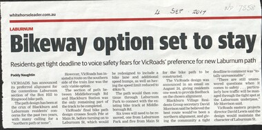
Article, Bikeway Option Set To Stay, 2017
... Whitehorse Historical Society Inc. 2-10 Deep Creek Road Mitcham melbourne bicycle paths laburnum vicroads middleborough road blackburn blackburn railway station laburnum street blackburn village residents group VicRoads has announced its preferred southern alignment of the bicycle path between Middleborough Road and Blackburn Railway Station with only one week for residents to respond. Bikeway Option ...VicRoads has announced its preferred southern alignment of the bicycle path between Middleborough Road and Blackburn Railway Station with only one week for residents to respond.bicycle paths, laburnum, vicroads, middleborough road, blackburn, blackburn railway station, laburnum street, blackburn village residents group