
Showing 67 items matching "railway road greensborough"
-
 Greensborough Historical Society
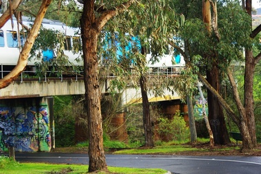
Photograph - Digital image, Marilyn Smith, Railway Road Rail Bridge over Plenty River Briar Hill, 17/09/2014
... railway road greensborough...Rail bridge over Railway Road Greensborough....Rail bridge over Railway Road Greensborough. railway road greensborough Digital copy of colour photograph Railway Road Rail Bridge over Plenty River Briar Hill Photograph - Digital image Marilyn Smith ...Rail bridge over Railway Road Greensborough.Digital copy of colour photographrailway road greensborough -
 Greensborough Historical Society
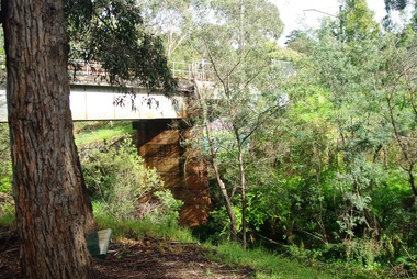
Photograph - Digital image, Marilyn Smith, Railway Road Rail Bridge over Plenty River Briar Hill, 17/09/2014
... railway road greensborough...Para Road near Railway Road Greensborough ...Para Road near Railway Road Greensborough railway road greensborough para road greensborough Digital copy of colour photograph Railway Road Rail Bridge over Plenty River Briar Hill Photograph - Digital image Marilyn Smith ...Para Road near Railway Road Greensborough Digital copy of colour photographrailway road greensborough, para road greensborough -
 Greensborough Historical Society
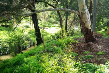
Photograph - Digital image, Marilyn Smith, On the Plenty River bank near Railway Road Briar Hill, 17/09/2014
... railway road greensborough...On the Plenty River bank near Railway Road Greensborough ...On the Plenty River bank near Railway Road Greensborough railway road greensborough plenty river Digital copy of colour photograph On the Plenty River bank near Railway Road Briar Hill Photograph - Digital image Marilyn Smith ...On the Plenty River bank near Railway Road Greensborough Digital copy of colour photographrailway road greensborough, plenty river -
 Greensborough Historical Society
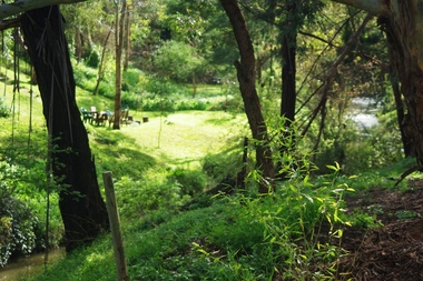
Photograph - Digital image, Marilyn Smith, On the Plenty River bank near Railway Road Briar Hill, 17/09/2014
... railway road greensborough...On the Plenty River bank near Railway Road Greensborough ...On the Plenty River bank near Railway Road Greensborough railway road greensborough plenty river Digital copy of colour photograph On the Plenty River bank near Railway Road Briar Hill Photograph - Digital image Marilyn Smith ...On the Plenty River bank near Railway Road Greensborough Digital copy of colour photographrailway road greensborough, plenty river -
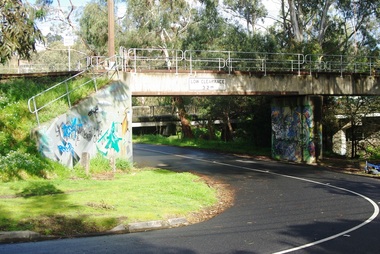 Greensborough Historical Society
Photograph - Digital image, Marilyn Smith, Railway Road Rail Bridge over Plenty River Briar Hill, 17/09/2014
... railway road greensborough...Rail bridge over Railway Road Greensborough, near Para Road....Rail bridge over Railway Road Greensborough, near Para Road. railway road greensborough para road greensborough Digital copy of colour photograph Railway Road Rail Bridge over Plenty River Briar Hill Photograph - Digital image Marilyn Smith ...Rail bridge over Railway Road Greensborough, near Para Road.Digital copy of colour photographrailway road greensborough, para road greensborough -
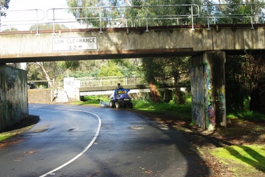 Greensborough Historical Society
Photograph - Digital image, Marilyn Smith, Railway Road Rail Bridge over Plenty River Briar Hill, 17/09/2014
... Rail bridge over Railway Road Greensborough....Rail bridge over Railway Road Greensborough. Digital copy of colour photograph Railway Road Rail Bridge over Plenty River Briar Hill Photograph - Digital image Marilyn Smith ...Rail bridge over Railway Road Greensborough.Digital copy of colour photograph -
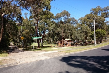 Greensborough Historical Society
Photograph - Digital Image, Marilyn Smith, E J Andrew Reserve, 16/01/2018
... The E J Andrew Reserve is situated in Railway Road Greensborough, near Sherbourne Road....The E J Andrew Reserve is situated in Railway Road Greensborough, near Sherbourne Road. e j andrew reserve briar hill Digital colour photograph E J Andrew Reserve Photograph - Digital Image Marilyn Smith ...The E J Andrew Reserve is situated in Railway Road Greensborough, near Sherbourne Road.Digital colour photographe j andrew reserve, briar hill -
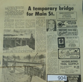 Greensborough Historical Society
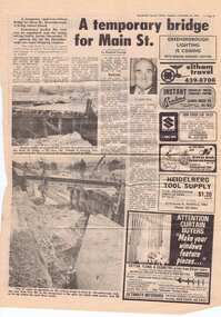
Newspaper clipping, A temporary bridge for Main Street, 24/10/1978
... greensborough...para road...railway...Leading up to the opening of Greensborough Plaza, traffic along Main Street was affected by the part closure due to the construction of a road bridge over the railway line....Significant infrastructure changes in Greensborough at the time of the opening of Greensborough Plaza in 1978. main street greensborough para road railway greensborough plaza Original news clipping (Item 904) and photocopy of same (Item 958). ...Leading up to the opening of Greensborough Plaza, traffic along Main Street was affected by the part closure due to the construction of a road bridge over the railway line.Significant infrastructure changes in Greensborough at the time of the opening of Greensborough Plaza in 1978.Original news clipping (Item 904) and photocopy of same (Item 958). Text and black and white images.main street greensborough, para road, railway, greensborough plaza -
 Greensborough Historical Society
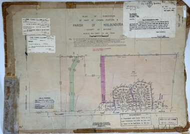
Poster - Planning Document, City of Heidelberg et al, Subdivision Plan # H 41 - Crown portion 8, Parish of Keelbundoora - Yallambie, and Crown Portion 9, Parish of Keelbundoora, 1922-1967
... Road, Allima Avenue, Koolya Court, Ekam Court (Jennings Estate). Side 2: Crown Portion 9, Parish of Keelbundoora consist of 5 small subdivision sheets: 1. Somers Avenue, Stewart Terrace, Toubay Street and Railway Place (no date); 2. Somers Avenue, Maxwell Street, Greensborough...Road, Allima Avenue, Koolya Court, Ekam Court (Jennings Estate). Side 2: Crown Portion 9, Parish of Keelbundoora consist of 5 small subdivision sheets: 1. Somers Avenue, Stewart Terrace, Toubay Street and Railway Place (no date); 2. Somers Avenue, Maxwell Street, Greensborough ...Planning Document: Subdivision Plan # H 41 Side 1, Crown portion 8, Parish of Keelbundoora - Yallambie Road, Allima Avenue, Koolya Court, Ekam Court (Jennings Estate). Side 2: Crown Portion 9, Parish of Keelbundoora consist of 5 small subdivision sheets: 1. Somers Avenue, Stewart Terrace, Toubay Street and Railway Place (no date); 2. Somers Avenue, Maxwell Street, Greensborough Road, 1924; 3. Heidelberg Avenue, Golf Avenue, St Andrews Avenue (no date); 4. Birdwood Avenue, May Street (no date); 5. Strathallan Road 1924.An example of hard copy subdivision plans from the Greensborough area. Mainly from the Shire of Diamond Valley era (1964-1994).Plan (2 sided) mounted on heavy card. Stamped and handwritten Council permissions, dates and other details.subdivision plans, city of heidelberg, yallambie, macleod, greensborough -
 Greensborough Historical Society
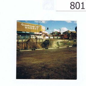
Photograph, Corner Para Road and Main Street Greensborough c1993, 1993_
... Road and Main Street Greensborough in 1993. The view also includes the Greensborough Hotel, the valley Buildings and the group of shops on the Para Rd corner named as Greensborough Valley Market. In the foreground it shows the Greensborough railway ...The photograph shows road works on the corner of Para Road and Main Street Greensborough in 1993.The view also includes the Greensborough Hotel, the valley Buildings and the group of shops on the Para Rd corner named as Greensborough Valley Market. In the foreground it shows the Greensborough railway station car park as unsealed.A colour photograph of a street scene.Nilpara rd, main st, greensborough, road works, valley buildings, greensborough hotel, greensborough valley market -
 Greensborough Historical Society
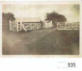
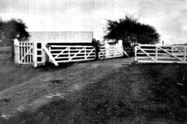
Photograph, Railway Gates at Grimshaw Street Greensborough, 1930c
... Two women are standing at the railway crossing gates, ready to open or close the gates [Possibly Iredale family?]. Originally thought to be the rail crossing at Grimshaw Street and Old Greensborough Road. ...Two women are standing at the railway crossing gates, ready to open or close the gates [Possibly Iredale family?]. Originally thought to be the rail crossing at Grimshaw Street and Old Greensborough Road. ...Two women are standing at the railway crossing gates, ready to open or close the gates [Possibly Iredale family?]. Originally thought to be the rail crossing at Grimshaw Street and Old Greensborough Road. In 2023, there is doubt that this is the case due to the double rail line and building in background. Please contact the Society if you have any idea where this is located.Copy of photo of railway gates. Sepia.On back: "Godwill from Val Wilson"railway gates, rail crossing, iredale -
 Greensborough Historical Society
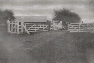
Photograph - Digital Image, Grimshaw Street rail crossing, 1930c
... Two women are standing at the railway crossing gates, ready to open or close the gates [Possibly Iredale family?]. Originally thought to be the rail crossing at Grimshaw Street and Old Greensborough Road. ...Two women are standing at the railway crossing gates, ready to open or close the gates [Possibly Iredale family?]. Originally thought to be the rail crossing at Grimshaw Street and Old Greensborough Road. ...Two women are standing at the railway crossing gates, ready to open or close the gates [Possibly Iredale family?]. Originally thought to be the rail crossing at Grimshaw Street and Old Greensborough Road. In 2023, there is doubt that this is the case due to the double rail line and building in background. Please contact the Society if you have any idea where this is located.Digital copy of black and white photograph.railway gates, iredale -
 Greensborough Historical Society
Photograph - Digital Image, Grimshaw Street Railway Gates and Crossing Greensborough, 1930c
... Two women are standing at the railway crossing gates, ready to open or close the gates [Possibly Iredale family?]. Originally thought to be the rail crossing at Grimshaw Street and Old Greensborough Road. ...Two women are standing at the railway crossing gates, ready to open or close the gates [Possibly Iredale family?]. Originally thought to be the rail crossing at Grimshaw Street and Old Greensborough Road. ...Two women are standing at the railway crossing gates, ready to open or close the gates [Possibly Iredale family?]. Originally thought to be the rail crossing at Grimshaw Street and Old Greensborough Road. In 2023, there is doubt that this is the case due to the double rail line and building in background. Please contact the Society if you have any idea where this is located.Digital copy of black and white photograph.rail crossing, iredale -
 Greensborough Historical Society
Newspaper clipping, A temporary bridge for Main Street, 24/10/1978
... Leading up to the opening of Greensborough Plaza, traffic along Main Street was affected by the part closure due to the construction of a road bridge over the railway line....Leading up to the opening of Greensborough Plaza, traffic along Main Street was affected by the part closure due to the construction of a road bridge over the railway line. ...Leading up to the opening of Greensborough Plaza, traffic along Main Street was affected by the part closure due to the construction of a road bridge over the railway line.Significant infrastructure changes in Greensborough at the time of the opening of Greensborough Plaza in 1978.Photocopy of news clipping (Item 958). Text and black and white images. -
 Greensborough Historical Society
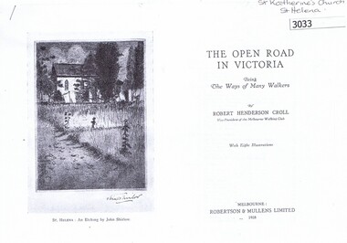
Article, Book, Robert Henderson Croll et al, The Open Road in Victoria: One day walks: St Helena, 1928_
... Description of a walk to St Helena via Greensborough Railway Station, including a detailed history and description of St Katherine's Church. 4p photocopy of an excerpt from 'The Open Road in Victoria', by Robert Henderson Croll. ...Description of a walk to St Helena via Greensborough Railway Station, including a detailed history and description of St Katherine's Church.4p photocopy of an excerpt from 'The Open Road in Victoria', by Robert Henderson Croll. Robertson and Mullens, 1928. -
 Greensborough Historical Society
Photograph - Digital image, Marilyn Smith, Railway Road Rail Bridge over Plenty River Briar Hill, 17/09/2014
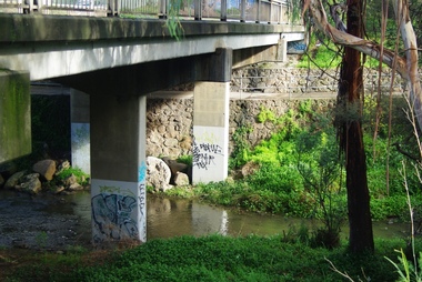
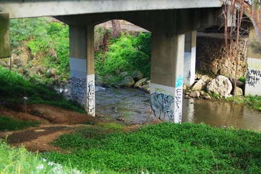
... Para Road bridge over Plenty River Greensborough, taken from the banks of the river. para road greensborough plenty river Digital copy of colour photograph Railway Road Rail Bridge over Plenty River Briar Hill Photograph - Digital image Marilyn Smith ...Para Road bridge over Plenty River Greensborough, taken from the banks of the river.Digital copy of colour photographpara road greensborough, plenty river -
 Greensborough Historical Society
Photograph - Digital image, Marilyn Smith, Railway Road Rail Bridge over Plenty River Briar Hill, 17/09/2014
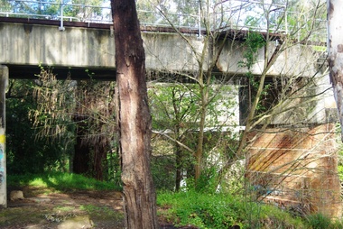
... Para Road bridge over Plenty River Greensborough, showing graffiti on bridge supports. para road greensborough plenty river Digital copy of colour photograph Railway Road Rail Bridge over Plenty River Briar Hill Photograph - Digital image Marilyn Smith ...Para Road bridge over Plenty River Greensborough, showing graffiti on bridge supports.Digital copy of colour photographpara road greensborough, plenty river -
 Greensborough Historical Society
Photograph - Digital image, Marilyn Smith, Railway Road Rail Bridge over Plenty River Briar Hill, 17/09/2014
... Para Road bridge over Plenty River Greensborough, taken from the banks of the river. para road greensborough plenty river Digital copy of colour photograph Railway Road Rail Bridge over Plenty River Briar Hill Photograph - Digital image Marilyn Smith ...Para Road bridge over Plenty River Greensborough, taken from the banks of the river.Digital copy of colour photographpara road greensborough, plenty river -
 Greensborough Historical Society
Map, Dianne Edwards, Part of Parish of Yan Yean 1878, 1978
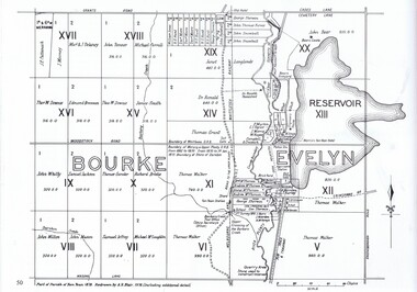
... Map includes Crown Portions V - XVII, showing Yan Yean Reservoir, Melbourne-Whittlesea Railway route, names of landowners, roads and various other features west of Greensborough Road. ...Map includes Crown Portions V - XVII, showing Yan Yean Reservoir, Melbourne-Whittlesea Railway route, names of landowners, roads and various other features west of Greensborough Road. ...Map includes Crown Portions V - XVII, showing Yan Yean Reservoir, Melbourne-Whittlesea Railway route, names of landowners, roads and various other features west of Greensborough Road. Redrawn by A. R. Blair in 1978.1 p. black and white photocopy of mapyan yean reservoir, yan yean -
 Greensborough Historical Society
Aerial Photograph, AAM Photographics, Heidelberg AAM1969c 086, 24/11/1991
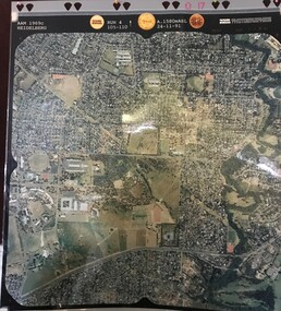
... One of a series of four overlapping aerial photographs of the Heidelberg/Greensborough areas in 1991, covering Simpson Barracks, Macleod, Rosanna, Viewbank, Watsonia & Yallambie. North boundary Yallambie Road; West boundary Hurstbridge railway....One of a series of four overlapping aerial photographs of the Heidelberg/Greensborough areas in 1991, covering Simpson Barracks, Macleod, Rosanna, Viewbank, Watsonia & Yallambie. North boundary Yallambie Road; West boundary Hurstbridge railway. simpson barracks yallambie watsonia macleod rosanna viewbank Laminated colour aerial photographs Heidelberg AAM1969c 086 Aerial Photograph AAM Photographics ...One of a series of four overlapping aerial photographs of the Heidelberg/Greensborough areas in 1991, covering Simpson Barracks, Macleod, Rosanna, Viewbank, Watsonia & Yallambie. North boundary Yallambie Road; West boundary Hurstbridge railway.Laminated colour aerial photographssimpson barracks, yallambie, watsonia, macleod, rosanna, viewbank -
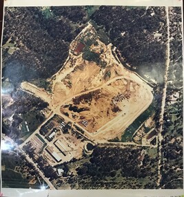 Greensborough Historical Society
Aerial Photograph, AAM Photographics, Heidelberg AAM1969c 088, 24/11/1991
... One of a series of overlapping aerial photographs of the Heidelberg/Greensborough area, covering Eaglemont, Heidelberg, Ivanhoe East & Viewbank. North boundary Hurstbridge railway, South boundary Ivanhoe East, East boundary Bulleen Road...One of a series of overlapping aerial photographs of the Heidelberg/Greensborough area, covering Eaglemont, Heidelberg, Ivanhoe East & Viewbank. North boundary Hurstbridge railway, South boundary Ivanhoe East, East boundary Bulleen Road eaglemont heidelberg ivanhoe east viewbank Laminated colour aerial photograph Heidelberg AAM1969c 088 Aerial Photograph AAM Photographics ...One of a series of overlapping aerial photographs of the Heidelberg/Greensborough area, covering Eaglemont, Heidelberg, Ivanhoe East & Viewbank. North boundary Hurstbridge railway, South boundary Ivanhoe East, East boundary Bulleen RoadLaminated colour aerial photographeaglemont, heidelberg, ivanhoe east, viewbank -
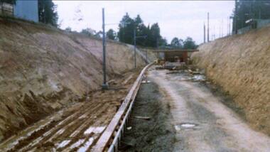 Greensborough Historical Society
Photograph - Digital Image, Watsonia Railway Station 1975, 1975_
... road level mid 1970s. This photograph shows work on the cutting and beginning of station. Watsonia Station was opened in 1977 when the rail line was lowered to remove level crossings and duplicate the line between Macleod and Greensborough. watsonia station hurstbridge rail line Digital copy of colour photograph Watsonia Railway Station 1975 Photograph - Digital Image ...Watsonia rail line being moved below road level mid 1970s. This photograph shows work on the cutting and beginning of station. Watsonia Station was opened in 1977 when the rail line was lowered to remove level crossings and duplicate the line between Macleod and Greensborough.Digital copy of colour photographwatsonia station, hurstbridge rail line -
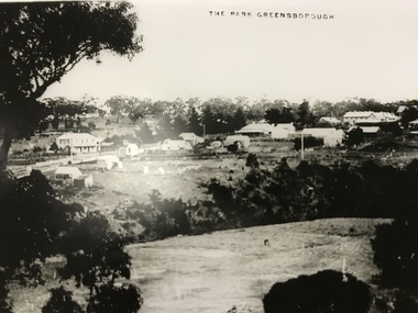 Greensborough Historical Society
Photograph, The Park Greensborough, 1900c
... View of Greensborough Park from Partington's Hill, showing sporting ground, Plenty River, Marble Hall, sparse housing on north side of Main Road, the Farmers' Arms hotel, the Rechabite Hall and Main Road bridge over the the railway line. ...View of Greensborough Park from Partington's Hill, showing sporting ground, Plenty River, Marble Hall, sparse housing on north side of Main Road, the Farmers' Arms hotel, the Rechabite Hall and Main Road bridge over the the railway line. ...View of Greensborough Park from Partington's Hill, showing sporting ground, Plenty River, Marble Hall, sparse housing on north side of Main Road, the Farmers' Arms hotel, the Rechabite Hall and Main Road bridge over the the railway line. Marble Hall is the double-storied building on the corner of Main Road.Part of a collection of 5 enlarged photographs dating from the early 1900s.Black and white enlargement of photographgreensborough park, main street greensborough, rechabite hall, farmers' arms hotel, marble hall, greensborough railway -
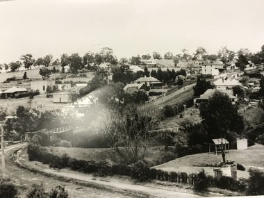 Greensborough Historical Society
Photograph, Main Road bridge looking to township of Greensborough, 1929c
... greensborough railway...chapman house...greensborough park...poulter avenue greensborough...carter street...para road...road approaching the bridge is unsealed. The rail bridge shows evidence of soot from steam trains and at the extreme left of picture the two concrete buildings indicate the line had been electrified. This occurred in 1923. Sparse housing is seen in the Flintoff Street and Grimshaw Street area. Part of a collection of photographic enlargements of views of Greensborough in the early 1900s. main street greensborough marble hall greensborough railway ...View of Main Street Greensborough from Partington's Hill including Plenty River bridge and Marble Hall on corner of Carter Street (now Para Road) and Main Street. This view of Greensborough Park shows the old pan toilets, the hawthorn fence line and the rather undeveloped roadside area of the park. Looking up Main Street we see the old Chapman house at the corner of Poulter Avenue and some newer houses below this. The stone river bridge appears to be only a single lane wide and the road approaching the bridge is unsealed. The rail bridge shows evidence of soot from steam trains and at the extreme left of picture the two concrete buildings indicate the line had been electrified. This occurred in 1923. Sparse housing is seen in the Flintoff Street and Grimshaw Street area.Part of a collection of photographic enlargements of views of Greensborough in the early 1900s.Black and white enlargement of photographic imagemain street greensborough, marble hall, greensborough railway, chapman house, greensborough park, poulter avenue greensborough, carter street, para road -
 Greensborough Historical Society
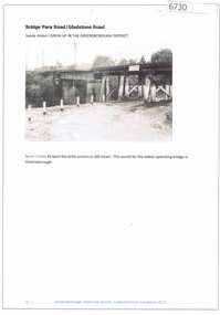
Article and Photograph, Bridge at Para Road and Gladstone Road, 2018_
... railway bridge greensborough...gladstone road...Information and photograph about the railway bridge at Para Road and Gladstone Road Greensborough....Any information is the opinion of the contributor. railway bridge greensborough gladstone road briar hill para road greensborough Article and photograph sourced from social media. ...Information and photograph about the railway bridge at Para Road and Gladstone Road Greensborough.This photograph and text was copied from a Facebook site. Members are people who lived in the Greensborough area and share their reminiscences of the area with others. The site is administered by a GHS member but is not officially affiliated with the Society. Any information is the opinion of the contributor. Article and photograph sourced from social media.railway bridge greensborough, gladstone road briar hill, para road greensborough -
 Eltham District Historical Society Inc
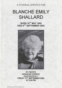
Document - Folder, Shallard family
... Road Montmorency...Greensborough Road Eltham...Eltham State School...Rechabites Hill Henry Street Eltham...Eltham Hotel...Boy Scouts Troup Eltham...Eltham District Cricket Association...First World War Memorial Tltham...Eltham Railway...Joseph Shallard Mary Emma Shallard nee Tinker Elizabeth Ann tinker nee Roberts Susan Shallard nee Roberts James roberts Sarah Roberts nee Pope Joseph Bromley Shallard William Shallard Joseph Tinker Jack Vincent Shallard Jocelyn Shallard Christopher Shallard Elsie Shallard nee Mills Meruka House Sherbourne Road Mary North Jack Shallard Blanche Shallard nee Everard Bill Everard Eltham Primary School Melbourne High School University of Melbourne Holy Trinity Church of England Kew St Margaret's Church of England Eltham St Faith's Church of England Montmorency Best Hooper Rintoul and Shallard Diamond Valley Community Hospital Blanche Emily Shallard nee Everard 63-65 Rattray Road Montmorency Jan Mullins Kerry Knowles Joy Neww Bruche Ness Les Robertson Marjorie North Eltham Festical Parade 1988 Opal Smith Eileen Gibbon Joyce Shallard Falkiner Street Eltham Bridge Street Eltham Karingal Drive Montmorency Sherbourne Road Montmorency "Kaweka" Sherbourne Road Montmorency Greensborough Road Eltham Eltham State School Rechabites Hill Henry Street Eltham Eltham Hotel Boy Scouts Troup Eltham Eltham District Cricket Association First World War Memorial Tltham Eltham Railway Station Newspaper clippings, A4 photocopies, etc Shallard family Document Folder ...Jack and Mary Emma Shallard and their three children, Bill, Joyce and Jack, moved to the Eltham area around 1912. Jack married Blanche Everard and lived in Montmorency and was active in community matters. Contents 1. Blanche Emily Shallard (1905-2002) • Photograph: Eltham Historical Society display at home of Joy and Bruce Ness 1987, Les Robertson, Jack Shallard, Blanche Shallard and Margorie North. • Photograph: Eltham Historical Society float, Eltham Festival Parade 1988, Blanche Shallard, Opal Smith and Eileen Gibbon. • Newspaper death notice for Blanche Shallard, The Age, 12 September 2002. • Newspaper funeral notice for Blanche Shallard, The Age, 13 September 2002. • Order of Service: Blanche Emily Shallard, St Faith's Anglican Church, Montmorency, 13 September 2002. • Kathryn Deighton; Eulogy for Nana on behalf of her grandchildren • Eulogy for Blanche Shallard by Jan Mullins • Eulogy for Blanche Shallard by Kerry Knowles • Letter Sue Law to the Shallard family, 15 September 2002. Acknowledging contribution of Blanche Shallard to EDHS and seeking copies of eulogies. • Newspaper article: "Community honours a favourite resident", Diamond Valley Leader, 20 November 2002. Obituary of Blanche Emily Shallard with photograph. • Newspaper advertisement: "63 and 65 Rattray Road, Montmorency", Diamond Valley Leader, 12 March 2003 • Advertisement: Auction 5 April of 63 and 65 Rattray Road, Montmorency; publication unknown, p44; [on reverse, Advertisement 20 Parry Road, Eltham North] • Notes, undated, of Sue Law's recollections from Blanche Shallard. 2. Jack Vincent Shallard (1905-1991) • Manuscript and typed notes, no date: Memories of Eltham and district by Jack Shallard. • Newspaper article: "Jack Shallard will be sadly missed", Diamond Valley News, 18 June 1991. Obituary of Jack Shallard. 3. Joseph Bromley Shallard (1877-1965) • Photocopy page, October 1920, re Eltham, noting Joseph Bromley Shallard as a Councillor for Eltham. • Letter Elizabeth Pidgeon to Eltham District Historical Society, 20 March 2001: Seeking information on Shallard family of Eltham, provides information on Roberts and Tinker families. Newspaper clippings, A4 photocopies, etcjoseph shallard, mary emma shallard nee tinker, elizabeth ann tinker nee roberts, susan shallard nee roberts, james roberts, sarah roberts nee pope, joseph bromley shallard, william shallard, joseph tinker, jack vincent shallard, jocelyn shallard, christopher shallard, elsie shallard nee mills, meruka house sherbourne road, mary north, jack shallard, blanche shallard nee everard, bill everard, eltham primary school, melbourne high school, university of melbourne, holy trinity church of england kew, st margaret's church of england eltham, st faith's church of england montmorency, best hooper rintoul and shallard, diamond valley community hospital, blanche emily shallard nee everard, 63-65 rattray road montmorency, jan mullins, kerry knowles, joy neww, bruche ness, les robertson, marjorie north, eltham festical parade 1988, opal smith, eileen gibbon, joyce shallard, falkiner street eltham, bridge street eltham, karingal drive montmorency, sherbourne road montmorency, "kaweka" sherbourne road montmorency, greensborough road eltham, eltham state school, rechabites hill henry street eltham, eltham hotel, boy scouts troup eltham, eltham district cricket association, first world war memorial tltham, eltham railway station -
 Eltham District Historical Society Inc
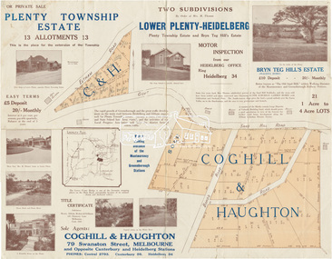
Map (item) - Sales Brochure, Plenty Township Estate and Bryn Teg Hill's Estate, Coghill & Haughton, Melbourne, c.1924
... Greensborough and the great traffic development on the main road between Heidelberg and Eltham augurs well for Plenty Township Estate. Already a Store, Post Office and State School have been started, and the activities of the Local Progress Association will help the district forward considerably. Within walking distance of the Montmorency and Greensborough stations." Bryn Teg Hill's Estate "Better known as "The Old Sand Hill, "within walking distance of the Montmorency and Greensborough railways...Greensborough and the great traffic development on the main road between Heidelberg and Eltham augurs well for Plenty Township Estate. Already a Store, Post Office and State School have been started, and the activities of the Local Progress Association will help the district forward considerably. Within walking distance of the Montmorency and Greensborough stations." Bryn Teg Hill's Estate "Better known as "The Old Sand Hill, "within walking distance of the Montmorency and Greensborough railways ...Plenty Township Estate "The rapid growth of Greensborough and the great traffic development on the main road between Heidelberg and Eltham augurs well for Plenty Township Estate. Already a Store, Post Office and State School have been started, and the activities of the Local Progress Association will help the district forward considerably. Within walking distance of the Montmorency and Greensborough stations." Bryn Teg Hill's Estate "Better known as "The Old Sand Hill, "within walking distance of the Montmorency and Greensborough railways stations." "Some few years back Mrs Thomas subdivided portion of the Sand Hill Paddocks, and the areas sold have been settled and many converted into charming outer suburban garden homes with cultivation and orchard plots. The south-eastern slope gives the land a grand outlook over the Yarra Valley on to the Dandenoings, and the are is very picturesque and homely." "A number of the blocks contain large deposits of valuable building sand, which should prove good speculation in view of the forecast for further rapid home development along the Eltham Suburban Electric Service." Sand Hills Road (Old Eltham Road) Date estimated as c.1924 - Electricification of railway line to Eltham referenced on map occured April 1923 and Mrs Mary Thomas died August 1925. Her home Bryn Teg became part of the Heidelberg Golf Club in 1927.The establishment of Lower Plenty as a suburban growth area supported by easy commuting facilitated by the elctrification of the Eltham railway linebonds road, bridge, bryn teg hill's estate, coghill & haughton, eltham road, heidelberg golf club hotel, houses, lower plenty, lower plenty bridge, lower plenty road, main road, plenty hotel, plenty river, plenty township estate, real estate agent, sales brochure, sand hills road, the old sand hill, sand hill paddocks, woodfull road, old eltham road, bryn teg, mrs m thomas -
 Eltham District Historical Society Inc
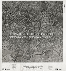
Photograph - Aerial Photograph, Central Plan Office, Eltham, Jan. 1960
... Road...Montmorency...Eltham...Eltham Lower Park...Heidelberg Golf Club...Hurstbridge Railway Line...Main Road Eltham...Yarra River...1960-01...Andrews Street...Arthur Street...Bolton Street...Briar Hill...Brougham Steet...Dave Lyon House...Eltham North...Eltham-Yarra Glen Road...Ernie Andrew house...Eucalyptus Road...Greensborough...Centred on Bolton Street and Brougham Street, Eltham bounded by Progress Road to north, Yarra River to south, Andrews Street and Euclyptus Road to east and Greensborough Railway Station to west. Historic Aerial Imagery Source: Central Plan Office Neg. .../Feb. 1960 Scale : 800 feet to 1 inch 37°43'18.2"S 145°08'13.0"E Melways : 21 J6 (ed. 42) Aerial Photo Lower Plenty Main Road Montmorency Eltham Eltham Lower Park Heidelberg Golf Club Hurstbridge Railway Line Main Road Eltham Yarra River 1960-01 Andrews Street Arthur Street Bolton Street Briar Hill Brougham Steet Dave Lyon House Eltham North Eltham-Yarra Glen Road Ernie Andrew house Eucalyptus Road Greensborough Railway Station henry street Karingal Road Melway 21J6 Montmorency Railway Station Mount Pleasant Road Progress Road railway road Southernwood Were Street Photo print on card 61 x 76 cm Eltham Photograph Aerial Photograph Central Plan Office ...Centred on Bolton Street and Brougham Street, Eltham bounded by Progress Road to north, Yarra River to south, Andrews Street and Euclyptus Road to east and Greensborough Railway Station to west. Historic Aerial Imagery Source: Central Plan Office Neg. No. 21451 (Print) Dept. of Lands & Survey and the Melb. & Metro. Board of Works. Aerial Photo Details: MELBOURNE METROPOLITAN AREA Section : 12 G West Date : Jan./Feb. 1960 Scale : 800 feet to 1 inch 37°43'18.2"S 145°08'13.0"E Melways : 21 J6 (ed. 42)aerial photo, lower plenty, main road, montmorency, eltham, eltham lower park, heidelberg golf club, hurstbridge railway line, main road eltham, yarra river, 1960-01, andrews street, arthur street, bolton street, briar hill, brougham steet, dave lyon house, eltham north, eltham-yarra glen road, ernie andrew house, eucalyptus road, greensborough railway station, henry street, karingal road, melway 21j6, montmorency railway station, mount pleasant road, progress road, railway road, southernwood, were street -
 Eltham District Historical Society Inc
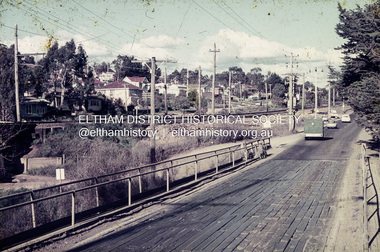
Slide, Russell Yeoman, Para Road (Carter Street) Bridge over the Plenty River, Briar Hill, Vic, July 1969
... Road on the Shire of Eltham side of the Plenty River and Carter Street on the Greensborough side. Google Street View Oct 2017: https://www.google.com.au/maps/@-37.7071433,145.1102785,3a,75y,119.82h,84.25t/data=!3m6!1e1!3m4!1sO-xWL1c1V6JVKNgxfhc_xQ!2e0!7i13312!8i6656 Briar Hill Film - Agfa Mount - Agfacolor Service (Blue) Para Road Railway ...Originally known as Para Road on the Shire of Eltham side of the Plenty River and Carter Street on the Greensborough side. Google Street View Oct 2017: https://www.google.com.au/maps/@-37.7071433,145.1102785,3a,75y,119.82h,84.25t/data=!3m6!1e1!3m4!1sO-xWL1c1V6JVKNgxfhc_xQ!2e0!7i13312!8i665635 mm colour positive transparency Mount - Agfacolor Service (Blue)July 1969briar hill, film - agfa, mount - agfacolor service (blue), para road, railway bridge, russell yeoman collection, scan - 35mm positive, bridge, carter street, para road bridge, railway line, 1969 -
 Eltham District Historical Society Inc
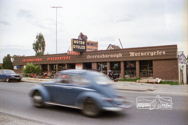
Negative - Photograph, Industrial development, Para Road, Briar Hill, c.1984
... Views of industrial sites and shop fronts on Para Road, Briar Hill including the business 'Greensborough Motorcycles'. Para Road, Briar Hill is parallel to the Hurstbridge Railway Line. ...Views of industrial sites and shop fronts on Para Road, Briar Hill including the business 'Greensborough Motorcycles'. Para Road, Briar Hill is parallel to the Hurstbridge Railway Line. ...Views of industrial sites and shop fronts on Para Road, Briar Hill including the business 'Greensborough Motorcycles'. Para Road, Briar Hill is parallel to the Hurstbridge Railway Line. The building 'Greensborough Motorcycles' was destroyed by fire in the early 2000s. Signage on building includes: 'Greensboröugh Motorcycles', 'International Discounters', 'Motor Cycles', and 'Mowers & Chainsaws' and 'Hutchinson's'.Roll of 35mm colour negative film, 4 stripsKodak CP 100 5094briar hill, greensborough, greensborough motorcycles, hutchinson's, industry, international discounters, para road, business, vw beetle
