Historical information
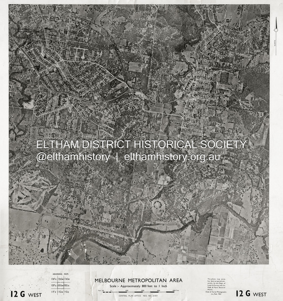
Centred on Bolton Street and Brougham Street, Eltham bounded by Progress Road to north, Yarra River to south, Andrews Street and Euclyptus Road to east and Greensborough Railway Station to west.
Historic Aerial Imagery
Source: Central Plan Office Neg. No. 21451 (Print)
Dept. of Lands & Survey and the Melb. & Metro. Board of Works.
Aerial Photo Details:
MELBOURNE METROPOLITAN AREA
Section : 12 G West
Date : Jan./Feb. 1960
Scale : 800 feet to 1 inch
37°43'18.2"S 145°08'13.0"E
Melways : 21 J6 (ed. 42)
Physical description
Photo print on card 61 x 76 cm
Subjects
- aerial photo,
- lower plenty,
- main road,
- montmorency,
- eltham,
- eltham lower park,
- heidelberg golf club,
- hurstbridge railway line,
- main road eltham,
- yarra river,
- 1960-01,
- andrews street,
- arthur street,
- bolton street,
- briar hill,
- brougham steet,
- dave lyon house,
- eltham north,
- eltham-yarra glen road,
- ernie andrew house,
- eucalyptus road,
- greensborough railway station,
- henry street,
- karingal road,
- melway 21j6,
- montmorency railway station,
- mount pleasant road,
- progress road,
- railway road,
- southernwood,
- were street