Showing 147 items matching "rainfall"
-
 Ringwood and District Historical Society
Register, T. Miles, Ringwood Rainfall Register incl Rainfall reading 1959-1969. Also newspaper article on Quambee and the Miles recording rainfall, 1969, 1959 - 1969
... Ringwood Rainfall Register incl Rainfall reading 1959-1969. ...Used by J Miles to record the rainfall at Quambe between 1959 - 1969...Buff coloured register for recording rainfall. Black printing on front. Instructions inside with 12 pages for recording rainfall and 13 loose pages. ...Instructions inside with 12 pages for recording rainfall and 13 loose pages. +Additional Keywords: Miles, J Ringwood Rainfall Register incl Rainfall reading 1959-1969. ...Used by J Miles to record the rainfall at Quambe between 1959 - 1969Buff coloured register for recording rainfall. Black printing on front. Instructions inside with 12 pages for recording rainfall and 13 loose pages. +Additional Keywords: Miles, J'Rain Register' Commonwealth Meteorology -
Dandenong & District Historical Society
Bland Family, Bland Family - Rainfall Charts
... Bland Family - Rainfall Charts...Bland Family - Rainfall Charts...Bland Family - Rainfall Charts...Dandenong & District Historical Society 1st Floor, 39 Clow Street Dandenong melbourne Bland Family - Rainfall Charts Bland Family - Rainfall Charts Bland Family - Rainfall Charts Bland Family ...Bland Family - Rainfall Charts -
Ringwood and District Historical Society
Envelope, Commonwealth Meteorology, Rainfall records kept by the Mile Family Ringwood (official record books). 1915-1958. History or Rainfall Observation at Ringwood 1969, 1915-1958
... History or Rainfall Observation at Ringwood 1969....Rainfall records kept by the Miles family; Three record books, rain register - Commonwealth Meteorology 1915-1925, 1937-1947, 1948-1958; History of Rainfall Observation at Ringwood: 13 February 1969; See also re rainfall collection 3466 2-3-3 Box 2; See also re rainfall collection 3993 2-7-05 Envelope +Additional Keywords: Temple Miles, A...Ringwood and District Historical Society 125A Warrandyte Road Ringwood North melbourne Rainfall records kept by the Miles family; Three record books, rain register - Commonwealth Meteorology 1915-1925, 1937-1947, 1948-1958; History of Rainfall Observation at Ringwood: 13 February 1969; See also re rainfall collection 3466 2-3-3 Box 2; See also re rainfall collection 3993 2-7-05 Envelope +Additional Keywords: Temple Miles, A Rainfall records kept by the Mile Family Ringwood (official record books). 1915-1958. ...Rainfall records kept by the Miles family; Three record books, rain register - Commonwealth Meteorology 1915-1925, 1937-1947, 1948-1958; History of Rainfall Observation at Ringwood: 13 February 1969; See also re rainfall collection 3466 2-3-3 Box 2; See also re rainfall collection 3993 2-7-05 Envelope +Additional Keywords: Temple Miles, A -
 Ballarat Tramway Museum
Newspaper, The Courier Ballarat, "Rainfall welcome despite the cold", 15/06/2004 12:00:00 AM
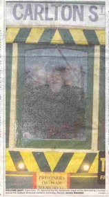
... "Rainfall welcome despite the cold"...Item was about the recent rainfall in Ballarat and the cold weather. ...Item was about the recent rainfall in Ballarat and the cold weather. ...Newspaper clipping from The Courier, Ballarat, 15/6/2004, featuring a colour photo of Frank Puls at the controls of a single trucker, contained within an item titled "Rainfall welcome despite the cold". Caption of photo is "Welcome Sight: Frank Puls, 72, operates the tiny windscreen wiper on his tram during a journey around the Ballarat Botanical Gardens yesterday." Picture Jeremy Bannister. Item was about the recent rainfall in Ballarat and the cold weather. On front cover is an item "A New Focus for Lake" about the Ballarat Tourist Association's focus on Lake Wendouree - notes the tram. Was continued on page 2. Notes that the area is a low cost tourist attraction. lake wendouree, weather, btm, tourism -
University of Melbourne, Burnley Campus Archives
Book - Register, Rainfall Registration, 1951-1983
... Rainfall Registration...Rainfall registration charts in a variety of forms recorded at Burnley. (1) 1 page handdrawn on cardboard, monthly and annual totals 1951-1978 (part). (2) 1974-1978 daily. (3) Unused forms. (4) 1980-1983. (5) Climatological Data for Melbourne up to 31st December 1964. ...Found in a folder labelled, "Burnley Weather Records." Rainfall Registration Book Register ...Rainfall registration charts in a variety of forms recorded at Burnley. (1) 1 page handdrawn on cardboard, monthly and annual totals 1951-1978 (part). (2) 1974-1978 daily. (3) Unused forms. (4) 1980-1983. (5) Climatological Data for Melbourne up to 31st December 1964. Found in a folder labelled, "Burnley Weather Records." rainfall registration, weather reports, climatological data -
Creswick Campus Historical Collection - University of Melbourne
Document, 1899-1990
... Rainfall records for Creswick, taken at School of Forestry 1899-1990. ...Rainfall records...These records are listed on Research Data Australia as a research set Rainfall records Document ...Rainfall records for Creswick, taken at School of Forestry 1899-1990. These records are listed on Research Data Australia as a research setRainfall records -
Ballarat Heritage Services
Photograph - Colour, Nigretta Falls after heavy rainfall, 2012, 18/08/2012
... Nigretta Falls after heavy rainfall, 2012...Nigretta Falls after heavy rainfall, 2012 Photograph - Colour ...Colour photographs of Nigretta Falls after heavy rain.nigretta falls, waterfall, flood -
 Kilmore Historical Society
Rainfall Records, Rainfall Records, Kilmore, 1902 - 1931, 1902 - 1931
... Rainfall Records, Kilmore, 1902 - 1931...Good condition. Rainfall Records, Kilmore, 1902 - 1931 Rainfall Records ...Four handwritten notebook, three black, one red. Red notebook has loose paper cover. The three black notebooks are worn. Good condition.rainfall records, kilmore east, westfield -
Whitehorse Historical Society Inc.
Article, Rain Man's daily drop-in centre, 1/10/2005 12:00:00 AM
... ...Rainfall...Article about volunteer Paul Smith's collection of data on daily rainfall since 1967....Whitehorse Historical Society Inc. 2-10 Deep Creek Road Mitcham melbourne Melbourne Water Rainfall Article about volunteer Paul Smith's collection of data on daily rainfall since 1967. ...Article about volunteer Paul Smith's collection of data on daily rainfall since 1967.Article about volunteer Paul Smith's collection of data on daily rainfall since 1967.Article about volunteer Paul Smith's collection of data on daily rainfall since 1967.melbourne water, rainfall -
Lakes Entrance Historical Society
Map - Alpine Study Area - Rainfall, Land Conservation Council
... ...rainfall...Map shows rainfall and water resources Golbourn River, Ovens River, Macalister Riverr Kiewa River, Mitta Mitta River, Murrary River and Snowy River...Lakes Entrance Historical Society 4 Marine Parade Lakes Entrance gippsland Water Resources rainfall study Map 5. Signature Ruth Clark Map shows rainfall and water resources Golbourn River, Ovens River, Macalister Riverr Kiewa River, Mitta Mitta River, Murrary River and Snowy River Map Alpine Study Area - Rainfall Land Conservation Council ...Map shows rainfall and water resources Golbourn River, Ovens River, Macalister Riverr Kiewa River, Mitta Mitta River, Murrary River and Snowy RiverMap 5. Signature Ruth Clarkwater resources, rainfall, study -
 Whitehorse Historical Society Inc.
Document, Melbourne water supply, 1932
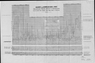
... ...rainfall...Melbourne and Metropolitan Board of Works, Melbourne water supply and sewerage diagrams showing water consumed, sewage pumped, rainfall and temperature, 1931....Whitehorse Historical Society Inc. 2-10 Deep Creek Road Mitcham melbourne melbourne and metropolitan board of works sewerage and sanitation rainfall temperature Melbourne and Metropolitan Board of Works, Melbourne water supply and sewerage diagrams showing water consumed, sewage pumped, rainfall and temperature, 1931. ...Melbourne and Metropolitan Board of Works, Melbourne water supply and sewerage diagrams showing water consumed, sewage pumped, rainfall and temperature, 1931.melbourne and metropolitan board of works, sewerage and sanitation, rainfall, temperature -
 Whitehorse Historical Society Inc.
Document, Melbourne water supply, 1937
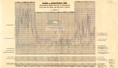
... ...rainfall...Diagrams showing water consumed, sewage pumped, rainfall and temperature, 1936....Diagrams showing water consumed, sewage pumped, rainfall and temperature, 1936. Melbourne water supply Document Document ...Melbourne and Metropolitan Board of Works. Melbourne water supply and sewerage. Diagrams showing water consumed, sewage pumped, rainfall and temperature, 1936.melbourne and metropolitan board of works, sewerage and sanitation, rainfall, temperature -
 Bendigo Historical Society Inc.
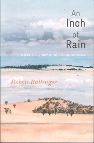
Book - 'An Inch of Rain' A water history of Northern Victoria by Robyn Ballinger
... Rainfall...Illustrated with B&W photos, maps and rainfall charts. Published 2012 by Australian Scholarly Publishing P/L, North Melbourne Printed by BPA Print Group ...History House 11 Mackenzie Street Bendigo goldfields Rainfall Northern Victoria Water 184-page soft cover book entitled 'An Inch of Rain' by Robyn Ballinger A water history of Northern Victoria. ...184-page soft cover book entitled 'An Inch of Rain' by Robyn Ballinger A water history of Northern Victoria. Illustrated with B&W photos, maps and rainfall charts. Published 2012 by Australian Scholarly Publishing P/L, North Melbourne Printed by BPA Print Group rainfall, northern victoria, water -
Glenelg Shire Council Cultural Collection
Administrative record - Rainfall Chart - Coffey's Lane, Heywood 1975, c. 1975
... Rainfall chart, single sided for 1975. Heavy card, buff coloured, block grid lines, rainfall figures in blue biro, promoting Elders-GM. ...Rainfall recorded at Coffeys Lane, Heywood. Administrative record Rainfall Chart - Coffey's Lane, Heywood 1975 ...Rainfall chart, single sided for 1975. Heavy card, buff coloured, block grid lines, rainfall figures in blue biro, promoting Elders-GM. Rainfall recorded at Coffeys Lane, Heywood. -
University of Melbourne, Burnley Campus Archives
Document, Burnley Weather Records, 1951-1980
... Rainfall charts, observations, notes, correspondence...University of Melbourne, Burnley Campus Archives 500 Yarra Boulevard Richmond melbourne rainfall charts observations burnley weather records Rainfall charts, observations, notes, correspondence Burnley Weather Records Document ...Rainfall charts, observations, notes, correspondencerainfall charts, observations, burnley, weather records -
Southern Sherbrooke Historical Society Inc.
Document - Rainfall records - Belgrave South
... All rainfall is measured in points. Rainfall recorded by Helen Gibson. ...All rainfall is measured in points. Rainfall recorded by Helen Gibson. ... -
 Bendigo Historical Society Inc.
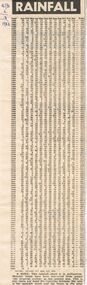
Newspaper - RAINFALL CHART, 1983
... Rainfall Chart; Bendigo Advertiser 2/3/1983. ...Chart shows rainfall from 1863 to1983. It is noted at the bottom that the rainfall chart is in millimetres. ...Rainfall Chart; Bendigo Advertiser 2/3/1983. Chart shows rainfall from 1863 to1983. It is noted at the bottom that the rainfall chart is in millimetres. Monthly totals have been converted from points (the imperial system) to the nearest mm. This is why there are some discrepancies between the sum of the monthly totals and the figure in the total column. Box 625bendigo, newspapers, bendigo advertiser, bendigo advertiser. rainfall chart. -
 National Wool Museum
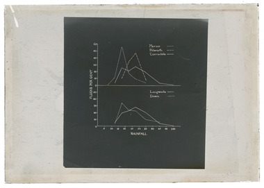
Negative - Graph, J W Allen, 1900 - 1940
... Black and white glass negative depicting a graph relating to sheep breeding and rainfall....New South Wales Graziers Association Travel Cattle Agriculture J W Allen Photography Negative Glass Lantern Slide Black and white glass negative depicting a graph relating to sheep breeding and rainfall. Negative Graph J W Allen ...This item is part of a collection of three unmounted black and white glass negatives previously housed together in a plain brown envelope. [8631 - 8633] The negatives are part of a greater collection of around forty three black and white glass lantern slides, along with other photographs and photo albums related to this collection. This item is associated with the New South Wales Graziers Association world tour of merino sheep 1928/9. The negatives were possibly used as supporting material in presentations made by J W Allen when on tour.Black and white glass negative depicting a graph relating to sheep breeding and rainfall.new south wales graziers association, travel, cattle, agriculture, j w allen, photography, negative, glass lantern slide -
 Whitehorse Historical Society Inc.
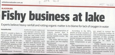
Article, Fishy Business At Lake, 28/03/2018 12:00:00 AM
... Heavy rainfall is likely to blame for the distressing sight of fish gasping for air at Blackburn Lake....Heavy rainfall is likely to blame for the distressing sight of fish gasping for air at Blackburn Lake. ...Heavy rainfall is likely to blame for the distressing sight of fish gasping for air at Blackburn Lake.Heavy rainfall is likely to blame for the distressing sight of fish gasping for air at Blackburn Lake.Heavy rainfall is likely to blame for the distressing sight of fish gasping for air at Blackburn Lake.blackburn lake, fish -
Glenelg Shire Council Cultural Collection
Administrative record - Rainfall Chart, c. 1974
... Rainfall chart, double sided, 1974 one side, 1979 the other. ...Administrative record Rainfall Chart ...Rainfall chart, double sided, 1974 one side, 1979 the other. Heavy card, buff coloured, green grid lines, rainfall figures in blue biro; promoting Castrol fuels. Red 'Sibley Motors Pty Ltd HEYWOOD AND PORTLAND', on both sides. -
 National Wool Museum
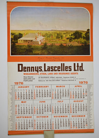
Dennys, Lascelles 1976 Calendar, 1976
... Woolbrokers, Stock, Land and Insurance Agents 1976 8032.2 - Rainfall Chart Dennys, Lascelles Limited...Woolbrokers, Stock, Land and Insurance Agents 1976 8032.2 - Rainfall Chart Dennys, Lascelles Limited Denny Lascelles 1976 Calendar with rain chart. ...The calendar was own by the donors father, John Arthur Ganly, who worked at Denny Lascelles most of his working life as an accountant. He started working at Denny's circa 1935 and stayed until he retired.Denny Lascelles 1976 Calendar with rain chart. The calendar has brown and orange accents. The "Meningoort" Homestead, Camperdown, 1861 from the original painting by Eugene von Guerard was used as the header image.8032.1 - Dennys, Lascelles Ltd. Woolbrokers, Stock, Land and Insurance Agents 1976 8032.2 - Rainfall Chart Dennys, Lascelles Limiteddenny lascelles, denny lascelles wool warehouse -
 Whitehorse Historical Society Inc.
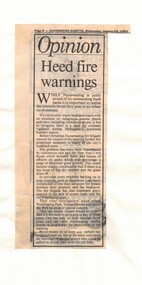
Article, Heed fire warnings, 22/01/1992 12:00:00 AM
... Article from the Nunawading Gazette 22 January 1992 warning of the fire threat in the area due to excessive rainfall....Whitehorse Historical Society Inc. 2-10 Deep Creek Road Mitcham melbourne bushfires nunawading fire brigade wandinong sanctuary yarran dheran antonio park mitcham blackburn lake sanctuary Nunawading Gazette 22 January 1992 warning of the fire threat in the area due to excessive rainfall. Article from the Nunawading Gazette 22 January 1992 warning of the fire threat in the area due to excessive rainfall. ...Nunawading Gazette 22 January 1992 warning of the fire threat in the area due to excessive rainfall.Article from the Nunawading Gazette 22 January 1992 warning of the fire threat in the area due to excessive rainfall.Nunawading Gazette 22 January 1992 warning of the fire threat in the area due to excessive rainfall.bushfires, nunawading fire brigade, wandinong sanctuary, yarran dheran, antonio park, mitcham, blackburn lake sanctuary -
 Kiewa Valley Historical Society
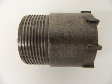
Drill Bit Diamond, circa mid to late 1900's
... ...rainfall...The use of "coring" to obtained samples for the SEC Kiewa Hydro Electricity Scheme(1920's onward) was to analyse the core to obtain temperature and rainfall patterns shown by the levels of layered solidified soil(rock). ...The use of "coring" to obtained samples for the SEC Kiewa Hydro Electricity Scheme(1920's onward) was to analyse the core to obtain temperature and rainfall patterns shown by the levels of layered solidified soil(rock). ...This hollow core bit has hard cutting inserts for drilling into rock. It was used to drill and recover 50mm diameter (most common size) rock cores. The rock cores were assessed by geologists and engineers to provide information for design of structures such as tunnels, dams and underground power stations (eg. McKay Creek Power Station, West Kiewa Power Station). This type of bit was also used where damage to the surrounding rock had to be minimised. The Diamond Drill Bit,used in the early 1900's, when it was primarily used as a method of sampling rock for ore deposits and oil exploration resulting in a "coring" of rock. The use of "coring" to obtained samples for the SEC Kiewa Hydro Electricity Scheme(1920's onward) was to analyse the core to obtain temperature and rainfall patterns shown by the levels of layered solidified soil(rock). This diamond drill would have been used in the early 1900's to provide a sub strata map of temperature and water patterns (over an long period of time). This was a pre requisite to any decisions about the viability of the region to provide the water needed for a successful hydro electricity scheme.This diamond drill for core sampling was at the forefront of the analysis whether to construct a hydro electrical facility in the Kiewa Valley and the adjoining alpine region. The rock core samples produced were assessed by geologists and structural engineers. It was only after extensive core drilling covering the region that solid scientific evidence could be provided to start the "SEC Vic Hydro Electricity Scheme" within its current boundaries.This "diamond" drill bit has eight "teeth" at its cutting edge. The drill creates an 55mm hole in extremely hard rock material to obtain 50mm core samples.. Three quarters down the shank it has thread screw channels to attach the bit to the drill pipe. The coring pipe attaches via screwing it onto this bit. Core samples are the main objective of this tool.alternate energy supplies, alpine feasibility studies temperature, rainfall, sec, kiewa hydro electric scheme, electricity -
 Federation University Historical Collection
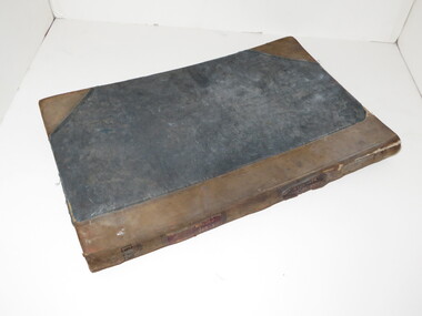
Book, Records of Meterological Data for Ballarat 1892-1897, 1892 - 1897
... The column headings are: (AM) Date, Barometer, Ther. of Bar., Wet Bulb., Dry Bulb, Maxim., Minim, Rainfall, Wind, Remarks and State of Weather (PM) Date, Barometer, Ther. of Bar., Wet Bulb., Dry Bulb, Maxim., Minim, Rainfall, Wind, Remarks and State of Weather....The column headings are: (AM) Date, Barometer, Ther. of Bar., Wet Bulb., Dry Bulb, Maxim., Minim, Rainfall, Wind, Remarks and State of Weather (PM) Date, Barometer, Ther. of Bar., Wet Bulb., Dry Bulb, Maxim., Minim, Rainfall, Wind, Remarks and State of Weather. ...A summary of meteorological data appears in the Ballarat School of Mines Annual Report for 1887 (P.35, 50). The last such summary appears in the Ballarat School of Mines Calendar 1901-2 (p58), which contains the data for the year 1900. No references have been found re names and job duties/positions of data collectors. The data was recorded by J. Matsen and A. Kiedahl.A charcoal grey hard covered, 120 page ledger, with brown leather spine and corners. The ledger has 31 special column heading, with the observed data added by hand. The column headings are: (AM) Date, Barometer, Ther. of Bar., Wet Bulb., Dry Bulb, Maxim., Minim, Rainfall, Wind, Remarks and State of Weather (PM) Date, Barometer, Ther. of Bar., Wet Bulb., Dry Bulb, Maxim., Minim, Rainfall, Wind, Remarks and State of Weather.Gold lettering on spine "Meteorological Observations: and on a glued on leather patch "School of Mines Ballarat" also in gold lettering. Written on inside front page: "Elevation of barometer 1420ft above Sea Level. To reduce barometric readings to Sea Level When Thermometer stands at 40 add 1.606 (to barometer) 45 " 1.590 50 " 1.574 55 " 1.559 60 " 1.543 65 " 1.528 70 " 1.528 80 " 1.499 85 " 1.471 90 " 1.457 95 " 1.444 100 " 1.431 Lightly hand written in pencil on the next page: "J. Matsen Feb 1891 to Feb 1894 - 3 years A. Kildahl Feb 1894 - " A circle has been place around the hottest temperature for the month. ballarat school of mines, smb, meteorology, j. matsen, a. kiedahl, kiedahl, matsen, rain, weather, meteorological data -
Clunes Museum
Booklet, CLUNES AND DISTRICT AGRICULTURAL SOCIETY, C. NOVEMBER 2022
... THIS EVENT WAS CANCELLED DUE TO HEAVY RAINFALL IN PRECEDING WEEKS....THIS EVENT WAS CANCELLED DUE TO HEAVY RAINFALL IN PRECEDING WEEKS. PROGRAM CLUNES AGRICULTURAL SHOW 68 PAGE BOOKLET WITH YELLOW COVER STAPLED. 2022 CLUNES & DISTRICT AGRICULTURAL SOCIETY INC. 160TH CLUNES SHOW 19TH NOVEMBER 2022. ...CLUNES & DISTRICT AGRICULTURAL SHOW. 160TH SHOW. THIS EVENT WAS CANCELLED DUE TO HEAVY RAINFALL IN PRECEDING WEEKS.68 PAGE BOOKLET WITH YELLOW COVER STAPLED. 2022 CLUNES & DISTRICT AGRICULTURAL SOCIETY INC. 160TH CLUNES SHOW 19TH NOVEMBER 2022. DETAILS INCLUDE PROGRAM OF EVENTS AND INFORMATION ABOUT ENTRY TO COMPETITIONS ETC.program, clunes agricultural show -
Glenelg Shire Council Cultural Collection
Functional object - Rainfall Chart - Sibley Motors Heywood, c. 1977
... Rainfall chart, double sided, 1977 one side, 1978 the other. ...Glenelg Shire Council Cultural Collection History House Cliff Street Portland great-ocean-road advertising 1977 Heywood Rainfall chart, double sided, 1977 one side, 1978 the other. ...Rainfall chart, double sided, 1977 one side, 1978 the other. Heavy card, buff coloured green grid lines, promoting Castrol fuels red Sibley Motors Heywood stamped on both sidesadvertising, 1977, heywood -
 Eltham District Historical Society Inc
Newspaper clipping, Eltham Festival postponed, Diamond Valley News Edition, 9 November, 2022
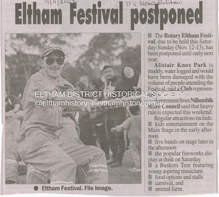
... Item on Eltham Festival being postponed to early 2023 due to Alistair Knox Park being waterlogged from substantial rainfalls...Eltham District Historical Society Inc 728 Main Rd Eltham melbourne Item on Eltham Festival being postponed to early 2023 due to Alistair Knox Park being waterlogged from substantial rainfalls 2022 Eltham Festival Rotary Eltham Town Festival Newsprint Eltham Festival postponed, Diamond Valley News Edition, 9 November Newspaper clipping ...Item on Eltham Festival being postponed to early 2023 due to Alistair Knox Park being waterlogged from substantial rainfallsNewsprint2022, eltham festival, rotary eltham town festival -
 Bendigo Historical Society Inc.
Newspaper - Kangaroo Flat Gold Mine Collection: shaft subsidence
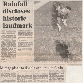
... Two articles on one page: 1.Bendigo Advertiser article, undated possibly1995, titled 'Rainfall discloses historic landmark'. Heavy rainfall caused a mine shaft in Wells Street, Ironbark, to subside to a depth of 3 metres. ...History House 11 Mackenzie Street Bendigo goldfields Gold mining Bendigo mine shaft subsidence Ironbark capping Two articles on one page: 1.Bendigo Advertiser article, undated possibly1995, titled 'Rainfall discloses historic landmark'. Heavy rainfall caused a mine shaft in Wells Street, Ironbark, to subside to a depth of 3 metres. ...Two articles on one page: 1.Bendigo Advertiser article, undated possibly1995, titled 'Rainfall discloses historic landmark'. Heavy rainfall caused a mine shaft in Wells Street, Ironbark, to subside to a depth of 3 metres. The mine was believed to be at least 50 metres deep. Black and white photo shoed Lynn Amos and Roseanna, inspecting the hole in their front lawn. 2. 'Bendigo Mining plans to double exploration funds'. Mr. Peter Phillips, Bendigo Mining, stated that the company would double its exploration budget to about $330,000 in the next month.gold mining, bendigo, mine shaft, subsidence, ironbark, capping -
Beechworth Honey Archive
Newspaper Extract, The Euroa Gazette, September, 1943
... On last page handwritten note "Football" Note: page 3 contains rainfall data for Euroa dating from 1883 to 1943...On last page handwritten note "Football" Note: page 3 contains rainfall data for Euroa dating from 1883 to 1943 The Euroa Gazette Newspaper Extract ...Four page copy of original Euroa Gazette for 28th September 1943. Included in papers of Frank Lebbell Frost. On last page handwritten note "Football" Note: page 3 contains rainfall data for Euroa dating from 1883 to 1943euroa gazette, 1943, newspaper, frost, beechworth honey -
 Orbost & District Historical Society
document, Bureau of Meteorology, DROUGHTS IN AUSTRALIA, 1957
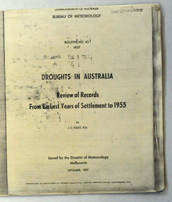
... (James Charles) (1892-1967) , classified major droughts in Australia from the early period of European settlement to 1955 on the basis of rainfall analyses. ...(James Charles) (1892-1967) , classified major droughts in Australia from the early period of European settlement to 1955 on the basis of rainfall analyses. This document is a useful reference tool. drought-Victoria Foley-James-Charles Bureau-of-Meteorology climate Author J.C. ...Foley, J. C. (James Charles) (1892-1967) , classified major droughts in Australia from the early period of European settlement to 1955 on the basis of rainfall analyses. This document is a useful reference tool.A 19 pp copy of a document titled DROUGHTS IN AUSTRALIA, Review of Records from Earliest Years of Settlement to 1955. It was compiled by the Bureau of Meteorology in September,1957. This section deals mostly with droughts in Victoria.Author J.C. Foleydrought-victoria foley-james-charles bureau-of-meteorology climate