
Showing 37 items matching "royal geographical"
-
 Victorian Aboriginal Corporation for Languages
Book, Catalogue of the manuscripts in the library of the Royal Geographical Society of Australasia (South Australian Branch) Inc, 1981
... Catalogue of the manuscripts in the library of the Royal Geographical Society of Australasia (South Australian Branch) Inc.......Royal Geographical Society of Australasia...Australian history sources Royal Geographical Society of Australasia manuscripts b&w illustrations, letters, documents Catalogue of the manuscripts in the library of the Royal Geographical Society of Australasia (South Australian Branch) Inc. ...b&w illustrations, letters, documentsaustralian history sources, royal geographical society of australasia, manuscripts -
 Mission to Seafarers Victoria
booklet - Brochure, Cook's "Endeavour" Bark
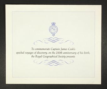
... ...royal geographical...A brochure produced in 1978 by the Royal Geographical Society, offering "by private invitation only" the opportunity for interested parties to purchase a print of the Bark 'Endeavour', in 24 karat gold and silver, of a very limited production run. ...Page 1 of the brochure consists of the Royal Geographical Society ensign at the top of the page and an introductory description of the commemoration, which is adorned above and below, with ink flourishes of curlicues and scrolls. ...Page 1: 'To commemorate Captain James Cook's epochal voyages of discovery, on the 250th anniversary of his birth, the Royal Geographical Society presents' ...The print was offered at $270 in 1978 - at not insignificant sum. 24 karat james cook endeavour royal geographical commemorative memorabilia souvenir Page 1: 'To commemorate Captain James Cook's epochal voyages of discovery, on the 250th anniversary of his birth, the Royal Geographical Society presents' Ornate paper and ink 3-page advertising brochure, in landscape orientation, from The Royal Geographical Society. ...A brochure produced in 1978 by the Royal Geographical Society, offering "by private invitation only" the opportunity for interested parties to purchase a print of the Bark 'Endeavour', in 24 karat gold and silver, of a very limited production run. The print was offered at $270 in 1978 - at not insignificant sum.Ornate paper and ink 3-page advertising brochure, in landscape orientation, from The Royal Geographical Society. The brochure is advertising the release of a commemorative framed silhouette print of the Bark 'Endeavour' in celebration of the 250th anniversary of the birth of Captain James Cook. Page 1 of the brochure consists of the Royal Geographical Society ensign at the top of the page and an introductory description of the commemoration, which is adorned above and below, with ink flourishes of curlicues and scrolls. Page 2 depicts an image of the framed silhouette print on offer. Page 3 contains 3 columns of text which briefly describe Captain Cook's travels, the work of the artist involved in producing the print and terms and conditions for ordering and purchase of the print. Page 1: 'To commemorate Captain James Cook's epochal voyages of discovery, on the 250th anniversary of his birth, the Royal Geographical Society presents' 24 karat, james cook, endeavour, royal geographical, commemorative, memorabilia, souvenir -
 Melbourne Athenaeum Archives
internet printout, Royal Historical Society Victoria - Invitation to Third Triennial meeting to mark Columbus' Discovery of America, 1492 held at Melbourne Athenaeum, October 12 1892 Royal Geographical Society of Australasia, Victorian Branch: Album
... Royal Historical Society Victoria - Invitation to Third Triennial meeting to mark Columbus' Discovery of America, 1492 held at Melbourne Athenaeum, October 12 1892 Royal Geographical Society of Australasia, Victorian Branch: Album...Royal Historical Society Victoria - Invitation to Third Triennial meeting to mark Columbus' Discovery of America, 1492 held at Melbourne Athenaeum, October 12 1892 Royal Geographical Society of Australasia, Victorian Branch: Album internet printout ... -
 Bendigo Historical Society Inc.
Book - ALEC H CHISHOLM COLLECTION: BOOK ''CENTENARY HISTORY OF SOUTH AUSTRALIA''
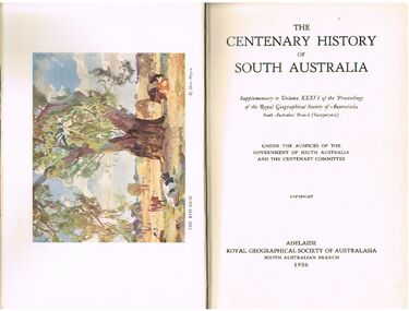
... ... ROYAL GEOGRAPHICAL SOCIETY OF AUSTRALASIA...Published in 1936 by The Royal Geographical Society of Australasia ( South Australian Branch). ...Published in 1936 by The Royal Geographical Society of Australasia ( South Australian Branch). ...Book. ALEC H CHISHOLM COLLECTION. 420 page history of South Australia (1836 - 1936). Illustrated with B & W photos, maps and a colour plate of a painting by Hans Heysen. Published in 1936 by The Royal Geographical Society of Australasia ( South Australian Branch). Printed by the Hassell Press, Adelaide. Chapters written by various contributors. Catalogue sticker ''2165 VAR'' on spine. A typed page stuck on the flyleaf indicates the book belonged to the Education Dept., Adelaide. Handwritten in ink on this typed insert ''Given to me by Adey's successor, Dr. C. Fenner. A H Chisholm''Variousbooks, collections, history, alec h chisholm collection, south australia, centenary, royal geographical society of australasia, history -
 Flagstaff Hill Maritime Museum and Village
Book - Technical Reference, Henry Raper, Lieut. R.N, The Practice of Navigation and Nautical Astronomy, 1891
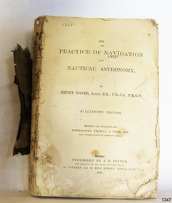
... ...Royal Geographical Society...(Friend of the Royal Geographical Society). The book is dedicated in honour of Rear-Admiral Sir Francis Beaufort K.C.B., Hydrographer to the Admiralty. ...(Friend of the Royal Geographical Society). The book is dedicated in honour of Rear-Admiral Sir Francis Beaufort K.C.B., Hydrographer to the Admiralty. ...This technical textbook is the nineteenth edition of the book by Henry Raper, Lieutenant in the Royal Navy with awards that include F.R.A.S. (Fellow of the Royal Astronomical Society) and F.R.G.S. (Friend of the Royal Geographical Society). The book is dedicated in honour of Rear-Admiral Sir Francis Beaufort K.C.B., Hydrographer to the Admiralty. He was awarded the title K.C.B. (King's Commander) as a Member of the Order of Bath, an order of British Chivalry, The book was first published in 1840 and soon became a resource for navigation students. It includes topics on nautical navigation, astronomy, navigation charts, calculations and mathematical tables, time, tides, ships, longitude, and position at sea. Thomas A. Hull, who revised and expanded this edition, was a Commander in the Royal Navy and had previously been Superintendent of Admiralty Charts used for navigation worldwide by seamen from many walks of life. The publisher, J D Potter of London, was at that time the sole agent for the Admiralty Charts produced by the Royal Navy. Printer Spottswoode and Co.,. was established by William Strachan in 1738. In 1819 his nephews A and R Spottswoode took over the business and bought premises in New-Street Square and Shoe Lane. In 1850 over 200 workers were employed by the firm. and five years later the business became Spottswoode & Co. Andrew Spottswoode invented the Spottswoode Press.This technical book was very popular as a textbook for students of maritime navigation, written and updated by members of the British Royal Navy and relied upon for accurate advice and information. The first edition was published in 1840, this edition was updated, expanded and published in 1891 when ports around the world were filling with travellers, merchants and business people. Title: The Practice of Navigation and Nautical Astronomy Author: Henry Raper, Lieut, R.N., F.R.A.S., F.R.G.S. Nineteenth Edition, revised and enlarged by Commander Thomas A. Hull, R.N., Late Superintendant of Admiralty Charts Dedication: To Rear-Admiral Sir Francis Beaufort K.C.B. Publisher: J D Potter, London, sole agent for the sale of Admiralty Charts Printer: Spottswoode and Co. New-Street Square, London Date: 1891 Small leather hardcover book with gold embossed text and lines on the spine. The Dedication in the book is as follows: - "To Rear-Admiral Sir Francis Beaufort K.C.B. Hydrographer to the Admiralty. Sir, The eminent station which you occupy in the naval scientific world renders it highly gratifying to me to dedicate the following Work to you as a testimony of my regard and esteem; while the general accordance of my views on the subject with those of your more experienced judgement, gives me the greater confidence in laying my labours before the Public. I have the honour to be, Sir, Your obedient servant, HENRY RAPER"flagstaff hill maritime museum, maritime museum, shipwreck coast, flagstaff hill, warrnambool, flagstaff hill maritime village, book, navigation, nautical astronomy, hydrography, nautical charts, nautical navigation, astronomical navigation, admiralty charts, henry raper, thomas a. hull, royal navy, j d potter, royal astronomical society, royal geographical society, calculations, mathematical tables, longitude, latitude, nautical time, location at sea, position at sea, maritime, practical navigation, spottswoode and co., sir francis beaufort, k.c.b., rear-admiral sir francis beaufort, hydrographer to the admiralty, scientific book, naval science -
 Emerald Museum & Nobelius Heritage Park
Relief prints, Thomas Baines et al, An Explorer's Camp, Circa 1875
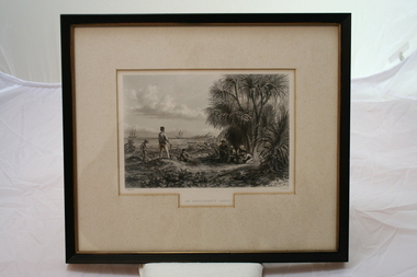
... Thomas Baines joined Augustus Gregory as official artist and storekeeper, in the expedition across northern Australia between 1855-1857 sponsored by the Royal Geographical Society to evaluate the northern area of Australia for suitability as a colonial settlement. ...Thomas Baines joined Augustus Gregory as official artist and storekeeper, in the expedition across northern Australia between 1855-1857 sponsored by the Royal Geographical Society to evaluate the northern area of Australia for suitability as a colonial settlement. ...Thomas Baines joined Augustus Gregory as official artist and storekeeper, in the expedition across northern Australia between 1855-1857 sponsored by the Royal Geographical Society to evaluate the northern area of Australia for suitability as a colonial settlement. ...From 'Australia' by Edwin Carton Booth. Thomas Baines joined Augustus Gregory as official artist and storekeeper, in the expedition across northern Australia between 1855-1857 sponsored by the Royal Geographical Society to evaluate the northern area of Australia for suitability as a colonial settlement. The Baines River was named after him.The item is socially and artistically significant as it is a very early image of Northern Australia.Framed black and white etching depicting a cap site located near the ocean.Artist T. Baines - J.J. Crew. From 'Australia' by Edwin Carton Booth. Thomas Baines joined Augustus Gregory as official artist and storekeeper, in the expedition across northern Australia between 1855-1857 sponsored by the Royal Geographical Society to evaluate the northern area of Australia for suitability as a colonial settlement. The Baines River was named after him.print, baines -
 Federation University Historical Collection
Image, Fourth Battalion, 1898, 1898
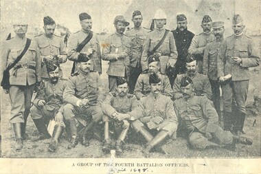
... Four magazine photographs. .1) Kitchen of the Fourth Battalion .2) Cadet Display at the Exhibition Ground, Jubilee Week, 1887 .3) 4th Battalion in Quarter Formation. .4) A group of Fourth Battalion officers, 1898 VersO - Certificate of the Royal Geographical Society of Australasia...The fourth Battalion appears to be made up of Castlemaine and Bendigo Residents. armed services fourth battalion cadets Voluntary regiment kitchen Exhibition grounds militia Four magazine photographs. .1) Kitchen of the Fourth Battalion .2) Cadet Display at the Exhibition Ground, Jubilee Week, 1887 .3) 4th Battalion in Quarter Formation. .4) A group of Fourth Battalion officers, 1898 VersO - Certificate of the Royal Geographical Society of Australasia Fourth Battalion, 1898 Image ...The fourth Battalion appears to be made up of Castlemaine and Bendigo Residents.Four magazine photographs. .1) Kitchen of the Fourth Battalion .2) Cadet Display at the Exhibition Ground, Jubilee Week, 1887 .3) 4th Battalion in Quarter Formation. .4) A group of Fourth Battalion officers, 1898 VersO - Certificate of the Royal Geographical Society of Australasiaarmed services, fourth battalion, cadets, voluntary regiment, kitchen, exhibition grounds, militia -
 Uniting Church Archives - Synod of Victoria
Plaque - Silver plaque, 1875
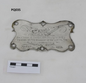
... He was a leading member of the Royal Geographical Society of Victoria. He had a winning personality and was held in high regard and affection by the communities in worked in. ...He was a leading member of the Royal Geographical Society of Victoria. He had a winning personality and was held in high regard and affection by the communities in worked in. ...Reverend Edwin Iredale Watkin, D.D. (1839-1916) was born in Sydney and spent his early life in New Zealand before coming to Australia . He began his Wesleyan ministry in 1859. He was a leading member of the Royal Geographical Society of Victoria. He had a winning personality and was held in high regard and affection by the communities in worked in. The plaque appears to be from the double-seated buggy the Rev E.I.Watkin was presented with together with an inscribed silver teapot, a set of gold studs and a gold pencil case on his leaving the Geelong East Methodist Circuit.Small silver plaque with an inscription and six holes around the edge."Presented TO THE REV. E.I. Watkin. AS A TOKEN OF ESTEEM AND AFFECTION BY HIS FRIENDS ON THE OCCASION OF HIS LEAVING THE Geelong East Circuit April 6th 1875"geelong east methodist circuit, yarra street wesleyan church, rev edwin iredale watkin (1839-1916) -
 Eltham District Historical Society Inc
Book, The Man history forgot by Vivienne Worthington, 2018
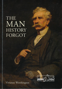
... Panton CMG, Discovery of gold, 1854 Year of Exhibitions, Mining commission, Europe, Bohemia, art and marriage, artist in the western district, patron of Victorian Academy of Art, First Police Magistrate of city court, pioneer pastoralist, aboard the yacht "Cushie Doo", fellow of Royal Geographical Society, London, Inaugural President of Victorian Artists Society, Later Life of Joseph Panton....Panton CMG, Discovery of gold, 1854 Year of Exhibitions, Mining commission, Europe, Bohemia, art and marriage, artist in the western district, patron of Victorian Academy of Art, First Police Magistrate of city court, pioneer pastoralist, aboard the yacht "Cushie Doo", fellow of Royal Geographical Society, London, Inaugural President of Victorian Artists Society, Later Life of Joseph Panton. jospeh anderson panton biography frederick mccubbin cushie doo (ship) gold discovery police magistrate victorian artists society Softcover book The Man history forgot by Vivienne Worthington Book Publishing Productions ...Biography of Goldfields Commissioner Joseph Anderson Panton for whom Panton Hill was named for. The cover painting "J.A. Panton, Esq., PM" 1904 is by Frederick McCubbin. Sections in the book refer to : J. A. Panton CMG, Discovery of gold, 1854 Year of Exhibitions, Mining commission, Europe, Bohemia, art and marriage, artist in the western district, patron of Victorian Academy of Art, First Police Magistrate of city court, pioneer pastoralist, aboard the yacht "Cushie Doo", fellow of Royal Geographical Society, London, Inaugural President of Victorian Artists Society, Later Life of Joseph Panton.Softcover bookjospeh anderson panton, biography, frederick mccubbin, cushie doo (ship), gold discovery, police magistrate, victorian artists society -
 Queenscliffe Maritime Museum
Book - Royal Atlas 1861, Keith Johnston, The Royal Atlas of Modern Geography, 1861
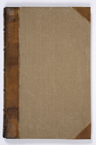
... The Royal Atlas of Modern Geography...In 1861 Johnston published the first edition of the Royal Atlas of Modern Geography with 48 maps. By 1914 the atlas had gone through 12 editions and morphed into the Johnston's Handy Royal Atlas of Modern Geography with 61 colour lithographed maps and an index of 84 pages. ...In 1861 Johnston published the first edition of the Royal Atlas of Modern Geography with 48 maps. By 1914 the atlas had gone through 12 editions and morphed into the Johnston's Handy Royal Atlas of Modern Geography with 61 colour lithographed maps and an index of 84 pages. ...Atlas of the word in 1861105 page leather bound atlas containing some coloured illustrations of maps of the countries of the world up to 1861. Published by William Blackwood & Sons, 1861. Folio [51x34cm] size with 9 pages of introductory text followed by 48 double-page spread and part coloured maps.non-fictionAtlas of the word in 1861geography, world atlas, keith johnstone -
 Bendigo Historical Society Inc.
Document - LETTERS AND HISTORICAL RESEARCH INFORMTION: JOHANN MENGE, 1997
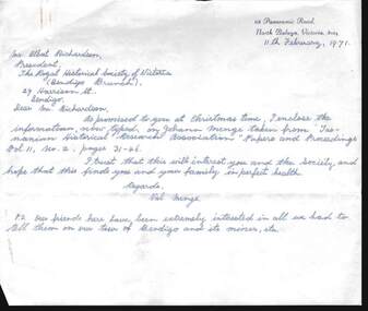
... Includes three letters to A Richardson from Val Menge (wife of possible descendant of Johann Menge) , dated December 19970, Feb 1971 and March 1971; Extract from ''South Australia and its Mines''(1846); Extract from ''Historical studies of Australia & New Zealand Vol 10''; Extract from the ''Australian Dictionary of Biography''; extract from George Stevenson's Journal in ''Royal Geographic Society of Australia - South Australian Branch, Vol 30, p. 62; Extract from ''The history of South Australia pp. 186-187; Extract from letter written by ''The South Australian Register'' (1852); Extract from '' Tasmanian Historical Research Association'' Papers and proceedings Vol 11, No. 2, pp 31 - 46; copy of book review (unknown paper) of ''Opal Men'', with sketch of Johann Menge, who first discovered opal in Australia. ...Includes three letters to A Richardson from Val Menge (wife of possible descendant of Johann Menge) , dated December 19970, Feb 1971 and March 1971; Extract from ''South Australia and its Mines''(1846); Extract from ''Historical studies of Australia & New Zealand Vol 10''; Extract from the ''Australian Dictionary of Biography''; extract from George Stevenson's Journal in ''Royal Geographic Society of Australia - South Australian Branch, Vol 30, p. 62; Extract from ''The history of South Australia pp. 186-187; Extract from letter written by ''The South Australian Register'' (1852); Extract from '' Tasmanian Historical Research Association'' Papers and proceedings Vol 11, No. 2, pp 31 - 46; copy of book review (unknown paper) of ''Opal Men'', with sketch of Johann Menge, who first discovered opal in Australia. ...Letters and historical research information re Johann Menge (1788-1852). Includes three letters to A Richardson from Val Menge (wife of possible descendant of Johann Menge) , dated December 19970, Feb 1971 and March 1971; Extract from ''South Australia and its Mines''(1846); Extract from ''Historical studies of Australia & New Zealand Vol 10''; Extract from the ''Australian Dictionary of Biography''; extract from George Stevenson's Journal in ''Royal Geographic Society of Australia - South Australian Branch, Vol 30, p. 62; Extract from ''The history of South Australia pp. 186-187; Extract from letter written by ''The South Australian Register'' (1852); Extract from '' Tasmanian Historical Research Association'' Papers and proceedings Vol 11, No. 2, pp 31 - 46; copy of book review (unknown paper) of ''Opal Men'', with sketch of Johann Menge, who first discovered opal in Australia. Menge was a mineralogist/geologist with a talent for languages - ''eccentric'' -died in poverty at Forest Creek, 1852.Val & Ted Mengeperson, individual, johann menge -
 Eltham District Historical Society Inc
Photograph - Digital Photograph, Alan King, Panton Hill Hotel, 27 March 2008
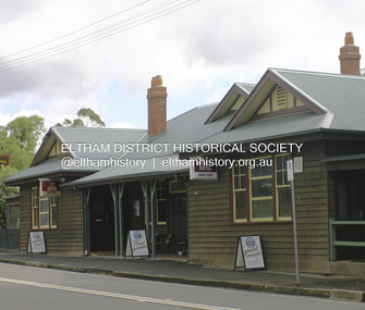
... Panton was also an artist, becoming president of the Victorian Arts Society in 1888, and in 1913, president of the Royal Geographical Society. Despite Panton Hill’s prosperity, it still lacked many services as poor roads made access to Melbourne difficult. ...Panton was also an artist, becoming president of the Victorian Arts Society in 1888, and in 1913, president of the Royal Geographical Society. Despite Panton Hill’s prosperity, it still lacked many services as poor roads made access to Melbourne difficult. ...Today’s Panton Hill Hotel was built around 1920. Published: Nillumbik Now and Then / Marguerite Marshall 2008; photographs Alan King with Marguerite Marshall.; p61 Panton Hill was originally known as Kingstown, and consisted of only one hotel when the Orams Reef was discovered in 1859. Kingstown was a quartz mining centre and many old mine shafts remain in the area. Orams Reef was one of the first reefs with a rich find of gold in the area. The Hotel Francais, which had been operating in 1861, was well situated on the way to Queenstown (later St Andrews). So was Herr Hirt’s Hotel and store at Smiths Gully. The Kingstown hotel, known as the Frenchman’s and in 1864 as the Hotel de France, was run by a Monsieur Emile Hude and his wife Jeanne, and known for its good food. They hosted social events, business conventions and debates, attracting patrons from as far as Melbourne. The hotel’s name was changed to Panton Hill Hotel in 1905. In 1883 Charles Caudwell built another hotel nearby, possibly in Long Gully Road,3 which it is thought, was burnt down early last century. Today’s Panton Hill Hotel, built around 1920, is the only one of the cluster of buildings in the main road, not to date from around the turn of last century. It was severely damaged by fire in 2003, then underwent extensive alterations. It is the township’s only hotel and is an example of a modest hotel building exterior, constructed early last century. In its early days the hotel also housed the first post office, newsagency and store. Orams Reef yielded a total of £100,000, and fossikers also found alluvial gold in the creeks and gullies, but there is no record of the total value of their finds. Gold greatly increased the Panton Hill population, which peaked between 1865 and 1885. On holidays large sports meetings were held with wood chopping contests and foot races and the day would end with a ball. Miners came from various countries to seek their fortune, including many from China. The Chinese became unpopular however, and gradually left the district, although some stayed and grew and sold vegetables.5 Panton Hill was named after Joseph Panton, who in 1862 was appointed Police Magistrate for the Woods Point, Heidelberg and Yarra districts. Panton was an outstanding man, who in 1852, was Commissioner of Crown Lands and Assistant Commissioner of Goldfields at Bendigo. In 1874 he was promoted to Chief Magistrate for the Melbourne Police. Panton was also an artist, becoming president of the Victorian Arts Society in 1888, and in 1913, president of the Royal Geographical Society. Despite Panton Hill’s prosperity, it still lacked many services as poor roads made access to Melbourne difficult. A horse-drawn mail coach travelled to Melbourne until 1890, when the railway came to Heidelberg. The nearest doctor was at Yarra Glen or Heidelberg, and the Indian hawker Singh’s annual visit was very welcome. A miner’s shack opposite the school was used as a post office. Today’s general store and post office in the main road dates from early last century, and has changed considerably. While most people searched for gold, the more enterprising ones established farms to feed the diggers. Farmers grew wheat, barley and oats, and sent animal skins to the Eltham tannery, to make furs in Melbourne. As gold became scarce from around 1880, miners took up farming on 19 to 20 acre (8ha) allotments. The first settlers in Cherry Tree Road included Purcell, Smith, Owens, Hughes and Shillinglaw. By 1900 all the land had been taken up around Panton Hill and Hurstbridge. The orchards in Panton Hill and the wider district, particularly of apple and pear, were very successful, and made Panton Hill a cohesive and successful community. About 1914 the Moores built the first cool-store and refrigeration plant at their orchard in Cherry Tree Road. Many settlers planted vineyards and made high quality wine, but in 1922 the blight destroyed them.This collection of almost 130 photos about places and people within the Shire of Nillumbik, an urban and rural municipality in Melbourne's north, contributes to an understanding of the history of the Shire. Published in 2008 immediately prior to the Black Saturday bushfires of February 7, 2009, it documents sites that were impacted, and in some cases destroyed by the fires. It includes photographs taken especially for the publication, creating a unique time capsule representing the Shire in the early 21st century. It remains the most recent comprehenesive publication devoted to the Shire's history connecting local residents to the past. nillumbik now and then (marshall-king) collection, panton hill hotel -
 Federation University Historical Collection
Book, The Plants Indigenous to the Colony of Victoria, 1865 (exact); "1864-1865, CR"
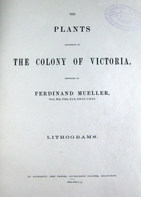
... Royal Society of New South Wales. He published many volumes on the Victorian plants. Many of Australian geographical features were named after him such as: the Mueller Ranges (WA), Muellers Range (Qld), Mount Mueller (in WA, NT, Tas and Vic) and many more. ...Royal Society of New South Wales. He published many volumes on the Victorian plants. Many of Australian geographical features were named after him such as: the Mueller Ranges (WA), Muellers Range (Qld), Mount Mueller (in WA, NT, Tas and Vic) and many more. ...Baron Sir Ferdinand Jacob Heinrich von Mueller was born in Germany on 30 June 1825. Ferdinand was a German-Australian physician, geographer, and a botanist. After passing the pharmaceutical examinations he studied botany at Kiel University. In 1847 he received the degree of Doctor of Philosophy from Kiel University.when he was 21 years old for a thesis on the flora of Schleswig-Holstein. In 1847, he moved to Adelaide, Australia and worked as a chemist. From 1848 to 1852 he travelled through the colony, discovering and describing a large number of unknown to Western science plants. He wrote a few papers to German periodicals on botanical subjects. In 1851, Mueller moved to Melbourne, capital of the new colony of Victoria. In 1853, He was appointed Government Botanist for Victoria by Governor Charles La Trobe. In 1873, Ferdinand received an honorary doctorate of the University of Rostock. In 1883, he was awarded the Clarke Medal by the Royal Society of New South Wales. He published many volumes on the Victorian plants. Many of Australian geographical features were named after him such as: the Mueller Ranges (WA), Muellers Range (Qld), Mount Mueller (in WA, NT, Tas and Vic) and many more. Mueller died in Melbourne on 10 October 1896 and is buried in the St. Kilda Cemetery A green cloth hard cover book. Title and author's name is engraved in gold on spine. It includes an introduction, a table of contents and plates. Lithograms in b/w. Each plate accompanied by a page with descriptive print. Number of plates XIII-LXXI. No. of supplement plates XII-XVII. The book illustrates Victorian plants and outlines the principal characters of those species. This book is No 1290 in the Original Register of Books (Cat. No. 005)Hand written pencil notes on contents page. Stamped throughout with "The School of Mines, Industries & Science, Ballarat. Ingenio Effodere Opes. In the University of Melbourne."australia, botany victoria, plants, ferdinand mueller, ferdinand von mueller, biodiversity, flora -
 Federation University Historical Collection
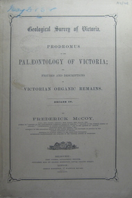
Book, Prodromus of the Palaeontology of Victoria No iv, 1876 (exact)
... geography and botany. In 1858 He became the Director of the National Museum of Victoria and the President of the Royal Society of Victoria in 1864. ...geography and botany. In 1858 He became the Director of the National Museum of Victoria and the President of the Royal Society of Victoria in 1864. ...This publication consists of many Decades which contain "figuers and descriptions of the fossil organic remains to be used for the determination of the geological ages of the different geological formations of the country." (p. 3). Frederick McCoy was born in Dublin, Ireland in 1817. He was a Professor of Natural Sciences, University of Melbourne 1854-1899. McCoy lectured in geology, zoology, chemistry, mineralogy, geography and botany. In 1858 He became the Director of the National Museum of Victoria and the President of the Royal Society of Victoria in 1864. In 1888, McCoy was awarded FRS for work in Palaeontology in Ireland, England and Australia. He died in his office while correcting examination papers in 1899A Paperback cover book. Decade IV. Title is written in black on front cover and on title page. At head of title: Geological Survey of Victoria. Illustrations, plates in b/w; 32 p. It includes figures and descriptions of Victorian Organic Remains and contents of Decades on the back cover of the book.australia palaeobotany, victoria palaeontology, geological survey of victoria, frederick mccoy, organic remains -
 Federation University Historical Collection
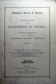
Book, Prodromus of the Palaeontology of Victoria, 1877 (exact)
... geography and botany. In 1858 He became the Director of the National Museum of Victoria and the President of the Royal Society of Victoria in 1864. ...geography and botany. In 1858 He became the Director of the National Museum of Victoria and the President of the Royal Society of Victoria in 1864. ...This publication consists of many Decades which contain "figuers and descriptions of the fossil organic remains to be used for the determination of the geological ages of the different geological formations of the country." (p. 3). Frederick McCoy was born in Dublin, Ireland in 1817. He was a Professor of Natural Sciences, University of Melbourne 1854-1899. McCoy lectured in geology, zoology, chemistry, mineralogy, geography and botany. In 1858 He became the Director of the National Museum of Victoria and the President of the Royal Society of Victoria in 1864. In 1888, McCoy was awarded FRS for work in Palaeontology in Ireland, England and Australia. He died in his office while correcting examination papers in 1899.A Paperback cover book. Decade v. Title is written in black on front cover and on title page. At head of title: Geological Survey of Victoria. Illustrations, plates in b/w; 41 p. It includes figures and descriptions of Victorian Organic Remains and contents of Decades on back cover.Stamped Ballarat East Public Library"australia palaeobotany, victoria palaeontology, geological survey of victoria, frederick mccoy, organic remains, ballarat east library, ballarat east public library -
 Federation University Historical Collection
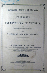
Book, John Ferres, Government Printer, Prodromus of the Palaeontology of Victoria Decade vi, 1878 (exact)
... geography and botany. In 1858 He became the Director of the National Museum of Victoria and the President of the Royal Society of Victoria in 1864. ...geography and botany. In 1858 He became the Director of the National Museum of Victoria and the President of the Royal Society of Victoria in 1864. ...This publication consists of many Decades which contain "figuers and descriptions of the fossil organic remains to be used for the determination of the geological ages of the different geological formations of the country." (p. 3). Frederick McCoy was born in Dublin, Ireland in 1817. He was a Professor of Natural Sciences, University of Melbourne 1854-1899. McCoy lectured in geology, zoology, chemistry, mineralogy, geography and botany. In 1858 He became the Director of the National Museum of Victoria and the President of the Royal Society of Victoria in 1864. In 1888, McCoy was awarded FRS for work in Palaeontology in Ireland, England and Australia. He died in his office while correcting examination papers in 1899.A Paperback cover book. Decade VI. Title is written in black on front cover and on title page. At head of title: Geological Survey of Victoria. Illustrations, plates in b/w; 42 p. It includes figures and descriptions of Victorian Organic Remains and contents of Decades at back of the book.australia palaeobotany, victoria palaeontology, geological survey of victoria, frederick mccoy, organic remains, john ferres -
Marysville & District Historical Society
Document (Item) - Research Document, Rene de Koning, Murchison Street Named After Roderick Impey Murchison (1792-1871), 13-08-2022
... His liberality and social position plus the pride he took in his science were of immense value in furthering the cause of learning in Britain. roderick impey murchison murchison street marysville victoria durham school royal military college great marlow peninsular war charlotte hugonin scotland muir of ord tarradale house ross and cromarty lower palaeozoic old red sandstone south wales welsh borderland the silurian system graywacke rocks adam sedgwick permian the geology of russia in europe and the ural mountains siluria cambrian system silurian system geological survey of great britain geological society the geographical society british association for the advancement of science wollaston medal geology geologist An account of the life of Roderick Impey Murchison whom Murchison Street in Marysville in Victoria is named for. ...An account of the life of Roderick Impey Murchison whom Murchison Street in Marysville in Victoria is named for.An account of the life of Roderick Impey Murchison whom Murchison Street in Marysville in Victoria is named for. Roderick Murchison was one of the most distinguished geologists of the 19th century. His liberality and social position plus the pride he took in his science were of immense value in furthering the cause of learning in Britain.roderick impey murchison, murchison street, marysville, victoria, durham school, royal military college great marlow, peninsular war, charlotte hugonin, scotland, muir of ord, tarradale house, ross and cromarty, lower palaeozoic, old red sandstone, south wales, welsh borderland, the silurian system, graywacke rocks, adam sedgwick, permian, the geology of russia in europe and the ural mountains, siluria, cambrian system, silurian system, geological survey of great britain, geological society, the geographical society, british association for the advancement of science, wollaston medal, geology, geologist -
 Ballarat Clarendon College
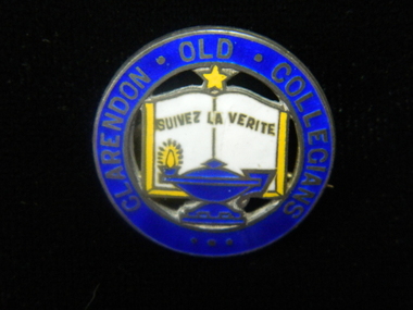
Badge, Clarendon Old Collegians
... Sections of the society met in different geographic areas, such as Melbourne or the Wimmera. clarendon-presbyterian-ladies-college clarendon-old-collegians Lettering around border: CLARENDON OLD COLLEGIANS Three circular enamel brooches featuring outer circle in royal blue with lettering enclosing features of school crest - open book in white with gold border, royal blue lamp with gold flame at base of book and gold star at top of book Clarendon Old Collegians Badge ...The Clarendon Old Collegians Association existed from very early times in the school history and was a singificant controbutor to school socail capacity and infrastructure. The OC's regularly donated funds and purchases to special projects. Sections of the society met in different geographic areas, such as Melbourne or the Wimmera. Three circular enamel brooches featuring outer circle in royal blue with lettering enclosing features of school crest - open book in white with gold border, royal blue lamp with gold flame at base of book and gold star at top of bookLettering around border: CLARENDON OLD COLLEGIANSclarendon-presbyterian-ladies-college, clarendon-old-collegians -
 Flagstaff Hill Maritime Museum and Village
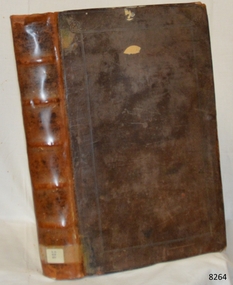
Book - Reference Encyclopedic Compendium, Peter Heylyn, Cosmography in Four Books, 1674
... Each section outlines geographical coordinates, local climates, political histories, royal lineages, cultures, and notable geographical features, accompanied by four large folding engraved maps, one for each continent. ...Cosmography in Four Books was originally published as Cosmographie and is one of the most famous and comprehensive English encyclopedic compendiums of global geography, history, and chorography, meaning regional topography, produced in the 17th century. The work was first published in 1652 and attempts to document every known region of the world at the time. The information is bound together as a single large folio volume and divided into four main sections or books: Book I: Europe and its surrounding islands. Book II: Asia and its kingdoms. Book III: Africa, its provinces, and coastal regions. Book IV: America, split into Northern and Southern America. Book IV features an Appendix speculating on Terra Australis Incognita (the unknown Southern Continent). Each section outlines geographical coordinates, local climates, political histories, royal lineages, cultures, and notable geographical features, accompanied by four large folding engraved maps, one for each continent.Hard cover book,Cosmography in Four Books Author: Peter Heylyn Publisher: Philip Cherwind & Anne Seile, London. Date: (MDCLXXIV) 1674 Further Information: Brown Leather bound volume, library label to spine, spine has raised ribbing front cover has border in gilt.non-fictionCosmography in Four Books was originally published as Cosmographie and is one of the most famous and comprehensive English encyclopedic compendiums of global geography, history, and chorography, meaning regional topography, produced in the 17th century. The work was first published in 1652 and attempts to document every known region of the world at the time. The information is bound together as a single large folio volume and divided into four main sections or books: Book I: Europe and its surrounding islands. Book II: Asia and its kingdoms. Book III: Africa, its provinces, and coastal regions. Book IV: America, split into Northern and Southern America. Book IV features an Appendix speculating on Terra Australis Incognita (the unknown Southern Continent). Each section outlines geographical coordinates, local climates, political histories, royal lineages, cultures, and notable geographical features, accompanied by four large folding engraved maps, one for each continent.flagstaff hill, warrnambool, shipwrecked coast, flagstaff hill maritime museum, maritime museum, shipwreck coast, flagstaff hill maritime village, great ocean road, book, pattison collection, warrnambool library, warrnambool mechanics’ institute, ralph eric pattison, corangamite regional library service, warrnambool city librarian, mechanics’ institute library, victorian library board, warrnambool books and records, warrnambool children’s library, cosmography in four books, philip chetwind, anne seile -
 Mission to Seafarers Victoria
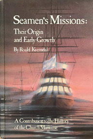
Book, Roald Kverndal, Seamen's Missions: Their origin and Early Growth. A contribution to the History of the Church Maritime, 1986
... geographical borders. In 2012, he completed a book trilogy on the origin and history of maritime mission. Roald’s dream was that seafarers themselves would take the lead in sharing the Good News across the globe. He rejoiced to see that his vision was beginning to unfold. A significant reference Recommendation of Kennerley and R.H. W Miller merchant seamen missions and charities royal ...Hardback cover book with white Title (see above) and author text, KVERNDAL, Roald, on pink grey cover. pp 903, ills. Cover image depicts a masted galleon ship at anchor with interior lights at dusk or dawn flying from the stern of the ship is the blue BETHEL flag featuring a star and dove of peace in top and lwr corners respectively. xxviii, 903 p. : ill. ; 24 cmnon-fictionmerchant seamen, missions and charities, royal navy chaplains, missions-to-seamen, mission to seafarers, roald kverndal -
Eltham District Historical Society Inc
Document - Folder, Thomson, Donald
... "N.T.S.R.U. 1941-1943" "Thomson of Arnhem Land" Victorian Aborigines Welfare Board Thomson Collection Museum Victoria Mia Mia Aboriginal Art Gallery Louise Thomson-Officer Marcia Langton Su baker Lake Tyers Victorian Aboriginal Reserve Gippsland Robert Macklin Yintjingga people 29 Edwin Road Templestowe Royal Geographic Society Nicholas Peterson Mapoon Mission Wongo Aboriginal man Wuluwirr Aboriiginal man Mattuwa Aboriginal man Mauwunbol Aboriginal man Munguyuma Aboriginal man Dja Dja Wurrung people Gavin Jennings Gary Murray Film "Ten Canoes" Galanbingu people Mandallpuy people Djinba people Rolf de Heer Arnhem Land Arafura Swamp Ramingining Caledon Bay Lindy Allen Bunjilaka Centre Newspaper clippings, A4 photocopies, etc Thomson, Donald Document Folder ...Anthropologist and Aboriginal activist Donald Thomson later lived in Eltham with wife Dorita. Contents Photocopy of photograph of Thomson family at "The Oaks", Kinglate 11 November 1891. Photocopy of old photograph of "Worlingworth", home of Donald Thomson. Booklet: "N.T.S.R.U. 1941-1943: text and photographs from the report of Sqn Leader Donald Thomson." Yirrkale Literature Production Centre, 1992. Photocopy of Australian Dictionary of Biography (Vol.16, pp385-386), entry for Thomson, Donald Finlay Fergusson. Newspaper article: "Drought close to city", no source, no date. Donald Thomson wants South Riding of Eltham declared a drought area, photograph of Elaine Thomson. Newspaper article: "Professor dies", The Post, 27 1970. Obituary of Donald Thomson. Photocopy of extracts from "Donald Thomson in Arnhem Land" 1983: Chapter "Donald Thomson: A biographical Sketch". pp1-15; Map; Notes on sources pp141-142. Newspaper article: "Memoirs of an advocate for Aboriginal rights", Diamond Valley News, 8 March 1983. Interview of Dorita Thomson, widow of Donald Thomson, about him and house "Worlingworth". Newspaper article: "Australia's secret Aboriginal 'army". Herald, 2 June 1983. Donald Thomson's life and work, and the book about it, "Donald Thomson of Arnhem Land". Invitation to exhibition of photographs by Donald Thomson, Brighton City Library, 22 July 1983. Publicity for film "Thomson of Arnhem Land" with note from Bruce Nixon, 8 June 2000. Newspaper article: "A crusader before his time", Diamond Valley News, 9 August 2000. Details of life and work of Donald Thomson. Newspaper article: "Outback part. of his life", Diamond Valley News, 9 August 2000. Interview of Dorita Thomson about Donald Thomson's life and work. Newspaper article: "Museum and Aboriginies to meet in stand-off over heritage items", The Age, 29 July 2004. Bark paintings on loan from British Museum in dispute. Magazine article: "Keeping time with Rolf", Time, 20 March 2006. Mentions of Donald Thomson. Newspaper advertisement: "The Thomson House" Templestowe, Emerson Oliver Estate Agent. The Weekly Review, no date (possibly 2017). Flier: "The Thomson House" Templestowe, Emerson Oliver Estate Agent. Newspaper article: "Once upon a time an anthropolgist watched men hunt in 10 canoes", The Age, 16 December 2006. Donald Thomson's work and a new film "Ten Canoes". Newspaper article: "A life's work offers forgotten link to the cultural wealth of nation's first people", The Age, 23 December 2024. The Donald Thomson Ethnohistory Collection. Newspaper clippings, A4 photocopies, etcdonald thomson, northern territory special reconnaissance unit, donald finlay fergusson thomson, "the oaks" kinglake, "worlingworth" eltham, elaine thomson, louise thomson, rosemary thomson, dorita thomson, st margaret's church of england eltham, australian institute of aboriginal studies, brandy creek gippsland, ."donald tomson in arnhem land"., "n.t.s.r.u. 1941-1943", "thomson of arnhem land", victorian aborigines welfare board, thomson collection museum victoria, mia mia aboriginal art gallery, louise thomson-officer, marcia langton, su baker, lake tyers victorian aboriginal reserve gippsland, robert macklin, yintjingga people, 29 edwin road templestowe, royal geographic society, nicholas peterson, mapoon mission, wongo aboriginal man, wuluwirr aboriiginal man, mattuwa aboriginal man, mauwunbol aboriginal man, munguyuma aboriginal man, dja dja wurrung people, gavin jennings, gary murray, film "ten canoes", galanbingu people, mandallpuy people, djinba people, rolf de heer, arnhem land, arafura swamp, ramingining, caledon bay, lindy allen, bunjilaka centre -
 Bendigo Military Museum
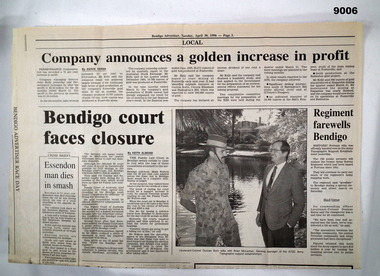
Newspaper - Army Survey Regiment farewells Bendigo
... As part of the CSP competitive tendering process, the ATSE Australian Public Service organisation was awarded the contract to continue to provide geographic support to the Australian Defence Force. This article is about the handover. Royal ...A single folded page (Page 3) of the Bendigo Advertiser dated 30 April 1996 containing an article about the Army Survey Regiment handing over to the Army Topographic Support Establishment (ATSE). As part of the CSP competitive tendering process, the ATSE Australian Public Service organisation was awarded the contract to continue to provide geographic support to the Australian Defence Force. This article is about the handover.A single folded page (Page 3) of the Bendigo Advertiser dated 30 April 1996 containing an article about the Army Survey Regiment handing over to the Army Topographic Support Establishment (ATSE)royal australian survey corps, rasvy, fortuna, army survey regiment, army svy regt, atse -
 Bendigo Military Museum
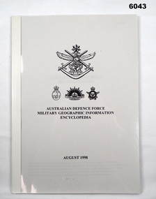
Manual - Australian Defence Force - Military Geographic Information Encyclopedia, Information Strategic Concepts Branch of the Australian Defence Force Strategic Command Division, Directorate of Strategic Military Geographic Information, 27 Aug 1998
... Military Geographic Information Encyclopedia in 3 Parts- Acronyms, Definitions, Web sites Royal Australian Survey Corps RASvy Fortuna Army Survey Regiment Army Svy Regt ASR Soft Film Cover, 3 Parts (Chapters), 77 Pages Australian Defence Force - Military Geographic Information Encyclopedia Manual Australian Defence Force - Military Geographic Information Encyclopedia Information Strategic Concepts Branch of the Australian Defence Force Strategic Command Division, Directorate of Strategic Military Geographic Information ...Military Geographic Information Encyclopedia in 3 Parts- Acronyms, Definitions, Web sitesSoft Film Cover, 3 Parts (Chapters), 77 Pagesroyal australian survey corps, rasvy, fortuna, army survey regiment, army svy regt, asr -
 Bendigo Military Museum
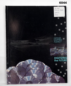
Manual - Defense Mapping Agency (US) - Digitizing the Future Third Edition, c1990
... Digitizing the Future Third Edition, An information booklet describing the types of new digital geographic products produced by the US Defense Mapping Agency. The Australian Army Survey Regiment went on to also produce many of these digital products Royal Australian Survey Corps RASvy Fortuna Army Survey Regiment Army Svy Regt ASR Front Cover, "DO NOT REMOVE FROM CARTO SQN" Soft Cover Book, Paper Pages, 3 parts with Numerous Sections in each Part, Text, Diagrams and Photographs, Data Information Sheets, DMA Stock No: DDIPDIGITALPAC Defense Mapping Agency (US) - Digitizing the Future Third Edition Manual Defense Mapping Agency (US) - Digitizing the Future Third Edition US Defense Mapping Agency ...Digitizing the Future Third Edition, An information booklet describing the types of new digital geographic products produced by the US Defense Mapping Agency. The Australian Army Survey Regiment went on to also produce many of these digital productsSoft Cover Book, Paper Pages, 3 parts with Numerous Sections in each Part, Text, Diagrams and Photographs, Data Information Sheets, DMA Stock No: DDIPDIGITALPACFront Cover, "DO NOT REMOVE FROM CARTO SQN"royal australian survey corps, rasvy, fortuna, army survey regiment, army svy regt, asr -
 Bendigo Military Museum
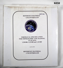
Manual - Portrayal Specification for Topographic Line Mapping at Scales1:50,000, 1:25,000 and 1:10,000, 16.07.1998
... Royal Australian Survey Corps RASvy Fortuna Army Survey Regiment Army Svy Regt ASR Director of Strategic Military Geographic Information DSMGI Plastic covered white four ring binder, 14 Chapters, 4 Annexes Portrayal Specification for Topographic Line Mapping at Scales1:50,000, 1:25,000 and 1:10,000 Manual Portrayal Specification for Topographic Line Mapping at Scales1:50,000, 1:25,000 and 1:10,000 DSMGI ...These specifications enabled the hard copy representation of digital topographic data for the Australian Defence Force (ADF) covering Australia and nearer regions.Plastic covered white four ring binder, 14 Chapters, 4 Annexesroyal australian survey corps, rasvy, fortuna, army survey regiment, army svy regt, asr, director of strategic military geographic information, dsmgi -
 Bendigo Military Museum
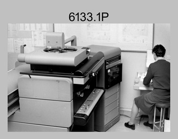
Photograph - Orthophotomap Workstation, Lithographic Squadron – Army Survey Regiment, Fortuna, Bendigo, 1988
... geographic area. Once an image is orthorectified, features on the image are shown in their planimetric locations. Royal ...This collection of four photos was most likely taken at Lithographic Squadron, Army Survey Regiment, Fortuna, Bendigo in 1988. Orthophoto mapping provided the Survey Corps with the capability to produce map products quickly in the event of a crisis. These are four photographs of equipment used by the Army Survey Regiment to produce orthophotomaps. The OR1 orthophoto projector and workstation was introduced in the mid-1980s. It was the second-generation equipment used to orthorectify colour and monochrome film aerial photography, replacing the system introduced in 1973. Orthorectification is the process of removing geometric distortions and scale errors/variations from images. Images have tilt and relief distortions that make it difficult to compare accurately a map and an image of the same geographic area. Once an image is orthorectified, features on the image are shown in their planimetric locations. These four photographs of orthorectification equipment in operation were taken at the Army Survey Regiment at Fortuna, Bendigo, 1988. The photographs were on 35mm negative film and were scanned at 96 dpi. They are part of the Army Survey Regiment’s Collection. .1) to .4) - Photo, black & white, 1988, WILD OR-1 Orthorectification Workstation, SPR Carmel (Butler) Fauth.No personnel are identifiedroyal australian survey corps, rasvy, army survey regiment, army svy regt, fortuna, asr, litho -
 Bendigo Military Museum
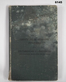
Manual - Mathematical Tables for the Computation of Geographic positions and Rectangular Coordinates, 1942
... Numerous mathematical tables for the computation of Geographical Positions and rectangular coordinates Royal Australian Survey Corps RASvy Fortuna Army Survey Regiment Army Svy Regt ASR "? ...Numerous mathematical tables for the computation of Geographical Positions and rectangular coordinatesHard covered Book, cloth covered, A5 in size, 169 pages, Title Page, contents Page, 5 x blank pages at front, 15 x blank pages at rear."? Slattery" , "Sgt RC Andrews. School Tac? Adm. Seymour" all crossed out, on 1st page inside cover. "Please Return to: Survey Directorate AHQ Victoria Barracks Melbourne" Front and rear pages.royal australian survey corps, rasvy, fortuna, army survey regiment, army svy regt, asr -
 Bendigo Military Museum
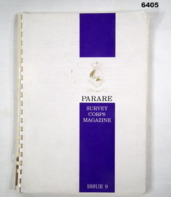
Magazine - "Parare" Survey Corps Magazine Issue 9, Royal Australian Survey Corps, 1993
... Military Geographic Information Pilot Project page 92. Royal Australian Survey Corps Aerial photography Team personnel list page 95. ...Military Geographic Information Pilot Project page 92. Royal Australian Survey Corps Aerial photography Team personnel list page 95. ...An annual magazine published for release on RASvy Corps birthday 1st July. All units with RASvy Corps are invited / expected to submit an article depicting their activities over the preceding years 1991 to 1993. 4Fd Svy Sqn Adventure training list pages 7, 8. Army Map Depot - Unit Ski Day, pages 20, 21. The William Patton Expedition - Locating his grave as part of the " Burke and Wills " expedition, list of personnel involved - page 43. 8 Fd Svy Sqn - names mentioned and photo - page 50. 4 Fd Svy Sqn (1992) names mentioned page 69. The G Res manning list on page 70. Names mentioned in "Unit sports pages 73, 74. Exercise Kokoda Cartographer July 1992 list of participants on Page 78. Iraq - The Gulf War, Topographic Support page 52. Adelaide (4 Fd Svy Sqn) 1992 page 65. 8 Fd Svy Sqn manning wind down list pages 89-90. Military Geographic Information Pilot Project page 92. Royal Australian Survey Corps Aerial photography Team personnel list page 95. Operation Belama 92 Team list page 96. Long term Schooling attendees and promotions, page 105. Litho Sqn Postings in and out pages 116-117. Special awards SGT Durrant page 113, SSGT SR Hill page 114. RASvy completes 1:50,000 scale mapping of the Pilbara Region page 121. 1st Topo Svy Sqn personnel mentioned on page 122. A4 sized booklet with soft glossy card covers, paper pages held together with a plastic spiral binder.army survey regiment, army survey regt, fortuna, royal australian survey corps, rasvy, asr -
 Bendigo Military Museum
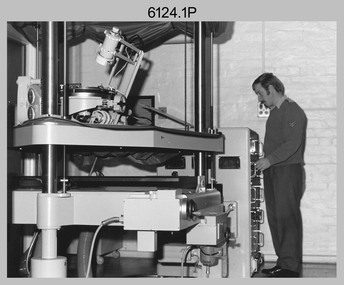
photograph - Orthorectification Equipment - Army Survey Regiment, Fortuna, Bendigo, c1975
... geographic area. Once an image is orthorectified, features on the image are shown in their planimetric locations. Royal ...Orthophoto mapping provided the Survey Corps with the capability to produce map products quickly in the event of a crisis. These are four photographs of equipment used by the Army Survey Regiment to produce orthophotomaps. The Wild GZ1 orthophoto projector was introduced in 1973 and was the first equipment used to orthorectify colour and monochrome film aerial photography. Height profiles were originally produced on a PEB8 Stereo profiler and later were software generated. Photos of the PEB8 are available in Victorian Collections item 6222.17P, photos .5P and .6P. In the same era the IBM 1130 computer; OMI/Nistri AP/C-3 analytical plotter with coordinatograph, OP/C orthophoto projector and Zeiss Planimat D2 stereoplotters were introduced. Orthorectification is the process of removing geometric distortions and scale errors/variations from images. Images have tilt and relief distortions that make it difficult to compare accurately a map and an image of the same geographic area. Once an image is orthorectified, features on the image are shown in their planimetric locations. These four photographs of orthorectification equipment were taken at the Army Survey Regiment at Fortuna, Bendigo, c1975. Photo .1P and .3P were printed on photographic paper and scanned at 300 dpi. Photos .2P, .4P and .5P were on 35mm negative film and scanned at 96 dpi. They are part of the Army Survey Regiment’s Collection. .1) - Photo, black & white, c1975, Wild GZ1 orthophoto projector operated by CPL Phil Boyle. .2) - Photo, black & white, c1975, Wild GZ1 orthophoto projector. .3) - Photo, black & white, c1975, Wild GZ1 orthophoto projector. .4) - Photo, black & white, c1978, Zeiss D2 Planimat Stereoplotter. .5) - Photo, black & white, c1978, Zeiss D2 Planimat Stereoplotter..1P to .5P No annotations.royal australian survey corps, rasvy, army survey regiment, army svy regt, fortuna, asr -
 Bendigo Military Museum
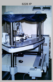
Photograph - Orthorectification Equipment - Army Survey Regiment, Fortuna, Bendigo, c1975, c1988
... geographic area. Once an image is orthorectified, features on the image are shown in their planimetric locations. The WILD OR1 orthophoto projector and workstation shown in photos .2P to.4P was introduced in the mid-1980s. It was the second-generation equipment used to orthorectify colour and monochrome film aerial photography, replacing the system introduced in 1973. See items 6124.5P and 6133.4P for more photographs of orthorectification equipment. Royal ...Orthophoto mapping provided the Survey Corps with the capability to produce map products quickly in the event of a crisis. These are four photographs of equipment used by the Army Survey Regiment to produce orthophotomaps. The Wild GZ1 orthophoto projector shown in photo.1P was introduced in 1973 and was the first equipment used to orthorectify colour and monochrome film aerial photography. Height profiles were originally produced on a PEB8 Stereo profiler and later were software generated. Photos of the PEB8 are available in Victorian Collections item 6222.17P, photos .5P and .6P. In the same era the IBM 1130 computer; OMI/Nistri AP/C-3 analytical plotter with coordinatograph, OP/C orthophoto projector and Zeiss Planimat D2 stereoplotters were introduced. Orthorectification is the process of removing geometric distortions and scale errors/variations from images. Images have tilt and relief distortions that make it difficult to compare accurately a map and an image of the same geographic area. Once an image is orthorectified, features on the image are shown in their planimetric locations. The WILD OR1 orthophoto projector and workstation shown in photos .2P to.4P was introduced in the mid-1980s. It was the second-generation equipment used to orthorectify colour and monochrome film aerial photography, replacing the system introduced in 1973. See items 6124.5P and 6133.4P for more photographs of orthorectification equipment.These four photographs of orthorectification equipment were taken at the Army Survey Regiment at Fortuna, Bendigo, c1975 and c1988. The photos are on 35mm colour slides and scanned at 96 dpi. They are part of the Army Survey Regiment’s Collection. .1) - Photo, colour, c1975, Wild GZ1 orthophoto projector. .2) - Photo, colour, c1988, WILD OR-1 unrectified colour photo in carrier, orthorectified and re-scaled colour image. .3) & .4) - Photo, colour, c1988, WILD OR-1 Orthorectification Workstation.1P to .4P – Some of the equipment is annotated on the frame of the 35mm slides.royal australian survey corps, rasvy, army survey regiment, asr, army svy regt, fortuna
