


Historical information
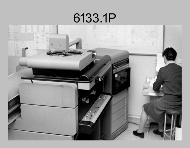
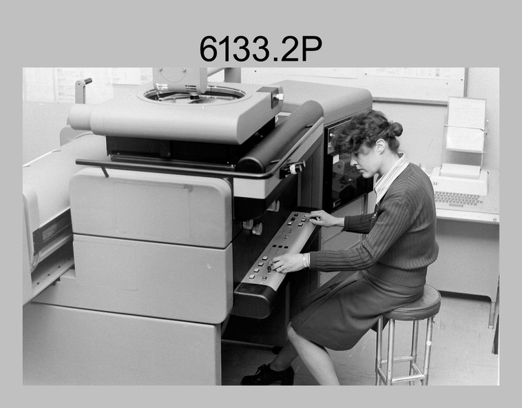
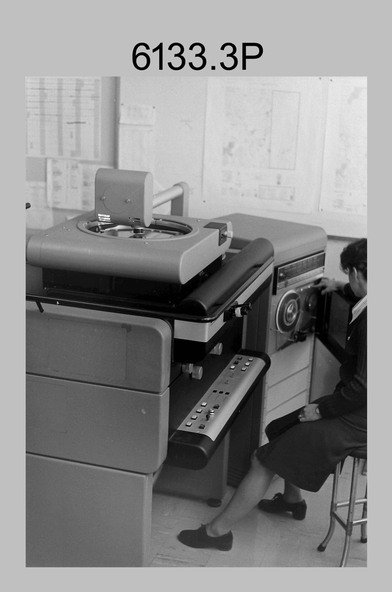
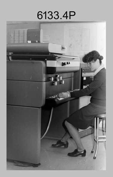
This collection of four photos was most likely taken at Lithographic Squadron, Army Survey Regiment, Fortuna, Bendigo in 1988. Orthophoto mapping provided the Survey Corps with the capability to produce map products quickly in the event of a crisis. These are four photographs of equipment used by the Army Survey Regiment to produce orthophotomaps. The OR1 orthophoto projector and workstation was introduced in the mid-1980s. It was the second-generation equipment used to orthorectify colour and monochrome film aerial photography, replacing the system introduced in 1973. Orthorectification is the process of removing geometric distortions and scale errors/variations from images. Images have tilt and relief distortions that make it difficult to compare accurately a map and an image of the same geographic area. Once an image is orthorectified, features on the image are shown in their planimetric locations.
Physical description
These four photographs of orthorectification equipment in operation were taken at the Army Survey Regiment at Fortuna, Bendigo, 1988.
The photographs were on 35mm negative film and were scanned at 96 dpi. They are part of the Army Survey Regiment’s Collection.
.1) to .4) - Photo, black & white, 1988, WILD OR-1 Orthorectification Workstation, SPR Carmel (Butler) Fauth.
Inscriptions & markings
No personnel are identified