Showing 21009 items matching shire%20of%20blackburn%20and%20mitcham
-
 Rutherglen Historical Society
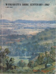
Book, J Colin Angus, A story of the districts included in the Shire of Wangaratta, 1967
Copy of book, autographed by the author, originally from the collection of Brian Jasper105 page book containing black and white illustrations, facsimilies, maps and portraits. Cover is printed in colour showing a painting of a forested landscape. Book presents the history of the Shire of Wangaratta on the occasion of its centenary in 1967.Autographed by the author on the inside of the front cover: "Colin Angus". At top of title page: "Brian S. Jasper"wangaratta shire, wangaratta council, centenary -
 Federation University Historical Collection
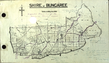
Plan, Shire of Bungaree
The former Shire of Bungaree is now part of Moorabool Shire.Plan of the Shire of Bungaree. Scale is 1 inch to 1 mile with the total distance approximately 40 miles. Includes Gong Gong Reservoir, Kirks Reservoir, White Swan Reservoir, Wilson's Reservois and Moorabool Reservoir. Purple line in purple pencil indictaes suggested scenic tour of the Bungaree Shirebungaree, water supply, barkstead, humffray street, ballarat, doveton (north) stret, ballarat, ballarat water commission, great dividing range, wombat state forest, mineral water springs, gong gon reservoir, kirks reservoir -
 Federation University Historical Collection
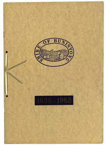
Book, Waller & Chester Printers, Shire of Buninyong 1858-1983, 1983
Documents special meeting of Buninyong Shire Council held on 30 August 1983 to commemorate the 125th anniversary of the first meeting of the Buninyong District Road Board.. Includes images of four generations of Archibald Fisken, photographic copy of Victoria Government Gazette proclamations of the Buninyong Road District, details of inaugural meeting and minutes of the first and second meetings, members of council 1983, a list of Chairmen, Mayors and Presidents and extracts from past records.Beige soft covered book 14 pages with images of four Archibald Fisken, KW McManus and other details related to the 100 years of the Bininyong Shire Council. Ink on paper.Shire of Buninyong 1858-1983buninyong shire council, buninyong road district, archibald fisken, local government -
 Eltham District Historical Society Inc
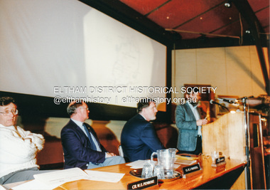
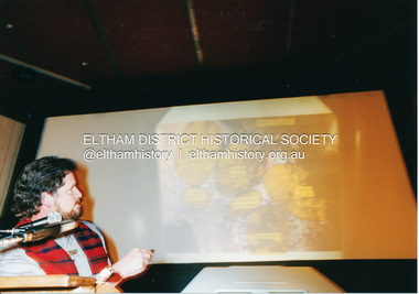
Photograph, Shire of Eltham, Meeting to discuss the new Nillumbik Shire, November 1994
Nillumbik Shire Council - Shire of Eltham Archives Series 046Nillumbik Shire Council - Shire of Eltham Archives Series 046 Series consists of colour photographs, 215mm x 150mm, depicting citizens and speakers at the meeting, including CEO Rodney Roscholler.Colour photograph1994, council amalgamation, nillumbik shire, public meeting, shire of eltham, series 46, shire of eltham archives -
 Eltham District Historical Society Inc
Photograph, Shire of Eltham, Meeting to discuss the new Nillumbik Shire, November 1994
Nillumbik Shire Council - Shire of Eltham Archives Series 046Nillumbik Shire Council - Shire of Eltham Archives Series 046 Series consists of colour photographs, 215mm x 150mm, depicting citizens and speakers at the meeting, including CEO Rodney Roscholler.Colour photograph1994, council amalgamation, nillumbik shire, public meeting, shire of eltham, series 46, shire of eltham archives -
 Learmonth and District Historical Society Inc.
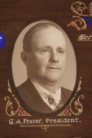
Photo - Fraser, Thornton Richards & Co Ballarat, Fraser. G.A. Shire President, 1954, 1954 (exact)
Councilor George Alexander Fraser was elected to council in 1947 and served until 1960. On Monday 7th September 1953 he was sworn in as Shire President for the 1953/54 year, having been nominated by Cr. Edwards. This collection Of photos was taken to comemorate the visit on the 6th of March 1954,to Ballarat, of Her Majesty Queen Elizabeth 11,and was presented to Council by the Shire President to mark the occaision.Section of the Original Historic Photo of Councilors for the year 1954.Sepia/Brown Photo Councilor G.A.Fraser who was Shire President for the year 1953-54.It is in the top left hand corner of a composite photo of Councilors for that year.Collection of Photos showing Shire Presidrnt & Councilors for the Financial Year 1953-54..george alexander fraser shire president 1953 54, visit queen elizabeth 11 ballaret 6th march 1954 -
 Eltham District Historical Society Inc
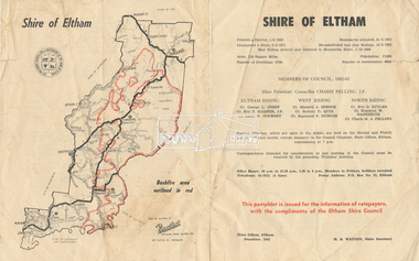
Document - Pamphlet, Shire of Eltham, December 1962
This pamphlet was issued for the information of ratepayers, with the compliments of the Eltham Shire Council. Subjects of information included: Shire statistics and history Members of Council 1962-63 Bushfires Dogs Rates Works Programme Shire Offices Town Planning Map of Shire of Eltham with Bushfire area outlined in redbushfires, charis pelling, charles m. a. pelling, councillors, dogs, eric dudley butler, eric percival harmer, franklin william nankervis, george l. cresp, leslie christopher docksey, m.b. watson, map, maxwell alexander spence, rates, raymond clive duncan, rodney d. quin, shire of eltham, shire offices, town planning, works programme -
 Tatura Irrigation & Wartime Camps Museum
Archive Box, Shire of Rodney, 2009
Grey Archive Box contains Shire of Rodney recordsLabelled "Shire of Rodney" and numbered "4359"shire of rodney, archive, box -
 Greensborough Historical Society
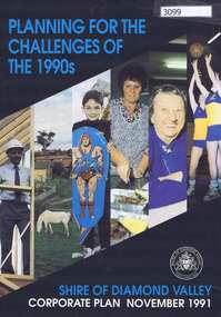
Pamphlet, Planning for the challenges of the 1990s: Shire of Diamond Valley Corporate Plan, 1991_11
Shire of Diamond Valley Corporate Plan 1991. Includes Shire map and statistics with plans for services to the community.16p. text and coloured photographsshire of diamond valley -
 Greensborough Historical Society
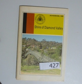
Book, Shire of Diamond Valley, Shire of Diamond Valley Handbook 1980, 1980_
Guide to services provided by Shire of Diamond Valley. The Shire of Diamond Valley was a Local Government Area located about 20 kilometres northeast of Melbourne. The shire covered an area of 74.38 square kilometres and existed from 1964 until 1994Annual guide to services in Shire of Diamond Valley32 pages, col illus., maps. Cover illustration of footbridge over the Plenty River at Flintoff Street. The span is 50 metres and cost $56,100 to build in 1978.shire of diamond valley, greensborough, handbooks -
 Greensborough Historical Society
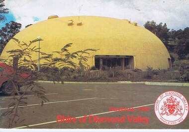
Book, The Shire of Diamond Valley Handbook 1981, 1981_
Guide to services provided by Shire of Diamond Valley. The Shire of Diamond Valley was a Local Government Area located about 20 kilometres northeast of Melbourne. The shire covered an area of 74.38 square kilometres and existed from 1964 until 1994.Annual guide to services in Shire of Diamond Valley28 pages, col illus., maps. Cover illustration of "Diamond Creek Bini-shell". (2 copies)shire of diamond valley, greensborough, handbooks -
 Greensborough Historical Society
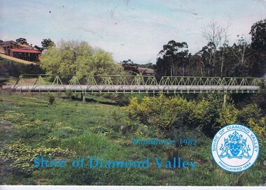
Book, The Shire of Diamond Valley Handbook 1982, 1982_
Guide to services provided by Shire of Diamond Valley. The Shire of Diamond Valley was a Local Government Area located about 20 kilometres northeast of Melbourne. The shire covered an area of 74.38 square kilometres and existed from 1964 until 1994.Annual guide to services in Shire of Diamond Valley32 pages, col illus., maps. Cover illustration of aqueduct and bridge over Plenty River near Apollo Parkways estste.shire of diamond valley, greensborough, handbooks -
 Greensborough Historical Society
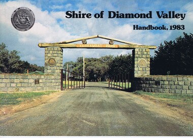
Book, Shire of Diamond Valley Handbook 1983, 1983_
Guide to services provided by Shire of Diamond Valley. The Shire of Diamond Valley was a Local Government Area located about 20 kilometres northeast of Melbourne. The shire covered an area of 74.38 square kilometres and existed from 1964 until 1994.Annual guide to services in Shire of Diamond Valley32 pages, col illus., maps. Cover illustration of the bluestone gateway, main entrance to Yarrambat Park, opened 1982.shire of diamond valley, greensborough, handbooks -
 Greensborough Historical Society
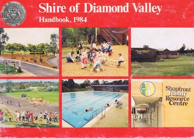
Book, Shire of Diamond Valley Handbook 1984, 1984_
Guide to services provided by Shire of Diamond Valley. The Shire of Diamond Valley was a Local Government Area located about 20 kilometres northeast of Melbourne. The shire covered an area of 74.38 square kilometres and existed from 1964 until 1994.Annual guide to services in Shire of Diamond Valley32 pages, col illus., maps. Cover illustration of recreation facilities in Diamond Valley.shire of diamond valley, greensborough, handbooks -
 Greensborough Historical Society
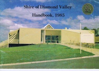
Book, Shire of Diamond Valley Handbook 1985, 1985_
Guide to services provided by Shire of Diamond Valley. The Shire of Diamond Valley was a Local Government Area located about 20 kilometres northeast of Melbourne. The shire covered an area of 74.38 square kilometres and existed from 1964 until 1994.Annual guide to services in Shire of Diamond Valley32 pages, col illus., maps. Cover illustration of Library/Arts facility at Civic Centre Greensborough, opened 1985.shire of diamond valley, greensborough, handbooks -
 Greensborough Historical Society
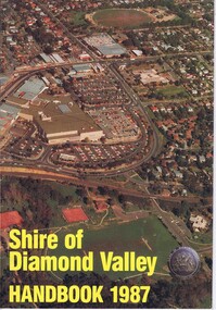
Book, Shire of Diamond Valley Handbook 1987, 1987_
Guide to services provided by Shire of Diamond Valley. The Shire of Diamond Valley was a Local Government Area located about 20 kilometres northeast of Melbourne. The shire covered an area of 74.38 square kilometres and existed from 1964 until 1994.Annual guide to services in Shire of Diamond Valley32 pages, col illus., maps. Cover illustration of aerial view of Greensborough shopping area and environs.shire of diamond valley, greensborough, handbooks -
 Greensborough Historical Society
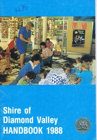
Book, Shire of Diamond Valley Handbook 1988, 1988_
Guide to services provided by Shire of Diamond Valley. The Shire of Diamond Valley was a Local Government Area located about 20 kilometres northeast of Melbourne. The shire covered an area of 74.38 square kilometres and existed from 1964 until 1994.Annual guide to services in Shire of Diamond Valley32 pages, col illus., maps. Cover illustration of activity following pre-school story time for 3-5 year olds at the library. (2 copies)shire of diamond valley, greensborough, handbooks -
 Greensborough Historical Society
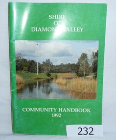
Book, Shire of Diamond Valley Community Handbook 1992, 1992_
Guide to services provided by Shire of Diamond Valley. The Shire of Diamond Valley was a Local Government Area located about 20 kilometres northeast of Melbourne. The shire covered an area of 74.38 square kilometres and existed from 1964 until 1994.Annual guide to services in Shire of Diamond Valley52 pages, col illus., maps. Cover illustration of Kalparrin Gardens Greensboroughshire of diamond valley, greensborough, handbooks -
 Greensborough Historical Society
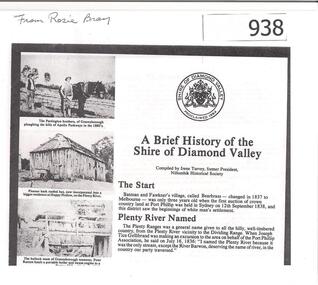
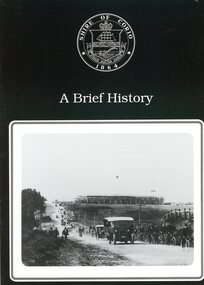
Article, Shire of Diamond Valley, A brief history of the Shire of Diamond Valley by Irene Turvey, 1837o
This brief history discusses the Shire of Diamond Valley. The Shire of Diamond Valley was a Local Government Area located about 20 kilometres northeast of Melbourne. The shire covered an area of 74.38 square kilometres and existed from 1964 until 1994.This article includes some images of early building in the Shire of Diamond Valley.Photocopied article. 4 pages text and illus.On front page "from Rosie Bray"shire of diamond valley, irene turvey -
 Greensborough Historical Society
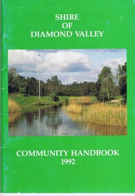
Book, Shire of Diamond Valley, Shire of Diamond Valley Community Handbook 1992, 1992_
Guide to services provided by Shire of Diamond Valley. The Shire of Diamond Valley was a Local Government Area located about 20 kilometres northeast of Melbourne. The shire covered an area of 74.38 square kilometres and existed from 1964 until 1994.Annual guide to services in Shire of Diamond Valley52 pages, col illus., maps. Cover illustration of Kalparrin Gardens Greensboroughshire of diamond valley -
 Learmonth and District Historical Society Inc.
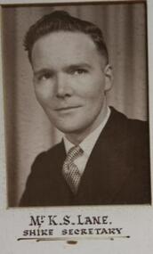
Photo - Kane, Possibly Drummond Studios, Kane.K.S.( Mr).Shire Secretary,1959
Mr. K.S.Lane was Shire Secretary for the Ballarat Shire Council in 1959.This forms part of a composite collection of photos presented by the Shire Preident,to commemorate the opening of the Wendouree Municiple Centreon 20th November 1959. Original Historical Photo of all Councilors for the year 1959Mr.K.S. Lane,(Shire Secretary).Sepia photo (rectangular) on white mount,situated left hand side of middle row,of composite photo of all councilors for the year 1959. Shire President Charles Edward,"Ted" Brown and councilors,commemorating opening of Wendouree Municiple Centre 20th November 1959.wendouree municiple centre opening 20th november 1959, ballarat shire council, lane k s mr, shire secretary 1959 -
 Greensborough Historical Society
Booklet, Shire of Corio, A Brief history of the Shire of Corio, 1980s
History of Shire of Corio, a local government area between Geelong and Werribee. The Shire included all of Geelong's northern suburbs and existed from 1861 to 1993.12 p., printed in green on white paper, photographs, stapled.geelong, shire of corio, werribee -
 Eltham District Historical Society Inc
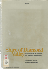
Book - Report, Gunn Hayball Pty Ltd Architects and Planners, Shire of Diamond Valley, Feasibility Study of Community Arts and Crafts Requirements, 1977
This report was prepared in response to a brief issued by the Shire of Diamond Valley to investigate the requirements for arts/crafts in the Shire and suggest options available in satisfying those requirements.Ex Yarra Plenty Regional Library - Local History, Dewey labels and catalogue stamp inside rear covershire of diamond valley, community arts and crafts, feasibility study -
 Greensborough Historical Society
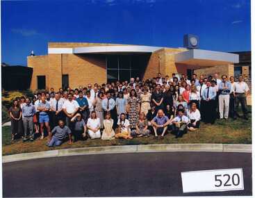
Photograph (Framed), Shire of Diamond Valley, Shire of Diamond Valley Staff. Last day 1992, 1992_12
Photograph of "indoor" staff, Shire of Diamond Valley, on their last day at work for the Shire.The Shire of Diamond Valley was a Local Government Area located about 20 kilometres northeast of Melbourne. The shire covered an area of 74.38 square kilometres and existed from 30/09/1964 until 14/12/1994.Large colour photograph in timber frame.shire of diamond valley -
 Greensborough Historical Society
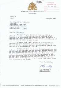
Letter, Letter from Shire of Diamond Valley to Mrs Margaret Willimott 1987, 26/05/1987
Letter from Shire Engineer, Shire of Diamond Valley to Mrs Margaret Willimott of Watsonia High School, confirming a donation of plants for the school's 25th Anniversary Garden. Single page typed on letterhead.shire of diamond valley, watsonia high school, margaret willimott -
 Greensborough Historical Society
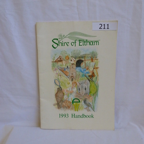
Book, Shire of Eltham, Shire of Eltham 1993 Handbook, 1993_
The Shire of Eltham was a Local Government Area located about 25 kilometres northeast of Melbourne. The shire covered an area of 277.13 square kilometres and existed from 1856 until 1994.Guide to services provided by Shire of Eltham in 1993.40 pages, illus. Front cover is a montage depicting various elements of the Eltham community. Handbook printed on recycled paper.eltham, shire of eltham, handbooks -
 Greensborough Historical Society
Book, Shire of Eltham, Shire of Eltham Handbook 1988, 1988_
The Shire of Eltham was a Local Government Area located about 25 kilometres northeast of Melbourne. The shire covered an area of 277.13 square kilometres and existed from 1856 until 1994.Guide to services provided by Shire of Eltham52 pages, illus. Front cover is a copy of the painting "Panton Hill" by David Armfield.eltham, shire of eltham, handbooks -
 Greensborough Historical Society
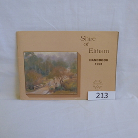
Book, Shire of Eltham, Shire of Eltham Handbook 1991, 1991_
The Shire of Eltham was a Local Government Area located about 25 kilometres northeast of Melbourne. The shire covered an area of 277.13 square kilometres and existed from 1856 until 1994.Annual guide to services in Shire of Eltham60 pages, Illus. Printed on beige paper. Front cover has a copy of the painting "Brougham Street Bridge" by Hilary Jackman.eltham, shire of eltham, handbooks -
 Greensborough Historical Society
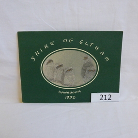
Book, Shire of Eltham, Shire of Eltham Handbook 1992, 1992_
The Shire of Eltham was a Local Government Area located about 25 kilometres northeast of Melbourne. The shire covered an area of 277.13 square kilometres and existed from 1856 until 1994.Annual guide to services in Shire of Eltham72 pages, illus. Front cover has a copy of a sketch "Frogmouths" by Margo Kroyer Pederson on dark green cover. Printed on recycled paper.eltham, shire of eltham, handbooks -
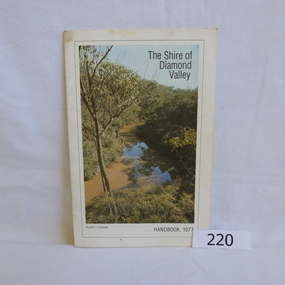 Greensborough Historical Society
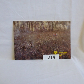
Book, Shire of Diamond Valley, The Shire of Diamond Valley Handbook 1977, 1977_
The Shire of Diamond Valley was a Local Government Area located about 20 kilometres northeast of Melbourne. The shire covered an area of 74.38 square kilometres and existed from 1964 until 1994.Annual guide to services in Shire of Diamond Valley18pages, illus (some colour), maps. Front cover photograph "Plenty Gorge".shire of diamond valley, greensborough, handbooks