
Showing 755 items matching "survey department"
-
 Montmorency–Eltham RSL Sub Branch
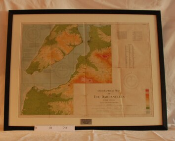
Map - Framed 1915 Map of Krithia, Gallipoli, 1915 Map of Krithia, Gallipolli, 1915
... ...survey department...A framed topographical map of The Dardenelles produced from captured Turkish maps by the Egyptian Survey Department. The main feature is the Krithia battlefield area in 1915....Survey Department - Egypt...world war one 1915 egypt map dardenelles krithia survey department turkey battlefields Krithia Peninsula (The Dardenelles) World War One - 1915 Map A framed topographical map of The Dardenelles produced from captured Turkish maps by the Egyptian Survey Department. ...A framed topographical map of The Dardenelles produced from captured Turkish maps by the Egyptian Survey Department. The main feature is the Krithia battlefield area in 1915.Krithia Peninsula (The Dardenelles) World War One - 1915 Mapworld war one, 1915, egypt, map, dardenelles, krithia, survey department, turkey, battlefields -
 Montmorency–Eltham RSL Sub Branch
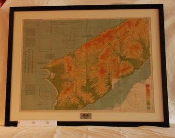
Map - Framed 1915 map of Sulva Bay, Gallipoli, 1915 Map of Silva Bay, Gallipoli, 1915
... ...survey department...Survey Department - Egypt...This map was used in the Dardenelles Campaign 1915-1916. world war one middle east gallipoli 1915 map dardenelles sulva bay survey department battlefields egypt cairo Framed map showing the Sulva Bay area of the Gallipoli battlefield in 1915. 1915 Map of Silva Bay, Gallipoli Map Framed 1915 map of Sulva Bay, Gallipoli Survey Department - Egypt ...This map was used in the Dardenelles Campaign 1915-1916.Framed map showing the Sulva Bay area of the Gallipoli battlefield in 1915.world war one, middle east, gallipoli, 1915, map, dardenelles, sulva bay, survey department, battlefields, egypt cairo -
 Montmorency–Eltham RSL Sub Branch
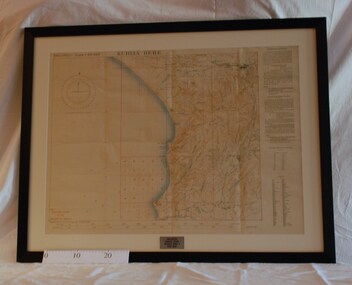
Map - Framed 1915 Anzac Cove Map, Gallipoli, 1915.ANZAC Cove Map, 1915
... A framed map depicting trench lines and the battlefields of the Gallipoli Campaign, 1915, made by the Survey Department Egypt. Depth soundings of landing areas off Anzac Cove....Survey Department - Egypt...world war one anzac gallipoli 1915 anzac cove map dardenelles trench lines depth soundings landing areas Gallipoli - Anzac Cove World War One Map - 1915 A framed map depicting trench lines and the battlefields of the Gallipoli Campaign, 1915, made by the Survey Department Egypt. Depth soundings of landing areas off Anzac Cove. 1915.ANZAC Cove Map Map Framed 1915 Anzac Cove Map, Gallipoli Survey Department - Egypt ...A framed map depicting trench lines and the battlefields of the Gallipoli Campaign, 1915, made by the Survey Department Egypt. Depth soundings of landing areas off Anzac Cove.Gallipoli - Anzac Cove World War One Map - 1915world war one, anzac, gallipoli, 1915, anzac cove, map, dardenelles, trench lines, depth soundings, landing areas -
 University of Melbourne, Burnley Campus Archives
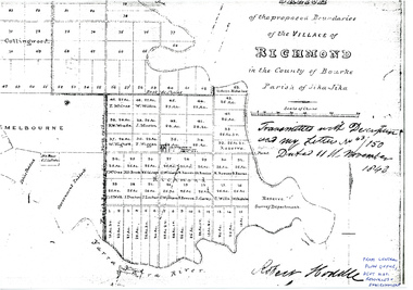
Plan - Photocopy, Sketch of the Proposed Boundaries of the Village of Richmond, 1843
... ...Survey Department...Shows Burnley Gardens site as "Reserve. Survey Department." original in Central Plan Office, Department of Natural Resources and Environment...richmond jika-jika Survey Department Yarra River Robert Hoddle In ink: From Central Plan Office Dept. ...Sketch of the proposed boundaries of the village of Richmond in the County of Bourke Parish of Jika-Jika. Handwritten on original: "Transmitted with Description and my letter No 43/150 Dated 11th November 1843 Robert Hoddle." Shows Burnley Gardens site as "Reserve. Survey Department." original in Central Plan Office, Department of Natural Resources and EnvironmentIn ink: From Central Plan Office Dept. Nat. Resources & Environmentrichmond, jika-jika, survey department, yarra river, robert hoddle -
 Flagstaff Hill Maritime Museum and Village
Award - Certificate of Service, F. W. Strahle, James Patten, 23-08-1907
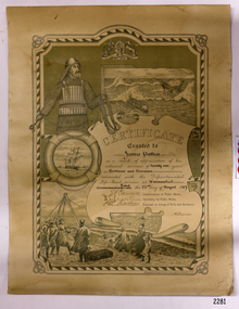
... Strahle at the request of the Department of Lands & Survey, Melbourne, Victoria. During his time of service, James Patten was awarded a medal and certificate by the Royal Humane Society of Australasia for his bravery. ...Departmental Life-Boat service at Warrnambool - dated the 23rd day of August 1907." SIGNATURES: [Commissioner of Public Works], [Secretary of Public Works], [Engineer in charge of Ports and Harbours Melbourne] "Lithographed at the Dept of Lands & Survey - Melb/ by F.W. ...Survey...Department of Life-Boat Service...Strahle Department of Lands & Survey Department of Life-Boat Service James Patten ...This certificate acknowledges 21 years of service given by James Patten, one of the original 1859 Lifeboat Warrnambool as a boatman and bowman. At the time, all retiring Volunteer lifeboatmen were honoured with this award. It was made as a lithograph that was created by F. W. Strahle at the request of the Department of Lands & Survey, Melbourne, Victoria. During his time of service, James Patten was awarded a medal and certificate by the Royal Humane Society of Australasia for his bravery. Patten and his friend Joseph Lowe, who couldn't swim, were with their friend James Ferrier in a boat on the Hopkins River, Warrnambool, when their boat capsized. Ferrier made it to shore, and Patten tried unsuccessfully to hold onto Lowe and bring him to shore. The event occurred on 18th April 1890. The images on the Certificate show a collage of rescue events performed by the lifesavers; a shipwreck rescue in progress, lifeboat conveying five boatmen using two oars each, and a bowman standing at the bow, a linesman wearing a life jacket and holding a rescue line, a lifesaver ring with images of three sailing ships inside it, a shipwreck near shore, a woman and girl in shallow water, a rescue using a breeches buoy on the lifeline, two rescuers walking towards the survivor, rescue crew wearing waterproof clothing, a rocket machine with a pulley to bring the survivor in a breaches buoy to shore, and a rescue crew member holding a flare. Volunteers at the time received a small payment, or 'retainer'', for their practices and a payment of gratitude for the rescues they attended. Across the years between 1856 to 1979 the combined service in Victoria saved 260 lives. Amazingly, some of the volunteers could not even swim.This certificate shows the State and Local Government's appreciation for the years of service spent by in the endeavour to save lives in peril in and on the local waters in the early 20th Century. The lithographed design depicts the many skills and services performed by the lifesavers of the era.Certificate of Service, unframed, awarded to James Patten on 23rd August 1907, recognising his 21 years of service with the original Warrnambool Life Boat Service as a Boatman and Bowman. Certificate is on rectangular, cream paper, lithographed design, printed and handwritten. Letterhead with the Royal Coat of Arms of the United Kingdom and a French motto. Images depict lifesaving crew, lifeboat, rescue equipment and a rescue in progress. The border is waves inside of frame of looped rope. Signatures of Commissioner of Public Works, Secretary of Public Works, and Engineer in charge of Ports and Harbours, Melbourne. Printed from a lithograph produced by F.W. Strahle on 23rd June 1907.MOTTO: "Dieu Droit Et Mon, Ni Soit Qui Mal y" TREXT: "Certificate granted to James Patten as a mark of appreciation of his esteemed services of 21 years as Boatman and Bowman connected with the Departmental Life-Boat service at Warrnambool - dated the 23rd day of August 1907." SIGNATURES: [Commissioner of Public Works], [Secretary of Public Works], [Engineer in charge of Ports and Harbours Melbourne] "Lithographed at the Dept of Lands & Survey - Melb/ by F.W. Strahle, 23.6.07"flagstaff hill, warrnambool, flagstaff-hill, maritime museum, maritime village, shipwreck-coast, flagstaff hill maritime museum & village, james patten, life-saving, lifesaving, rescue, bravery, drowning, joseph lowe, james ferrier, hopkins river, boat accident, certificate of service, 1890, 1907, bowman, boatman, departmental life-boat service, life-boat service, lifeboat service, august 1907, commissioner of public works, public works, ports and harbours melbourne, lands & survey melbourne, f w strahle, lithograph, 1856-1979, 260 lives saved, victorian volunteers, lifeboatmen, retired lifeboatmen -
 Emerald Museum & Nobelius Heritage Park
Map - Survey Map, Department of Lands and Survey, 1948
... ...Department of Lands and Survey...Survey...Department of Lands and Survey Government Printer...Emerald Victoria Australia land surveys pioneers Department of Lands and Survey Survey map which includes Emerald Township Map Survey Map Department of Lands and Survey Department of Lands and Survey Government Printer ...Map of area bounded by Monbulk in north and Berwick in the south; includes Emerald township on eastern border and Upwey Station on western border. Shows land holders.Survey map which includes Emerald Townshipemerald, victoria, australia, land surveys, pioneers, department of lands and survey -
Port Melbourne Historical & Preservation Society
Plan - Football Ground, Department of Survey & Lands, 13 May 1880
... Football Ground, Department of Survey & Lands...Plan for Football Ground on land being granted by Department of Survey & Lands, 1880...Sport - Australian Rules Football Sport - Recreational Grounds J Kitchen & Sons Pty Ltd Port Melbourne Football Club PMFC Plan for Football Ground on land being granted by Department of Survey & Lands, 1880 Plan Football Ground, Department of Survey & Lands ...Plan for Football Ground on land being granted by Department of Survey & Lands, 1880sport - australian rules football, sport - recreational grounds, j kitchen & sons pty ltd, port melbourne football club, pmfc -
 Kew Historical Society Inc
Photograph - Aerial Photograph, Division of Survey and Mapping, Department of Property and Services, City of Kew, Scale 1 : 3,000, 1989, 1989
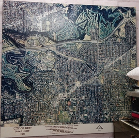
... Photomosaic compiled by Division of Survey and Mapping, Department of Property and Services. © Crown (State of Victoria) Copyright 1990....Division of Survey and Mapping, Department of Property and Services...Photomosaic compiled by Division of Survey and Mapping, Department of Property and Services. © Crown (State of Victoria) Copyright 1990. ...The City of Kew was a local government area about 4 kilometres east of Melbourne, the state capital of Victoria, Australia, on the southeast bank of the Yarra River. The city covered an area of 14.56 square kilometres, and existed from 1860 until 1994.Very large aerial photograph of “City of Kew” Scale 1 : 3,000. 1989. “City of Kew” Scale 1 : 3,000. 1989. Photomosaic compiled by Division of Survey and Mapping, Department of Property and Services. © Crown (State of Victoria) Copyright 1990.city of kew, kew (vic.), aerial photography -
 Bendigo Historical Society Inc.
Administrative record - Ex-Fortuna Survey Association Collection: Department of Transport and Construction Reports, July-Nov 1982
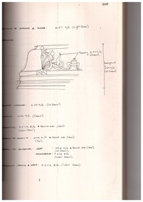
... Ex-Fortuna Survey Association Collection: Department of Transport and Construction Reports...Administrative record Ex-Fortuna Survey Association Collection: Department of Transport and Construction Reports ...Fortuna Villa has undergone numerous additions and alterations over more than a century. The oldest part of the building dates back to the late 1860s, originally built by Balderstedt and later purchased by mining magnate George Lansell.Lansell expanded the house significantly during his ownership (1869–1905), with further changes after his death and army occupation from 1942 onward. Early photographs and plans were used to tentatively date various additions and alterations, such as verandahs, conservatories, and new blocks. The building's form evolved substantially between the 1870s and early 1900s, with major structural changes and new architectural features added over time. Detailed paint sampling was conducted in four rooms, with more general investigation in others. The complexity of the building and its many alterations made it difficult to precisely date all decorative schemes. Family papers may hold further information, but were not examined in this report. The report suggests that any future restoration or reconstruction should include more comprehensive research, especially into family archives, to better understand the original decorative treatments.Fortuna Villa - Department of Transport and Construction Reports July 1982 by Allom Lovell & Associates in Association with Prudance Sanderson, 15 Niagra Lane Melbourne 3000 and G B Loader Nov 1982 This Document Contains the following two Items: 11231.1a This document is an investigation report on the internal decorative treatments and paint schemes of Fortuna Villa in Bendigo, focusing on its historical development and restoration considerations. Introduction pages only of a large report and workbook which describes things such as plaster ornations, panelling etc. Mostly done with hand-written notes and sketches. 11231.1b Typical Page of the report describing a ceiling cornise. The Document consists of 163 pages typed with spaces for photographs (Black and White), sketches and plans; with space on pages where hand-written details and observations have been entered. It is stapled together with a rear gold cover. The binder is of the black fabric type which due to age has almost detached itself. It appears that this is a black and white copy of an original coloured copy. The legends to the plans were origionally coloured. 11231.1c This document (20 pages) provides the final recommendations for the internal colour scheme for the restoration of the heritage property "Fortuna Villa" in Bendigo, Australia. First two pages and the colour samples fold out page. The document outlines the recommended proprietary colours for the interior restoration of Fortuna Villa, a significant heritage property. A detailed list of recommended colours is included, featuring shades such as Bamboo, Beanstalk, Blazer Brown, Chatham Green, Cream, Deep Brunswick Green, Desert Sand, and others.Some finishes include clear polyurethane and varnish.A few colours are noted as having "NO SAMPLE" available. The document is held together by black fabric binding which is coming apart. bendigo, fortuna villa, history, army survey regiment -
 Bendigo Historical Society Inc.
Administrative record - Ex-Fortuna Survey Association Collection: Department of Administrative Services Construction Report: Parts 1 and 2 Conservation Analysis (Drafts), Dec 1987 - Jan 1988
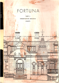
... Ex-Fortuna Survey Association Collection: Department of Administrative Services Construction Report: Parts 1 and 2 Conservation Analysis (Drafts)...The property was owned by the Commonwealth of Australia, managed by the Department of Defence, and occupied by the Army Survey Corps. The study primarily addresses key structures on the site, including the former house, laundry, quartz mill, coach house, stables, swimming bath, summerhouse, fountain, and arbor. ...Administrative record Ex-Fortuna Survey Association Collection: Department of Administrative Services Construction Report: Parts 1 and 2 Conservation Analysis (Drafts) ...This plan was commissioned by the Department of Administrative Services to outline the heritage qualities of Fortuna and provide guidelines for its future conservation. The property was owned by the Commonwealth of Australia, managed by the Department of Defence, and occupied by the Army Survey Corps. The study primarily addresses key structures on the site, including the former house, laundry, quartz mill, coach house, stables, swimming bath, summerhouse, fountain, and arbor. Fortuna is listed on the Register of the National Estate, classified by the National Trust of Australia (Victoria), and designated as a significant building in the City of Bendigo Planning Scheme. The site was originally part of the Ravenswood or Mount Alexander squatting run, licensed in 1840. Gold was discovered in the area in 1851, leading to the establishment of government camps and the development of Bendigo as a major gold mining center. The Victoria reef, located near the site, was one of the principal gold-bearing reefs in Bendigo, with mining activity beginning in the mid-1850s. The evolution of mining technology and the formation of mining companies played a significant role in the area's development. Fortuna is recognized for its historical, architectural, and environmental value, with conservation efforts focused on the estate as it existed around 1907 under the Lansells' ownership. Key structures to be conserved include the main house, shadehouse, stables, coach house, swimming bath, battery, retort room, Pompeii fountain, summerhouse, arbour, garage, laundry, and tunnel The plan includes detailed documentation of the site's existing structures, site plans, building plans, elevations, and features. Early photographs, drawings, and chronological development plans are used to support the analysis. The document assesses the historical, architectural, and environmental significance of the site.It provides a statement of cultural significance and recommendations for conservation priorities. This plan serves as a foundational document for understanding Fortuna's heritage value and guiding its preservation.Fortuna Villa Department of Administrative Services Construction Report: Part 1 Conservation Analysis (Draft) Dec 1987 by consultants John and Thurley O'Connor Pty Ltd, Architects, 10 Sefton Place, Camberwell, Vic, 3124 This Document Contains the following Items: PART 1 11231.2a This conservation management plan provides a comprehensive analysis of the Fortuna site in Bendigo, focusing on its historical, architectural, and cultural significance. The first have pages are copied here. 11231.2b Front Cover It appears that this is a black and white copy of an original coloured copy. The Document consists of approximately 200 pages typed with historical notes, photographs (Black and White), sketches (of various items including furniture and fittings; plans, and copies of legal documents. It is stapled together with a rear manila cover; and further held with metal holders. There is no binder. PART 2 11231.2c Front Cover 11231.2d This document outlines the management and conservation plan for the Fortuna Bendigo estate, focusing on heritage preservation, user requirements, and development guidelines. The first five pages are copied here. It appears that this is a black and white copy of an original coloured copy. The Document consists of approximately 90 pages typed with historical notes, mostle plans of the rooms and outbuidings. It is stapled together with a rear manila cover; and further held with metal holders. There is no binder. bendigo, fortuna villa, history, army survey regiment -
Stawell Historical Society Inc
Archive - Maps, Victorian Government, Bailliere's Country Atlas of Victoria, 1866
... Under the Supervision of the Mining and Survey Department...Stawell is on Wimmera & Loddon Map Under the Supervision of the Mining and Survey Department Large Boxed Volume of Maps in Book Burgandy Coloured Box Bailliere's Country Atlas of Victoria Archive Maps Victorian Government ...Stawell is on Wimmera & Loddon MapLarge Boxed Volume of Maps in Book Burgandy Coloured BoxUnder the Supervision of the Mining and Survey Department -
 Glenelg Shire Council Cultural Collection
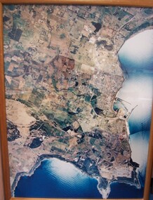
Photograph - Photograph - aerial view of Portland, 1988
... Division of Survey & Mapping, Department of Property & Services, Government of Victoria...Portland Dec. 1988. aerial photography central Portland Portland Harbour Front: (no inscriptions) Back: (no inscriptions) Aerial view of the "City of Portland" and surrounding rural area to a scale of 1:10,000 Aerial Photomosaic of Portland Bay, 1988 Photograph Photograph - aerial view of Portland Division of Survey & Mapping, Department of Property & Services, Government of Victoria ...Census Project No. 1995. Portland Dec. 1988.Aerial view of the "City of Portland" and surrounding rural area to a scale of 1:10,000 Aerial Photomosaic of Portland Bay, 1988Front: (no inscriptions) Back: (no inscriptions)aerial photography, central portland, portland harbour -
 City of Greater Bendigo - Civic Collection
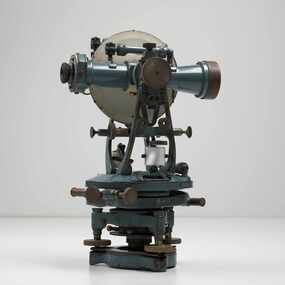
Instrument - Theodolite, Cooke, Troughton & Simms, c 1940
... ...Lands and Survey Department Bendigo...City of Greater Bendigo Administration Item Lands and Survey Department Bendigo Cooke, Thoughton & Simms Ltd / York. ...Theodolites are a highly accurate instrument that measures angles between designated visible points in the horizontal and vertical planes. The theodolite has a long history, with the term first found in 1571 in a surveying textbook 'A geometric practice named Pantometria' by Leonard Digges. (source https://en.wikipedia.org/wiki/Theodolite). Cooke Troughton & Simms began when John Troughton starting selling products in Fleet Street, London in 1782. He went into partnership with his brother Edward in 1807 who expanded the business considerably. William Simms, a former apprentice with the company was taken as a partner and then manager after Edward died in 1835 and the company became Troughton & Simms. By 1887 the company was able to produce all the parts necessary for their instruments and the company employed nearly 200 people and was one of the most well respected firms of instrument makers of the 1800's. James Simms, son of William who had inherited the company died in 1915 and the company was turned into a limited liability company by his two sons William and James. Things however were not so easy for the two sons and in 1922 the business was brought out by their rival T. Cooke & Sons becoming Cooke, Troughton & Simms. Theodolites are used by surveyors as part of their everyday work and although there is no specific information regarding the provenance of this particular one it is assumed it was used locally by the City of Bendigo and / or the Lands Department.A grey theodolite no 39161 made by Cooke, Thoughton & Simms. Various moving parts showing signs of extensive use particularly on the uprights on the main body and around knobs and dials where the paint is worn back to brass.Cooke, Thoughton & Simms Ltd / York. England / No 39161. Sticker; DPS - Asset No / (barcode) / 0010173city of greater bendigo administration item, lands and survey department bendigo -
 City of Greater Bendigo - Civic Collection
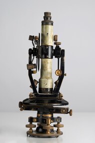
Instrument - Theodolite, E. R. Watts & Sons, c 1930
... Lands and Survey Department Bendigo...surveying textbook 'A geometric practice named Pantometria' by Leonard Digges. (source https://en.wikipedia.org/wiki/Theodolite). Theodolites are used by surveyors as part of their everyday work and although there is no specific information regarding the provenance of this particular one it is assumed it was used locally by the Shire of Marong and / or the Lands Department. ...Watts & Son Ltd amalgamating with Adam Hilger Ltd to form Hilger & Watts in 1948. Lands and Survey Department Bendigo Shire of Marong Watts & Sons / London / 5974 For N H Seward / Melbourne 0442.1 A black and grey theodolite no 39161 made by Watts & Sons. ...Theodolites are a highly accurate instrument that measures angles between designated visible points in the horizontal and vertical planes. The theodolite has a long history, with the term first found in 1571 in a surveying textbook 'A geometric practice named Pantometria' by Leonard Digges. (source https://en.wikipedia.org/wiki/Theodolite). Theodolites are used by surveyors as part of their everyday work and although there is no specific information regarding the provenance of this particular one it is assumed it was used locally by the Shire of Marong and / or the Lands Department. Edwin Watts started the company in 1856, trading up to 1920s as E.R. Watts & Son with E. R. Watts & Son Ltd amalgamating with Adam Hilger Ltd to form Hilger & Watts in 1948.0442.1 A black and grey theodolite no 39161 made by Watts & Sons. Various moving parts showing signs of extensive use particularly on the uprights on the main body and around knobs and dials where the paint is worn back to brass. Is housed in original box with key, oil container and pin. 0442.2 handwritten instructions for making adjustments to the Theodolite written on the back of Road Users' Association of Victoria letterhead note paper.Watts & Sons / London / 5974 For N H Seward / Melbournelands and survey department bendigo, shire of marong -
 Alfred Hospital Nurses League - Nursing History Collection
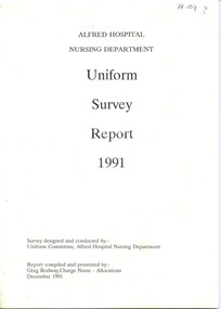
Document - Survey report, Alfred Hospital Nursing Department, Alfred Hospital Nursing Department Uniform Survey Report, 1991, December 1991
... Alfred Hospital Nursing Department Uniform Survey Report, 1991...Copies of the questionaires are included in the report Insight into how information is gathered prior to making any changes to nurses uniforms ALfred Hospital nurses uniform Nurses uniform Nurses uniform survey Previous catalogue number handwritten [black ink] at top right of front cover Bound booklet with white print and white binding. Title and presenters name on front cover Alfred Hospital Nursing Department Uniform Survey Report, 1991 Document Survey report Alfred Hospital Nursing Department Greg Rodway ...This survey was undertaken to review the Alfred Hospital registered nurses uniform that had been introduced in 1982. For a period of approximately 18 months (November 1989-May 1991) a group of staff members (26 female and 12 male) trialled a variety of uniforms, at the end of the trial they were asked to complete a questionaire. Questionaires were also distrubted to 923 "observers" (nursing staff not wearin the trial uniforms) for their opinions. Copies of the questionaires are included in the reportInsight into how information is gathered prior to making any changes to nurses uniformsBound booklet with white print and white binding. Title and presenters name on front coverPrevious catalogue number handwritten [black ink] at top right of front coveralfred hospital nurses uniform, nurses uniform, nurses uniform survey -
 Whitehorse Historical Society Inc.
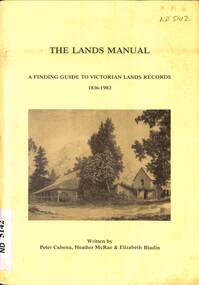
Manual - Government (Lands Dept), Royal Historical Society of Victoria, The Lands Manual - A Finding Guide to Victorian Land Records 1836 - 1983, March 1989
... Victoria. Department of Crown Lands and Survey...The manual documents the archives of the Department of Crown Lands and Survey (Lands Department) and explains how they can be used for historical research....The manual documents the archives of the Department of Crown Lands and Survey (Lands Department) and explains how they can be used for historical research. ...The manual documents the archives of the Department of Crown Lands and Survey (Lands Department) between 1836 to 1983 and explains how they can be used for historical research.The manual documents the archives of the Department of Crown Lands and Survey (Lands Department) and explains how they can be used for historical research.The manual documents the archives of the Department of Crown Lands and Survey (Lands Department) between 1836 to 1983 and explains how they can be used for historical research.crown lands, victoria. department of crown lands and survey -
 Bendigo Historical Society Inc.
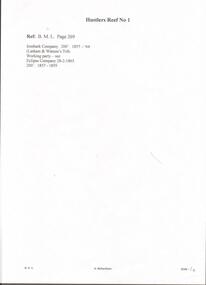
Document - HUSTLERS REEF - PLANS & SECTIONS TO ACCOMPANY BULLETIN NO 33
... Geological Survey of Victoria... Department...Mine, Hustler's Consols Mine, Fortuna Hustler's Mine. Department of Mines Geological Survey of Victoria 1914. Written on the back: Lightning Hill area to Summer Hill....DOCUMENT Hustlers Reef Plans & Sections to Accompany Bulletin No 33 Geological Survey of Victoria Department of Mines Hustler's Line of Reef H S Whitelaw Fortuna Hustler's Mine Hustler's Royal Reserve No 2 Mine Hustler's Royal Reserve Mine Park Shaft Great Extended Hustler's Mine Hustler's Reef Mine Hustler's Reef No 1 Mine Comet Mine United Hustler's Mine Redan Mine K K Mine Hustler's Consols Mine Fortuna Hustler's Mine Hustler's Consols Mine Albert J Mullett Government Printer Melbourne Pink page pasted onto cream card titled Plans and Sections to accompany Bulletin No 33. ...Pink page pasted onto cream card titled Plans and Sections to accompany Bulletin No 33. Hustler's Line of Reef, Bendigo by H S Whitelaw, by Authority: Albert J. Mullett, Government Printer, Melbourne. Plate No 1 to No 34. Mines mentioned: Fortuna Hustler's Mine, Hustler's Royal Reserve No 2 Mine, Hustler's Royal Reserve Mine Park Shaft, Great Extended Hustler's Mine, Hustler's Reef and Hustler's Reef No 1 Mines, Hustler's Reef Mine, Comet Mine, United Hustler's and Redan Mine, K. K. Mine, Hustler's Consols Mine, Fortuna Hustler's Mine. Department of Mines Geological Survey of Victoria 1914. Written on the back: Lightning Hill area to Summer Hill.document, hustlers reef, plans & sections to accompany bulletin no 33, geological survey of victoria, department of mines, hustler's line of reef, h s whitelaw, fortuna hustler's mine, hustler's royal reserve no 2 mine, hustler's royal reserve mine park shaft, great extended hustler's mine, hustler's reef mine, hustler's reef no 1 mine, comet mine, united hustler's mine, redan mine, k k mine, hustler's consols mine, fortuna hustler's mine, hustler's consols mine, albert j mullett, government printer melbourne -
University of Melbourne, Burnley Campus Archives
Map - Geological map, Melbourne and Suburbs, 1959
... Geological Survey of Victoria...Department...Melbourne metropolitan area geology Geological Survey of Victoria Department of Mines Geological map of Melbourne, 1959, modified by officers of the Geological Survey of Victoria, from earlier geological surveys. ...Geological map of Melbourne, 1959, modified by officers of the Geological Survey of Victoria, from earlier geological surveys. Scale 1:31.680melbourne metropolitan area, geology, geological survey of victoria, department of mines -
University of Melbourne, Burnley Campus Archives
Document, 1979 - 81 Triennial Survey, 1978
... survey...tafe...courses...department...tafec triennal survey tafe courses department of agriculture TAFEC Triennial Survey, Dept. of Agriculture Triennial Surveys for TAFE and CAE courses. 3 1979 - 81 Triennial Survey Document ...TAFEC Triennial Survey, Dept. of Agriculture Triennial Surveys for TAFE and CAE courses. 3tafec, triennal survey, tafe, courses, department of agriculture -
 Ringwood and District Historical Society
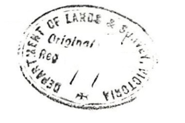
Archive, Lands Department Field Notes, Ringwood 1878-1955 (Parent Record)
... This record is the Parent Record for contents of folder "Lands Department - Survey of Field Notes of Ringwood Area"....This record is the Parent Record for contents of folder "Lands Department - Survey of Field Notes of Ringwood Area". ...This record is the Parent Record for contents of folder "Lands Department - Survey of Field Notes of Ringwood Area". -
Whitehorse Historical Society Inc.
Map, Blackburn East Primary School
... Rolled map. Works Department detail survey....Public Works Department Works Department detail survey. Public 1979. Rolled map. Works Department detail survey. ...Works Department detail survey.Public 1979. Rolled map. Works Department detail survey.Works Department detail survey.blackburn east primary school no. 4800, victoria. public works department -
 Federation University Historical Collection
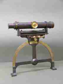
Instrument - Scientific Equipment, Miner's Dial, c1893 - 1901
... On suppliers label: "Instrument maker to the surveying and engineering departments of her Majesty's Government of South Australia"...The 1893 Ballarat School of Mines Calendar states that mine surveying instruments "always at the disposal of the students" including "one miner's dial". ballarat school of mines surveying scientific instruments scientific objects otto boettger optician Miner's Dial On suppliers label: "Instrument maker to the surveying and engineering departments of her Majesty's Government of South Australia" A surveying instrument consisting of theodolite with single crosshair(.1) mountable on a magnetic compass (.2), designed to sit inside a polished wood carry box. ...Used for surveying classes at the Ballarat School of Mines. Purchased/acquired during Queen Victoria's reign. The 1893 Ballarat School of Mines Calendar states that mine surveying instruments "always at the disposal of the students" including "one miner's dial".A surveying instrument consisting of theodolite with single crosshair(.1) mountable on a magnetic compass (.2), designed to sit inside a polished wood carry box. Serial Number 4470On suppliers label: "Instrument maker to the surveying and engineering departments of her Majesty's Government of South Australia"ballarat school of mines, surveying, scientific instruments, scientific objects, otto boettger, optician, miner's dial -
 Stawell Historical Society Inc
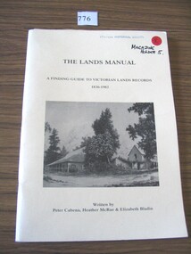
Book, Peter Cabena, Heather McRae & ElizabethBladin, The Lands Manual - A Finding guide to Victorias Lands Records 1836-1983, 1989
... The Purpose of this manual is to describe the documentary archives of the Department of Crown Lands and Survey (Lands Department) and Explain, how they can be used for historical research...The Purpose of this manual is to describe the documentary archives of the Department of Crown Lands and Survey (Lands Department) and Explain, how they can be used for historical research stawell The Lands Manual A Finding guide to Victorian Lands Records 1836-1983 Written by Peter Cabena, Heather McRae & Elizabeth Baldin Yellow card Cover Black Print and B/W Photo of two wooden buildings The Lands Manual - A Finding guide to Victorias Lands Records 1836-1983 Book Peter Cabena, Heather McRae & ElizabethBladin Alliance Printing Company Pty, Ltd ...The Purpose of this manual is to describe the documentary archives of the Department of Crown Lands and Survey (Lands Department) and Explain, how they can be used for historical researchYellow card Cover Black Print and B/W Photo of two wooden buildings The Lands Manual A Finding guide to Victorian Lands Records 1836-1983 Written by Peter Cabena, Heather McRae & Elizabeth Baldinstawell -
 Orbost & District Historical Society
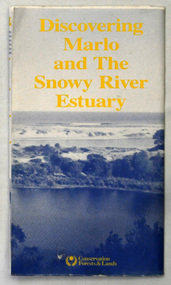
map/brochure, Discovering Marlo & The Snowy River Estuary, December 1988
... In 1983 the Department of Conservation, Forests and Lands replaced the Department of Crown Lands and Survey, the Department of State Forests and the Ministry for Conservation. ...In 1983 the Department of Conservation, Forests and Lands replaced the Department of Crown Lands and Survey, the Department of State Forests and the Ministry for Conservation. ...In 1983 the Department of Conservation, Forests and Lands replaced the Department of Crown Lands and Survey, the Department of State Forests and the Ministry for Conservation. This brochure/map was used as tourist information in Orbost.This item is a useful research tool.A folded map/brochure titled "DISCOVERING MARLO & THE SNOWY RIVER ESTUARY". On the front is a photograph of Marlo and the title in yellow print. There is a locality map for access to Corringle beach and the brochure Includes a key to fishing sites and various tourist locations. On the back of the brochure are notes on fishing, wildlife and a boating guide, map brochure snowy-river marlo -
 Bendigo Historical Society Inc.
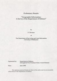
Document - FORTUNA COLLECTION: DOCUMENT
... Document - titled: Preliminary Results 'Geographic Information: A Survey of the Department of Defence' Additional written information on title page reads: 'by P. ...Department of Defence University of Melbourne Document - titled: Preliminary Results 'Geographic Information: A Survey of the Department of Defence' Additional written information on title page reads: 'by P. ...Document - titled: Preliminary Results 'Geographic Information: A Survey of the Department of Defence' Additional written information on title page reads: 'by P. Thwaites at The Department of Surveying and Land Information University of Melbourne. Sponsored by: Department of Defence (through the Post Graduate Study Award Scheme, Date: June 1988. ' Document is 17 single pages in length including a Contents page.department of defence, university of melbourne -
Emerald Museum & Nobelius Heritage Park
Map - Geological Survey Map 1882, Mines Department, Victoria, 1969
... Part of geological survey of Victoria by Department of Mines. Includes Emerald....Part of geological survey of Victoria by Department of Mines. Includes Emerald. ...Part of geological survey of Victoria by Department of Mines. Includes Emerald.Coloured map of geological survey of Ringwood geological zone. Scale 1 mile to 1 inch. Laminated.emerald, victoria, australia, dandenong ranges, victoria, australia, maps, geology, department of mines, victoria -
 Bendigo Historical Society Inc.
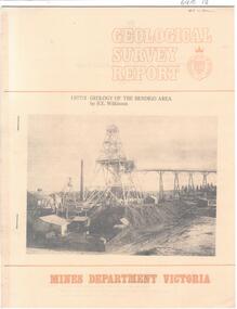
Document - CAROL HOLSWORTH COLLECTION: 1977 GEOLOGY OF THE BENDIGO AREA
... Sixteen page booklet Geological Survey Report, Mines Department Victoria. 'Geology of the Bendigo Area' by H.E. ...BENDIGO Mining geological survey report Sixteen page booklet Geological Survey Report, Mines Department Victoria. 'Geology of the Bendigo Area' by H.E. ...Sixteen page booklet Geological Survey Report, Mines Department Victoria. 'Geology of the Bendigo Area' by H.E. Wilkinson. Photo of Lansell's 222 Mine on the New Chum Line, Bendigo. Tallest poppet head on the field, approximately 38 m high, with a shaft depth of 635 m.bendigo, mining, geological survey report -
 Department of Energy, Environment and Climate Action
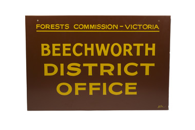
Beechworth FCV District office sign
... The Forests Commission had a long and proud history of innovation and of managing Victoria's State forests but in September 1983 lost its discrete identity when it was merged into the newly formed Victorian Department of Conservation, Forests and Lands (CFL) along with the Crown Lands and Survey Department, National Park Service, Soil Conservation Authority and Fisheries and Wildlife Service. ...The Forests Commission had a long and proud history of innovation and of managing Victoria's State forests but in September 1983 lost its discrete identity when it was merged into the newly formed Victorian Department of Conservation, Forests and Lands (CFL) along with the Crown Lands and Survey Department, National Park Service, Soil Conservation Authority and Fisheries and Wildlife Service. ...This sign proudly hung outside the Forests Commission Victoria (FCV) Beechworth office which is now site of the Forestry Heritage Museum. The granite building in the Beechworth's historic precinct was once the Gold Warden's Office and is one of the town's original buildings. The FCV was the main government authority responsible for management and protection of State forests in Victoria between 1918 and 1983. The Commission was responsible for ″forest policy, prevention and suppression of bushfires, issuing leases and licences, planting and thinning of forests, the development of plantations, reforestation, nurseries, forestry education, the development of commercial timber harvesting and marketing of produce, building and maintaining forest roads, provision of recreation facilities, protection of water, soils and wildlife, forest research and making recommendations on the acquisition or alienation of land for forest purposes″. The Forests Commission had a long and proud history of innovation and of managing Victoria's State forests but in September 1983 lost its discrete identity when it was merged into the newly formed Victorian Department of Conservation, Forests and Lands (CFL) along with the Crown Lands and Survey Department, National Park Service, Soil Conservation Authority and Fisheries and Wildlife Service. After the amalgamation the management of State forests and the forestry profession continued but the tempo of change accelerated, with many more departmental restructures occurring over the subsequent four decades. Responsibilities are currently split between the Department of Energy, Environment and Climate Action (DEECA), Forests Fire Management Victoria (FFMV), Parks Victoria, Melbourne Water, Alpine Resorts Commission, the State Government-owned commercial entity VicForests and the privately owned Hancock Victorian Plantations (HVP).Large office sign. Hand painted in traditional FCV mission brown and gold colour scheme.forests commission victoria (fcv), forest signs -
 Bendigo Military Museum
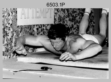
Photograph - 4th Field Survey Squadron – CPL John Ratcliffe World Record, Keswick Barracks, Adelaide SA, 1986
... CPL Ratcliffe, who works in the Army’s surveying department, said the most important aspect of the exercise was raising money for Legacy, not getting his name in the record books.” ...CPL Ratcliffe, who works in the Army’s surveying department, said the most important aspect of the exercise was raising money for Legacy, not getting his name in the record books.” ...This is a set of 12 photographs of 4th Field Survey Squadron’s CPL John Ratcliffe setting a world record for an exercise routine comprising push-ups, sit-ups and double back-arches at Keswick Barracks, Adelaide in November 1986. A newspaper article of unknown origin titled “John sets world’s best time in routine” was published reporting the achievement. The article reported: “Corporal John Ratcliffe has smashed his personal best time, his greatest expectations and the 16-year-old Australian record for a push-up, sit-up and double back-arch routine. Corporal Ratcliffe, 37, set a world record by doing 1232 push-ups (clapping his chest with his hands between each one), 1936 back-arches and 440 sit-ups in one hour, 16 minutes and 29 seconds yesterday. Officials representing the Guinness Book of Records were present and passed his effort. The record was achieved by repeating a set of 14 push-ups, 22 double back-arches and 5 sit-ups, 88 times. The Australian record for the same routine was set in 1970 in the time of 1 hour 41 minutes. CPL Ratcliffe beat his personal best time by 13 minutes. “I could not do it without them” CPL Ratcliffe said of the crowd. Nearing the end of the routine when he was tiring, the crowd of more than 100 clapped and chanted encouragement. CPL Ratcliffe, who works in the Army’s surveying department, said the most important aspect of the exercise was raising money for Legacy, not getting his name in the record books.” This achievement was also reported in the Army Newspaper dated 11th Dec 1986. There are eight more photos that have not been published in the set of negatives.This is a set of 12 photographs of 4th Field Survey Squadron’s CPL John Ratcliffe setting a exercise routine world record at Keswick Barracks, Adelaide in November 1986. The black & white photographs are on 35mm negative film and are part of the Army Survey Regiment’s Collection. The photographs were scanned at 96 dpi. .1) to .9) - Photo, black & white, 1986. CPL John Ratcliffe during his exercise routine. .10) - Photo, black & white, 1986. CPL John Ratcliffe celebrates the new world record. L to R: Bob Rogister, Wally Chilcott. .11) - Photo, black & white, 1986. CPL John Ratcliffe celebrates the new world record. L to R: Peter Imeson, Bob Rogister, Wally Chilcott. .12) - Photo, black & white, 1986. CPL John Ratcliffe interviewed by media after setting the new world record. .1P to .12P – There are no other personnel identified. ‘CPL RATCLIFFE “WORLD RECORD”. NOV 1986’ annotated on negatives sleeve.royal australian survey corps, rasvy, 4 fd svy sqn -
 Bendigo Historical Society Inc.
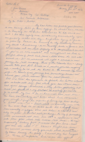
Document - Albert Richardson Collection: John H.W. Pettit letters, 1852 - 1853
... In October 1854 John Pettit settled at Tarraville where he was employed as a superintendent of works connected with Roads and Bridges, later he set up privately as an architect, builder, land surveyor until September 1856, when he was appointed Assistant Surveyor in the Survey Department in which capacity he selected up a new line of road to the Omeo diggings and laid out townships. ...In October 1854 John Pettit settled at Tarraville where he was employed as a superintendent of works connected with Roads and Bridges, later he set up privately as an architect, builder, land surveyor until September 1856, when he was appointed Assistant Surveyor in the Survey Department in which capacity he selected up a new line of road to the Omeo diggings and laid out townships. ...The three transcribed letters, numbers five, six and seven, are from a series of letters written by John Heithfield Wroth Pettit, 1852 - 1868, to his father in England. Letters five, six and seven are written mainly from the Forest Creek diggings at Castlemaine but also describe his time on the Bendigo goldfield. The full set of Pettit's letters describe his journey out to Australia on the 'Atrevida', his arrival, journey to the diggings, tools and methods used to search for gold during 1853 and his later life experiences working with roads and bridges, primarily in Gippsland area. In October 1854 John Pettit settled at Tarraville where he was employed as a superintendent of works connected with Roads and Bridges, later he set up privately as an architect, builder, land surveyor until September 1856, when he was appointed Assistant Surveyor in the Survey Department in which capacity he selected up a new line of road to the Omeo diggings and laid out townships. In 1862 he set up a business in Sale, Gippsland, as an architect/surveyor (Gippsland Times, 5th September, 1862, page 3). Letters from October 1854 to September 1856 give some information on the people, social life, opossum and kangaroo hunting, mustering cattle etc. Letters after 1856 mainly describe the country, methods of work and life led. Vocabularies of the Omeo, Norradyeree and Gippsland tribes c 1859 and a list of names of places, rivers and more, in the language of various un-named tribes in Gippsland c1857 occupy pages 148 – 162. (Source: https://indigenous.sl.nsw.gov.au/collection-items/john-h-w-pettit-letters-his-father-england-illustrated-sketches-writer-1852-1868#&gid=1&pid=3) Albert Richardson, the transcriber of the letters, was a long time member of the Bendigo Historical Society. He was particularly interested in the mining history of the region and wrote extensively on the mines on the Bendigo field. Thirty seven page handwritten transcription on lined foolscap paper by Albert Richardson of three of John Pettit's letters, numbers five, six and seven. The letters describe John's experiences on the Castlemaine, Bendigo and Ballarat goldfields. Extract from letter number five: 'We have been sinking sev'l holes about have obtained gold enough to pay the expenses of living up here perhaps a little more - it is hard work we usually rise with the Sun and keep at it until dark' John Pettit written in capitals in blue pen, top right hand corner of front pagejohn h.w. pettit, gold, goldmining, castlemaine, forest creek diggings, bendigo, gippsland
