Showing 1283 items matching "victoria archaeology"
-
 Federation University Historical Collection
Document, Eureka Stockade Site, 1991, 14/05/2014
... Ten typed pages of notes relating to the site of the Eureka Stockade by Iain Stuart of the Victoria Archaeological survey...It is not certain where the actual site of the stockade is. eureka eureka stockade eureka stockade site phillip clingin iain stuart eureka eureka stockade eureka stockade site phillip clingin iain stuart Ten typed pages of notes relating to the site of the Eureka Stockade by Iain Stuart of the Victoria Archaeological survey Eureka Stockade Site, 1991 Document Document ...The Eureka Stockade was attached on 03 December 1854. It is not certain where the actual site of the stockade is. Ten typed pages of notes relating to the site of the Eureka Stockade by Iain Stuart of the Victoria Archaeological surveyeureka, eureka stockade, eureka stockade site, phillip clingin, iain stuart, eureka, eureka stockade, eureka stockade site, phillip clingin, iain stuart -
 Greensborough Historical Society
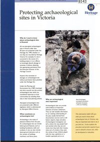
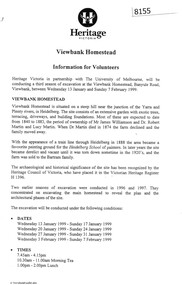
Pamphlet, Heritage Victoria, Protecting archaeological sites in Victoria, 1999c
... ...victoria archaeology...Greensborough Historical Society 34A Glenauburn Road Lower Plenty Lower Plenty melbourne Information on the protection and care of Victorian heritage sites; illustrations are are of work on Viewbank Homestead viewbank homestead victoria archaeology 4 p. pamphlet, text and colour photographs. 3 copies Protecting archaeological sites in Victoria. ...4 p. pamphlet, text and colour photographs. 3 copiesnon-fictionviewbank homestead, victoria archaeology -
 Greensborough Historical Society
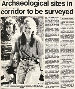
Newspaper - Newspaper Clipping - Digital Image, Diamond Valley News, Archaeological sites in corridor to be surveyed, 1990c
... ...victoria archaeology...The findings were published separately by Ellender and Weaver. plenty valley plenty river victoria archaeology victorian archaeological survey isabel ellender fiona weaver Digital copy of newspaper article Archaeological sites in corridor to be surveyed Newspaper Newspaper Clipping - Digital Image Diamond Valley News ...An undated newspaper article announcing an archaeological survey of the Plenty Valley corridor to be undertaken by Isabel Ellender and Fiona Weaver. The findings were published separately by Ellender and Weaver.Digital copy of newspaper articleplenty valley, plenty river, victoria archaeology, victorian archaeological survey, isabel ellender, fiona weaver -
Tatura Irrigation & Wartime Camps Museum
Booklet, VAS News, 1989
... Newsletter of the Victoria Archaeological Survey...Tatura Irrigation & Wartime Camps Museum 49 Hogan Street Tatura the-murray Newsletter of the Victoria Archaeological Survey vas news archalological survey tatura archaeology books newsletters Soft cover magazine, illustrated. ...Soft cover magazine, illustrated. Photograph of old man and 2 boys on front cover. Newsletter No. 6. Spring 1989-90. 16 pages.vas news, archalological survey, tatura, archaeology, books, newsletters -
 Ringwood and District Historical Society
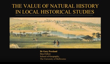
Mixed media - Video, RDHS Guest Speaker Presentation - "The Value of Natural History in Local Historical Studies" - Dr Gary Presland FRHSV, School of Geography, University of Melbourne
... He was a staff member of the Victoria Archaeological Survey from 1983 to April, 1988. ...He was a staff member of the Victoria Archaeological Survey from 1983 to April, 1988. ...Digitised video (4.41GB). Duration: 63 minutes. Recorded March, 2018. (Video is available for viewing at Ringwood & District Historical Society Archives by appointment)Presenter: Gary Presland is an Australian archaeologist and writer who studied history at LaTrobe University, 1973-76 and archaeology at the University of London, 1977-79. He was a staff member of the Victoria Archaeological Survey from 1983 to April, 1988. His research interests are in the Aboriginal and natural history of Melbourne. -
 Bacchus Marsh & District Historical Society
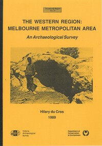
Book, The Western Region: Melbourne Metropolitan Area: An Archaeological Survey
... Part of Occasional reports series (Victoria Archaeological Survey) ; No. 27. Published by Department of Conservation and Environment, Melbourne, 1990. ...Part of Occasional reports series (Victoria Archaeological Survey) ; No. 27. Published by Department of Conservation and Environment, Melbourne, 1990. ...This study aimed to locate and document Aboriginal archaeological sites in the western region of Melbourne. This area was defined by the study as extending out from the western suburbs of Melbourne to the Brisbane Ranges and north beyond Bacchus Marsh. The specific aim of the study was to investigate the Aboriginal archaeology of the Western Plains area in the vicinity west of Melbourne. The Bacchus Marsh, Melton and Werribee shire boundaries of the time defined the areas of the study. The study contains extensive lists of the types of artifacts found the the locations where they were found.Soft cover foolscap size book. 96 pages with b & w illustrations, images and maps (some folded). Part of Occasional reports series (Victoria Archaeological Survey) ; No. 27. Published by Department of Conservation and Environment, Melbourne, 1990. Author, Hilary Du Cros. BMDHS Loc. AR/SU5This study aimed to locate and document Aboriginal archaeological sites in the western region of Melbourne. This area was defined by the study as extending out from the western suburbs of Melbourne to the Brisbane Ranges and north beyond Bacchus Marsh. The specific aim of the study was to investigate the Aboriginal archaeology of the Western Plains area in the vicinity west of Melbourne. The Bacchus Marsh, Melton and Werribee shire boundaries of the time defined the areas of the study. The study contains extensive lists of the types of artifacts found the the locations where they were found. aboriginal australians victoria western plains, aboriginal artifacts, archaelogical sites victoria western plains, aboriginal artifacts bacchus marsh region -
 Orbost & District Historical Society
book, A History of the Aboriginal people of East Gippsland by Kym Thompson, January, 1985
... It is a report for the Land Conservation Council, Victoria, 1985. Contains archaeological research, history of white invasion and matters related to the preservation of sites of significance in the area. 284pp....It is a report for the Land Conservation Council, Victoria, 1985. Contains archaeological research, history of white invasion and matters related to the preservation of sites of significance in the area. 284pp. ...A manuscript book with a pink cover. A History of the Aboriginal People of East Gippsland by Kym Thompson. It is a report for the Land Conservation Council, Victoria, 1985. Contains archaeological research, history of white invasion and matters related to the preservation of sites of significance in the area. 284pp.book australian-aborigines land-conservation-council thompson-kym -
 Warrnambool and District Historical Society Inc.
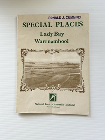
Pamphlet - Special Places Lady Bay Warrnambool, Philprint Warrnambool, 1989
... Victoria) for Heritage Week, April 16-23, 1989 and contains information written by Warrnambool residents about their locality. This was a co-operative venture by people with a common interest in protecting the natural environment near their home. Areas covered in the written information include: Formation of the Coast, Archaeological...Victoria) for Heritage Week, April 16-23, 1989 and contains information written by Warrnambool residents about their locality. This was a co-operative venture by people with a common interest in protecting the natural environment near their home. Areas covered in the written information include: Formation of the Coast, Archaeological ...This pamphlet was produced for the Warrnambool Branch of the National Trust of Australia (Victoria) for Heritage Week, April 16-23, 1989 and contains information written by Warrnambool residents about their locality. This was a co-operative venture by people with a common interest in protecting the natural environment near their home. Areas covered in the written information include: Formation of the Coast, Archaeological survey, Gunditjmara History, vegetation, history and recreational uses of the Lady Bay area. The map shows special places of interest including past and present navigational aids, sites of shipwrecks and other historical places of interest. The Warrnambool Branch of the National Trust was originally formed in March 1969 and merged with the Port Fairy Branch in late 1970. In October 1979, the Warrnambool Branch was reformed and operated into the late 1990's. This is an example of a publication produced by the Warrnambool Branch of the National Trust Australia (Victoria). It provides historical information and perspectives of the recreational uses in and around Lady Bay Warrnambool.An A2 piece of buff coloured thick paper folded into eight to make an A5 pamphlet. The front cover has green printing with the National Trust symbol of three eucalyptus leaves in green. There is a brown sepia photograph showing a view across Lady Bay with the suspension bridge across the Merri River in the foreground, Viaduct Road in the middle ground and the breakwater in the background. There is a purple inked stamp on the top right hand corner. The rear cover has brown writing and includes logos of bodies who assisted with the publication. There is a brown line drawing of the viaduct and pier at the Warrnambool Breakwater. The inside of the unfolded pamphlet contains a map of Lady Bay and adjacent area showing places of interest and shipwrecks marked in red circlesFront cover: Special Places Lady Bay Warrnambool National Trust of Australia (Victoria) Warrnambool Branch Ronald J. Cummingwarrnambool, lady bay warrnambool, national trust australia victoria warrnambool branch, heritage week 1989, lady bay shipwrecks -
 Orbost & District Historical Society
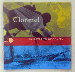
book, Impact Printing, Clonmel, 1999
... Although the wreck of the Clonmel was a disaster at the time, it is now one of the most significant archaeological sites in Victoria. (Ref. Australian National Shipwreck Database) ...Although the wreck of the Clonmel was a disaster at the time, it is now one of the most significant archaeological sites in Victoria. (Ref. Australian National Shipwreck Database) This item is a useful reference tool on a significant part of shipping history in Victoria. ...The paddle steamer Clonmel was one of the first steam-powered vessels on the Australian coast. However, its career was short, being wrecked on its third voyage on what is now known as Clonmel Island at the Port Albert entrance. All on board reached safety, but much of the cargo was lost.The wreck of the Clonmel was instrumental in the settlement of Gippsland and the establishment of the towns of Port Albert, Tarraville and Alberton. Although the wreck of the Clonmel was a disaster at the time, it is now one of the most significant archaeological sites in Victoria. (Ref. Australian National Shipwreck Database) This item is a useful reference tool on a significant part of shipping history in Victoria.A thin 27 pp cardboard covered book titled, "Clonmel Disaster to Discovery". On the cover is a black drawing of the Clonmel with a coloured background of yellow, red and blue blocks. The book contains the history of the paddle-steamer Clonmel which was wrecked at port Albert in 1841.clonmel-paddle-steamer shipwreck-port-albert -
Federation University Historical Collection
Booklet, Preserving Our Archaeological Heritage
... Barker Library (top floor) Mount Helen goldfields archaeology victorian archaeological survey aboriginal sites aboriginal statements register of aboriginal sites glenaire rock shelter lake condah fish trap st arnaud rock wells carisbrook archaeological area Nine page booklet with a ohotograph of a buried dingo skeleton on the cover. contents include: * Legislation Relating to Aboriginal Relics * Register of Aboriginal Sites * Site protection and Preservation * Archaeological Research * Coastal midden * Lake Condah * Archaeological Relics Advisory Committee * Community Education, Training and Information * What to do when youfind a relic Preserving Our Archaeological Heritage Booklet Booklet Victoria Archaeological Survey ...Nine page booklet with a ohotograph of a buried dingo skeleton on the cover. contents include: * Legislation Relating to Aboriginal Relics * Register of Aboriginal Sites * Site protection and Preservation * Archaeological Research * Coastal midden * Lake Condah * Archaeological Relics Advisory Committee * Community Education, Training and Information * What to do when youfind a relicarchaeology, victorian archaeological survey, aboriginal sites, aboriginal statements, register of aboriginal sites, glenaire rock shelter, lake condah fish trap, st arnaud rock wells, carisbrook archaeological area -
Federation University Historical Collection
Booklet - Book, Burra Lotjpa Dunguludja: Victorian Aboriginal Justice Agreement Phase 4, 2018
... Burra Lotjpa Dunguludja: Victorian Aboriginal Justice Agreement Phase 4 Booklet Book Victoria Archaeological Survey ...Burra Lotjpa Dunguludja means 'Senior Leaders Talking Strong' in Yorta Yorta language.Sixty page book aiming to continue to address Aboriginal over-representation across the justice system, and to progress self-determination as the core policy approach. The vision was to ensure Aboriginal people have access to n equitable justice system that is shaped by self-determination, and protects and upholds their human, civil, legal and cultural rights.aboriginal, martin pakula, tont lovett, marion hansen, aboriginal justice, aboriginal justice caucus, message stick, koori justice unit -
 Flagstaff Hill Maritime Museum and Village
Tool - Wood Sample, Before 1878
... Victoria. It is significant for its association with the shipwreck, which is on the Victorian Heritage Register (VHR S417). The collection is significant because of the relationship between the objects, as together they have a high potential to interpret the story of the LOCH ARD. The LOCH ARD collection is archaeologically ...On a piece of paper subsequently glued near one end of its curved upper face, this length of planed and polished hardwood timber bears the inscription: “A [p]iece of w[r]ec[k] of the Loch Ard wrecked near Sherbroke River”. The timber is carefully worked with rich dark colouring and a uniformly moulded design, suggesting that it was part of a fitting or furnishing that was publicly visible and prominent. If the artefact is what it is declared to be, then it is possible that it formed part of the ship’s railings or companionway stairs. The LOCH ARD was a 1,693 ton, 3 masted barque, built on the Clyde in 1873. In an age of increasing competition for the emigrant passenger trade from steam-driven vessels, special attention was paid to her wooden furnishings and fittings. The Loch Line owners prided themselves on their attractive, distinctively painted, sailing ships. Below decks, where cargo and third class passengers were stowed, was made of iron. But everything above deck, and on show to the saloon and second class passengers, was carved and varnished timber. Captain Daish’s 1878 report for the ship’s underwriters notes “a quantity of general Cargo washed up in a confused mass” in the cove and “a number of Cases, Casks and Bales; also deals and boards floating about in some of the gorges” further west of the shipwreck. Contemporary newspaper accounts also reported a large quantity of cargo and timber washed ashore in the days following the LOCH ARD shipwreck, adding “but those were speedily removed by persons who came down from Port Campbell, Scott’s Creek and other places with carts and pack horses”. The appearance and good condition of this wood artefact, and the aged patina and dated hand-writing style of its pasted on inscription, support the suggestion that it was ‘souvenired’ from the floating debris of the LOCH ARD at or near the 1878 date of its foundering off Mutton Bird Island. HISTORY OF THE LOCH ARD The LOCH ARD belonged to the famous Loch Line which sailed many ships from England to Australia. Built in Glasgow by Barclay, Curdle and Co. in 1873, the LOCH ARD was a three-masted square rigged iron sailing ship. The ship measured 262ft 7" (79.87m) in length, 38ft (11.58m) in width, 23ft (7m) in depth and had a gross tonnage of 1693 tons. The LOCH ARD's main mast measured a massive 150ft (45.7m) in height. LOCH ARD made three trips to Australia and one trip to Calcutta before its final voyage. LOCH ARD left England on March 2, 1878, under the command of Captain Gibbs, a newly married, 29 year old. She was bound for Melbourne with a crew of 37, plus 17 passengers and a load of cargo. The general cargo reflected the affluence of Melbourne at the time. On board were straw hats, umbrella, perfumes, clay pipes, pianos, clocks, confectionary, linen and candles, as well as a heavier load of railway irons, cement, lead and copper. There were items included that intended for display in the Melbourne International Exhibition in 1880. The voyage to Port Phillip was long but uneventful. At 3am on June 1, 1878, Captain Gibbs was expecting to see land and the passengers were becoming excited as they prepared to view their new homeland in the early morning. But LOCH ARD was running into a fog which greatly reduced visibility. Captain Gibbs was becoming anxious as there was no sign of land or the Cape Otway lighthouse. At 4am the fog lifted. A man aloft announced that he could see breakers. The sheer cliffs of Victoria's west coast came into view, and Captain Gibbs realised that the ship was much closer to them than expected. He ordered as much sail to be set as time would permit and then attempted to steer the vessel out to sea. On coming head on into the wind, the ship lost momentum, the sails fell limp and LOCH ARD's bow swung back. Gibbs then ordered the anchors to be released in an attempt to hold its position. The anchors sank some 50 fathoms - but did not hold. By this time LOCH ARD was among the breakers and the tall cliffs of Mutton Bird Island rose behind the ship. Just half a mile from the coast, the ship's bow was suddenly pulled around by the anchor. The captain tried to tack out to sea, but the ship struck a reef at the base of Mutton Bird Island, near Port Campbell. Waves broke over the ship and the top deck was loosened from the hull. The masts and rigging came crashing down knocking passengers and crew overboard. When a lifeboat was finally launched, it crashed into the side of LOCH ARD and capsized. Tom Pearce, who had launched the boat, managed to cling to its overturned hull and shelter beneath it. He drifted out to sea and then on the flood tide came into what is now known as LOCH ARD Gorge. He swam to shore, bruised and dazed, and found a cave in which to shelter. Some of the crew stayed below deck to shelter from the falling rigging but drowned when the ship slipped off the reef into deeper water. Eva Carmichael had raced onto deck to find out what was happening only to be confronted by towering cliffs looming above the stricken ship. In all the chaos, Captain Gibbs grabbed Eva and said, "If you are saved Eva, let my dear wife know that I died like a sailor". That was the last Eva Carmichael saw of the captain. She was swept off the ship by a huge wave. Eva saw Tom Pearce on a small rocky beach and yelled to attract his attention. He dived in and swam to the exhausted woman and dragged her to shore. He took her to the cave and broke open case of brandy which had washed up on the beach. He opened a bottle to revive the unconscious woman. A few hours later Tom scaled a cliff in search of help. He followed hoof prints and came by chance upon two men from nearby Glenample Station three and a half miles away. In a state of exhaustion, he told the men of the tragedy. Tom returned to the gorge while the two men rode back to the station to get help. By the time they reached LOCH ARD Gorge, it was cold and dark. The two shipwreck survivors were taken to Glenample Station to recover. Eva stayed at the station for six weeks before returning to Ireland, this time by steamship. In Melbourne, Tom Pearce received a hero's welcome. He was presented with the first gold medal of the Royal Humane Society of Victoria and a £1000 cheque from the Victorian Government. Concerts were performed to honour the young man's bravery and to raise money for those who lost family in the LOCH ARD disaster. Of the 54 crew members and passengers on board, only two survived: the apprentice, Tom Pearce and the young woman passenger, Eva Carmichael, who lost all of her family in the tragedy. Ten days after the LOCH ARD tragedy, salvage rights to the wreck were sold at auction for £2,120. Cargo valued at £3,000 was salvaged and placed on the beach, but most washed back into the sea when another storm developed. The wreck of LOCH ARD still lies at the base of Mutton Bird Island. Much of the cargo has now been salvaged and some was washed up into what is now known as LOCH ARD Gorge. Cargo and artefacts have also been illegally salvaged over many years before protective legislation was introduced. One of the most unlikely pieces of cargo to have survived the shipwreck was a Minton porcelain peacock - one of only nine in the world. The peacock was destined for the Melbourne International Exhibition in 1880. It had been well packed, which gave it adequate protection during the violent storm. Today, the Minton peacock can be seen at the Flagstaff Hill Maritime Museum in Warrnambool. From Australia's most dramatic shipwreck it has now become Australia's most valuable shipwreck artefact and is one of very few 'objects' on the Victorian State Heritage Register. The Loch Ard wreck is of state significance – Victorian Heritage Register S417. However there is a lack of documented provenance that limits the interpretive value of this piece of timber (for example, its potential to interpret nineteenth century souveniring and scavenging from shipwrecks along the south west coast of Victoria). Flagstaff Hill’s collection of artefacts from LOCH ARD is significant for being one of the largest collections of artefacts from this shipwreck in Victoria. It is significant for its association with the shipwreck, which is on the Victorian Heritage Register (VHR S417). The collection is significant because of the relationship between the objects, as together they have a high potential to interpret the story of the LOCH ARD. The LOCH ARD collection is archaeologically significant as the remains of a large international passenger and cargo ship. The LOCH ARD collection is historically significant for representing aspects of Victoria’s shipping history and its potential to interpret sub-theme 1.5 of Victoria’s Framework of Historical Themes (living with natural processes). The collection is also historically significant for its association with the LOCH ARD, which was one of the worst and best known shipwrecks in Victoria’s history. A length of hardwood timber, planed and varnished to smooth finish on three sides, with two unfinished tongues protruding from each end (one broken off), possibly from the wreck of the LOCH ARD. The front or upper face is moulded and routed to a regular, linear (skirting board type) design along its entire length, the two sides flat planed. One side contains two inserted dowel rods that have been broken off. The bottom face has not been finished to the same standard. The sample is good quality wood that has retained its density and weight and shows no evidence of having been submerged in seawater for any length of time. Glued on to the upper face of the length of timber near the right hand end is a deteriorated square of paper bearing an inscription. The paper, peeling back and with torn edges, is stuck over an original wood stain but under a subsequent layer of varnish. The faded ink words are indecipherable where paper is missing, but written carefully in an old fashioned cursive script.The inscription on the paper reads: “A [p]iece of w[r]ec[k] of the Loch Ard wrecked near Sherbroke River”. flagstaff hill, warrnambool, shipwrecked coast, flagstaff hill maritime museum, maritime museum, shipwreck coast, flagstaff hill maritime village, great ocean road, loch line, loch ard, captain gibbs, eva carmichael, tom pearce, glenample station, mutton bird island, loch ard gorge, nineteenth-century souveniring, shipwreck scavenging, loch line sailing ships, wood sample -
 Flagstaff Hill Maritime Museum and Village
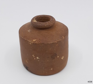
Container - Ink Bottle, Prior to 1878
... Victoria and is registered on the Victorian Heritage Register ( S 417). Flagstaff Hill has a varied collection of artefact's from Loch Ard and its collection is significant for being one of the largest accumulation of artefact's from this notable Victorian shipwreck of which the subject items are a small part. The collection's objects give us a snapshot of how we can interpret the story of this tragic event. The collection is also archaeologically ...This design of ink bottle was commonly referred to as a ‘penny ink well’ because it was very inexpensive to produce. It is also known as a dwarf ink bottle. Pen and ink has been in use for hand writing from about the seventh century up until the mid-20th century up until around the mid-19th century a quill pen made from a bird’s feather was used. In the 1850s the steel point pen was invented and could be manufactured on machines in large quantities. In the 1880s a successful portable fountain pen was designed, giving a smooth flowing ink and ease of use replacing the quill or dip pen. History of the Loch Ard: The Loch Ard got its name from "Loch Ard" a loch that lies to the west of Aberfoyle, and the east of Loch Lomond. It means "high lake" in Scottish Gaelic. The vessel belonged to the famous Loch Line which sailed many vessels from England to Australia. The Loch Ard was built in Glasgow by Barclay, Curle & Co. in 1873, the vessel was a three-masted square-rigged iron sailing ship that measured 79.87 meters in length, 11.58 m in width, and 7 m in depth with a gross tonnage of 1693 tons with a mainmast that measured a massive 45.7 m in height. Loch Ard made three trips to Australia and one trip to Calcutta before its fateful voyage. Loch Ard left England on March 2, 1878, under the command of 29-year-old Captain Gibbs, who was newly married. The ship was bound for Melbourne with a crew of 37, plus 17 passengers. The general cargo reflected the affluence of Melbourne at the time. Onboard were straw hats, umbrellas, perfumes, clay pipes, pianos, clocks, confectionery, linen, and candles, as well as a heavier load of railway irons, cement, lead, and copper. There were other items included that were intended for display in the Melbourne International Exhibition of 1880. The voyage to Port Phillip was long but uneventful. Then at 3 am on June 1, 1878, Captain Gibbs was expecting to see land. But the Loch Ard was running into a fog which greatly reduced visibility. Captain Gibbs was becoming anxious as there was no sign of land or the Cape Otway lighthouse. At 4 am the fog lifted and a lookout aloft announced that he could see breakers. The sheer cliffs of Victoria's west coast came into view, and Captain Gibbs realised that the ship was much closer to them than expected. He ordered as much sail to be set as time would permit and then attempted to steer the vessel out to sea. On coming head-on into the wind, the ship lost momentum, the sails fell limp and Loch Ard's bow swung back towards land. Gibbs then ordered the anchors to be released in an attempt to hold their position. The anchors sank some 50 fathoms - but did not hold. By this time the ship was among the breakers and the tall cliffs of Mutton Bird Island rose behind. Just half a mile from the coast, the ship's bow was suddenly pulled around by the anchor. The captain tried to tack out to sea, but the ship struck a reef at the base of Mutton Bird Island, near Port Campbell. Waves subsequently broke over the ship and the top deck became loosened from the hull. The masts and rigging came crashing down knocking passengers and crew overboard. When a lifeboat was finally launched, it crashed into the side of Loch Ard and capsized. Tom Pearce, who had launched the boat, managed to cling to its overturned hull and shelter beneath it. He drifted out to sea and then on the flood tide came into what is now known as Lochard Gorge. He swam to shore, bruised and dazed, and found a cave in which to shelter. Some of the crew stayed below deck to shelter from the falling rigging but drowned when the ship slipped off the reef into deeper water. Eva Carmichael a passenger had raced onto the deck to find out what was happening only to be confronted by towering cliffs looming above the stricken ship. In all the chaos, Captain Gibbs grabbed Eva and said, "If you are saved Eva, let my dear wife know that I died like a sailor". That was the last Eva Carmichael saw of the captain. She was swept off the ship by a huge wave. Eva saw Tom Pearce on a small rocky beach and yelled to attract his attention. He dived in and swam to the exhausted woman and dragged her to shore. He took her to the cave and broke the open case of brandy that had washed up on the beach. He opened a bottle to revive the unconscious woman. A few hours later Tom scaled a cliff in search of help. He followed hoof prints and came by chance upon two men from nearby Glenample Station three and a half miles away. In a complete state of exhaustion, he told the men of the tragedy. Tom then returned to the gorge while the two men rode back to the station to get help. By the time they reached Loch Ard Gorge, it was cold and dark. The two shipwreck survivors were taken to Glenample Station to recover. Eva stayed at the station for six weeks before returning to Ireland by steamship. In Melbourne, Tom Pearce received a hero's welcome. He was presented with the first gold medal of the Royal Humane Society of Victoria and a £1000 cheque from the Victorian Government. Concerts were performed to honour the young man's bravery and to raise money for those who lost families in the disaster. Of the 54 crew members and passengers on board, only two survived: the apprentice, Tom Pearce, and the young woman passenger, Eva Carmichael, who lost her family in the tragedy. Ten days after the Lochard tragedy, salvage rights to the wreck were sold at auction for £2,120. Cargo valued at £3,000 was salvaged and placed on the beach, but most washed back into the sea when another storm developed. The wreck of Lochard still lies at the base of Mutton Bird Island. Much of the cargo has now been salvaged and some items were washed up into Lochard Gorge. Cargo and artefact's have also been illegally salvaged over many years before protective legislation was introduced in March 1982. One of the most unlikely pieces of cargo to have survived the shipwreck was a Minton majolica peacock- one of only nine in the world. The peacock was destined for the Melbourne 1880 International Exhibition. It had been well packed, which gave it adequate protection during the violent storm. Today the Minton peacock can be seen at the Flagstaff Hill Maritime Museum in Warrnambool. From Australia's most dramatic shipwreck it has now become Australia's most valuable shipwreck artifact and is one of very few 'objects' on the Victorian State Heritage Register.This ink well is historically significant as it represents methods of hand written communication that were still common up until the mid-20th century, when fountain pens and ballpoint pens took over in popularity and convenience. The shipwreck of the Loch Ard is of significance for Victoria and is registered on the Victorian Heritage Register ( S 417). Flagstaff Hill has a varied collection of artefact's from Loch Ard and its collection is significant for being one of the largest accumulation of artefact's from this notable Victorian shipwreck of which the subject items are a small part. The collection's objects give us a snapshot of how we can interpret the story of this tragic event. The collection is also archaeologically significant as it represents aspects of Victoria's shipping history that allows us to interpret Victoria's social and historical themes of the time. Through is associated with the worst and best-known shipwreck in Victoria's history.Stoneware penny Ink bottle ironstone salt-glazed, stoneware cylindrical shape with small mouth and squat neck, broad shoulders brown colour, . with light coloured encrustation spots.flagstaff hill, warrnambool, flagstaff hill maritime museum, shipwreck coast, flagstaff hill maritime village, great ocean road, loch line, loch ard, captain gibbs, eva carmichael, tom pearce, glenample station, mutton bird island, loch ard gorge, penny ink well, writing equipment, domestic, stoneware, clay, ceramic, pottery, ink well, inkwell, ink bottle, dip pen, ink, hand writing, business, vintage, dwarf ink -
 Flagstaff Hill Maritime Museum and Village
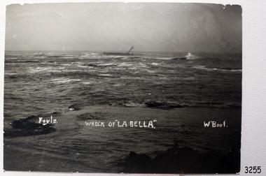
Photograph, Foyle Photographic Studio, Wreck of La Bella, about 11/11/1905
... Flagstaff Hill’s collection of artefacts from the La Bella is of historical and archaeological significance because of its association with the La Bella, which is on the Victorian Heritage Register, and because of the relationship between the objects. The collection represents aspects of Victorian history, and the letter to William Ferrier demonstrates how important his rescue efforts were to Victoria and Australia. ...The photograph shows the wreck of La Bella in Lady Bay, Warrnambool, Australia. It was probably taken on 11th November 1905, the morning after she was wrecked. “Foyle” written on the photograph is the name of Foyle’s Photographic studio. At the time of the photograph the studio was owned by both Charles and Lilian Foyle (sometimes known as Lillian or Lily), either of whom could have taken this photograph. They also worked together at a later date on the photographs, sketches and paintings of the famous and historical Pioneers’ Honour Board, which is currently on view in the Warrnambool Library. Foyles Photography was the studio of James Charles Foyle. He owned “Foyle’s Photo Card Studios” in Liebig St , Warrnambool, which operated between 1889 – 1919 . A letter to the editor (by Mr Edward Vidler) in the Melbourne Argus, 3rd August, 1907, mentions that in that year Warrnambool would celebrate its 60th anniversary of its proclamation as a town, and that talented local artist Miss Lily Foyle would paint 200 portraits in watercolour of the pioneers who settled in the district prior to 1860. The Pioneer Honour Board can still be seen on display in the Warrnambool Library. In the Warrnambool Standard, Dec. 1917, “Mr Foyle’s studio was awarded contract to decorate rail cars on newly opened Trans-Continental railway, assisted by his sister, Miss Findlay.” The subject of the painting, La Bella, has its own tragic story. Read on for further details … On November 10th, 1905, the Norwegian-built barquentine La Bella approached Warrnambool at the end of her 37 day voyage. She was carrying a cargo of timber from Lyttleton, New Zealand, in heavy seas and evening mist. (On its only other visit to Warrnambool a year earlier the master had gone to shore to find a tow. He returned to the ship to find the crew drunk and unwilling to take up their posts, even though the ship was dragging its anchors and in a dangerous position.) As Captain Mylius steered La Bella to Lady Bay Channel the ship was tossed onto its side by heavy breakers and ran aground on what is now known as La Bella Reef. The sea was so rough that it wrenched a one-and-a- half ton anchor from the vessel. Several attempts were made by parties of volunteers in lifeboats to rescue the stricken sailors, but the rough conditions made this difficult for the boats to get close enough to the ship and the parties had to return to shore. The La Bella’s crew became exhausted and sailors were being washed overboard, one by one. By sunrise only five of the twelve crew still clung to the wreck. A local fisherman, 25 year old William Ferrier, rowed his small dingy through the heavy seas and managed to rescue the captain, whilst the volunteer lifeboat crew rescued a further three sailors, returning to shore. Ferrier made a final attempt at rescue and was able to reach its stern as the conditions eased slightly, saving the last remaining, terrified sailor just before the ship broke up and sank. William Ferrier became a national hero as news of the daring rescue spread. He was awarded the Silver Medal for bravery by the Royal Humane Society and was honoured by the Prime Minister and the Governor. He was presented with several other awards for his daring rescue. Ferrier’s rescue efforts are one of the most heroic in Victoria’s shipwreck history. The wreck now lies in 13m of water and is home to an abundance of marine life. Flagstaff Hill’s La Bella Collection includes a rail holder from La Bella, a photograph of William Ferrier with four of the five men rescued, a rail holder from the ship and the letter from the Prime Minister and other Members of Parliament that was sent to William Ferrier to commend him for his bravery. La Bella has been protected under the Commonwealth Historic Shipwrecks Act (1976) as a Historic Shipwreck since 23 April 1982 (VHR S401). It is archaeologically significant as the remains of an international and inter-colonial passenger and cargo ship. Flagstaff Hill’s collection of artefacts from the La Bella is of historical and archaeological significance because of its association with the La Bella, which is on the Victorian Heritage Register, and because of the relationship between the objects. The collection represents aspects of Victorian history, and the letter to William Ferrier demonstrates how important his rescue efforts were to Victoria and Australia. Black and white photograph of the wreck of the sailing ship La Bella in the bay at Warrnambool. The photograph shows the ship lying on its side in rough sea, with mast and rope rigging hanging loosely. Several large rocks are also visible. The photograph is a rectangle shape, mounted on heavy card, with slightly ragged edges. The photographer’s name, a title for the photograph and the location are hand written in white along the bottom third of the photograph. The back of the photograph is blank. Printed in white hand writing “Foyle”, “WRECK OF “LA BELLA”, “W’Bool”foyle, la bella, william ferrier, lady bay, lifeboats, lilian foyle, lillian foyle, charles foyle, james foyle, royal humane society medal, flagstaff hill, warrnambool, shipwrecked coast, flagstaff hill, flagstaff hill maritime museum, maritime museum, shipwreck coast, flagstaff hill maritime village -
 Flagstaff Hill Maritime Museum and Village
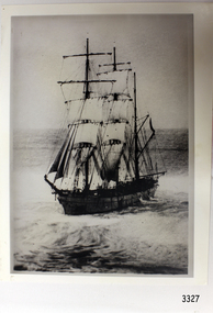
Photograph, post 1889
... The Newfield collection is archaeologically significant as it is the remains of an international cargo ship. The Newfield collection is historically significant for representing aspects of Victoria’s shipping history and its potential to interpret sub-theme 1.5 (Living with natural processes). ...The photograph shows the three-masted iron and steel bark "Newfield" sailing in open seas. It event would have been between 1889-1892 during the ship's working life. ABOUT THE NEWFIELD The Newfield was a three-masted iron and steel barque, built in Dundee, Scotland, in 1889 by Alexander Stephen and Sons. It was owned by the Newfield Ship Company in 1890 and later that year It was registered in Liverpool to owners Brownells and Co. The Newfield left Sharpness, Scotland, on 28th May 1892 with a crew of 25 under the command of Captain George Scott and on 1st June left Liverpool. She was bound for Brisbane, Australia, with a cargo of 1850 tons of fine rock salt, the main export product of Sharpness. At about 9pm on 28th August 1892, in heavy weather, Captain Scott sighted, between heavy squalls, the Cape Otway light on the mainland of Victoria but, due to a navigational error (the ship’s chronometers were wrong), he assumed it to be the Cape Wickham light on King Island, some 40 miles south. He altered his course to the north, expecting to enter Bass Strait. The ship was now heading straight for the south west Victorian coast and at about 1:30am ran aground on a reef about 100 yards from shore and one mile east of Curdie’s Inlet, Peterborough. The ship struck heavily three times before grounding on an inner shoal with 6 feet of water in the holds. Rough sea made the job of launching lifeboats very difficult. The first two lifeboats launched by the crew were smashed against the side of the ship and some men were crushed or swept away. The third lifeboat brought eight men to shore. It capsized when the crew tried to return it to the ship for further rescue The Port Campbell rocket crew arrived and fired four rocket lines, none of which connected with the ship. A local man, Peter Carmody, volunteered to swim one mile to the ship with a line to guide the fourth and final lifeboat safely to shore. Seventeen men survived the shipwreck but the captain and eight of his crew perished. One of the men, apprentice William McLeod, was rescued by local woman Margaret E. MacKenzie. The Newfield remained upright on the reef with sails set for a considerable time as the wind slowly ripped the canvas to shreds and the sea battered the hull to pieces. The Marine Board inquiry found the wreck was caused by a "one man style of navigation" and that the Captain had not heeded the advice of his crew. According to Jack Loney ‘… when the drama was over . . the Newfield was deserted except for the Captain’s dog and two pigs.’ Flagstaff Hill Maritime Museum has several artefacts that have been salvaged from the wreck. The report from SHP documented the following in regards to the Newfield collection: Flagstaff Hill’s collection of artefacts from the Newfield is of historical and archaeological significance at a State level, because of its association with the shipwreck, which is on the Victorian Heritage Register. The collection is significant because of its relationship between the objects. The Newfield collection is archaeologically significant as it is the remains of an international cargo ship. The Newfield collection is historically significant for representing aspects of Victoria’s shipping history and its potential to interpret sub-theme 1.5 (Living with natural processes). The collection is also historically significant for its association with the shipwreck. Black and white photograph of the three-masted sailing ship “Newfield” in the open sea, sails unfurled. The ship was built in 1859 by Alexander Stephen and Sons Limited of Dundee, Scotland. flagstaff hill, warrnambool, shipwrecked-coast, flagstaff-hill, flagstaff-hill-maritime-museum, maritime-museum, shipwreck-coast, flagstaff-hill-maritime-village, barque newfield, photograph, 1880s sailing ship -
 Flagstaff Hill Maritime Museum and Village
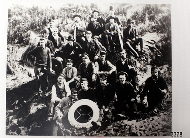
Photograph - Ship Crew, 1889-1892
... The Newfield collection is archaeologically significant as the remains of an international cargo ship. The Newfield collection is historically significant for representing aspects of Victoria’s shipping history and its association with the shipwreck. ...This black and white photograph shows the crew of the barque Newfield. They are pictured seated on a grassy slope and rock, a lifebuoy from the Newfield, Liverpool, resting on the men in the front row. The men are formally dressed, some with bowler hats, a bow tie and pipe, rather than in their sailing uniforms. ABOUT THE NEWFIELD The Newfield left Sharpness, Scotland, on 28th May 1892 with a crew of 25 under the command of Captain George Scott and on 1st June left Liverpool. She was bound for Brisbane, Australia, with a cargo of 1850 tons of fine rock salt, the main export product of Sharpness. At about 9pm on 28th August 1892, in heavy weather, Captain Scott sighted, between heavy squalls, the Cape Otway light on the mainland of Victoria but, due to a navigational error (the ship’s chronometers were wrong), he assumed it to be the Cape Wickham light on King Island, some 40 miles south. He altered his course to the north, expecting to enter Bass Strait. The ship was now heading straight for the south west Victorian coast. At about 1:30am the Newfield ran aground on a reef about 100 yards from shore and one mile east of Curdie’s Inlet, Peterborough. The ship struck heavily three times before grounding on an inner shoal with 6 feet of water in the holds. Rough sea made the job of launching lifeboats very difficult. The first two lifeboats launched by the crew were smashed against the side of the ship and some men were crushed or swept away. The third lifeboat brought eight men to shore. It capsized when the crew tried to return it to the ship for further rescue The rescue was a difficult operation. The Port Campbell Rocket Crew arrived and fired four rocket lines, none of which connected with the ship. Peter Carmody, a local man, volunteered to swim about one mile off shore to the ship with a line to guide the fourth and final lifeboat safely to shore. He was assisted by James McKenzie and Gerard Irvine. Seventeen men survived the shipwreck but the captain and eight of his crew perished. The Newfield remained upright on the reef with sails set for a considerable time as the wind slowly ripped the canvas to shreds and the sea battered the hull to pieces. The Marine Board inquiry found the wreck was caused by a "one man style of navigation" and that the Captain had not heeded the advice of his crew. According to Jack Loney ‘… when the drama was over . . the Newfield was deserted except for the Captain’s dog and two pigs.’ Peter Carmody was awarded the Bramley Moore medal by the Liverpool Shipwreck and Humane Society for Saving Life at Ssea, which he received by mail on January 21st 1893. Flagstaff Hill’s collection of artefacts from the Newfield is significant for its association with the shipwreck Newfield, which is listed on the Victorian Heritage Registry. The collection is significant because of the relationship between the objects. The Newfield collection is archaeologically significant as the remains of an international cargo ship. The Newfield collection is historically significant for representing aspects of Victoria’s shipping history and its association with the shipwreck. The Letter accompanying the Medal for Bravery awarded to Peter Carmody is significant because the attempt to save lives is associated with the shipwreck Newfield. Black and white photograph of the crew of the sailing ship “Newfield”. The men in formal dress are seated on rocky slope with the ship’s lifebuoy showing the name “NEWFIELD, LIVERPOOL”. Photograph taken 1889-1892 flagstaff hill, warrnambool, shipwrecked-coast, flagstaff-hill, flagstaff-hill-maritime-museum, maritime-museum, shipwreck-coast, flagstaff-hill-maritime-village, newfield, photograph, crew of the newfield, 19th century sailing ship, peterborough, cape otway, medal for bravery -
Federation University Historical Collection
Book - Book - Scrapbook, Ballarat College of Advanced Education: Scrapbook of newspaper cutting, Book 7; January 1980 to September 1980
... The cuttings cover the period from 31 January 1980 to 5 September 1980. . employment advertisements application for enrolment outline of courses colleges spend up education needs publicity college pay review prof compes professor of safety class of 1930 class of '46 cae prizes presented mineral boom jobless boon wes walters wins archibald prize lismore art prize to margaret bennett track and field competion bcae second in national titles library files on film bill hitchins enrolments inrease bcae head praises mp's efforts re-opening of mine at berringa bcae graduates michael and gregory stowe richards medal presentation bcae help for national squad the need for innovation prof john crisp institution of engineers australia move for archaeological society anne freeman elected graeme lowe introduces new law elective for teachers career scope for chemists grant for wood pulping research dispute halts work on hall music department has superb facilities grant for water pollution research david hemmings at bcae college staff to hold stop-work canberra moves on colleges name decided for 'great hall' notable year for bcae victoria lagging in farm safety laws $40000computer plan students attend memorial lecture ceramics exhibition boom in part-time study open day at mt helen visiting ceramics lecturer information technology week science students win bursaries margaret haddon francis brown seminar on rural television toxic effects of sea wasp Book with grey cover, front. ...Newspaper cuttings relating to Ballarat College of Advanced Education. These are from various newspapers and include The Age, Ballarat Courier, The Australian, The Herald. The cuttings cover the period from 31 January 1980 to 5 September 1980. . Book with grey cover, front. Image of two trotters. Spiral bound.employment advertisements, application for enrolment, outline of courses, colleges spend up, education needs publicity, college pay review, prof compes, professor of safety, class of 1930, class of '46, cae prizes presented, mineral boom jobless boon, wes walters wins archibald prize, lismore art prize to margaret bennett, track and field competion, bcae second in national titles, library files on film, bill hitchins, enrolments inrease, bcae head praises mp's efforts, re-opening of mine at berringa, bcae graduates, michael and gregory stowe, richards medal presentation, bcae help for national squad, the need for innovation, prof john crisp, institution of engineers australia, move for archaeological society, anne freeman elected, graeme lowe introduces new law elective for teachers, career scope for chemists, grant for wood pulping research, dispute halts work on hall, music department has superb facilities, grant for water pollution research, david hemmings at bcae, college staff to hold stop-work, canberra moves on colleges, name decided for 'great hall', notable year for bcae, victoria lagging in farm safety laws, $40000computer plan, students attend memorial lecture, ceramics exhibition, boom in part-time study, open day at mt helen, visiting ceramics lecturer, information technology week, science students win bursaries, margaret haddon, francis brown, seminar on rural television, toxic effects of sea wasp -
 Eltham District Historical Society Inc
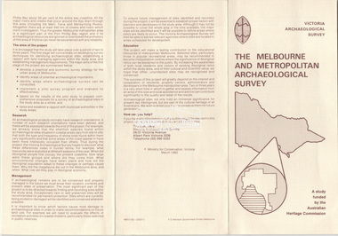
Document - Folder, Victoria Archaeological Survey, 1982-1990
... Trifold Leaflet: The Melbourne and Metropolitan Archaeological Survey, Ministry for Conservation Victoria, March 1982 2. ...Eltham District Historical Society Inc 728 Main Rd Eltham melbourne Sites Structures Archaeological Significance Victoria Archaeological Survey Contents: 1. Trifold Leaflet: The Melbourne and Metropolitan Archaeological Survey, Ministry for Conservation Victoria, March 1982 2. ...sites, structures, archaeological significance, victoria archaeological survey -
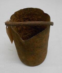 Bendigo Historical Society Inc.
Tool - MERCURY BUCKET
... Victoria. Peter Davies1... Susan Lawrence... and Jodi Turnbull... Department of archaeology...Victoria. Peter Davies1 Susan Lawrence and Jodi Turnbull Department of archaeology and history La Trobe university. ...Cast iron mercury bucket, used to hold mercury, potentially in the process of recovering minute pieces of gold mixed in soil and sediments. See research page for description of one process of using mercury to extract gold.gold mines, mining equipment, mercury bucket, miners used mercury in a number of ways to amalgamate gold, with each mill or battery operator having their preferred method depending on the nature of the ore. by the late 1850s the most common way of crushing goldbearing quartz ores or consolidated alluvial cements was in a stamp battery. the battery featured heavy iron stamp heads held in a frame, with each head often weighing up to 500 pounds (226 kg) or more (see msv 1880, page 45) (birrell 2005). stamp heads were lifted and dropped by a rotating overhead cam shaft driven by a steam engine or water wheel. ore was fed into a large cast-iron battery box, mixed with a steady stream of water, and pulverised by the stamp heads. in some batteries, mercury was placed in the base of the boxes to amalgamate with freed gold. the violent agitation of the mercury in the mortar box, however, could cause the mercury to break into myriad tiny globules that were carried away by the water with the tailings, thus losing a certain amount of gold in the process (thompson 1867; ritchie & hooker 1997). the water and sand slurry was splashed by the falling stamps from the box through fine mesh screens and onto inclined wooden tables below the mortar box (figure 2). the tables were covered with copper sheets or plates coated with mercury, which caught and amalgamated with a portion of the gold. the grey putty-like amalgam was periodically scraped off the sheets and retorted in a furnace to collect the gold and recover the mercury for reuse. mercury was inevitably lost from the plates, while poor maintenance resulted in further losses of gold and mercury in the tailings. mercury use and loss from gold mining in 19th century victoria. peter davies1, susan lawrence, and jodi turnbull, department of archaeology and history, la trobe university. -
 The Beechworth Burke Museum
Photograph
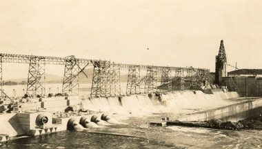
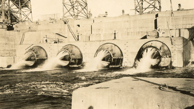
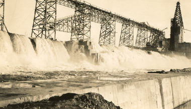
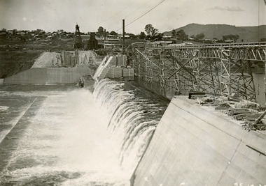
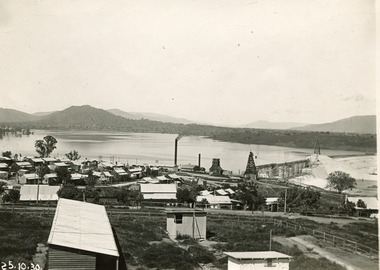
... archaeological excavation should be done: Camp Ganger’s Quarters, Stableman’s Quarters, and the Industrial Dump. The excavation uncovered artefacts. Mitta Mitta: Mitta Mitta is situated between Mount Welcome and Mount Misery. It is named after the river that explorers Hume and Hovell discovered in 1824. The town would eventually become a huge gold mining town. Mitta Mitta is called Midamodunga by the local Indigenous peoples Wodonga: Wodonga is situated on the Murray River and is part of North East Victoria...archaeological excavation should be done: Camp Ganger’s Quarters, Stableman’s Quarters, and the Industrial Dump. The excavation uncovered artefacts. Mitta Mitta: Mitta Mitta is situated between Mount Welcome and Mount Misery. It is named after the river that explorers Hume and Hovell discovered in 1824. The town would eventually become a huge gold mining town. Mitta Mitta is called Midamodunga by the local Indigenous peoples Wodonga: Wodonga is situated on the Murray River and is part of North East Victoria ...Taken on 25 October 1930, various houses with the Hume Dam under construction are depicted in the background. The construction of the Hume Dam took place from 1919 to 1936. At the time of construction, it was the second largest dam in the world. It was also one of the earliest civil projects developed after the Federation. Some of the Dam workers consisted of World War I veterans. Dam workers often settled their families in Mitta Junction Village and Wodonga. Archaeological surveys were completed by Austral Archaeology, which was done when the Department of Land & Water Conservation was doing work to improve Hume Dam. The archaeological report that came out of the survey recommended three sites of interest where archaeological excavation should be done: Camp Ganger’s Quarters, Stableman’s Quarters, and the Industrial Dump. The excavation uncovered artefacts. Mitta Mitta: Mitta Mitta is situated between Mount Welcome and Mount Misery. It is named after the river that explorers Hume and Hovell discovered in 1824. The town would eventually become a huge gold mining town. Mitta Mitta is called Midamodunga by the local Indigenous peoples Wodonga: Wodonga is situated on the Murray River and is part of North East Victoria. Hume and Hovell: Hamilton Hume (1979-1873) and William Hilton Hovell (1786-1875). W. H. Hovell was born in Norfolk England and Hume was born in Parramatta, New South Wales Hovell and Hume undertook an exploration journey in 1824 and thought they discovered a river, which turned out to be the Murray River. They returned home in 1825, but returned to the area in 1826 and discovered coal in the area. This photo is historically significant as it shows the Hume Dam under construction in 1930. The Dam was named after Hamilton Hume, who is an important historical figure for this area as he helped discover the area where resources were found.Sepia rectangular photograph printed unmountedReverse: 84-19-5 / 1997.3185/ Values & spillway. / When completed the wall / will be as high as the / scaffolding. [featuring trademark: kodak print]construction, houses, veterans, mitta junction village, hume dam, world war i, federation, wodonga, archaeological survey, excavation, austral archaeology, department of land & water conservation, camp ganger's quarter's, stableman's quarters, industrial dump, artefacts, mitta mitta, mount welcome, mount misery, murray river, hamilton hume, william hilton hovell, hume and hovell expedition -
 The Beechworth Burke Museum
Photograph, c1930
... archaeological excavation should be done: Camp Ganger’s Quarters, Stableman’s Quarters, and the Industrial Dump. The excavation uncovered artefacts. Mitta Mitta: Mitta Mitta is situated between Mount Welcome and Mount Misery. It is named after the river that explorers Hume and Hovell discovered in 1824. The town would eventually become a huge gold mining town. Mitta Mitta is called Midamodunga by the local Indigenous peoples Wodonga: Wodonga is situated on the Murray River and is part of North East Victoria...archaeological excavation should be done: Camp Ganger’s Quarters, Stableman’s Quarters, and the Industrial Dump. The excavation uncovered artefacts. Mitta Mitta: Mitta Mitta is situated between Mount Welcome and Mount Misery. It is named after the river that explorers Hume and Hovell discovered in 1824. The town would eventually become a huge gold mining town. Mitta Mitta is called Midamodunga by the local Indigenous peoples Wodonga: Wodonga is situated on the Murray River and is part of North East Victoria ...Taken on 25 October 1930, various houses with the Hume Dam under construction are depicted in the background. The construction of the Hume Dam took place from 1919 to 1936. At the time of construction, it was the second largest dam in the world. It was also one of the earliest civil projects developed after the Federation. Some of the Dam workers consisted of World War I veterans. Dam workers often settled their families in Mitta Junction Village and Wodonga. Archaeological surveys were completed by Austral Archaeology, which was done when the Department of Land & Water Conservation was doing work to improve Hume Dam. The archaeological report that came out of the survey recommended three sites of interest where archaeological excavation should be done: Camp Ganger’s Quarters, Stableman’s Quarters, and the Industrial Dump. The excavation uncovered artefacts. Mitta Mitta: Mitta Mitta is situated between Mount Welcome and Mount Misery. It is named after the river that explorers Hume and Hovell discovered in 1824. The town would eventually become a huge gold mining town. Mitta Mitta is called Midamodunga by the local Indigenous peoples Wodonga: Wodonga is situated on the Murray River and is part of North East Victoria. Hume and Hovell: Hamilton Hume (1979-1873) and William Hilton Hovell (1786-1875). W. H. Hovell was born in Norfolk England and Hume was born in Parramatta, New South Wales Hovell and Hume undertook an exploration journey in 1824 and thought they discovered a river, which turned out to be the Murray River. They returned home in 1825, but returned to the area in 1826 and discovered coal in the area.This photo is historically significant as it shows the Hume Dam under construction in 1930. The Dam was named after Hamilton Hume, who is an important historical figure for this area as he helped discover the area where resources were found.Sepia rectangular photograph printed unmountedReverse: 84-19-2/ 1997.3188/ These are the four / release valves they are / not always open (illegible) this / when closed the water flows / over the spillway. [featuring trademark: kodak print] photograph number: 354construction, houses, veterans, mitta junction village, hume dam, world war i, federation, wodonga, archaeological survey, excavation, austral archaeology, department of land & water conservation, camp ganger's quarter's, stableman's quarters, industrial dump, artefacts, mitta mitta, mount welcome, mount misery, murray river, hamilton hume, william hilton hovell, hume and hovell expedition -
 The Beechworth Burke Museum
Photograph, 25 October 1930
... archaeological excavation should be done: Camp Ganger’s Quarters, Stableman’s Quarters, and the Industrial Dump. The excavation uncovered artefacts. Mitta Mitta: Mitta Mitta is situated between Mount Welcome and Mount Misery. It is named after the river that explorers Hume and Hovell discovered in 1824. The town would eventually become a huge gold mining town. Mitta Mitta is called Midamodunga by the local Indigenous peoples Wodonga: Wodonga is situated on the Murray River and is part of North East Victoria...archaeological excavation should be done: Camp Ganger’s Quarters, Stableman’s Quarters, and the Industrial Dump. The excavation uncovered artefacts. Mitta Mitta: Mitta Mitta is situated between Mount Welcome and Mount Misery. It is named after the river that explorers Hume and Hovell discovered in 1824. The town would eventually become a huge gold mining town. Mitta Mitta is called Midamodunga by the local Indigenous peoples Wodonga: Wodonga is situated on the Murray River and is part of North East Victoria ...Taken on 25 October 1930, various houses with the Hume Dam under construction are depicted in the background. The construction of the Hume Dam took place from 1919 to 1936. At the time of construction, it was the second largest dam in the world. It was also one of the earliest civil projects developed after the Federation. Some of the Dam workers consisted of World War I veterans. Dam workers often settled their families in Mitta Junction Village and Wodonga. Archaeological surveys were completed by Austral Archaeology, which was done when the Department of Land & Water Conservation was doing work to improve Hume Dam. The archaeological report that came out of the survey recommended three sites of interest where archaeological excavation should be done: Camp Ganger’s Quarters, Stableman’s Quarters, and the Industrial Dump. The excavation uncovered artefacts. Mitta Mitta: Mitta Mitta is situated between Mount Welcome and Mount Misery. It is named after the river that explorers Hume and Hovell discovered in 1824. The town would eventually become a huge gold mining town. Mitta Mitta is called Midamodunga by the local Indigenous peoples Wodonga: Wodonga is situated on the Murray River and is part of North East Victoria. Hume and Hovell: Hamilton Hume (1979-1873) and William Hilton Hovell (1786-1875). W. H. Hovell was born in Norfolk England and Hume was born in Parramatta, New South Wales Hovell and Hume undertook an exploration journey in 1824 and thought they discovered a river, which turned out to be the Murray River. They returned home in 1825, but returned to the area in 1826 and discovered coal in the area.This photo is historically significant as it shows the Hume Dam under construction in 1930. The Dam was named after Hamilton Hume, who is an important historical figure for this area as he helped discover the area where resources were found.Sepia rectangular photograph printed unmountedReverse: 84-19-6/ 1997.3187/ The spillway [featuring trademark: kodak print] construction, houses, veterans, mitta junction village, hume dam, world war i, federation, wodonga, archaeological survey, excavation, austral archaeology, department of land & water conservation, camp ganger's quarter's, stableman's quarters, industrial dump, artefacts, mitta mitta, mount welcome, mount misery, murray river, hamilton hume, william hilton hovell, hume and hovell expedition -
 The Beechworth Burke Museum
Photograph, 25 October 1930
... archaeological excavation should be done: Camp Ganger’s Quarters, Stableman’s Quarters, and the Industrial Dump. The excavation uncovered artefacts. Mitta Mitta: Mitta Mitta is situated between Mount Welcome and Mount Misery. It is named after the river that explorers Hume and Hovell discovered in 1824. The town would eventually become a huge gold mining town. Mitta Mitta is called Midamodunga by the local Indigenous peoples Wodonga: Wodonga is situated on the Murray River and is part of North East Victoria...archaeological excavation should be done: Camp Ganger’s Quarters, Stableman’s Quarters, and the Industrial Dump. The excavation uncovered artefacts. Mitta Mitta: Mitta Mitta is situated between Mount Welcome and Mount Misery. It is named after the river that explorers Hume and Hovell discovered in 1824. The town would eventually become a huge gold mining town. Mitta Mitta is called Midamodunga by the local Indigenous peoples Wodonga: Wodonga is situated on the Murray River and is part of North East Victoria ...Taken on 25 October 1930, various houses with the Hume Dam under construction are depicted in the background. The construction of the Hume Dam took place from 1919 to 1936. At the time of construction, it was the second largest dam in the world. It was also one of the earliest civil projects developed after the Federation. Some of the Dam workers consisted of World War I veterans. Dam workers often settled their families in Mitta Junction Village and Wodonga. Archaeological surveys were completed by Austral Archaeology, which was done when the Department of Land & Water Conservation was doing work to improve Hume Dam. The archaeological report that came out of the survey recommended three sites of interest where archaeological excavation should be done: Camp Ganger’s Quarters, Stableman’s Quarters, and the Industrial Dump. The excavation uncovered artefacts. Mitta Mitta: Mitta Mitta is situated between Mount Welcome and Mount Misery. It is named after the river that explorers Hume and Hovell discovered in 1824. The town would eventually become a huge gold mining town. Mitta Mitta is called Midamodunga by the local Indigenous peoples Wodonga: Wodonga is situated on the Murray River and is part of North East Victoria. Hume and Hovell: Hamilton Hume (1979-1873) and William Hilton Hovell (1786-1875). W. H. Hovell was born in Norfolk England and Hume was born in Parramatta, New South Wales Hovell and Hume undertook an exploration journey in 1824 and thought they discovered a river, which turned out to be the Murray River. They returned home in 1825, but returned to the area in 1826 and discovered coal in the area.This photo is historically significant as it shows the Hume Dam under construction in 1930. The Dam was named after Hamilton Hume, who is an important historical figure for this area as he helped discover the area where resources were found.Black and white rectangular photograph printer unmountedReverse: 84-20-1/ 1997.3147construction, houses, veterans, mitta junction village, hume dam, world war i, federation, wodonga, archaeological survey, excavation, austral archaeology, department of land & water conservation, camp ganger's quarter's, stableman's quarters, industrial dump, artefacts, mitta mitta, mount welcome, mount misery, murray river, hamilton hume, william hilton hovell, hume and hovell expedition -
 The Beechworth Burke Museum
Photograph, 25 October 1930
... archaeological excavation should be done: Camp Ganger’s Quarters, Stableman’s Quarters, and the Industrial Dump. The excavation uncovered artefacts. Mitta Mitta: Mitta Mitta is situated between Mount Welcome and Mount Misery. It is named after the river that explorers Hume and Hovell discovered in 1824. The town would eventually become a huge gold mining town. Mitta Mitta is called Midamodunga by the local Indigenous peoples Wodonga: Wodonga is situated on the Murray River and is part of North East Victoria...archaeological excavation should be done: Camp Ganger’s Quarters, Stableman’s Quarters, and the Industrial Dump. The excavation uncovered artefacts. Mitta Mitta: Mitta Mitta is situated between Mount Welcome and Mount Misery. It is named after the river that explorers Hume and Hovell discovered in 1824. The town would eventually become a huge gold mining town. Mitta Mitta is called Midamodunga by the local Indigenous peoples Wodonga: Wodonga is situated on the Murray River and is part of North East Victoria ...Taken on 25 October 1930, various houses with the Hume Dam under construction are depicted in the background. The construction of the Hume Dam took place from 1919 to 1936. At the time of construction, it was the second largest dam in the world. It was also one of the earliest civil projects developed after the Federation. Some of the Dam workers consisted of World War I veterans. Dam workers often settled their families in Mitta Junction Village and Wodonga. Archaeological surveys were completed by Austral Archaeology, which was done when the Department of Land & Water Conservation was doing work to improve Hume Dam. The archaeological report that came out of the survey recommended three sites of interest where archaeological excavation should be done: Camp Ganger’s Quarters, Stableman’s Quarters, and the Industrial Dump. The excavation uncovered artefacts. Mitta Mitta: Mitta Mitta is situated between Mount Welcome and Mount Misery. It is named after the river that explorers Hume and Hovell discovered in 1824. The town would eventually become a huge gold mining town. Mitta Mitta is called Midamodunga by the local Indigenous peoples Wodonga: Wodonga is situated on the Murray River and is part of North East Victoria. Hume and Hovell: Hamilton Hume (1979-1873) and William Hilton Hovell (1786-1875). W. H. Hovell was born in Norfolk England and Hume was born in Parramatta, New South Wales Hovell and Hume undertook an exploration journey in 1824 and thought they discovered a river, which turned out to be the Murray River. They returned home in 1825, but returned to the area in 1826 and discovered coal in the area. This photo is historically significant as it shows the Hume Dam under construction in 1930. The Dam was named after Hamilton Hume, who is an important historical figure for this area as he helped discover the area where resources were found. Black and white rectangular photograph printer unmountedReverse: 1997.3145/ 84-20-2construction, houses, veterans, mitta junction village, hume dam, world war i, federation, wodonga, archaeological survey, excavation, austral archaeology, department of land & water conservation, camp ganger's quarter's, stableman's quarters, industrial dump, artefacts, mitta mitta, mount welcome, mount misery, murray river, hamilton hume, william hilton hovell, hume and hovell expedition -
Greensborough Historical Society
Article, The Willis Diary by Anne Paul. Based on A Pioneer Squatter's Life, 09/04/1837o
... Victoria, Vol. 6. The Crown, the land, and the squatter, 1835-1840. She includes further information on the Willis family and photographs of the archaeological dig at the Bridge Inn Hotel Mernda in 2017....Victoria, Vol. 6. The Crown, the land, and the squatter, 1835-1840. She includes further information on the Willis family and photographs of the archaeological dig at the Bridge Inn Hotel Mernda in 2017. ...The Willis Diary by GHS member Anne Paul is based on A Pioneer Squatter's Life (Item158). The Willis family were early settlers at Lower Plenty, just near where the hotel and old bridge are today. Anne has reviewed and analysed this chapter from Historical Records of Victoria, Vol. 6. The Crown, the land, and the squatter, 1835-1840. She includes further information on the Willis family and photographs of the archaeological dig at the Bridge Inn Hotel Mernda in 2017.Diary of James L Willis from 1837, portraying hardships suffered in the young colony of Victoria.15 page, text and colour illustrations. Digital copy.willis family, plenty river, lower plenty, james willis, bridge inn hotel mernda -
 Greensborough Historical Society
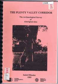
Book, Victoria Archaeological Survey, The Plenty Valley Corridor: the archaeological survey of Aboriginal sites / by Isabel Ellender 1989, 1989_
... Book Book Victoria Archaeological Survey ...This archaeological survey of th Plenty Valley was conducted by Isabel Ellender in 1989 for the Ministry of Planning and Environment. The area studied is north of Greensborough to Whittlesea. A number of Aboriginal sites were identified and recommendations made for the future.103 p., illus., maps. Plastic spiral binding.plenty river, aboriginal heritage sites -
 Greensborough Historical Society
Pamphlet, Heritage Victoria, Viewbank Homestead: Information for volunteers, 1998
... Greensborough Historical Society 34A Glenauburn Road Lower Plenty Lower Plenty melbourne Information about Viewbank Homestead, and the proposed archaeological dig with Viewbank Excavation volunteer application form viewbank homestead 3p text Viewbank Homestead: Information for volunteers Pamphlet Pamphlet Heritage Victoria ...Information about Viewbank Homestead, and the proposed archaeological dig with Viewbank Excavation volunteer application form3p textviewbank homestead -
 Greensborough Historical Society
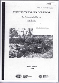
Book, The Plenty Valley Corridor: the archaelogical survey of historic sites, by Fiona Weaver, for the Ministry of Planning & Environment, 1989_
... archaeological survey 115 p., photocopy, unbound. Illus., maps The Plenty Valley Corridor: the archaelogical survey of historic sites, by Fiona Weaver, for the Ministry of Planning & Environment Book Book Fiona Weaver Victoria Archaelogical Survey Fiona Weaver Victoria Archaelogical Survey ...The Victorian Archaelogical Survey managed this study onbehalf of the Ministry for Planning & Environment. The study was intended to provide a brief history of Aboriginal and European occupation and use of the area and an outline of the geography of the chief areas of cultural heritage concern, with recommendations for protection of significant cultural sites and recommendations for further research, survey and consultation.115 p., photocopy, unbound. Illus., mapsplenty river, fiona weaver, victorian archaeological survey -
Greensborough Historical Society
Article, A Squatter's life on the Plenty River at 'Wanstead' by Anne Paul, 09/04/1837o
... Victoria, Vol. 6. The Crown, the land, and the squatter, 1835-1840. She includes further information on the Willis family and photographs of the archaeological dig at the Bridge Inn Hotel Mernda in 2017....Victoria, Vol. 6. The Crown, the land, and the squatter, 1835-1840. She includes further information on the Willis family and photographs of the archaeological dig at the Bridge Inn Hotel Mernda in 2017. ...The Willis Diary by GHS member Anne Paul is based on A Pioneer Squatter's Life (Item158). The Willis family were early settlers at Lower Plenty, just near where the hotel and old bridge are today. Anne has reviewed and analysed this chapter from Historical Records of Victoria, Vol. 6. The Crown, the land, and the squatter, 1835-1840. She includes further information on the Willis family and photographs of the archaeological dig at the Bridge Inn Hotel Mernda in 2017.Diary of James L Willis from 1837, portraying hardships suffered in the young colony of Victoria.10 pages, text and colour illustrations. Abridged hard copy of item 4491.willis family, plenty river, lower plenty, james willis, bridge inn hotel mernda -
Phillip Island and District Historical Society Inc.
Book, JORDAN, D.J, East coast shipwrecks : a thematic historical survey, 1996
... victoria...historic sites...underwater archaeology...Phillip Island and District Historical Society Inc. phillip-island-and-the-bass-coast shipwrecks victoria historic sites underwater archaeology East coast shipwrecks : a thematic historical survey Book JORDAN, D.J. ...shipwrecks, victoria, historic sites, underwater archaeology