
Showing 659 items matching "water race"
-
 Stawell Historical Society Inc
Photograph, Water Race Black Range -- 18 Photos
... Water Race Black Range -- 18 Photos...Water Race (18 Colour Photos) Black Range...Water Race (18 Colour Photos) Black Range Stawell 18 colour photographs in bushland setting Water Race Black Range -- 18 Photos Photograph ...Water Race (18 Colour Photos) Black Range18 colour photographs in bushland setting stawell -
 Malmsbury Historical Society
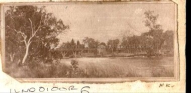
Photograph (Item), B/W Bridge Or Water Race Over A River, Malmsbury c1900
... B/W Bridge Or Water Race Over A River, Malmsbury c1900...Buildings - "Bridge, Water Race" People - "Ellis, Florence Sarah; Ellis Godfrey William"...Buildings - "Bridge, Water Race" People - "Ellis, Florence Sarah; Ellis Godfrey William" B/W Bridge Or Water Race Over A River, Malmsbury c1900 Photograph Photograph ...Associated with - Malmsbury Or Coolgardie? Buildings - "Bridge, Water Race" People - "Ellis, Florence Sarah; Ellis Godfrey William" -
 Upper Yarra Museum
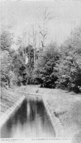
Negative Photographic Reproduction, O'Shannessy Water race
... O'Shannessy Water race ...O'Shannessy Water race Negative Photographic Reproduction ... -
 Malmsbury Historical Society
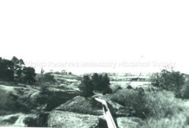
Photograph (Item), "The Race, Water Supply To Bendigo", Malmsbury ca1930
... "The Race, Water Supply To Bendigo", Malmsbury ca1930... People - Young Family Buildings - "Water Race Chimney,Blyth's Flourmill,Rifle Range"...People - Young Family Buildings - "Water Race Chimney,Blyth's Flourmill,Rifle Range" "The Race, Water Supply To Bendigo", Malmsbury ca1930 Photograph Photograph ...People - Young Family Buildings - "Water Race Chimney,Blyth's Flourmill,Rifle Range" -
 The Beechworth Burke Museum
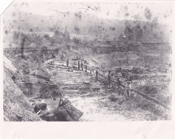
Photograph - Photograph - Reproduction
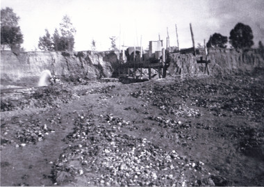
... ...water race...As suggested by the numerous figures involved in labouring along the water race, sluicing was a source of considerable employment within the region. ...As suggested by the numerous figures involved in labouring along the water race, sluicing was a source of considerable employment within the region. ...This photograph depicts mining operations within the Beechworth area, in an unidentified valley where sluicing was utilised as a method for extracting gold from the environment. After gold was discovered in the region in 1851, sluicing became a characteristic of gold mining in the region - "Ovens miners carved intricate networks of races" throughout the region - involved the diversion of water in many channels, or water races, which contained inbuilt 'ripple devices' designed to trap gold for later extraction. By 1871, 900 miles of water races had been cut into the Beechworth Mining District. As suggested by the numerous figures involved in labouring along the water race, sluicing was a source of considerable employment within the region. This image is of important historical significance for its ability to convey information about sluicing and the methods used to find gold in the 1850s, and provides clues as to how sluicing and the widespread construction of water ranges changed the environment of the region. This image is important for current research into the history of the Ovens region in Victoria, which played such a prominent role in the early Australian gold mining industry. Therefore, this image has the capacity to be beneficial for research into society and the motivations of those living and working in this region during this period and therefore, has social significance. The Beechworth Burke Museum has additional images relating to gold sluicing and and the mining activities in the area more generally, which can be analysed and studied alongside images like this one.A black and white rectangular photograph printed on matte photographic paperbeechworth, mining, miners, labour, water race, sluicing -
 The Beechworth Burke Museum
Photograph, 1920-1950
... ...water race...The manipulation of surface and ground water via race networks was well planned and recorded in detail by local mining surveyors. ...The manipulation of surface and ground water via race networks was well planned and recorded in detail by local mining surveyors. ...This image taken between 1920-1930 depicts open-cut hydraulic sluicing at the Three Mile Mine, located about five kilometres south of Beechworth. Alluvial, or surface, mining began on this site in the 1850s, but was soon replaced by hydraulic sluicing methods. By the start of 1880 it is estimated that nine hundred miles of water races had been cut though soil and rock in the Beechworth district. Hydraulic sluicing employs high pressure jets of water to blast away large areas of earth and wash it down to be run through a sluice box. Gold gets caught in the sluice and the remaining slurry is washed away. Large water quantities were required for hydraulic sluicing, and the long water races and deep tailraces that were constructed were considered great engineering feats. This method of mining is extremely effective, but causes significant environmental damage and impacts to waterways and agricultural operations. Miners at Beechworth built extensive networks of races and dams to secure reliable supplies of water on a scale far greater than elsewhere in Victoria. By the 1880s Beechworth's water barons continued to hold more than half of all the water right licences on issue and undertook sluicing operations on a massive scale. The manipulation of surface and ground water via race networks was well planned and recorded in detail by local mining surveyors. The maps that were created, combined with modern geo-spatial technologies, provide a vital key in understanding the great lengths to which miners went to capture and control critical water resources. Today, Three Mile mine is called Baarmutha. The Three Mile Mine was unproductive until 1865 when John Pund and three other miners secured a fifteen year license and constructed a water race from Upper Nine Mile Creek to Three Mile Creek. In the early twentieth century Pund & Co. averaged over one thousand ounces of gold per year from the mine. After Pund's death in 1915, GSG Amalgamated Co operated the site, continuing sluicing until 1950. This image of hydraulic sluicing methods shows the extent of water-works engineering in the landscape. This photograph has historic and research potential for understanding changes to the landscape, the evolution of mining methods, and the extensive construction, manipulation and management of water networks in the Beechworth district. Black and white rectangular photograph on matte paperReverse: 7597-1 / Sluice Mining / Copied from original on loan from Webb (Qld) / Donated Nov 2009 / Baarmutha Three Mile Mine c1920-1950 / Managed by the Plain Bros then Parkinsons / Current Location is: Beechworth Animal Shelter / used for Baarmuthaburke museum, beechworth museum, beechworth, gold fields, gold rush, victorian gold rush, hydraulic sluicing, spring creek, netwown falls, mining tunnels, water races, tailraces, gold ming history, colonial australia, australian gold rushes, mining technology, beechworth historic district, indigo gold trail, indigo shire, john pund, water manipulation, water engineering, three mile creek, three mile mine, water race, large-scale mining methods, historical mining construction, alluvial mining, mining environmental impacts, baarmutha, water barons -
 Stawell Historical Society Inc
Book, Land Conservation Council, Historic Places Special Investigation South Western Victoria Proposed Recommendations, 1996
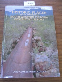
... Card cover with photo of a water metal water race with moutains in the background ...Historic Places Special Investigation South Western Victoria descriptive report Jan 1996 stawell heritage Historic places Special Investigation South-Western Victoria Descriptive report Land Conservation Council Card cover with photo of a water metal water race with moutains in the background Historic Places Special Investigation South Western Victoria Proposed Recommendations Book Land Conservation Council ...Historic Places Special Investigation South Western Victoria descriptive report Jan 1996Card cover with photo of a water metal water race with moutains in the background Historic places Special Investigation South-Western Victoria Descriptive report Land Conservation Councilstawell heritage -
 The Beechworth Burke Museum
Photograph
... ...water race...Beechworth Mining District Three Mile Creek Division Three Mile Creek three mile mine water race water races Mining pipe Baarmutha Gold Mining Sluicing Reverse: SW-50-1 / 1997 3140 / unreadable pencil markings Black and white square photograph printed on matte photographic paper. ...Taken in the 1950s, depicted is a crowd of men, women and children in a mine cutting at the Three Mile Mine, Baarmutha. The majority of the crowd do not appear to be mine workers. Some appear to be inspecting or interacting with the equipment. Three Mile was a part of the Beechworth Mining District which was established in 1858. The District contained seven divisions: Spring Creek, Snake Valley, Three Mile Creek, Buckland, Woolshed, Yackandandah and Omeo. Over time the role of Mining Districts was reduced until the Beechworth Mining District, and other Mining Districts in the area, was put under the administration of the Mines Department in 1975. Water races were commonly used in gold mining as the miners require large volumes of water to separate the gold from the dirt. Beechworth was the site of many firsts in Victorian colonial goldfield water management. Laws and regulations for water management and the control of water rights were established at Beechworth. The first Victorian water permits were also issued there, and the first sales of water for mining. This photograph is historically significant as an example of the importance of the gold rush in Beechworth. The photograph also depicts water infrastructure which has a significant history regarding usage and policy development within the Beechworth Mining District. Black and white square photograph printed on matte photographic paper.Reverse: SW-50-1 / 1997 3140 / unreadable pencil markingsbeechworth mining district, three mile creek division, three mile creek, three mile mine, water race, water races, mining, pipe, baarmutha, gold mining, sluicing -
 Federation University Historical Collection
Book, Victorian Government Legislative Assembly, The Select Committee on Castlemaine and Sandhurst water supply, Report from the Select Committee on Castlemaine and Sandhurst Water Supply, together with the proceedings of the Committee, minutes of evidence and appendices, 19/5/1865 (exact)
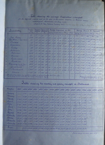
... ...daylesford water race...He was assistant engineer for the Ballaarat and Ballarat East Water Supply Committee and helped plan local reservoirs. water supply victoria castlemaine directories sandhurst directories ballarat directories james blackburn edward wardle daylesford water race c j taylor george avery fletcher bagge ohlfsen bagge george foote john h reilly ambrose johnson george francis timber preservation james forbes alfred surplice malcolm carmichael robert adams frederick hugh thomas h o christerpherson william downe thomas lawrence brown francis hadgson nixon strangways guildford maldon muckleford lauriston malmesbury franklinford walmer strathloddon downe ferdinand krause m7082 trentham castlemaine drummond metcalfe sutton grange lockwood ravenswood mandurang yandoit c.h. ohlfsen bagge moorabool reservoir gong gong reservoir harry beale's reservoir pincott reservoir frank pinkerton water A signature by "Ferdinand M. ...This book contains the report from the select committee on Castlemaine and Sandhurst water supply; with the proceedings of the committee, minutes of evidence and appendices. It also contains the report Of the Engineer-In-Chief of Railways, and reply of the Chief Engineer of Water Supply on the works constructed by the Victorian Water Supply Department, presented to both houses of parliament by His Excellency’s command. Ferdinand M. Krause, was a lecturer at the Ballarat School of Mines in Geology Mineralogy Mining Engineering and Surveying. He was a Fellow of the Geological Society and a Fellow of the Linnian Society. He was assistant engineer for the Ballaarat and Ballarat East Water Supply Committee and helped plan local reservoirs.A brown cloth hard cover, foolscap book with leather spine. Title is written in black on the title page. "Water Supply Reports" is engraved in gold on spine. It includes a table showing the monthly and yearly rainfall and shade temperature at Ballarat, 2nd February, 1885. It also includes two reports and two replies, a map No.7082.2 of Victorian Water Supply, Castlemaine and Sandhurst district general plan including lines of Aqueduct, Reservoirs. No. 7082.3 of Victorian Mining districts, Mining Divisions and The Gold Fields in 1866 - includes districts to be supplied under the Waterworks Act, 1965. It also includes: *Report of the Engineer-in-chief of Railways and Reply of the Chief Engineer of Water Supply on the works constructed by the Victorian Water Supply Department, 1869. * Coliban Water Scheme, 1864 * Ballarat and Ballarat East Water Supply (1869) including the Ballarat Water Supply List containing names of occupiers and nature of improvements on lands comprised within the proposed reserve of Gong Gong Reservoir, Ballaarat. At Warrenheip the names included: Honora McCallin, William Honan, C. McMahon, Patrick McMahon, J.P. Beach, J.H. Smith, Michael Nestor, Martin Quinn, Martin McIntyre, Robert Higgins, Coleman Kane, Robert Bond. At Ballarat: William Clarke, Richard White, John Hosking, Wesleyan Chapel, J. Hewitt, Robert McRobinson. At Bungaree: John Pullin, John Llewellyn. William Daw, Smith and Wynne, William Brough, A. Alexander. * Ballarat and Ballaarat East Water Supply report upon the advisability, or otherwise, of constructing a reservoir at the junction of the Yarrowee Creek and Gile's Creek, upon a site known as Gile's Reservoir (printed by Frank Pinkerton). This report has numerous notes written on it (most probably by Krause) and includes the capacity of Harry Beale's Reservoir, Pimcott's Reservoir and the Proposed Gong Gong Reservoir. * Statement as to the position of the Ballaarat and Ballaarat East Borough Councils in Connection with Water Supply, September 1869. * Ballarat and Ballaarat East Water Supply - General Statement upon the Ballaarat and Ballaarat east Scheme of Water Supply. Includes information on Moorabool reservoir, Harry Beale's Reservoir, Lal Lal Creek, Two Mile Creek, Beale's Dam, Yarrowee Creek, Gong Gong Reservoir, Kirk's Dam, Devil's Creek, Moorabool Creek. Additional handwritten notes (probably by Krause) * Engineer's Report on the resolution of the COmmittee of Water Supply, of the 7th July 1868. The report refers to the Country around Mount Warrenheip. Names mentioned are L. Abraham, Great North-West Gold Mining Company, Border Sawmills, Ferdinand Krause, Ohlfsen Bagge, W.H. Shaw, A signature by "Ferdinand M. Krause" at the top corner of the title page. A few pages have handwriting on the margins, it is believed to be his handwriting. water supply victoria, castlemaine directories, sandhurst directories, ballarat directories, james blackburn, edward wardle, daylesford water race, c j taylor, george avery fletcher, bagge, ohlfsen bagge, george foote, john h reilly, ambrose johnson, george francis, timber preservation, james forbes, alfred surplice, malcolm carmichael, robert adams, frederick hugh thomas, h o christerpherson, william downe, thomas lawrence brown, francis hadgson nixon, strangways, guildford, maldon, muckleford, lauriston, malmesbury, franklinford, walmer, strathloddon, downe, ferdinand krause, m7082, trentham, castlemaine, drummond, metcalfe, sutton grange, lockwood, ravenswood, mandurang, yandoit, c.h. ohlfsen bagge, moorabool reservoir, gong gong reservoir, harry beale's reservoir, pincott reservoir, frank pinkerton, water -
Federation University Historical Collection
Book, Janice Newton, Tracks to Trails: A History of Mt Evelyn, 1997
... ...water race...Mt Evelyn Staff publications railway dam tourism fauna walden hut water race country women Mt Evelyn POst Office Mt Evelyn Railway woiwurong wurrundjeri land selection 238 page book on the history of Mount Evelyn Tracks to Trails: A History of Mt Evelyn Book Janice Newton ...238 page book on the history of Mount Evelynnon-fictionmt evelyn, staff publications, railway, dam, tourism, fauna, walden hut, water race, country women, mt evelyn post office, mt evelyn railway, woiwurong, wurrundjeri, land selection -
Federation University Historical Collection
Book, Jacobs Lewis Vines Architects and Conservation Planners, Historic Sites Survey: Ballarat Study Area, 1980, 1980
... ...water race...This survey was commissioned by the Land Conservation Council, Australian Heritage Commission and the Ministry for Conservation historic sites ballarat Wendy jacobs miles lewis gary vines berringa buninyong creswick dunnstown fiery creek lal lal langi logan cathcart mount cole Mount Egerton nerrina gong gong wombat state forest railways explorers routes early roads land conservation council ausralian hertiage commission department of planning ICOMOS (Burra) Charter nigel lewis richard aitken freehold land public land langi ghiran New jubille mine birthday tunnel mine pitfield plains smythesdale buninyong company Mount Clear mt clear canadian gully Warrenheip Distillery thomas mitchell waterloo trawalla beaufort raglan internment camps forestry mining mining mt egerton Mary Hollick Collection Jubilee Mine Burra Charter Historica areas data form explorers Egerton Company Black Horse mine Mt Egerton Government Battery kaolin Mines Anderson Brothers Barkstead Anderson's Tramway Clarkesdale Berry Leads Birthday Tunnel Mine Berringa Warrenheip Australasian Company Mount Mercer Lanvi-Kal-Kal water race 114 page report on historic sites in the Ballarat region. ...This survey was commissioned by the Land Conservation Council, Australian Heritage Commission and the Ministry for Conservation 114 page report on historic sites in the Ballarat region. It includes information on sites, a schexdule of sites, silte selection and designated areas (ie around towns)historic sites, ballarat, wendy jacobs, miles lewis, gary vines, berringa, buninyong, creswick, dunnstown, fiery creek, lal lal, langi logan, cathcart, mount cole, mount egerton, nerrina, gong gong, wombat state forest, railways, explorers routes, early roads, land conservation council, ausralian hertiage commission, department of planning, icomos (burra) charter, nigel lewis, richard aitken, freehold land, public land, langi ghiran, new jubille mine, birthday tunnel mine, pitfield plains, smythesdale, buninyong company, mount clear, mt clear, canadian gully, warrenheip distillery, thomas mitchell, waterloo, trawalla, beaufort, raglan, internment camps, forestry, mining, mining, mt egerton, mary hollick collection, jubilee mine, burra charter, historica areas data form, explorers, egerton company, black horse mine, mt egerton government battery, kaolin mines, anderson brothers, barkstead, anderson's tramway, clarkesdale, berry leads, birthday tunnel mine berringa, warrenheip, australasian company, mount mercer, lanvi-kal-kal, water race -
 Bendigo Historical Society Inc.
Document - PETER ELLIS COLLECTION: LETTER, 20th August, 1980
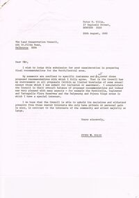
... Old Underground Water Race...PERSON Individual peter ellis oam Peter Ellis Collection Land Conservation Council Kamarooka State park Whipstick State park Eucalyptus Oil Production FNCV Victorian Naturalist D J Paton Bendigo Field Naturalists Club Wellsford Forest Mandurang Forest Main Coliban Channel Lockwood Forest Waanyaras Fryerstown Whipstick Hill (Flagstaff Hill) Parish of Neilborough Old Underground Water Race Puddling Machine SRWSC Letter (11 Pages) from Peter N Ellis to the Land Conservation Council. ...Letter (11 Pages) from Peter N Ellis to the Land Conservation Council. Letter refers to proposed State parks - Kamarooka State Park and Whipstick State Park. other areas mentioned are the Wellsford Forest, Mandurang Forest, Lockwood Forest, Waanyaraa, Fryerstown, Whipstick Hill (Flagstaff Hill) and Black Rock. Other areas are Wellsford/Axedale Forest, Sugarloaf Range, Mandurang Forest, Main Coliban Channel, Lockwood Forest, Tarnagulla/Dunolly Forest, Fryerstown, Seven Sisters (between Huntly and Goornong). Plant and tree life in each area is mentioned including the cutting of eucalypt for the production of Eucalyptus oil.person, individual, peter ellis oam, peter ellis collection, land conservation council, kamarooka state park, whipstick state park, eucalyptus oil production, fncv victorian naturalist, d j paton, bendigo field naturalists club, wellsford forest, mandurang forest, main coliban channel, lockwood forest, waanyaras, fryerstown, whipstick hill (flagstaff hill), parish of neilborough, old underground water race, puddling machine, srwsc -
 Bendigo Historical Society Inc.
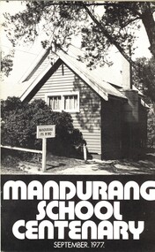
Book - MANDURANG SCHOOL CENTENARY SEPTEMBER 1977, c1977
... ... water race...SCHOOL Centenary mandurang History of Mandurang State School and District Industries Wine Milk Gold Tannery Look-out Timber Hotels water race floods post office sports churches fire brigade school opens 1877 head teachers mothers club education Mr G Pearce, Mr J Sloan, Mr K O'Brien, Mrs, J French Mandurang School Centenary, September 1977. ...Mandurang School Centenary, September 1977. Espress Print, Bendigo. 24 pages. Photographs and illustrations. With IndexMr G Pearce, Mr J Sloan, Mr K O'Brien, Mrs, J Frenchschool, centenary, mandurang, history of mandurang state school and district, industries, wine, milk, gold, tannery, look-out, timber, hotels, water race, floods, post office, sports, churches, fire brigade, school opens 1877, head teachers, mothers club, education -
 The Beechworth Burke Museum
Photograph, 1910
... ...water race...Sluicing El Dorado Beechworth water race flume pipes Cocks pioneer gold and tin sluicing company no liabilities dredging Cocks pioneer G&T S.L. ...This photograph depicts Cocks Pioneer Gold & Tin Sluicing Company, N.L. (no liabilities) site No.3 and is looking from the east side of the site. The image is captured within a small valley creek bed and presents the conditions in which mining was evolving in the early 1900s. In the foreground are remnants of components such as flume pipes, timber and iron pieces, mixed with rocks and rubble. These appeared to have connections to the small processing sluice plant featured in the background. The scale of the processing plant appears to be relatively small with the structure resembling a shack or cottage built from iron and positioned upon a floating pontoon. This is known as dredge sluicing, essentially a floating factory, that was capable of covering large areas of the lake and dams. As this dredge was compact it could maneuver in tight spaces, which larger structure could not. The size of the figures at the front opening, which appears to be a doorway, indicate the scale of this very modest production plant. Scaffolding on the roof and to the left process alluvial from the stream floor into sluicing boxes, which filtered deposits passing over a series of ripples to collect the heavier material such as gold. A faded sepia rectangular photograph printed on matte photographic paper mounted on grey green cardCocks pioneer G&T S.L. Co. N.L./ 1910/ No.3 site looking eastsluicing, el dorado, beechworth, water race, flume pipes, cocks pioneer gold and tin sluicing company no liabilities, dredging -
 Stawell Historical Society Inc
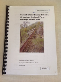
Book, Gary Vines, Stawell Water Supply Scheme, Grampians National Park, Heritage Action Plan, 2004
... White paper with black print and colour photo of a water race. this book has a black plastic binding...Prepared for Parks Victoria, by Gary Vines of Biosis Research Pty Ltd White paper with black print and colour photo of a water race. this book has a black plastic binding Stawell Water Supply Scheme, Grampians National Park, Heritage Action Plan Book Gary Vines ...White paper with black print and colour photo of a water race. this book has a black plastic bindingStawell Water Supply Scheme, Grampians National Park, Heritage Action Plan. Prepared for Parks Victoria, by Gary Vines of Biosis Research Pty Ltdstawell -
 Kiewa Valley Historical Society
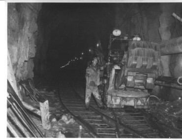
Photograph of Rail Mounted Battery operated soil Bucket, between 1941 and 1946
... water...tail race...July, 1950 Shows the size of the tunnel and the machinery used for excavation in the 1940's/50's. tunnel machinery water tail race Handwritten on back of photograph "Jumbo" in Tailrace Tunnel Black and white photograph Photograph of Rail Mounted Battery operated soil Bucket Photograph taken by Mr. ...This machine was in use in the 1940's during the construction of the tunnels for the Hydro Electric scheme. This particular photograph was taken in the Tailrace Tunnel which brings water from West Kiewa Power Station to the open tailrace in Mt. Beauty and then into the regulating pondage before discharge into the Kiewa River. This machine (or one similar) is on display on the Northern side of the entrance to the Visitor's Centre. The tailrace tunnel (or West Kiewa tunnel) was commenced in 1947 from both ends and the breakthrough occurred on 22nd. July, 1950Shows the size of the tunnel and the machinery used for excavation in the 1940's/50's.Black and white photographHandwritten on back of photograph "Jumbo" in Tailrace Tunneltunnel, machinery, water, tail race -
 Bendigo Historical Society Inc.
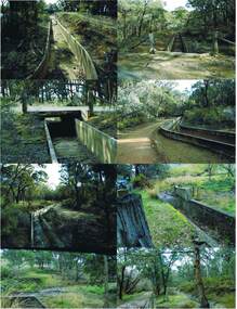
Photograph - COLIBAN MAIN CHANNEL, July,2009
... Water...coliban race...PLACE Water coliban race Coliban Main Channel. Ray Smith and Phil Wilkin - Bendigo Historical Society. ...Photograph - colour. All photographs are of the Coliban Main Channel. Photo's 1,2,3,4 + 5 = were taken from South Mandurang Road, Spring Road end. Photo's 6,7,8,9,10,11,12 + 13 = were taken top of dirt road section of Springs Road. Photo's 14 + 15 = Taken between Sedgwick and North Harcourt, used to be called 'Prestonvale'. Photo No.14 is called Wirths Tunnel, 633 metres in length. Three more sheets of photo's of the Coliban Main Channel, between Sedgwick and Harcourt North. If more info.Ray Smith and Phil Wilkin - Bendigo Historical Society.place, water, coliban race, coliban main channel. -
 Bendigo Historical Society Inc.
Photograph - JOSEPH BRADY COLLECTION: FLUMING BETWEEN MALMSBURY RESERVOIR AND CALDER HIGHWAY, 1934
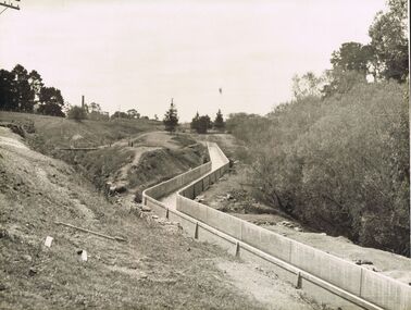
... Water...coliban race...PLACE Water coliban race John Brady Collection. Coliban Race Black and white photograph: image shows concrete channel snaking down hill, top LH side appears to be bluestone mill with tall chimney. ...Black and white photograph: image shows concrete channel snaking down hill, top LH side appears to be bluestone mill with tall chimney. Trees on RH side of channel. Comments on the back of the photo 'Between Malmsbury Res and Calder Hwy. 8 feet wide 4 foot 6 inches deep. Taken 1934. JA 10/81 concrete grand fluming at 12.5 miles Main channel 8 feet wide 4 foot 6 inches high. Constructed 1928.'place, water, coliban race, john brady collection. coliban race -
 Bendigo Historical Society Inc.
Photograph - JOSEPH BRADY COLLECTION: BYRNE'S TUNNEL, COLIBAN SYSTEM
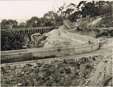
... Water...coliban race...PLACE Water coliban race John Brady Collection. Coliban Race Photograph black and white. ...Photograph black and white. Comments on back of photo: 1st Gully upstream of Byrne's Tunnel. Constructed 1927/28. Concrete ground fluming.place, water, coliban race, john brady collection. coliban race -
 Bendigo Historical Society Inc.
Photograph - JOSEPH BRADY COLLECTION: COLIBAN RACE CONCRETE FLUMING
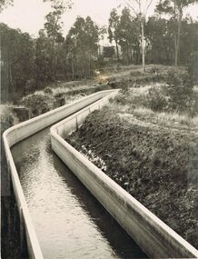
... Water...coliban race...PLACE Water coliban race John Brady Collection. Coliban Race Photograph - black and white. ...Photograph - black and white. Comments received with photo: Coliban Race Concrete grand fluming at 12.5 miles main channel; 8 feet wide, 4 foot 6 inches high constructed 1928.place, water, coliban race, john brady collection. coliban race -
 Stanley Athenaeum & Public Room
Artwork, other - Lithograph - framed reproduction - coloured, Stanley, Ovens 1859
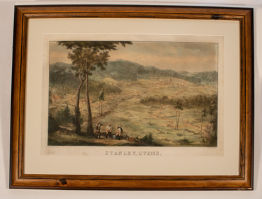
... Outlying dwellings and a water-race also feature....Outlying dwellings and a water-race also feature. Stanley, Ovens 1859. ...Edward Hulme - artist's early landscape of Stanley Village overlooking the plateau and hills. There are 3 miners in the foreground washing the gravel by a cradle with 2 tall eucalypts to the left. Outlying dwellings and a water-race also feature.E.Hulme clel & lith. Ladd and Carr. imp. Reproduction company for National Library, Australia -
 Emerald Museum & Nobelius Heritage Park
Postcard, Victoria Stamp Market, Track through Bush, c. 1905
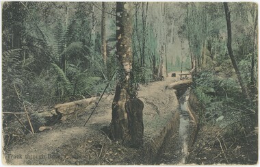
... Obverse, Caption: "Track through Bush, Gembrook" Reverse: Handwritten Annotation: "Water race along the Menzies Creek / near A'Vard Park. / GOLD" Printed Label, Vertical: "Printed in Prussia" Printed Label, Horizontal: "V.S.M. ...This postcard is significant for its relative uniqueness as a colourised depiction of Emerald's gold mining history. 1890s Emerald Gold Mining Obverse, Caption: "Track through Bush, Gembrook" Reverse: Handwritten Annotation: "Water race along the Menzies Creek / near A'Vard Park. / GOLD" Printed Label, Vertical: "Printed in Prussia" Printed Label, Horizontal: "V.S.M. ...While the caption on this postcard says 'Gembrook', this photograph is believed to be from Menzies Creek (where VEMUP0840.1 and VEMUP0840.3 were taken). Menzies Creek does not run to Gembrook; it diverges from Woori Yallock Creek at Butterfield Reserve in Emerald and then runs to the town of Menzies Creek. This makes it more likely that this photograph is from Emerald or Menzies Creek, with the annotation on the reverse suggesting it was near A'Vard Park (where Menzies Creek intersects A'Vard Road) and therefore in Emerald. It is part of Melbourne's V.S.M. (Victoria Stamp Market) Series, printed in Prussia, Germany alongside several similar hand-coloured postcards in our collection. This postcard is believed to originate from c. 1905, but the image itself - depicting a gold washing bath on Menzies Creek - might be older. Gold mining in Emerald was most popular in the 1850s and 60s. However, gold mining on Menzies Creek reopened in the 1890s depression, which is a more likely source of this photograph.This postcard is significant for its relative uniqueness as a colourised depiction of Emerald's gold mining history.This item is a hand-coloured photographic postcard. The reverse has empty message, stamp, and address sections, with a small handwritten annotation in pencil and printed publication information. The photograph is accompanied by a printed caption in the bottom-left. It depicts a walking track running alongside a channel or creek, with both approaching from the centre of the background to the left of the foreground. They are surrounded on either side by trees, shrubs, and ferns. The paper of the reverse is slightly yellowed.Obverse, Caption: "Track through Bush, Gembrook" Reverse: Handwritten Annotation: "Water race along the Menzies Creek / near A'Vard Park. / GOLD" Printed Label, Vertical: "Printed in Prussia" Printed Label, Horizontal: "V.S.M. Series, Melbourne"1890s, emerald, gold mining -
Bendigo Historical Society Inc.
Map - CAMPBELL COLLECTION: BENDIGO AND DISTRICT MAPS, 22-3-29
... Crusoe Reservoir & Viaduct and water race. Compiled in W.P.B. fro Field Survey and Parish Plans. ...Crusoe Reservoir & Viaduct and water race. Compiled in W.P.B. fro Field Survey and Parish Plans. ...Map. Marong, Parishes of Marong, Lockwood and Mandurang, Scale 20 chains to 1 inch, Total area 5106 acres. Crusoe Reservoir & Viaduct and water race. Compiled in W.P.B. fro Field Survey and Parish Plans. B.W.L.22-3-29 (number 389 in map cupboard 1)B.W.L.map, bendigo, allotments -
 Bendigo Historical Society Inc.
Document - MCCOLL, RANKIN AND STANISTREET COLLECTION: CENTRAL NAPOLEAN GOLD MINING CO N/L, 1934 - 1947
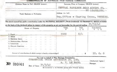
... Lease agreement Use of Water Race, Application for Shares, Tribute Agreements. ...Lease agreement Use of Water Race, Application for Shares, Tribute Agreements. ...Document. Envelope containing: - War Damage Commission receipt. Agreement with State Electricity Commission (1938), Share Register, Lease Agreement, Receipt from Holland Bros Engineers, Agreement for water rights. Lease agreement Use of Water Race, Application for Shares, Tribute Agreements. Napoleon (B.M.L.) Mines No Liability.McColl, Rankin & Stanistreetorganization, business, gold mining - legal, mccoll, rankin & stanistreet, central napoleon gold mining co nl, gold mining, share register, leases, sec, holland bros engineers, water rights -
Bendigo Historical Society Inc.
Map - CAMPBELL COLLECTION: BENDIGO AND DISTRICT MAPS, 23-4-29
... Whirrakee, Parish of Whirrakee, Total area 4419 acres, scale 20 chains to 1 inch. Unused water race in centre of map. Eucalypt Oil Distillery, bottom of map. ...Whirrakee, Parish of Whirrakee, Total area 4419 acres, scale 20 chains to 1 inch. Unused water race in centre of map. Eucalypt Oil Distillery, bottom of map. ...Map. Whirrakee, Parish of Whirrakee, Total area 4419 acres, scale 20 chains to 1 inch. Unused water race in centre of map. Eucalypt Oil Distillery, bottom of map. Prepared in W.P.B. from Assessor's Plan and Parish Plan. G.W.Latimer 23-4-29. (number 385 in map cupboard 1)G.W.Latimermap, bendigo, agricultural lands -
 Bendigo Historical Society Inc.
Document - MISS G ALICE JONES COLLECTION: ACCOUNT
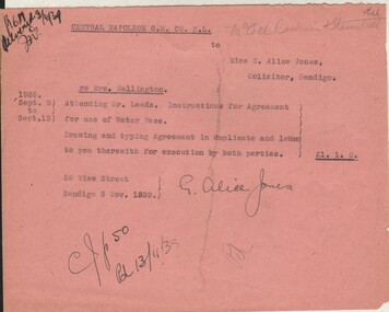
... Account details costs and work involved for Agreement for use of Water Race. Cost £1.1.0. R681 delivered 3/11/39 written in top left corner....Account details costs and work involved for Agreement for use of Water Race. Cost £1.1.0. R681 delivered 3/11/39 written in top left corner. ...Central Napoleon G. M. Co N. L. to Miss G. Alice Jones. Pink paper dated Sept. 9 to Sept. 13, 1939. re Mrs. Wellington. Account details costs and work involved for Agreement for use of Water Race. Cost £1.1.0. R681 delivered 3/11/39 written in top left corner.miss g. alice jones collection - account, central napoleon g m co n. l, mrs wellington -
 Bendigo Historical Society Inc.
Document - Phillip's Water Wheel, Diamond Hill, Bendigo, 1876
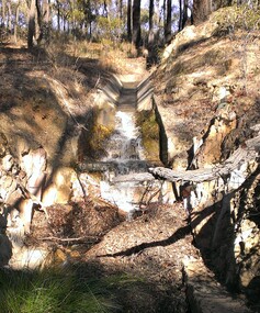
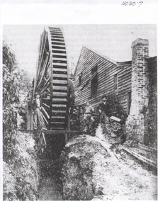
... The lack of water available for the venture from the water race caused much controversy in the following years. ...The lack of water available for the venture from the water race caused much controversy in the following years. ...'Messrs. George Phillips and Richard Williams erected a water wheel crushing machine near the site of the Old Albert shaft at Diamond Hill'. ( Bendigo Advertiser 4th June, 1890). The lack of water available for the venture from the water race caused much controversy in the following years. There was only enough water available in July 1890, to allow the company to operate three head of a ten head stamper. The site of the water wheel is still visible on the side of the water race at Diamond Hill. Mr. Geo Phillips held 1000 shares in the float of the Kangaroo Hydraulic Crushing & Gold Mining Company. He was one of the largest shareholders. (Victorian Government Gazette 72 Page 2260, 1893) Black and white photocopy. Image shows the Phillip's Water Wheel on Diamond Hill, Bendigo, date unknown but must be in 1890's. Three men and a dog standing in front of a weatherboard shed, brick chimney on side. Large water wheel on left hand side of image. Three images, 2008, showing former site of water wheel on channel, after heavy rain in district caused dry channel to run. mining, sandhurst, phillip's hydraulic waterwheel, stafford gold mine, diamond hill, george phillips, richard williams -
 Bendigo Historical Society Inc.
Photograph - Phillip's Water Wheel, Diamond Hill, Bendigo, Unknown
... The lack of water available for the venture from the water race caused much controversy in the following years. ...The lack of water available for the venture from the water race caused much controversy in the following years. ...The site of the water wheel is still visible on the side of the water race at Diamond Hill, Bendigo. Messrs. George Phillips and Richard Williams erected a water wheel crushing machine near the site of the Old Albert shaft at Diamond Hill'. ( Bendigo Advertiser 4th June, 1890). The lack of water available for the venture from the water race caused much controversy in the following years. There was only enough water available in July 1890, to allow the company to operate three head of a ten head stamper. Mr. Geo Phillips held 1000 shares in the float of the Kangaroo Hydraulic Crushing & Gold Mining Company. He was one of the largest shareholders. (Victorian Government Gazette 72 Page 2260, 1893) Black and white photocopy of original. Image shows the Phillip's Water Wheel on Diamond Hill, Bendigo. Weatherboard building on right hand side of image, brick chimney on side of building. Large water wheel in cutting directly alongside building. Two men standing in between water wheel and building, one man standing on landing of waterwheel.mining, sandhurst, phillip's hydraulic waterwheel, stafford gold mine, diamond hill, george phillips, richard williams -
 Bendigo Historical Society Inc.
Document - MCCOLL, RANKIN AND STANISTREET COLLECTION: CENTRAL NAPOLEON GOLD MINING CO. N.L, 1940 - 1950
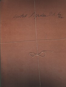
... Document: 2 brown sheets of cardboard held together with string - Contents; notes and receipts regarding Financial Statements (1940's & 1950's), includes receipt for insurance, petty cash, advertising, lease rent, survey, various items purchased for mining, wages, electricity, battery supervision, rent store room, rent water race, caretaking, markings read: Central Napoleon G.M. ...ORGANIZATION Business industrial - mining McColl Rankin & Stanistreet mining gold mining Central Napoleon Document: 2 brown sheets of cardboard held together with string - Contents; notes and receipts regarding Financial Statements (1940's & 1950's), includes receipt for insurance, petty cash, advertising, lease rent, survey, various items purchased for mining, wages, electricity, battery supervision, rent store room, rent water race, caretaking, markings read: Central Napoleon G.M. ...Document: 2 brown sheets of cardboard held together with string - Contents; notes and receipts regarding Financial Statements (1940's & 1950's), includes receipt for insurance, petty cash, advertising, lease rent, survey, various items purchased for mining, wages, electricity, battery supervision, rent store room, rent water race, caretaking, markings read: Central Napoleon G.M. Co N.Lia.organization, business, industrial - mining, mccoll rankin & stanistreet, mining, gold mining, central napoleon -
 Bendigo Historical Society Inc.
Map - OLD TOM MINE, WHIPSTICK
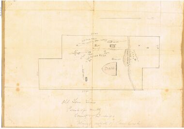
... Map shows Old Tom Reef, old working open cutting, shaft 150 ft., Easter Reef, dam sand heap, water race, 3 other shafts, 120ft., 90ft., and 500 ft. marked on map. ...Map shows Old Tom Reef, old working open cutting, shaft 150 ft., Easter Reef, dam sand heap, water race, 3 other shafts, 120ft., 90ft., and 500 ft. marked on map. ...2 copies ( A4 and A3) of Old Tom lease. Map shows Old Tom Reef, old working open cutting, shaft 150 ft., Easter Reef, dam sand heap, water race, 3 other shafts, 120ft., 90ft., and 500 ft. marked on map. Stamped on map '64.3.34' Written on bottom of map in handwriting ' Old Tom Lease, Parish of Huntly, County of Bendigo, Mining district of Sandhurst'bendigo, mining, old tom lease map
