Showing 40 items matching "weather map"
-
 Moorabbin Air Museum
Book - Meteorology, Through the Overcast
... ...Weather map & teletype symbols...Meteorology Becoming a weather detective Stability & instability Air masses Weather map & teletype symbols Fronts and cyclones Fog /thunderstorms & icing. ...Overview of weather & the art of instrument flying, circa 1943non-fictionOverview of weather & the art of instrument flying, circa 1943becoming a weather detective, stability & instability, air masses, weather map & teletype symbols, fronts and cyclones, fog /thunderstorms & icing., making a weather map., forecasting, weather & airline flying, climatology, weather instruments, aircraft instruments, sperry gyro, power plant, fuel & lubrication, fuel-air ratios, the spark plug, whirling props, airplane behaviour, dead reckoning, radio, radio flying & orientation, instrument technique, celestial navigation -
Moorabbin Air Museum
Book - Aerial navigation, Flight - Meteorology, Aircraft Instruments and Navigation
... ...Weather map...Moorabbin Air Museum Moorabbin Airport 12 First Street Moorabbin melbourne Aerial navigation Atmosphere Weather map Airway weather service Aerial photogrophy Aviation radio Aircraft instruments Aerial navigation Overview of basic meteorology , aircraft instrumentation & navigation, circa 1943 Flight - Meteorology, Aircraft Instruments and Navigation Book Aerial navigation ...Overview of basic meteorology , aircraft instrumentation & navigation, circa 1943non-fictionOverview of basic meteorology , aircraft instrumentation & navigation, circa 1943atmosphere, weather map, airway weather service, aerial photogrophy, aviation radio, aircraft instruments, aerial navigation -
 Warrnambool and District Historical Society Inc.
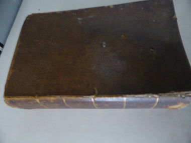
Book, A Complete Epitome of Practical Navigation - J W Norie, 1848
... These notes are of great historical interest This book is of great interest because it belonged to a Port Fairy historical figure and because of the hand written weather notes inside the front cover. john cowtan port fairy J Cowtan 1849 This is a hard covered, leather bound book of 680 pages. It contains printed text, illustrations, tables, maps and sketches. ...This book is a 19th Century treatise on aids to navigation. It belonged to John Cowtan who held land near the Cassady's Bridge area in Caramut Road today (he was related to the Cassady family) and who is mainly important in the history of Port Fairy. Captain John Cowtan was a ship's master for John Griffiths and a Launceston entrepreneur and ship owner between 1839 and 1844. In 1847 he went into partnership with John Bland, establishing a merchant's business with riverside buildings at the Port Fairy wharf. He left Port Fairy in the 1860s. The date of John Cowtan's signature in this book is 1849 (certainly a very early one in our history) and inside the front cover he has written notes about the local weather, mainly as it affected sailing conditions in late 1849 and early 1850. These notes are of great historical interestThis book is of great interest because it belonged to a Port Fairy historical figure and because of the hand written weather notes inside the front cover. This is a hard covered, leather bound book of 680 pages. It contains printed text, illustrations, tables, maps and sketches. One page is torn Some pages are stained. J Cowtan 1849john cowtan, port fairy -
 Warrnambool and District Historical Society Inc.
Article, Newspaper S McDonald, 1940’s
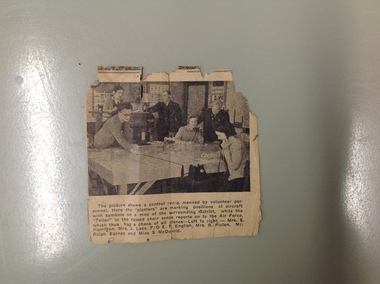
... weather watching. This photograph shows a group of local volunteers at their work. Mrs. S Hamilton, Mrs. J Lees, F/O E F English, Mrs. R Picton, Mr. Ralph Barnes and Miss S McDonald A local item which relates to an organization which operated around Australia in the 1940’s. Volunteer Air Observers Corps, Volunteer Air Observers Corps, Mrs. S Hamilton, Mrs. J Lees, F/O E F English Mrs. R Picton Mr. Ralph Barnes Miss S McDonald warrnambool The picture shows a control room manned by volunteer personnel. Here the plotters are marking positions of aircraft with symbols on a map ...The Volunteers Air Observers was formed in 1941 with the aim of observing aircraft flying over Australia. There were over 24000 civilians volunteering their services and as the military threat to Australia subsided they took on roles as coast and weather watching. This photograph shows a group of local volunteers at their work. Mrs. S Hamilton, Mrs. J Lees, F/O E F English, Mrs. R Picton, Mr. Ralph Barnes and Miss S McDonaldA local item which relates to an organization which operated around Australia in the 1940’s. Small newspaper cutting with photograph with six people around a table. Text is underneath the photo. The back has an advertisement for Fletcher Jones clothingThe picture shows a control room manned by volunteer personnel. Here the plotters are marking positions of aircraft with symbols on a map of the surrounding district while the Teller in the raised chair sends reports on to the Air Force, which thus has a check of all planes left to right Mrs. S Hamilton, Mrs. J Lees, F/O E F English, Mrs. R Picton, Mr. Ralph Barnes and Miss S McDonald volunteer air observers corps,, volunteer air observers corps,, mrs. s hamilton,, mrs. j lees,, f/o e f english, mrs. r picton, mr. ralph barnes, miss s mcdonald warrnambool -
 Kiewa Valley Historical Society
Photograph - Coloured Photographs x 5 - Bogong High Plains, January 1969 and c1970
... maps, pole lines and tracks. He perished in the winter of 1936 after attempting to make the first winter crossing from Mt. Hotham to Mt. Bogong on skis. The two others with him, Howard Michell and Mick Hull survived. The weather...maps, pole lines and tracks. He perished in the winter of 1936 after attempting to make the first winter crossing from Mt. Hotham to Mt. Bogong on skis. The two others with him, Howard Michell and Mick Hull survived. The weather ...Bivouac Hut was built in 1935 on the Northern end of Mt. Bogong, on the Staircase Spur, about halfway to the summit. It was funded by Cleve Cole and he arranged for Walter Maddison to build it. Cleve Cole dedicated his life to the mountains and wanted to make them safer to visit - more huts and improved maps, pole lines and tracks. He perished in the winter of 1936 after attempting to make the first winter crossing from Mt. Hotham to Mt. Bogong on skis. The two others with him, Howard Michell and Mick Hull survived. The weather conditions were extreme at the time and having made the summit of Mt. Bogong they then became disorientated in the blizzard and came down the southern end of Bogong instead of the northern end . Howard Michell made it out to Glen Valley, a small mining town, to get help. Mick and Cleve were carried out on rough bush stretchers and Cleve died a few hours later. The Summit Hut was funded by Howard Michell and built in the 1940's. It was deliberately burnt down in the early 1980's. Bivouac hut was rebuilt in the 1980's.These photographs are of historical significance. Both huts were funded by experienced bushwalkers to provide shelter from the weather and so make walking and skiing in the area safer. They are both now gone with Bivouac being replaced with a more modern structure but there is nothing left of the Summit Hut. 5 coloured photographs, A4 in size, 4 near the summit of Mt. Bogong (Three of the Summit Hut) and one of Bivouac Hut on the Staircase Spur leading up to the summit.1. Hand written in ink on back of Photo - "Mt. Bogong Sep. 1976' - all underlined. Below this "Staircase Spur Hut The bloke in the hat me (David Jones)". 2. Handwritten in ink on back of photo - "Mt. Bogong winter 1970" (underlined). Underneathe "Same old Hut". 3. Handwritten in ink "Mt. Bogong Jan. 1969" (Underlined) Underneath "Tawonga Saddle looking towards the Summit". 4.Handwritten in ink back of photo "Mt. Bogong Jan. 1969" (underlined) Old hut near Summit, since removed, at the top of Staircase Spur. View looking out over Kiewa Valley." 5.Hand written on back of photo "Mt. Bogong Jan. 1969" (Underlined). Underneath - " Same old Hut (Staircase Spur) early morning".mt. bogong, summit hut, bivouac hut -
 Kiewa Valley Historical Society
Maps - Bogong x2, Tawonga, Omeo, Dargo, Victoria and others, 1. Bogong Alpine Area; 2. Bogong 8324; 3. Tawonga Topographical; 4. Omeo 8433; 5. Dargo 8323; 6. Victoria State
... Map. survey & Mapping Victoria, Government of Victoria, Edition 2, reprinted 1991 with an image of Mt. Feathertop on the front. Information for tourist in the Alpine National Park: Bogong Area. Including: recreational activities, history, weather...Map. survey & Mapping Victoria, Government of Victoria, Edition 2, reprinted 1991 with an image of Mt. Feathertop on the front. Information for tourist in the Alpine National Park: Bogong Area. Including: recreational activities, history, weather ...1. Bogong Alpine Area (outdoor Leisure Map. survey & Mapping Victoria, Government of Victoria, Edition 2, reprinted 1991 with an image of Mt. Feathertop on the front. Information for tourist in the Alpine National Park: Bogong Area. Including: recreational activities, history, weather and vegetation and a list of walks together with locality maps and photographs. The front cover has an image of Mt Feathertop against a blue sky with yellow writing 'Bogong Alpine Area', there is a yellow triangular block on the right hand top corner with black writing 'Outdoor Leisure Map. On the bottom edge is a block of yellow with black writing 'Survey & Mapping Victoria' and a light green map of Victoria with 'VICMSP' printed in white. 2. 8324 Bogong Victoria, Edition 1, Commonwealth of Australia 1981. A topographical Map: 1:100,000 scale (1 cm to 1 KM). Map has a red cover with white writing together with a white block and black writing and a map insert. 3. Tawonga Topographical Map - Forests Commission Victoria, / revised 5/9/77, DEG No. 68-G/399. A Tawonga 803 folded map in a beige colour with the back blank. 4. Omeo 8433 Victoria, Edition 1, Department of Natural Resources. The map has a red and white cover with black writing and a simple map of Australia at the bottom. 5. 8323 Dargo, Edition 1, Commonwealth of Australia. A red and white cover with a map insert. 6. Victoria State Map, Hema Maps, 2002. Hema Maps, State Map, colourful cover with a map of Australia and four tourism photographs. Scale 1: 850,000 An inscription handwritten in blue pen "Trappers Gap to Mitta Mitta 1" to 1 mile". There are some pen markings and notations of tracks.maps, bogong, omeo, tawonga, dargo, victoria, bogong alpine area -
 Monbulk RSL Sub Branch
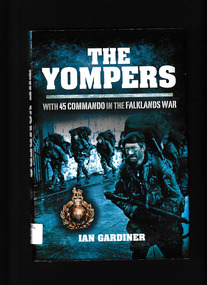
Book, Barnsley Pen & Sword Military, The Yompers : with 45 Commando in the Falklands War, 2012
... Lacking helicopters and short of food, they yomped in appalling weather carrying overloaded rucksacks, across ground which threatened to break legs and ankles at every step. Despite extreme hardship, their morale and training ensured they remained a cohesive fighting-fit body of men. Ill, maps ...Yomping was revealed by the journalist Charles Laurence in 1982 as the word which the Royal Marines used to describe carrying heavy loads long distances on foot. Given the intense public interest in the dramatic events then unfolding in the South Atlantic, it caught on and is now in common usage.The Yompers is the first account to be written by a company commander who fought in the Falklands War. Called to action from their beds early on 2 April 1982, the author along with the rest of 45 Commando Royal Marines, sailed 8,000 miles to play a key role in the recovery of the Falkland Islands from Argentine occupation. Lacking helicopters and short of food, they yomped in appalling weather carrying overloaded rucksacks, across ground which threatened to break legs and ankles at every step. Despite extreme hardship, their morale and training ensured they remained a cohesive fighting-fit body of men.Ill, maps, p.208.non-fictionYomping was revealed by the journalist Charles Laurence in 1982 as the word which the Royal Marines used to describe carrying heavy loads long distances on foot. Given the intense public interest in the dramatic events then unfolding in the South Atlantic, it caught on and is now in common usage.The Yompers is the first account to be written by a company commander who fought in the Falklands War. Called to action from their beds early on 2 April 1982, the author along with the rest of 45 Commando Royal Marines, sailed 8,000 miles to play a key role in the recovery of the Falkland Islands from Argentine occupation. Lacking helicopters and short of food, they yomped in appalling weather carrying overloaded rucksacks, across ground which threatened to break legs and ankles at every step. Despite extreme hardship, their morale and training ensured they remained a cohesive fighting-fit body of men.falklands war 1982, great britain - royal marines - commando 45 -
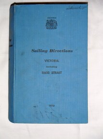 Bay Steamers Maritime Museum
Book, Ports and Harbours Division, Sailing Directions Victoria including Bass Strait, 1970
... Bay Steamers Maritime Museum Shed 2 N Wharf Road Docklands melbourne non-fiction sailing Victoria Bass Strait communications fuel maps charts weather navigation Inside front cover, white sticker with red printing "JOHN DONNE & SON / CHARTS, MAPS & MARINE BOOKS / 372 LITTLE BOURKE ST. / MELBOURNE" Blue hard cover book of 745 pages Sailing Directions Victoria including Bass Strait Book Ports and Harbours Division ...Blue hard cover book of 745 pagesInside front cover, white sticker with red printing "JOHN DONNE & SON / CHARTS, MAPS & MARINE BOOKS / 372 LITTLE BOURKE ST. / MELBOURNE" non-fiction, sailing, victoria, bass strait, communications, fuel, maps, charts, weather, navigation -
 Otway Districts Historical Society
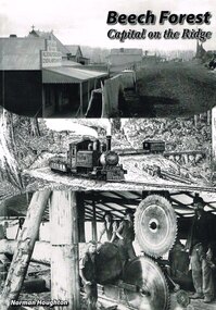
Book, Norman Houghton, Beech Forest: Capital on the Ridge. Norman Houghton, 2008
... Otway Districts Historical Society Cliff Young Drive Beech Forest great-ocean-road beech forest; the ridge; norman houghton; roads; railway; bushfires; weather; governance; commercial life; timber; agriculture; education; churches; sports; Beech Forest: capital on The Ridge. Norman Houghton. 1st ed. reprinted. Geelong (Vic.); Norman Houghton; 2007. iv, 112 p.; illus, maps ...Beech Forest: capital on The Ridge. Norman Houghton. 1st ed. reprinted. Geelong (Vic.); Norman Houghton; 2007. iv, 112 p.; illus, maps. Soft cover. beech forest; the ridge; norman houghton; roads; railway; bushfires; weather; governance; commercial life; timber; agriculture; education; churches; sports; -
Port Melbourne Historical & Preservation Society
Map - Proposed cut and Ferguson Dock, Port Melbourne, Jul 2008
... Map of proposed cut and Ferguson Dock which would have run from near the location of Princes Pier to swinging basin in Yarra River. Varied information on back - weather...Port Melbourne Historical & Preservation Society Port Melbourne Town Hall 333 Bay Street Port Melbourne melbourne piers and wharves - miscellaneous melbourne harbor trust - port of melbourne authority mr ferguson fishermans bend ferguson dock Map of proposed cut and Ferguson Dock which would have run from near the location of Princes Pier to swinging basin in Yarra River. Varied information on back - weather ...Map of proposed cut and Ferguson Dock which would have run from near the location of Princes Pier to swinging basin in Yarra River. Varied information on back - weather and some local informationpiers and wharves - miscellaneous, melbourne harbor trust - port of melbourne authority, mr ferguson, fishermans bend, ferguson dock -
 Flagstaff Hill Maritime Museum and Village
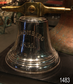
Functional object - Bell, Schomberg 1855, Before 1855
... map. During the night, the crew launched a lifeboat to search for a safe landing spot for the passengers. The scouting party advised Forbes to wait until morning, as rough seas posed a danger to the lifeboats. At dawn, the ship’s Chief Officer spotted the SS Queen and signalled for help. The master of the Queen brought his vessel alongside, and all passengers and crew disembarked safely. The Black Ball Line’s Melbourne agent sent another steamer to collect the passengers’ baggage, and other steamers assisted with cargo salvage until worsening weather...map. During the night, the crew launched a lifeboat to search for a safe landing spot for the passengers. The scouting party advised Forbes to wait until morning, as rough seas posed a danger to the lifeboats. At dawn, the ship’s Chief Officer spotted the SS Queen and signalled for help. The master of the Queen brought his vessel alongside, and all passengers and crew disembarked safely. The Black Ball Line’s Melbourne agent sent another steamer to collect the passengers’ baggage, and other steamers assisted with cargo salvage until worsening weather ...The Rescue and Journey of the Schomberg Bells: This bell was the smaller of two rescued by the crew of the Schomberg following the ship’s wreck in 1855. While the specific purpose of the smaller bell is unknown, it may have served to assemble the crew or signal mealtimes on board. After surviving the shipwreck, the crew carried both bells as they made their way along the coastline. Their journey eventually led them to the home of settler John Manning, located at Hopkins Point near Warrnambool. Manning took possession of the bells and subsequently presented them to two churches in Warrnambool. The smaller bell went to St Joseph’s Catholic Church, while the larger bell went to St John’s Presbyterian Church. After around a year, the small bell at St Joseph’s developed a crack and became unusable. Thomas Manifold imported a replacement bell for the church, and the damaged bell was stored at his farm. Years later, when the property was sold to John Logan, the discarded bell was donated to the old Warrnambool Museum upon its opening in 1886. The Curator, Joseph Archibald, placed the bell on display in the entry. In 1975, it was transferred from the Warrnambool Art Gallery to Flagstaff Hill. The ’Mystery’ of the small bell solved: Despite numerous attempts by the staff at Flagstaff Hill to restore the bell’s lustre, the bell remained dull and tarnished. In October 1986, Director Peter Ronald decided to send the bell for professional advice. The bell was entrusted to Briggs Marine Products, a renowned brass founder established in 1912. Upon examination, the specialists at Briggs discovered the reason behind the bell’s persistent lack of shine: it had originally been silver-plated, but most of the plating had worn away over time. The experts at Briggs then undertook the task of restoring the bell, successfully returning it to a gleaming silver surface. The Sailing Ship Schomberg: Launched in 1855, the Schomberg was regarded as the “Noblest” ship afloat at the time. Owned by the Black Ball Line, it was built for their passenger fleet by Alexander Hall of Aberdeen at a cost of £43,103. The construction featured three skins: one planked fore and aft and two diagonally planked, all fastened with screw-threaded trunnels (wooden rails). The ship’s First Class accommodation was luxurious, boasting velvet pile carpets, large mirrors, rosewood, birds-eye maple and mahogany timbers, satin damask soft furnishings, and an oak-lined library with a piano. Schomberg had a capacity for 1,000 passengers. The ship’s master, Captain James Nicol Forbes—also known as ‘Bully’ Forbes—was only 34 years old at the launch. He had a reputation for setting and breaking speed records on the Black Ball Line’s Marco Polo and Lightning. In 1852, Forbes completed the London to Melbourne journey on the Marco Polo in 68 days, a record at the time, though 53 passengers died during the voyage. In 1854, he sailed the Lightning to Melbourne in 76 days and returned in only 63 days—a record that stood among sailing ships. Forbes was known for driving his ship and crew to their limits, often prioritising speed over passenger comfort. Determined to set new records, he promised to reach Melbourne in sixty days, declaring he would do so “with or without the help of God.” The Maiden Voyage and the Wreck: Schomberg departed Liverpool on 6th October 1855, flying a banner that read “Sixty Days to Melbourne”. The vessel carried 430 passengers and 3,000 tons of cargo, including materials to build the Melbourne to Geelong Railway and a bridge over the Yarra River. Among the cargo were a cow for fresh milk, pens for fowls and pigs, and 90,000 gallons of water for drinking and washing. Additionally, it transported 17,000 letters and 31,800 newspapers. The ship and cargo were insured for $300,000, a considerable sum for the era. Poor winds while crossing the equator delayed Schomberg’s progress. Land was first sighted on Christmas Day at Cape Bridgewater near Portland. Captain Forbes followed the coastline towards Melbourne, but was reportedly playing cards when the third mate, Henry Keen, reported land only three miles away. The ship ran aground on a sand spit near Curdie’s Inlet (approximately 56 km west of Cape Otway) on 26th December 1855, after 78 days at sea. The sand spit and nearby currents were not marked on Forbes’s map. During the night, the crew launched a lifeboat to search for a safe landing spot for the passengers. The scouting party advised Forbes to wait until morning, as rough seas posed a danger to the lifeboats. At dawn, the ship’s Chief Officer spotted the SS Queen and signalled for help. The master of the Queen brought his vessel alongside, and all passengers and crew disembarked safely. The Black Ball Line’s Melbourne agent sent another steamer to collect the passengers’ baggage, and other steamers assisted with cargo salvage until worsening weather forced operations to cease. Notably, a plunderer later recovered a case of Wellington boots, but all were for the left foot. The wreck and its cargo were sold to local merchants Manifold & Bostock, who did not attempt further salvage. They later sold their interest to a Melbourne businessman and two seafarers. In 1864, after two men drowned in their attempt to reach the Schomberg, salvage efforts were abandoned. By 1870, parts of the ship had washed ashore on New Zealand’s South Island. Today, the wreck is about nine metres below the surface. Although most woodwork has disintegrated, the vessel’s shape remains discernible due to the railway irons, girders, and framework. Various goods and materials from the ship are scattered nearby. The bell is particularly significant in that along with other items from the wreck helped in part to having the legislation changed to protect shipwrecks, with far tighter controls being employed to oversee the salvaging of wreck sites. This bell forms part of the Schomberg collection at Flagstaff Hill maritime museum. The collection as a whole is of historical and archaeological significance at a State level. Flagstaff Hill’s collection of artefacts from the Schomberg is also significant for its association with the Victorian Heritage Registered Schomberg shipwreck (VHR S 612). The collection is of additional significance because of the relationship between the objects salvaged, as together they help us to interpret the story of the Schomberg. The collection as a whole is historically significant for representing aspects of Victoria's maritime history and its potential to interpret social and historical themes from society at the time of the wreck. A small ship’s bell. The silver-plated metal bell bears the ship’s name and year of construction on one side and the name and address of the ship’s builders on the other. These details are deeply engraved into the metal and formed in bold, upper-case lettering. The bell has two bell stands: the left and the right. Both stands have an Iron pipe bent into an inverted ‘Y’ shape, with a hole along its length and feet attached to a rectangular metal plate at the other two ends. Feet are bolted to a timber base that has a hole drilled through the centre for mounting. Bell's front; “SCHOMBERG” with “1855” below. Bell's back “HALL & SONS (crack splits letter “N”) / BUILDERS (in italics) / ABERDEEN” (crack splits letter “B”).flagstaff hill, flagstaff hill maritime museum and village, warrnambool, maritime museum, maritime village, great ocean road, shipwreck coast, schomberg, silver plated bell, mess bell, bell stands, captain ‘bully’ forbes, alexander hall and son, james baines and company, liverpool’s black ball line, bell, schomberg bell, ship's bell, small bell, st joseph's church, briggs marine, john manning, john logan, warrnambool museum, briggs foundry, silver bell -
 Flagstaff Hill Maritime Museum and Village
Container - Chart Case, ca 19th century
... "Flagstaff Hill c/ J Lindsay" This chart case is an example of maritime chart storage used in colonial times to protect charts and maps from the weather and to store them is an easily accessible was. flagstaff hill warrnambool shipwrecked-coast flagstaff-hill flagstaff-hill-maritime-museum maritime-museum shipwreck-coast flagstaff-hill-maritime-village chart case navigation chart storage Chart case, black painted metal cylindrical container with caps on both ends. ...Black painted metal cylindrical container. Label attached at one end with inscription. "Flagstaff Hill c/ J Lindsay"This chart case is an example of maritime chart storage used in colonial times to protect charts and maps from the weather and to store them is an easily accessible was. Chart case, black painted metal cylindrical container with caps on both ends.flagstaff hill, warrnambool, shipwrecked-coast, flagstaff-hill, flagstaff-hill-maritime-museum, maritime-museum, shipwreck-coast, flagstaff-hill-maritime-village, chart case, navigation, chart storage -
Federation University Historical Collection
Photograph - Black and White, Former Ballarat Library, c1960
... Lack of materials and bad weather prolonged the building of more permanent buildings and most men were still living in tents. Area was known as Camp Reserve. In 1864 a subdivision map...Lack of materials and bad weather prolonged the building of more permanent buildings and most men were still living in tents. Area was known as Camp Reserve. In 1864 a subdivision map ...First known development on this site was the establishment of the Government Camp from the early 1850s. It was established to accommodate officials, troopers and police who were needed to administer the goldfields. Some permanent buildings were constructed. Lack of materials and bad weather prolonged the building of more permanent buildings and most men were still living in tents. Area was known as Camp Reserve. In 1864 a subdivision map shows the reserve be used for Public Buildings. Library applied for land on corner of Sturt and Camp Streets in 1878. 1880s plans show section of the reserve be used for a Free Library and Reading Room. Lease was granted and the old mining boardroom was initially used. Land for additional building to house a Museum and Art Gallery sought and agreement reached in 1882-3. Compensation paid to owners and library granted the land. Plans for a new library building with tower and lantern roof abandoned due to lack of funds. It wasn't until 1895 that a solution to funding was found and the library was able to begin constructing the complex of buildings on the Free Library Reserve. A number of changes have occurred since 1910s - the Classical Revival facade replaced with an angled facade in a stripped Classical style with Art Deco features and high parapet. Building is now part of Federation UniversityPhotograph of former library. Shows a two-storey rendered brick building in a Classical style. Some Art Deco features. Central pair of double windows with single window either side. High parapet above.government camp, goldfields, camp reserve, free library, reading room, sturt street, camp street, museum, art gallery, troopers, police, barracks, camp street -
 Woodend RSL
Map, Afghanistan South Western Oruzgan Helmad and Kandahar Province’s July 2009, September 2009
... map for South Western Orguzgan Helmand and Kandahar Province’s. Scale 1:200,000. Produced by Australian Government Department of Defence Intelligence and Security. Table top right -Military Legend. Tables middle right - Language distribution, and translation glossary. Table bottom right hand corner - Topograhic Legend. Table centre bottom - Grid magnetic Diagrams. Table top left corner - Tarwin Kowt weather...map for South Western Orguzgan Helmand and Kandahar Province’s. Scale 1:200,000. Produced by Australian Government Department of Defence Intelligence and Security. Table top right -Military Legend. Tables middle right - Language distribution, and translation glossary. Table bottom right hand corner - Topograhic Legend. Table centre bottom - Grid magnetic Diagrams. Table top left corner - Tarwin Kowt weather ...Map was used by Alan Mitchell-Lapin during patrols with Commando Regiment. Alan Mitchell-Lapin is a resident of Woodend.Alan Mitchell-Lappin is a member of the Woodend RSL who served with the Commandos in Afghanistan. Alan was awarded a Commendation for Gallantry for his service in Afghanistan. The map was utilised by Alan during his patrols.Patrol map for South Western Orguzgan Helmand and Kandahar Province’s. Scale 1:200,000. Produced by Australian Government Department of Defence Intelligence and Security. Table top right -Military Legend. Tables middle right - Language distribution, and translation glossary. Table bottom right hand corner - Topograhic Legend. Table centre bottom - Grid magnetic Diagrams. Table top left corner - Tarwin Kowt weather infromation.Produced by the Defence Imagery and Geospatial Organisation, Geospatial Analysis Centre, September 2009. Restricted at time of issue.afghanistan, map, orguzgan, helmand, kandahar, operation slipper, mitchell-lapin, 2009, digo 0098-0910, commando, special forces -
 Sunshine and District Historical Society Incorporated
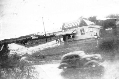
Photograph - Deer Park General Store Ballarat Road Corner Station Road Deer Park, Des Johnson, 1948
... Photograph Deer Park General Store A weather board building selling Chaff Grain Wood and Petrol from Top of Home and Hovell Corner of Ballarat Road and Station Road. Monument a large blue stone rock near Deer Park State School North of Ballarat Road A Reprint of Original Picture by Des Johnson age 16 years Melway Map 25-E-8...Shop Ballarat Road Station Road Deer Park Photograph Deer Park General Store A weather board building selling Chaff Grain Wood and Petrol from Top of Home and Hovell Corner of Ballarat Road and Station Road. Monument a large blue stone rock near Deer Park State School North of Ballarat Road A Reprint of Original Picture by Des Johnson age 16 years Melway Map 25-E-8 Deer Park General Store Photograph Photograph Deer Park General Store Ballarat Road Corner Station Road Deer Park Des Johnson Des Johnson ...Donated by Des Johnson, 29 July, 2011.Photograph Deer Park General Store A weather board building selling Chaff Grain Wood and Petrol from Top of Home and Hovell Corner of Ballarat Road and Station Road. Monument a large blue stone rock near Deer Park State School North of Ballarat Road A Reprint of Original Picture by Des Johnson age 16 years Melway Map 25-E-8shop, ballarat road, station road, deer park -
 Apollo Bay Museum
Film - Frosty on wild fishing weather
... Audio slideshow with Russell Frost (Frosty) memories and photographs of wild fishing weather. Created as part of the Heart Maps project with Amy Tsilemanis...Apollo Bay Museum 6250 Great Ocean Road Apollo Bay great-ocean-road Audio slideshow with Russell Frost (Frosty) memories and photographs of wild fishing weather. Created as part of the Heart Maps project with Amy Tsilemanis Apollo Bay Fishing Frosty on wild fishing weather Film Frosty on wild fishing weather ...Audio slideshow with Russell Frost (Frosty) memories and photographs of wild fishing weather. Created as part of the Heart Maps project with Amy Tsilemanisapollo bay, fishing -
B-24 Liberator Memorial Restoration Australia Inc
Map - Silk Map of South West Pacific Ocean, Ocen Currents and Surface winds of the West pacific Area May-October
... maps were carried by air crew flying in the Pacific Ocean areas. OCEAN CURRENTS AND SURFACE WINDS FOR THE WEST PACIFIC AREA MAY- OCTOBER COMPILED BY THE 2ND AND 3RD OPERATIONS ANALYSIS SECTIONS,HQ, FEAF, FROM OCEAN CURRENT CHARTS DEIGNED BY THE SCRIPTS INSTITUTE OF OCEANOGRAPHY, AND FROM WIND CHARTS PREPARED BY THE U.S. WEATHER ...These maps were carried by air crew flying in the Pacific Ocean areas.Square silk mapOCEAN CURRENTS AND SURFACE WINDS FOR THE WEST PACIFIC AREA MAY- OCTOBER COMPILED BY THE 2ND AND 3RD OPERATIONS ANALYSIS SECTIONS,HQ, FEAF, FROM OCEAN CURRENT CHARTS DEIGNED BY THE SCRIPTS INSTITUTE OF OCEANOGRAPHY, AND FROM WIND CHARTS PREPARED BY THE U.S. WEATHER BUREAU. REPRODUCED BY R.A.A.F HEADQUARTERS [cartographic section] OCTOBER 1944 RESTRICTED -
Lakes Entrance Historical Society
Map - Orbost Forest District, D O'Bryan, December 1977
... Roading maps of the forest area of Orbost. Marks highways, all weather roads, dry weather roads, four wheel drive only roads....Lakes Entrance Historical Society 4 Marine Parade Lakes Entrance gippsland Forest Roads and Streets Roading maps of the forest area of Orbost. Marks highways, all weather roads, dry weather roads, four wheel drive only roads. ...Roading maps of the forest area of Orbost. Marks highways, all weather roads, dry weather roads, four wheel drive only roads.forest, roads and streets -
 Victorian Aboriginal Corporation for Languages
Book, Victorian Aboriginal Corporation for Languages, Yarnin up : Wathaurong, 2010
... Victorian Aboriginal Corporation for Languages 33 Saxon Street Brunswick melbourne Wathaurong pronunciation place names kinship terms feelings body parts country animals weather counting maps, word lists, colour illustrations Words and phrases in Wathaurong. ...Words and phrases in Wathaurong.maps, word lists, colour illustrationswathaurong, pronunciation, place names, kinship terms, feelings, body parts, country, animals, weather, counting -
 Victorian Aboriginal Corporation for Languages
Book, Victorian Aboriginal Corporation for Languages, Yarnin up : Gunnai, 2010
... Victorian Aboriginal Corporation for Languages 33 Saxon Street Brunswick melbourne Gunnai Gunai pronunciation place names kinship terms feelings body parts country animals weather counting maps, word lists, colour illustrations Words and phrases in Gunai. ...Words and phrases in Gunai.maps, word lists, colour illustrationsgunnai, gunai, pronunciation, place names, kinship terms, feelings, body parts, country, animals, weather, counting -
 Victorian Aboriginal Corporation for Languages
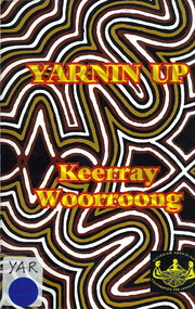
Book, Victorian Aboriginal Corporation for Languages et al, Yarnin up : Keerray Woorroong, 2010
... Victorian Aboriginal Corporation for Languages 33 Saxon Street Brunswick melbourne Keerray Woorroong pronunciation place names kinship terms feelings body parts country animals weather counting maps, word lists, colour illustrations Words and phrases in Keerray Woorroong. ...Words and phrases in Keerray Woorroong.maps, word lists, colour illustrationskeerray woorroong, pronunciation, place names, kinship terms, feelings, body parts, country, animals, weather, counting -
 Victorian Aboriginal Corporation for Languages
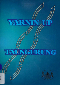
Book, Victorian Aboriginal Corporation for Languages, Yarnin up : Taungurung, 2010
... Victorian Aboriginal Corporation for Languages 33 Saxon Street Brunswick melbourne Taungurung pronunciation place names kinship terms feelings body parts country animals weather counting maps, word lists, colour illustrations Words and phrases in Taungurung. ...Words and phrases in Taungurung.maps, word lists, colour illustrationstaungurung, pronunciation, place names, kinship terms, feelings, body parts, country, animals, weather, counting -
Victorian Aboriginal Corporation for Languages
Book, Victorian Aboriginal Corporation for Languages et al, Yarnin up : Keerray Woorroong, 2014
... Victorian Aboriginal Corporation for Languages 33 Saxon Street Brunswick melbourne Keerray Woorroong pronunciation place names kinship terms feelings body parts country animals weather counting maps, word lists, colour illustrations Words and phrases in Keerray Woorroong. ...Words and phrases in Keerray Woorroong.maps, word lists, colour illustrationskeerray woorroong, pronunciation, place names, kinship terms, feelings, body parts, country, animals, weather, counting -
 Federation University Art Collection
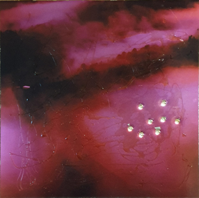
Artwork, other - Artwork, 'Ghosts in the Himalayas (Shot Up)' by Lisa Anderson, 2016
... mapped or metaphysical borders. She develops projects around ways of understanding the effects of climate change. These include work with folklore, legends and religions that tell stories of coping with weather, forced migration of animals and people and coping with difference. ...mapped or metaphysical borders. She develops projects around ways of understanding the effects of climate change. These include work with folklore, legends and religions that tell stories of coping with weather, forced migration of animals and people and coping with difference. ...Dr Lisa ANDERSON (1958- ) Dr Anderson’s research questions environmental issues that impact on the social structures of communities and their mapped or metaphysical borders. She develops projects around ways of understanding the effects of climate change. These include work with folklore, legends and religions that tell stories of coping with weather, forced migration of animals and people and coping with difference. She has undertaken international residency programs and exhibitions in the Arctic, Iceland, Paris, Norway, London and China, and she was the first Artist in Residence at the Australian Museum. These unique opportunities continue an extensive art practice of installation work, video, photography and sculpture. Anderson has an extensive record of exhibitions in Australia and overseas with work included in both private and corporate collections. Her exhibitions include Journeys: Due North, a large installation work that includes work created over a 10-year period of engagement in expedition and science work North of the Arctic Circle. Beneath the Beauty of Architecture, an exhibition at her London Gallery, Bicha, used images created in China, Nunuvut Territory in Canada and the Antarctic while working with the migration stories of survival. Dr Anderson has created many large scale artworks that challenge notions of occupation of the City, including Writing the City, a three-year program of installation works to shift the use of Sydney to being a city of public space in its pre-Olympic development. Singing up Stones celebrated the people who created and use the Opera House and the Quay for performance and ideas. This included the first image projection onto the Sydney Opera House, a projection onto the Sydney Harbour Bridge and a ballet of cruise liners with the sound simulcast on the local radio station. Two digital prints with acrylic on metal and bullet holes. This work is the result of research on the hidden voice of landscape undertaken by Dr Lisa Anderson while an Honorary Professor at Federation University Australia. lisa anderson, available -
 8th/13th Victorian Mounted Rifles Regimental Collection
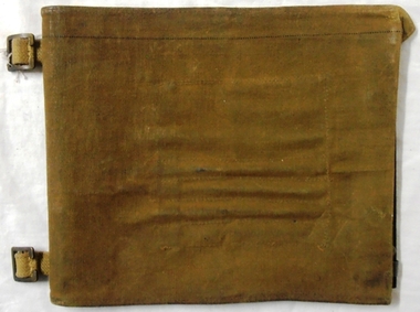
Functional object - Map case, 1942
... Fine example of officer's accessory to hold map securely and protected from weather....8th/13th Victorian Mounted Rifles Regimental Collection 4/19 Prince of Wales's Light Horse Simpson Barracks McLeod melbourne Fine example of officer's accessory to hold map securely and protected from weather. Fine example of officer's accessorily to hold map securely and protected from weather. map motor 13th Gippsland Stamped on cover flap "CG Hartley & Co 1942" Hard fibre board panel with metal clips securing clear Perspex sheet covering map; canvas flap attached to one edge of board folding over and secured to other side of board with two metal press studs. ...Fine example of officer's accessory to hold map securely and protected from weather.Fine example of officer's accessorily to hold map securely and protected from weather.Hard fibre board panel with metal clips securing clear Perspex sheet covering map; canvas flap attached to one edge of board folding over and secured to other side of board with two metal press studs. Underside of flap has pockets for chinagraph marking pencils. Map is RACV road map of area southwest of Eildon Victoria probably a training area for 13th Motor Regiment. Also has two buckles to allow attachment to user's webbing.Stamped on cover flap "CG Hartley & Co 1942"map, motor, 13th, gippsland -
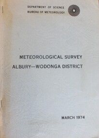 Wodonga & District Historical Society Inc
Book - Meteorological Study Albury Wodonga District March 1974, Australian Government Publishing Service
... Wodonga & District Historical Society Inc Hut 97, Bonegilla Migrant Experience, 132 Bonegilla Road Bonegilla the-murray Meteorology Wodonga Meteorology Albury Historical weather statistics climate Albury-Wodonga A compilation of historical records, tables, maps and data documenting meteorological observations throughout the Albury- Wodonga district. ...A compilation of historical records, tables, maps and data documenting meteorological observations throughout the Albury- Wodonga district. Records for Albury date from 1860 and those for Wodonga date from 1898. Other areas documented include Beechworth, Yackandandah and Corowa.A plain covered publication. Pages are stapled stapled together down the left side of pages.A compilation of historical records, tables, maps and data documenting meteorological observations throughout the Albury- Wodonga district. Records for Albury date from 1860 and those for Wodonga date from 1898. Other areas documented include Beechworth, Yackandandah and Corowa.meteorology wodonga, meteorology albury, historical weather statistics, climate albury-wodonga -
University of Melbourne, Burnley Campus Archives
Book - Report, E.B. Littlejohn, Victoria 1944 State Regional Boundaries Committee Report on Regional Boundaries, 1944
... Report includes 32 maps of Regions for Planning and Development, geographical, weather, power, water resources, crops, livestock, etc. ...Littlejohn e.b. littlejohn planning development regions Report includes 32 maps of Regions for Planning and Development, geographical, weather, power, water resources, crops, livestock, etc. ...See paper catalogue for complete contents. Item formerly property of E.B. LittlejohnReport includes 32 maps of Regions for Planning and Development, geographical, weather, power, water resources, crops, livestock, etc. Maps 31 and 32 are composite sheets showing coverage of Victoria by various series of maps, and smaller versions of large mapse.b. littlejohn, planning, development, regions -
Southern Sherbrooke Historical Society Inc.
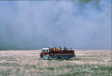
Information folder - Fires 2003, 2003
... Contents: -3 photos of Omeo after the fires, by Dulcie Strahan -DSE/DPI Fire Update report dated 21st February -2 photos of fires in North-east Victoria by Andrew Aubert -3 Fire Overview maps, dated 24 January, 27 January (2 copies) and 16 February -leaflet, "Upper Murray Fires", community update, dated 12 January -copy of fire overview map, dated 16 February, with annotations -weather page, Border Mail, 8 January...Contents: -3 photos of Omeo after the fires, by Dulcie Strahan -DSE/DPI Fire Update report dated 21st February -2 photos of fires in North-east Victoria by Andrew Aubert -3 Fire Overview maps, dated 24 January, 27 January (2 copies) and 16 February -leaflet, "Upper Murray Fires", community update, dated 12 January -copy of fire overview map, dated 16 February, with annotations -weather page, Border Mail, 8 January Information folder - Fires 2003 ...Folder containing information pertaining to the 2003 Victorian, NSW & ACT bushfires. Contents: -3 photos of Omeo after the fires, by Dulcie Strahan -DSE/DPI Fire Update report dated 21st February -2 photos of fires in North-east Victoria by Andrew Aubert -3 Fire Overview maps, dated 24 January, 27 January (2 copies) and 16 February -leaflet, "Upper Murray Fires", community update, dated 12 January -copy of fire overview map, dated 16 February, with annotations -weather page, Border Mail, 8 Januarybushfires -
 Melton City Libraries
Photograph, Edna Barrie, 1920, 1924, 1933 and 1940
... Edna kept up to date with radio procedure following the 1967 handbook; preparing maps, plotting compass points and taking notes on weather forecasts from the SA Border and Western District. ...Edna kept up to date with radio procedure following the 1967 handbook; preparing maps, plotting compass points and taking notes on weather forecasts from the SA Border and Western District. ...SUMMARY - Edna (Myers) Barrie, 1918 – 2018, Profile Early Life Edna was born at Melton and delivered by Hannah Watts. Her mother Martha walked in the dark at night with her basket under her arm to the bridge over the Toolern Creek Bridge and into Sherwin Street to the corner of Yuille Street to Hannah’s house Lynch Cottage. Martha’s husband was away shearing and eventually heard the news of the birth of their blue eyed third child and second daughter. She was born into a family that was surrounded by music; her father played the “squeeze box” and mother the mouth organ. From an early age the family were aware of the great composers, a framed picture of Beethoven, Chopin, Schubert and Wagner hung above the door to the lounge room of their 4 roomed cottage, the room where the piano stood. Her life on stage started as a singer aged 6 years at the Melton Mechanics Institute Hall. Edna was born with a natural ear for music learning piano and singing from her older sister Marjorie who became an accomplished pianist and soloist and renowned music teacher in Melton and district. In the 1920s and 1930s concerts at the Melton Mechanics Institute were regular events were the local talent was fostered. The Myers children, like other children of Melton and Rockbank, studied singing, piano and elocution, sat examinations, entered in competitions in South Street Ballarat, Footscray and Melbourne. In 1929 a Sacred Concert was broadcast by 3AR from the Hall as part of the Back to Melton Celebrations. Marjorie Myers performed two of the items on the piano. Edna attended Melton State School 430 from 1924 – 1933. Her father Fred had also attended the same school. In 1924 the School staged Cinderella at the Melton Mechanics Institute Hall with a cast of 33 students. After completing her education a Melton she boarded in South Melbourne and attending Melbourne Girls High School (MacRobertson Girls High School), a school which recognized her musical attributes. She travelled home on the train on the weekends, sometimes getting off at Rockbank to save a few pennies in fares. Working life The early 1930s the Depression was a difficult time for a young woman to find work. Jobs were often menial and given to the youngest and therefore cheapest applicant. She worked as sales assistant at Polonskis and Myer in the city, and Irvines Modes in Footscray. Working to 1pm on Saturday, and when held up by a customer meant missing the train home. While at Myer Department store she lived at home and rode her bike to the Melton railway station. On one occasion she had a nasty fall when a part of her bicycle came loose causing the bike to crash rendering her concussed and injuring her nose. During the 1930s she was given a camera “a little snap” by Mrs Kelly her landlady. This began her interest in photography documenting family life at their “Burnbank” home. Musically, while at Myers she participated in annual performances held at The Kings Hall and the Myer Mural Hall. Working in the basement at Myers she was often embarrassed when her name was called, customers assuming she belonged to the Myer Family. Ken Myer worked in the basement at the same time handling the ‘Wheeler’, a wicker basket used for moving goods around the store. The family philosophy was for the children to start at the bottom and work their way up. Social life Social life in her teenage years was connected also with Scots Presbyterian Church. She attended Sunday School classes and received book prizes for attendance. She loved to read and welcomed the times when she received new book. She took part in the Sunday School Anniversaries and was presented with a Bible from the Superintendent, Henry Robinson for her assistance with the music. Marriage and War years In 1941 Edna married Ernest “Bonnie” Barrie. War in the Pacific was soon to break out. While in Sydney on their honeymoon they met up with Jim Barrie who was on his way to Canada via Hawaii just missing Pearl Harbour by two days. Jim became a Spitfire Pilot and joined the RAF and was based in England. He returned to Australia later in RAAF to fight the Japanese off the coast of New Guinea. The three eldest Barrie brothers were farmers and food producers and were thus except from military service. Edna and Bon were members of the VAOC- Volunteer Air Observers Corp entailing being rostered on duty as plane spotters. The women took shifts during the day and the men at night which involved staying overnight in the Shire Offices. Later the spotting tower was built in the plantation opposite the Post Office. Edna and Bon carried on with this from their home in Ferris Rd when the threat of invasion had ceased Community life Community life in Melton revolved around fund raising events for the Melton Mechanics Institute for the War effort and keeping up with maintenance for the Hall. In 1944 the Minister for Health gave approval for the Shire of Melton to open and Infant Welfare Centre inviting Edna to form part of the Committee with seven other women. In 1948 she was President of Melton Branch of the Victorian Health Centres Association. She volunteered this use of her car driving the person in charge, Sister Smith to visit mothers and their babies. In 1963, along with Betty Jones and Isabel Snell, Edna was instrumental in forming the 1st Melton Cub Pack and later supported the formation of the 1st Melton Scouts. During 1963 – 1968 she completed the Australian Boy Scout Association Cub Pack Preliminary Training and achieved her Wood Badge. Country Women’s Association In 1944-1996 she was a member of the Melton Branch Country Women’s Association (CWA), Melton Branch, Secretary of the Branch in 1945 – 1946 and Branch International Secretary 1970-1971. She worked with choir, music and drama interest groups within the branch attaining both first and second place in 1959, second place in 1952 Exhibition and second in Music in 1960 in the state. She was involved in their handicraft craft events, fund raising and musical events and singing competitions. During the 1950s she trained Trios and Quartets in part singing for the CWA competitions in Ballarat and Melbourne. It was at this time that she developed her skill as a conductor and trainer of choirs. She later auditioned for the Victorian Choir for alto parts believing she would stand a better chance of being chosen, because of her ability to sing in natural harmony. In 1962 she participated in the Tenth Australian Country Women of the World (ACWW) Triennial Conference “Australia Presents: CWA Massed Choir” in the Melbourne Town Hall. This event was recorded by Super Sound Spotlight on 45 extended play vinyl record. The songs were Australian music and words, for example The Silver Stars are in the Sky, The Graceful Swaying Wattle and Kookaburra. Edna continued with her interest in the Victorian Choir regularly meeting at the CWA Headquarters in Toorak for rehearsals. In 1974 she took part in the Australian Choir at the fourteenth Triennial conference of the ACWW Interfaith Service held at the Perth Concert Hall on the 13th of October. Arts and Culture Edna was also in the Choir of 3KZ Carols by Candlelight at the Myer Music Bowl in 1963 and 1964. Melton Choral Society. Edna was Director and Conductor in the 1970s performing at many community events such as Carols by Candle Light, Church Services, Easter and Palm Sunday services, Mothers Union and the 1976 Community Services Week Combined Church Service. The October – November 1978 Program covered the following: songs from the Musicals, Choral and Solo with Narratives, Guest Instrumental Item, Recitation Negro Spirituals and Australian Songs. Her involvement with church choirs included the Scots Presbyterian Church Choir Easter and Christmas performances and the 1967 Centenary Service. In 1980s the Melton Uniting Church Sacred Music Performances included The Crucifixion by Stainer, The Olivet to Calvary and other church Hymns. Edna was Musical Director of the Melton Amateur Theatrical Society and worked on performances in collaboration with Mabel Rogers on script and musical interpretation. Melton and District Historical Society Annual Art and Craft Show. First held in Melton Mechanics Institute Hall in 1973, it later took place in the in the Melton Community Hall. The Art Show was also run in conjunction with other community organizations such as Rotary and Girl Guides. Community history and research Melton streetscape and society Over 20 years commencing in the 1970s, Edna undertook extensive photographing of the changing streetscape of Melton’s High Street. She anticipated the impact of change on the community during the time of Melton’s rapid transition from a small farming district to a large urban community and this led to her extensively document and photograph many of the structures and landscape features of the township that have since been lost. She also meticulously recorded much of the contemporary life of the town and has left a significant legacy of archival material. Melton State School 100 Years Celebration, October 1970 Co-author with Mabel Rogers “The First 100 Years, 1870 – 1970” Assembled a collection of School Class Photograph and identified and compiled lists of names for future school history. She also assembled a photographic display for the 125th anniversary in 1995. Melton and District Historical Society (M&DHS) Foundation Member, 1968 Held President and Secretary positions from its inception Research associated with the classification of Heritage buildings Christ Church Classification C Scots’ Presbyterian Church Classification D Set up the storage and Catalogue system in the Office at the Willows Organised society visits to Heritage sites in and beyond the Shire of Melton, including Stathtulloh, Eynesbury, Deanside, ToolernVale sites including Merrywood (now demolished) Staughton Vale, Chirnside, Point Cook, Shwerkolts Cottage. 1970 – 1983 Melton and District Historical Society Letterhead. Staughton Memorial Light from early newspaper cutting in its location before restoration to present location. Sketch by Wendy Barrie. Designing and printing pamphlets, stationery, and other sale items with Willows title. M&DHS street naming research for new housing developments (1970 – 2000). Collaborated with Mary Tolhurst to research the names of early landowners and pioneer families connected to the first settlers. Researched Aboriginal names for inclusion on lists submitted to developers. An early example is the naming of Kuranjang and the street names associated with the McPherson family. Plains of Promise (Shire of Melton history) by Joan Starr (1985). Edna assisted with Historical Society materials and contributed her own research and photographs. Contacted and organised for Hubert Opperman to launch the book. (She was also present at his last bike ride at Rochester in 1995.) Western Metropolitan Groups of Historical Societies. Member attending meetings and representing Melton, also hosted the Group at Melton The Willows Member of the Committee of Management for the restoration of the “Willows” house the establishment of The Willows Park 1982 March - Official Opening of the Willows Park- Preparation and planning for the event. Involved in the collecting of items in the furnishing of the display rooms in the Willows house. Donated items and furniture from the Myers and Daley family houses. (19th century) Machinery Shed Establishment. Involved with Jeff Robinson in the construction and collection of machinery display Other significant sites Championed and participated in the restoration and preservation significant sites in Melton, including: restoration of the Staughton Memorial Light and its return to its present site restoration of the Pykes Grave (using EW Barrie earthmoving equipment) restoration and reconstruction of Dunvegan restoration and reconstruction of Macs Cottage, the management and Caretakers residence Melton State School War Memorial Gates removed from Unitt Street entrance and relocated to the Willows Park Donated the Barrie family single furrow plough which was standing at the Court House Plaza. It removed and to Council Depot and later missing. The plaque was taken to the Willows. Jimmy Melrose (aviator) cairn restoration at crash site in Melton South Donald Mackintosh (Olympic gold medallist marksman) grave site at the Melton Cemetery (Historical items held by the Myers family collection.) Houdini first flight at Diggers Rest. Edna’s father was shearing at Diggers Rest at the time and witnessed the flight. She attended the 90 year anniversary of the event at the site in 2000. Radio and electronics Edna’s husband Bon interest in wireless communication dates in the 1920s with the building of a crystal set in the early days of public broadcasting. At the Back to Melton Celebrations in 1929, 3AR broadcast a concert from the Melton Mechanics Institute on the 20th February at 8pm featuring Footscray City Band, James Hill baritone, Vera Carew Soprano, James Foran Tenor, Marjorie Myers Piano, and James Williamson Entertainer. Accompanists: Miss Agnes Ross and Mrs James Hill. The Myers children had recordings of their piano playing made onto the aluminium records, Martha Myers’ voice can be heard introducing an item. These were made in a studio in Melbourne. Marjorie was given a upright Gramophone by Donald Mackintosh in recognition of her talent and her contribution to the cultural life of Melton. The family were then able to listen to 78rpm recordings of the famous classical recordings. The turntable was hand wound metal stylus needles had to be regularly replaced. The aluminium disk needed a bamboo needle to prevent damage to the surface. Before electricity was introduced to Melton in 1939 the Mechanics Hall relied on generators to produce electricity. Bon Barrie, being mechanically minded, built a public address system for be used a community functions at the Hall and Recreational Park. By 1939 this was up and running and used for over three decades. A large Collection of 78rpm records provided music for dances, marching, parades and any public event needing music and microphones. The early system was portable and worked on batteries. CFA Radio Communication In the 1950s with the introduction two-way HF and later VHF very high frequency radio sets. Melton Rural Fire Brigade was part of the Bacchus Marsh Group. Radio sets where located in the Melton Fire Truck, and in the house of the Barrie family at Ferris Road. This was an ideal location to observe a 360 degree view in all directions when smoke appeared on the horizon. An antenna was erected beside the house. The set OX 7 was located in the kitchen and monitored 24 hours by the family. When an electrical fire occurred at the junction of the electricity to the house there was time to radio the fire station and summons the men working in the paddocks, thus saving the house from possible destruction. With the introduction of UHF – ultra high frequency Vinten Radios the signal was clearer and static and interference lessened and radio traffic became easier to read, and reduced noise levels in the household. VL3 LY Radio Base became the Group Headquarters was established in 1967. By 1970 the Brigades were: Melton, Rockbank, Sydenham, Toolern Vale, Diggers Rest, Truganina, and Werribee. In 1974 when the family moved to First Avenue, another antenna and a small building were erected adjacent to the residence and used to house the equipment, maps. Radio traffic consisted of regular schedule times and communication with adjoining groups of brigades such as Bacchus Marsh, Mt Macedon and Little River Groups. Many of the brigade and group base radios were situated in private residences and operated primarily by fire fighters wives who held the position of Communications Officer, either registered as a brigade member or informally. Edna was never registered as an operational brigade member but operated informally as an assistant to her husband Bon. She was however a member of the Melton Fire Brigade Ladies Auxiliary from its inception in 1968, a non-operational position. Edna kept up to date with radio procedure following the 1967 handbook; preparing maps, plotting compass points and taking notes on weather forecasts from the SA Border and Western District. Daily notes were taken in anticipation of fire warnings. These log books and daily radio traffic were incidental to the regular radio schedules. Emergency turnouts noted, burning off times and predicted location of smoke. In the summer fire season all TBF (total fire ban days were recorded.) In times of emergency the Barrie family assisted Bon the base radio operator to plot the position and location of fire trucks and to help clarify garbled radio traffic, keep notes and make telephone calls. These log books are held in the EE and EW Family Archive. Melton Uniting Church Edna founded the Church Opportunity with Maisie Robinson in 1975 in the Melton South Methodist Church building. Methodist and Presbyterian Churches of Melton had combined severing their long held connection with Bacchus Marsh. A Manse had been recently built for the Melton Minister. At a Parish Committee meeting at the Melton South Church it was suggested to use the building as an Opportunity Shop. It opened in July 1975, and it raised $1,600 contribution to the church budget in 1976. In 1977 The Uniting Church in Australia was formed and the Melton South Uniting Church Opportunity shop continued to go from strength to strength expanding the buildings providing the welfare needs of the community. Archive Set up by Edna Catalogued items dating from 1857 Minute Book and set ongoing system and storage of items of heritage. Melton Un Awards and recognition of service to the Melton community Rotary Award for Community Service, 1980 Victoria 150th Anniversary Celebrations contributions, 1985 Life Membership of the Melton and District Historical Society (M&DHS), 1989 Extra-Ordinary Contribution for years of service to M&DHS, 1992 Long Service for Exceptional Service MD&HS, 1993 Royal Historical Society of Victoria Award of Merit, 1997 Shire of Melton Certificate of Appreciation for continued support and dedication as a member of MD&HS to the preservation of Melton’s History, 1998 Centenary of Federation Peoplescape (Canberra) Melton Shire nomination, 2001 Uniting Church Melton Life Membership of the Opportunity Shop Uniting Church in Australia Commission for Mission for 30 years of hard work and dedications to the Uniting Church, 2007 Uniting Church Adult Fellowship Certificate appreciation in recognition of valuable support through the “Sammy” Stamp Fund Neighbourhood Watch 5 year award Photographs of Edna at different ageslocal identities -
 Melton City Libraries
Photograph, Burning Off, Unknown
... Edna kept up to date with radio procedure following the 1967 handbook; preparing maps, plotting compass points and taking notes on weather forecasts from the SA Border and Western District. ...Edna kept up to date with radio procedure following the 1967 handbook; preparing maps, plotting compass points and taking notes on weather forecasts from the SA Border and Western District. ...Many of the brigade and group base radios were situated in private residences and operated primarily by fire fighters wives who held the position of Communications Officer, either registered as a brigade member or informally. Edna Barrie was never registered as an operational brigade member but operated informally as an assistant to her husband Bon. She was however a member of the Melton Fire Brigade Ladies Auxiliary from its inception in 1968, a non-operational position. Edna kept up to date with radio procedure following the 1967 handbook; preparing maps, plotting compass points and taking notes on weather forecasts from the SA Border and Western District. Daily notes were taken in anticipation of fire warnings. These log books and daily radio traffic were incidental to the regular radio schedules. Emergency turnouts noted, burning off times and predicted location of smoke. In the summer fire season all TBF (total fire ban days were recorded.)CFA burning off dry grassemergency services