
Showing 26 items matching "weir system"
-
 Clunes Museum
Plan - PLANS, Harry E Sando, Borough of Clunes Contract 96.6 of 1893/4, c1894
... ...Weir System...(Borough Enginee) as at 10th March 1894, this plan also signed by the contactor and witness, both signatures are illegible Creswick Creek Flood mitigation Weir System Headings on plans; "Ground Plan No.1, Ground Plan No.2, Sections of weirs Coloured drawings on tracing/architects papers, pinned with dress makers pins to stiff paper. ...Harry E Sando C.E. (Borough Enginee) as at 10th March 1894, this plan also signed by the contactor and witness, both signatures are illegibleColoured drawings on tracing/architects papers, pinned with dress makers pins to stiff paper. Scale 2 feet to 1 inchHeadings on plans; "Ground Plan No.1, Ground Plan No.2, Sections of weirscreswick creek, flood mitigation, weir system -
 Bendigo Historical Society Inc.
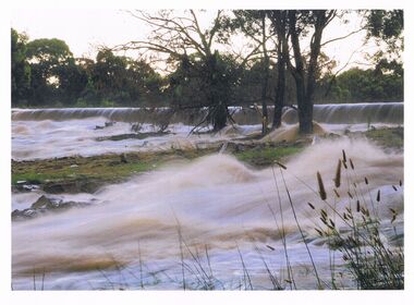
Photograph - HUGH ENNES COLLECTION: EPPALOCK WEIR WATER OVERFLOW - JAN 2011
... system...Eppalock Weir. Coliban System....STATE INFRASTRUCTURE Water supply coliban system Eppalock Weir. Coliban System. The Hugh Ennes collection. ...The Hugh Ennes collection. Colour photograph. Water overflows from Eppalock Weir, January 2011.state infrastructure, water supply, coliban system, eppalock weir. coliban system. -
 Federation University Historical Collection
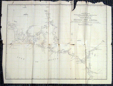
Map, British New Guinea, 1893, 1893
... A copy of "The Goulburn Weir and its Dependent System of Works" and this map (in a government envelope addressed to Salmon) were left at the property. ...A copy of "The Goulburn Weir and its Dependent System of Works" and this map (in a government envelope addressed to Salmon) were left at the property. ...The map was surveyed by ship compass, distances by estimation or rate of launch by officers of the Government ; supervised and compiled by J.B. Cameron, G.S. March 1893. This map was in the possession of Charles Carty Salmon (1860-1917), politician, born on 27 July 1860 at Amherst, Victoria. (http://adb.anu.edu.au/biography/salmon-charles-carty-8328 ) Although living in Melbourne Charles Carty Salmon kept property at Talbot. The property was leased, then purchased by the donor's family. A copy of "The Goulburn Weir and its Dependent System of Works" and this map (in a government envelope addressed to Salmon) were left at the property. See http://nla.gov.au/nla.map-rm1894-1 .1) Sketch map showing the rivers and an outline of the coast from Long. 144?30'E. to Long. 146?30'E. Gulf of Papua British New Guinea Scale [ca. 1:316,800]. .2) Large envelope addressed to The Hon Charles Carty Salmon M.P., Talbot, Victoria. The map was folded and stored in this envelope. Map extending from Port Bevan to Kaikavau Pt, showing rivers and notes on soil and vegetation. Relief shown by hachures and spot heights. Also available in an electronic version via the Internet at: http://nla.gov.au/nla.map-rm1894-1 .1) "Enclosure in Despatch No. 32 of 3rd May 1893 - Appendix G.". "Map no. 4 British New Guinea report 1892-93". .2) "This envelope can only be lawfully used by Government Officials on public business. Any use by Officials on private business, or by others under any circumstances, is punishable." "Commonwealth Celebrations. General Secretary's Office, Melbourne."carty salmon, charles carty salmon, new guinea, j.b. cameron -
 Federation University Historical Collection
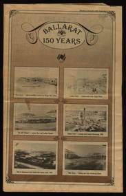
Newspaper, Ballarat 150 Years: Supplement to the Ballarat Courier, 1988, 17/03/1988
... Weir; Ludbrook Plumbing Service; Mars; Robert Sim Building Supplies, Frank Day; Sectrol Systems; Thornton Richards...Weir; Ludbrook Plumbing Service; Mars; Robert Sim Building Supplies, Frank Day; Sectrol Systems; Thornton Richards Ballarat 150 Years: Supplement to the Ballarat Courier, 1988 Newspaper ...A supplement to celebrate 150 since the establishment of the Port Phillip Colony (Victoria).40 page newspaper published to celebrate the Sesquicentenary of Ballarat. Articles include: 1838-the pastoral period begins; First White Settlers arrive (Anderson, Winter, Yuille, Kirkland, Learmonth); Learmonths - Pioneer Settlers; The Rush to Ballarat; Last of the Aborigines; Eureka Affair Gains New Importance; Mining-After the rush; SMB - First Technical School; Clubs Play their Part; Ballarat Yuilles had Wealthy Ancestors; Town, Country Share a Close Relationship; Many Sides to Metals Industry; True Victorian City; Five Severe Recessions; Financiers to the Fore; Ready for War; City Rich in Sport Facilities; Visitors to most exciting place; No Place for a Nervous Lady; Theatres Provide Welcome Diversion for Mines; Might Achievers Among famous Citizens; Life Seemed Different After the War; Ballarat School of Mines Eastern Station Hotel; Memorial (Her Majesty's) Last of Many Theatres; Art Gallery at its Best; Pilgrimage to Yuille Cairn at Sebastopol Images include: Jelbart tractor; Sunshine Harvester; Bailey's Mansion; Pennyweight Hotel; Bridge Mall; Blue Riband Mine, Black Hill, Burrumbeet Shooting party; A wendouree rowing club; Motor Cycle Racing; Women bowlers, Queen Elizabeth; Gong Gong Methodist Church; Arbour day at Waterloo Farm, Smythes Rd; Gold panners (1890s); Ballarat Cricket Team (1902); William Peart; D'Angri's store; Sturt St Advertisements include: Rehfisch and Co.; UFS Dispensaries; Deutscher Mower Sales and Service; Haymes Paint; Cincotta's; Abraham's Sportscene; McK's; McKay Macleod; St John of God Hospital; Benjamins Real Estate; Ballarat Water Board; Cornell's Pharmacy; Laminex Industries; Coltman Mitre 10; Lal Lal Iron Mine; Heinz Bros; Crockers; Frank ford travel; S.J. Weir; Ludbrook Plumbing Service; Mars; Robert Sim Building Supplies, Frank Day; Sectrol Systems; Thornton Richardsballarat, anniversary, sydney abraham, cincotta, eureka, ballarat school of mines, mining, ballarat club, lal lal iron mine, ballarat rangers, victorian rifles, 3rd battalion victorian rifles, ballarat militia, white flat, celia scott, adelphi theatre, victoria theatre, montezuma theatre, charlie napier, juliamatthews, royal theatre, dick richards, henry sutton, eleanor lucus, martin hosking, newington estate, saleyards, g. gay & co, ballarat books, old benev' alleviated distress on goldfields -
Federation University Historical Collection
Book, Historic Sites Survey: North Central Study Area, 1979, 1979
... system...eucalyptus distillery...mia mia bridge...korokubeal township researce...concegella slate quarry...chewton...fryerstown...kingower...timor...talbot...majorca...carisbroook...clunes...st arnaud...taradale...icomos...dunolly...limestone...castlemaine slate quarry...harcourt granite...taradale railway viaduct...loddon united waterworks trust...gouldburn weir...The North Central Study Area included the Shires of Avoca, Bet Bet, east Loddon, Goulburn, Untly, Kara Kara, Korong, Maldon, Marong, Metcalfe, McIvor, Newstead, Strathfieldsaye, Stawell, Talbot, Clunes, Tullaroop and Waranga. castlemaine mount alexander goldfield maldon percydale warrenmang moliagul tarnagulla stuart mill the whipstick whroo rushworth graytown ironbark forest st arnoaud new bendigo landsborough inglewood kurting wedderburn wehla kooroora langham flat mcintyre rheola diamond hill fosterville coliban water works green gully newstead muckleford forest costerfield graytown bailieston waranga irrigaiton system eucalyptus distillery mia mia bridge korokubeal township researce concegella slate quarry chewton fryerstown kingower timor talbot majorca carisbroook clunes st arnaud taradale icomos dunolly limestone castlemaine slate quarry harcourt granite taradale railway viaduct loddon united waterworks trust gouldburn weir carisbrook lock-up history of tree planting in streets history of public reserves r.u. nicholls nurseryman thomas lang francis moss ballarat botanical gardens ballarat school of mines botanical gardens lake wendouree victoria park, ballarat muont holled smith ballaarat old cemetery planting eastern oval ballarat east botanical gardens ballarat east town hall gardens eureka stockade reserve ballarat observatory plantings yarrowee creek plantings yarrowee bluestone channels ballarat woollen mill band and albion mullock heap black hill plantings yarrowee creek channels canadian creek channel specimen vale channel poverty point reserve union jack reserve buninyong imperial mine, buninyong victoria street plantings bridge mall sturt street gardens ballarat avenue of honour plantings white flat oval plantings camp street elms burnt creek 153 page book with white plastic binding. ...The North Central Study Area included the Shires of Avoca, Bet Bet, east Loddon, Goulburn, Untly, Kara Kara, Korong, Maldon, Marong, Metcalfe, McIvor, Newstead, Strathfieldsaye, Stawell, Talbot, Clunes, Tullaroop and Waranga. 153 page book with white plastic binding. It is an historic sites survey for the North Central Study Area commissioned by the Land Conservation Council, the Ministry for COnservation and the Australian Heritage Commission. castlemaine, mount alexander goldfield, maldon, percydale, warrenmang, moliagul, tarnagulla, stuart mill, the whipstick, whroo, rushworth, graytown ironbark forest, st arnoaud, new bendigo, landsborough, inglewood, kurting, wedderburn, wehla, kooroora, langham flat, mcintyre, rheola, diamond hill, fosterville, coliban water works, green gully, newstead, muckleford forest, costerfield, graytown, bailieston, waranga irrigaiton system, eucalyptus distillery, mia mia bridge, korokubeal township researce, concegella slate quarry, chewton, fryerstown, kingower, timor, talbot, majorca, carisbroook, clunes, st arnaud, taradale, icomos, dunolly, limestone, castlemaine slate quarry, harcourt granite, taradale railway viaduct, loddon united waterworks trust, gouldburn weir, carisbrook lock-up, history of tree planting in streets, history of public reserves, r.u. nicholls nurseryman, thomas lang, francis moss, ballarat botanical gardens, ballarat school of mines botanical gardens, lake wendouree, victoria park, ballarat, muont holled smith, ballaarat old cemetery planting, eastern oval, ballarat east botanical gardens, ballarat east town hall gardens, eureka stockade reserve, ballarat observatory plantings, yarrowee creek plantings, yarrowee bluestone channels, ballarat woollen mill, band and albion mullock heap, black hill plantings, yarrowee creek channels, canadian creek channel, specimen vale channel, poverty point reserve, union jack reserve buninyong, imperial mine, buninyong, victoria street plantings, bridge mall, sturt street gardens, ballarat avenue of honour plantings, white flat oval plantings, camp street, elms, burnt creek -
 Federation University Historical Collection
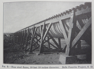
Book, Irrigation Practice and Engineering Volume 2: Conveyance of Water and Volume 3: Irrigation Structures and Distribution System by B.A. Etchevery, 1915 and 1916
... Etcherverry was Head of Department or Irrigation, University of California irrigation water canals tunnels flumes pipes concrete pipes wrought iron and steel pipes wooden pipes california diversion works weirs spillways canals check gates railroad crossing america united states of america university of california yellowstone river colorado arizona windlass hoist twin falls idaho arkansas valley truckee-carson salmon river umatilla cippoletti weir box Blue hard covered books. .2) Volume III Irrrigation Structures and Distrubution System Irrigation Practice and Engineering Volume 2: Conveyance of Water and Volume 3: Irrigation Structures and Distribution System by B.A. ...Blue hard covered books. .2) Volume III Irrrigation Structures and Distrubution Systemirrigation, water canals, tunnels, flumes, pipes, concrete pipes, wrought iron and steel pipes, wooden pipes, california, diversion works, weirs, spillways, canals, check gates, railroad crossing, america, united states of america, university of california, yellowstone river, colorado, arizona, windlass hoist, twin falls, idaho, arkansas valley, truckee-carson, salmon river, umatilla, cippoletti weir box -
 Federation University Historical Collection
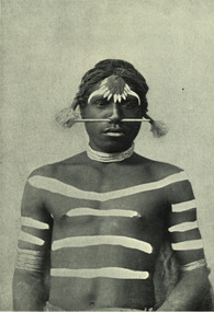
Image - black and white, Barwon River Man (New South Wales)
... Digitised directly from 'The Native Races of the British Empire: Victoria' The Barwon River in New South Wales is formed through the confluence of the Macintyre River and Weir River (part of the Border Rivers system), north of Mungindi, in the Southern Downs region of Queensland. ...Digitised directly from 'The Native Races of the British Empire: Victoria' The Barwon River in New South Wales is formed through the confluence of the Macintyre River and Weir River (part of the Border Rivers system), north of Mungindi, in the Southern Downs region of Queensland. ...Digitised directly from 'The Native Races of the British Empire: Victoria' The Barwon River in New South Wales is formed through the confluence of the Macintyre River and Weir River (part of the Border Rivers system), north of Mungindi, in the Southern Downs region of Queensland. The Barwon River generally flows south and west, joined by 36 tributaries, including major inflows from the Boomi, Moonie, Gwydir, Mehi, Namoi, Macquarie, Bokhara and Bogan rivers. During major flooding, overflow from the Narran Lakes and the Narran River also flows into the Barwon. The confluence of the Barwon and Culgoa rivers, between Brewarrina and Bourke, marks the start of the Darling River.Black and white Image of an Aboriginal man from Barwon River, New South Wales. Aboriginal people from six language groups originally occupied the area of the Barwon River wetlands. These were the Ngemba, the Baranbinja, the Murrawari, the Ualayai, the Weilwan, and the Kamilaroi peoples. The Aboriginal people generally used the wetlands for hunting, fishing, and gathering uses, and for cultural association.(Wikipedia) The name "barwon" is derived from the Australian Aboriginal words of barwum or bawon, meaning great, wide, awful river of muddy water; and also baawan, a Ngiyambaa name for both the Barwon and Darling rivers. The history, culture and livelihoods of the local Aboriginal people are closely intertwined with the Barwon River and its associated tributaries and downstream flows. (Wikipedia)aborigine, aboriginal, barwon river -
 Greensborough Historical Society
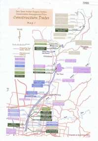
Maps, Yan Yean Water Supply System Conservation Management Plan: Construction dates Map 1, 2007_
... Plan of Yan Yean Water Supply System, showing natural and constructed features from 1850s to 1930s from Silver Creek Weirs to Eastern Freeway....Plan of Yan Yean Water Supply System, showing natural and constructed features from 1850s to 1930s from Silver Creek Weirs to Eastern Freeway. water supply yan yean reservoir plenty river Printed in colour one side. 3 copies Yan Yean Water Supply System Conservation Management Plan: Construction dates Map 1 Maps Spatial Vision ...Plan of Yan Yean Water Supply System, showing natural and constructed features from 1850s to 1930s from Silver Creek Weirs to Eastern Freeway.Printed in colour one side. 3 copieswater supply, yan yean reservoir, plenty river -
 Eltham District Historical Society Inc
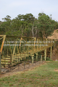
Photograph - Digital Photograph, Alan King, Maroondah Aqueduct Siphon Bridge over the Plenty River, 26 January 2008
... system in 1914. In 1920 work began on the present concrete Maroondah Dam one mile (1.6km) from the weir on the Watts River. ...system in 1914. In 1920 work began on the present concrete Maroondah Dam one mile (1.6km) from the weir on the Watts River. ...Opened in 1891, the bridge formed part of the Maroondah Aqueduct carrying water from Watts River near Healesville to the reservoir at Preston where it joined Melbourne's metropolitan water system. Covered under Heritage Overlay, Nillumbik Planning Scheme. Published: Nillumbik Now and Then / Marguerite Marshall 2008; photographs Alan King with Marguerite Marshall.; p99 Built to supply thirsty Melbourne in the late 19th century, the siphon bridge spanning the Plenty River off Leischa Court, Greensborough, was part of an engineering masterpiece. Opened in 1891, the bridge formed part of the Maroondah Aqueduct carrying water from the Watts River near Healesville to the reservoir at Preston where it joined the metropolitan distribution system. A major link in Melbourne’s water supply, it also had a huge impact on communities, which mushroomed along its route. Named after the Aboriginal word for the area around the Maroondah Reservoir, the Maroondah Aqueduct was fully operational until the 1970s. Since the 1980s the land along parts of the aqueduct have been used for walking and bicycle riding, shaded in places by Monterey Pine trees planted to stabilise the surrounding ground. From 1857 the Yan Yean Reservoir supplied Melbourne’s water but the growing city needed additional catchments.1 In 1886 work began on a weir on the Watts River to enable the aqueduct to carry most of the river water 41 miles (66km) to Melbourne. The aqueduct, built by the Board of Works, is the oldest remaining aqueduct near Melbourne and was probably the first built with concrete.2 Although the aqueduct is now only used between the Maroondah and Sugarloaf Reservoirs, it can still be traced across the Shire. It extends from the Maroondah Reservoir through Christmas Hills, Kangaroo Ground, Research, Eltham, St Helena and then previously wound west through Greensborough to Reservoir.3 Built by horse and manpower the aqueduct gravity fed 25 million gallons (113.6ML) of water a day to Melbourne along a gradient of one foot to the mile. It included 25 miles (41km) of open concrete and brick channel, six miles (10km) of tunnels, and nine miles (15km) of 14 inverted siphons of riveted wrought-iron across creeks. Bricks for the aqueduct were made from clay found near the sites and remains of several kilns can still be found between Kangaroo Ground and Christmas Hills. Building the aqueduct transformed local communities. An abattoir was established at Christmas Hills. Grog shanties and labourers’ camps sprang up and local courts dealt with cases of ‘petty pilfering and boisterous behaviour’.4 The Kangaroo Ground school population jumped to 91, crammed into a room with one teacher. Miners who built the tunnels camped just north of Churinga in Greensborough – then called Tunnel Hill Camp – and adjacent to the Evelyn Arms Hotel. The miners’ high spirits were sometimes quenched in horse troughs or by a ‘welt under the ear and kick on the behind’ as the local constable calmed them down rather than lock them up.5 But the growing city of Melbourne needed more water, so the O’Shannassy catchment, east of Warburton, was added to the system in 1914. In 1920 work began on the present concrete Maroondah Dam one mile (1.6km) from the weir on the Watts River. The aqueduct capacity was thus doubled to 50 million gallons (227ML) a day.6 Intense land development threatened to pollute the open water supply, so channel sections were replaced with large pipes. In the late 1960s a large water main was built from the tunnel outlet at Research and extended through St Helena and Greensborough, so this section of the aqueduct was taken out of use. Long sections of the unused open channels in Greensborough and Bundoora were destroyed, but the old channel in Research and Eltham North remained largely intact. In the 1970s, the Sugarloaf Reservoir was constructed, inundating 445 hectares of land in Christmas Hills. Sugarloaf was officially opened in 1980 and serves as a water storage and treatment plant supplying Melbourne. In the early 1980s pipes replaced the section from Sugarloaf Reservoir to the tunnel entrance at Kangaroo Ground. The Research-Kangaroo Ground tunnel operates as part of the pipeline system.This collection of almost 130 photos about places and people within the Shire of Nillumbik, an urban and rural municipality in Melbourne's north, contributes to an understanding of the history of the Shire. Published in 2008 immediately prior to the Black Saturday bushfires of February 7, 2009, it documents sites that were impacted, and in some cases destroyed by the fires. It includes photographs taken especially for the publication, creating a unique time capsule representing the Shire in the early 21st century. It remains the most recent comprehenesive publication devoted to the Shire's history connecting local residents to the past. nillumbik now and then (marshall-king) collection, maroondah aqueduct, pipe bridge, siphon bridge -
 Eltham District Historical Society Inc
Book, The Melbourne & Metropolitan Board of Works Water Supply, Sewerage, etc. Photographic Views, 1908
... In 1908 the Melbourne & Metropolitan board of Works published this book to illustrate its many constructions to provide Melbourne with its reticulated water and sewerage systems. This is now is a rare copy. mmbw weirs dams & pumping stations reservoirs aqueducts Nil Photographic images, landscape dimensions, hardboard cover, grey green colour The Melbourne & Metropolitan Board of Works Water Supply, Sewerage, etc. ...In 1908 the Melbourne & Metropolitan board of Works published this book to illustrate its many constructions to provide Melbourne with its reticulated water and sewerage systems.This is now is a rare copy.Photographic images, landscape dimensions, hardboard cover, grey green colour Nilmmbw, weirs, dams & pumping stations, reservoirs, aqueducts -
 Melbourne Water
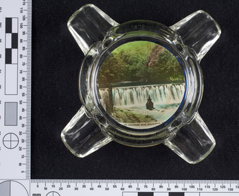
Ashtray, Graceburn Weir, Healesville Souvenir, 1930s-1940s
... This souvenir item has been curated by Melbourne Water as it represents an important historical aspect of the organisation by demonstrating the popularity of its water asset sites as recreational places and tourist attractions, and although these sites are functional parts of the water supply system, they were also designed to be enjoyed by the public both aesthetically and recreationally. melbourne metropolitan board of works, mmbw, maroondah, dam, healesville, melbourne water, scenic view, souvenir, glass, ashtray graceburnweir This Souvenir glass ashtray, used as a receptacle for ash from cigarettes, features a photograph of the Graceburn Weir on the base, with text reading “The Graceburn Weir, Healesville”. ...The Maroondah System was first and foremost developed as a functional component of Melbourne's Water Supply System. In addition to functionality, the Melbourne and Metropolitan Board of Works (MMBW) envisioned the Maroondah Reserve to be enjoyed aesthetically and recreationally by the public. This souvenir illustrates the realisation of the Maroondah System as a local recreational and tourist attraction in the early 20th century. The Maroondah Reserve gardens were landscaped with English-style ornamental stonework, exotic trees, flower beds and rose gardens. All features of the water supply system became widely celebrated as beauty spots that continue to be very popular to this day with tourists and locals alike. This souvenir is a product of that flourishing tourist trade. These water supply sites continue to enhance Melbourne’s charm and liveability and are now recognised as places of cultural and historic significance.This souvenir item has been curated by Melbourne Water as it represents an important historical aspect of the organisation by demonstrating the popularity of its water asset sites as recreational places and tourist attractions, and although these sites are functional parts of the water supply system, they were also designed to be enjoyed by the public both aesthetically and recreationally.This Souvenir glass ashtray, used as a receptacle for ash from cigarettes, features a photograph of the Graceburn Weir on the base, with text reading “The Graceburn Weir, Healesville”. Rather small in size, this ashtray has a unique shape with four protruding glass points to place cigarettes. melbourne metropolitan board of works, mmbw, maroondah, dam, healesville, melbourne water, scenic view, souvenir, glass, ashtray, graceburnweir -
 Bendigo Historical Society Inc.
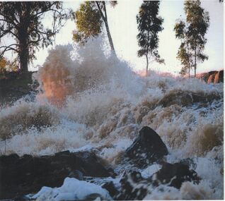
Photograph - HUGH ENNES COLLECTION: EPPALOCK WEIR WATER OVERFLOW - JAN 2011
... STATE INFRASTRUCTURE Water supply coliban system The Hugh Ennes collection. Colour photograph. Water overflows from Eppalock Weir, January 2011. ...The Hugh Ennes collection. Colour photograph. Water overflows from Eppalock Weir, January 2011.state infrastructure, water supply, coliban system -
 Bendigo Historical Society Inc.
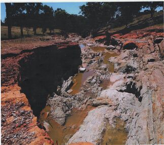
Photograph - HUGH ENNES COLLECTION: EPPALOCK WEIR WATER OVERFLOW - JAN 2011
... STATE INFRASTRUCTURE Water supply coliban system The Hugh Ennes collection. Colour photograph. Erosion after water overflows from Eppalock Weir, January 2011. ...The Hugh Ennes collection. Colour photograph. Erosion after water overflows from Eppalock Weir, January 2011. There are two copies of thios photo.state infrastructure, water supply, coliban system -
 Bendigo Historical Society Inc.
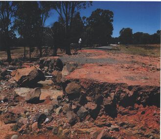
Photograph - HUGH ENNES COLLECTION: EPPALOCK WEIR WATER OVERFLOW - JAN 2011
... STATE INFRASTRUCTURE Water supply coliban system The Hugh Ennes collection. Colour photograph. Erosion after water overflows from Eppalock Weir, January 2011. ...The Hugh Ennes collection. Colour photograph. Erosion after water overflows from Eppalock Weir, January 2011.state infrastructure, water supply, coliban system -
 Port of Echuca
Photograph, Early 20th Century
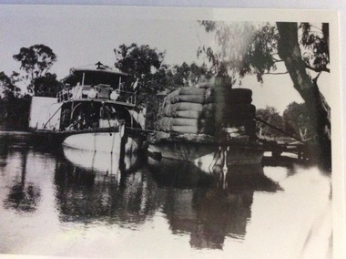
... It was a working vessel during the construction of the Yarrawonga weir in the 1930s which was the beginning of the irrigation system which enabled the Agriculture Industry to become such a prominent part of the Murray-Darling River Basin social history. p.s australien yarrawonga weir echuca paddlesteamers murray river paddle steamers wilson, richard Wool industry A paddle steamer and a barge, loaded with wool, are seen docked together on a river. ...The P.S Australien was built in 1897 by Richard Wilson, of Moama. In 1937 the vessel was used to tow boilers, winches and derricks to the banks of the Murray River to aide in the construction of Locks 6,7,9 and Yarrawonga Weir. The barge is viewed from the rear, as the rudder can be seen, and shows the enormity of the loads of wool which a barge could carry. The two vessels are tied together and appear to be moored at a small pier.The P.S Australien is one of the oldest paddle steamers built at Echuca. It was a working vessel during the construction of the Yarrawonga weir in the 1930s which was the beginning of the irrigation system which enabled the Agriculture Industry to become such a prominent part of the Murray-Darling River Basin social history. A paddle steamer and a barge, loaded with wool, are seen docked together on a river. There is a small wooden jetty leading to the bank where gum trees are growing.p.s australien, yarrawonga weir, echuca paddlesteamers, murray river paddle steamers, wilson, richard, wool industry -
 Stawell Historical Society Inc
Photograph, Wimmera River Weir at Glenorchy
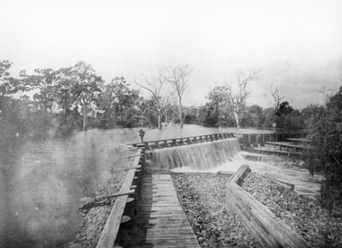
... Wimmera River Weir Glenorchy. Part of Wimmera Mallee Irrigation System...Wimmera River Weir Glenorchy. Part of Wimmera Mallee Irrigation System water Reproduction Rights Reserved Copied by State Library of Victoria Black & white photograph of a weir across a river. ...Wimmera River Weir Glenorchy. Part of Wimmera Mallee Irrigation SystemBlack & white photograph of a weir across a river. Construction of weir is log & wood with a person walking along the weir. Trees in the background.Reproduction Rights Reserved Copied by State Library of Victoriawater -
Tatura Irrigation & Wartime Camps Museum
Photograph, Goulburn Weir Sign, 1970s
... Sign describing Goulburn Weir - "State rivers and Water Supply Commission/Goulburn Weir/Diversion Headworks for Goulburn Irrigation System/Designed and Constructed by Victorian Water Supply Department 1891....Sign describing Goulburn Weir - "State rivers and Water Supply Commission/Goulburn Weir/Diversion Headworks for Goulburn Irrigation System/Designed and Constructed by Victorian Water Supply Department 1891. ...Taken by photographer for State Rivers and Water Supply Commission.Medium sized black and white photograph. Sign describing Goulburn Weir - "State rivers and Water Supply Commission/Goulburn Weir/Diversion Headworks for Goulburn Irrigation System/Designed and Constructed by Victorian Water Supply Department 1891./Full Supply Level is 408 Feet Above Sea Level/Stuart Murray M.I.C.E Chief Engineer/William Henderson A.M.I.C.E Supervising Engineer."goulburn weir, victorian state rivers and supply commission -
Tatura Irrigation & Wartime Camps Museum
Photograph, Stuart Murray Canal Sign, 1890s
... Sign:-"STATE RIVERS AND WATER SUPPLY COMMISSION/GOULBURN IRRIGATION SYSTEM/STUART MURRAY CANAL/CONVEYS WATER FROM GOULBURN WEIR TO WARANGA RESERVOIR/DESIGNED AND CONSTRUCTED BY VICTORIAN WATER SUPPLY DEPARTMENT - 1981....Taken by photographer for State Rivers and Water Supply Commission. goulburn weir victorian state rivers and supply commission Medium sized black and white photograph. Sign:-"STATE RIVERS AND WATER SUPPLY COMMISSION/GOULBURN IRRIGATION SYSTEM/STUART MURRAY CANAL/CONVEYS WATER FROM GOULBURN WEIR TO WARANGA RESERVOIR/DESIGNED AND CONSTRUCTED BY VICTORIAN WATER SUPPLY DEPARTMENT - 1981. ...Taken by photographer for State Rivers and Water Supply Commission.Medium sized black and white photograph. Sign:-"STATE RIVERS AND WATER SUPPLY COMMISSION/GOULBURN IRRIGATION SYSTEM/STUART MURRAY CANAL/CONVEYS WATER FROM GOULBURN WEIR TO WARANGA RESERVOIR/DESIGNED AND CONSTRUCTED BY VICTORIAN WATER SUPPLY DEPARTMENT - 1981./STUART MURRAY M.I.C.E CHIEF ENGINEER."goulburn weir, victorian state rivers and supply commission -
Tatura Irrigation & Wartime Camps Museum
Photograph, Goulburn Irrigation System, 1970s
... Taken by photographer for State Rivers and Water Supply Commission. goulburn weir victorian state rivers and supply commission Medium sized black and white photograph. Map showing the Goulburn Irrigation System in Northern Victoria including Eildon Reservoir, Waranga Reservoir, Eppalock Reservoir, Eppalock, Cairn Curran, Laancoorie, Tullaroop Reservoirs, the Stuart Murray, Cattanach Canal, East Goulburn Main and Waranga Western Channels. ...Taken by photographer for State Rivers and Water Supply Commission.Medium sized black and white photograph. Map showing the Goulburn Irrigation System in Northern Victoria including Eildon Reservoir, Waranga Reservoir, Eppalock Reservoir, Eppalock, Cairn Curran, Laancoorie, Tullaroop Reservoirs, the Stuart Murray, Cattanach Canal, East Goulburn Main and Waranga Western Channels.goulburn weir, victorian state rivers and supply commission -
Tatura Irrigation & Wartime Camps Museum
Book, Irrigation and Water Supply Development in Victoria, 1954
... Reference to Eildon Reservoir, Goulburn Weir, Waranga Reservoir, River Murray irrigation systems...Reference to Eildon Reservoir, Goulburn Weir, Waranga Reservoir, River Murray irrigation systems irrigation water supply goulburn river books history local Buff and blue covered book, showing farmhouse, dairy cattle on front cover, cattle, trees and channel on back Irrigation and Water Supply Development in Victoria Book ...History of irrigaton in Victoria. Reference to Eildon Reservoir, Goulburn Weir, Waranga Reservoir, River Murray irrigation systemsBuff and blue covered book, showing farmhouse, dairy cattle on front cover, cattle, trees and channel on backirrigation, water supply, goulburn river, books, history, local -
Tatura Irrigation & Wartime Camps Museum
Program, Goulburn Weir Rehabilitation Works Opening Ceremony
... Includes weir construction history, aboriginal names of Victoria, map, Goulburn River system...Includes weir construction history, aboriginal names of Victoria, map, Goulburn River system irrigation document program rural industry Program of Opening Ceremony. ...Includes weir construction history, aboriginal names of Victoria, map, Goulburn River systemProgram of Opening Ceremony. White paper, black writing, blue water wheel logo in plastic sleeveirrigation, document, program, rural, industry -
Tatura Irrigation & Wartime Camps Museum
Book, The Goulburn Weir, 1893
... Giving information re engineering undertaken during construction of weir, plus cross sections of work related to production the goulburn weir irrigation dependant systems tatura books history local SM Hawkins esq. per M Nally. 21.5.1896 Card covered with marbled paper. ...Giving information re engineering undertaken during construction of weir, plus cross sections of work related to productionCard covered with marbled paper. Leather spine. Title as a label in centre positionSM Hawkins esq. per M Nally. 21.5.1896the goulburn weir, irrigation, dependant systems, tatura, books, history, local -
 Tatura Irrigation & Wartime Camps Museum
Book, Nagambie Waterways The way they were. Compiled and written by Elaine Lodding, May 2009
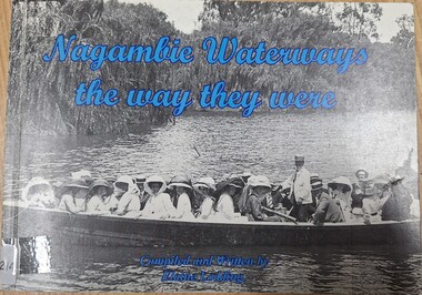
... System and the waterways. Collection of early photographs of the area telling the history. irrigation history lake nagambie goulburn weir and environs life in the area Credits page, supported by the Strathbogie Shire Council.and Nagambie Historical Society. ...History of the Goulburn Irrigation System and the waterways.Collection of early photographs of the area telling the history.Rectangular shaped book, Cover is a B/W photo of the 'Merriwee', boat, owned by W. L Forbes C 1920 with a group of people on board about to enjoy a sailing. There are 92 pages with many B/W photos detailing the history of the waterways. Blue cursive writing name and author nameCredits page, supported by the Strathbogie Shire Council.and Nagambie Historical Society.irrigation history, lake nagambie, goulburn weir and environs, life in the area -
 Kew Historical Society Inc
Photograph, J F C Farquhar, Dight's Falls, 1891
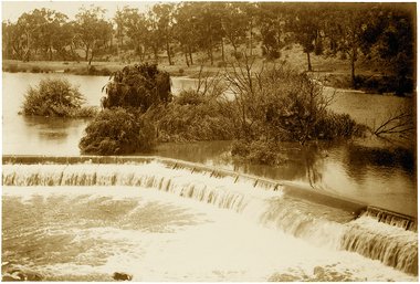
... In 1888, William Guilfoyle, Director of the Melbourne Botanical Gardens had called for fresh water to be piped from above the weir to the Botanical Gardens, using a pumping station on the Kew side of the Falls, a holding reservoir in Walmer Street and a series of pipes from there to the Gardens. This system...In 1888, William Guilfoyle, Director of the Melbourne Botanical Gardens had called for fresh water to be piped from above the weir to the Botanical Gardens, using a pumping station on the Kew side of the Falls, a holding reservoir in Walmer Street and a series of pipes from there to the Gardens. This system ...At the beginning of the 1890s, the Kew businessman and Town Councillor, Henry Kellett, commissioned J.F.C. Farquhar to photograph scenes of Kew. These scenes included panoramas as well as pastoral scenes. The resulting set of twelve photographs was assembled in an album, Kew Where We Live, from which customers could select images for purchase.The preamble to the album describes that the photographs used the ‘argentic bromide’ process, now more commonly known as the gelatine silver process. This form of dry plate photography allowed for the negatives to be kept for weeks before processing, hence its value in landscape photography. The resulting images were considered to be finely grained and everlasting. Evidence of the success of Henry Kellett’s venture can be seen today, in that some of the photographs are held in national collections.It is believed that the Kew Historical Society’s copy of the Kellett album is unique and that the photographs in the book were the first copies taken from the original plates. It is the first and most important series of images produced about Kew. The individual images have proved essential in identifying buildings and places of heritage value in the district.Dight’s Falls in Studley Park is an artificial weir built on a natural rock bar across the Yarra. The weir was built in the 1840s to provide water to the ‘Ceres’ flour mill, one of the earliest industrial sites in Melbourne. The falls were later to be named after the owner of this mill. In 1888, William Guilfoyle, Director of the Melbourne Botanical Gardens had called for fresh water to be piped from above the weir to the Botanical Gardens, using a pumping station on the Kew side of the Falls, a holding reservoir in Walmer Street and a series of pipes from there to the Gardens. This system was opened in May 1891. Farquhar’s photograph of the man-made weir obscures the industrial activity on both sides of the Falls and focusses solely on the river and the surrounding natural vegetation. The photograph probably predates the disastrous flooding of the Yarra River in July 1891, the greatest to have occurred in the Colony since the foundation of Melbourne.Dight's Fallskew illustrated, kew where we live, photographic books, henry kellett, yarra river -
 Wodonga & District Historical Society Inc
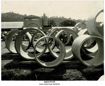
Photograph - ROCLA, Wodonga
... Another early major contract for ROCLA was with the Victorian State Rivers and Water Supply Commission for the provision of pipes for the new sewerage system in the new town of Tallangatta, relocated due to the enlargement of the Hume Weir. ...Another early major contract for ROCLA was with the Victorian State Rivers and Water Supply Commission for the provision of pipes for the new sewerage system in the new town of Tallangatta, relocated due to the enlargement of the Hume Weir. ...ROCLA was founded by two friends, Walter Robertson and Heaton Clarke, who combined the first letters of their surnames to create the brand name in 1922. The company first came to the Albury – Wodonga area in late 1927 when tenders were called for the construction of their works and office in Kiewa Street, Albury. They were a popular provider of concrete pipe culverts and reinforced concrete troughs for farm use. In 1949 ROCLA began operations at Bandiana. Initially this was to produce pipes for the Snowy Mountains Hydro-Electric Scheme which officially began construction on 17 October 1949. They also provided pipes for the Kiewa Hydro Scheme. Another early major contract for ROCLA was with the Victorian State Rivers and Water Supply Commission for the provision of pipes for the new sewerage system in the new town of Tallangatta, relocated due to the enlargement of the Hume Weir. This contract called for the supply of 21,000 six inch pipes and 7,000 nine inch pipes. At this time ROCLA employed 15 men and this job required about 80 bags of cement per day. By 1964 ROCLA Concrete Pipes was Wodonga’s largest secondary industry. A new concrete pole manufacturing plant was established in the early 1980s. ROCLA poles also dot the landscape in several Australian States. ROCLA poles also hold up many of the Hume Freeway bridge and support the Union Bridge which crosses the Murray River at Albury. After various changes in management, ROCLA was taken over by New Zealand's Fletcher Building group in 2005. In September 2021 ROCLA became part of the Civilmart Group. These images are significant because they record the history of a major manufacturing industry in Wodonga.A collection of photographs and advertisements representing the ROCLA, Wodonga company.manufacturing industries wodonga, rocla wodonga, wodonga industries -
 Wodonga & District Historical Society Inc
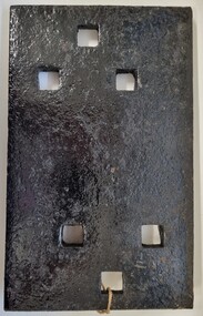
Functional object - Rail tie plate from Cudgewa Line, 1930 - 1960s
... Weir and the Snowy Mountains Scheme. Victorian Railways Cudgewa rail line Railway components A section of flat metal plate. These plates were secured to the wooden sleepers. This system ...Cudgewa Line -The Cudgewa railway line opened in stages between 1889 and 1921. The first section from Wodonga to Huon opened on 10 September 1889. It was extended to Bolga on 18 July 1890, Tallangatta on 24 July 1891, Shelley on 13 June 1916 (the highest station in Victoria), Beetomba on 10 April 1919 and Cudgewa on 5 May 1921. The line had 1 in 30 grades and trestle bridges that have been heritage listed. In 1919, the line was used to carry materials for the construction of Hume Weir, and three years later a spur line connecting Ebden to the weir was opened. In the 1960s, Cudgewa became the railhead of materials for the Snowy Mountains Scheme. The last passenger service from Wodonga to Tallangatta ran on 30 September 1961. The turntable and passenger platform at Cudgewa were abolished in 1976. This tie plate came from the rails of the Cudgewa Line at Gordon Roy's hut which was situated behind Perry's Stump Hotel outside Wodonga. The hut was used as an office with the points lever outside to switch trucks to different tracks on the Bandiana and Cudgewa lines.This item is significant as it was part of the railway line to Cudgewa which played an important role in North east Victoria carrying freight during the construction of the Hume Weir and the Snowy Mountains Scheme.A section of flat metal plate. These plates were secured to the wooden sleepers. This system played a vital role in maintaining the stability and safety of the railway track structure.victorian railways, cudgewa rail line, railway components
