Showing 53 items matching "world atlas"
-
 Falls Creek Historical Society
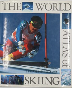
Book - The World Atlas of Skiing, Stephen Pooley, 1990
... The World Atlas of Skiing...The World Atlas of Skiing...It is divided into sections of Europe, The Americas and The Rest of the World. The World Atlas of Skiing Book The World Atlas of Skiing Stephen Pooley Hamlyn Publishing Group Ltd ...Skiing is the most exhilarating and popular winter sport in the world. The number of skiers has expanded every year since the advent of cheaper travel in the 1960s and an increased affluence brought a new group of ski enthusiasts to the slopes. The professional sport has also expanded and attracts a very large television audience. The World Atlas of Skiing looks at over 50 of the most prestigious and beautiful ski resorts in the world. From the older and more established destinations, like St Moritz, Gstaad, Kitzbühel, and St Anton in the Alps, and the chic American resorts of Aspen, Vail and Jackson Hole, to the huge, new custom-built skiing areas such as the Trois Vallees and Val d'Isere in Europe and Taos and Ski the Summit in the U.S. The continuing expansion of the sport has meant that one can ski in most parts of the world from Scotland and Russia to Australia, New Zealand and India. Each resort is illustrated with specially commissioned artworks which show the runs - from the nursery slopes to the most demanding which only the most experienced skiers attempt - ski lifts, cable cars as well as other distinctive features, such as the langlauf routes. The history and events of international championships - Winter Olympics or World Cup - that have given particular character to the resort are described, as well as the skiing greats who have mastered them.A volume of 190 pages including a table of contents, index, photographs and maps describing popular ski resorts around the world. It is divided into sections of Europe, The Americas and The Rest of the World.non-fictionSkiing is the most exhilarating and popular winter sport in the world. The number of skiers has expanded every year since the advent of cheaper travel in the 1960s and an increased affluence brought a new group of ski enthusiasts to the slopes. The professional sport has also expanded and attracts a very large television audience. The World Atlas of Skiing looks at over 50 of the most prestigious and beautiful ski resorts in the world. From the older and more established destinations, like St Moritz, Gstaad, Kitzbühel, and St Anton in the Alps, and the chic American resorts of Aspen, Vail and Jackson Hole, to the huge, new custom-built skiing areas such as the Trois Vallees and Val d'Isere in Europe and Taos and Ski the Summit in the U.S. The continuing expansion of the sport has meant that one can ski in most parts of the world from Scotland and Russia to Australia, New Zealand and India. Each resort is illustrated with specially commissioned artworks which show the runs - from the nursery slopes to the most demanding which only the most experienced skiers attempt - ski lifts, cable cars as well as other distinctive features, such as the langlauf routes. The history and events of international championships - Winter Olympics or World Cup - that have given particular character to the resort are described, as well as the skiing greats who have mastered them.skiing travel books, ski resorts of the world -
 Moorabbin Air Museum
Book - Hammond NEW ERA WORLD ATLAS, C.S. Hammond & Company
... Hammond NEW ERA WORLD ATLAS...Hammond NEW ERA WORLD ATLAS...Hammond NEW ERA WORLD ATLAS Book Hammond NEW ERA WORLD ATLAS C.S. ... -
 Sunshine and District Historical Society Incorporated
Book, Reader's Digest, The Reader's Digest Great World Atlas
... The Reader's Digest Great World Atlas...The Reader's Digest Great World Atlas|Reece Carland 3 Leith Ave Sunshine inscribed inside the front cover...Brimbank Library, 301 Hampshire Road, Sunshine 3020. melbourne Atlas The Reader's Digest Great World Atlas|Reece Carland 3 Leith Ave Sunshine inscribed inside the front cover Large green hard covered book with a map of the world & text printed in gold The Reader's Digest Great World Atlas Book Reader's Digest ...Large green hard covered book with a map of the world & text printed in goldatlas -
 Whitehorse Historical Society Inc.
Book
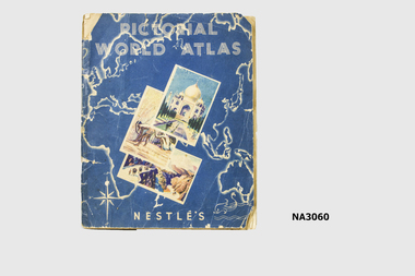
... Pictorial World Atlas - a Nestles collectors album of cards of various country's of the world. ...Nestles Pictorial World Atlas...|Album was given to Dianne Warren, daughter of donor, by her cousin whose father had a sweet shop in Glenferrie. books collections Nestles Pictorial World Atlas Pictorial World Atlas - a Nestles collectors album of cards of various country's of the world. ...Nestles had a small chocolate bar dispenser on railway station from which for one penny inserted in the dispenser you received a chocolate bar with a coloured card. Card could be inserted in album in a space reserved for that card in the country it referred to.|Album was given to Dianne Warren, daughter of donor, by her cousin whose father had a sweet shop in Glenferrie.Pictorial World Atlas - a Nestles collectors album of cards of various country's of the world. See History.Nestles Pictorial World Atlasbooks, collections -
 Glenelg Shire Council Cultural Collection
Book - Book -s - The Modern World Encyclopaedia Vol,1, 7,8 and 9, 519.1 - The Modern World Encyclopaedia. Vol 1: A-BED519.2 - The Modern World Encyclopaedia. Vol 7: OBE-SHA519.3 - The Modern World Encyclopaedia. Vol 8: SHA-ZYG519.4 - The Modern World Encyclopaedia. Vol 9: World Atlas, 1935
... Vol 8: SHA-ZYG519.4 - The Modern World Encyclopaedia. Vol 9: World Atlas...Vol 8: SHA-ZYG519.4 - The Modern World Encyclopaedia. Vol 9: World Atlas Book Book -s - The Modern World Encyclopaedia Vol,1, 7,8 and 9 Home Entertainment Library ...Brown cloth-covered cardboard covers and spine. Gold text on spine. Title impressed on cover. -
 Yarrawonga and Mulwala Pioneer Museum
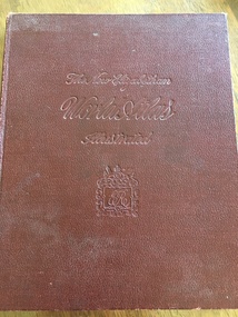
Book, The Specialty Press, The New Elizabethan World Atlas Illustrated, 1952
... The New Elizabethan World Atlas Illustrated...atlas. Front embossed with title and royal seal. 152 pages. Contains detailed maps of world countries in colour. ...The New Elizabethan World Atlas Illustrated Book The Specialty Press Colourgravure publications ...Provides names of countries and their borders as they were during the 1950'sMaroon hard cover illustrated atlas. Front embossed with title and royal seal. 152 pages. Contains detailed maps of world countries in colour. Early world history and it's development and comprehensive gazetteer.Owners name written in front pagesmaps -
 Lilydale RSL Sub Branch
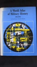
Book, Book Club Associates, A World Atlas of Military History 1945-1984, 1984
... A World Atlas of Military History 1945-1984...Lilydale RSL Sub Branch 52 Anderson Street Lilydale yarra-valley-and-the-dandenong-ranges Book A World Atlas of Military History 1945-1984 Book Book Club Associates ...Book -
Phillip Island and District Historical Society Inc.
Book, W. & A.K. Johnston, world-wide atlas of modern geography, political and physical, containing one hundred and twenty-eight plates and complete index with an introduction by J. Scott Keltie, 1906
... world-wide atlas of modern geography, political and physical, containing one hundred and twenty-eight plates and complete index with an introduction by J. ...Phillip Island and District Historical Society Inc. phillip-island-and-the-bass-coast world-wide atlas of modern geography, political and physical, containing one hundred and twenty-eight plates and complete index with an introduction by J. ... -
 Stawell Historical Society Inc
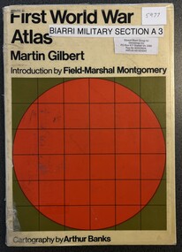
Book - Military Atlas, First World War Atlas, 1970
... First World War Atlas...History of first war through Maps, Intro by Field Marshal Viscount Montgomery OG Alamein, KG Cartography by Arthur Banks Text by Martin Gilbert First World War Cartography History Donated to Stawell Biarri group for genealogy inc 4/3/2009 by John Wynd Galen Champgnat Colege Library Wangaratta paperback, covered in clear contact, white wig green square and red circle with grid First World War Atlas Book Military Atlas ...History of first war through Maps, Intro by Field Marshal Viscount Montgomery OG Alamein, KG Cartography by Arthur Banks Text by Martin Gilbertpaperback, covered in clear contact, white wig green square and red circle with gridDonated to Stawell Biarri group for genealogy inc 4/3/2009 by John Wynd Galen Champgnat Colege Library Wangarattafirst world war cartography history -
 Numurkah & District Historical Society
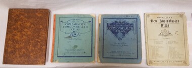
Book - School Atlases, Macmillan's New Australian Atlas / Phillip's New Comparitive Commonwealth Atlas (2) / The New Pictorial Atlas of the World
... Macmillan's New Australian Atlas / Phillip's New Comparitive Commonwealth Atlas (2) / The New Pictorial Atlas of the World...4 x World Atlas book. Cardboard covers & paper pages...Numurkah & District Historical Society Old Bank Building cnr Melville and Knox Street (118-120 Melville St) Numurkah the-murray education school atlas geography see photo 4 x World Atlas book. Cardboard covers & paper pages Macmillan's New Australian Atlas / Phillip's New Comparitive Commonwealth Atlas (2) / The New Pictorial Atlas of the World Book School Atlases ...4 x World Atlas book. Cardboard covers & paper pagessee photoeducation, school, atlas, geography -
 Bendigo Military Museum
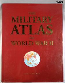
Book, Chris Bishop, The Military Atlas of World War II, c.2005
... The Military Atlas of World War II...Bendigo Military Museum 37 - 39 Pall Mall Bendigo goldfields books military history Red, hard cover with red loose paper jacket, map of world on front (circular, in colours mainly white), gold & white print, black print on inside cover. Colour illustrations & photographs throughout, 176 pages. The Military Atlas ...Red, hard cover with red loose paper jacket, map of world on front (circular, in colours mainly white), gold & white print, black print on inside cover. Colour illustrations & photographs throughout, 176 pages.books, military history -
 Lilydale RSL Sub Branch
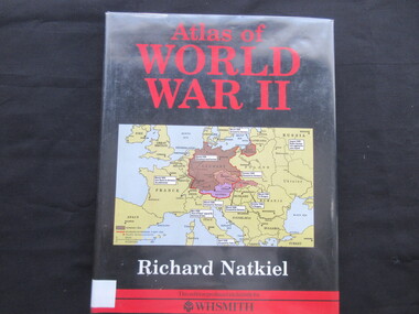
Book, Richard Natkiel, Atlas of World War 11, 1985
... Atlas of World War 11...Lilydale RSL Sub Branch 52 Anderson Street Lilydale yarra-valley-and-the-dandenong-ranges Book Atlas of World War 11 Book Book Richard Natkiel W.H.Smith & Son Ltd ...Book -
Moorabbin Air Museum
Book, Dana Bell, ATLAS OF WORLD AVIATION
... ATLAS OF WORLD AVIATION...Moorabbin Air Museum Moorabbin Airport 12 First Street Moorabbin melbourne ATLAS OF WORLD AVIATION Book Dana Bell ... -
 Queenscliffe Maritime Museum
Book - Royal Atlas 1861, Keith Johnston, The Royal Atlas of Modern Geography, 1861
... ...World Atlas...105 page leather bound atlas containing some coloured illustrations of maps of the countries of the world up to 1861. ...While the Bartholomew's Citizen's Atlas sold more copies, being half the price, the Royal Altlasbecame the standard library atlas throughout the British Empire. 19th century atlas of modern geography Geography World Atlas Keith Johnstone Atlas of the word in 1861 Keith Johnstone Royal Atlas 105 page leather bound atlas containing some coloured illustrations of maps of the countries of the world up to 1861. ...Atlas of the word in 1861105 page leather bound atlas containing some coloured illustrations of maps of the countries of the world up to 1861. Published by William Blackwood & Sons, 1861. Folio [51x34cm] size with 9 pages of introductory text followed by 48 double-page spread and part coloured maps.non-fictionAtlas of the word in 1861geography, world atlas, keith johnstone -
Clunes Museum
book, PEARS, PEARS CYCOPAEDIA, CIRCA 1912
... DICTIONARY OF THE WORLD, ATLAS OF THE WORLD. DICTIONARY OF EVENTS. ...DICTIONARY OF THE WORLD, ATLAS OF THE WORLD. DICTIONARY OF EVENTS. ...NGLISH DICTIONARY, GENERAL INFORMATION, PROMINENT PEOPLE.RED HARD COVERED BOOK. PEARS SHILLING CYCLOPAEDIA. INDEX ON FRONT COVER. 1072 PAGES. HAS UNIVERSAL TIME INDICATER IN BACK COVER. PRINTED AND PUBLISHED BY A AND F PEARS LIMITED, 71 - 75 NEW OXFORD STREET.non-fictionNGLISH DICTIONARY, GENERAL INFORMATION, PROMINENT PEOPLE.local history, book, reference, books - reference -
Frankston RSL Sub Branch
Pocketbook, Souvenir, Taschenbuch Groß-Deutschland, Geschichtstafel, Deutschlands Wehrmacht, Weltatlas, 31 August, 1941
... The pocket book title translates as "Paperback Greater Germany, History Chart, Germany's Wehrmacht, World Atlas" and is a collection of information about the German Reich, German military units and insignia and world maps, 1942 calendar, etc. ...The pocket book title translates as "Paperback Greater Germany, History Chart, Germany's Wehrmacht, World Atlas" and is a collection of information about the German Reich, German military units and insignia and world maps, 1942 calendar, etc. ...provenance unknownSmall, soft cover, pocketbook presumably souvenired from a German soldier during the latter stages of World War 2. The pocketbook is of the type originally issued by the German military and was printed in August 1941, edited by Georg Westermann, Braunschweig. The book has a red coloured cover with black printing and contains 48 pages. Pages are printed in black, the maps are printed in colour. The pocketbook is in good condition, some pages have tears and the cover is scuffed. The pocket book title translates as "Paperback Greater Germany, History Chart, Germany's Wehrmacht, World Atlas" and is a collection of information about the German Reich, German military units and insignia and world maps, 1942 calendar, etc. The original owner has made markings on some maps and has made notes.The front cover is printed in black ink with the following "Taschenbuch Groß-Deutschland, Geschichtstafel, Deutschlands Wehrmacht, Weltatlas" -
 Warrnambool and District Historical Society Inc.
Archive (Collection) - A.A. Briggs collection of ledgers and personal papers, Arthur Briggs, Personal Papers, 1893-1937
... World' which is currently housed in a meeting room in the Christ Church Warrnambool Hammond Centre. This collection is of considerable interest as it records the work of a prominent Warrnambool person (late 19th and early 20th centuries) and contains the names of a great number of Warrnambool residents at that time. A.A. Briggs Warrnambool Victorian Alliance Atlas ...Administrative records of A. A. Briggs, Warrnambool accountant, real estate agent, insurance and commission agent donated to the Warrnambool and District Historical Society, source and date unknown byadministrative records of a Warrnambool businessmanNine ledgers and four folders of documents held in A3 archival boxesHandwritten administrative records and personal papers of nine ledgers and four foldersa.a. briggs warrnambool, victorian alliance, atlas assurance company, warrnambool hospital, warrnambool permanent building societya.a. briggs warrnambool, victorian alliance, atlas assurance company, warrnambool hospital, warrnambool permanent building society -
 Bendigo Military Museum
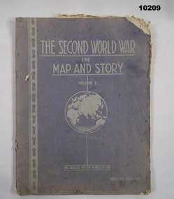
Book - ATLAS, Argus Newspaper, The Second World War in Map and Story. Volume 2, c. WW2
... The Second World War in Map and Story. Volume 2. Book ATLAS Argus Newspaper Neville Smith Robert M. ...Part of the "Kevin John Herdman" (No. 397661) Collection. See Catalogue No. 5942P for details of his service.Blue coloured textured cover with pages secured with two staples. Un-numbered white pages with cut edges. Text on cover in white print. Map of World printed below title. Pages feature text in black type and maps in colour.Handwritten in blue ink on first page: "H. Kofoed, Mandurang".kevin john herdman, maps, ww2, atlas -
 Kiewa Valley Historical Society
Book - Educational - School Atlas, Collins' Australian Clear School Atlas
... This atlas is of interest because it is circa 1950s and shows the world at this time. australian school atlas clare roper Cover page: handwritten "Margaret Tulloh / C. ...Australian schools used Atlases to teach students geography and the nationalities of countries worldwide.Clare Roper was a resident of the Kiewa Valley. This atlas is of interest because it is circa 1950s and shows the world at this time.Thick red cardboard cover with black print and map of Australia on cover. It includes coloured maps of countries, black & white photos and an index at the back. On the inside of the cover both front and back it has black and white maps. There are 30 pages and it is bound. Circa 1950sCover page: handwritten "Margaret Tulloh / C. Roper / Margaret Tulloh / M.L.C. Some pages have been marked with pencilaustralian school atlas, clare roper -
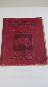
 Kiewa Valley Historical Society
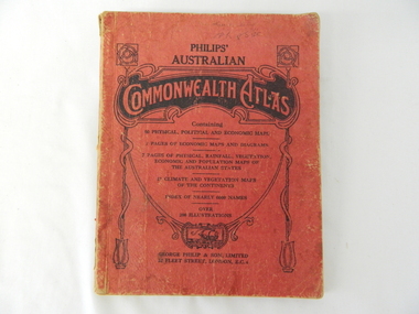
Atlas Australian Commonwealth, Philips' Australian Commonwealth Atlas, 1944
... This atlas, printed in 1944, details not only the geographic and political boundaries of the world as it was at that time but also the snap shot of life of the time. ...The inside cover has the atlas title and contents and the publisher details. The atlas contain 56 pages of world and Australian maps, vegetation and rainfall maps. ...The inside cover has the atlas title and contents and the publisher details. The atlas contain 56 pages of world and Australian maps, vegetation and rainfall maps. ...This atlas, printed in 1944, details not only the geographic and political boundaries of the world as it was at that time but also the snap shot of life of the time. This snap shot in time covers the major Australian cities, the major farming, grazing, industrial and sporting/recreational activities. Also there are snap shots of similar activities from other global areas. The period also covered World War II, detailed by a photo of "shell making", munitions, required by Australian soldiers. The great political and territorial changes made as a result of World War II can be clearly identified for example , Israel (the Jewish homeland). The various prewar colonies of major European nations.This atlas was used by children of a Kiewa Valley family and shows the value and the general educational exposure that these children had at this time. The rural setting and within the backdrop of a world war did not severely alter the life style of children in this region. The "news reels" shown in cinemas of cities and larger towns were the only visual realisations of major events of global significance available to these children. The information provided by this atlas allowed students to glimpse at what the "outside world" was. The majority of these students would possibly never see these regions for themselves. The great communication facilities of the late 1900s and beyond, was still only science fiction.This atlas has a thick (350 g/m) red cardboard cover with bold black lettering and shading. The cover is set out within a shield like frame. The shield is held up by two square markings, each with a four part circular pattern and a cord entwining two pendulum structures ending with a bowl figure at the bottom. There is a semi circular form enclosing a printed book contents list. The inside cover has the atlas title and contents and the publisher details. The atlas contain 56 pages of world and Australian maps, vegetation and rainfall maps. Within this atlas there are 27 double sided pages of black and white photographs depicting life styles, buildings, landscapes and prominent and significant to Australia males from 1652 to 1944. The pages are of approximately 200 g/m and have the yellow aged appearance.On front cover "Philips' Australian COMMONWEALTH ATLAS" and underneath "Containing" underneath "60 PHYSICAL, POLITICAL AND ECONOMIC MAPS". Publisher George Philip & Son, Limited 32 Fleet Street, London E.C. 4. Inside cover are: written, in freehand and in ink the following names and dates; "J.Muller Form V 1945", "L L Muller Form IV 1946", "N.J. Muller Form I + II + III 1948 +49 + 50" and "D Muller Form I 1949". also handwritten and in pencil is "Peter Leslie". On the last page is a small freehand sketch of Australia in biro.1940s school curriculum, rural education, 1940s atlas, australian atlas -
 Bendigo Military Museum
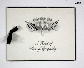
Card - SYMPATHY CARD, Atlas Press, Marlborough series, 1917
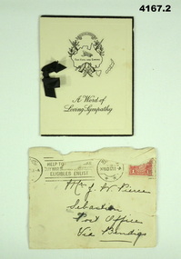
... world of sympathy”, in ink “To Mrs and Mr Pierce from Agnes.E.Staples”. Four page folding card, front cover has a set of flags with a cross and wreath, inside a short poem headed “he fought the good fight”, next page is a brief sympathy note and under a hand written note in ink, a small black ribbon holds the pages together. Card SYMPATHY CARD Atlas ...The card relates to the death of George Frederick Pierce DCM. Refer Cat No 4136P for his service, award and death. Part of the collection of William (Bill) Thomason, refer Cat No 4136P.Four page folding card, front cover has a set of flags with a cross and wreath, inside a short poem headed “he fought the good fight”, next page is a brief sympathy note and under a hand written note in ink, a small black ribbon holds the pages together.Front cover, “A world of sympathy”, in ink “To Mrs and Mr Pierce from Agnes.E.Staples”.sympathy, military, cards -
 Bendigo Military Museum
Card - SYMPATHY CARD and ENVELOPE, ATLAS PRESS Marlborough series, Both 1917
... world of Sympathy”. Inside in ink from “Hilda C Stephens” .2) on front in black pen, “Mrs J Pierce Sebastian Post Office Via Bendigo” .1) four page folding card, front cover has a map of Australia, crossed rifles, wreath, Corolla, inside has a short poem headed “He hath fought the good fight”. Next page a brief sympathy message with hand written entry in ink, a small black ribbon holds the pages together. .2) Yellowish envelope with two circular stamp marks, red 1 penny stamp and addressed in black pen. Envelope is stamped “20 NOV 2017 Card SYMPATHY CARD and ENVELOPE ATLAS ...Items in the collection relating to George Frederick Pierce DCM. Refer Cat No 4136P for his service details, award and death Part of the collection of William (Bill) Thomason, refer Cat No 4136P..1) four page folding card, front cover has a map of Australia, crossed rifles, wreath, Corolla, inside has a short poem headed “He hath fought the good fight”. Next page a brief sympathy message with hand written entry in ink, a small black ribbon holds the pages together. .2) Yellowish envelope with two circular stamp marks, red 1 penny stamp and addressed in black pen. Envelope is stamped “20 NOV 2017.1) front cover,” A world of Sympathy”. Inside in ink from “Hilda C Stephens” .2) on front in black pen, “Mrs J Pierce Sebastian Post Office Via Bendigo”sympathy, cards, military -
 Bendigo Military Museum
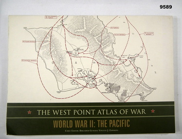
Book - ATLAS, PACIFIC, WW2, Brigadier General Vincent J. Esposito, THE WEST POINT ATLAS OF WAR/ WORLD WAR II: THE PACIFIC, Original 1959
... THE WEST POINT ATLAS OF WAR/ WORLD WAR II: THE PACIFIC....The West Point Atlas of War: World War II/ The Pacific provides a unique way of studying military history."...The West Point Atlas of War: World War II/ The Pacific provides a unique way of studying military history." ..."Originally published in 1959 as part of a two volume set. The West Point Atlas of War: World War II/ The Pacific provides a unique way of studying military history."Soft cover book. Cover - cardboard, beige and gold colour print on front, spine and back. Illustrated - front and back - red and black colour print of maps. 128 pages - cut, plain, off white colour, heavy gauge paper. Illustrated black, red and dark green maps and black and white photographs.publication, book, atlas, pacific, ww2 -
 Greensborough Historical Society
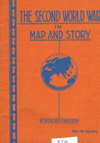
Book, Neville Smith, The Second World War in map and story, ed. by Neville Smith, 1941_
... The Second World War in map and story, ed. by Neville Smith Book Book Neville Smith Argus Atlas Robert N Myers ...Series of articles first published in the "Argus" from 1941 to 1945, dealing with events and campaigns in World War 2.63 p., black & white photographs, col. maps.world war 2 -
 Greensborough Historical Society
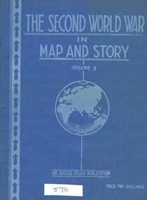
Book, Neville Smith, The Second World War in Map and Story, volume 3, ed. by Neville Smith, 1943_
... The Second World War in Map and Story, volume 3, ed. by Neville Smith Book Book Neville Smith Argus Atlas Robert N Myers ...Series of articles published by the "Argus" 1941-1943, dealing with events and campaigns in World War 2.48 p., col. maps.world war 2 -
 Greensborough Historical Society
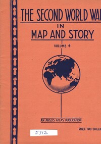
Book, Neville Smith, The Second World War in Map and Story, volume 4, ed. by Neville Smith, 1944_07
... The Second World War in Map and Story, volume 4, ed. by Neville Smith Book Neville Smith Argus Atlas Robert N Myers ...Series of articles published by the "Argus" 1941-1945, dealing with events and campaigns in World War 2.48 p., col. maps.world war 2 -
 Greensborough Historical Society
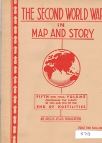
Book, Neville Smith, The Second World War in map and story, Vol. 5, ed. by Neville Smith, 1945_
... The Second World War in map and story, Vol. 5, ed. by Neville Smith Book Book Neville Smith Argus Atlas Robert N Myers ...Series of articles first published in the "Argus" from 1941 to 1945, dealing with events and campaigns in World War 2.50 p., black & white photographs, col. maps.world war 2 -
Phillip Island and District Historical Society Inc.
Book, WEBSTER, D.L, Encyclopedia of useful information and world's atlas, 1889
... Encyclopedia of useful information and world's atlas Book WEBSTER, D.L. Ogilvie & Gillett ...Stamped 'Phillip Island & District Historical Society'. -
Phillip Island and District Historical Society Inc.
Book, BARTHOLOMEW, John, Black's general atlas of the world, 1860
... Black's general atlas of the world...Black's general atlas of the world Book BARTHOLOMEW, John Adam & Charles Black ...Book from the Cleeland Bequest - a comprehensive collection of books relating to the History of England, Civil & Military, Religious, Intellectual & Social. Labelled 'Cowes Free Public Library', 'Phillip Island Historical Society, Cleeland Bequest'. Inscribed 'Jno Cleeland'.cleeland bequest -
 Bendigo Historical Society Inc.
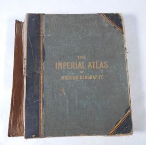
Book - Atlas, The Imperial Atlas of Modern Geography, 1860
... The atlas includes an extensive series of maps embracing the most recent discoveries and the latest political divisions of territory in all parts of the world compiled and engraved from the most authentic sources. ...The atlas includes an extensive series of maps embracing the most recent discoveries and the latest political divisions of territory in all parts of the world compiled and engraved from the most authentic sources. ...Publisher Walter Graham Blackie (1816-1906) began as a letterpress operator, printer and publisher. He married Marion Brodie 16/4/1846. In 185, his successful business in Glasgow, employed 60 men and 40 boys.The Imperial Atlas of Modern Geography published in London by Blackie and Son, Warwick Square, E.C.; Glasgow and Edinburgh in 1860 MDCCCLX. The atlas includes an extensive series of maps embracing the most recent discoveries and the latest political divisions of territory in all parts of the world compiled and engraved from the most authentic sources. world maps, index