Historical information
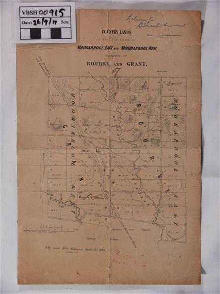
This is a map of "Country Lands" around the Werribee River, north of Ballan in the Counties of Bourke and Grant.
Physical description
A relatively small map, paper on a material backing.
Shows topographical features, roads and property divisions. Scale of forty chains to one inch.
The map is dated March 31st, 1859.
Inscriptions & markings
There is a small inscription under the chain scale that reads "No 58/364 John Phillips ? Survey 1st August 1858".
The name Dugald McPherson is hand written on one of the blocks of land.