


Historical information
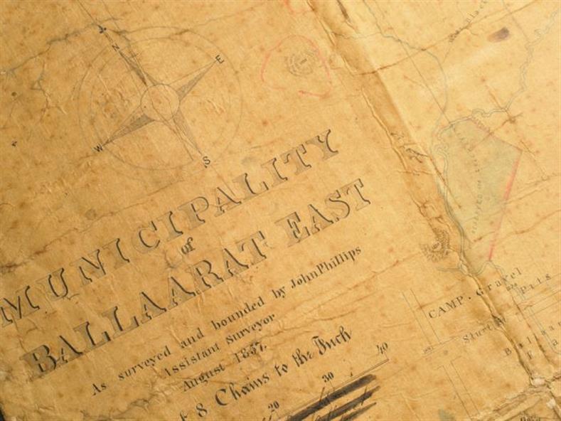
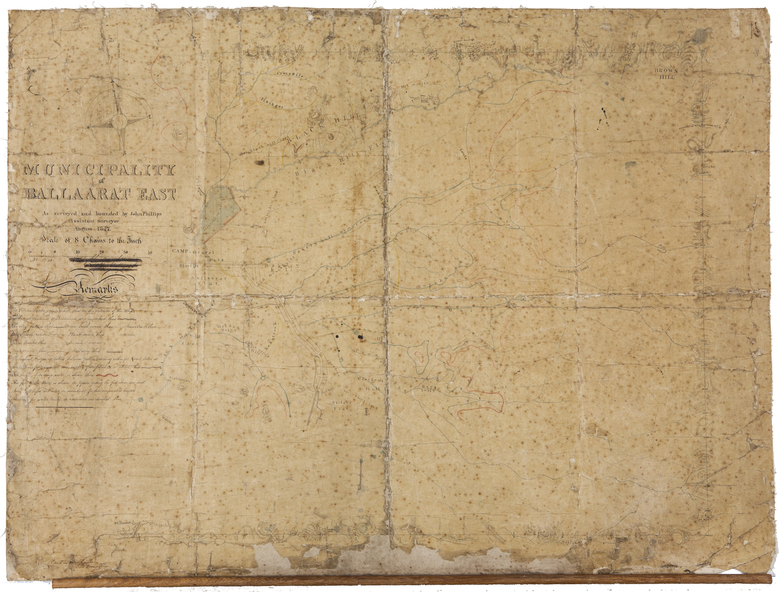
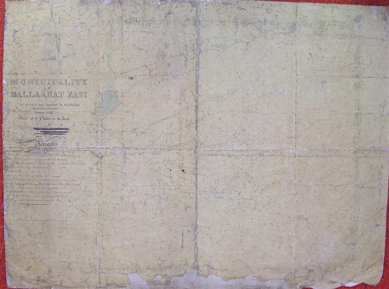
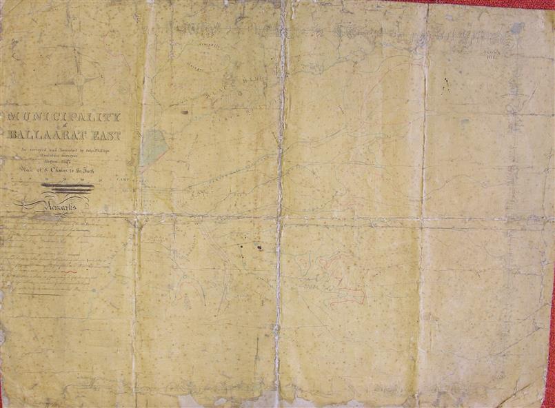
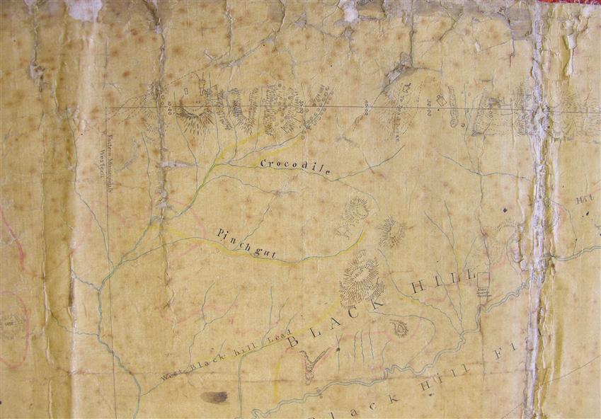
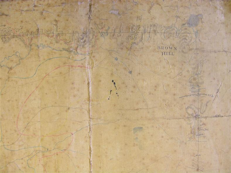
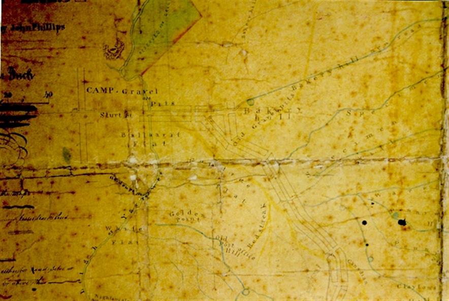
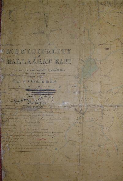
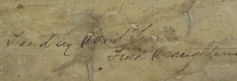
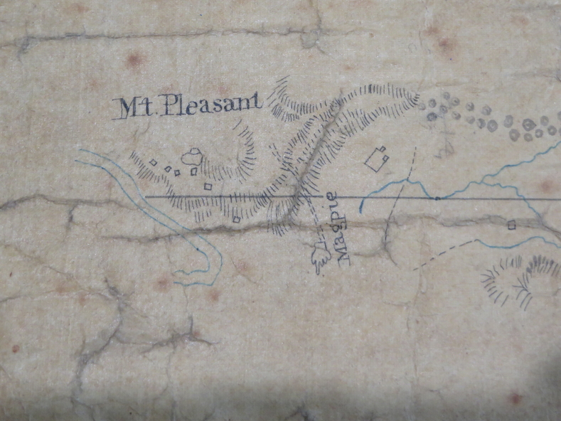
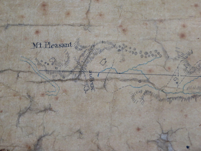
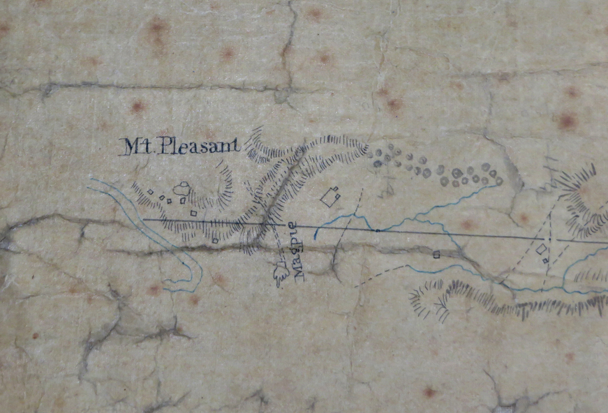
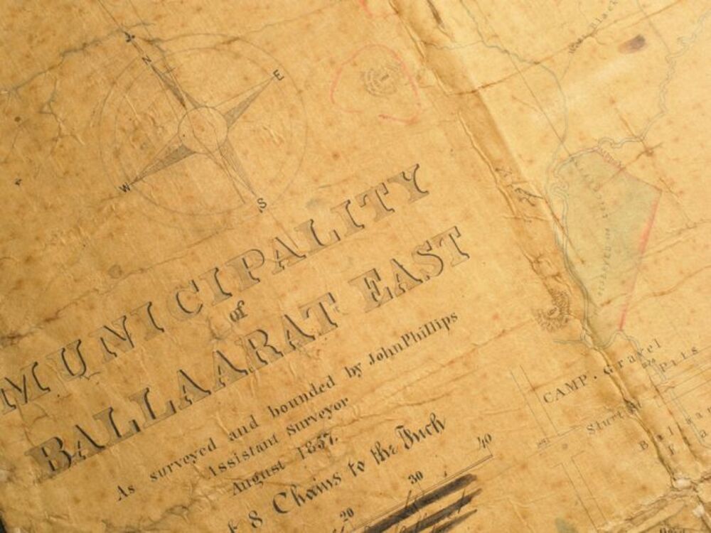
Gold was discovered in Ballarat in 1851. This plan was created six years later and names some of the great gold locations of Ballarat East. It also shows the locality of the Eureka Stockade (1854) and the walking tracks and roads on the Ballarat East Goldfield.
Significance
In 2007 this map was listed on the inaugural Ballarat Treasure's Register.
Physical description
Large map backed onto linen. The map has read and blue highlights, and identifies areas such as Mount Pleasant, Golden Point, White Flat, Nightingale, Malekoff, Old Post Office Hill, Red streak, Gumtree Flat, Old Gravelpits, Bakery Hill, Ballaarat Flat, The Camp, Specimen Gully, Pennyweight Hill, Warrenheip Gully, Gays Gully, Pennyweight Flat, Eureka, Black Hill, Pinchgut, Crocodile, Hit or Miss, Little Bendigo, Brown Hill, Mopoke, Cricket Reserve, Canadian Hotel, Ballarat East
Subjects
- mount pleasant,
- golden point,
- white flat,
- nightingale,
- malekoff,
- old post office hill,
- red streak,
- gumtree flat,
- old gravelpits,
- bakery hill,
- ballaarat flat,
- the camp,
- specimen gully,
- pennyweight hill,
- warrenheip gully,
- gays gully,
- pennyweight flat,
- eureka,
- black hill,
- pinchgut,
- crocodile,
- hit or miss,
- little bendigo,
- brown hill,
- mopoke,
- cricket reserve,
- canadian hotel,
- ballarat eastm phillips,
- john phillips,
- field draughtsman,
- ballarat east,
- ballarat east map