


Historical information
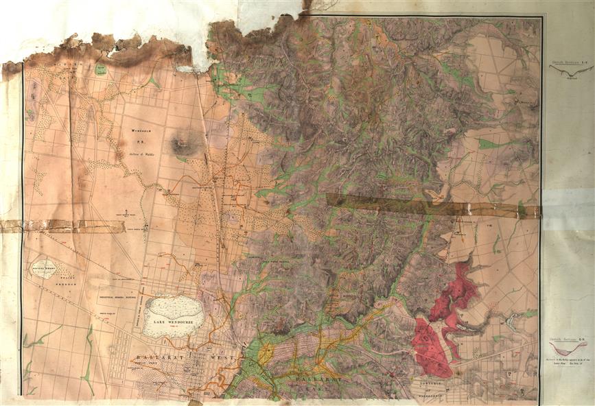
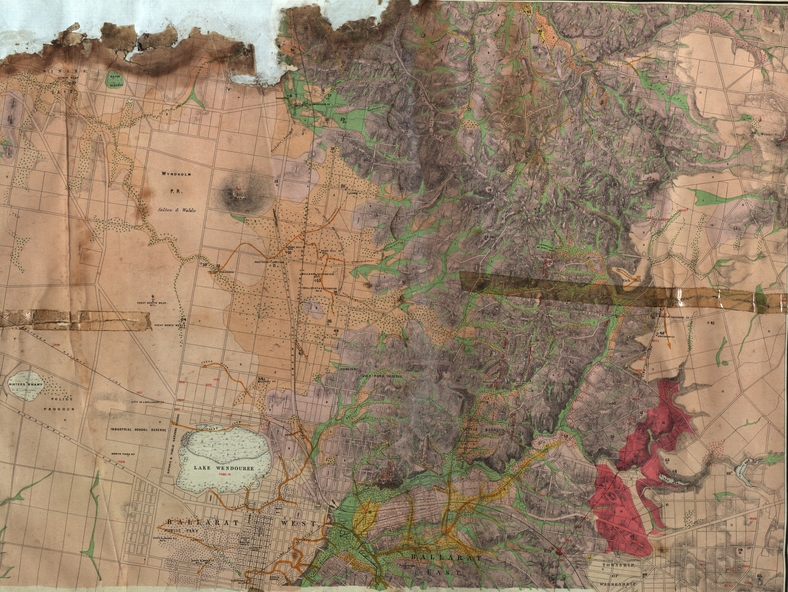
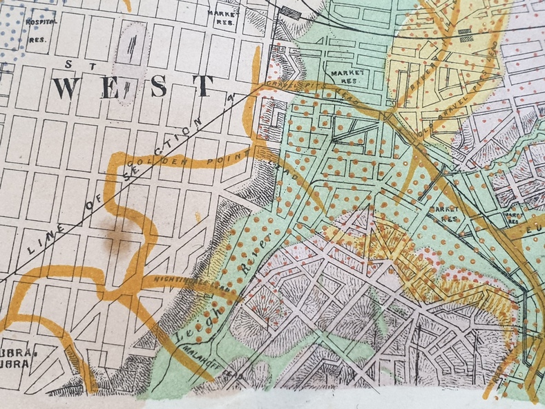
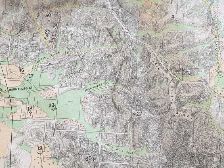
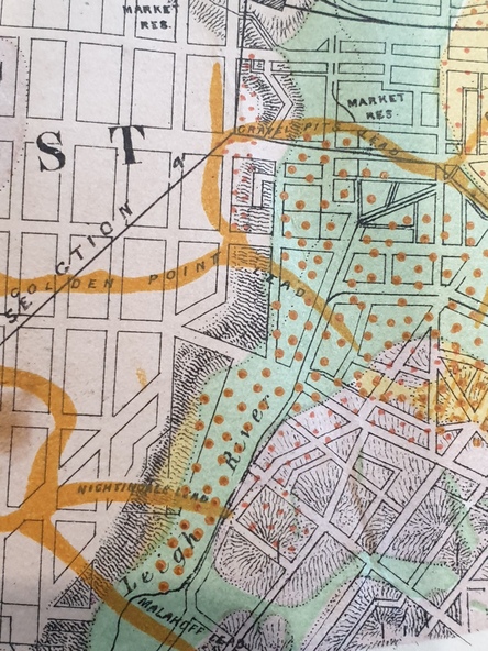
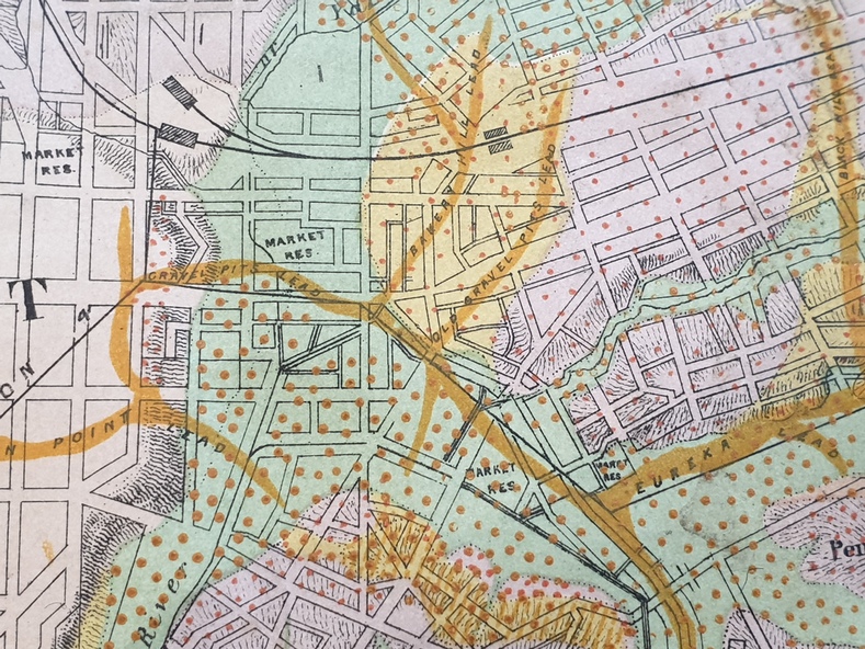
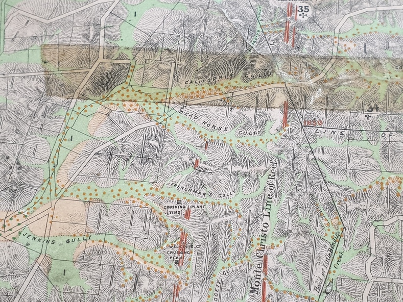
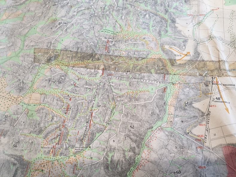
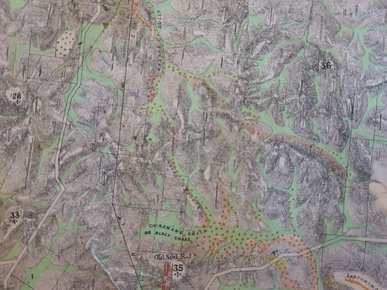
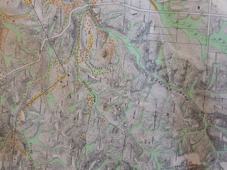
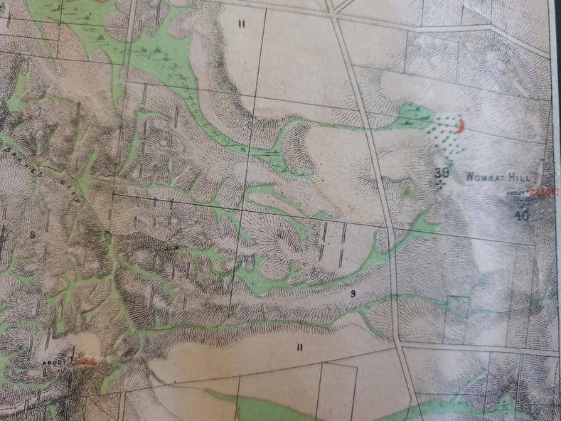
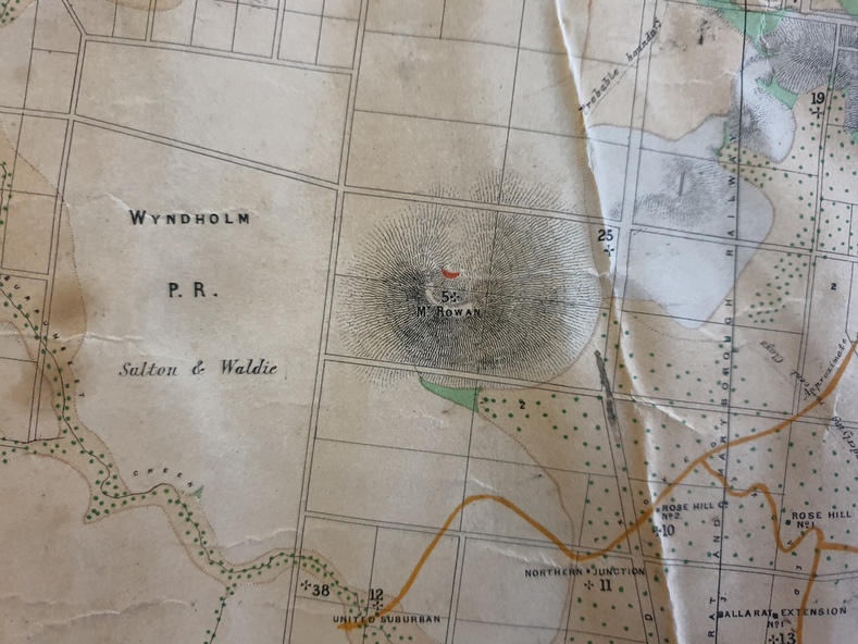
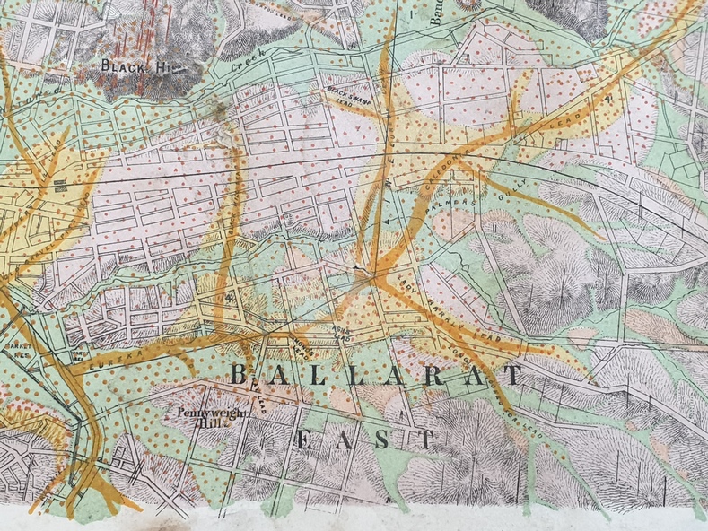
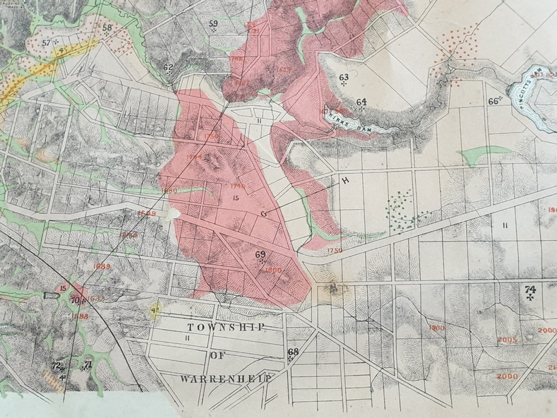
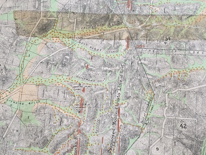
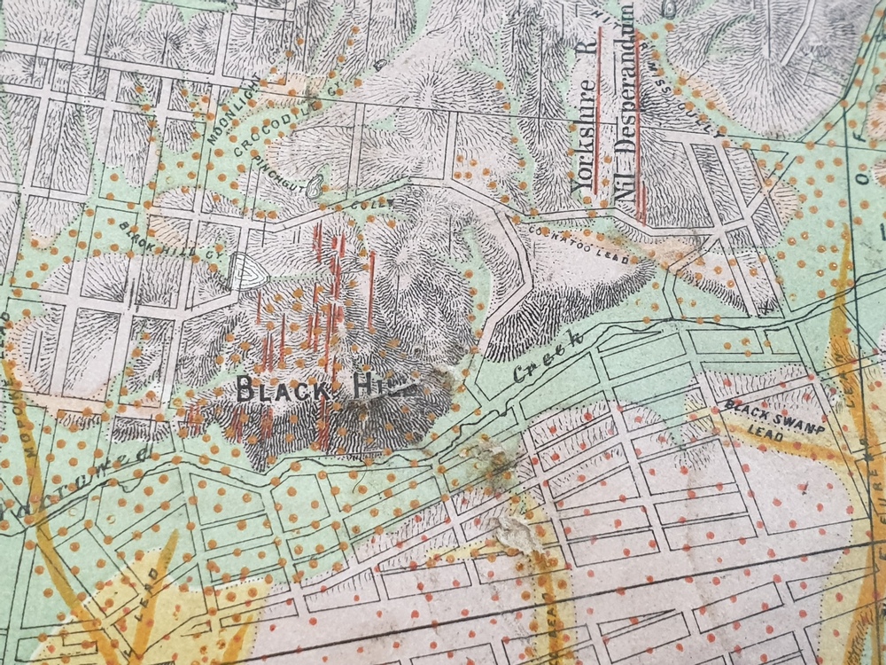
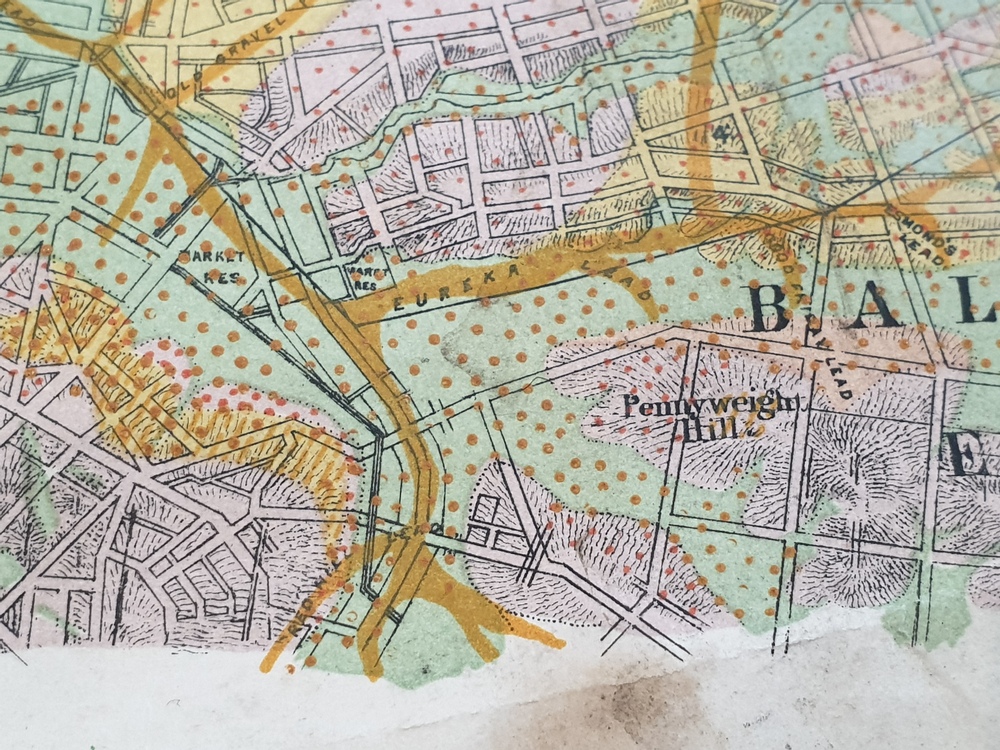
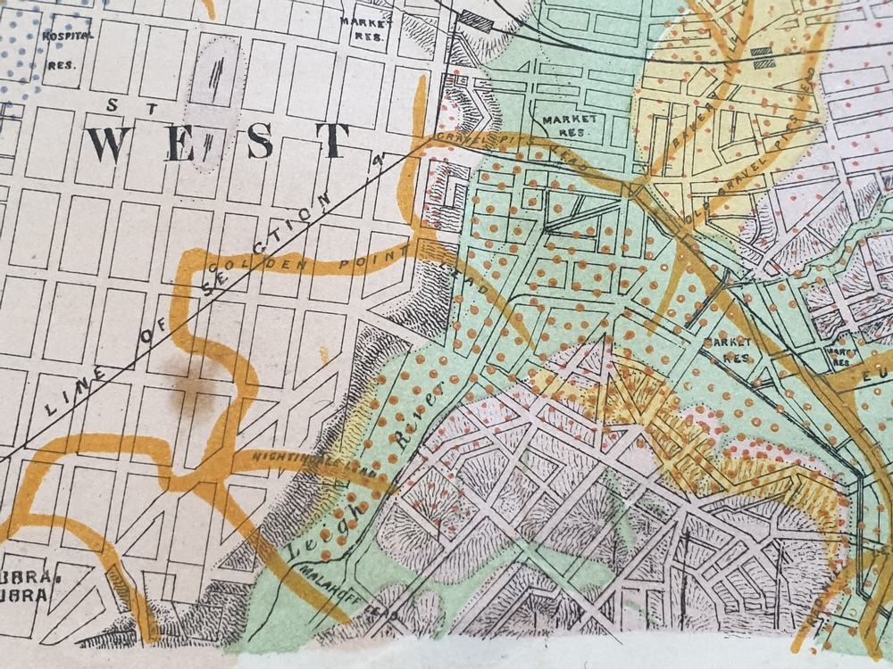
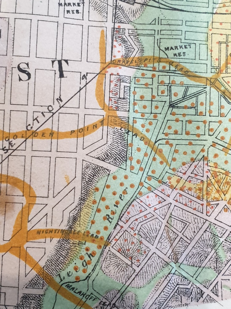
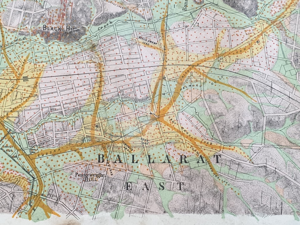
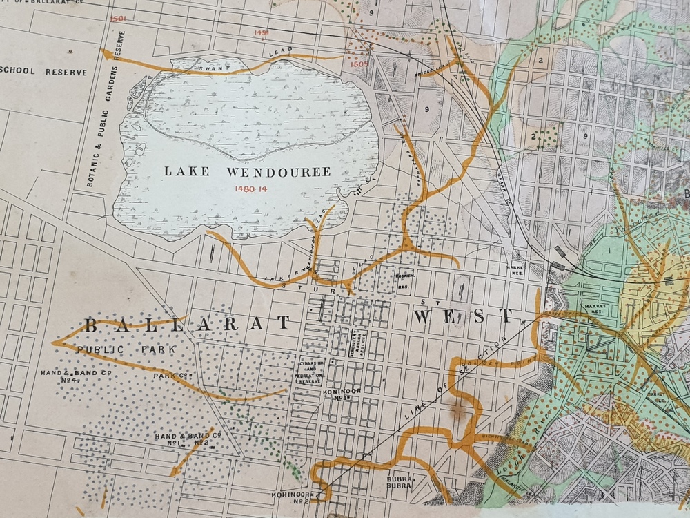
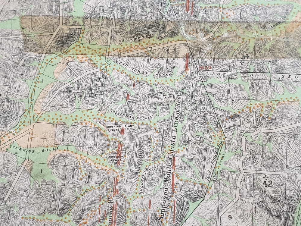
This map shows geological features, suggests the last basalt flow, and includes alotments and names of Mining Companies.
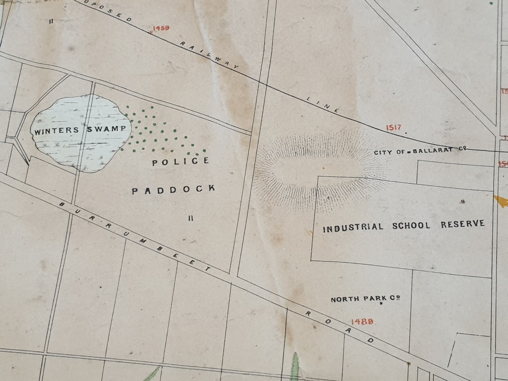
Although this map has no date on it the Ballarat Industrial School is used for dating purposed. The Ballarat Industrial School ran from 1869-1879, but the term Ballarat Industrial School Reserve was still in use in 1898 and possibly beyond.
Physical description
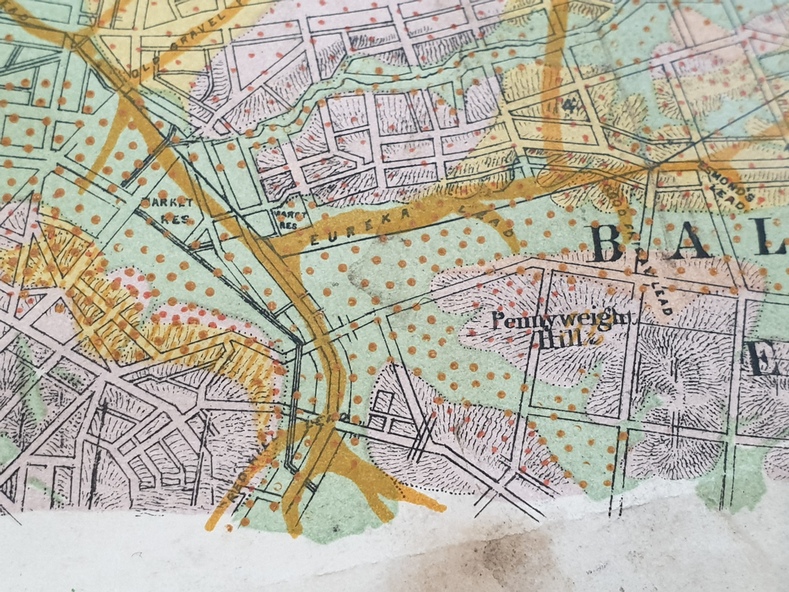
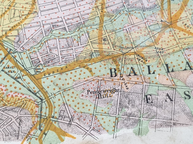
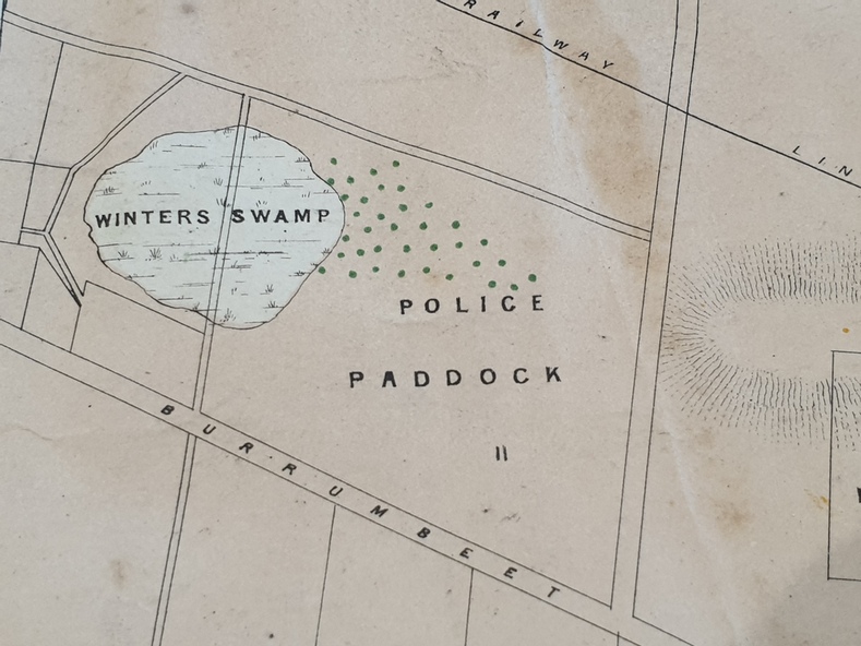
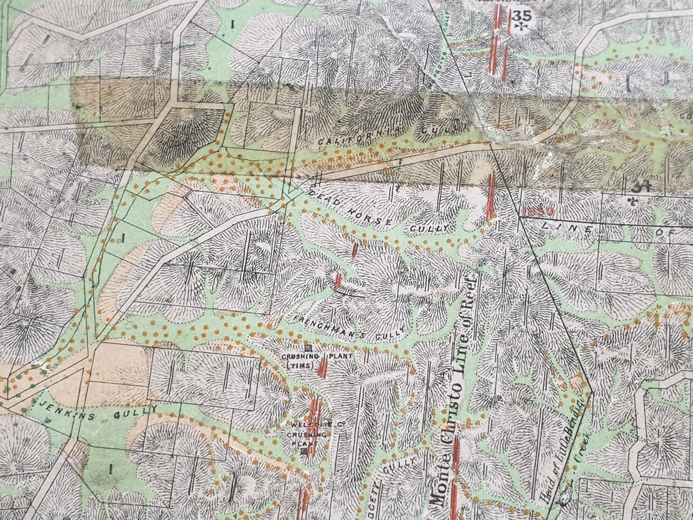
Geological Map of Ballarat with 3 holes in the left hand side. The map indicates the position of Lake Wendouree, Township of Warrenheip, Ballarat East, Industrial School Reserve, Winters Swamp, Police Paddock, Wyndholm Premptive Right (Salton and Waldie), Black Hill, Vale Park Reserve, Pennyweight Hill, Little Bendigo, Black Swamp Lead, monte Christo Reef, Chinaman's Gully, Miners Rest, Pincotts Dam, Northumberland Gully.
It also show the following goldmining companies: City of Ballarat, Kohinor, Hand and Band, Great North West, Northern Junction, Kneeshaw, Rossers Freehold, Silurial.
Subjects
- ballarat,
- warrenheip,
- lake wendouree,
- ballarat east,
- winters swamp,
- winter swamp,
- wyndholm premptive right,
- cemetery,
- vale park reserve,
- little bendigo,
- kneeshaw co.,
- industrial school reserve,
- kirks dam,
- pincotts dam,
- black hill,
- wombat hill,
- dead horse gully,
- miners rest,
- mt rowan,
- salton and waldie,
- rose hill co,
- great north west no 1,
- rose's freehold co,
- hand and band co,
- police reserve,
- police paddock,
- mount rowan,
- ballarat industrial school reserve,
- market reserve,
- winter's swamp,
- kneeshar co,
- monte cristo line of reef,
- chinaman's gully or black snake,
- milkmaid's gully,
- ballarat gold field,
- bakery hil lead,
- old gravel pits lead,
- golden point lead,
- eureka lead,
- miner's rest,
- yarrowee creek,
- leigh creek,
- black swamp lead,
- yorkshire reef,
- nil desperandum reef,
- cockatoo lead,
- hit or miss gully,
- herbert werner frederick de nully,
- pennyweight hill,
- esmond's lead,
- ash's lead,
- nightingale lead,
- john bull gully,
- gladstone reef,
- whitehorse reef,
- petticoat creek,
- pincott's dam,
- frenchman's gully,
- tim's crushing plant,
- jenkin's gully,
- california gully,
- drake's creek,
- sulton and waldie,
- ballarat undustrial school,
- ballarat & mariborough railway