

Historical information
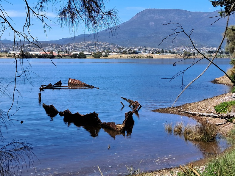
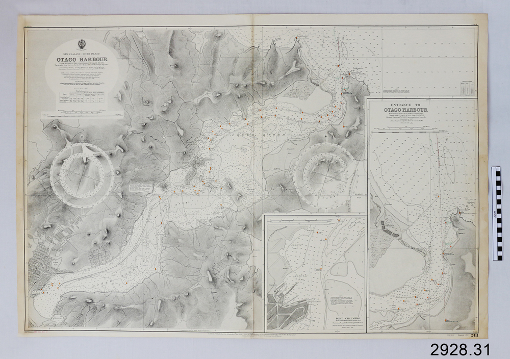
Navigation charts are used by mariners around the world for navigating waterways. This chart was created for Otago Harbour in New Zealand. A ship, "Otago", was named after this harbour and was once commanded by the renowned maritime author Joseph Conrad. That ship now lies wrecked in Otago Bay, in the Derwent River, Tasmania.
The Otago 1869-1931
The iron-hulled 3-masted barque Otago was built in Glasgow by Alexander Stephen & Sons Ltd, Kelvinhaugh, as a merchant ship and launched in 1869. The vessel changed hands several times in the late 19th century after being sold to an Australian firm in 1871. During one of its voyages, the captain died while the ship was in port at Bangkok. The renowned marine fiction author, Joseph Conrad (1857-1927), was on board and being a qualified captain, he took command and continued the journey to Sydney and Mauritius. It was the only ship he ever commanded.
In 1903, the Melbourne shipping company Huddart, Parko & Co., purchased the Otago and converted it to serve as a coal hulk for use in Sydney. The Otago was later sent to Hobart, Tasmania, where it continued as a hulk until 1931. It was sold for scrap and eventually abandoned on the banks of the Derwent River at a place now known as Otago Bay, opposite Conrad Drive, Otago. The outline of the hull is still visible, and a nearby plaque tells the story. There are other vessels also named Otago, one of them in the same year.
Significance
This navigation chart was published by the British Admiralty cartographer, to aid mariners to navigate the world's water bodies. Navigation charts are still used today, along with other navigational instruments.
Physical description
British Admiralty Navigation Chart - Otago Harbour, South Island, New Zealand. Chart shows insets with finer detail of important sections. The chart was originally stored in a wooden map case with over 60 other charts.
Inscriptions & markings
Published in London, 1928, by the British Admiralty. Printed in Melbourne.
Subjects
- warrnambool,
- shipwrecked-coast,
- flagstaff-hill,
- flagstaff-hill-maritime-museum,
- maritime-museum,
- shipwreck-coast,
- flagstaff-hill-maritime-village,
- shipwrecked-artefact,
- british admiralty navigation chart,
- navigation chart,
- british admiralty,
- otago harbour,
- south island,
- new zealand,
- otago bay,
- derwent river,
- tasmania,
- joseph conrad
References
- Maritime Museum Tasmania The vessel OTAGO and author JOSEPH CONRAD