Historical information
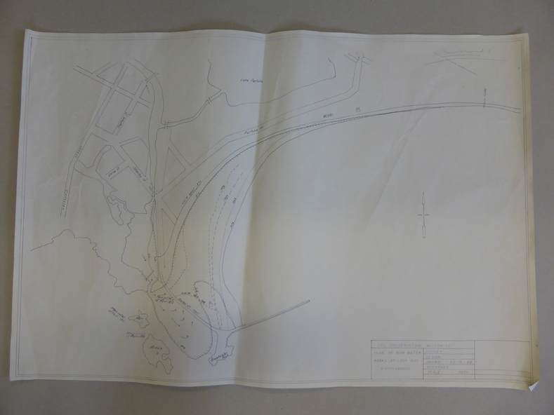
This map documents the changing state of Lady Bay from around 1870 until 1976. It depicts the changing high water mark over that period and the main outlet of the Merri River in 1872 and 1976.
Significance
This map provides a useful and significant insight into the ever changing face of Lady Bay from the 1870’s through to 1980’s.
Physical description
Cream paper map drawn with black ink showing Lady Bay and South Warrnambool section of Warrnambool.
Inscriptions & markings
In lower RH corner Soil conservation AuthorityPlan of High water marks at Lady Bay Warrnambool. Drawn P.D. 19.1/84.
Scale 1:3600. Written on back in black pencil: Lady Bay Historical HWM