Historical information
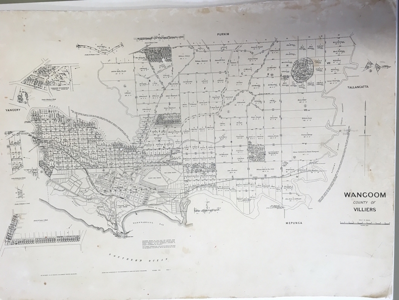
This map contains the names, acreage details and dates of the original property owners of the Parish of Wangoom (County of Villiers), excluding the township of Warrnambool. It also has details of the Crown Lands adjoining the Merri and Hopkins Rivers.
Significance
This is a most important map as it has details on the original property owners. It is a most valuable research tool and is one of our most-used maps.
Physical description
This is a map, printed in black and white and mounted on cardboard. Where there was intensive land ownership the details have been reproduced in larger print on the margins of the map. There are scuff and dirt marks on the map but it is otherwise in good condition.
Inscriptions & markings
‘Wangoom, County of Villiers’