

Historical information
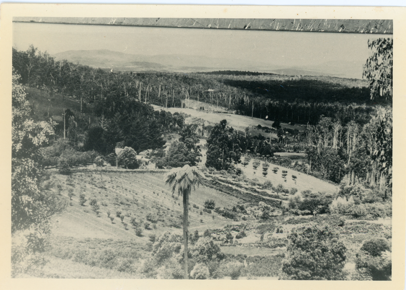
View of Harmony Vale, the original Kalorama settlement taken from Barbers Road. Child's sawmill can be seen (centre) with the log yard to the right. Richardson's home "Harmony Vale' is in the orchard above the logs.
Physical description
Black and white photograph copied from a Rose Series postcard showing the area known as "Harmony Vale' - the original Kalorama settlement. Child's sawmill is in the centre.
Inscriptions & markings
Rose Series Photo of Harmony Vale on the Olinda Creek taken from Logans Lot 28. Link Rd crossing centre Shiloah complex left centre. Richardsons (Jeannie’s) “Mt Calvin” between trees above tree fern. Isaac Jeeves house with the tree fern floor among trees against forest right centre. Mill yard with logs above cultivated flat. Mill to left. “Harmony Vale” homestead among orchard above logs. “Glenrivers” in gully at top of clearing. About 1913. Copied JLC 1973