


Historical information
Gallipoli 1915 Maps and Naval plan of Operations World War One ANZAC
Significance
Rare examples that explain both ANZAC and Naval Operations during World War One Gallipoli & Dardanelles Passage .
Physical description
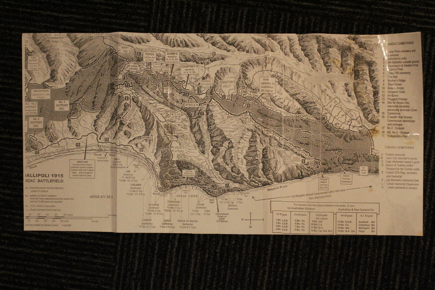
!. Black and White Photocopy of Gallipoli 1915 ANZAC Battlefield - detailed positions of troops and Cemeteries.
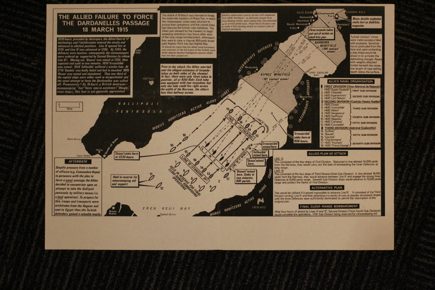
2.The Allied Failure to Force The Dardanelles Passage 18 March 1915 - detailed line of Attack Naval Organisation, Mine layout, Plan of Attack (and copy)..
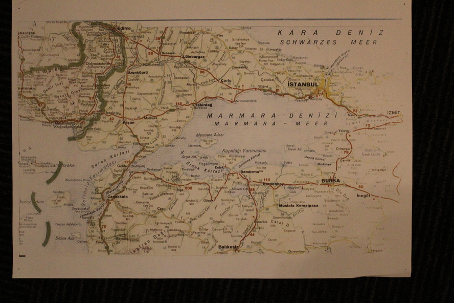
3. Map of Turkey and surrounding area written in Turkish and German Languages. C0olor version main roads and distances. (and copy)..
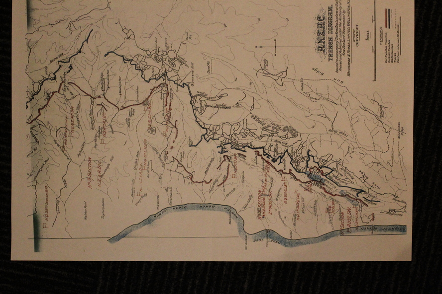
4. Map of ANZAC Trench Diagram. World War One.Color. (and copy).
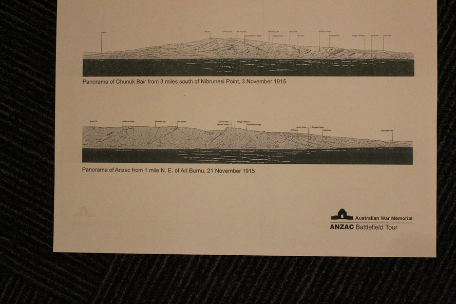
5.Panorama of Chunuk Blair from 3 miles south of Nibrunesi Point, 3 November 1915 and Anzac from 1 mile N. E. of Ari Burnu, 21 November 1915. Black & White
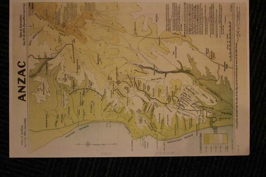
6. Color Map of ANZAC positions with topographical Details, notes.
Inscriptions & markings
1. Artwork and copyright by Srewart Cownie, Gallipoli 1915 ANZAC Battlefield with Landings and later evacuation marked.
2. Details of Naval actions taken in the Dardanelles Passage 18 March 1918.
3. Local area Map or Turkey. Shows roads network and townships.
4. ANZAC Trench Diagram, copyright Whitcombe & Tombs Limited , Wellington N.Z. 1919
5. Panorama of two coast views of ANZAC area. Australian War Memorial,
6. Map of ANZAC positions of World War One, Gallipoli 1915. Published by H.E.C. Roberinson, George Street, Sydney N.S.W.18 April 1916