Historical information
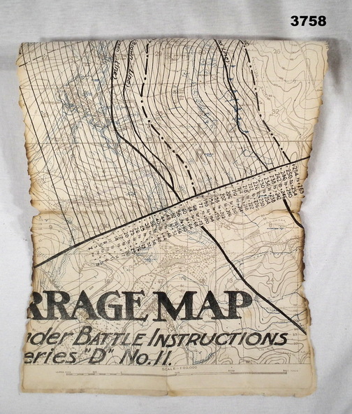
Villeret is centred within the areas of Rosiel, Bony, Bellicourt and Bellenglise. The map is possibly when the advance was into the Hindenburg Line in late 1918.
Item re William Alexander No 502 AIF. Refer Cat No 3746.3 for his service details.
Physical description
Map, small section of a “Barrage map” showing objective lines with distances, enemy trenches are in blue. Top half and bottom half of the map are missing. Area covered appears to be “Villeret” scale 1:20,000