


Historical information
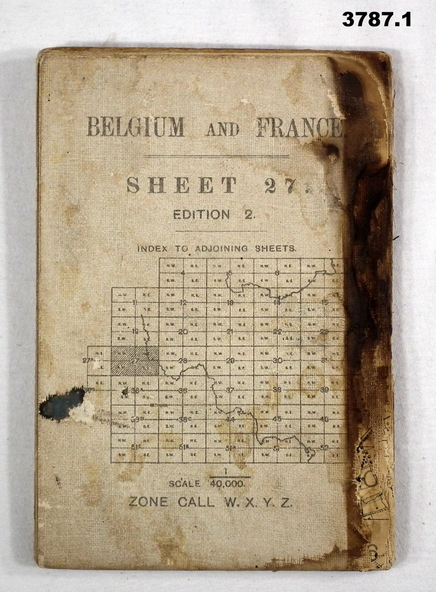
(.1) Areas covered on this map, Bollezeele to Poperinghe, Arques to Meteren.
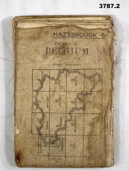
(.2) Areas covered on this map, BourBourg to Poelcapple, Reemilly to Armentieres.
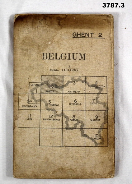
(.3) Areas covered on this map, Bruges, Neuzen, Ghent.
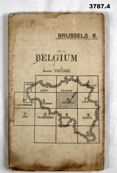
(.4) Areas covered on this map, Alost, Loulain, Soignes, St Germain.
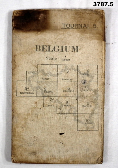
(.5) Areas covered on this map, Roulers, Oosterzeele, Lille, Thoriecourt.
Items relate to William Alexander No 502 AIF. Refer 3746.3 for his service details.
Physical description
(.1) Map, Belgium and France, sheet 27, Edition 2, scale 1:40,000, zone call W.X.Y.Z, Ordnance survey May 1917, gauze lined.
(.2) Map, Belgium, Hazebrouck 5A, Edition 2, scale 1:100,000, Ordnance survey 1916, gauze lined.
(.3) Map, Belgium, Ghent 2, scale 1:100,000, War Office June 1915.
(.4) Map, Belgium, Brussels 6, scale 1:100,000, Drawn at War Office, Ordnance survey 1912.
(.5) Map, Belgium, Tournai 6, scale 1:100,000, War Office Ordnance survey July 1912.
Inscriptions & markings
(.1) On rear, “Glossary of terms”