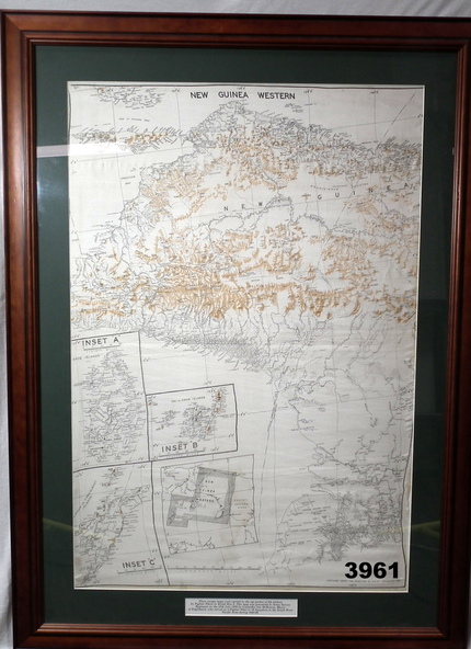
Physical description
Map of Western section of New Guinea. Black print on white background with mountain ridges in tan. Mounted with green border & brown wooden frame, glass front & white cardboard backing with wire hanging strap on back.
Inset LHS bottom:
A: Aroe Island
B: KIA Island
C: Taniimba Island
Inscriptions & markings
Printed in black at top centre: “NEW GUINEA WESTERN’
Printed on border under map:
“These escape maps were carried in the zip pockets of life jackets by fighter pilots in WW2. This map was presented to A.S.R. on the 12/7/79 by Councillor Ian McKenzie, Mayor of Eaglehawk, who served as a fighter pilot in 78th SQN in S.W. Pacific area during 1943-44.”
Subjects
- map,
- new guinea,
- western,
- raaf