

Historical information
Lot 2 was bought by Harry Walker in the early 1900s. Harry was married to Eva Hand, one of the six daughters of Thomas and Eliza Hand. Harry cleared the land and planted half with raspberries that remained productive until c1928. Harry's son William took over the property. The land was cut in half when the new CRB road went through in the early 1920s.
John Lundy-Clarke grew up in the Kalorama/Mt Dandenong area and later in life (1972-74) began to write a comprehensive history of the area working from an original settlement map in an effort to cover all areas.
Physical description
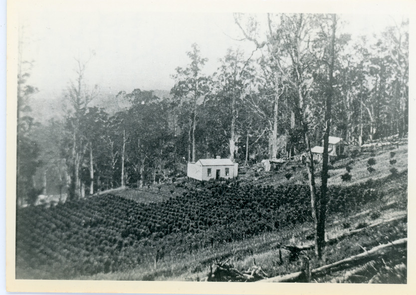
Black and white photograph showing a single storey white house in the centre surrounded by crops. Handwritten description on reverse by John Lundy-Clarke.
Inscriptions & markings
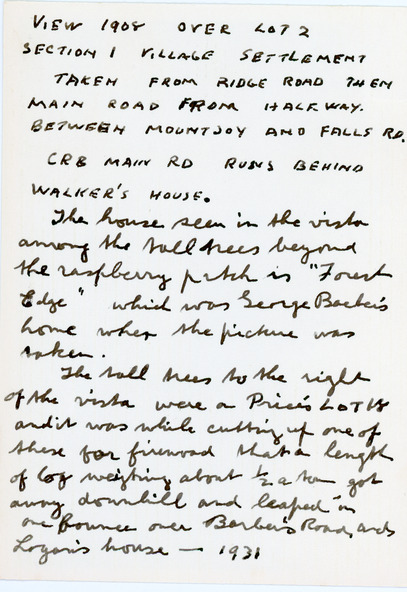
VIEW 1908 OVER LOT 2 SECTION 1 VILLAGE SETTLEMENT. TAKEN FROM RIDGE ROAD THEN MAIN ROAD FROM HALFWAY BETWEEN MOUNTJOY AND FALLS RD. CRB MAIN RD RUNS BEHIND WALKER’S HOUSE. The house seen in the vista among the tall trees beyond the raspberry patch is “Forest Edge” which was George Barber’s home when the picture was taken. The tall trees to the right of the vista were on Price’s LOT 18 and it was while cutting up one of these for firewood that a length of log weighing about ½ a ton got away downhill and leaped in one bounce over Barbers Road and Logan’s house – 1931.