Historical information
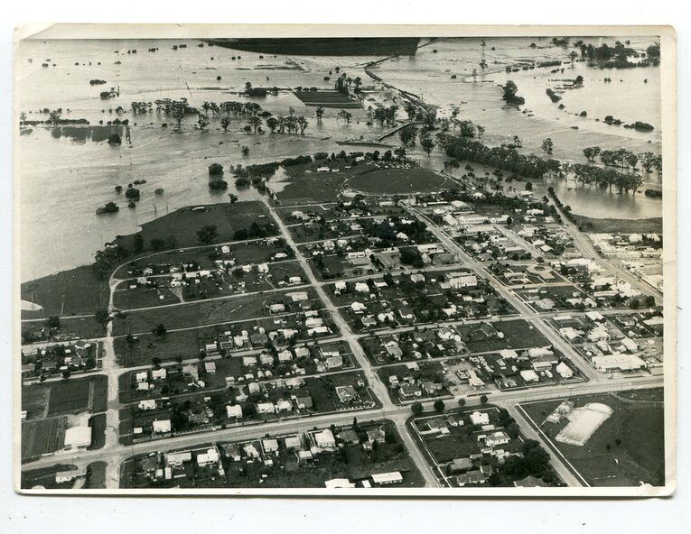
This photograph is an aerial view of the township of Orbost taken by the Bairnsdale Advertiser newspaper. It was taken from the northern end of the town.
The 1971 flood was the the worst flood on record. At Jarrahmond it was at least 11 metres and up to one and a half kilometres wide on the flats causing enormous damage to the flood plain. Records say that "The brown floodwater stain in Bass Strait could be seen from passing airliners." Considerable damage was done to railway infrastructure, roads and farms.
More information from the APRIL, 2008 newsletter by John Phillips. (see orbosthistory.com.au)
Significance
This is a pictorial record of a significant event in the history of Orbost,
Physical description
A black / white aerial photograph of a township with floodwaters in the background.
Inscriptions & markings
on back - "Note main current through the lagoon 1971."