Historical information
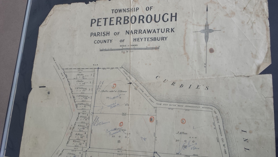
Same map as 4012 but printed names are easier to read. Hand drawn arrows show the road now built connecting Macs St to the Warrnambool Rd
Significance
Shows early layout of the town and names of landowners
Physical description
government map of the township of Peterborough with handwritten notes on it. Includes the names of the landowners 1931
Inscriptions & markings
some hand drawn arrows.