Historical information
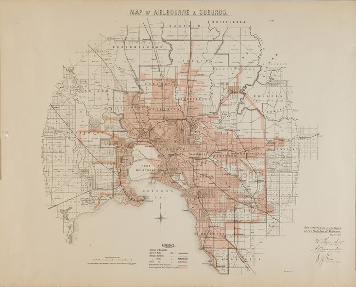
The Metropolitan Fire Brigades Board commenced service on 1 May 1891. Melbourne and its surrounding suburbs were divided into 5 sub districts each with a district superintendent and paid firefighters with additional support from paid auxiliaries. This map was produced on 6 May 1899 by the Department of Lands & Survey Melbourne showing the distribution of water in Melbourne for use by fire brigades. While by 1910, there were 123,227 connections to Melbourne's water supply system, it is unclear in this 1899 map whether water was supplied to all built structures in the defined areas or only to fire hydrants and stand pipes.
Physical description
Map accompanying report on fire protection of Melbourne showing those areas with water supplies tinted.
Inscriptions & markings
"MAP OF MELBOURNE & SUBURBS / Plan referred to in the Report on Fire Protection in Melbourne, May 6th 1899 / Scale 80 Chains to 1 inch / Photo-lithographed at the Department of Lands and Survey Melbourne by T.F. McGauran, 1891" / May 1899 No.76"