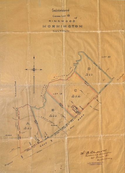


Physical description
Surveyor's map on wax paper
Inscriptions & markings
Subdivision map includes Mullum Creek, Government Road to Anderson's Creek, later Warrandyte Road, Government Road to Lillydale, later Whitehorse Road, small creek bridge, later Sandy Creek at Ringwood Lake.
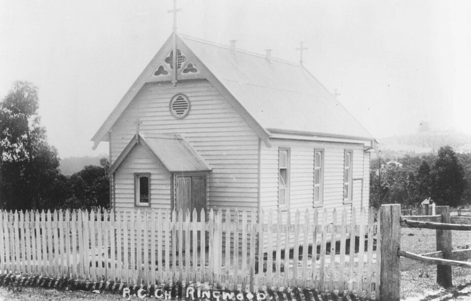
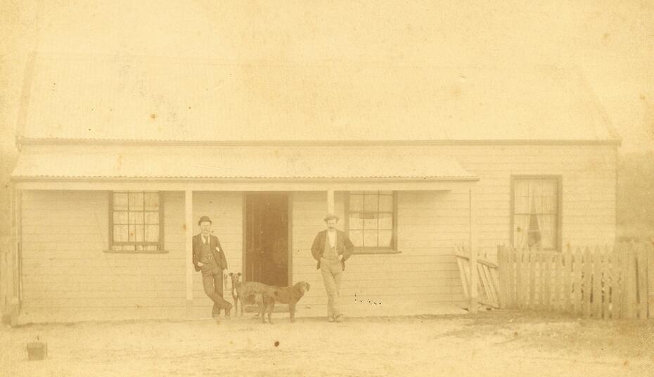
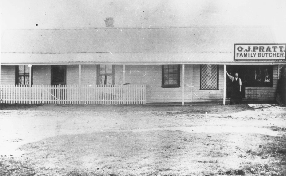
Buildings marked include Roman Catholic Church, O.J. Pratt's House and Pratt's butcher shop (photos attached). Map by A.B. Bruford & Co., Licensed Surveyor, 47 Queen Street, Melbourne.