Historical information
Refer Cat 5547 - Matheson.
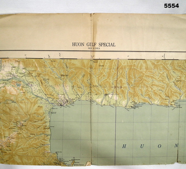
Physical description
This is a single sided map, printed in colour.
Scale 1:253,440, 4 miles to an inch, grid squares are 10mm x 10mm. Top right side shows Finschafen. Top centre is Lae, Middle is Salamau. Bottom is Lasanga Island. Top left vicinity is Nadzab and Markham River.
Inscriptions & markings
There are four "corner" marks in pencil. Two on land and two out in the gulf.
Subjects
- ww2,
- new guinea,
- map