

Historical information
The district of Strathfieldsaye was proclaimed in 1861 and named a Shire on the 17th September in 1866. It remained a shire until amalgamation in 1994 when it became part of the City of Greater Bendigo. The shire was located 8 km to the south- east of Bendigo and covered an area of 601 square kilometres and extended from the Calder Highway to the Coliban and Campaspe Rivers. The shire's administration centre was in Strathfieldsaye until 1972 when new offices were opened in Kennington.
Physical description
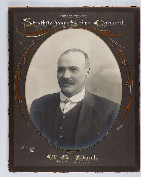
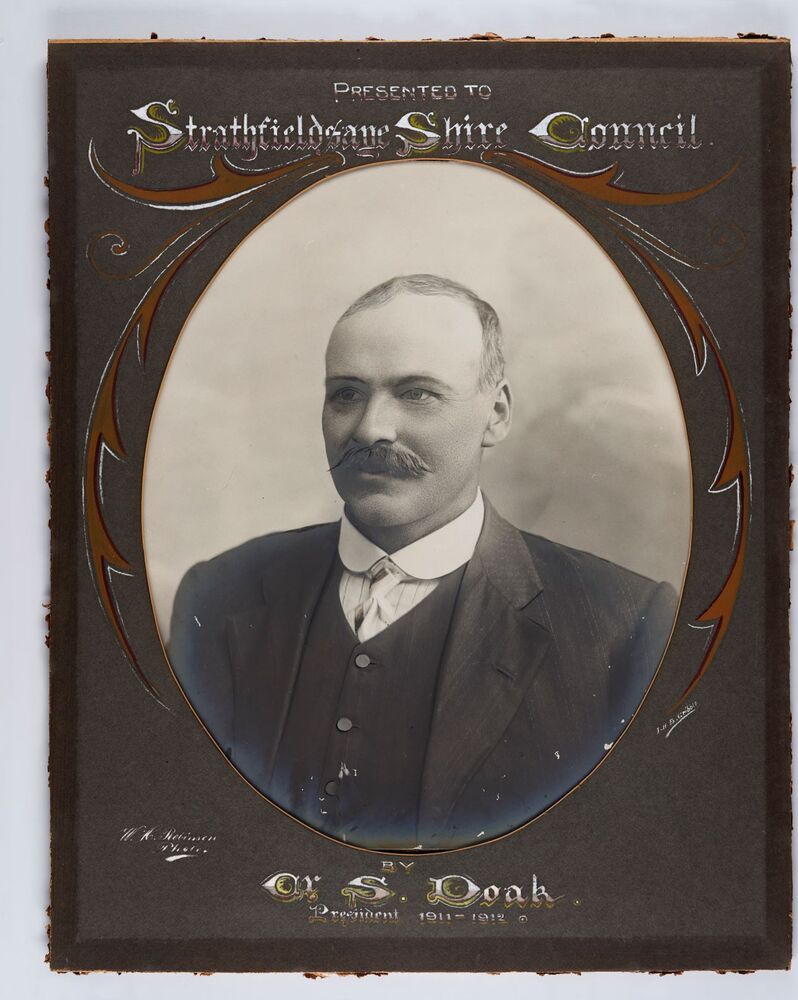
Framed black and white head and shoulder portrait of Councillor Doak with hand coloured and drawn detail. Left facing profile with walrus moustache. Cut oval brown mount decorated with text and scrolls. Hand written title top and lower centre.
Inscriptions & markings
Presented to / Strathfieldsaye Shire Council / W. H. Robinson / Photo / JMB Gribble / by Cr S. Doak / President 1911 - 1912