Historical information
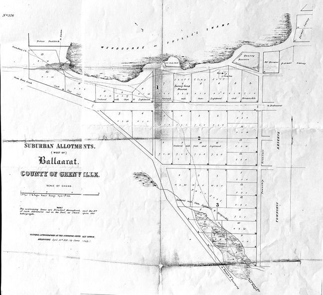
This map of the 1856 survey shows the numbered suburban allotments and the boundaries surrounding this area including Wendouree or Yuilles's Swamp close to where the Ballarat Botanical Gardens and the Lake exist today.
Significance
This map gives a clear idea of an early survey of this western area and directions to areas of Ballarat surrounding these allotments.
Physical description
2 pages of the same map, except p.2 shows the Township Reserve on the lefthand side of the page. On the back of p.2, righthand corner is the Public Records Stamp.
Inscriptions & markings
P2, righthand corner is the citation in pencil.