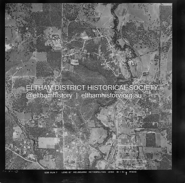
Historical information
Centred on Allison Crecent Reserve, Sherbrook Road and Scenic Crescent, Eltham bounded by Allendale Road to north, Dudley Street to south, Zig Zag Road to east and St Helena Road to west.
Historic Aerial Imagery
Source: Landata.vic.gov.au
Aerial Photo Details:
Project No :65
Project : MELBOURNE AND METROPOLITAN PROJECT NO. 2
Run : 7
Frame : 10
Date : 01/1951
Film Type : B/W
Camera : EAG9
Flying Height : 12200
Scale : 12000
Film Number : 1419
GDA2020 : 37°42'14"S, 145°08'36"E
MGA2020 : 336339, 5825416 (55)
Melways : 21 H2 (ed. 42)
Significance
Historical aerial photos and photo maps provide viusal evidence of the chronology of changes to the built landscape of the district and assist in dating other images
Physical description
Digital jpg and electronic PDF file