Historical information
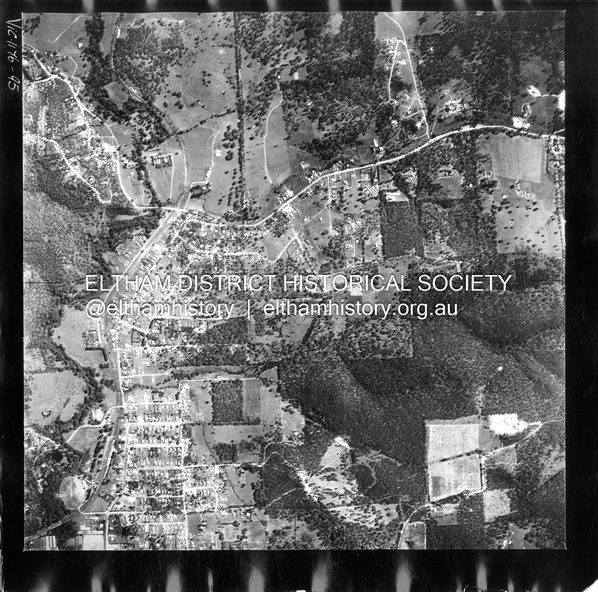
Centred on present day Shalbury Avenue, Eltham bounded by Leane Drive and Parsons Road to north, Nyora Road to south, Reynolds Road to east and the Diamond Creek to west
Historic Aerial Imagery
Source: Landata.vic.gov.au
Aerial Photo Details:
Project No :250
Project : MELBOURNE OUTER SUBURBS PROJECT
Run : 18
Frame : 95
Date : 02/1956
Film Type : B/W
Camera : EAG9
Flying Height : 10000
Scale : 12000
Film Number : 1176
GDA2020 : 37°41'57"S, 145°09'51"E
MGA2020 : 338145, 5825965 (55)
Melways : 22 C1 (ed. 42)
Physical description
Digital jpg and electronic PDF file