

Historical information
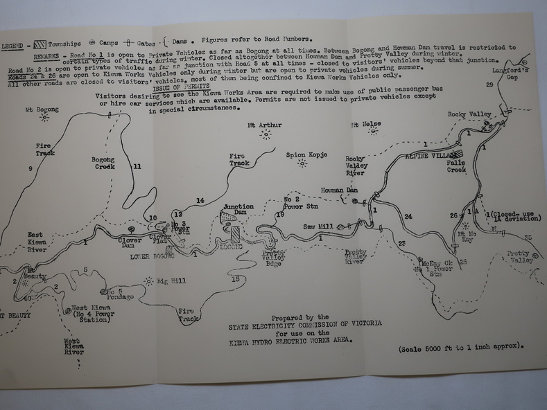
An early map of the Kiewa Hydro Electric Scheme Works Area prepared by the SECV for use when requesting access to the area. The regulations are printed regarding permits.
Significance
During construction of the KHES there were restrictions on access to the area. This map identifies the land marks and states the regulations for entry to the area.
Physical description
Black and white map folded into three showing a legend with the townships, camps, gates and dams marked.Also indicating the roads, rivers, mountains and infrastructure of the KHES.