Historical information
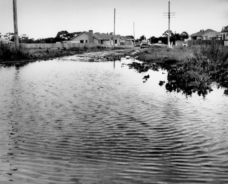
This photograph depicts flooding of Ozone Avenue in Beaumaris, located off Balcombe Road. Roads in the Beaumaris area lacked sufficient drains to clear surface water. In many cases streets were unsealed and without footpaths and some were dirt tracks. Gutters and road surfaces were made of clay and in the wetter months of winter, unsealed roads and tracks became impossible quagmires that were unnavigable for vehicles and pedestrians.
Significance
In the first decade after World War II there was rapid expansion in construction of new houses in the suburb of Beaumaris. Utilities and infrastructure to support the growth of housing was inadequate and not provided for prior to the development of the area. Without rudimentary drainage, flooding was frequent. Storm water runoff, domestic sullage and septic tank overflow would form large pools and families were sometimes marooned within their homes. The frequent flooding caused isolation and hardship and residents endured difficulties with accessibility to facilities. These disadvantages had the potential to cause social issues for the new residents.
Physical description
Black and white photograph of flooding in Ozone Avenue, Beaumaris. The image shows floodwaters with boggy and rough terrain on an unsealed road with housing in the distance.
Inscriptions & markings
Handwritten in blue ink: 2124 circled
Handwritten in red ink: 80%
Handwritten in blue ink on yellow Post-It note: Chap 6. underlined, 2194 Ozone Ave Beaumaris 1958
Subjects
References
- Cribbin, J., '"Growing like a mushroom" The Post-War Years', Moorabbin: A Pictorial History 1862-1994, pp137-171, pg150