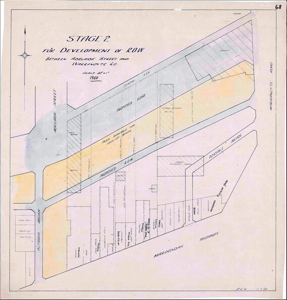
Map, Development of Right of Way Stage 2, Ringwood, Victoria - 1950
5030 .JPG Format
Reuse this media
Can you reuse this media without permission?No (with exceptions, see below)
Conditions of use
All rights reserved
This media item is licensed under "All rights reserved". You cannot share (i.e. copy, distribute, transmit) or rework (i.e. alter, transform, build upon) this item, or use it for commercial purposes without the permission of the copyright owner. However, an exception can be made if your intended use meets the "fair dealing" criteria. Uses that meet this criteria include research or study; criticism or review; parody or satire; reporting news; enabling a person with a disability to access material; or professional advice by a lawyer, patent attorney, or trademark attorney.
Attribution
Please acknowledge the item’s source, creator and title (where known)
Borough Engineer's technical drawing for Development of Right of Way between Adelaide Street and Warrandyte Road, Ringwood, showing existing retail establishments and outbuildings, and area available for lock-up shops.