Physical description
Detailed history of the event, continuing on next Page (VC entry 15513)
Untitled image
Can you reuse this media without permission? No (with exceptions, see below)
All rights reserved
This media item is licensed under "All rights reserved". You cannot share (i.e. copy, distribute, transmit) or rework (i.e. alter, transform, build upon) this item, or use it for commercial purposes without the permission of the copyright owner. However, an exception can be made if your intended use meets the "fair dealing" criteria. Uses that meet this criteria include research or study; criticism or review; parody or satire; reporting news; enabling a person with a disability to access material; or professional advice by a lawyer, patent attorney, or trademark attorney.
Please acknowledge the item’s source, creator and title (where known)
Have a question? Contact Ringwood and District Historical Society


Detailed history of the event, continuing on next Page (VC entry 15513)
Parent Record for Archive collection of photographs and documents relating to Borough of Ringwood, formed in 1924
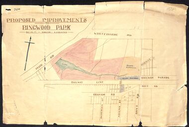
Proposed Improvements to Ringwood Park (Ringwood Lake) dated 14 January 1927, signed Cr McCaskill. Main Road is Whitehorse Road (Maroondah Highway), and Mt Dandenong Road is incorrectly labelled Whitehorse Road. The map shows Rosedale Crescent and Railway Parade, both of which exist in 2024. On the bottom of the map, south of the railway line, showing proposed streets - Graham Road, Anderson Street and Adams Street - in preparation for the sale of the Theo Anderson property. That area is now Bedford Park.
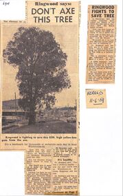
Two newspaper articles, re the fight to save tree near Ringwood Timber on Maroondah Highway, late 1950s. The Yellow Box tree was located west of Ringwood timber, outside Bill Patterson's Motors near the New Street intersection. The fight was led by Cr Ben Hubbard, the secretary of the Ringwood Horticultural Society, Mr Kearsley, but was eventually lost. The articles are from The Herald and dated December 1957 and 11th June 1959.
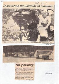
Various newspaper articles about car parks, children's tiles and improvements to Ringwood Lake 1955 - April 1990.
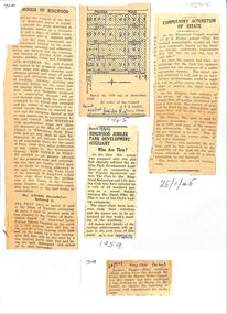
Various newspaper articles about detals of the acquisition, by Ringwood Council, of 40 acres of land for Jubilee Park, formerly known as Sanders Estate, for recreation purposes in 1945-1959. The area included named streets - Prussia Road (not West Prussia Road), Duffy Street, Ireland Street, Evens Street and Chapman Street.
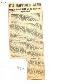
Newspaper articles detailing the gift of 17 acres of land south end of New Street, by Frank Pike of Heatherdale Road, for parkland. The new park will be called Pomona Park. It was later called Proclamation Park, used for athletics, baseball and cricket.
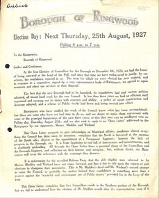
Two-page letter
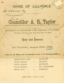
South-West Riding of the Shire. Voting booth at Recreation Hall, Ringwood
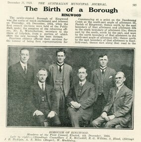
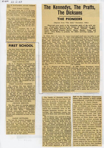
Pages 585-587. Includes photos of the first Borough of Ringwood council and the new Ringwood State School
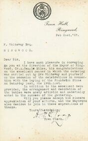
Signed by the Ringwood Town Clerk AFB Long
Includes end of article from VC entry 15512
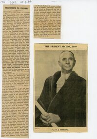
Also photo of Cr BJ Hubbard, Mayor of Ringwood in 1949
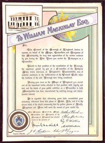
To William Mackinlay Esq. for services rendered as a Foundation Councillor for the Borough of Ringwood 1924-1929. Dated and signed by all Councillors and Town Clerk on 1st May 1930. He was a North Ringwood orchardist and Mayor in 1927/28. The certificate has the Common Seal of the Borough.
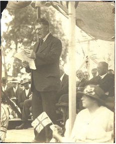
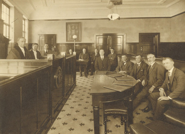
Black and white photograph on cardboard backing. Speaker - W.H. Everard - MLA, in front of (L-R) J.K. McCaskill (partially obscured), W. Mackinlay, and A.T. Miles (Mayor).
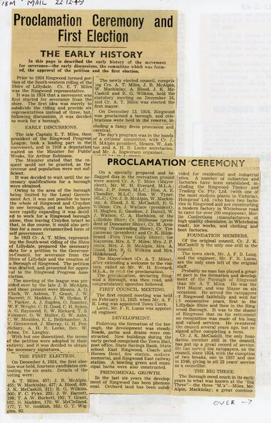
Source: Ringwood - Place of Many Eagles - High Anderson (page 154): ... "The proclamation celebrations, 'a day of rejoicing' for Ringwood, took place on 13 December 1924." ... "The official ceremony was performed from a covered platform by W.H. Everard, MLA., who substituted for the Minister for Public Works, and after numerous speeches, a reception for the parliamentarians and other civic dignitaries was held at the Mechanics' Institute." ...
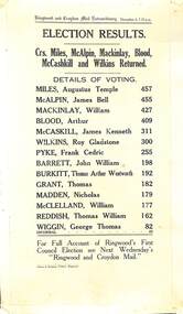
Cardboard backed notice of election results with list of candidates and number of votes.
ELECTION RESULTS. Crs. Miles, McAlpin, Mackinlay, Blood, McCaskill and Wilkins Returned. DETAILS OF VOTING. Miles, Augustus Temple - 457 McAlpin, James Bell - 455 Mackinlay, William - 427 Blood, Arthur - 409 McCaskill, James Kenneth - 311 Wilkins, Roy Gladstone - 300 Pyke, Frank Cedric - 255 Barrett, John William - 198 Burkitt, Thomas Arthur Wentworth - 192 Grant, Thomas - 182 Madden, Nicholas - 179 McClelland, William - 177 Reddish, Thomas William - 162 Wiggin, George Thomas - 82 Informal - 23 For full account of Ringwood's Frist Council Election see Next Wednesday's "Ringwood and Croydon Mail." Ostrom & Sampson, Printers, Ringwood.