


Physical description
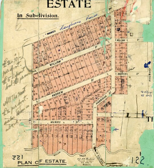
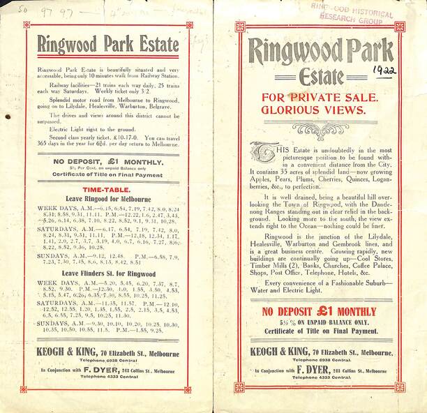
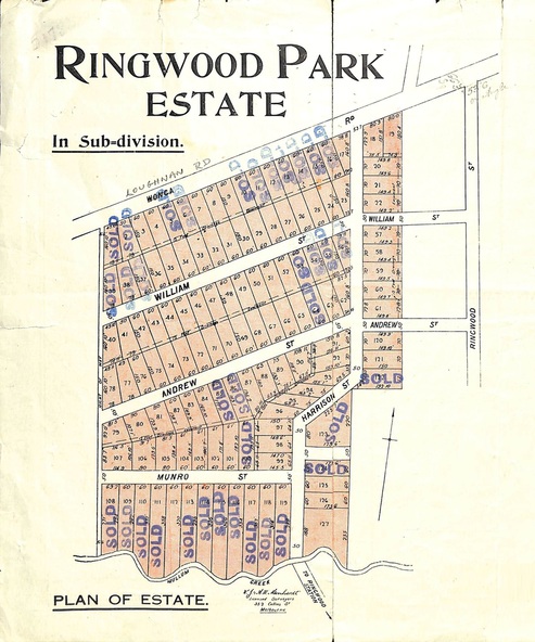
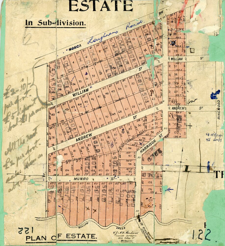
Green card with cut-out map of residential allotments, some marked "sold". "Plan of Estate" includes Wonga Road, Loughnans Road, William Street, Andrew Street, Harrison Street, and Munro Street, Ringwood. (Surrounding area is part of Ringwood Park Estate featured in seperate 1922 auction flyer).
Inscriptions & markings
Handwritten notations - (northern section) {£2-10/- per foot. £5 deposit bal £1 per month} All the rest £2 per foot, value same as above. Licensed Surveyors - W.J. & A.W. Kenhardt, 352 Collins Street, Melbourne.