Card, Subdivision Maps - Ringwood, Victoria - (Undated, circa 1920s)
Untitled image
Reuse this media
Can you reuse this media without permission?Yes
Conditions of use
Attribution-NonCommercial-ShareAlike 4.0 International (CC BY-NC-SA 4.0)
This media item is licensed under Attribution-NonCommercial-ShareAlike 4.0 International (CC BY-NC-SA 4.0). You may share (i.e. copy, distribute, transmit) and rework (i.e. alter, transform, build upon) this item provided that you attribute the content source and copyright holder, and identify any alterations; do not use the content for commercial purposes; and distribute the reworked content under the same or similar license.
Attribution
Please acknowledge the item’s source, creator and title (where known)
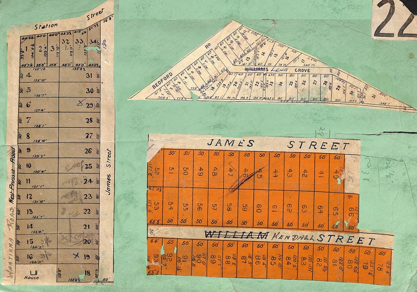
Collage of three residential allotment maps on green cardboard backing.
Inscriptions & markings
Subdivisions include West Prussia Road, Wantirna Road, Station Street, James Street, Bedford Road, Williams Grove (later Lena Grove), and William Street (later Kendall Street), Ringwood.